Tag Archives: river

George Washington National Forest

George Washington National Forest

Virginia, West Virginia

Managed by U.S. Forest Service, Southern Region

1,795,084 acres (1,065,369 federal/ 729,715 other)

Website: https://www.fs.usda.gov/gwj

Overview

First established as the Shenandoah National Forest in 1918, George Washington National Forest covers portions of the Blue Ridge and Allegheny Mountains.  It includes the northern 60 miles of the Blue Ridge Parkway and a significant stretch of the Appalachian National Scenic Trail south of Shenandoah National Park.  The National Forest’s proximity to Washington, D.C. and Baltimore makes it a major recreation destination, particularly for trail runners.  It is now co-managed with the more western Jefferson National Forest, together encompassing 230,000 acres of old-growth forests, 139,461 acres of Wilderness areas, and more than 2,000 miles of trails.

Highlights

Mt. Pleasant National Scenic Area, Big Walker Mountain Scenic Byway, Highland Scenic Tour, Massanutten Visitor Center, Sherando Lake, White Rock Creek Falls, Lake Moomaw, Woodstock Tower, Upper Shamokin Falls, Slacks Overlook, High Knob Fire Tower, Maple Flats, Bird Knob Loop Trail, Lion’s Tale National Recreation Trail, Waterfall Mountain Loop Trail, McDowell Battlefield Trail, Big Schloss Trail, Crabtree Falls Observation Trail, Story Book Trail, Pig Iron Loop Trail, Dragons Tooth Trail, Appalachian National Scenic Trail

Must-Do Activity

Driving the Blue Ridge Parkway through George Washington National Forest is a must-do, but there are other attractions to be found in this ridgeline-running forest.  Not far east off Interstate 81, it is a short drive up a gravel road to Woodstock Lookout Tower, where a short, flat trail accesses the metal structure that provides views of the Seven Bends of the Shenandoah River.  Downhill on the eastern side of that ridge (and protected from freeway noise) is the free Little Fort Campground with nine campsites.  There is a charge to ride the Peters Mill Gap and Taskers Run ATV/OHV trails (covering 40 miles) that leave from the campground.  A one-mile hiking trail leaves from Campsite 8 and climbs up to Woodstock Tower.

Best Trail

Crabtree Falls Observation Trail (day use fee) is easy to access from paved State Route 56 east of the Blue Ridge Parkway.  There are actually five waterfalls here with a total drop of 1,200 feet spread over a half-mile.  The first overlook of the lower falls is only 500 feet from the parking lot and is handicap accessible.  From there, the trail switchbacks up 1.7 miles one-way to a fourth and final view of the falls, then continues on another two miles to the Appalachian National Scenic Trail after gaining more than 1,000 feet in elevation. 

Watchable Wildlife

Extensive sections of old-growth forest can be found in Mt. Pleasant National Scenic Area and much of the Rich Hole and Ramsey’s Draft Wildernesses.  This provides habitat for a healthy population of black bears, as well as white-tailed deer, bobcats, raccoons, river otters, martens, and weasels.  Large birds found in George Washington National Forest include wild turkeys, turkey vultures, bald eagles, peregrine falcons, and several types of hawks.  Wetlands, like Maple Flats, are home to cricket frogs, painted turtles, spotted turtles, and many species of salamanders, such as marbled, Cow Knob, Cheat Mountain, Shenandoah, and tiger salamanders.  Over 100 species of freshwater fish reside here, and fishing is popular activity in the Jackson River and 152-foot-deep Lake Moomaw.

Instagram-worthy Photo

With five major cascades dropping 1,200 feet in total, there are plenty of places to catch your breath and snap some photographs along the steep Crabtree Falls Observation Trail.

Peak Season

Spring and fall

Fees

There is a day use fee for hiking Crabtree Falls Observation Trail and riding the Peters Mill Gap and Taskers Run ATV/OHV trails. 

Road Conditions

Parking at Crabtree Falls is paved and RV accessible, and the one unpaved road we took to Woodstock Tower and Little Fort Campground was in good shape.

Camping

There are many designated campgrounds found throughout George Washington National Forest, including the free, nine-site Little Fort Campground not far east off Interstate 81 (see Must-Do Activity).  Although dispersed camping can be hard to find, we read there are sites on the four-wheel-drive road (SR 826) at the top of Crabtree Falls Observation Trail near where it meets the Appalachian National Scenic Trail. 

Wilderness Areas

Barbours Creek Wilderness (also in Jefferson National Forest)

Priest Wilderness

Ramsey’s Draft Wilderness

Rich Hole Wilderness

Rough Mountain Wilderness

Saint Mary’s Wilderness

Shawvers Run Wilderness (also in Jefferson National Forest)

Three Ridges Wilderness

Related Sites

Booker T. Washington National Monument (Virginia)

Cedar Creek and Belle Grove National Historical Park (Virginia)

Jefferson National Forest (Virginia, West Virginia, Kentucky)

Daniel Boone National Forest (Kentucky)

Nearest National Park

Shenandoah

Conifer Tree Species

eastern hemlock, eastern white pine, shortleaf pine, Table Mountain pine, red spruce, eastern redcedar

Flowering Tree Species

tulip-poplar, American beech, shagbark hickory, white oak, black oak, northern red oak, rock chestnut oak, pin oak, yellow birch, gray birch, sweet birch, striped maple, red maple, black gum, sassafras, basswood, flowering dogwood, sourwood, cucumber magnolia, mountain laurel, quaking aspen, paper birch, witch hazel, dwarf willow, winterberry, rhododendron

Explore More – In 1972, what company sponsored the planting of the National Children’s Forest in a burned-out area east of Jordan Mines?

Learn more about this and the 154 other National Forests in our new guidebook Out in the Woods

We are a participant in the Amazon Services LLC Associates Program, an affiliate advertising program designed to provide a means for us to earn fees by linking to Amazon.com and affiliated sites.

Gallatin National Forest

Gallatin National Forest

Montana

Managed by U.S. Forest Service, Northern Region

2,151,461 acres (1,819,515 federal/ 331,946 other)

Website: https://www.fs.usda.gov/main/custergallatin/home

Overview

Gallatin National Forest borders much of the north and west sides of Yellowstone National Park, providing important wildlife habitat in the Absaroka-Beartooth and Lee Metcalf Wilderness areas.  The National Forest also contains portions of the Bridger Range and Crazy Mountains north of Bozeman and Interstate 90.  The Gallatin Petrified Forest is only accessible by trail, either from a short two-mile one-way jaunt (that gains 650 feet of elevation) or by backpacking the 27-mile Gallatin Divide-Devils Backbone Trail.  Free permits are available from Forest Service Ranger Stations to collect up to 20 cubic-inches of petrified wood each year.  Since 2014, it has been co-managed as the Custer-Gallatin National Forest, stretching east into South Dakota.

Highlights

Earthquake Lake Visitor Center, film, Fairy Lake, Devils Slide, Flathead Pass, Big Timber Canyon, Palisade Falls, Spire Rock Campground, Natural Bridge, Kersey Lake, Hardscrabble Peak, Pine Creek Falls, Bridger Mountains National Recreation Trail, Spanish Creek Trail, Red Canyon Trail, Petrified Forest Interpretive Trail

Must-Do Activity

Earthquake Lake Geologic Area stretches along Highway 287 to commemorate the events that occurred around midnight on August 17, 1959 when a magnitude 7.5 earthquake hit West Yellowstone, Montana.  The strongest earthquake ever recorded in the Rocky Mountains caused a hillside to crumble and block the Madison River and form Quake Lake, which is still there today.  Seiches (“lake tsunamis”) on Hebgen Lake and landslides claimed 28 lives and trapped hundreds campers.  The next day, after Forest Service smokejumpers parachuted in to assist survivors, the most seriously injured were evacuated out by helicopter.  Today there is an interpretive auto tour with multiple stops along the highway.  In addition, a visitor center operates in the summer where they show a film and the 0.3-mile Landslide Trail has signs explaining the events and how the massive Memorial Boulder crossed from one side of the valley to the other in less than 20 seconds (see Instagram-worthy Photo).

Best Trail

Pine Creek Falls is located 1.3 miles from the Pine Creek Campground after a 400 foot elevation gain.  The popular route first enters a burned forest then crosses a bridge over the creek at a half-mile before reaching the waterfall where most hikers turn around.  The trail gets steeper as it continues another four miles to Pine Creek Lake climbing about 3,400 feet, including one grueling stretch that ascends 1,800 feet in only 1.3 miles.

Watchable Wildlife

There are more than 4,000 miles of streams and rivers in the National Forest, including major tributaries of the Yellowstone and Missouri Rivers.  This makes Gallatin National Forest one of the premiere fly fishing destinations in the U.S. and also attracts bald eagles and ospreys.  Due to its proximity to Yellowstone National Park, there are also gray wolves and grizzly bears.  Other large mammals include elk, mule deer, moose, bighorn sheep, pronghorns, mountain lions, and black bears.

Instagram-worthy Photo

Memorial Boulder and Sister Boulder used to be located across the valley, but during the 1959 earthquake these six-million-pound dolomite slabs crossed the half-mile distance in less than 20 seconds.

Peak Season

Summer

Fees

None

Road Conditions

The roads are paved up to the Earthquake Lake Visitor Center, Pine Creek Campground, and Big Sky Mountain Village (south of Bozeman).  It is 13 miles (mostly unpaved) from Highway 89 to the Petrified Forest Interpretive Trail, and there is a free campground where Rock Creek Road dead ends at the trailhead.  There are also many miles of four-wheel-drive roads to explore throughout the National Forest.

Camping

There are many campgrounds in Gallatin National Forest (like Eagle Creek just outside Gardiner on the northern border of Yellowstone National Park), as well as dispersed camping options. 

Wilderness Areas

Absaroka-Beartooth Wilderness (also in Custer and Shoshone National Forests)

Lee Metcalf Wilderness (also in Beaverhead National Forest)

Related Sites

Custer National Forest (Montana-South Dakota)

Big Hole National Battlefield (Montana)

Beaverhead–Deerlodge National Forest (Montana)

Nearest National Park

Yellowstone

Conifer Tree Species

lodgepole pine, ponderosa pine, whitebark pine, subalpine fir, Douglas-fir, Engelmann spruce

Flowering Tree Species

quaking aspen, balsam poplar, cottonwood, alder, mountain maple, mountain ash

Explore More – Why was the National Forest named after Albert Gallatin?

Learn more about this and the 154 other National Forests in our new guidebook Out in the Woods

We are a participant in the Amazon Services LLC Associates Program, an affiliate advertising program designed to provide a means for us to earn fees by linking to Amazon.com and affiliated sites.

Cedar River National Grassland

Cedar River National Grassland

North Dakota

Managed by U.S. Forest Service, Northern Region

6,717 acres (6,717 federal/ 0 other)

Website: https://www.fs.usda.gov/recarea/dpg/recarea/?recid=79471

Overview

Cedar River National Grassland was created in 1998 from part of Custer National Forest, as is true of all four of the units managed as The Dakota Prairie Grasslands by the U.S. Forest Service.  The number above showing 0 acres of private inholdings is a little misleading since Cedar River National Grassland is a patchwork of public lands surrounded by the Standing Rock Reservation of the Lakota Sioux.  It is administered from the office just across the state border in Lemmon, South Dakota along with 154,783-acre Grand River National Grassland.  Although situated close to the Cedar River, the grassland contains no river bottomlands and is primarily composed of rolling hills cut by dry gullies.

Highlights

Knispel Wildlife Area, Cedar River

Must-Do Activity

The soils of Cedar River National Grassland are mostly clay, but we found some interesting rocks on the surface near the buttes at Knispel Wildlife Area off Highway 31.  Although it is not in the National Grassland, you should try to drive across one of the bridges over the namesake Cedar River.  Using the Forest Service app, we hiked to a small pond with cattails we could see on the aerial photos near the North Community Allotment.

Best Trail

There are no designated trails in Cedar River National Grassland, so we just walked cross-country.  We do recommend a stop at the World’s Largest Petrified Wood Park in nearby Lemmon, South Dakota.

Watchable Wildlife

About 25% of the National Grassland was reseeded with crested wheatgrass providing good grazing for white-tailed deer, pronghorn, and cattle.  Sharp-tailed grouse and exotic pheasants are also found in this area and the neighboring farm fields (primarily growing sunflowers).  Potholes and stock ponds provide habitat for blue-winged teals, gadwalls, and mallards, as well as fathead minnows, painted turtles, and northern leopard frogs.  In the summer, listen for the songs of western meadowlarks.  Birds of prey reported are red-tailed hawks, ferruginous hawks, Swainson’s hawks, northern harriers, American kestrels, golden eagles, and bald eagles.  We saw evidence of a hut on a dry stream built by a beaver, and there are also or muskrats, raccoons, coyotes, red foxes, and badgers. 

Instagram-worthy Photo

Cottonwood trees are about the only subject that will break the horizon in a photograph at Cedar River National Grassland.

Peak Season

Summer

Fees

None

Road Conditions

Highway 31 is paved, but most of the roads were unpaved; those with gravel were in good shape in October, although the clay could turn to gumbo during wet spring months.

Camping

There is not a designated campground and dispersed camping might be tough due to the lack of pullouts and the predominance of private land.  It is probably better to head south to Grand River National Grassland, which has campgrounds.

Related Sites

Cimarron National Grassland (Kansas)

Knife River Indian Villages National Historic Site (North Dakota)

Fort Union Trading Post National Historic Site (North Dakota-Montana)

Nearest National Park

Theodore Roosevelt

Explore More – After the federal government acquired about 48,000 acres of the Standing Rock Reservation from homesteads in the 1930s, how many acres did they later return to the Lakota Sioux (although the tribe would like it all returned)?

Moosalamoo National Recreation Area

Moosalamoo National Recreation Area

Vermont

Managed by U.S. Forest Service, Eastern Region

15,875 acres

Website: https://www.fs.usda.gov/recarea/gmfl/recreation/recarea/?recid=64903&actid=29

Overview

Created by the New England Wilderness Act of 2006, Moosalamoo National Recreation Area is located in the northern portion of Vermont’s Green Mountain National Forest.  Moosalamoo (pronounced moose-ah-la-moo) comes from the Abenaki word for a moose call.  Recreation here is centered around water, with the Falls of Lana on Sucker Brook, a hike-in campground on Silver Lake, and boating on Sugar Hill Reservoir formed by Goshen Dam.  There are 70 miles of hiking trails, which are also open to mountain bikers, equestrians, and cross-country skiers in the winter.  Blueberry picking is a fun activity in the fall along trails and in cultivated fields at Blueberry Hill Inn in Goshen.

Highlights

Falls of Lana, Silver Lake, Voter Brook Overlook, Sugar Hill Reservoir , Robert Frost Interpretive Trail, Goshen Trail, Chandler Ridge-Leicester Hollow Loop, Mt. Moosalamoo Trail

Must-Do Activity

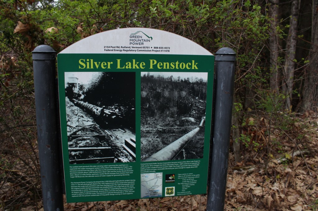
A short, steep hike from Silver Lake South Trailhead takes you underneath a welded steel penstock (or water pipe) that is part of a hydroelectric project.  From here, carefully go left down the rocks on an unmarked route to the base of the Falls of Lana.  The trail continues to the Rattlesnake Cliffs (closed seasonally due to raptor nesting) and Silver Lake, which has a backcountry campground.  Another popular hike climbs about 1,500 feet in 2.5 miles to the top of Mt. Moosalamoo, with an additional 0.2-mile sidetrip to the South Vista.

Best Trail

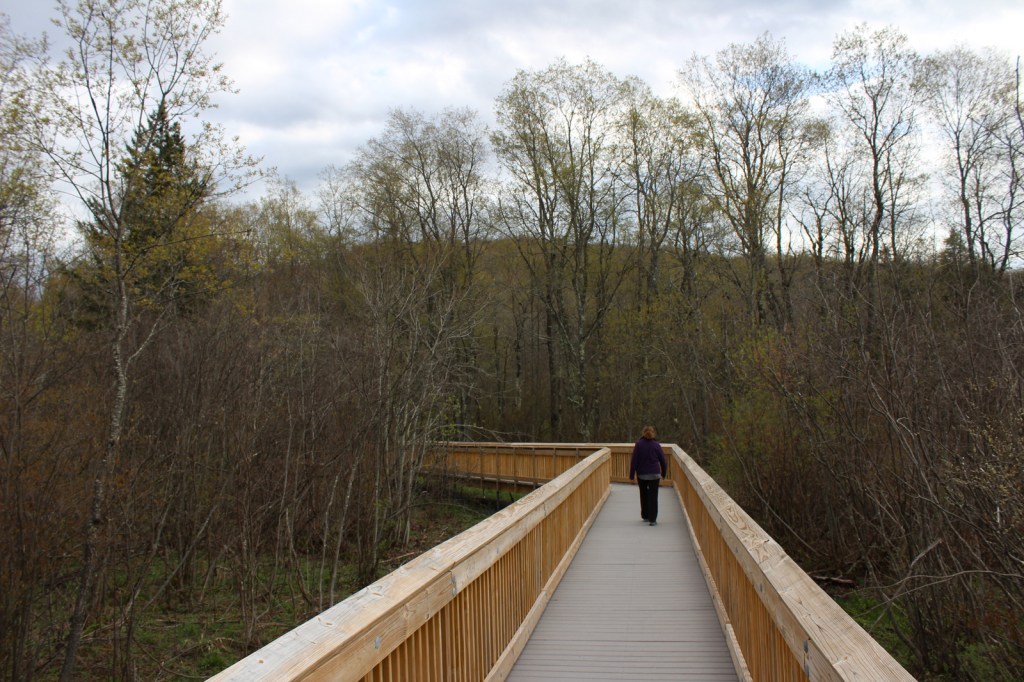
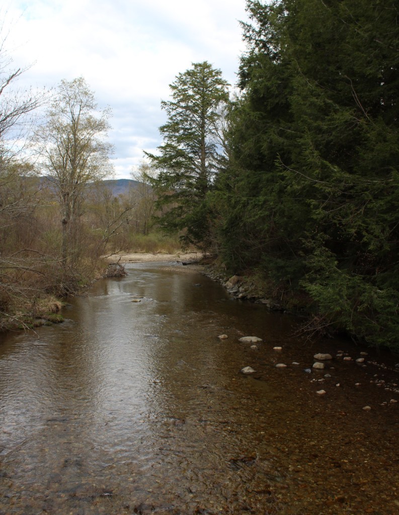
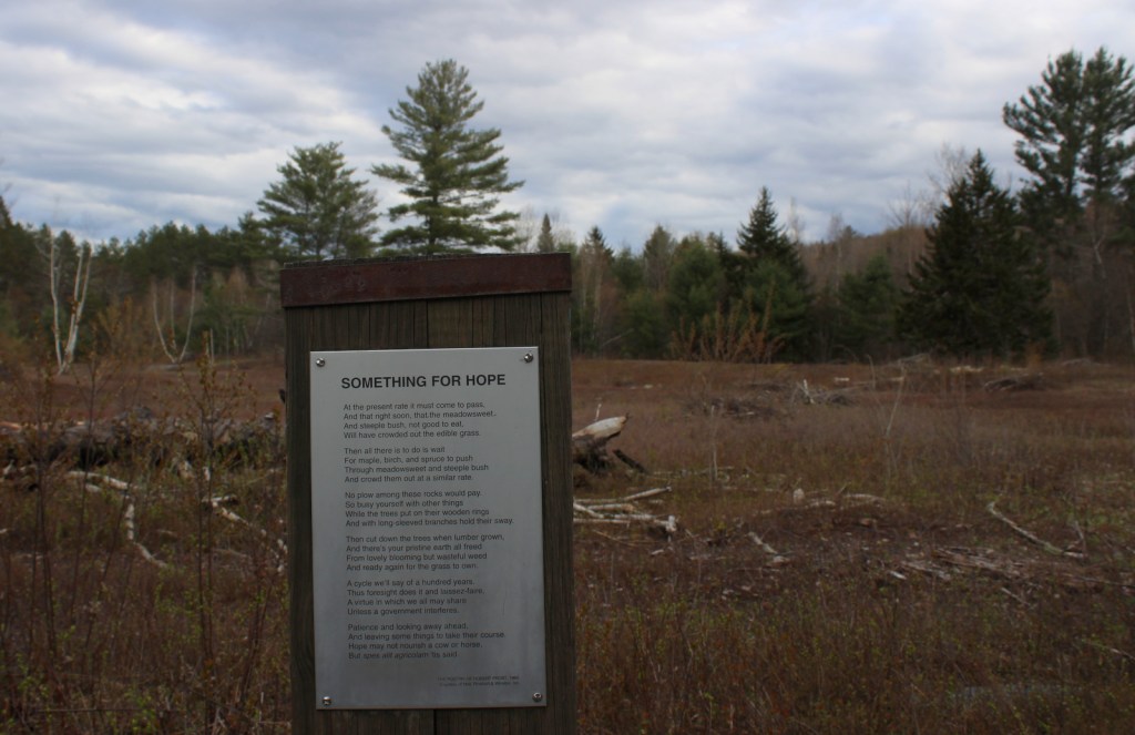
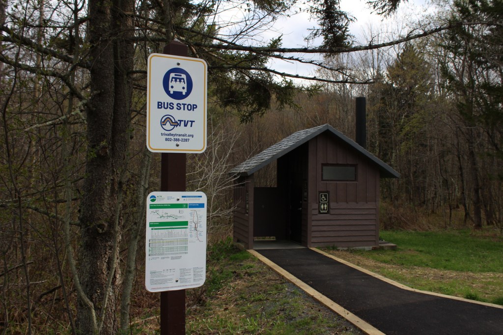
Robert Frost, a four-time Pulitzer Prize winner in poetry, spent his summers at the Bread Loaf School of English, which he cofounded.  On Highway 125, the Robert Frost Interpretive Trail is a handicap accessible boardwalk with posted poems by the author that also connects into the Crosswalk, North Star, Afternoon Delight, and Sundown Trails.  Look for evidence of beavers near the ponds and the South Branch of the Middlebury River, as well as blueberries and huckleberries growing in old fields (maintained with prescribed fire).  Unique to Forest Service trailheads, this one is a bus stop on the Tri-Valley Transit route.

Instagram-worthy Photo

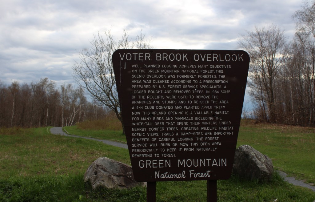
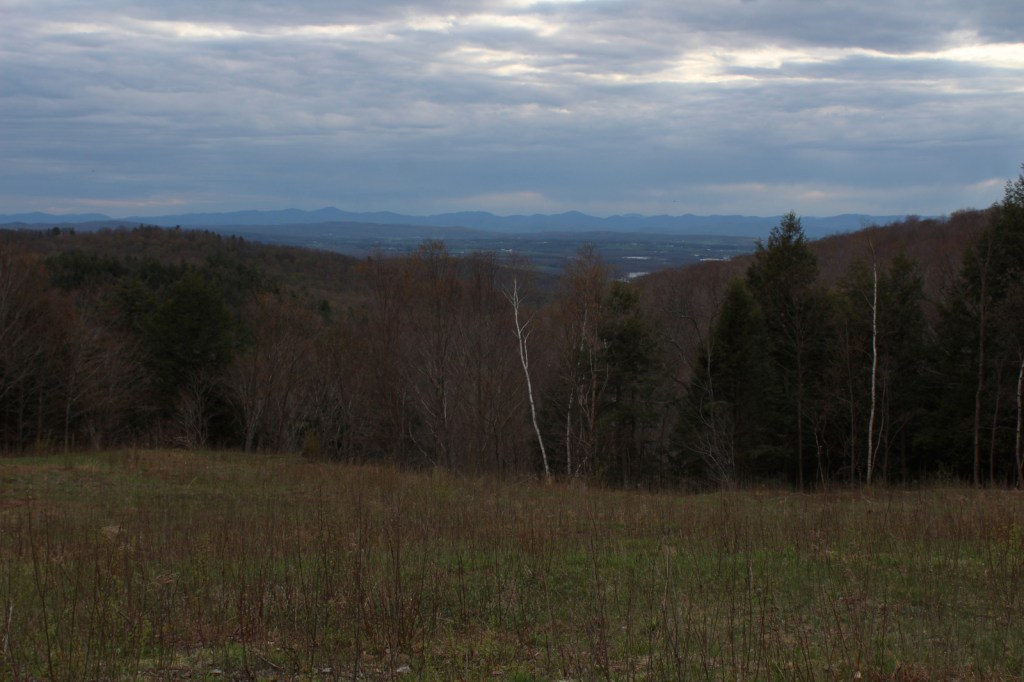
Voter Brook Overlook was clearcut and planted with apple trees to provide a nice viewshed in this otherwise dense hardwood forest.
Peak Season

Summer

Fees

None

Road Conditions

All the gravel roads we drove were in good shape during the spring and we were so impressed by one new road culvert we stopped to take a photo (see below).

Camping

Open from Memorial Day through Labor Day, Moosalamoo Campground has 18 campsites located at the base of the Mt. Moosalamoo Trail, near Voter Brook Overlook.  There are a couple dispersed campsites also on the road, but we had one of our worst nights camping here with college kids blasting music late and another group waking us up before sunrise.  The backpacking campground at Silver Lake is nice, or you can stay at Branbury State Park on Lake Dunmore.

Related Sites

Green Mountain National Forest (Vermont)

White Rocks National Recreation Area (Vermont)

Marsh-Billings-Rockefeller National Historical Park (Vermont)

Saint-Gaudens National Historical Park (New Hampshire)

Nearest National Park
Acadia

Explore More – Although his name is not Lana, the Falls of Lana are named for which U.S. Army General who served in the 1848 Mexican-American War?

Black Kettle National Grassland

Black Kettle National Grassland

Oklahoma, Texas

Managed by U.S. Forest Service, Southern Region

33,113 acres (31,286 federal/ 1,827 other)

Website: https://www.fs.usda.gov/detail/cibola/home/?cid=stelprdb5397425

Overview

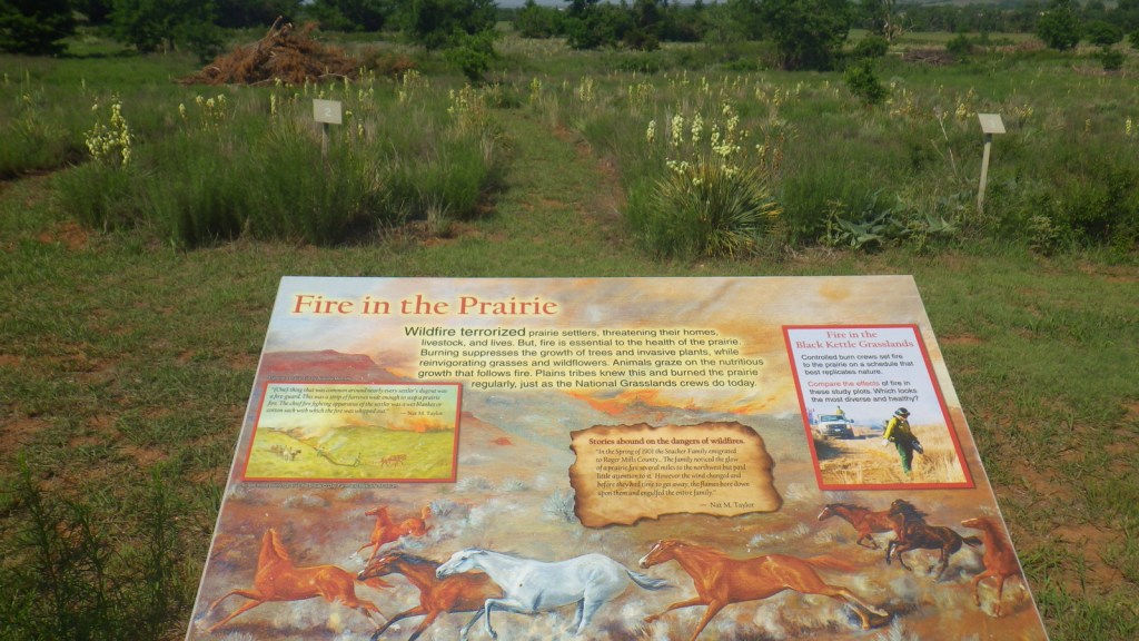
Like Cimarron National Grassland in Kansas, Black Kettle National Grassland was purchased by the federal government during the 1930s Dust Bowl.  This is one of the only National Grasslands with a visitor center, shared with the National Park Service (NPS) who manages Washita Battlefield National Historic Site at the site of an 1868 massacre that took the life of Chief Black Kettle of the Southern Cheyenne.  Even though the downstairs U.S. Forest Service office was closed on our Saturday visit, the NPS ranger at the desk provided a map and information on the National Grassland.  We also walked the paved interpretive trail at the visitor center that explained homesteading, prescribed burning, and preserving the rare shinnery oak species. 

Highlights

Black Kettle Recreation Area, Lake Marvin, Spring Creek Lake, Croton Creek Watchable Wildlife Area, Skipout Lake, Cheyenne Nature Walk

Must-Do Activity

Recreation here surrounds four reservoirs, including a tiny parcel around 63-acre Lake Marvin in Texas.  In Oklahoma, there are 60-acre Skipout Lake, 50-acre Spring Creek Lake, and 80-acre Dead Warrior Lake.  Fishing, picnicking, and free primitive camping are allowed at all four reservoirs, with a 1.75-mile trail circling Skipout Lake and wooded trails south of Dead Warrior Lake in Black Kettle Recreation Area. 

Best Trail

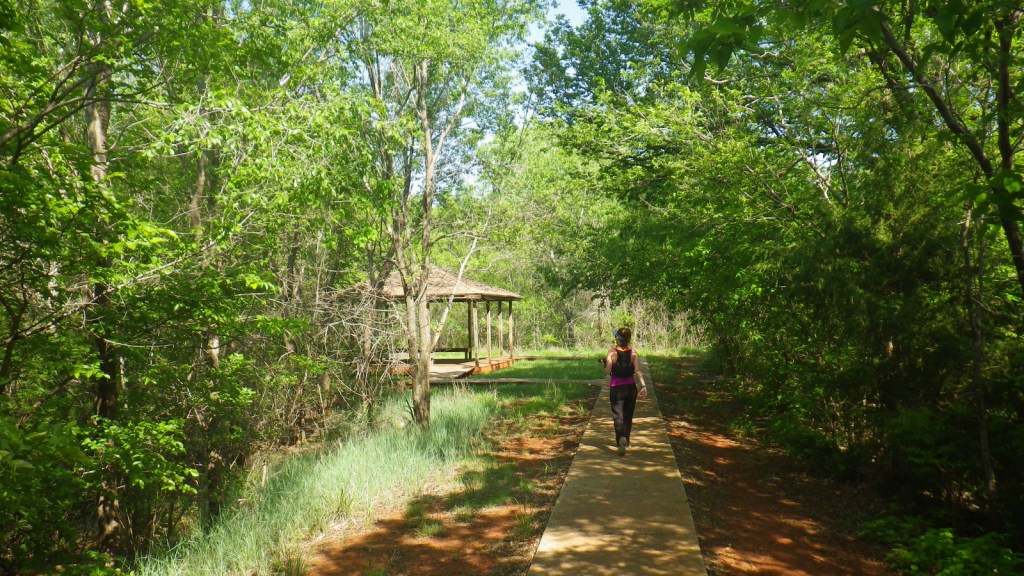
Unlike some other National Grasslands, there are multiple marked and maintained trails here, including two loops totaling 1.6 miles at Croton Creek Watchable Wildlife Area (south of Highway 47) lined by small signs describing native grasses, trees, and birds.  A slightly hidden trail is shown on the Forest Service app in the town of Cheyenne where a sidewalk heads into the woods leaving from the parking lot at the high school baseball field.  The Cheyenne Nature Walk is paved and has a gazebo and boardwalk crossing a wetland area that was dry during our May visit.

Watchable Wildlife

Three unique bird species we spotted during our May visit were Mississippi kites, northern bobwhite quail, and scissor-tailed flycatchers.  In addition, we saw cardinals and woodpeckers, and heard whippoorwills, barn owls, and barred owls overnight.  Wild turkeys, cedar waxwings, and lesser prairie chickens are also among the 277 bird species identified.  Tracks of white-tailed deer and raccoons were abundant on the Croton Creek Trail, plus there are bobcats, mountain lions, and beavers in the area.  Fishermen can catch black bass, saugeye, catfish, and other types of pan fish. 

Instagram-worthy Photo

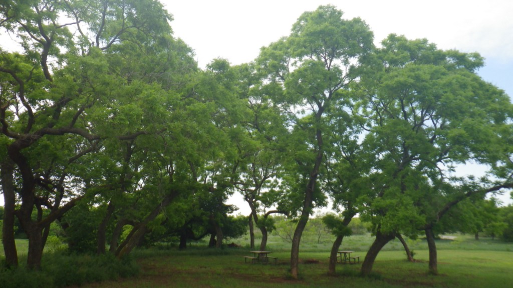
This area is more heavily wooded than some other prairie National Grasslands, which can be experienced on the Croton Creek Trail and Cheyenne Nature Walk (watch for poison-ivy).

Peak Season

Spring and fall

Fees

None

Road Conditions

Highways 283, 33, and 47 are paved roads that run through the National Grassland, and despite abundant spring rainstorms, we did not have any difficulty with the unpaved roads.

Camping

All four lakes offer free primitive campsites with some picnic tables, as does Croton Creek Watchable Wildlife Area where we stayed only six miles west of Cheyenne.  RV campsites with hookups at Lake Marvin cost $20 a night.

Related Sites

Washita Battlefield National Historic Site (Oklahoma)

Alibates Flint Quarries National Monument (Texas)

Cimarron National Grassland (Kansas)

Nearest National Park
Great Sand Dunes

Explore More – The South Canadian River flows north of Black Kettle National Grassland, but what is the river that runs through the middle of it?