Tag Archives: ocean

National Park of American Samoa

National Park of American Samoa

American Samoa (territory)

Managed by National Park Service

Established 1988

13,500 acres

Website: nps.gov/npsa

Overview

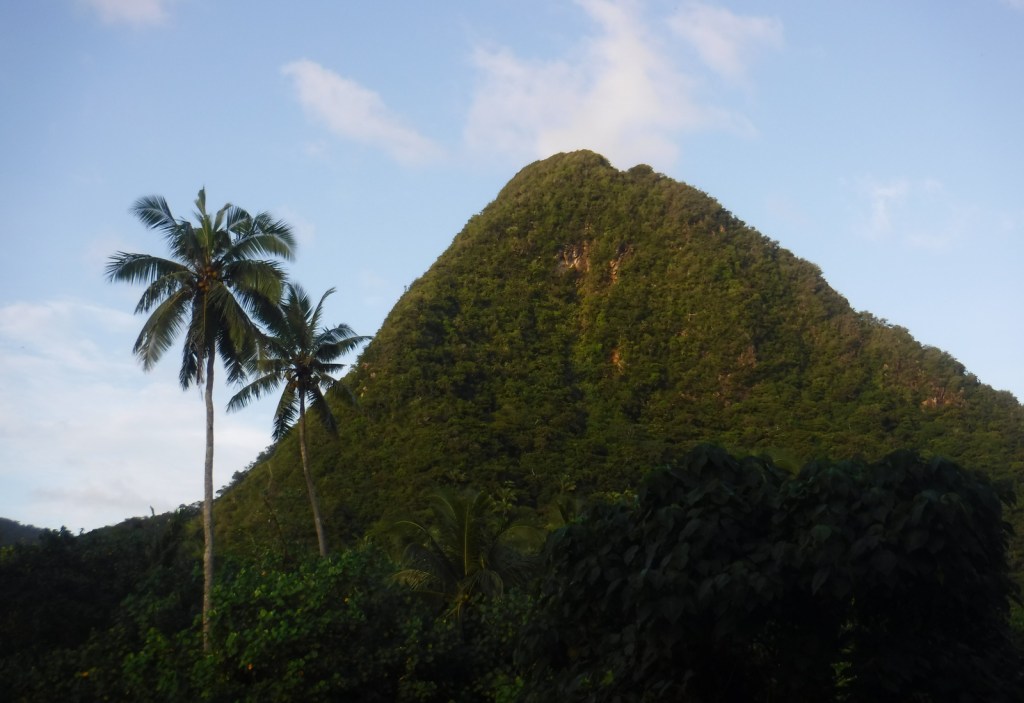
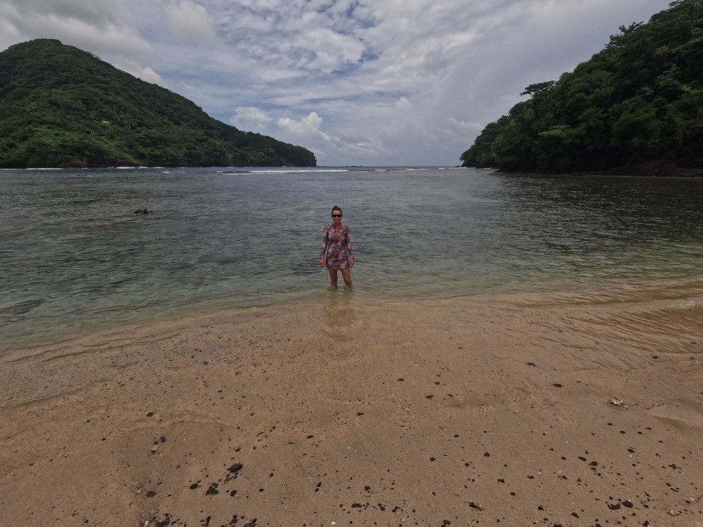
The only U.S. territory located south of the equator, American Samoa is home to a National Park unlike any other in the National Park Service system.  In 1900, the U.S. Navy Governor outlawed the sale of land to non-Samoans so the federal government leases the land for the park on three separate islands in the South Pacific Ocean.  There are two flights per week to Pago Pago (on the island of Tutuila) from Honolulu, Hawai‘i on Mondays and Thursdays, and flights from Pago Pago to Ofu Island on Tuesdays and Thursdays (only reservable once you are in American Samoa).  You would need to charter a boat from Ofu to nearby Ta‘ū Island to see the highest sea cliffs in the world.

Highlights

Mt. ‘Alava Trail, Tuafanua Trail, Pola Island Trail, Blunts Point Trail (outside park), Matafao Peak Trail (outside park), Fagatele Bay (outside park, currently closed), Lower Sauma Ridge Trail

Must-Do Activity

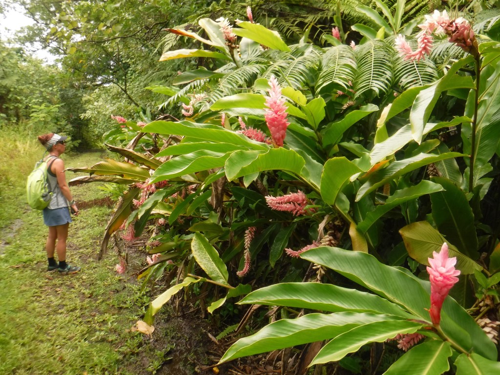
The best place to start is the visitor center in Pago Pago, where the park rangers can answer your questions and update you on what trails are currently open.  Hiking is the only activity on Tutuila, at least with the waves as large as they were during our visit.  We have heard there is good snorkeling right off the beach on Ofu, and we found good coral reefs in Utulei protected within Pago Pago Harbor (outside the National Park at Sadie’s by the Sea).  The coral is very shallow in most places, so it is best to snorkel around high tide.  Everything about this tropical forest is unique, but we were most fascinated by the fruit bats called flying foxes that are diurnal and have three-foot wingspans.

Best Trail

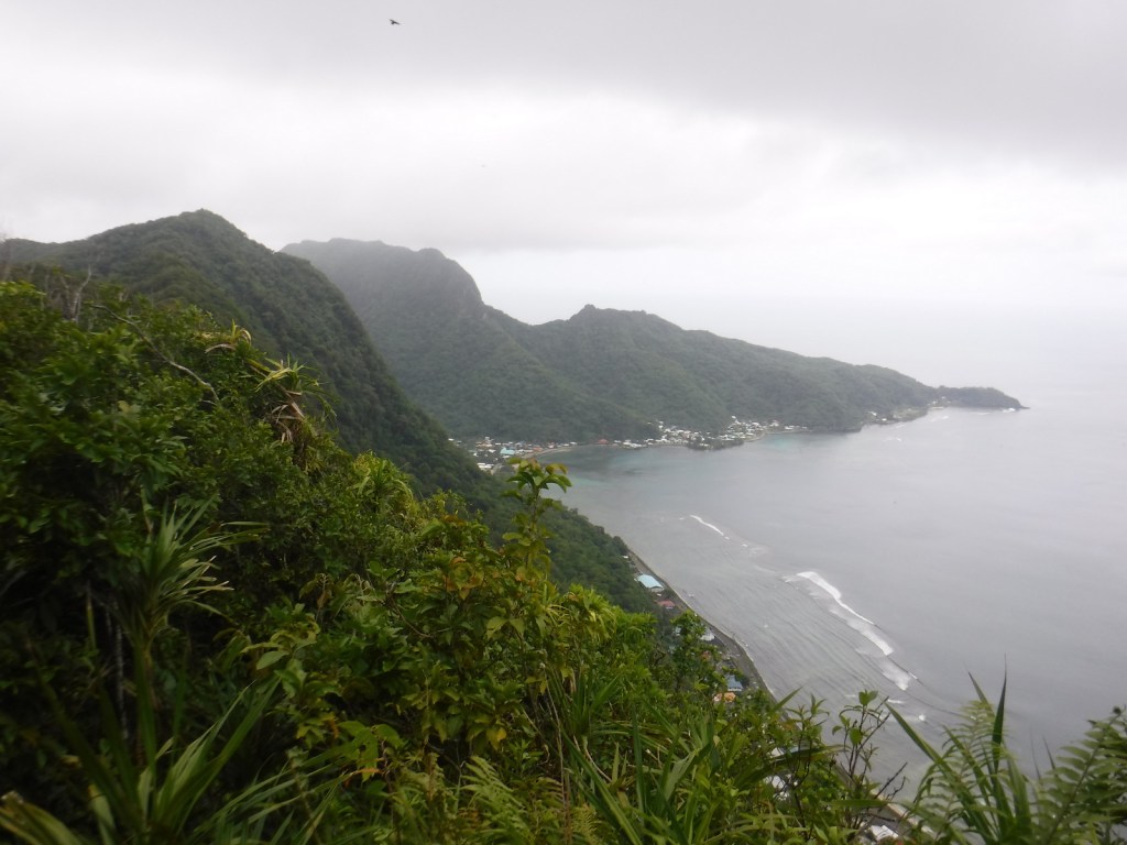
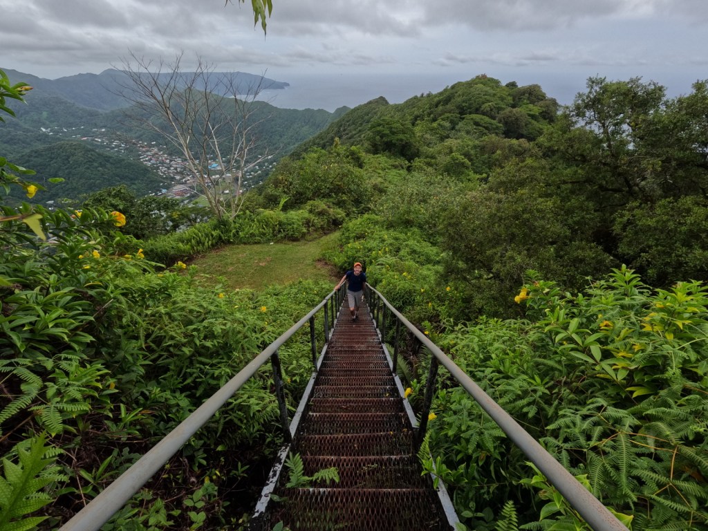
The Mt. ‘Alava Trail travels 3.4 miles one-way from Fagasā Pass on an old, rutted road to an incredible overlook of Pago Pago Harbor where an old tramway station sits rusting.  If you continue along the ridgeline you immediately come to a “ladder” built into the slope with a knotted rope for dropping down the muddy hill, which is part of the Mt. ‘Alava Adventure Trail (which is partially closed and not a loop).  This is the first of many ladders that descend the 1,610-foot mountain to the seaside village of Vatia.  It would be difficult to find the trailhead from that side (it is basically in somebody’s backyard) and since there is not currently a bus to Vatia we rode in the bed of a pickup truck back to the main road in Aua.

Instagram-worthy Photo

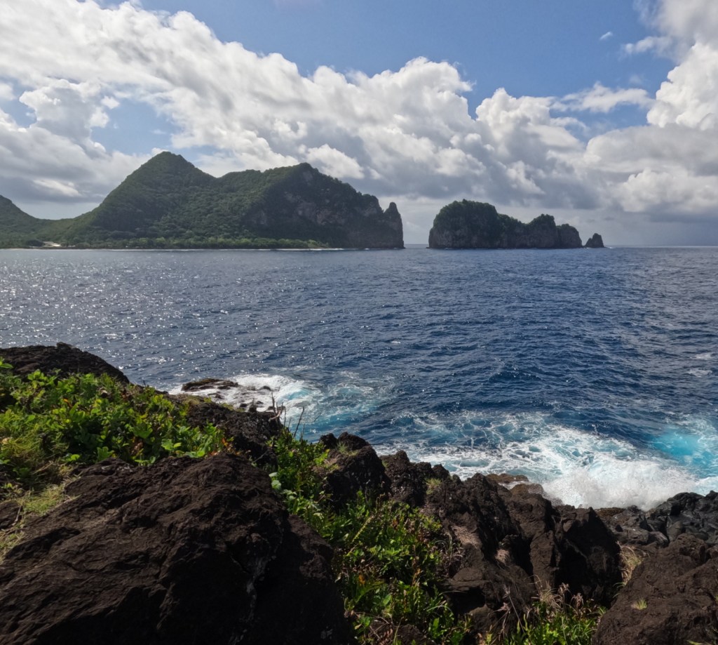
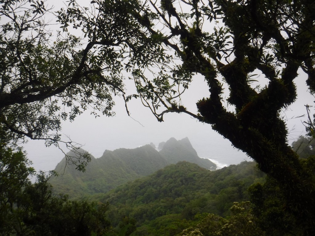
The Lower Sauma Ridge Trail quickly drops down about 300 feet to an incredible view of Pola Island and Vai‘ava Strait National Natural Landmark.

Peak Season

Year round, but the Park Ranger we met said she recommends April after the rainy season ends

Hours

https://www.nps.gov/npsa/planyourvisit/basicinfo.htm

Fees

There is no entrance fee, but this is one of the most expensive National Parks to visit (a roundtrip plane ticket from Honolulu costs around $1,000 per person).

Road Conditions

All roads are paved except for the short stretch to the Pola Island Trailhead, which requires high clearance.  There is no longer a bus that runs to Vatia, so you will need to rent a car to access the trails on the north side of the island, but we did catch a bus to Fagasā Pass for the Mt. ‘Alava Trail (and some buses run on Sunday despite what we were told).

Camping

There is no camping allowed in the National Park, but there are other accommodations on Tutuila (we stayed at an Airbnb in Mesepa).  Since the COVID-19 pandemic, the National Park Service has not been able to get any families to volunteer for the Homestay Program that this park was once known for.

Related Sites

War in the Pacific National Historical Park (Guam)

Haleakalā National Park (Hawai‘i)

El Yunque National Forest (Puerto Rico)

Explore More –What tragic event occurred in 1980 that shut down the tramway across Pago Pago Harbor?

We are a participant in the Amazon Services LLC Associates Program, an affiliate advertising program designed to provide a means for us to earn fees by linking to Amazon.com and affiliated sites.

Katmai National Park and Preserve

Katmai National Park and Preserve

Alaska

Managed by National Park Service

Established 1918 National Monument, 1980 National Park

3,674,529 acres

Website: nps.gov/katm

Overview

Katmai National Monument was created after the Novarupta Volcano erupted in 1912 (an event recorded in the skinny tree rings grown throughout Alaska that year).  Ash fell in Seattle (1,500 miles away) and piled up to 700 feet deep in the Valley of Ten Thousand Smokes.  The valley is no longer smoking, but it is there are still 15 active volcanoes within the park’s boundaries.  This remote park on the Alaska Peninsula has few roads and is only accessible by airplane (typically equipped with floats for water landings).  Oh yeah, and there are lots of grizzly bears, or brown bears as they are called in coastal areas of Alaska.

Highlights

Brooks Falls, North Arm of Naynek Lake, Hallo Bay, Valley of Ten Thousand Smokes, Baked Mountain Huts, Savonoski Loop

Must-Do Activity

The grizzly/brown bears of Brooks Falls are celebrities due to the annual Fat Bear Week vote for the chunkiest bear on social media.  Less famous are the bears that hang out around Hallo Bay on the coastline, eating grass and shellfish until the salmon arrive.  Regardless of your destination, flights from road-accessible portions of Alaska (like Homer and Kenai) can be quite costly.  Most of the approximately 50,000 annual visitors come only for a day trip, although there are three expensive lodges and a campground in the park.

Best Trail

Brooks Falls Trail connects the Lower River Bear Viewing Platform 1.2 miles to the Falls and Riffles Platforms at Brooks Falls.  Near the visitor center, the short Cultural Site Trail visits a prehistoric camp and reconstructed dwelling.

Instagram-worthy Photo

Brooks Falls is a world-class destination for wildlife photographers from around the world, so you might want to bring along a camera with a good zoom lens if you pay to get there during the peak months of July and September. This photo is from Scott’s father (see more of his photos and paintings at Bruce Sink.com)

Peak Season

Summer

Hours

https://www.nps.gov/katm/planyourvisit/hours.htm

Fees

The National Park Service does not charge an entry fee, but it is very expensive to fly to Brooks Camp or Hallo Bay.

Road Conditions

There is a 23-mile long road that leads from Brooks Falls to the Valley of Ten Thousand Smokes and a daily eight-hour ranger-guided bus tour is available in the summer.  Backpackers can buy one-way tickets and explore the area, with the Baked Mountain Huts a popular destination 12 miles away across two difficult river crossings.

Camping

There are 60 sites at Brooks Camp Campground (reservations required prior to arrival), which is surrounded by an electric fence to keep bears out.

Related Sites

Kenai Fjords National Park (Alaska)

Lake Clark National Park and Preserve (Alaska)

Denali National Park and Preserve (Alaska)

Explore More – How many grizzly/brown bears are estimated to live within Katmai National Park and Preserve?

We are a participant in the Amazon Services LLC Associates Program, an affiliate advertising program designed to provide a means for us to earn fees by linking to Amazon.com and affiliated sites.

Timucuan Ecological and Historic Preserve

Overview

The Timucuan Indians inhabited northeastern Florida’s coastal wetlands and maritime hammocks when French colonists first arrived in 1562.  The settlers constructed Fort Caroline (a National Memorial established in 1950), which the National Park Service (NPS) administers as a unit of Timucuan Ecological and Historic Preserve (established in 1988).  Start your visit at the NPS museum at Fort Caroline National Memorial, which provides information on the indigenous Timucuan, as well as the European colonization efforts.  Then you can tour a one-third scale reconstruction of the triangular Fort Caroline based upon a drawing from 1564 by French artist Jacques le Moyne.

Highlights

Fort Caroline, Kingsley Plantation, Theodore Roosevelt Area

Must-Do Activity

The second place the NPS manages a visitor center is at Kingsley Plantation on Fort George Island east of Jacksonville, Florida.  Established in 1798, it is the oldest remaining plantation house in Florida.  Slaves here harvested Sea Island cotton, which is still grown in a small garden alongside indigo, another regional cash crop.  Visitors can take a self-guided trail around the property, but tours inside the main plantation house are only offered on weekends and require a reservation.

Best Trail

The 1.5-mile Willie Browne Trail winds through the 600 undeveloped acres at Theodore Roosevelt Area, donated by the trail’s namesake to the Nature Conservancy in 1969.  The Spanish Pond Trail connects this trail with Fort Caroline National Memorial.

Instagram-worthy Photo

The tabby walls of 23 of the original 32 slave quarters still stand in a row at Kingsley Plantation. 

Peak Season

Winter

Hours

https://www.nps.gov/timu/planyourvisit/hours.htm

Fees

None

Road Conditions

All major roads are paved, but the fastest route between Fort Caroline and Kingsley Plantation is probably via the St. Johns River Ferry.

Camping

The NPS does not have a campground, but nearby Little Talbot Island State Park, Huguenot Memorial Park, and Kathryn Abbey Hanna Park all do.

Related Sites

Fort Caroline National Memorial (Florida)

Fort Matanzas National Monument (Florida)

Castillo de San Marcos National Monument (Florida)

Explore More – Florida had “relatively liberal” racial policies under Spanish rule, but that changed when it became a U.S. territory in what year?

Boston Harbor Islands National Recreation Area

Overview

Established in 1996, there are 34 separate sites encompassed within Boston Harbor Islands National Recreation Area.  Not all of the areas are islands, some, like Worlds End, are the tips of peninsulas with roads accessing them from the suburbs of Boston, Massachusetts.  The park is a managed by a hodgepodge of agencies, including the U.S. Coast Guard’s Boston Light on Little Brewster Island (open to ranger-led tours in the summer months).

Highlights

Worlds End, Governors Island, Webb Memorial State Park, Spectacle Island

Must-Do Activity

It is probably best to pick one island and thoroughly explore it by catching a ferry from Long Wharf North in downtown Boston, Hingham Shipyard, or Pemberton Point in Hull.  We chose Georges Island which is mostly taken up by Fort Warren, which dates back to 1850.  During the Civil War, the fort served as an artillery base and a prison.  The National Park Service (NPS) operates an excellent museum on the island and shows a film on its history.  Georges and Spectacle Islands are the only two islands that offer food for sale, plus they have water taxis leave from each dock to access many of the other islands.

Best Trail

Spectacle Island has five miles of hiking trails and also contains the highest point within Boston Harbor Islands National Recreation Area at 157 feet in elevation.

Instagram-worthy Photo

The site of the first lighthouse in America, Boston Light on Little Brewster Island can be seen from Georges Island and is open to guided tours in the summer.

Peak Season

Summer

Hours

https://www.nps.gov/boha/planyourvisit/basicinfo.htm

Fees

Passengers ferries charge fares, but there is not an entrance fee to the islands or Webb Memorial State Park.

Road Conditions

Most of the islands do not allow private vehicles, but you can bring your bicycle onto the ferries.  Webb Memorial State Park, Deer Island, Worlds End, and Nut Island are accessible by paved roads in the Boston area.

Camping

There are yurts on Peddocks Island and tent camping is allowed on Bumpkin, Grape, Peddocks, and Lovells Islands from late June through Labor Day.  Backcountry permits are required for stays on undeveloped islands.

Related Sites

Boston National Historical Park (Massachusetts)

Cape Cod National Seashore (Massachusetts)

Gateway National Recreation Area (New York-New Jersey)

Explore More – During the Civil War, who wrote the lyrics to “John Brown’s Body” while serving at Fort Warren?

Kenai Fjords National Park

Overview

Our favorite of the eight National Parks in Alaska is Kenai Fjords.  It is a great place to witness the thunderous calving of a tidewater glacier, an experience that should be on everyone’s bucket list.  Boat tours leave from the port of Seward and travel up beautiful Resurrection Bay, a long saltwater-filled valley (or fjord).  The town was named in 1903 for the Secretary of State who purchased the Alaska Territory from Russia in 1867 for less than two cents per acre, a move then known as “Seward’s Folly.”  Exit Glacier is the only portion of the park accessible by road and is worth the side trip. 

Learn more in our guidebook to the National Parks, A Park to Yourself: Finding Adventure in America’s National Parks (available on Amazon).

Highlights

Exit Glacier, boat tours, tidewater glaciers, marine wildlife

Must-Do Activity

A tour boat is the easiest way to get up close to the variety of marine mammals and seabirds, but hardier souls can kayak the silty blue waters of Resurrection Bay.  Along the route to actively calving Aialik Glacier, you will see an abundance of wildlife: orcas, humpback whales, sea otters, sea lions, bald eagles, puffins, cormorants, and so much more.  Some tour boats have a National Park Service ranger on board to narrate, answer questions, and help kids earn Junior Ranger badges.  Tour boats get you close to the action to witness a tidewater glacier calving into the ocean.  These glaciers are one of 32 arms of the massive Harding Ice Field.

Best Trail

It is a short and worthwhile hike from the parking lot to the face of the rapidly receding Exit Glacier; black bears are common in the area, so keep an eye out for them.  You can continue hiking the steep 3.7-mile one-way trail up to 3,500 feet to view the expansive Harding Ice Field, but that requires at least four hours, serious endurance, and gear for the winter conditions that persist year round at that elevation.

Instagram-worthy Photo

Bundle up as it gets chilly when you pull up close to the actively calving Aialik Glacier.  You will be tempted to try capturing it all on your camera, but take some time to experience the action with your eyes, not through a viewfinder. 

Peak Season

Summer

Hours

https://www.nps.gov/kefj/planyourvisit/hours.htm

Fees

None at Exit Glacier; boat tours cost about $200 per person

Road Conditions

The roads to Exit Glacier and Seward, Alaska are paved.

Camping

Two public-use cabins are available for rent in the summer and only accessible by water.  A free 12-site, walk-in tent campground is available at Exit Glacier, plus a winter-use cabin.  There are multiple RV parks in Seward, Alaska, a beautiful place to spend a few days fishing and visiting the Alaska SeaLife Center (recommended to do before your boat tour of Kenai Fjords National Park).

Related Sites

Glacier Bay National Park and Preserve (Alaska)

Lake Clark National Park and Preserve (Alaska)

Wrangell-St. Elias National Park and Preserve (Alaska)

This design we created to celebrate Kenai Fjords National Park is available on a variety of products at Cafe Press and Amazon.

Explore More – Who is Rockwell Kent and what is his connection with Resurrection Bay (hint: check out our Top 10 list of Alaska non-fiction books)?

We are a participant in the Amazon Services LLC Associates Program, an affiliate advertising program designed to provide a means for us to earn fees by linking to Amazon.com and affiliated sites.