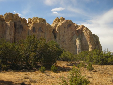
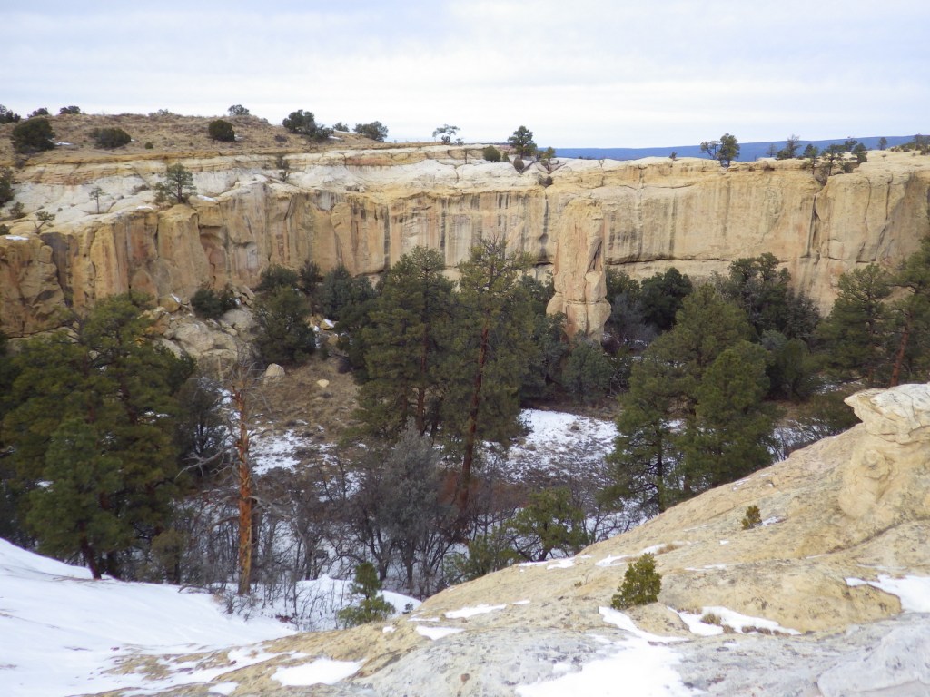
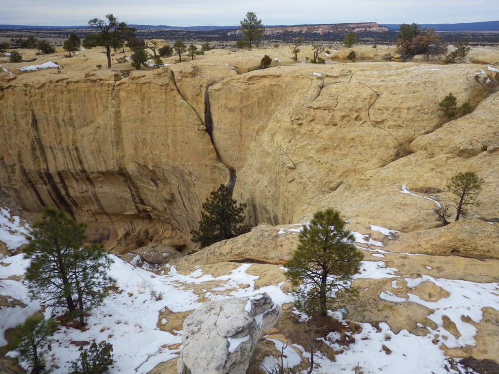
A small pool of reliable water at the base of a sandstone bluff has attracted humans and animals for centuries in this arid region. Ancestral Puebloans built a village atop the 200-foot-tall mesa and Spanish explorers carved their names alongside petroglyphs at a place they dubbed “el morro” (the headland). Today, El Morro National Monument is located about 125 miles west of Albuquerque, about 42 miles off Interstate 40.
Highlights
Inscription Rock Trail, Atsinna Pueblo ruins, Mesa Top Trail
Must-Do Activity
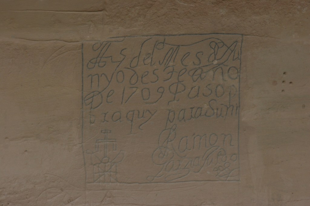
The National Park Service visitor center offers a 15-minute film and the half-mile paved Inscription Rock Trail loop to view the carvings. Pick up a free guidebook that provides details on the earliest European inscriptions that date back to 1605 and the petroglyphs that may be around 1,000 years old.
Best Trail
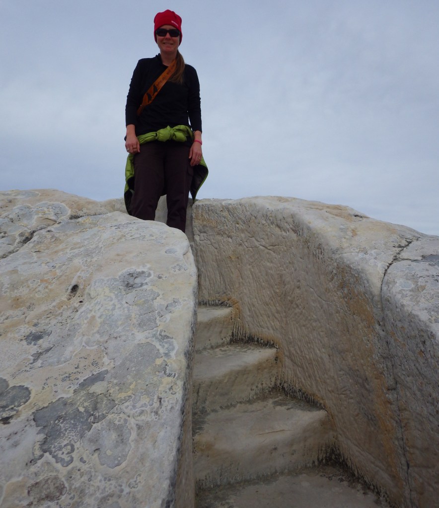
The Mesa Top Trail loop climbs to the top of the bluff where there are Ancestral Puebloan ruins and great views of the volcanic El Malpais National Monument. The hike is about two miles roundtrip, with interesting steps carved into the soft sandstone in places. The trail may be closed during thunderstorms during the summer and after heavy snowfalls in the winter.
Instagram-worthy Photo
It is worth the short but steep climb to check out the ruins of Atsinna Pueblo (built in the late-1200s) atop the sandstone bluff.
The small primitive campground at El Morro National Monument is open year round (except during snowstorms), plus there is a private RV park located near the entrance.
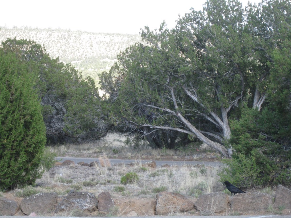
Inscription Rock TrailWater attracts wildlifeCottontail rabbitWinter visitBighorn sheep petroglyphsScott on Mesa Top TrailTiff on Mesa Top TrailRaven about the park
Explore More – Who were the first Anglo-Americans to inscribe their names at El Morro in 1849?
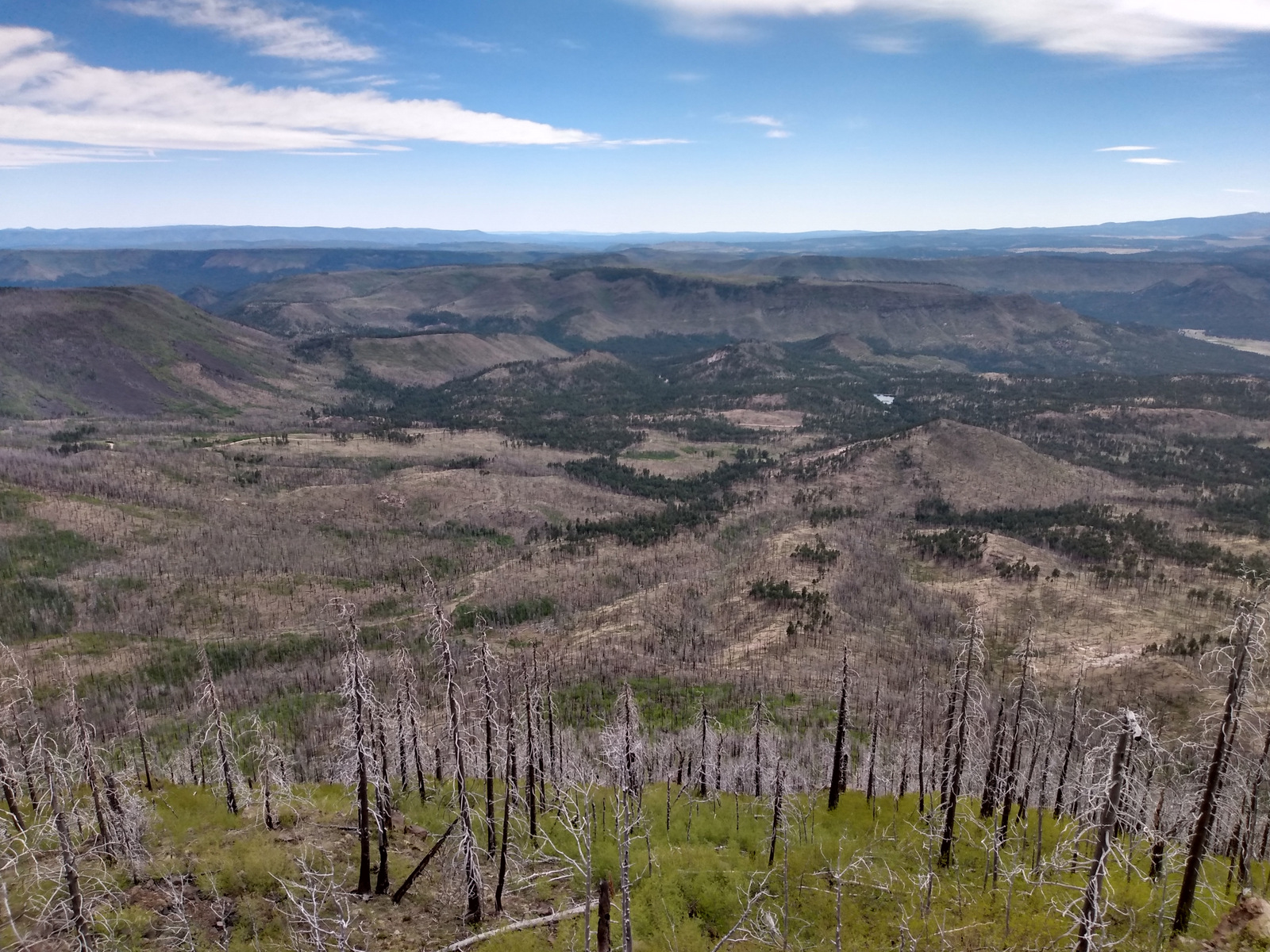
Growing up in Arizona, we only ever heard this referred to as Apache-Sitgreaves National Forest since it was merged in 1974. The more eastern Apache National Forest section represents about 69% of the combined forests total acreage and partly spills into New Mexico. On its west side it borders the Fort Apache and the San Carlos Indian Reservations, only containing one side of Mt. Baldy (which is famous for its ski resort). The National Forest contains the eastern portions of the White Mountains and Mogollon Rim, a forested escarpment that cuts 200 miles across much of the state of Arizona.
Highlights
Coronado Trail Scenic Byway, Mt. Baldy, Butler Canyon, Escudilla National Recreation Trail, Hannagan Meadow, Chitty Canyon, Big Tree Trail, Eagle National Recreation Trail
Must-Do Activity
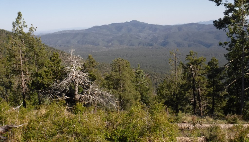
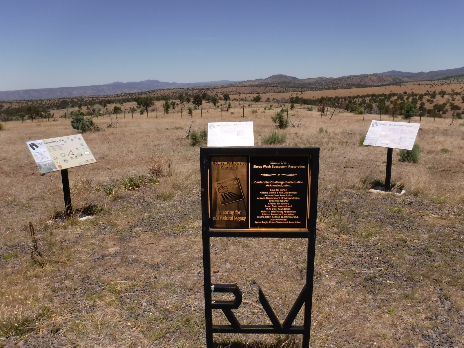
The Coronado Trail Scenic Byway (Highway 191) is a narrow, winding paved road that runs 120 miles north-south through Apache National Forest and is the best way to explore. Near the northern end of the highway, a steep unpaved road leads east up to the trailhead for Escudilla National Recreation Trail. A fire burned the 10,912-foot mountain that the trail summits and on our hike in May 2020 we counted 75 downed trees that we had to step over, both on the three miles in and the three miles out. To the east, the remote Blue Range Primitive Area was created in 1933, but has yet to receive Wilderness designation. About 18 miles south of Alpine make a stop at the historic Hannagan Meadow lodge, the only place to get gas along the route (or air if like us you have to put on your spare tire). The highway continues south dropping down from the Mogollon Rim into a more desert-like environment.
Best Trail
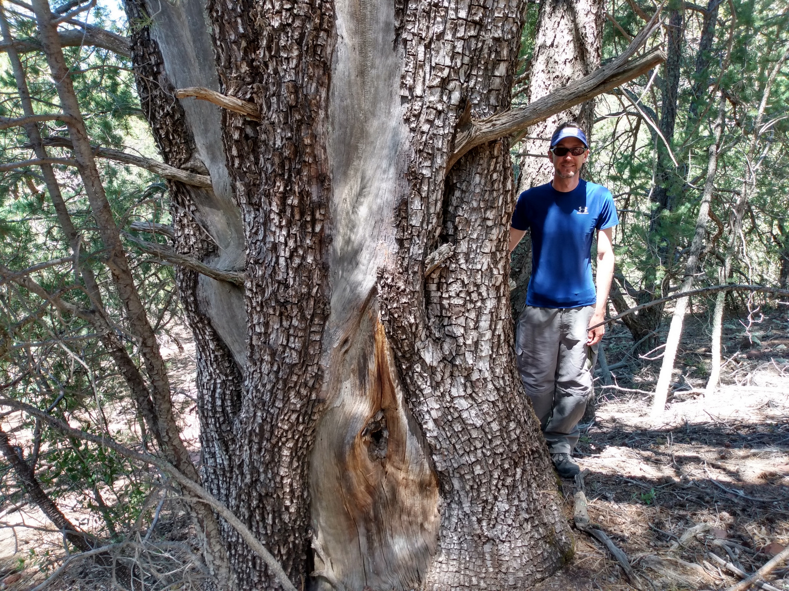
A short, but worthwhile hike descends west from Sardine Saddle near the southern end of the Coronado Trail Scenic Byway. At the end of the 0.4-mile trail is the largest Arizona cypress tree growing in the United States (97 feet tall with a 181-inch trunk circumference). There are also some big alligator juniper trees growing near the bottom of the canyon, and if you see their bark you will realize why they got their name.
Watchable Wildlife
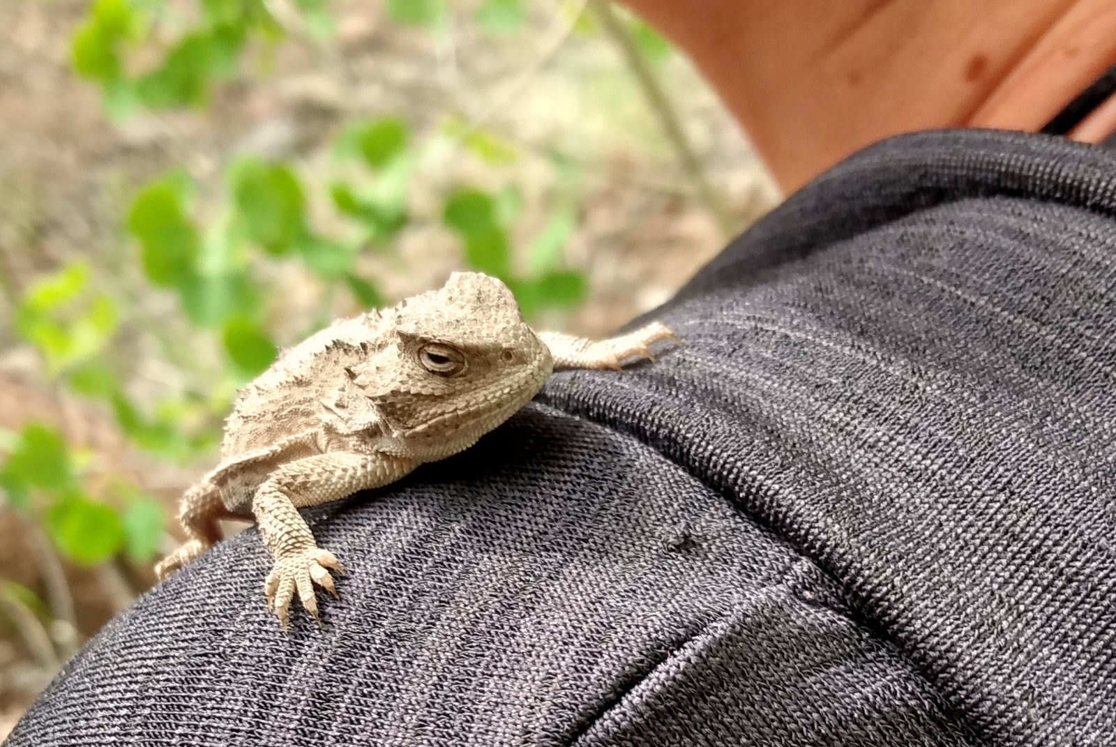
We were excited to find horned lizards (a.k.a. frogs or toads) along the Escudilla National Recreation Trail. The cliffs of the Mogollon Rim provide good thermal updrafts so are a good place to looks for turkey vultures and a variety of raptors. The ranges of mule deer and Coues whitetail deer overlap in this part of the country. We saw turkeys on the road back to Rose Spring Trail (Forest Road 54).
Instagram-worthy Photo
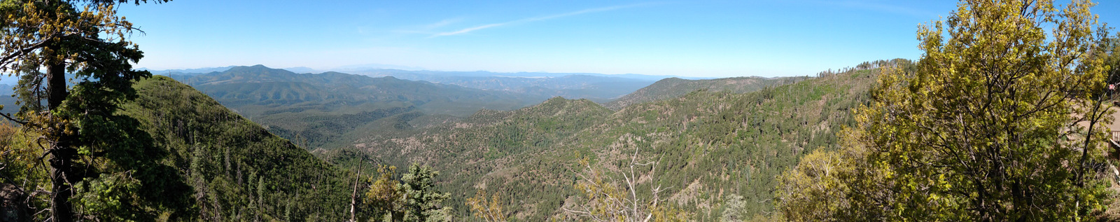
There are great views from atop the Mogollon Rim at Blue Point Overlook on the Coronado Trail Scenic Byway.
Peak Season
Spring and fall
Fees
None
Road Conditions
Highway 191 is paved, but is a slow drive due to its many curves. Many of the side roads are very rough and a high-clearance vehicle is recommended. We got a flat tire on the rocky Forest Road 54.
Camping
There are several developed campgrounds, including one at Luna Lake and several along the East Fork of the Black River. Dispersed camping options abound, including on the road to Escudilla National Recreation Trail and we found a nice campsite near the entrance to Forest Road 54.
Scott and his mother on Escudilla National Recreation TrailHorned lizardHornzed lizard on Tiff’s shoulderView from Escudilla National Recreation TrailScott and Tiff at the end of Escudilla National Recreation TrailAspen groveAspen tree eating Wilderness boundary signTurkeysTiff in a hammock at our dispersed campsiteInterpretive signs along the Coronado Trail Scenic BywayCoronado Trail Scenic BywayScott’s mother with the champion Arizona cypressClaret cup hedgehog cactusScott with an alligator juniper tree
We are a participant in the Amazon Services LLC Associates Program, an affiliate advertising program designed to provide a means for us to earn fees by linking to Amazon.com and affiliated sites.
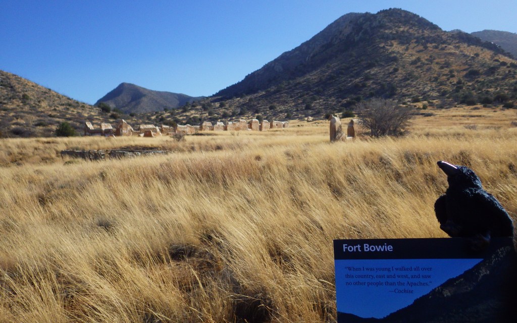
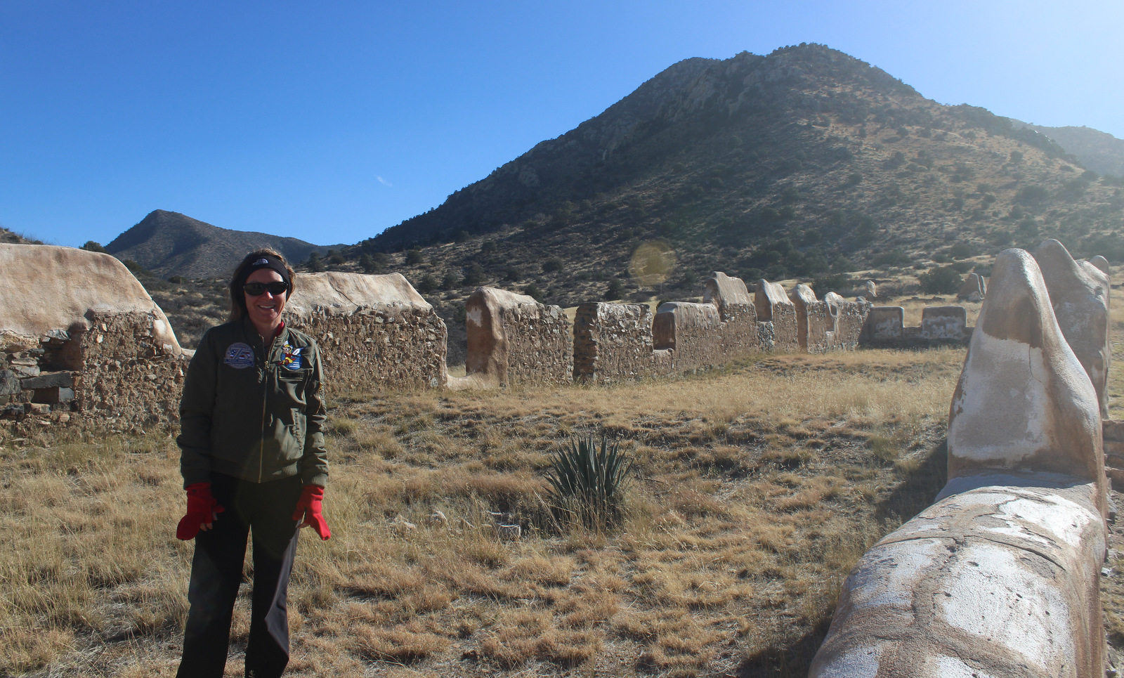
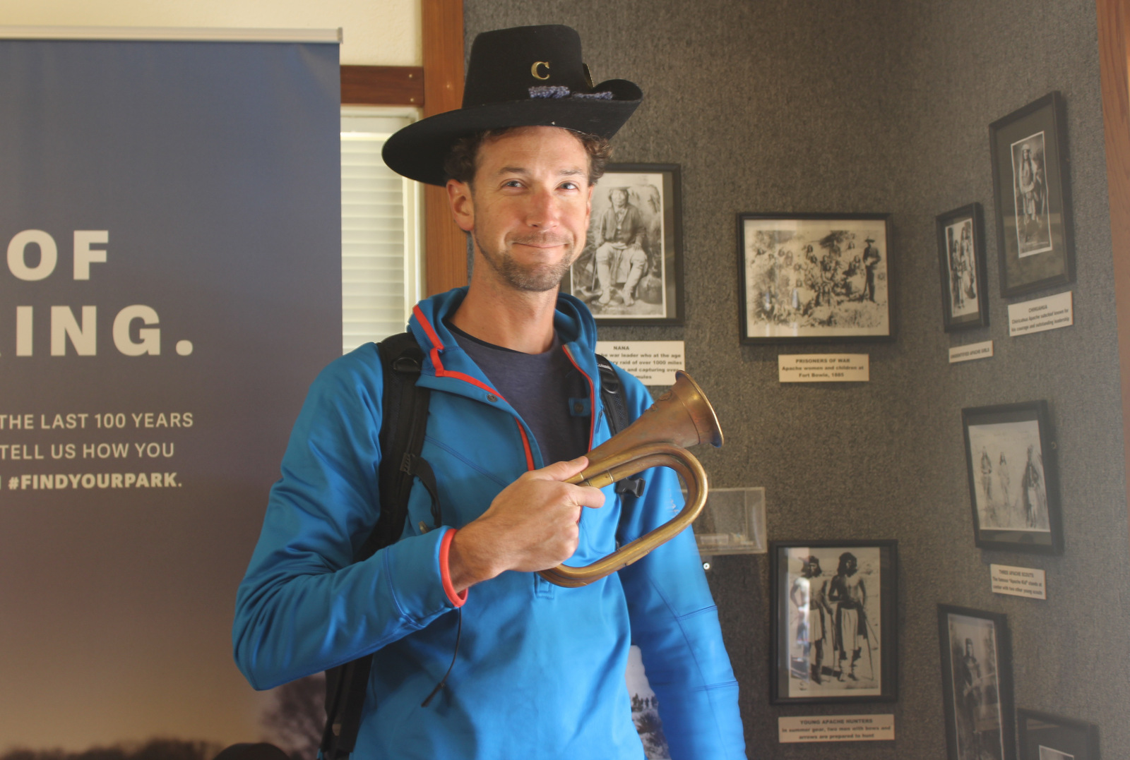
The spring at Apache Pass has attracted humans to this part of the Sonoran Desert for hundreds of years (at least). As you might have guessed from its name, the Apaches were the area’s inhabitants when the Butterfield Overland Mail route built a station here in 1858. Four years later, after Apaches ambushed the Union Army during the Civil War, they constructed Fort Bowie to help keep peace in New Mexico. The fort received an upgrade in 1868, and then was used to fight against Cochise and Geronimo until it was finally abandoned in 1894.
Highlights
Fort Bowie ruins, cemetery, stage station ruins, site of wagon train massacre
Must-Do Activity
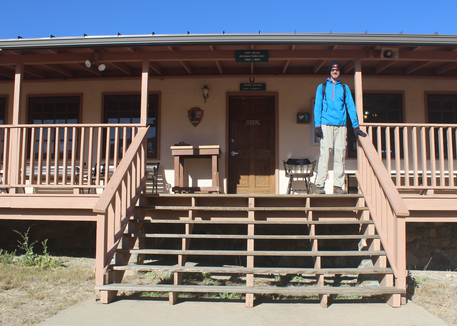
To visit the National Park Service (NPS) visitor center, the literal “must-do activity” is to hike 1.5 miles from the trailhead. You do pass interpretive signs, a cemetery, and ruins along the way, plus you earn an “I Hike For Health” pin just by getting there. For those unable to hike the trail, contact the NPS for alternate access directions.
Best Trail
Getting to the NPS visitor center means hiking three miles roundtrip in a shadeless desert. If it is a nice day, make a loop of it by taking Overlook Ridge on the way back to the trailhead.
Instagram-worthy Photo
The post cemetery has freshly-painted wooden grave markers, including one for Geronimo’s two-year-old son.
Access to this NPS site requires driving a graded dirt road that is impassable during flash floods.
Camping
Private campgrounds are available in Bowie and Wilcox, Arizona, but we recommend a night at the NPS campground in Chiricahua National Monument (which is well-known for its ringtail and coati sightings).
Explore More – When did Geronimo finally surrender to U.S. troops before being sent to Fort Bowie and on to Florida’s Fort Pickens (now part of Gulf Islands National Seashore)?
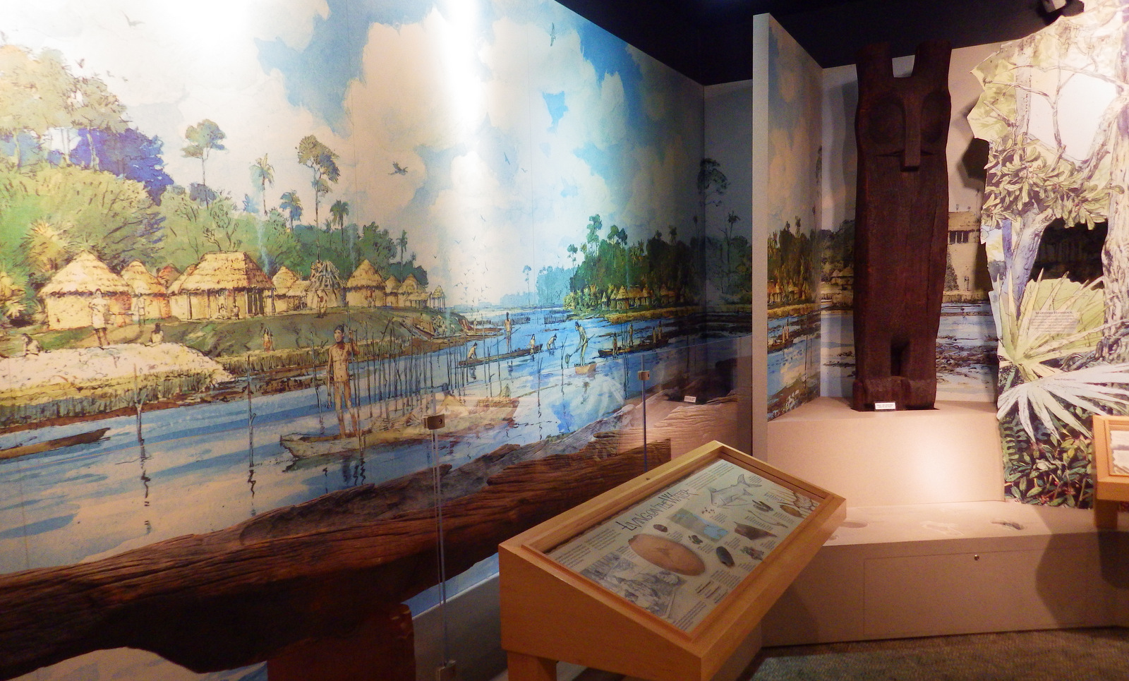
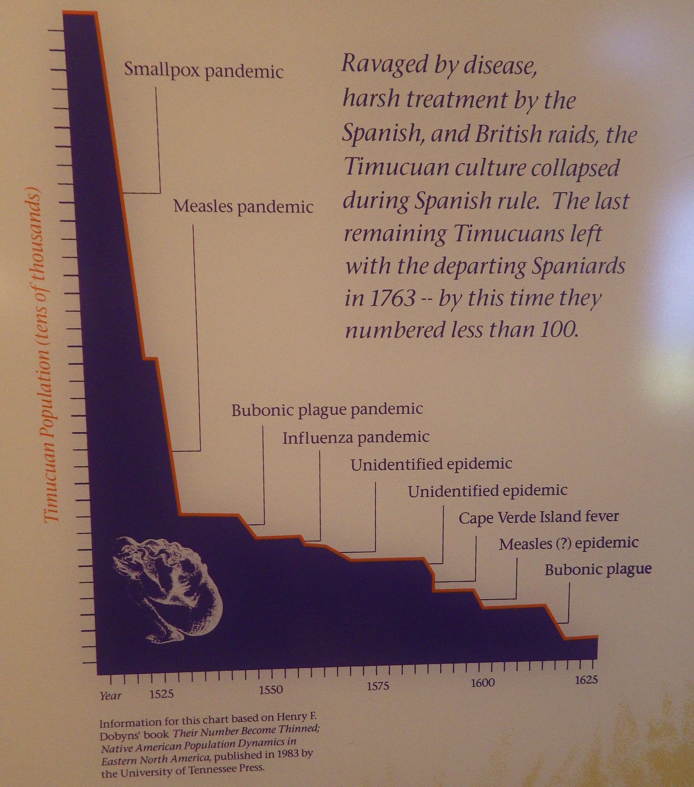
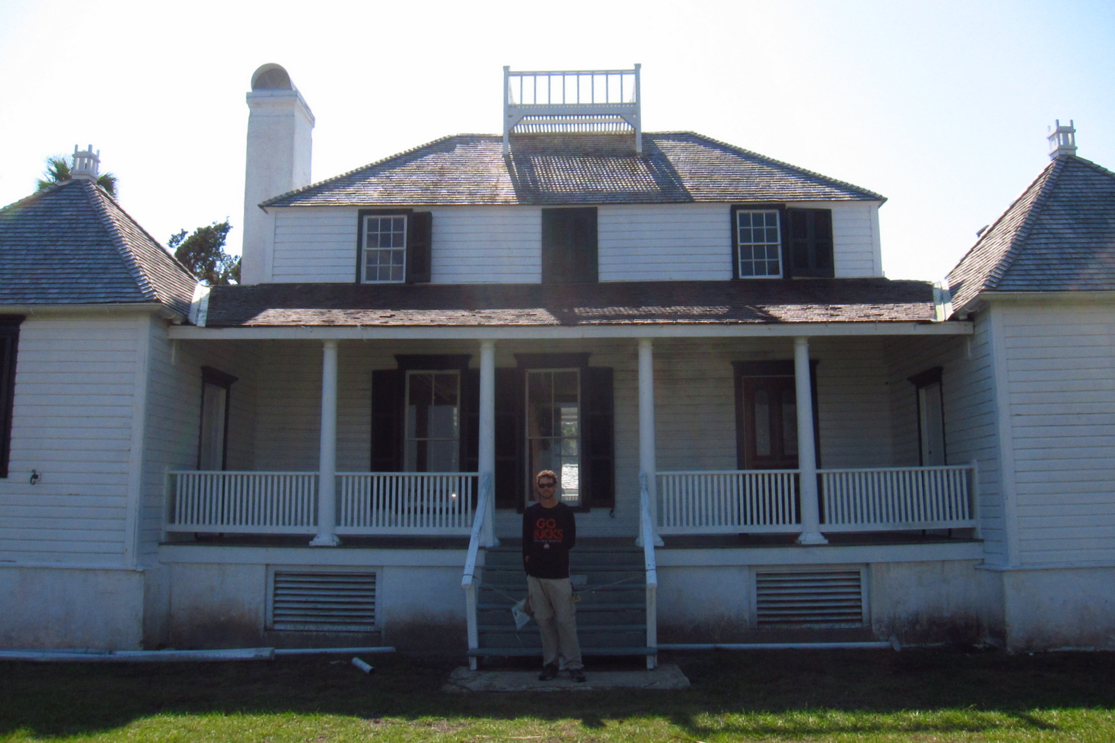
The Timucuan Indians inhabited northeastern Florida’s coastal wetlands and maritime hammocks when French colonists first arrived in 1562. The settlers constructed Fort Caroline (a National Memorial established in 1950), which the National Park Service (NPS) administers as a unit of Timucuan Ecological and Historic Preserve (established in 1988). Start your visit at the NPS museum at Fort Caroline National Memorial, which provides information on the indigenous Timucuan, as well as the European colonization efforts. Then you can tour a one-third scale reconstruction of the triangular Fort Caroline based upon a drawing from 1564 by French artist Jacques le Moyne.
Highlights
Fort Caroline, Kingsley Plantation, Theodore Roosevelt Area
Must-Do Activity
The second place the NPS manages a visitor center is at Kingsley Plantation on Fort George Island east of Jacksonville, Florida. Established in 1798, it is the oldest remaining plantation house in Florida. Slaves here harvested Sea Island cotton, which is still grown in a small garden alongside indigo, another regional cash crop. Visitors can take a self-guided trail around the property, but tours inside the main plantation house are only offered on weekends and require a reservation.
Best Trail
The 1.5-mile Willie Browne Trail winds through the 600 undeveloped acres at Theodore Roosevelt Area, donated by the trail’s namesake to the Nature Conservancy in 1969. The Spanish Pond Trail connects this trail with Fort Caroline National Memorial.
Instagram-worthy Photo
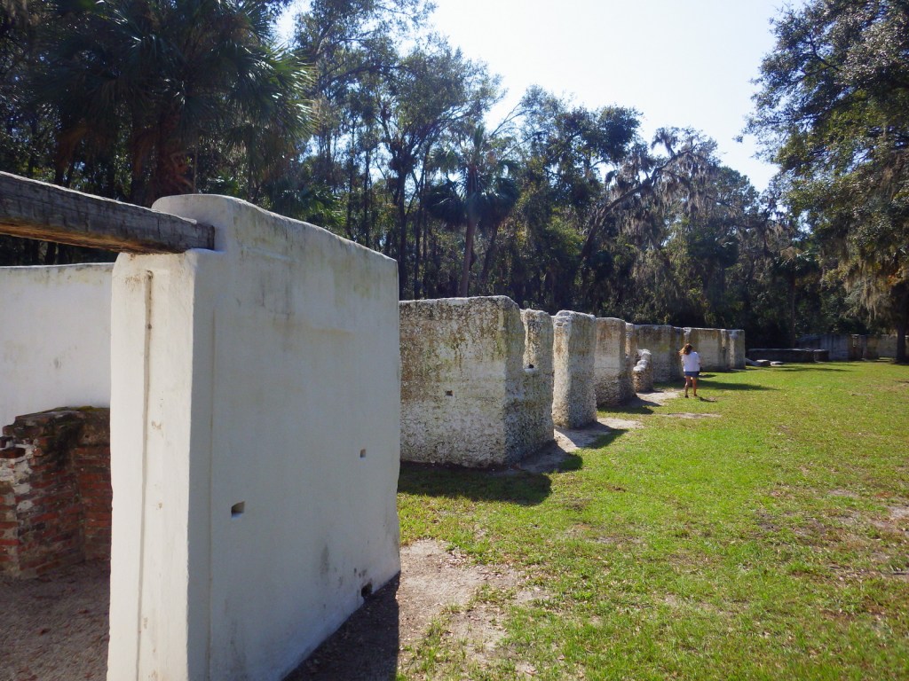
The tabby walls of 23 of the original 32 slave quarters still stand in a row at Kingsley Plantation.
Inside the Fort Caroline National Monument visitor centerFort CarolineScott at the Kingsley Plantation HouseTiff with a gnarly eastern redcedar treeCotton ball with insectsIndigo plantSwallow
Explore More – Florida had “relatively liberal” racial policies under Spanish rule, but that changed when it became a U.S. territory in what year?
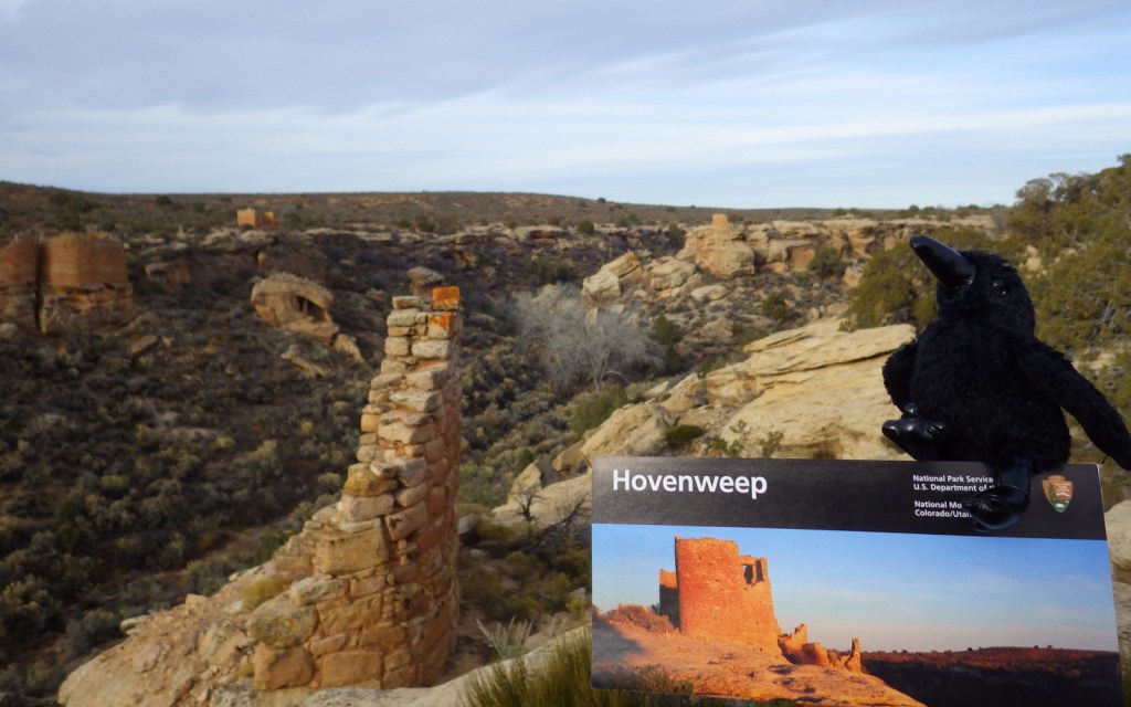
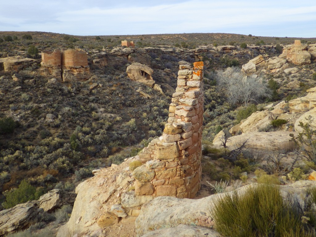
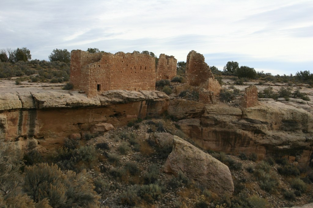
Partially surrounded by Canyons of the Ancients National Monument (run by the Bureau of Land Management), Hovenweep National Monument occupies a remote area on the southern Utah-Colorado border. Established in 1923, it is composed of six units, the largest of which has a National Park Service (NPS) visitor center on the rim of Little Ruin Canyon, the location of the variable architectural styles of Square Tower Group.
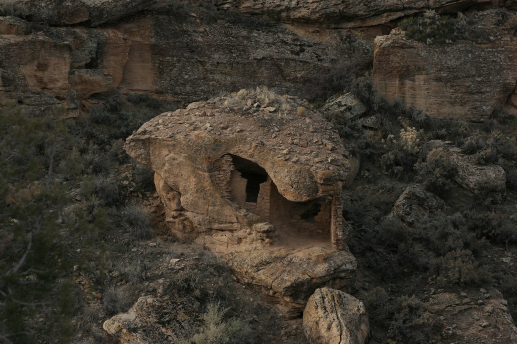
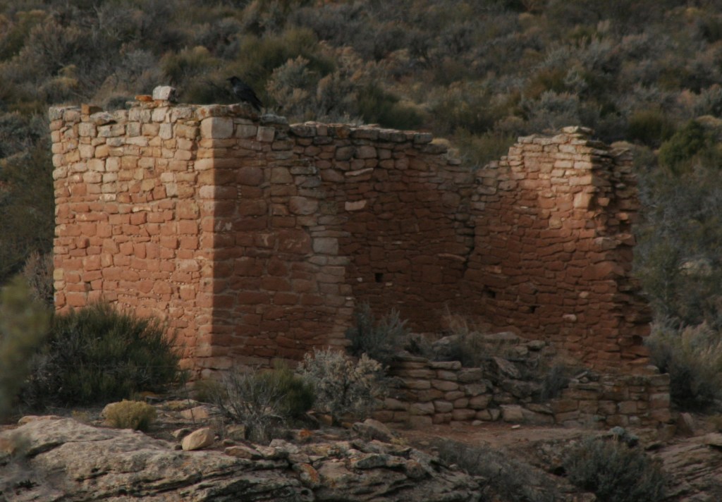
At Square Tower Group a two-mile loop hike takes visitors past an impressive collection of structures that date back to the 1200s, the same period that Ancestral Puebloans inhabited nearby Mesa Verde National Park. The variety of building styles in this narrow canyon is remarkable, from Square Tower and Hovenweep Castle to Twin Towers and the unique Eroded Boulder House. There is almost no shade to be found on the sagebrush plain of Cajon Mesa, so visiting in the heat of summer may not be as enjoyable. The good news is that it makes for boundless vistas, especially to the south where Sleeping Ute Mountain looms.
Best Trail
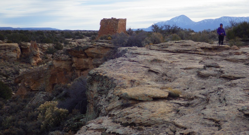
The loop trail at Square Tower Group is paved and wheelchair accessible to the first overlook at Stronghold Point, but then gets much rougher over its two miles, especially at the end where it drops into Little Ruin Canyon. A four-mile one-way trail connects this area to the Holly Group of ruins.
Instagram-worthy Photo
Little Ruin Canyon has one of the highest density collections of ruins anywhere in the southwest U.S., including the cool Eroded Boulder House, a part of the Square Tower Group.
Despite its remote location, roads are paved to Square Tower Group, but accessing most of the other units requires driving or hiking rough dirt roads. Further east in Colorado’s Canyons of the Ancients National Monument, visitors can drive well-maintained roads to the Escalante Ruins and Lowry Pueblo, as well as the two trailheads for Sand Canyon.
Camping
The NPS runs a 30-site campground (for a fee) at its visitor center near Square Tower Group. Dispersed camping is allowed in many parts of Canyons of the Ancients National Monument.