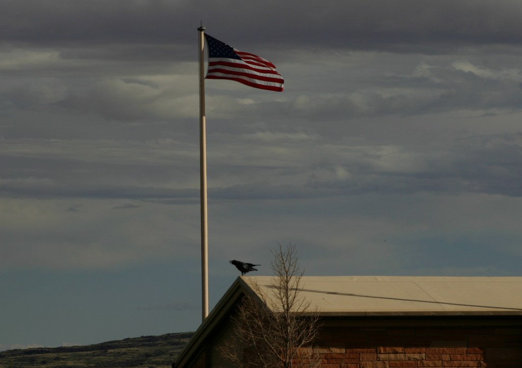
Saint Francis Dam Disaster National Memorial and Monument was authorized on March 12, 2019 to commemorate the 431 lives that were lost when an 185-foot-tall concrete gravity dam failed around midnight on the same date 91 years earlier. The death toll is second in the history of California to the 1906 earthquake in San Francisco. Saint Francis Dam was only two years old when it failed, and other dams from that time period remain in use as part of the Los Angeles aqueduct system. A detailed historical account of the disaster is available on Wikipedia. Currently, a California Historical Landmark is located 1.5 miles south at Powerhouse No. 2, but there is nothing developed at the actual site. In 2003 in Santa Paula, a memorial statue was erected featuring two motorcycle officers in honor of two heroes who warned sleeping residents of the impending flood, saving countless lives.
Ruins of dam, California Historical Landmark #919, Santa Paula Memorial
Must-Do Activity
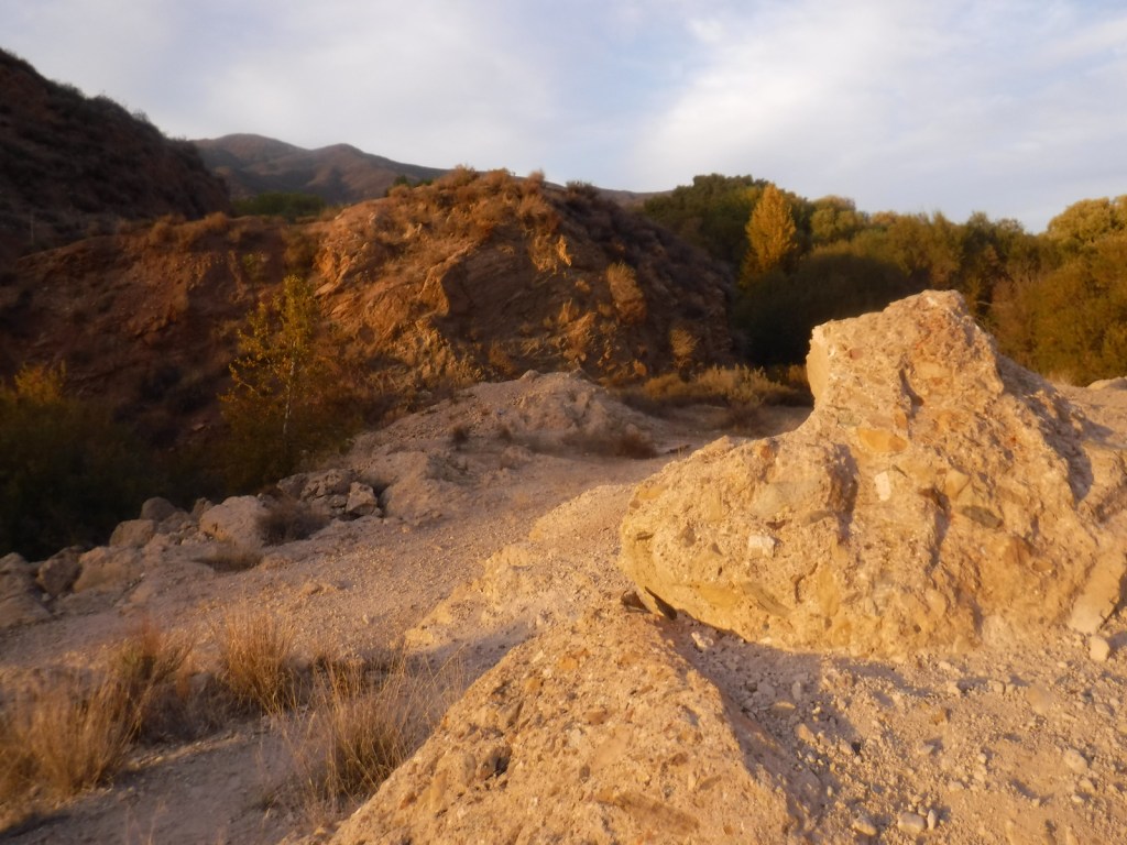
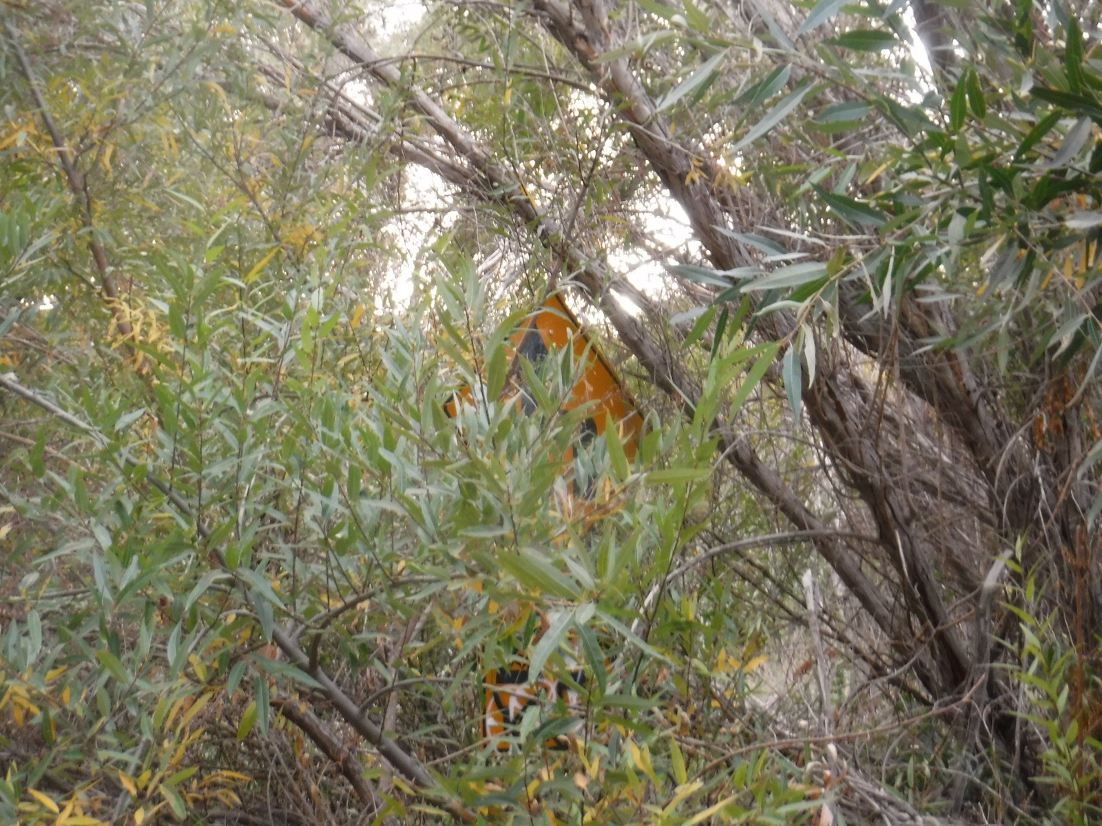
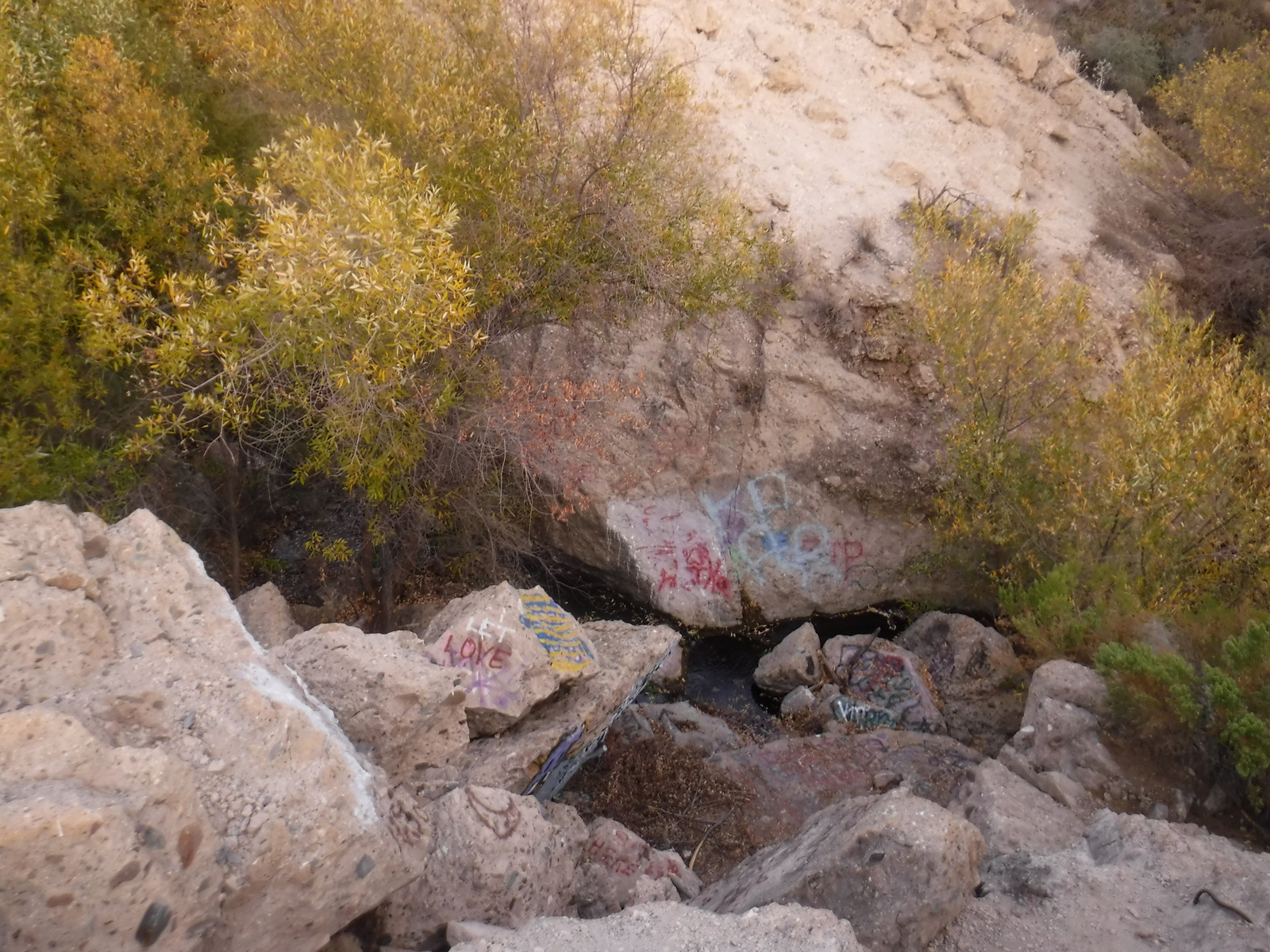
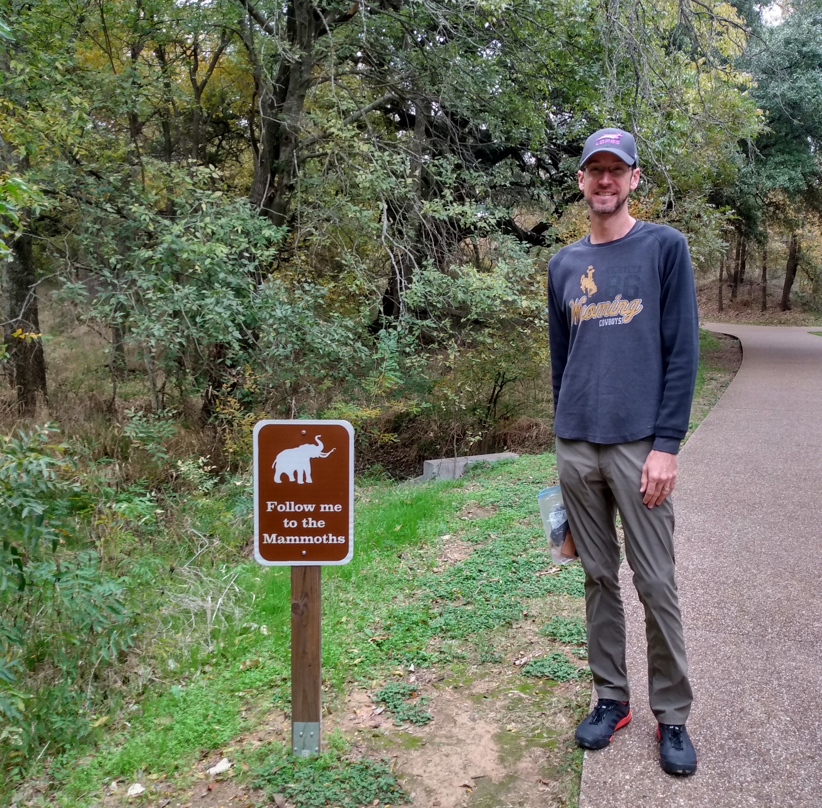
There are plans to build a National Memorial at the dam, but currently it is a pile of rubble heavily spray-painted by local teenagers. After its fall in 1928, authorities further toppled the structure with dynamite, bulldozers, and jackhammers to discourage sightseers and souvenir hunters. The site is located in a scenic canyon where the leaves were just turning yellow for winter during our mid-November visit. It is less than a mile walk to the site from the unmarked pulloff on the east side of San Francisquito Canyon Road in Angeles National Forest. The pathway is the heavily overgrown original roadbed that was abandoned after a storm in 2005 and it reeked of urine. It will be interesting to see how the Forest Service cleans up the area in the future.
Best Trail
There is no official trail, and it is quite a steep drop from the paved remnants of old San Francisquito Canyon Road to the actual rubble pile down at creek level.
Photographic Opportunity
The dam disaster site is not much to look at right now, but there are some angles where you can avoid getting graffiti in your photo.
Peak Season
Spring and fall
Fees
None
Road Conditions
San Francisquito Canyon Road is paved, but exercise caution as there is currently no sign for the parking areas nor is there a turn lane on this high-speed two-lane highway.
Camping
There are numerous Forest Service campgrounds in the area, with Spunky Canyon and South Portal being the closest to the north.
Driving San Francisquito Canyon RoadTiff walking on old San Francisquito Canyon RoadThe road has overgrown since 2005Scott walking on the dam ruinsLooking down towards the creekLooking back towards old San Francisquito Canyon RoadNorthern parking area off San Francisquito Canyon RoadLooking at the southern end of old San Francisquito Canyon RoadA California Historical Landmark is located 1.5 miles south at Powerhouse No. 2This area is still important for supplying L.A. with waterCrowin’ about the park
Explore More – How many billions of gallons of water were released when the St. Francis Dam failed in 1928?
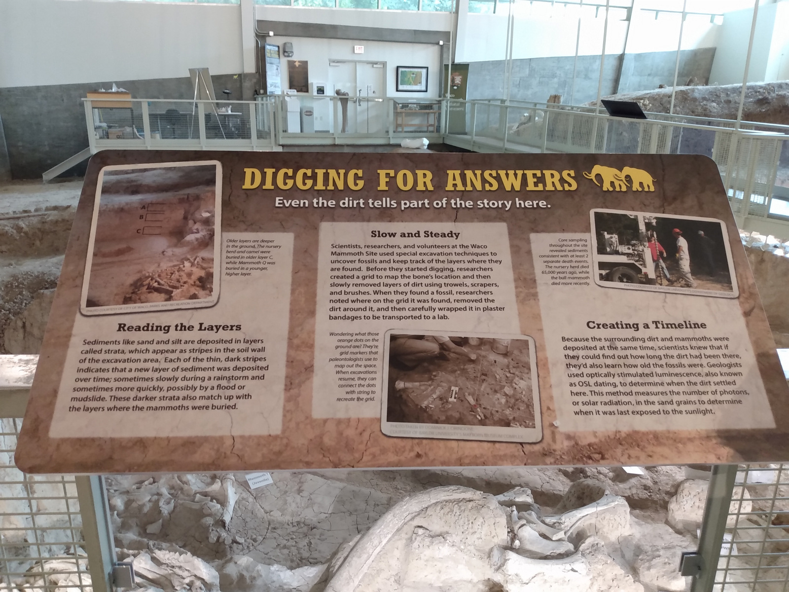
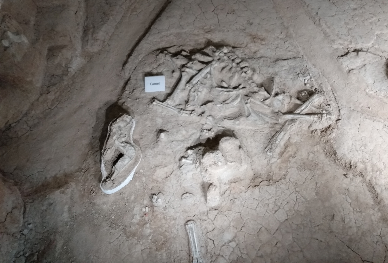
Columbian mammoths grew up to 14 feet in height, much larger than woolly mammoths that reached about 10 feet. About 65,000 years ago, a nursery herd of Columbian mammoths died in a ravine here due to unknown causes, possibly a flood or drought. Then about 51,000 years ago, another three mammoths died at the same spot before the onset of a new glacial period. Many of the fossils have been left in situ within the Dig Shelter, but others are on display at Baylor University’s Mayborn Museum Complex.
Highlights
Dig Shelter tour, Eagle Trail
Must-Do Activity
Established in 2015, this National Monument was already developed for visitors by the city of Waco and Baylor University. As such, annual America the Beautiful passes provide no discount for the guided tour to the Dig Shelter where the 65,000-year-old Columbian mammoth and camel bones have been excavated. First discovered in 1978, this dig site has since had a building constructed around it, making it a pleasant place to visit year round.
Best Trail
From the paved Mammoth Trail, there is the short Deer Loop that connects to the longer Eagle Trail. Located south of Waco Mammoth National Monument, Cameron Park in Waco has trails along the Brazos and Bosque Rivers.
Instagram-worthy Photo
The Dig Shelter is only viewable on a guided tour (admission charged).
Sunday we had our third article published in the Wyoming Tribune-Eagle, the local daily in our hometown of Cheyenne, Wyoming. It talks about our recent travels in California as we get closer to our goal of hiking in all 155 National Forests! Please find the entire article below:
Wilderness experiences in northern California’s Mendocino National Forest
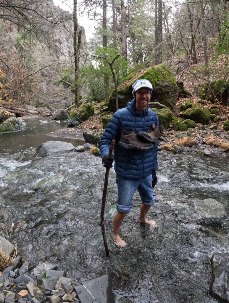
The first shock of dipping my bare foot into the frigid water of the South Fork of Stony Creek temporarily made my brain go blank. I was already a bit cold since the air temperature was in the 40s, but thankfully it was not breezy at the bottom of this steep, forested canyon. My wife, Tiff, held my forearm and in my other hand I grasped a stick I picked up on shore to help balance on the rounded rocks. The creek was only ten feet across, but it was running deep and fast enough that there was no way to hop across it. We made it through quickly together, taking turns moving and providing stabilization, but as we approached the opposite side the burning sensation in my feet was quite unpleasant. As I sat down to put my socks and shoes back on, I was grateful for the steep climb ahead of me so I could warm up on my way to Deafy Glade.
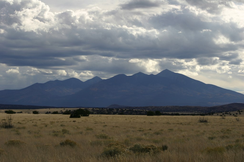
I was in northern California to visit Mendocino National Forest, the second to last stop in my quest to hike in all 155 national forests. Tiff and I rolled into the forest after dark, driving up to 3,000 feet in elevation from the valley and setting up a dispersed campsite. The view looking east the next morning was beautiful, the mountains of the Coast Range lit up by the rising sun. As we drove the winding road to the trailhead, we passed campgrounds full of RVs that were getting ready for a motorcycle event that weekend. Our hike took us far from any road noise, past congregations of lady bugs that numbered in the hundreds as we climbed steeply to 5,300 feet in elevation. The trail continued to the summit of 7,056-foot Snow Mountain, but we already found great views of the Rice Valley and decided to turn around at the 4.5 mile point, just inside the official boundary of the Snow Mountain Wilderness.
Despite its relative proximity to the densely-populated San Francisco Bay area, the Snow Mountain Wilderness feels quite remote. Our drive west of Interstate 5 into Stonyford, California cut through a rural area of the state with more cattle than people. Once we crossed the boundary into Mendicino National Forest we saw even fewer signs of civilization. The 915,532-acre National Forest stretches north-south along the Coast Range covering parts of six counties. There are 18 National Forests in California, the most of any state, but Mendocino is the only one not crossed by a paved highway. It is a wonderful destination for outdoor recreation, both motorized and non-motorized.
Wildfire
We originally scheduled a visit to Mendocino National Forests last summer, but about half the forest was closed due to firefighting efforts and the rest had awful air quality conditions. That wildfire eventually burned more than one-million acres, and this was only two years after the Mendocino Complex Fire burned 284,000 acres, including the entire Snow Mountain Wilderness. Heartbreakingly, a firefighter was killed by falling debris during that incident. Tragedy previously struck here in 1953, when one U.S. Forest Service employee and 14 volunteer firefighters died in the Rattlesnake Fire.
Firefighting annually consumes more than half the Forest Service’s $7-billion budget, especially in western states where forests are naturally evolved to burn periodically. Less than 25 years ago that was not the case, but the agency’s spending drastically shifted over time. We expected a desolate landscape after reading about the recent fires, but about three-quarters of the trees along the Deafy Glade Trail were still alive and showed only minor charring at their bases.
Much of the vegetation in Mendocino National Forest is chaparral, a mix of shrub species that are adapted to a frequent fire return interval. Ceonothus, mountain-mahogany, and manzanita are examples of shrubs that bounce back quickly after burning. Even the native tree species, like Douglas-fir, ponderosa pine and sugar pine, grow thick bark to survive surface fires. Knobcone pine and gray pine adapted serotinous cones that remain on the tree for decades, opening up to release their seeds by the heat of a fire. Unique species like Sargent cypress and the shorter McNab cypress grow on outcrops of serpentine rock where there is less vegetation to carry flames. These trees can tolerate the high magnesium levels in the soil of this bedrock that are toxic to other plants. Both species of cypress can be found growing along Frenzel Creek near Little Stoney Campground.
Wilderness Areas
The Snow Mountain Wilderness covers 60,076 acres entirely within Mendocino National Forest and since 2015 the new Berryessa Snow Mountain National Monument. There are three other Wilderness areas designated in this national forest: Sanhedrin, Yuki and Yolla Bolly-Middle Eel (which also spreads into Trinity and Six Rivers National Forests). According to the Wilderness Act of 1964, a Wilderness is “an area where the earth and its community of life are untrammeled by man, where man himself is a visitor who does not remain.” The law states a Wilderness must be at least 5,000 acres in size and expressly prohibits road building, oil exploration, mining, and logging. It also bans the use of all motorized equipment, in addition to bicycles and hang gliders (which are actually quite popular on Hull Mountain in Mendocino National Forest).
Forty years before passage of the Wilderness Act, the 558,014-acre Gila Wilderness in New Mexico became the world’s first designated Wilderness due to the efforts of forward-thinking people like Forest Service Supervisor Aldo Leopold. Many of the 109-million acres of Wilderness areas in the United States today would not meet his definition of an area “big enough to absorb a two weeks’ pack trip.” While the majority of National Park Service land is Wilderness (nearly 44-million acres), this does not officially include some of its wildest areas, like Yellowstone National Park. About 18% of the Forest Service’s land holdings are designated Wilderness (more than 36-million acres). My travels in national forests took me to some extremely remote mountainous areas like Wyoming’s Fitzpatrick Wilderness, as well as swampy Indian Mounds Wilderness in eastern Texas that is literally bisected by a paved road.
The first Wilderness designated in a U.S. territory was created in 2005 in Puerto Rico’s El Yunque National Forest, the final destination in my journey to all 155 National Forests. I look forward to sharing my experiences from the only tropical national forest with you in a few weeks.
Tiff near where we turned around in the Snow Mountain Wilderness
After getting our first article published last week, we have part two of four this week. Click here to see it in the online edition of the Wyoming Tribune-Eagle and click here for the first article. Thanks for reading!
Hiking the many National Monuments of southern California
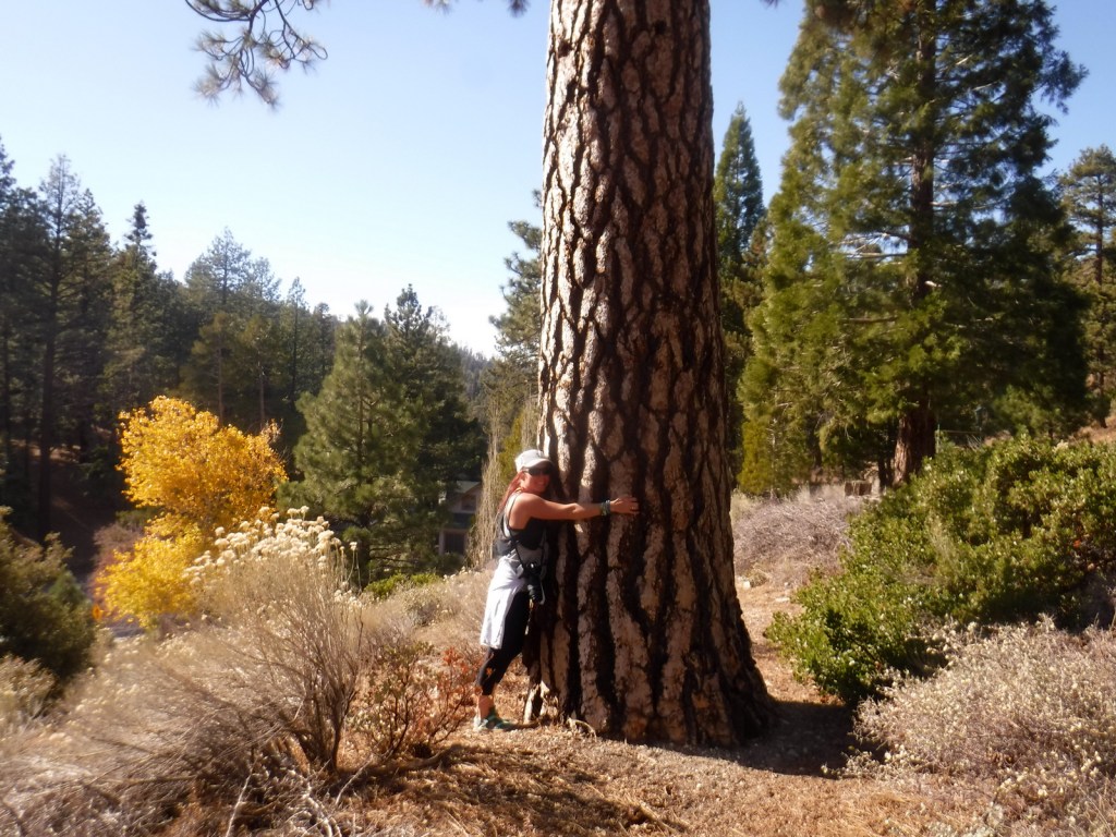
The rich odor of incense-cedar trees filled the warm air as we ascended the rocky trail from the historic Big Pines Visitor Center. This soulful smell may be more familiar to you than you think since its wood is commonly used to make pencils. It was a sunny November afternoon at 7,000 feet in elevation on the Angeles Crest Highway, which traverses the steep-sided San Gabriel Mountains that rise above southern California’s infamous smog. The partially shaded path was lined with interpretive signs that introduced the trees and shrubs growing on this dry, south-facing hillside. Across the narrow valley, a ski resort was cut into the dense stands of conifers on the shady north slope. Further down the trail, my wife and I stopped to sniff the orange, platy bark of a Jeffrey pine for its pleasant vanilla scent which brought back memories of our time spent living in the state.
Scott with an incense-cedar tree
My hike in Angeles National Forest marked number 153 in my quest to hike in all 155 National Forests. The trail was located inside the boundaries of San Gabriel Mountains National Monument, established in 2014 and managed by the U.S. Forest Service north of the Los Angeles metropolitan area. The National Forest gets its name from the city, which since 1781 has officially been titled El Pueblo de Nuestra Señora la Reina de los Ángeles de Porciúncula, which must be why most people call it L.A. Despite this region’s reputation for sun and surf, the high elevations (topping out at 10,064 feet on Mt. San Antonio) regularly get snow in the winter. The paved Angeles Crest Highway used to go through to Glendale, but closed due to damage from the 2020 Mission Fire, and this after the 2009 Station Fire burned about one-quarter of the National Forest.
Angeles National Forest is registered as a California Historical Landmark since it became the first protected woodland in the state as the San Gabriel Timberland Reserve in 1891. Its 661,565 acres serve as a major recreation area for the large population center with 697 miles of hiking trails, several lakes, and two alpine ski areas. The vegetation ranges from chaparral to oak and mixed evergreen forest. Most of the shrub and tree species are adapted to periodic fire, including the familiar lodgepole pine. Many species commonly found in this National Forest only grow in this region and nowhere else on Earth, including California black oak, canyon live oak, bigcone Douglas-fir, knobcone pine, and Coulter pine (famous for its massive pinecones that weigh up to 11 pounds).
Big Pines Visitor Center
National Monuments
National Monuments like San Gabriel Mountains can be created by proclamation of the President of the United States or an act of Congress. The Antiquities Act of 1906 states that the President may set aside “historic landmarks, historic and prehistoric structures, and other objects of historic or scientific interest.” Within three months of its passing, Theodore Roosevelt used that power to establish Devils Tower National Monument in Wyoming, followed by many others that later became National Parks, including Petrified Forest and Grand Canyon.
There are currently 128 National Monuments in the U.S. managed by the National Park Service, Bureau of Land Management, U.S. Forest Service, and other government agencies. That number is constantly in flux as designations are changed, such as when New Mexico’s White Sands became a National Park in 2019 after nearly 90 years as a National Monument. On the other end of the spectrum, South Carolina’s Reconstruction Era (est. 2017) was a National Monument for only two years before it was redesignated as a National Historical Park.
Wyoming had another historic moment involving National Monuments during World War II when President Franklin D. Roosevelt controversially proclaimed Jackson Hole National Monument after Congress declined to incorporate lands acquired by John D. Rockefeller, Jr. into Grand Teton National Park. In 1950, those two parcels were combined, but that law also barred future Presidents from using the Antiquities Act in Wyoming for areas larger than 5,000 acres. Since then, Fossil Butte has been the only National Monument created in the state and that was by Congressional act in 1972.
The court system has continually approved the President’s power to use the Antiquities Act in this way, although it has not always been popular, especially with industries based on natural resource extraction. After 56-million acres of land within Alaska were set aside by President Jimmy Carter, a federal law in 1980 limited designations in that state to under 5,000 acres, similar to Wyoming. More recently, Bears Ears and Grand Staircase-Escalante National Monuments in Utah have been the subject of political Ping-Pong.
Tiff holding a Coulter pine cone
Other National Monuments
We also visited Saint Francis Dam Disaster National Monument while in Angeles National Forest. It was established on March 12, 2019 to commemorate the 431 lives that were lost when a concrete gravity dam failed in 1928 only two years after its construction. The death toll is second in the history of California to the 1906 earthquake in San Francisco. There are plans to build a memorial at the dam, but currently it is a pile of rubble heavily spray-painted by local teenagers. The site is located in a scenic canyon where the leaves were just turning yellow for winter in mid-November. It will be interesting to see how the U.S. Forest Service cleans up the area in the future.
Many other National Monuments are not well developed for tourism and some are nearly inaccessible. Those that do offer visitor centers and guided tours are typically managed by the National Park Service, such as Montana’s Little Bighorn Battlefield (est. 1940) and New York’s African Burial Ground (est. 2006). The U.S. Forest Service and Bureau of Land Management tend to take a more hands-off approach, as we experienced on our trip while stopping at Sand to Snow National Monument in southeastern California. Established in 2016, the two federal agencies co-manage this area along with other landowners in the San Bernardino Mountains north of Palm Springs. We took a pleasant hike through Big Morongo Canyon Preserve, which was mostly on a boardwalk shaded by tall cottonwood trees, an unexpected ecosystem in the Mojave Desert.
Our trip through southern California also included a ferry trip out to kayak the sea caves in Channel Islands National Park, a day trip that we highly recommend. Our journey will continue next week as we visit Berryessa Snow Mountain National Monument and Mendocino National Forest, the second to last in our quest to hike in all 155 National Forests.
Scott walks up to the site of the Saint Francis Dam disaster in southern California
—
Scott Sink has visited 106 National Monuments, although that number has been decreasing due to redesignations. He writes his travel blog (RavenAboutTheParks.com) from Cheyenne, Wyoming.
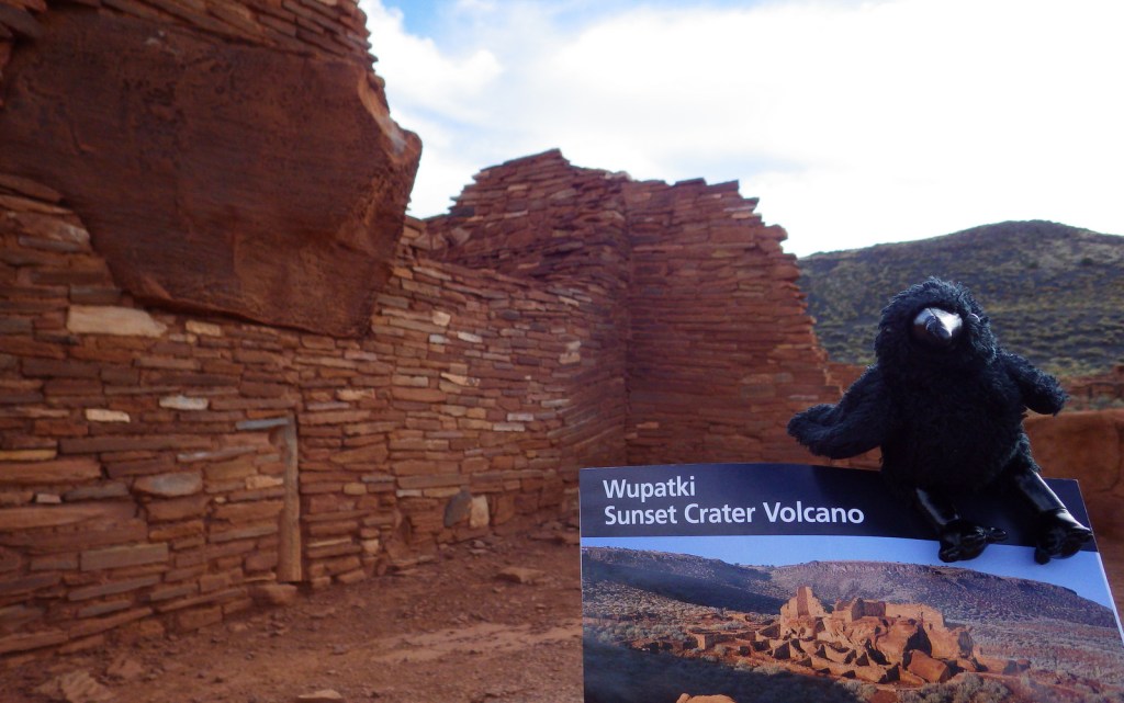
In the open plateau northeast of Flagstaff, Arizona lies 35,000 acres set aside in 1924 to protect a collection of archaeological sites. A 35-mile drive through Sunset Crater Volcano National Monument and adjacent Wupatki National Monument passes through ponderosa pine forests and sunflower-filled meadows on its way to an arid, rocky high desert. Archaeologists theorize the Ancestral Puebloan people were attracted to this place by the fertile volcanic ash deposited by the contemporaneous eruptions at Sunset Crater.
Highlights
Wupatki Pueblo, Lomaki Pueblo, Citadel and Nalakihu Pueblos, Wukoki Pueblo
Must-Do Activity
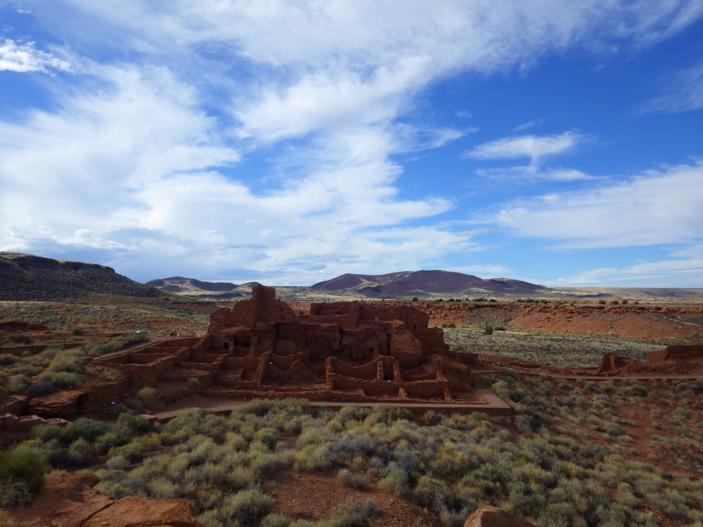
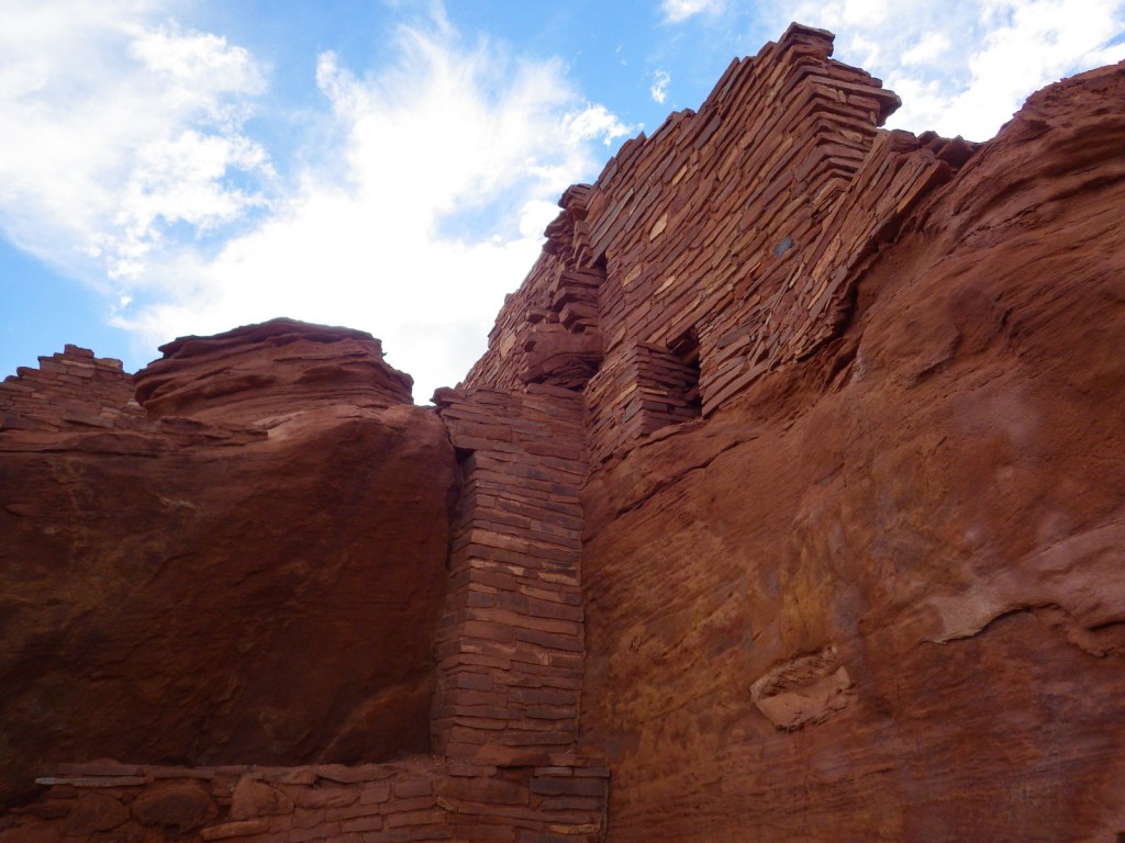
The most famous of the ruins is named Wupatki Pueblo, a three-story, 100-room house inhabited by Sinagua around AD 1100. At the height of its occupation, the structure was three stories tall and contained 100 rooms. Its location near a spring allowed villagers to farm the volcanically-enriched soil, plus the leisure to build an amphitheater and ball court. Here there is more than just crumbling ruins and pottery shards behind glass in a museum; there is a palpable feeling that this was a place where people lived.
Best Trail
The paved walking loop from the visitor center at Wupatki Pueblo is a half mile long and there are short interpretive trails at several additional ruins (see Highlights above), most located not far from parking lots.
Instagram-worthy Photo
Next to the ball court, do not miss the small opening to a larger cavern (or earthcrack) that breathes in or out depending upon the change in barometric pressure. It is not hard to imagine kids playing here hundreds of years ago.
All roads to ruins are paved, but there is one dirt road that leads to the Little Colorado River, which forms the border with the Navajo Indian Reservation.
Camping
The U.S. Forest Service runs the Bonito Campground across from the Sunset Crater visitor center between May and October. Dispersed camping is allowed in portions of Coconino National Forest.