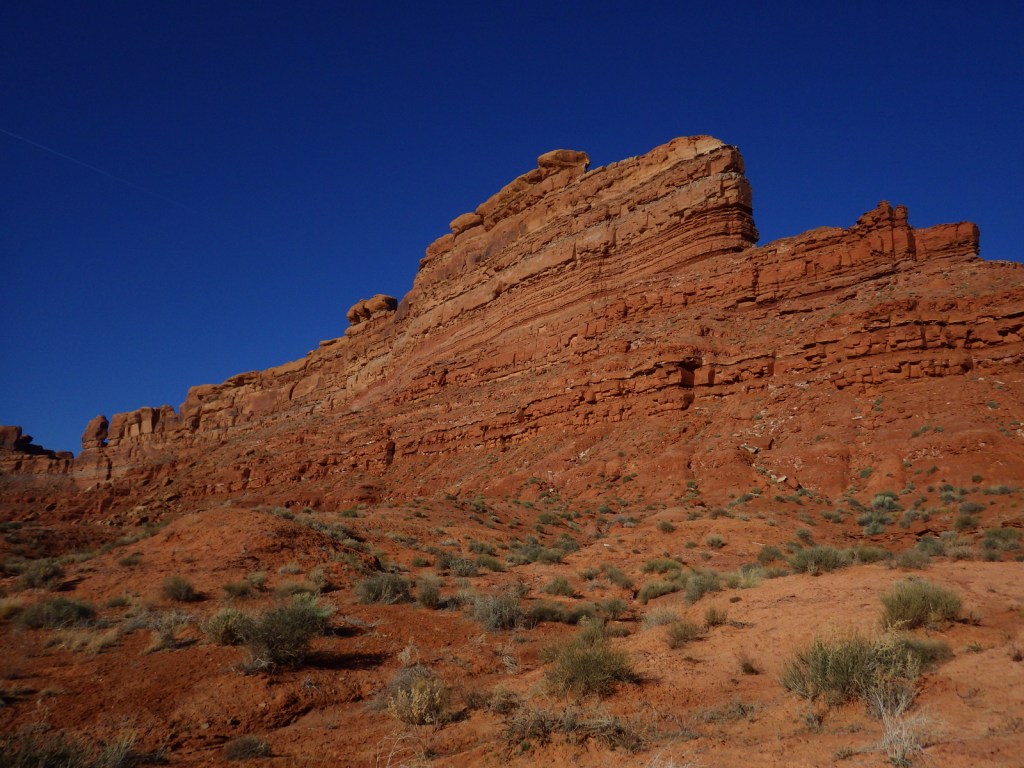
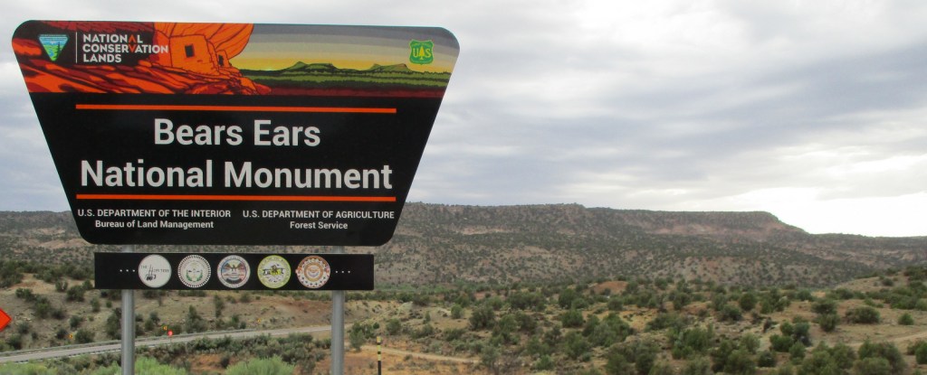
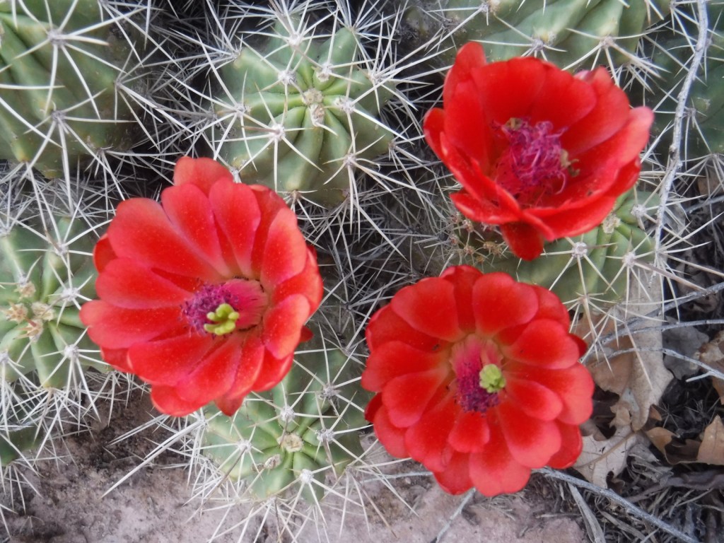
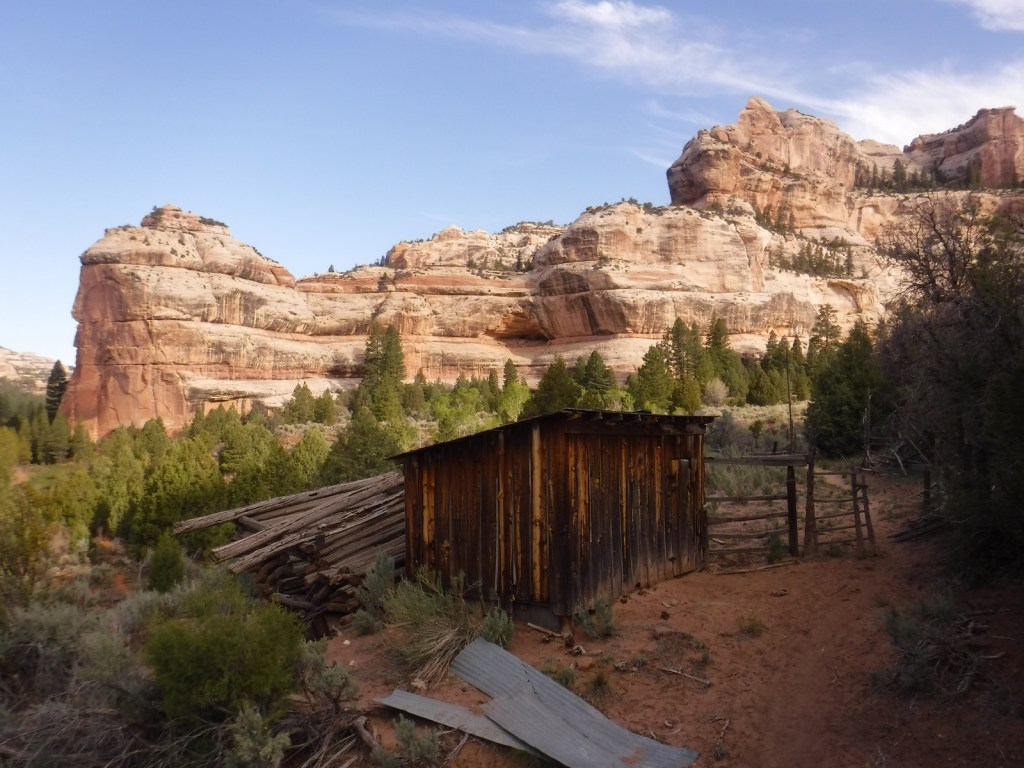
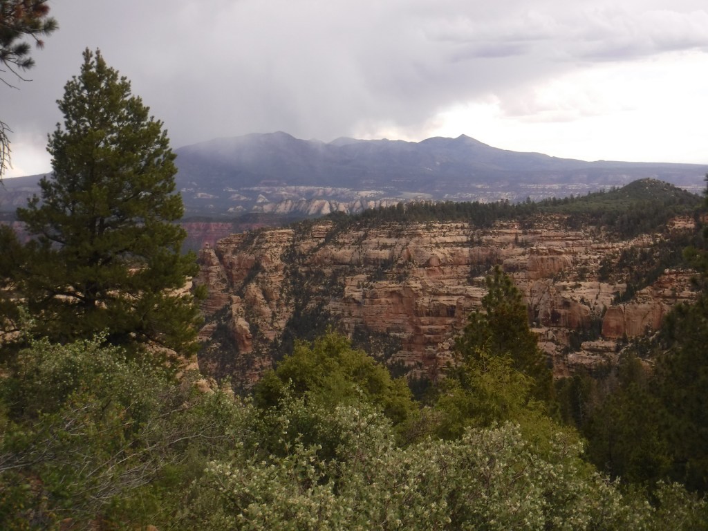
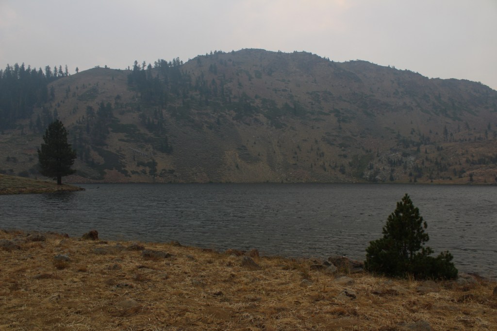
The Bureau of Land Management (BLM) and U.S. Forest Service manage the more than one-million acres of Bears Ears National Monument in partnership with five local Native American tribes. After it was established, in 2017 it was controversially reduced in size to 201,876 acres before being restored four years later. Much of the southern portion of La Sal National Forest, including the Dark Canyon Wilderness, is included inside its boundaries. The entire area protects millions of years of the paleontological record and has more than 100,000 archaeological sites, especially on Cedar Mesa where day-use and overnight permits are required. The BLM has excellent maps and trip-planning resources available on their website.
Butler Wash, Moon House Ruin, Newspaper Rock, Moki Dugway, San Juan River, Elk Ridge Scenic Backway, Dark Canyon Wilderness, Mule Canyon, Seven Kivas, The Citadel Trail
Must-Do Activity
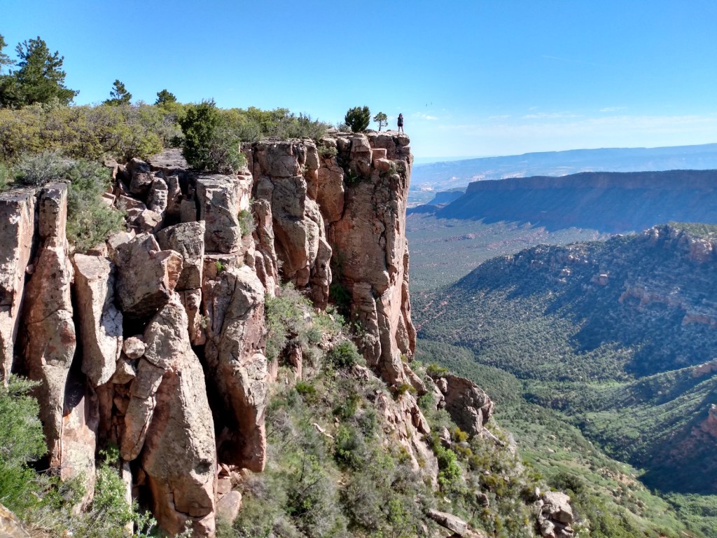
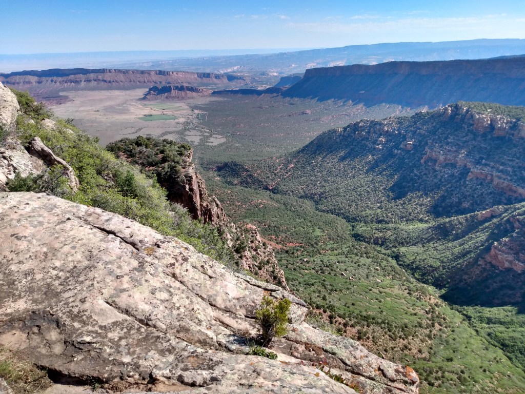
It would be easy to spend more than a week exploring the roads and trails within Bears Ears National Monument. Everyone should try to drive the good 17-mile-long dirt road through Valley of the Gods to see rock formations like Rooster Butte and Woman in the Tub. West of Blanding, paved State Route 95 passes Mule Canyon Interpretive site, Butler Wash Interpretive Trail, and Butler Wash Dinosaur Tracksite. In La Sal National Forest, the 58-mile-long Elk Ridge Scenic Backway is a well-maintained (though unpaved) route that leads north from Natural Bridges National Monument to Highway 211, which connects to the Needles District of Canyonlands National Park. There are multiple trails along the way that provide access to the Dark Canyon Wilderness, an area known for old-growth forests, natural arches, and Ancestral Puebloan ruins and pictographs.
Best Trail
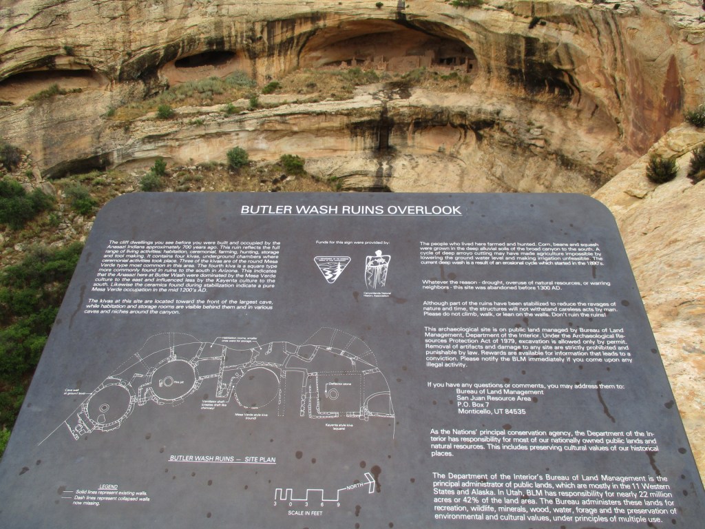
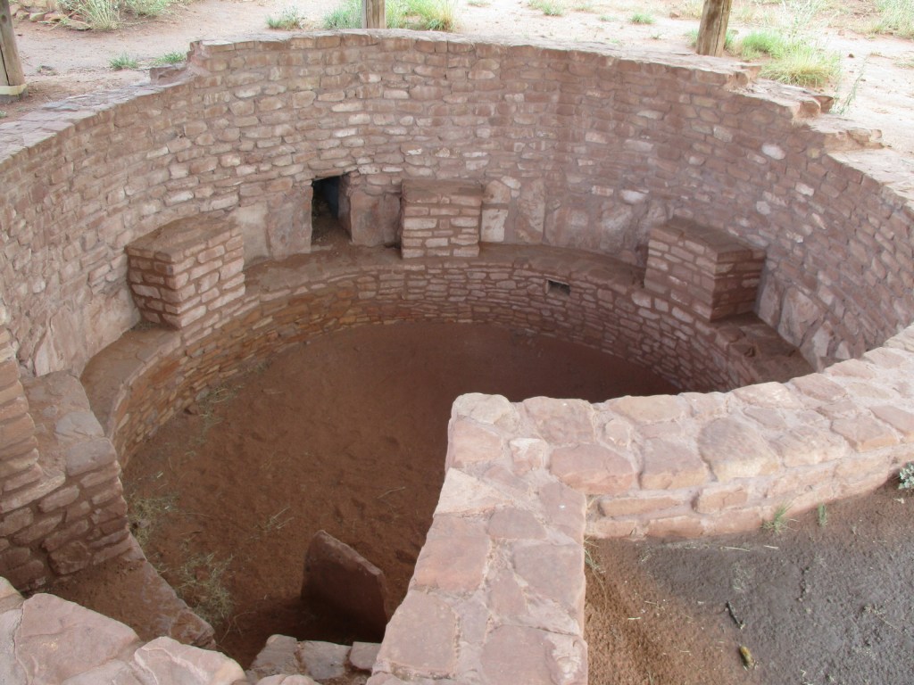
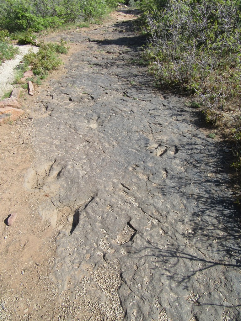
There are many trails to choose from, but one of the most popular is off unpaved Texas Flat Road that enters Mule Canyon (parking fee) and accesses House on Fire, a well-preserved granary located one mile in after multiple stream crossings. There is a paved parking lot suitable for RVs at Butler Wash Interpretive Trail, a half-mile one-way walk on to an overlook of a cliff dwelling.
Photographic Opportunity
Along Highway 211 to the Needles District of Canyonlands National Park, be sure to stop at the paved parking lot for Newspaper Rock. Another nice panel of rock art is found in Sand Island Campground along the San Juan River near Bluff, Utah.
Peak Season
Spring and fall
Fees
A day-use fee of $5 per person applies at several parking areas on Cedar Mesa in southern Bears Ears National Monument, including Mule Canyon access to House on Fire Ruins. There are pay stations at several sites, as well as pre-paid online permits (including for 20 people per day to access Moon House Ruin).
Road Conditions
State Route 95 and Highway 211 are both paved, but other roads like the Moki Dugway, Valley of the Gods Road, and 58-mile-long Elk Ridge Scenic Backway should not be attempted by RVs. A high-clearance vehicle is required to drive many side roads, including six-mile-long Cigarette Springs Road to The Citadel and Seven Kivas Trails. Be aware that flash floods are a danger as many roads traverse canyons.
Camping
There are numerous developed campgrounds spread throughout Bears Ears National Monument. We enjoyed our stay at Hamburger Rock Campground outside the Needles District of Canyonlands National Park. Dispersed camping is also a good option, especially in scenic Valley of the Gods and along lightly-traveled Elk Ridge Scenic Backway. All backcountry camping on Cedar Mesa requires a permit and no campfires are allowed.
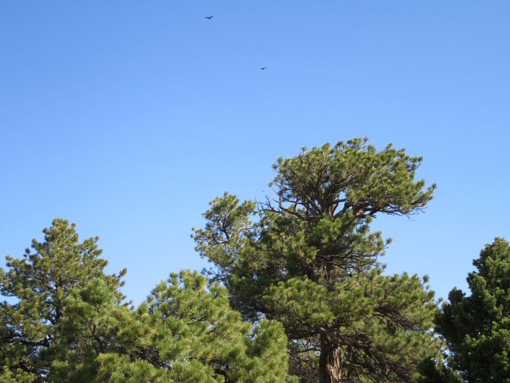
Valley of the GodsWoman in the Tub formationValley of the GodsValley of the GodsValley of the GodsValley of the GodsMexican HatCamping at Hamburger RockTiff on the Moki DugwayDinosaur tracksFlash flood over dinosaur tracksMule CanyonMule CanyonMule CanyonThe “Bears Ears” formationRavens about the park
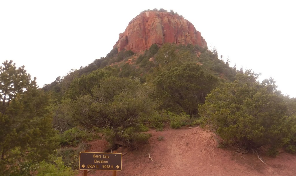
Explore More – Where are the actual Bears Ears formations that give the National Monument its name?
La Sal National Forest is found in two separate sections of southeastern Utah surrounding the La Sal and Abajo Mountains, topping out on 12,721-foot Mt. Peale. Much of the southern portion of the National Forest, including the Dark Canyon Wilderness, was included in the 1.35-million-acre Bears Ears National Monument, established in 2016 and then controversially reduced in size before being restored. Since 1949, it has been administratively combined with the northern and separate Manti National Forest, so it can be difficult to find information for La Sal National Forest alone.
Highlights
Bears Ears National Monument, La Sal Mountain Loop Scenic Backway, Warner Lake, Bull Canyon Dinosaur Tracks, Buckeye Reservoir, Elk Ridge Scenic Backway, Harts Draw Highway, Abajo Loop State Scenic Backway, Mt. Peale, Arch Canyon, Mt. Tukuhnikivatz
Must-Do Activity
Many visitors access the forest south from Moab on the mostly-paved La Sal Mountain Loop Scenic Backway, a steep drive suitable for passenger vehicles that is accessible in the warmer months. The often snow-capped La Sal Mountains are featured as the backdrop in nearly every photo of Delicate Arch in Arches National Park. The Sierra La Sal (“Salt Mountains” in Spanish) were a prominent landmark on the Old Spanish Trail between Santa Fe and Los Angeles. Be sure to make the dirt Gateway Road (FS 207) detour 5.4 miles to visit Bull Canyon Dinosaur Tracks, where there is also a commanding view of Fisher Mesa and Bull Canyon. Oowah Lake and Warner Lake are also located on unpaved side roads (3.2 and 5.2 miles respectively) from La Sal Mountain Loop Road.
Best Trail
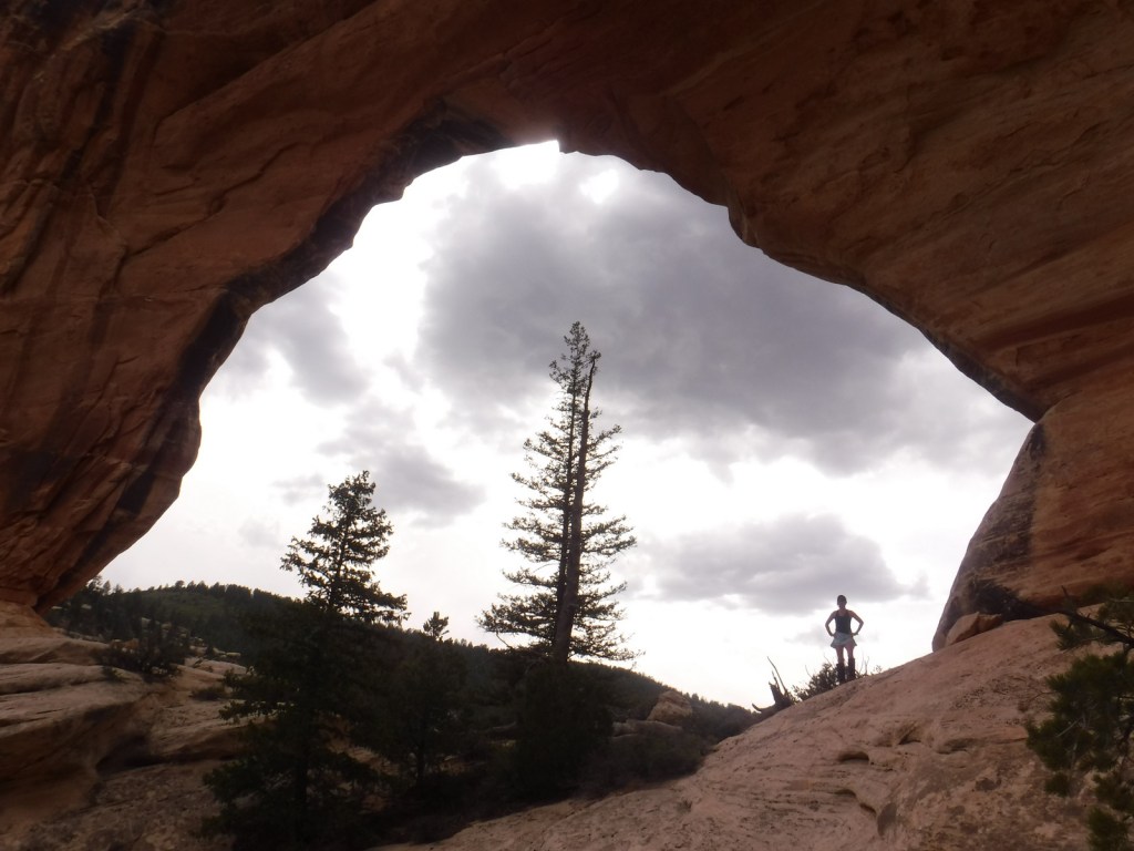
The 58-mile-long Elk Ridge Scenic Backway is a well-maintained, though unpaved route that leads north from Natural Bridges National Monument to Highway 211, which connects to the Needles District of Canyonlands National Park. There are multiple trails along the way that provide access to the Dark Canyon Wilderness, an area known for old-growth forests, natural arches, and Ancestral Puebloan ruins and pictographs. A high-clearance vehicle is not required to reach Big Notch Trailhead where a trail steeply drops into Dark Canyon. Erosion has cut red clay walls that make navigation somewhat difficult in places. About four miles in, not far past the large Cicada Arch on the north side, you reach a spring at the meeting with Drift Trail Canyon. Another two miles takes you to Scorup Cabin, a good place to turn around or explore Horse Pasture Canyon.
Watchable Wildlife
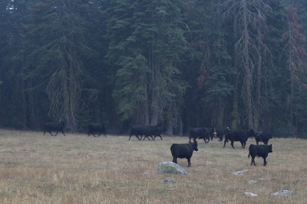
Wildlife species are similar to Utah’s Dixie National Forest and Fishlake National Forest, including black bears, mountain lions, bobcats, coyotes, porcupines, raccoons, skunks, badgers, bighorn sheep, elk, mule deer, and pronghorns. Large birds include bald eagles, golden eagles, northern goshawks, turkey vultures, wild turkeys, common ravens, and various species of owls and woodpeckers. Look for short-horned lizards in the Dark Canyon Wilderness. There are many trout and other gamefish found in the streams and small lakes spread across the high-elevations of the La Sal and Abajo Mountains.
Photographic Opportunity
In the summer months, take La Sal Mountain Loop Scenic Backway to Bull Canyon Dinosaur Tracks to see 200-million-year-old therapod tracks, plus an awesome overlook to the north.
Peak Season
Summer
Fees
None
Road Conditions
La Sal Mountain Loop Road is mostly paved, but side roads to Bull Canyon Dinosaur Tracks, Oowah Lake, and Warner Lake are not. The 58-mile-long Elk Ridge Scenic Backway is a rocky, unpaved route that leads north from Natural Bridges National Monument to Highway 211; and side roads to some trailheads require a high-clearance vehicle.
Camping
Warner Lake Campground takes reservations, as does Buckeye Reservoir in Colorado and a few others. Dispersed camping is also an option, especially along lightly-traveled Elk Ridge Scenic Backway.
Explore More – Due to an administrative error in 1908, what was the misspelled name of La Sal National Forest (which was quickly corrected)?
Learn more about this and the 154 other National Forests in our new guidebook Out in the Woods
We are a participant in the Amazon Services LLC Associates Program, an affiliate advertising program designed to provide a means for us to earn fees by linking to Amazon.com and affiliated sites.
In northwest Montana, Kootenai National Forest includes parts of the Cabinet, Purcell, Salish, Selkirk, and Whitefish Mountains on the border of Canada. In 1975, the 422-foot-tall Libby Dam on the Kootenai River created 90-mile-long international Lake Koocanusa (a contraction of Kootenai-Canada-U.S.A.). Elevations in Kootenai National Forest range from 1,832 feet up to 8,738-foot Snowshoe Peak in the Cabinet Mountains Wilderness, encompassing a variety of habitats from subalpine meadows to arid plains with cacti.
Highlights
Lake Koocanusa Scenic Byway, Northwest Peak Scenic Area, McGregor Lake, Yaak Falls, Ten Lakes Scenic Area, Ross Creek Cedar Grove Scenic Area, Loon Lake, Tenmile Falls, Bluebird Basin Trail, Vinal McHenry Boulder National Recreation Trail, Pacific Northwest National Scenic Trail
Must-Do Activity
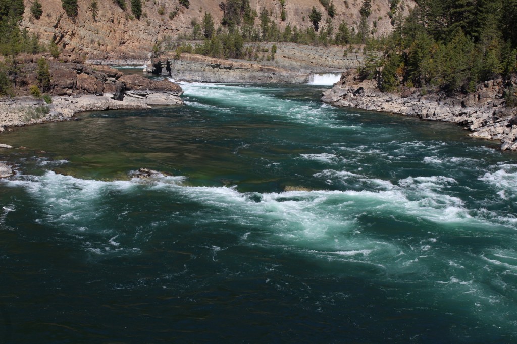
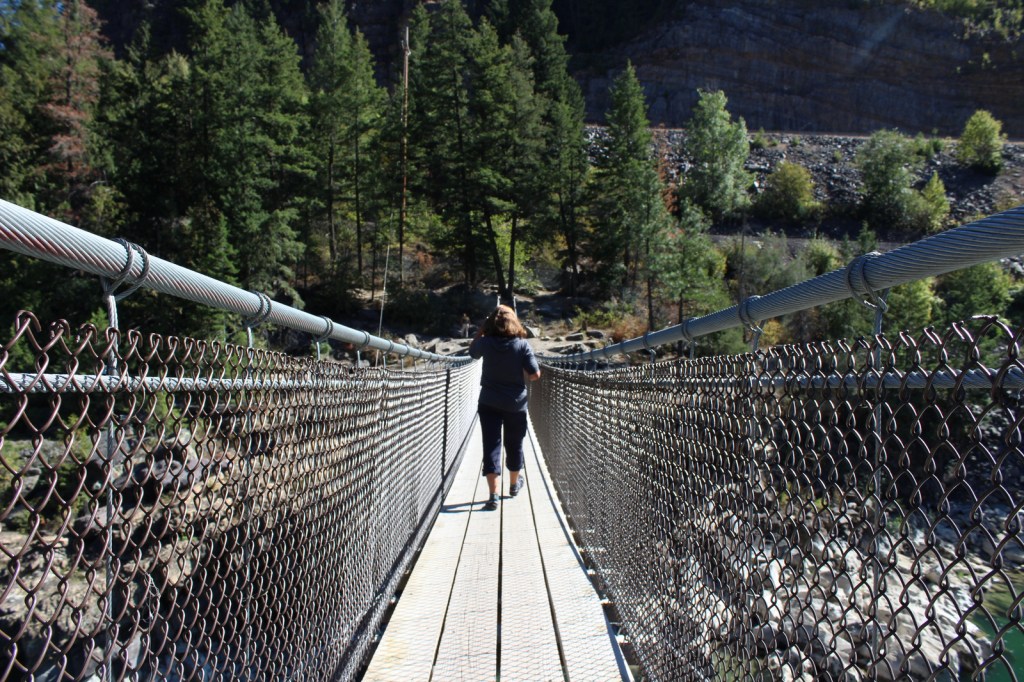
There are more than 1,200 miles of trails in Kootenai National Forest, including 90 miles of the Pacific Northwest National Scenic Trail. Two of the best places to hike are the Northwest Peak and Ten Lakes Scenic Areas, in the remote upper corners of the National Forest. Outside of Libby, Montana, Blue Mountain Trail (1.5 miles one-way), Skyline National Recreation Trail (22 miles), and Scenery Mountain Lookout Trail (2.5 miles) all climb to incredible overlooks. At Kootenai Falls (see Photographic Opportunity), a new suspension bridge crosses the Kootenai River to Forest Service land on the north shore. From there, Koot Creek Canyon Trail travels another three miles to a dirt road in Kootenai National Forest.
Best Trail
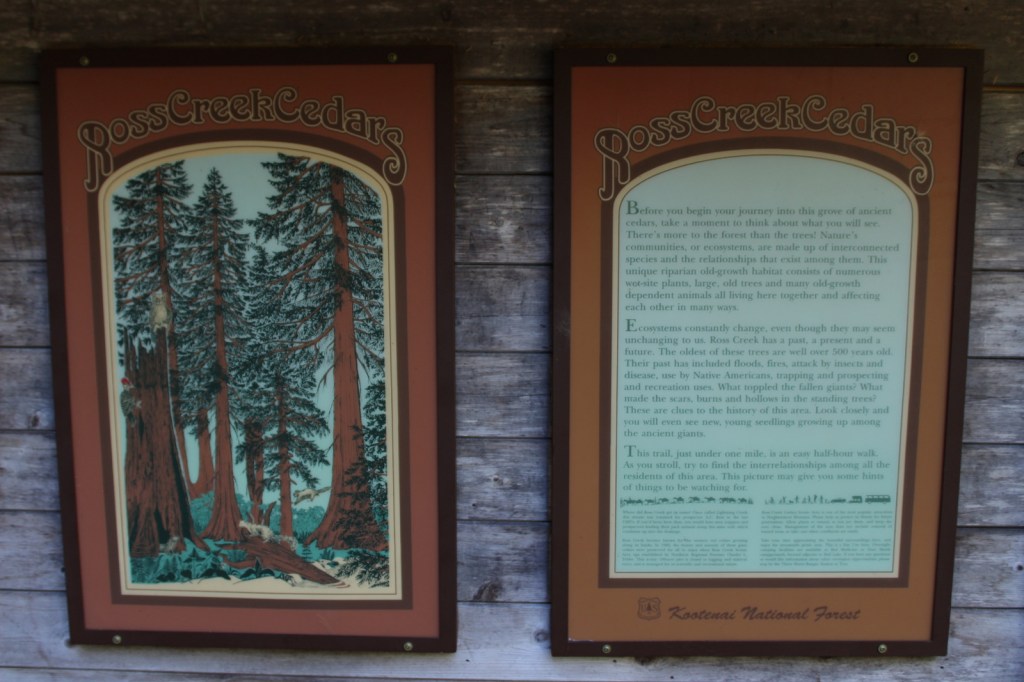
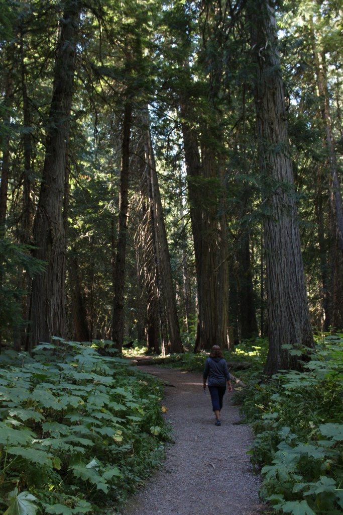
In 1959, Ross Creek Cedar Grove Scenic Area preserved 101 acres of western redcedar trees up to eight feet in diameter. A one-lane paved road with pullouts leads 4.3 miles from Highway 56 to a large parking area with a day-use fee. The main trail is a less than one-mile loop with interpretive signs, but continues five miles to the North Fork of Ross Creek. The old-growth forest is also home to large Douglas-fir, Engelmann spruce, grand fir, and western hemlock trees growing above a lush green understory of ferns and Devil’s-club.
Watchable Wildlife
The mountains provide habitat for grizzly bears, black bears, Canada lynxes, bobcats, mountain lions, wolverines, mink, pine martens, long-tailed weasels, porcupines, snowshoe hares, pika, moose, bighorn sheep, and mountain goats. Hoskins Lake is a wintering range for mule deer and white-tailed deer, as well as an osprey nesting area in the summer. The National Forest’s numerous rivers and more than 100 lakes support gamefish like cutthroat, rainbow, brown, and endangered bull trout. The endangered white sturgeon is also found in this area.
Photographic Opportunity
Located in a county park on the side of Highway 2, Kootenai Falls is only about 20 feet tall, but it is impressively wide and beautiful. An overlook is located one-tenth of a mile from the parking lot, but there is also a walking bridge that crosses over the railroad tracks to a viewpoint at the edge of the falls, and a suspension bridge only a quarter-mile further downstream.
Peak Season
Summer
Fees
Ross Creek Cedar Grove Scenic Area has a day-use fee (or the America the Beautiful pass is also accepted).
Road Conditions
Paved roads like the Lake Koocanusa Scenic Byway, U.S. Highway 2, and State Highway 56 make it easy to explore Kootenai National Forest. To access Ross Creek Cedar Grove Scenic Area, a one-lane paved road with pullouts leads 4.3 miles from Highway 56. A nice drive through the Purcell Mountains can be made by looping State Route 508 and Forest Road 68.
Camping
There are Forest Service campgrounds at Kilbrennan Lake, Loon Lake, Rexford Branch, Caribou, Red Top, Whitetail, Pete Creek, Howard Lake, and elsewhere. Big Creek Baldy Mountain lookout cabin can be rented, too.
Kootenai FallsSuspension bridge at Kootenai FallsSuspension bridge at Kootenai FallsKootenai RiverKootenai FallsScott’s mother in Ross Creek Cedar Grove Scenic AreaScott in Ross Creek Cedar Grove Scenic AreaScott’s mother in Ross Creek Cedar Grove Scenic Area
lodgepole pine, whitebark pine, ponderosa pine, Douglas-fir, western hemlock, western redcedar, , western larch, alpine larch, Engelmann spruce, subalpine fir, grand fir
Rocky Mountain maple, boxelder, quaking aspen, balsam poplar, dwarf birch, paper birch, Piper’s hawthorn, Bebb willow, western mountain-ash, choke cherry, western serviceberry
Explore More – The Kootenai (or Kootenay in Canada) River is named after the local Ktunaxa Indians, which translates as what in the Algonquian language?
Learn more about this and the 154 other National Forests in our new guidebook Out in the Woods
We are a participant in the Amazon Services LLC Associates Program, an affiliate advertising program designed to provide a means for us to earn fees by linking to Amazon.com and affiliated sites.
Split into two separate sections by Interstate 5, Klamath National Forest is spread across the Marble, Salmon, Scott, and Siskiyou Mountains of northern California, with less than 2% of its acreage across the border in Oregon. The National Forest headquarters is located in Yreka on Interstate 5, from where the Forest Service also manages the small Butte Valley National Grassland. In this remote portion of California, Klamath National Forest borders Modoc, Rogue River, Siskiyou, Six Rivers, Shasta, and Trinity National Forests. It contains 152 miles of designated National Wild and Scenic Rivers, including some popular for fishing and rafting, like the Klamath River.
Highlights
Horsetail Falls, Kangaroo Lake, Sawyers Bar Catholic Church, Sur Cree Falls, Crater Glass Flow, Panhandle Lake, Chimney Rock, Diamond Lake, Juanita Lake, Cedar Mountain, Kelly Lake, East Boulder Trail, Taylor Lake Trail, Clear Creek National Recreation Trail, Pacific Crest National Scenic Trail
Must-Do Activity
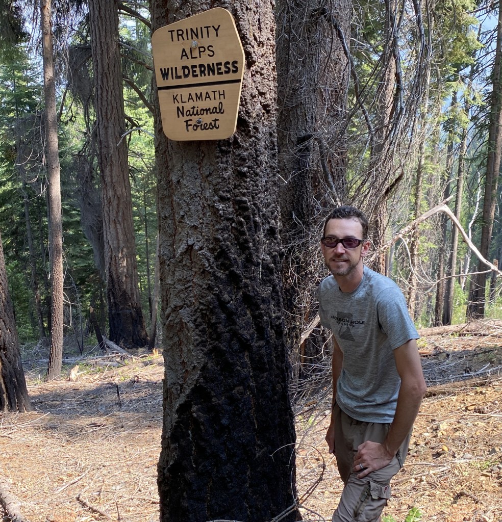
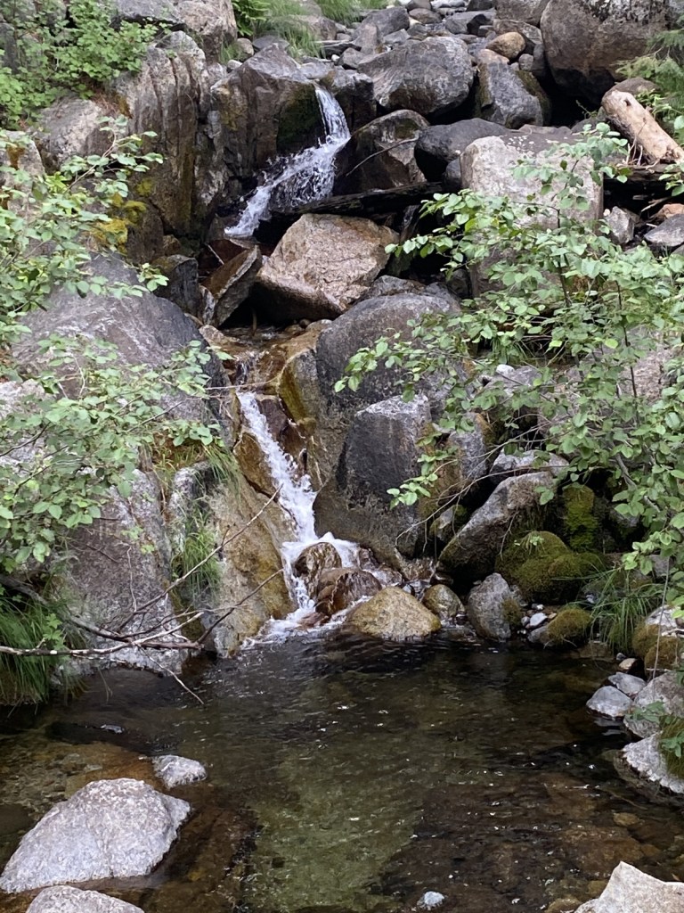
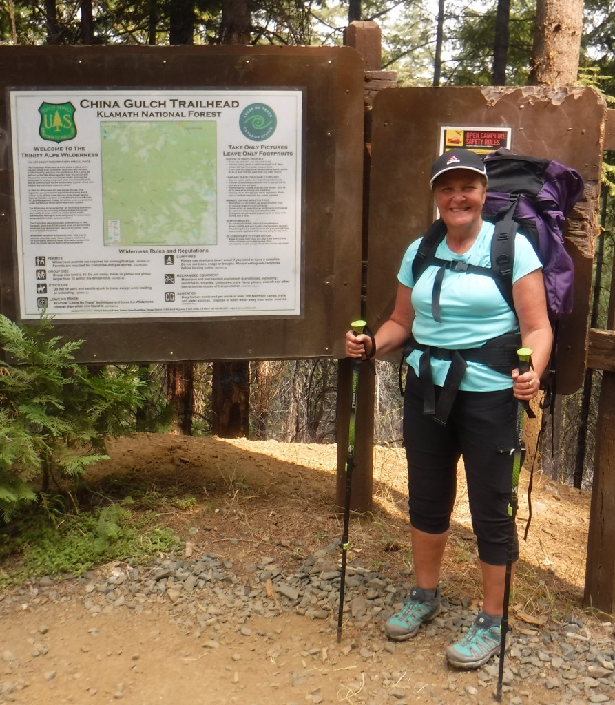
The mountainous western portion of Klamath National is home to several designated Wilderness areas that offer excellent hiking and backpacking (as well as a long stretch of the Pacific Crest National Scenic Trail). In the Siskiyou Wilderness, a quarter-mile hike leads to Kelly Lake with picnic tables at both ends and an option to continue hiking three miles to a beautiful meadow near Poker Flat. From the Shackleford Creek Trailhead, a trail follows the creek into the Marble Mountain Wilderness to Log Lake (three miles) and Campbell Lake (4.3 miles). Russian Lake in the Russian Wilderness is heavily visited, although it is a difficult 4.5-mile hike from the Deacon Lee Trailhead. Many trails enter the Trinity Alps Wilderness, such as East Boulder (see Best Hike) and Carter Meadows Summit, as well as Long Gulch and Trail Gulch (which together can be a turned into thru-hike with a two-car shuttle)
Best Trail
A popular destination for day hikers, East Boulder Lake is accessed by a 1.7-mile one-way trail that climbs 1,000 feet into the northern Trinity Alps Wilderness. Due to the number of user trails around the lake, it is difficult to navigate to the 7,100-foot pass, but continue southeast past Upper Boulder Lake and keep heading uphill to locate it. It is 1.2 miles past East Boulder Lake to the junction with the Pacific Crest National Scenic Trail that runs east-west following the summits of the Scott Mountains (in Shasta National Forest). It is possible to turn this into a loop hike by connecting with the Middle Boulder Trail and Boulder Tie Trail.
Watchable Wildlife
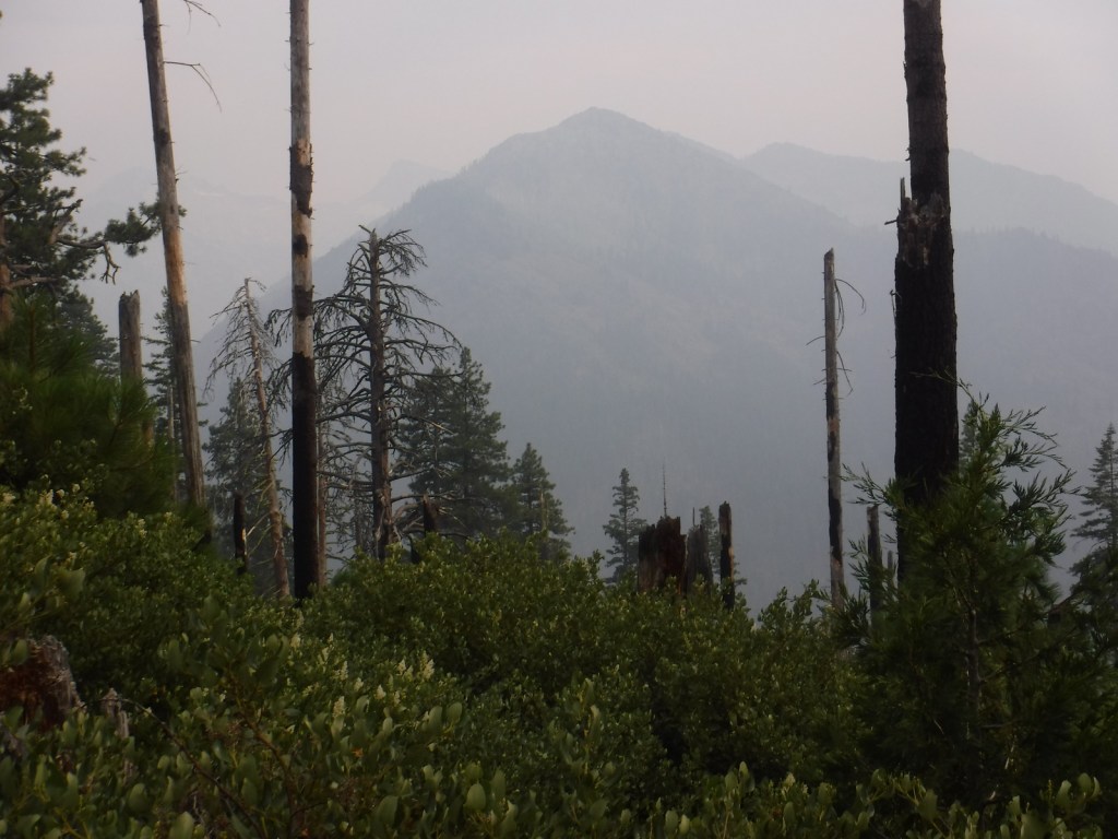
Elevations in Klamath National Forest range from 900 to nearly 9,000 feet supporting a variety of ecosystems, including 168,000 acres of old-growth forest. Large mammals found here include black bears, mountain lions, bobcats, coyotes, foxes, pine martens, skunks, raccoons, mule deer, and possibly gray wolves. Fishing for rainbow trout, steelhead, and salmon is a major draw to Klamath National Forest with its countless lakes and major rivers like the Klamath, Salmon, Scott, and Trinity.
Photographic Opportunity
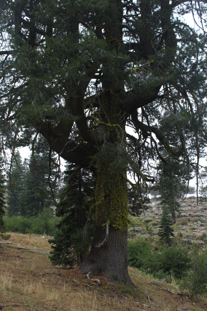
The abundant rainfall that soaks the coastal mountains of California allows conifer trees to reach impressive diameters, like this ponderosa pine we found in the Trinity Alps Wilderness.
Peak Season
Summer
Fees
A free Wilderness Entry Permit is required for overnight trips in the popular Trinity Alps Wilderness where group size is limited to ten people.
Road Conditions
Twisty but paved State Route 96 traverses the western part of the National Forest providing access to the Klamath River, trailheads for the Wilderness areas, and campgrounds. East Boulder Trailhead is located 7.8 miles from the town of Callahan, which is in a remote part of California north of Clair Engle Lake. A high-clearance vehicle may help, but is not required for the unpaved final part of the drive. In the remote eastern portion of the National Forest, a scenic back road travels six miles from Laird’s Camp over Gold Digger Pass near Lava Beds National Monument.
Camping
There are several campgrounds located along paved State Route 96, including Tree of Heaven, Totten, Rocky Bar, and Sulphur Springs (where Elk Creek Trail is a shady two-mile hike to a picnic area by the creek). In the National Forest’s eastern portion, Juanita Lake Campground has a 1.5 mile paved, barrier-free trail that circles the lake.
Wilderness Areas
Marble Mountain Wilderness
Red Buttes Wilderness
Russian Wilderness
Siskiyou Wilderness (also in Six Rivers National Forest)
Trinity Alps Wilderness (also in Shasta, Six Rivers, and Trinity National Forests)
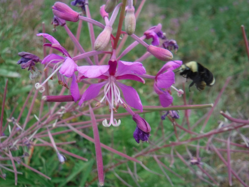
Scott’s mother climbing over the East Boulder Lake damScott’s mother at Boulder LakeBlack-tailed deerIncense-cedarSugar pineFireweedFireweedScott’s mother ready for backpacking
Explore More – How many species of conifers (or Gymnosperms) have been recorded in the Russian Wilderness, possibly the most biodiverse spot for these plants in California, if not the world?
Learn more about this and the 154 other National Forests in our new guidebook Out in the Woods
We are a participant in the Amazon Services LLC Associates Program, an affiliate advertising program designed to provide a means for us to earn fees by linking to Amazon.com and affiliated sites.
Best time of year: Summer for the state fair and access to the northern lakes
We recently published our guidebook 50 States of Great: Road Trip Guide to America, so we decided to start a new type of blog post where we create a travel itinerary for all 50 states, in addition to our usual National Forest and National Park entries. After starting with Kansas, Georgia, Idaho, and Rhode Island, we decided to do a state that is part Midwest and part North Woods. We made an ambitious seven-day plan starting in the southern Minnesota, with plenty of options to extend the trip.
Located in the small town of Austin, this free museum is full of interactive exhibits and photo opportunities, but the best part is that it does not take itself too seriously. Even if you do not like to eat the canned “spiced ham” product, you will come to appreciate its significance to World War II history and pop culture, as well as its amazing gift shop with more branded products than you can imagine.
Niagara Cave is a privately-owned show cave named for its 60-foot-tall underground waterfall that is only viewable on guided tours. Not far away, Forestville/Mystery Cave State Park contains the state’s longest cave (47 degrees year round) which also offers guided tours.
If you come into the state from the southwest corner, consider a stop at a spot that people have come for 2,000 years to mine the red quartzite rock (also known as catlinite). The soft sedimentary stone is relatively easy to carve into smoking pipes and effigies. April through October, you can watch American Indian carvers at the National Park Service (NPS) museum demonstrate how to sculpt this soft yet durable stone into hollow pipes and other beautiful ornaments, some of which you can buy in the gift shop.
Fans of the author’s “Little House” series of books will want to see a replica of the Ingalls’ home in Walnut Grove and some of the family’s historic heirlooms.
Indoor shopping malls are still thriving in the Twin Cities (Minneapolis-St. Paul) metropolitan area, perhaps due to the cold and snowy winter weather. The most famous is the Mall of America with its indoor amusement park and 520 stores, making it the largest mall in the western hemisphere (and eleventh largest in the world).
This park follows 72 miles of the great river’s course through Minnesota, from busy metropolitan sections in the Twin Cities to secluded stretches of water where it reaches its confluence with the Saint Croix National Scenic Riverway. In downtown Minneapolis, Minnehaha Regional Park contains its namesake falls celebrated in Henry Wadsworth Longfellow’s Song of Hiawatha. Nearby, St. Anthony Falls is the only true waterfall along the entire length of the Mississippi River, now controlled by a lock and dam.
Optional stop at University of Minnesota Golden Gophers’ football game
We saw wild turkeys wandering around this beautiful campus that sits on a bluff east of the Mississippi River. Nobody seems to be exactly sure what a golden gopher is (possibly a thirteen-lined ground squirrel), but their mascot Goldie is the cutest in all of college football. Huntington Bank Stadium has one of the best pregame areas with plenty of photo ops and a pep rally held outside the hockey arena, plus we got free Culver’s custard, a clear bag giveaway, and Mystic Lake casino provided free towels and “spinny video thing.” The football team typically schedules their home opener on the Thursday before Labor Day during the Minnesota State Fair.
You will need all day to visit America’s best state fair that is held annually the 12 days before Labor Day, welcoming more than two-million visitors annually. The fair has the standard carnival rides, butter sculptures, farm animals, and artwork, as well as stages where musicians, comedians, and magicians perform throughout the day. Some of the unique food offerings include hotdish-on-a-stick, poutine, fried cheese curds, pronto pup, fried pickles, pork chop-on-a-stick, and fried buckeyes (chocolate and peanut butter candy). Since it started in 1979, Sweet Martha’s Cookie Jar has been overfilling buckets of fresh-baked chocolate chip cookies for customers, making up to 200,000 cookies an hour. To wash all that down, you might want to visit one of the stands offering all-you-can-drink milk.
If you are still hungry after the Minnesota State Fair then you probably didn’t do it right, but we will make one of our rare restaurant recommendations for this unique spot in downtown Minneapolis with interesting décor and really good food (try the poutine or walleye bites).
Day 4
Paul Bunyan Expressway
The legendary giant lumberjack Paul Bunyan is a big deal in Minnesota and he has statues honoring him in many towns along the Paul Bunyan Expressway. The 18-foot-tall statues in Bemidji were originally built in 1937 to honor these larger-than-life heroes and continue to be an essential roadside attraction. In Brainerd, Paul Bunyan Land is an entire amusement park built around a 26-foot-tall talking statue of Paul and 19-foot Babe, the latter refurbished after it blew over in a 2006 windstorm.
The Lost 40 is 144 acres of old-growth red and white pine forest that was never logged due to a surveying error that mapped the area as part of Coddington Lake in 1882. The oldest tree here is more than 250 years old and can be seen on an easy one-mile loop trail with interpretive signs. The trailhead is located east of Blackduck on well-signed back roads that are also popular for snowshoeing in the winter. Nearby, Camp Rabideau is perhaps the best preserved Civilian Conservation Corps (CCC) camp left from the 1930s, with free guided tours in the summer.
Lake Itasca is considered the headwaters of the Mississippi River and is located just west of Highway 71 at the beginning of the 2,069-mile-long Great River Road that goes all the way to Louisiana.
Day 5
Roadside Sculptures
Driving north on Highway 71, there is seemingly another great roadside attraction located every few miles. We saw the statues of Uncle Dan Campbell in Big Falls, Jack Pine Savage in Littlefork, the world’s largest crow in Belgrade, and a giant black duck in the town of Blackduck. Right outside Voyageurs National Park, which surrounds Lake Kabetogama, was our favorite—a giant walleye with a saddle for riding. If Kabetogama seems like a mouthful, rest assured that everyone, including park rangers, simply calls it “Lake Kab.”
The park is famous for its manmade destinations, including Kettle Falls Hotel, Hoist Bay Resort, and the unique sculptures at Ellsworth Rock Gardens. Try to get out on one of Minnesota’s 10,000 lakes via a ranger-led tour or take your own boat to one of the shoreline campsites inaccessible by car (permit required). Reservations can be made for the ranger-guided North Canoe Voyage that lets passengers paddle a 26-foot canoe, just like the French-Canadian “voyageurs” of old.
Day 6
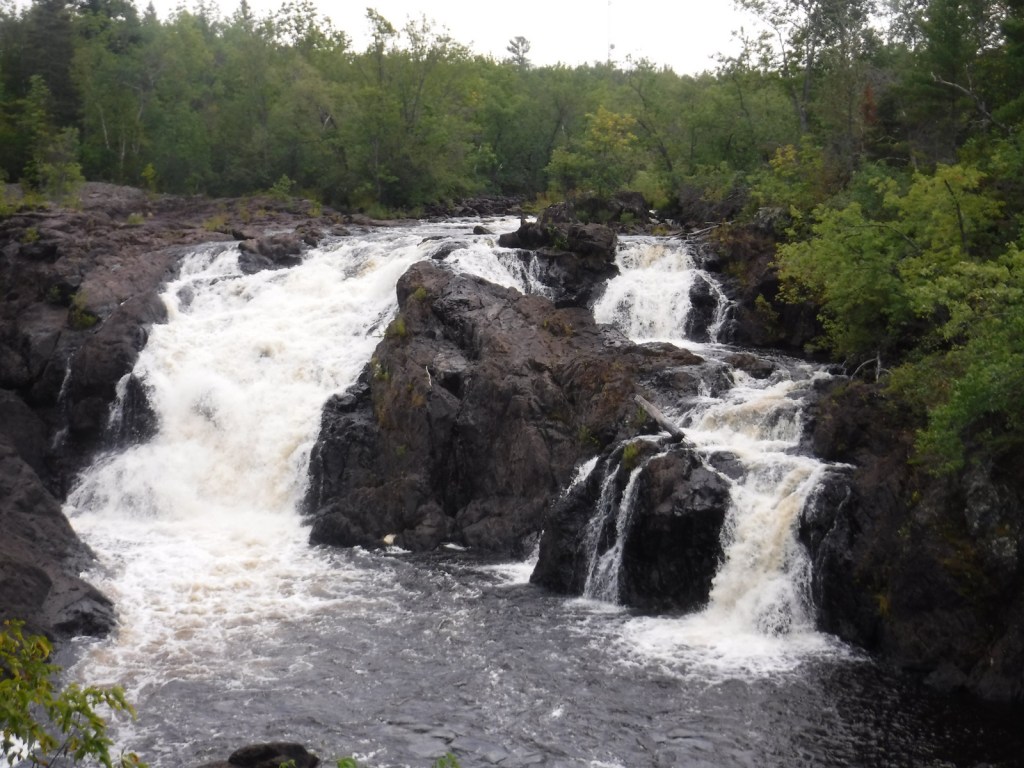
Kawishiwi Falls in Ely
The little town of Ely is the gateway to the Boundary Waters Canoe Area Wilderness (see below), but even if you are just passing through be sure to make the short hike to Kawishiwi Falls below the dam on Garden Lake.
Gray wolves (called timber wolves regionally) reside in the North Woods and while a few lucky travelers might hear them howling, your best bet to see one is at the Wolf Center. It also has a section dedicated to Sigurd Olson, a talented local author and naturalist.
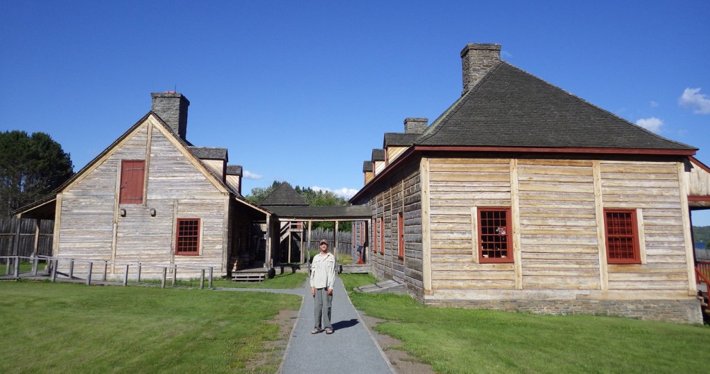
French-Canadian voyageurs had to walk their canoes and goods along an eight-mile-long portage to bypass the rapids on the Pigeon River. In 1784, the end of the trail on the edge of Lake Superior became the site of the North West Company headquarters where they held an annual rendezvous, where today visitors can walk around the reconstructed buildings and talk with the costumed reenactors during the summer.
Optional stop at Two Harbors
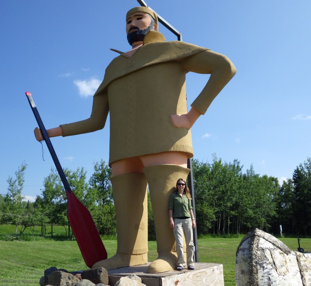
North of Duluth, the North Shore Scenic Drive passes through the town of Two Harbors where there is a giant rooster at Weldon’s Gifts and a huge statue of Pierre the Voyageur outside the Earthwood Inn. If you press the speaker button at the statue’s base, Pierre will tell you all about the history of the region, but he never explains why he is not wearing any pants.
In addition to encompassing the state’s highest mountain, Superior National Forest also offers scenic drives on the Gunflint Trail (County Road 12), Fernberg Road (State Route 169), and Echo Trail (County Road 116). Vermilion Gorge Trail is an easy 1.5-mile one-way hike to a narrow canyon cut through Canadian Shield rock in the small community of Crane Lake (on the east side of Voyageurs National Park). Not far away down a dirt road, a short trail leads to Vermilion Falls where the same river cuts a narrow channel through the rock.
Permits for the peak season can be hard to come by for the world’s premiere destination for backcountry canoeing, so plan ahead. This one-million-acre preserve has more than 1,000 lakes with over 1,500 miles of canoe routes and 2,200 designated backcountry campsites. In addition to its famous water routes with numerous portages, a few overland trails exist like the 12-mile Angleworm Trail and the 39-mile Kekekebic Trail, an official part of the North Country National Scenic Trail.