During the Civil War, the Battle of Mill Springs started on January 19, 1862 in the Union state of Kentucky (where slavery was still legal). North of the Cumberland River, a surprise attack by the Confederate Army was repelled and celebrated as the first decisive Union victory in the western theater. The battlefield was declared a National Historic Landmark in 1993 and acquired by the National Park Service (NPS) in 2020.
Museum, film, Mill Springs National Cemetery, Zollicoffer Park, Brown-Lanier House, Mill Springs Mill, Lake Cumberland
Must-Do Activity
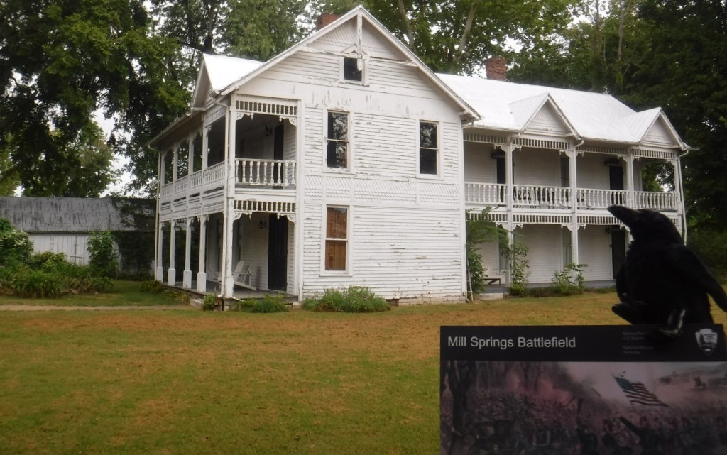
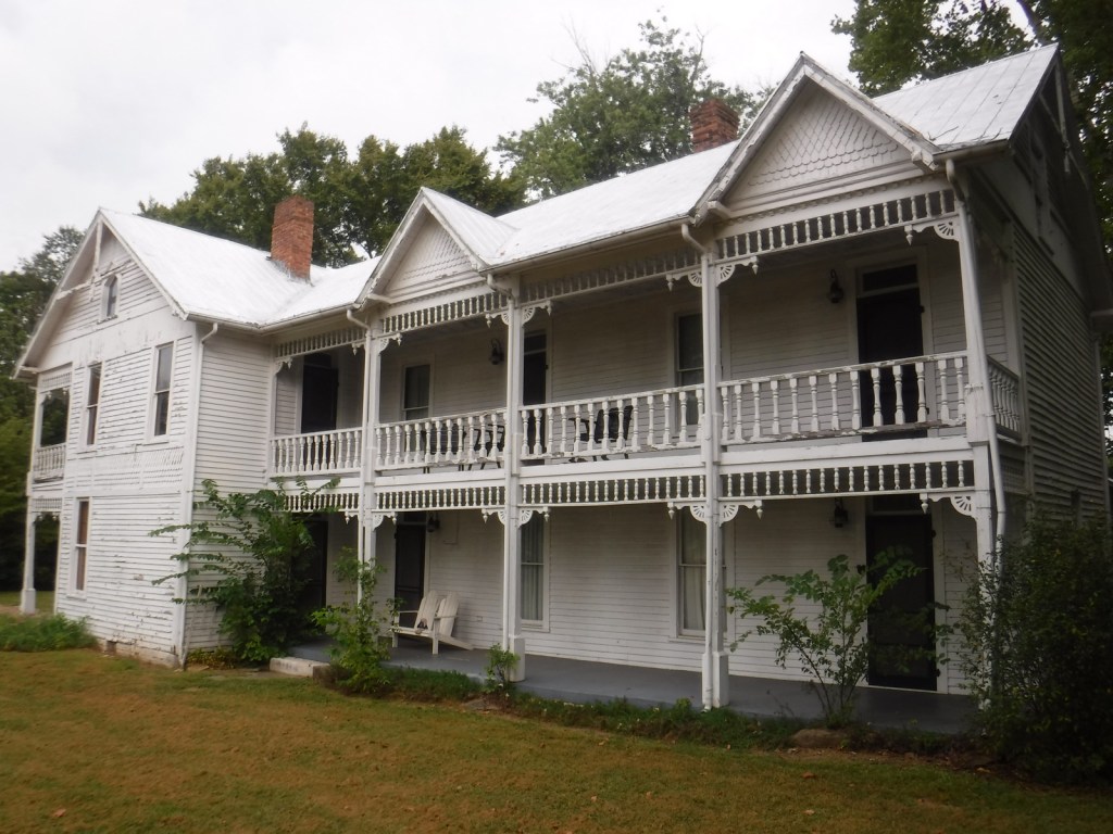
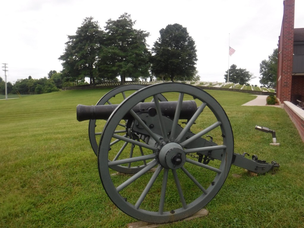
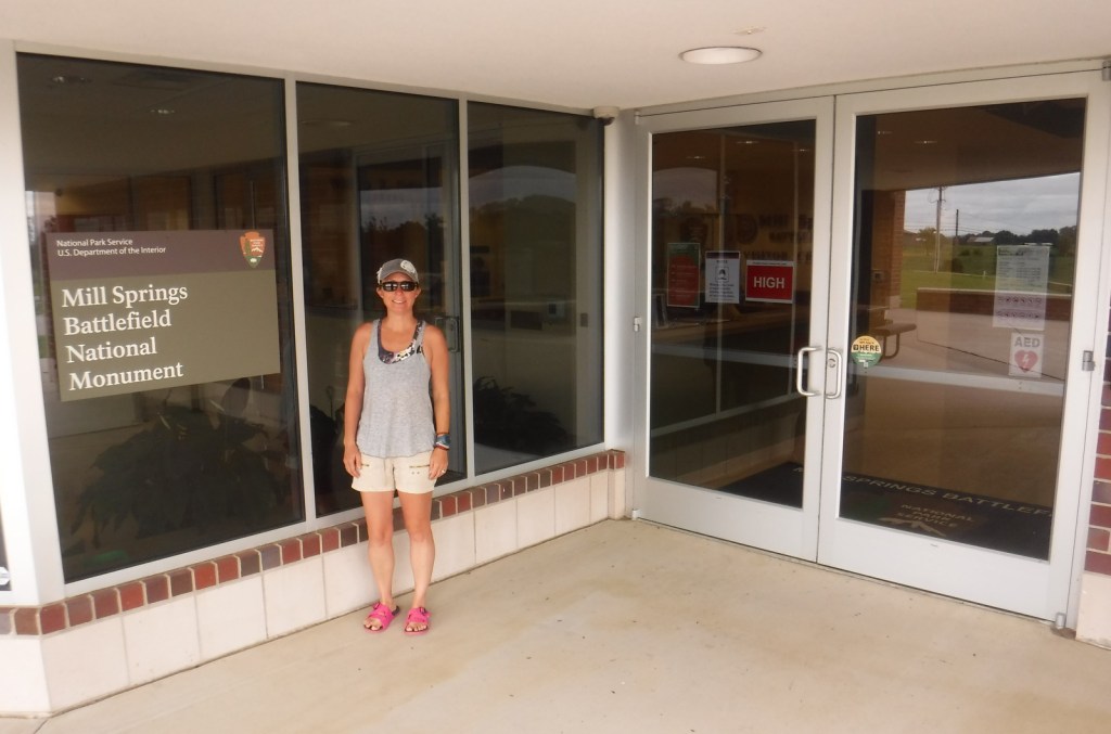
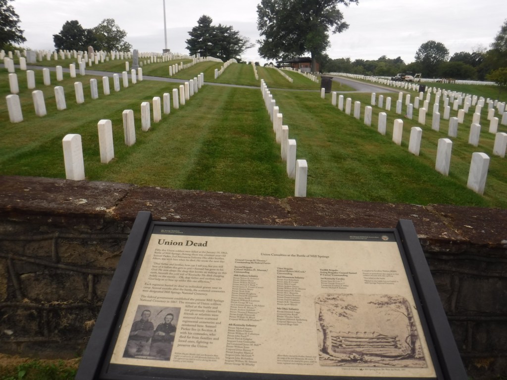
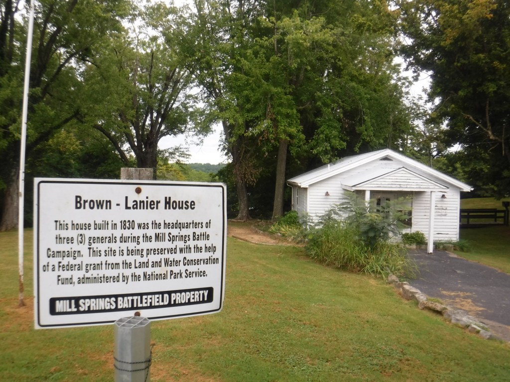
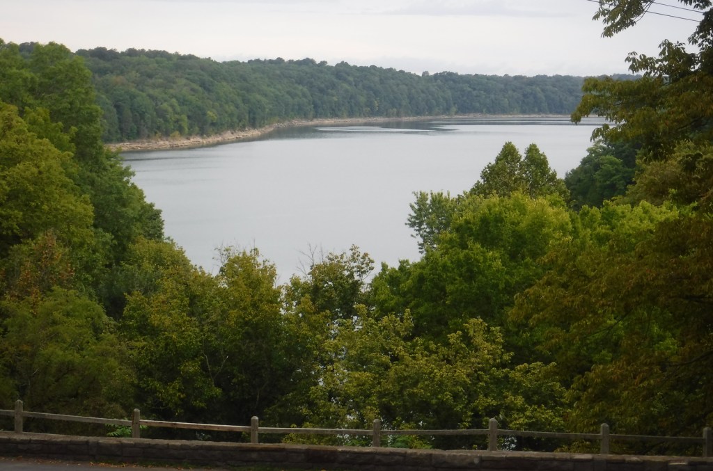
Start your visit by watching the film at the NPS visitor center next to Mill Springs National Cemetery, opened in 1867 as one of 12 original National Cemeteries. The driving tour starts from there south down Kentucky Highway 235 to Zollicoffer Park where there are markers for Confederate General Felix K. Zollicoffer (buried beneath the “Zollie Tree”) and a Confederate mass grave. There are six more stops on the driving tour north of Lake Cumberland, but there is no bridge across the reservoir, so to reach the final two stops requires backtracking and connecting to Kentucky Highway 1275. There you will reach the Brown-Lanier House at Mill Springs that was utilized by both sides of the battle. Open seasonally to the public, the working grist mill on Lake Cumberland dates to 1877 and is managed by the Army Corps of Engineers. The final tour stop is at the West-Metcalfe House that served as a Confederate headquarters and hospital, but is not currently open.
Best Trail
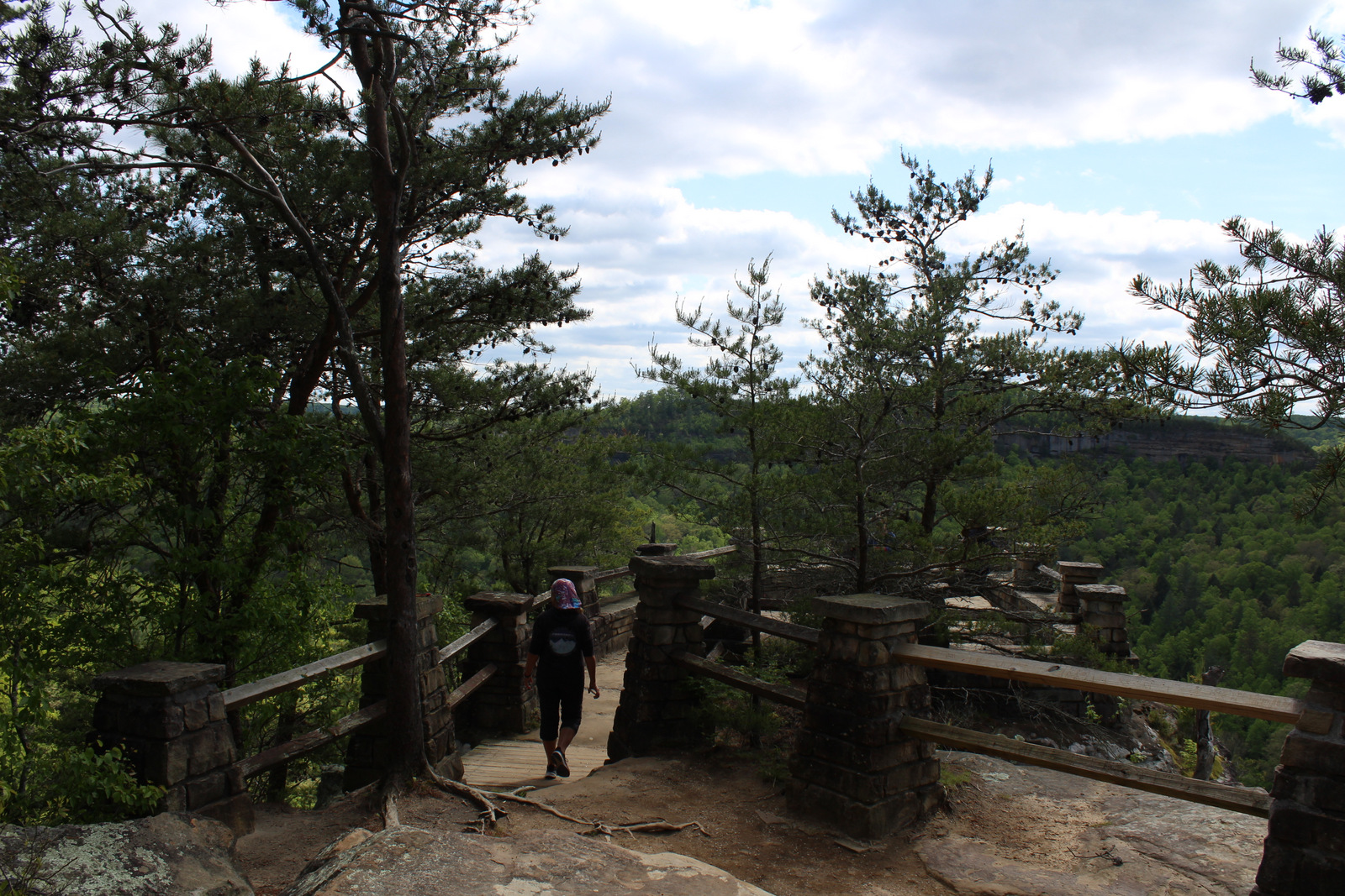
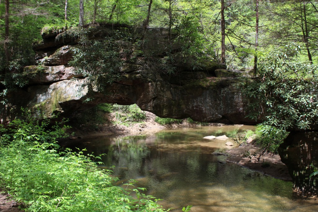
A 0.75-mile walking trail in Zollicoffer Park goes down into a ravine that was behind the Confederate lines, as explained by interpretive signs there. You can also walk to the edge of Lake Cumberland at Ferry Landing on the north shore and Mill Springs Mill on the south shore.
Photographic Opportunity
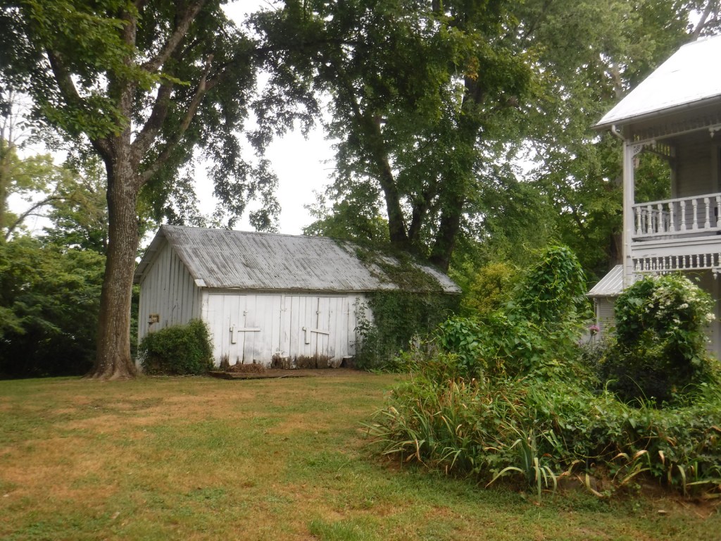
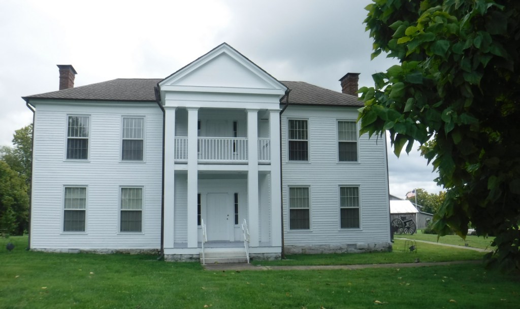
Built in 1860, the Brown-Lanier House offers guided tours inside the house that was twice hit by artillery during the Battle of Mill Springs.
In western Virginia, Jefferson National Forest contains Mt. Rogers, the state’s highest point at 5,729 feet (see our post on Mt. Rogers National Recreation Area). There are 17 designated Wildernesses in Jefferson National Forest, second only to the 19 in Alaska’s massive Tongass National Forest. In 1995, George Washington and Jefferson National Forests were administratively combined. Is it just us, or does that name seem to celebrate George Jefferson from the 1970s sitcom? It is supposed to commemorate native-Virginian Thomas Jefferson who was the original author of the 1776 Declaration of Independence and the third President of the U.S. The Omnibus Public Land Management Act of 2009 created both the Bear Creek (5,503 acres) and Seng Mountain (6,455 acres) National Scenic Areas as specially designated parts of Jefferson National Forest.
Highlights
Blue Ridge Parkway, Mt. Rogers National Recreation Area, Seng Mountain National Scenic Area, Bear Creek National Scenic Area, Settlers Museum of Southwest Virginia, James River Gorge, Mountain Lake, Apple Orchard Falls, Cave Mountain Lake, Glenwood Iron Furnace, High Knob, Little Stony Creek, Lake Keokee, Olinger Gap Trail, Virginia Creeper Trail, Virginia Highlands Trail, Appalachian National Scenic Trail
Must-Do Activity
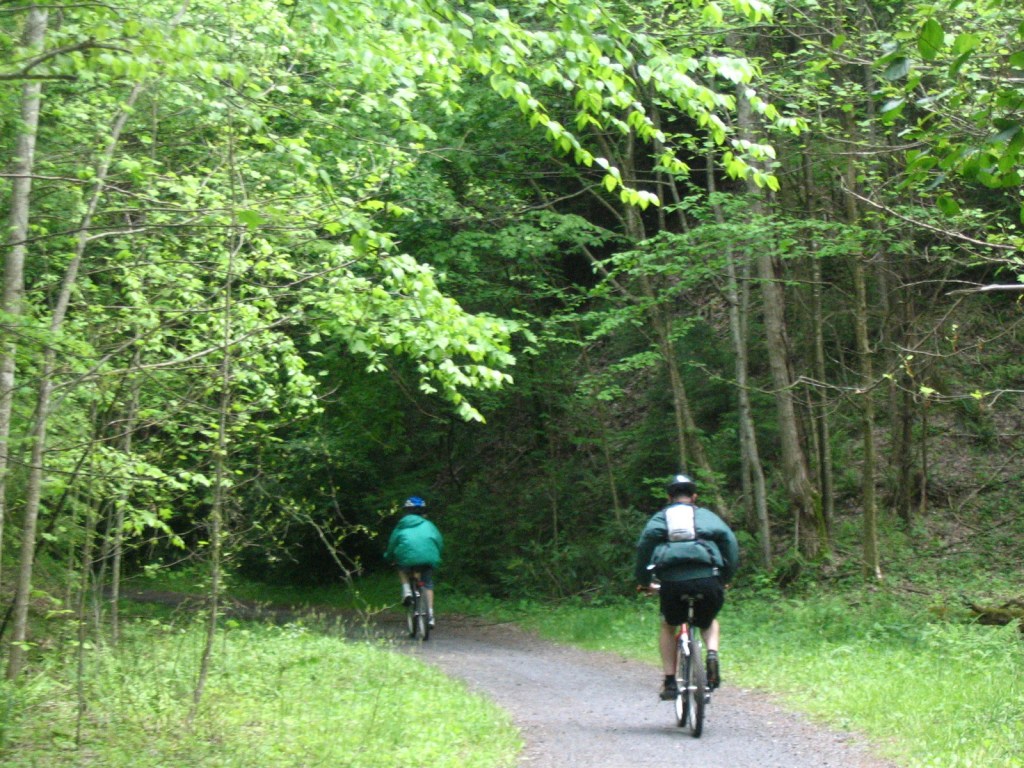
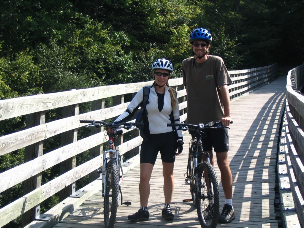
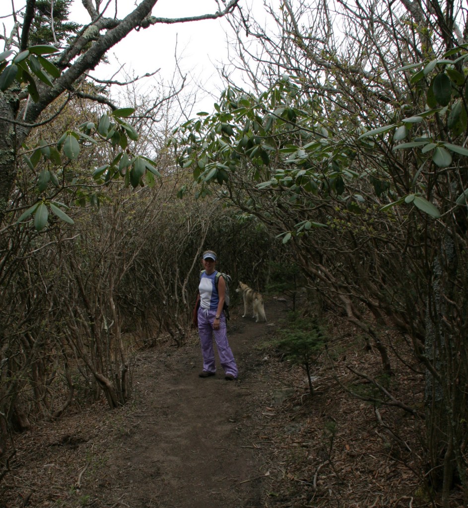
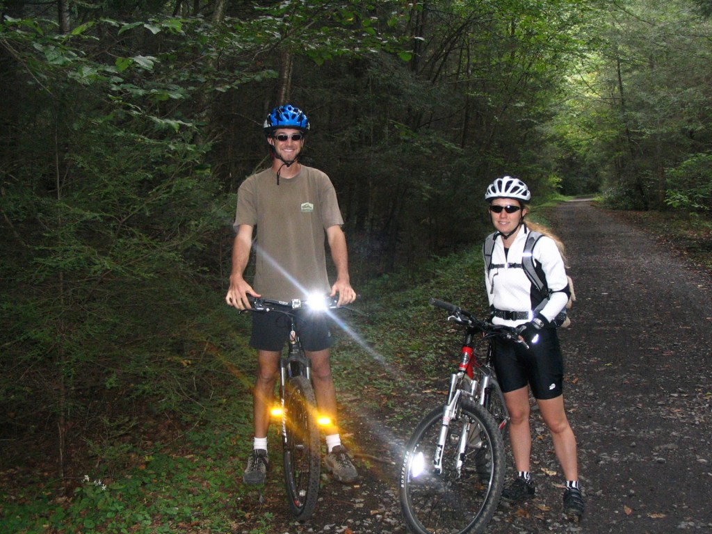
We have only visited the Mt. Rogers National Recreation Area (which made it on our Top 10 List) portion of Jefferson National Forest, which sits just north of the North Carolina border. One popular day trip there is to bike the 33-mile-long Virginia Creeper Trail, which is also open to hikers and horse riders. Last used in 1977, the former railroad grade runs 18 miles downhill from Whitetop Station Visitor Center to the town of Damascus, and local outfitters can provide shuttles to the trailheads and rental bikes. The trail drops 1,600 feet in total (sometimes at a 7% grade); no wonder those steam locomotives were “creeping” up the hill. Outside the National Forest, another 15 miles of railroad bed runs to Abingdon and includes the lowest point on the trail at the scenic South Holston Trestle.
Best Trail
Apple Orchard Falls has a drop of 200 feet and can be accessed from Sunset Fields Overlook at Milepost 78 on the Blue Ridge Parkway. Considered the most popular hike in Jefferson National Forest, the steep trail is only 1.3 miles long one-way, but gains more than 1,000 feet in elevation. A six-mile loop can be completed by connecting to the Cornelius Creek Trail with a total elevation gain of 1,438 feet. Olinger Gap Trail is another short, scenic route that connects the 3.7-mile Lake Keokee Loop Trail and the 14-mile Stone Mountain Trail.
Watchable Wildlife
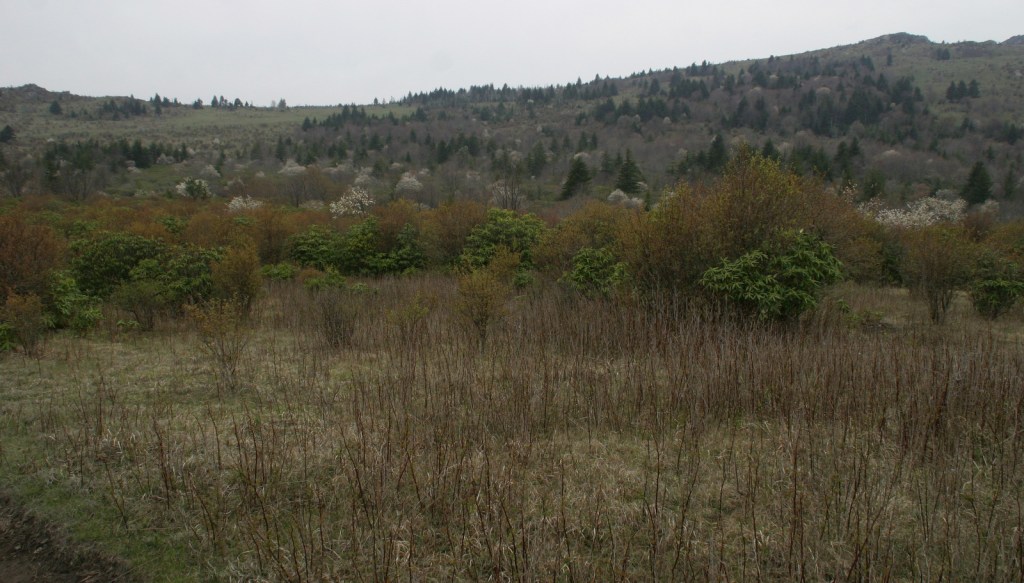
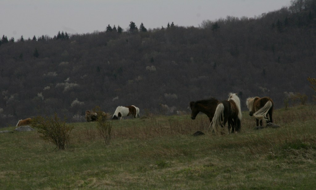
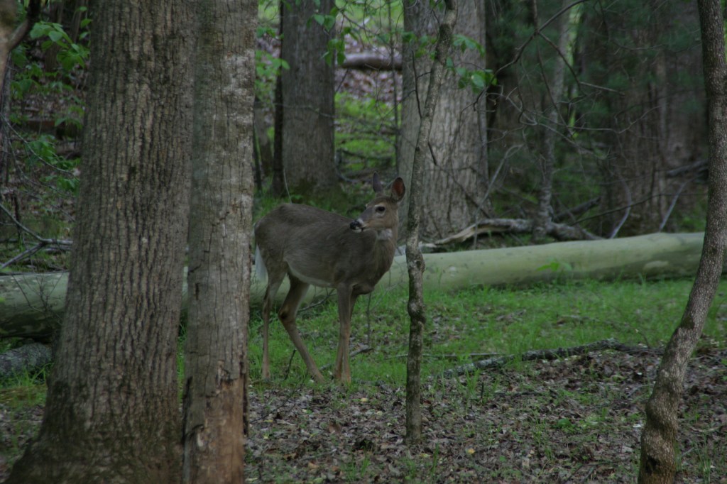
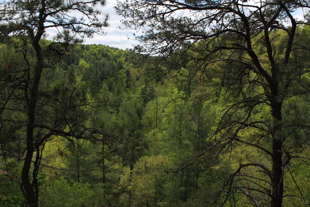
Jefferson National Forest has elevations ranging from 649 feet at the James River up to 5,729 feet, offering a variety of habitats. Its most famous residents may be the wild miniature ponies that hang out in the heath balds around Mt. Rogers. Like George Washington National Forest, there are several types of rare salamanders found here, including the golden pygmy salamander. Noteworthy mammals are white-tailed deer, black bears, bobcats, raccoons, river otters, martens, and weasels. Large birds found in Jefferson National Forest include wild turkeys, turkey vultures, bald eagles, peregrine falcons, and several types of hawks.
Instagram-worthy Photo
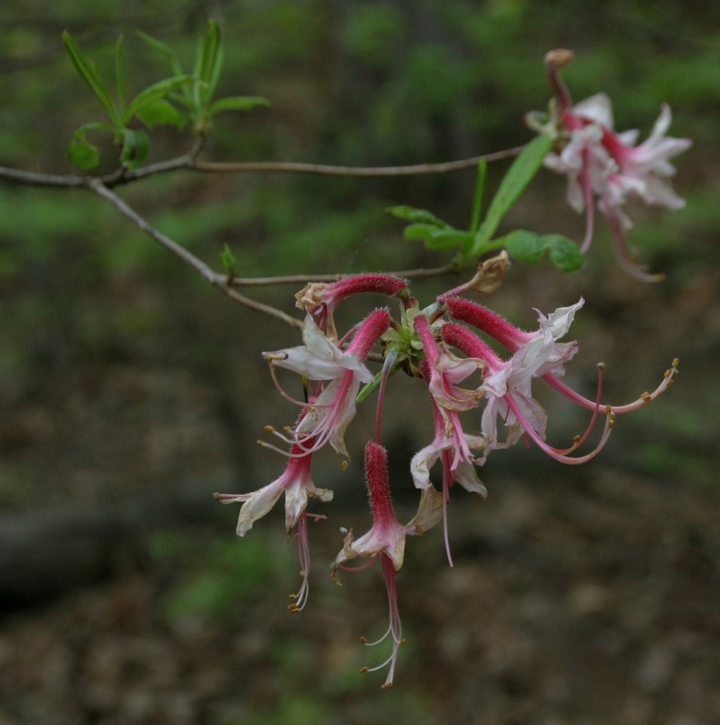
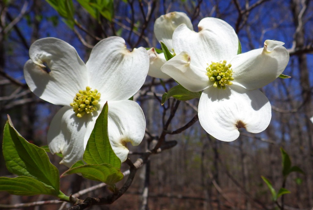
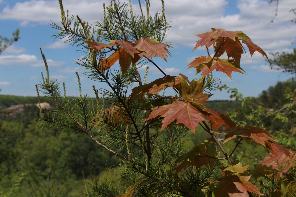
Spring and early summer are a great time to visit to see blooming azalea, mountain laurel, and rhododendron bushes.
Peak Season
Spring and fall
Fees
$5 day-use fee at Beartree Recreation Area
Road Conditions
The Peaks of Otter Visitor Center on the paved Blue Ridge Parkway is managed by the National Park Service adjacent to Jefferson National Forest. There are unpaved roads scattered throughout the mountains, including a rough road off Forest Road 606 that comes close to the 15-foot-tall Falls of Dismal (also accessible by hiking trail).
Camping
Beartree, Hurricane, Cane Patch, Laurel Falls, Cave Springs, Bark Camp Lake, Cave Mountain Lake, Pines, and White Rocks are only a selection of the many designated campgrounds in Jefferson National Forest. There is a 25-foot right-of-way for backpack camping on both sides of the Virginia Creeper Trail, except on private property.
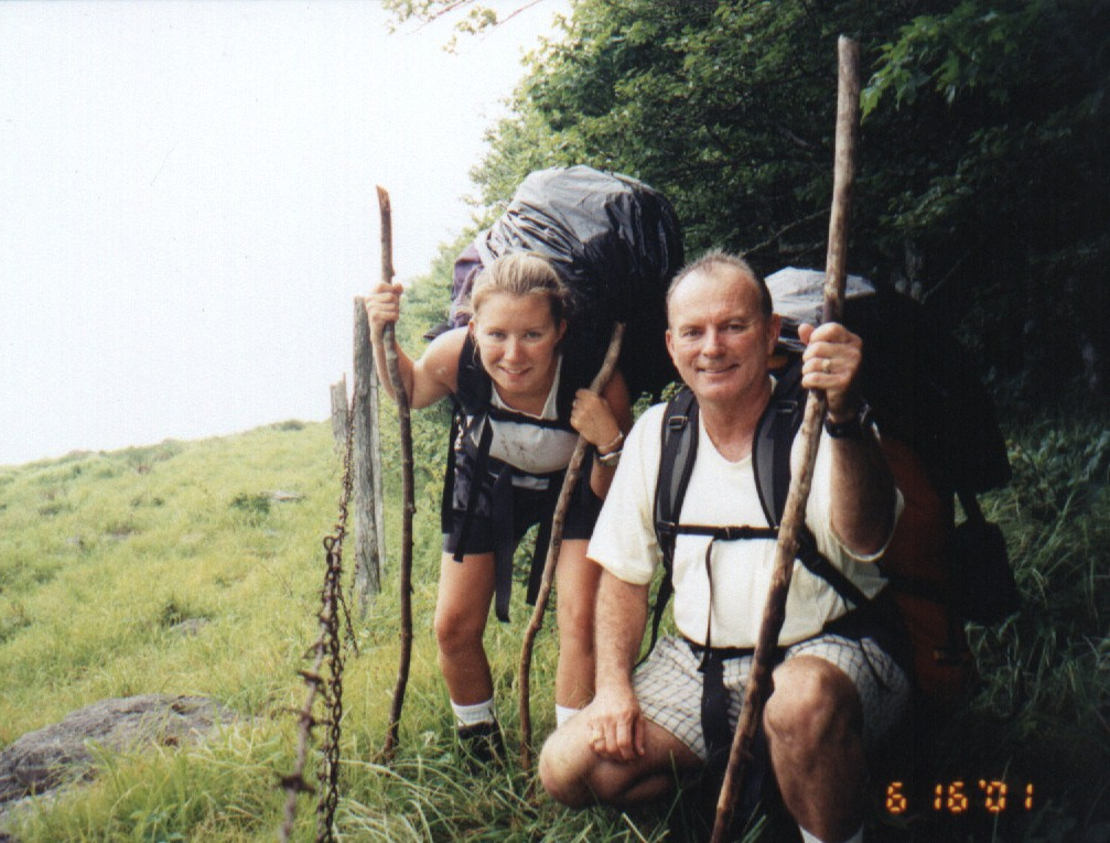
Tiff on the Virginia Creeper TrailVirginia Creeper TrailVirginia Creeper TrailTiff and Scott on the Virginia Creeper TrailTiff with a friendly localTiff and her father backpacking in 2001Tiff and Scott on the Virginia Creeper TrailVirginia Creeper TrailWhite-tailed deer
American beech, yellow birch, mountain maple, sugar maple, white oak, black oak, northern red oak, rock chestnut oak, bear oak, hickory, basswood, sweet buckeye, American elm, sourwood, mountain laurel, azalea, rhododendron
Explore More – What is the scientific name for Virginia creeper, the native vine with palmately compound leaves?
Learn more about this and the 154 other National Forests in our new guidebook Out in the Woods
We are a participant in the Amazon Services LLC Associates Program, an affiliate advertising program designed to provide a means for us to earn fees by linking to Amazon.com and affiliated sites.
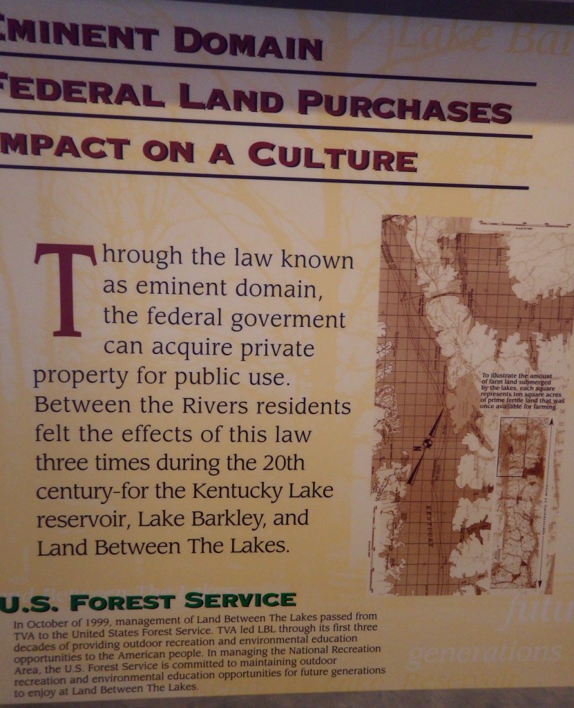
In western Kentucky, the U.S. Forest Service manages 106,458-acres as Land Between The Lakes National Recreation Area (and not part of any National Forest). It gets its name from the narrow strip of land left after the damming of the Tennessee River to create Kentucky Lake and the Cumberland River to create Lake Barkley. The dams were constructed by the Tennessee Valley Authority, who managed this area for recreation until 1999. In 1991, this area was designated a UNESCO Biosphere Reserve, but was withdrawn from the program by the Trump administration. On December 10, 2021, an EF-4 tornado hit the northern portion of the National Recreation Area and recovery is ongoing.
Highlights
Woodlands Trace National Scenic Byway, Elk and Bison Prairie, Golden Pond Planetarium, Homeplace 1850’s Farm, Golden Pond Visitors Center
Must-Do Activity
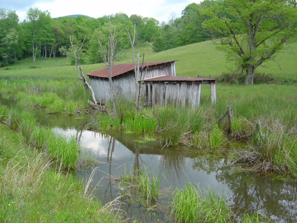
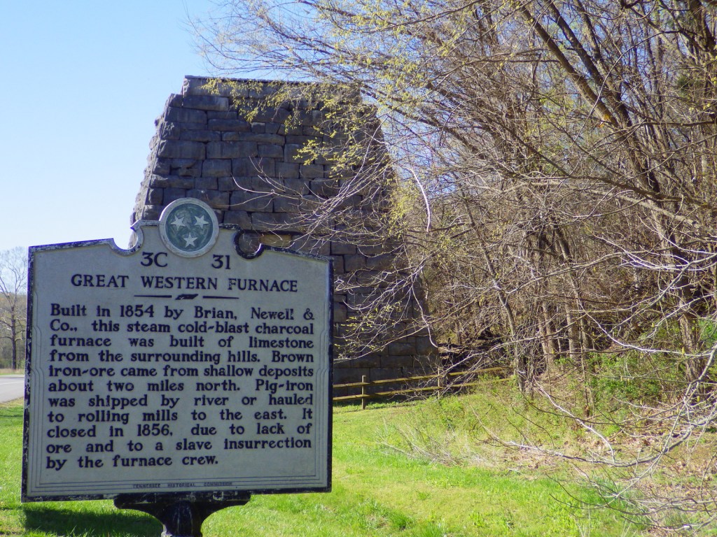
In addition to the traditional watersports, Land Between The Lakes National Recreation Area has several attractions found along the Woodlands Trace National Scenic Byway. These include developed areas (with fees) like the Golden Pond Visitor Center and Planetarium, Elk and Bison Prairie, Woodlands Nature Station, Turkey Bay Off-Highway Vehicle Area, and Homeplace 1850’s Farm (across the border in Tennessee). The roadside pullout for the Great Western Furnace is worth a stop to check out the 1854 charcoal furnace used to create pig-iron.
Best Trail
The North-South Trail runs 59 miles from Kentucky’s Nickell Branch Backcountry Area to Tennessee’s Devils Backbone State Natural Area (near where Civil War-era Fort Henry was submerged beneath Kentucky Lake).
Instagram-worthy Photo
Starting in the 1970s, the Tennessee Valley Authority conducted prescribed burns and reseeded to expand patches of native grasses on 700 acres that became the Elk and Bison Prairie (that officially opened in 1996). There is also a South Bison Range along the Woodlands Trace National Scenic Byway in Tennessee.
Peak Season
Summer
Fees
It is free to drive through Land Between The Lakes National Recreation Area and park at many trailheads, but most attractions require an admission fee.
Road Conditions
Woodlands Trace National Scenic Byway is paved (as is the 3.5-mile loop in the Elk and Bison Prairie) and the gravel roads are well maintained.
Camping
There are several lakeside campgrounds, including Wrangler’s Campground with horse stalls. For those interested in backpacking, there are multiple free backcountry areas to explore, including the Devils Backbone State Natural Area where we camped. The unique Annual Backcountry Camping Permit only costs $30 per person (three-day permits $7).
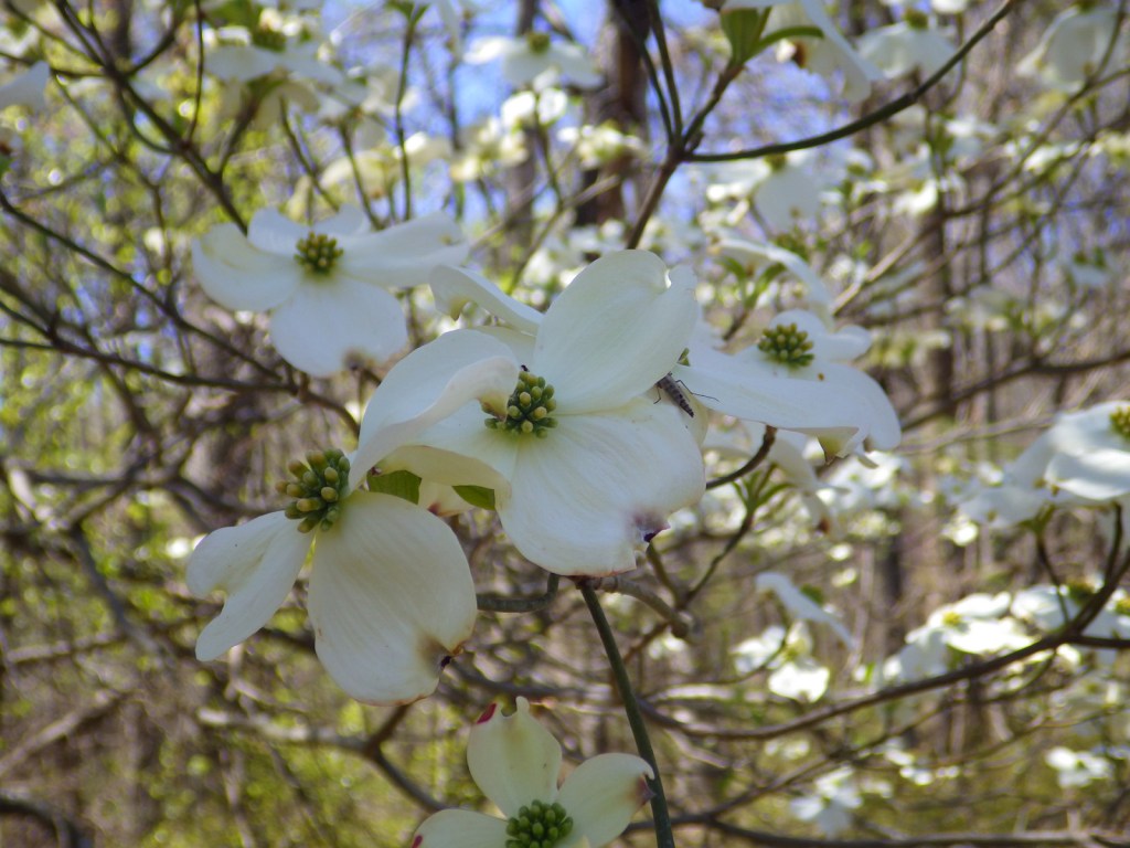
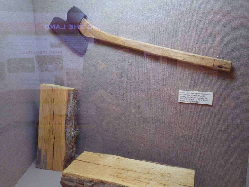
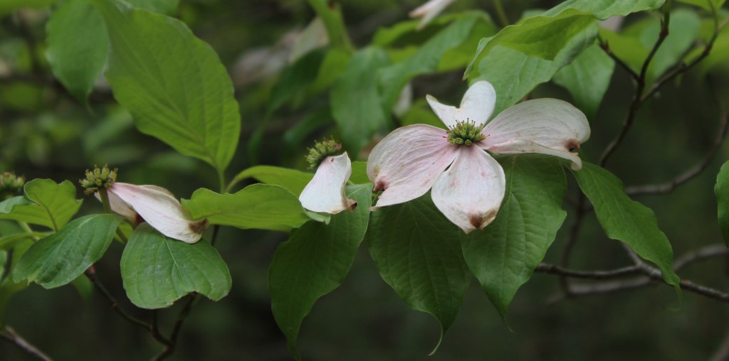
Flowering dogwoodFlowering dogwoodScott with some flowering dogwood treesThe Bob Taylor Buzzard Wing BroadaxTiff with an old furnaceTiff hiking the Devils Backbone
Explore More – Where were the elk reintroduced from into the Elk and Bison Prairie?
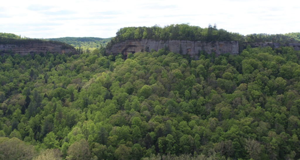
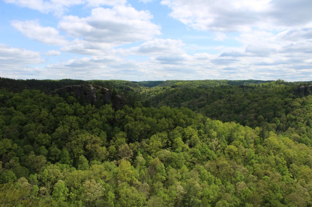
Daniel Boone National Forest is spread across the Cumberland Plateau in Kentucky, covering more than two-million acres when including private land and the 145,839-acre Redbird Purchase Unit. The National Forest also surrounds three popular State Parks: Buckhorn Lake, Cumberland Falls, and Natural Bridge. The latter is adjacent to the spectacular Red River Gorge Geological Area, which is a major reason Daniel Boone National Forest sees more than one-million visitors annually. The forest has nearly 100 developed recreation areas and 600 miles of trails, plus several historic sites like Clear Creek Iron Furnace, Nada Railroad Tunnel, and Camp Wildcat (site of the first Civil War engagement of regular troops in Kentucky).
Highlights
Zilpo Scenic Byway, Red River Gorge Geological Area, Nada Tunnel, Cave Run Lake Recreation Area, Lick Creek Falls, Clear Creek Iron Furnace, Camp Wildcat, Laurel River Lake Recreation Area, Chimney Top Rock, Chestnut Knob, Yahoo Arch, Sheltowee Trace National Recreation Trail
Must-Do Activity
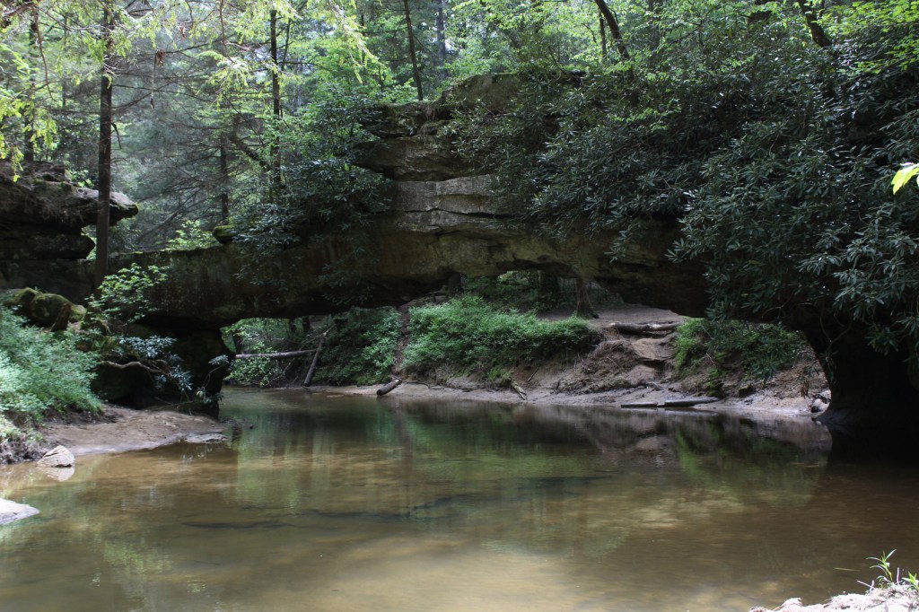
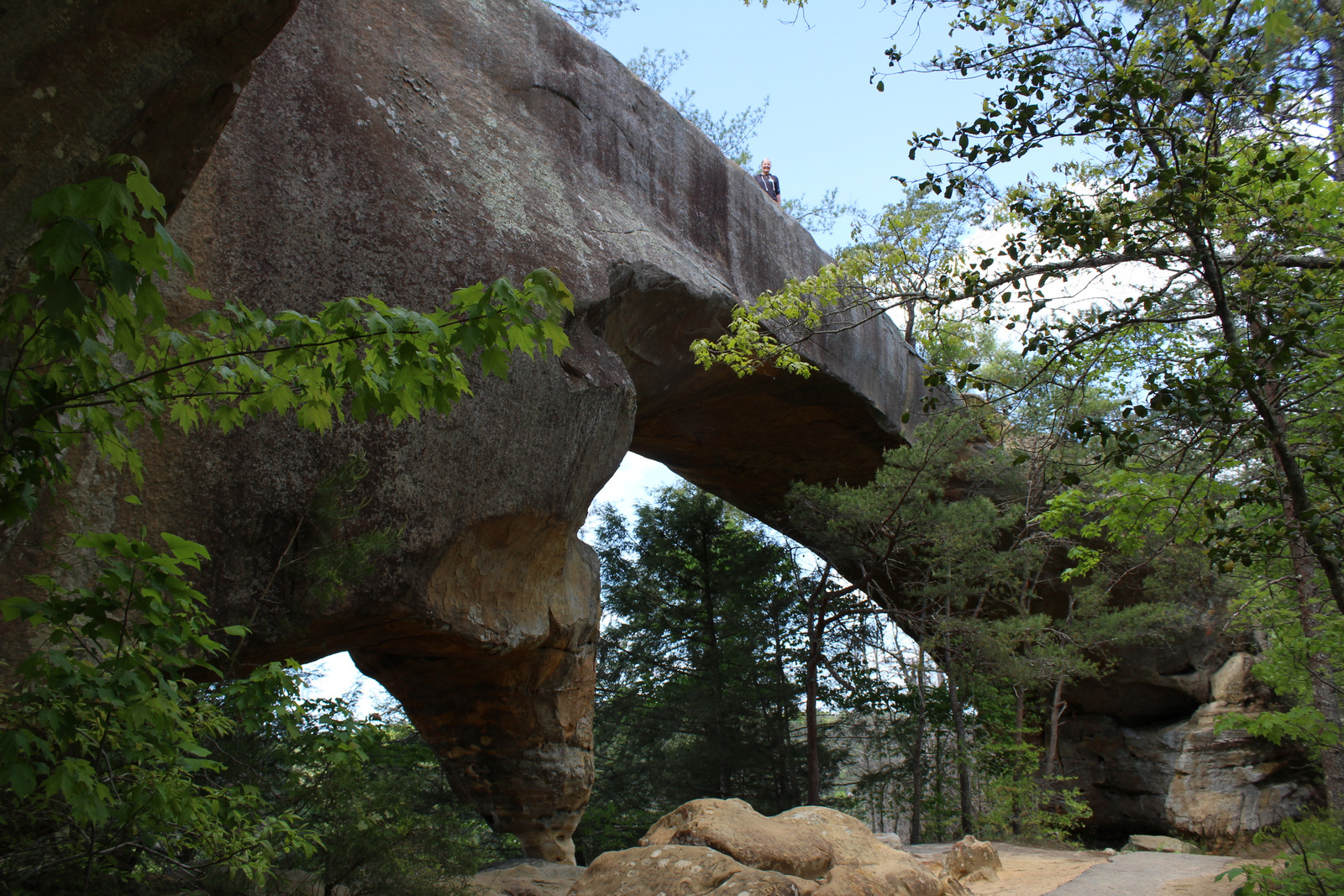
In the rolling hills of the Cumberland Plateau, Red River Gorge Geological Area is full of enough sandstone arches to keep you busy exploring for days. Although 91-foot long Koger Arch was closed during our visit, we enjoyed short hikes to 75-foot Sky Bridge and 32-foot Princess Arch. Rock Bridge Trail is a 1.3-mile loop that passes the sole natural bridge in the area with water flowing through it, and the only one formed by a waterfall cutting through the sandstone.
Best Trail
The 282-mile-long Sheltowee Trace National Recreation Trail runs from Tennessee north into the southern end of Daniel Boone National Forest and Big South Fork National River and Recreation Area (where a camping permit is required by the National Park Service). The trail marked by white turtle blazes passes through Alum Ford primitive campground on the Big South Fork of the Columbia River. From Yahoo Falls Scenic Area, a short jaunt takes hikers to 113-foot-tall Yahoo Falls, which you can walk behind. Yahoo Arch (17 feet tall) is accessible further up that two-mile section of trail or from a separate Forest Service trailhead on KY700, as is Markers Arch on a separate half-mile spur.
Watchable Wildlife
Major mammals found in Daniel Boone National Forest include black bear, coyote, bobcat, red fox, gray fox, mink, white-tailed deer, gray squirrel, muskrat, opossum, raccoon, cottontail rabbit, woodchuck, and three species of bat. Wild turkey, northern bobwhite quail, ruffed grouse, red-cockaded woodpecker, and bald eagle are some of the 194 bird species identified. Copperheads and timber rattlesnakes are two types of venomous snakes found here. Lakes and streams have rainbow trout, largemouth bass, smallmouth bass, bluegill, crappie, and muskie.
Instagram-worthy Photo
Kentucky is riddled with caves—from the manmade Louisville Mega Cavern to Mammoth Cave National Park. Daniel Boone National Forest has an estimated 1,500 to 2,000 limestone caves, in addition to small overhangs in the sandstone of Red River Gorge Geological Area.
Peak Season
Summer
Fees
There is not a day use fee to park, hike, or picnic in Red River Gorge Geological Area (unless you park overnight).
Road Conditions
Most of the trailheads in Red River Gorge Geological Area are accessed by well-marked and well-maintained dirt roads.
Camping
South of Interstate 64, Cave Run Lake stretches across 8,270 acres in northeastern Kentucky where we spent the night at a Forest Service campground on a cross-country roadtrip in 2007. There are campgrounds in Red River Gorge Geological Area, where backpacking in the Clifty Wilderness only costs $5 per day per car for a permit.
chestnut oak, scarlet oak, black oak, northern red oak, white oak, rock chestnut oak, tulip-poplar, American beech, mockernut hickory, bitternut hickory, pignut hickory, black gum, white ash, sassafras, mountain laurel, basswood, red mulberry, witch hazel, sugar maple, red maple, sourwood, cucumber magnolia, bigleaf magnolia, flowering dogwood, serviceberry, pawpaw, river birch, sycamore, silver maple, black willow, sweetgum, devil’s walkingtick, white rhododendron, Cumberland azalea
Explore More – In what year did the frontiersman Daniel Boone fight in the Battle of Blue Licks during the American Revolution?
Learn more about this and the 154 other National Forests in our new guidebook Out in the Woods
We are a participant in the Amazon Services LLC Associates Program, an affiliate advertising program designed to provide a means for us to earn fees by linking to Amazon.com and affiliated sites.
Camp Nelson National Monument occupies 525 acres where a Civil War fort was located 20 miles south of Lexington. During the war, Kentucky was technically a Union state so the Emancipation Proclamation of 1863 did not apply to the state’s slaves. Many local slaves were impressed by the U.S. Army to build the camp and their owners were compensated for the work. In May 1864, when freedom was offered to any black man to join the United States Colored Troops, thousands of escaped slaves brought their families (who were not granted freedom) to this supply depot, which led to numerous conflicts between refugees and Army officials.
Museum, film, Oliver Perry House, barracks, Fort Putnam, Fort Jones, Home for Colored Refugees Site
Must-Do Activity
Unlike many new National Monuments, this one was already developed as the Camp Nelson Civil War Heritage Park so it has a historical museum, hiking trails, and interpretive film (that made our Top 10 list for NPS films). The Oliver Perry House is the only original structure on site, although a barracks building and the earthworks of Fort Putnam have been reconstructed. A living history weekend is typically held during the summer in the park, which is adjacent to Camp Nelson National Cemetery (see photos below) where hundreds of Civil War soldiers are buried.
Best Trail
There are four miles of trails in Fort Nelson National Monument with numerous interpretive signs and flags placed to identify the former locations of the bakery, prison, stables, Quartermaster Office, and other structures. The Fort Jones/Overlook Trail accesses extensive stone revetment walls that provided defenses for the eastern side of Camp Nelson. There is little shade in this grassy landscape, so come prepared on hot summer afternoons.
Instagram-worthy Photo
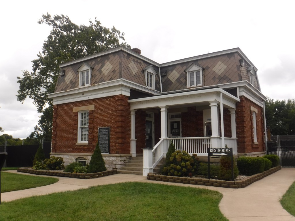
Built in 1846, the Oliver Perry House (also called the White House) is the only remaining original structure on site, which served as officers’ quarters.
There is no campground on site, but there are some nice ones found throughout the Kentucky state parks system and Daniel Boone National Forest (where we recommend Cave Run Lake).
The White HouseInside the White HouseHome for Colored Refugees SiteCamp Nelson National CemeteryCamp Nelson National Cemetery
Explore More – When was Army policy changed at Camp Nelson to allow the families of United States Colored Troops to have a mess hall, school, and housing?