Tag Archives: history

National Park of American Samoa

National Park of American Samoa

American Samoa (territory)

Managed by National Park Service

Established 1988

13,500 acres

Website: nps.gov/npsa

Overview

The only U.S. territory located south of the equator, American Samoa is home to a National Park unlike any other in the National Park Service system.  In 1900, the U.S. Navy Governor outlawed the sale of land to non-Samoans so the federal government leases the land for the park on three separate islands in the South Pacific Ocean.  There are two flights per week to Pago Pago (on the island of Tutuila) from Honolulu, Hawai‘i on Mondays and Thursdays, and flights from Pago Pago to Ofu Island on Tuesdays and Thursdays (only reservable once you are in American Samoa).  You would need to charter a boat from Ofu to nearby Ta‘ū Island to see the highest sea cliffs in the world.

Highlights

Mt. ‘Alava Trail, Tuafanua Trail, Pola Island Trail, Blunts Point Trail (outside park), Matafao Peak Trail (outside park), Fagatele Bay (outside park, currently closed), Lower Sauma Ridge Trail

Must-Do Activity

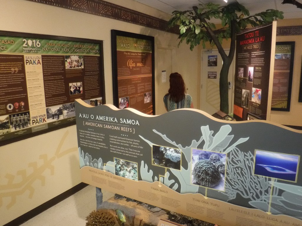
The best place to start is the visitor center in Pago Pago, where the park rangers can answer your questions and update you on what trails are currently open.  Hiking is the only activity on Tutuila, at least with the waves as large as they were during our visit.  We have heard there is good snorkeling right off the beach on Ofu, and we found good coral reefs in Utulei protected within Pago Pago Harbor (outside the National Park at Sadie’s by the Sea).  The coral is very shallow in most places, so it is best to snorkel around high tide.  Everything about this tropical forest is unique, but we were most fascinated by the fruit bats called flying foxes that are diurnal and have three-foot wingspans.

Best Trail

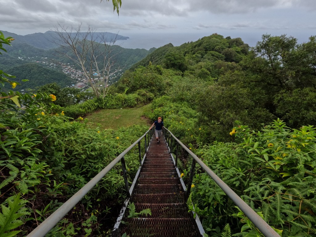
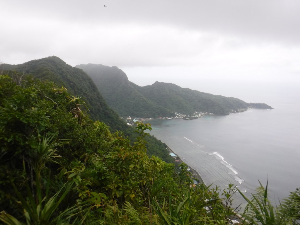
The Mt. ‘Alava Trail travels 3.4 miles one-way from Fagasā Pass on an old, rutted road to an incredible overlook of Pago Pago Harbor where an old tramway station sits rusting.  If you continue along the ridgeline you immediately come to a “ladder” built into the slope with a knotted rope for dropping down the muddy hill, which is part of the Mt. ‘Alava Adventure Trail (which is partially closed and not a loop).  This is the first of many ladders that descend the 1,610-foot mountain to the seaside village of Vatia.  It would be difficult to find the trailhead from that side (it is basically in somebody’s backyard) and since there is not currently a bus to Vatia we rode in the bed of a pickup truck back to the main road in Aua.

Instagram-worthy Photo

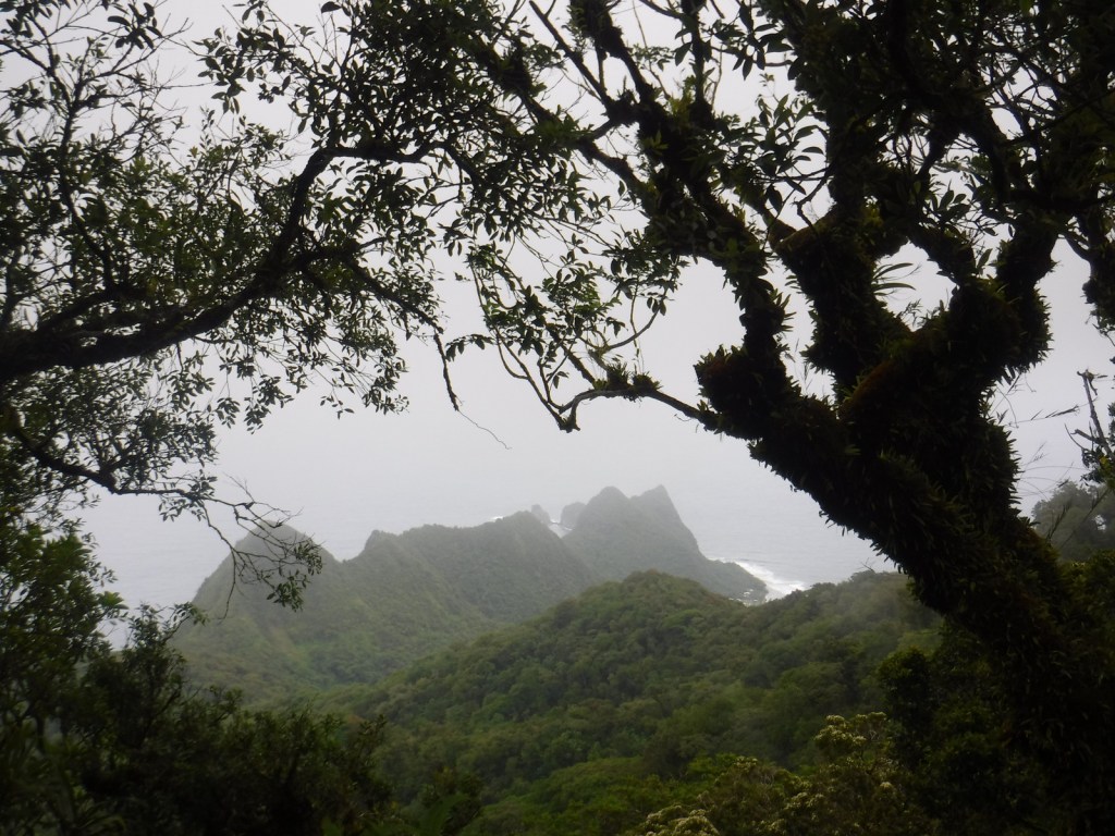
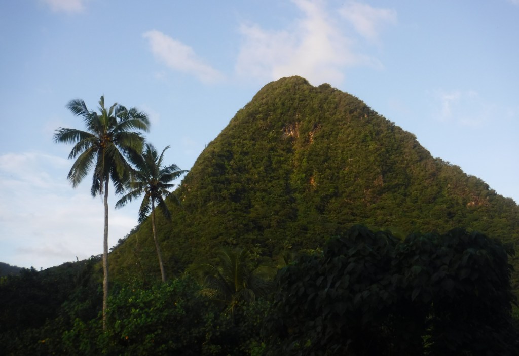
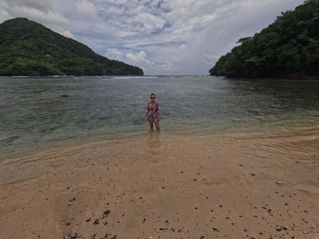
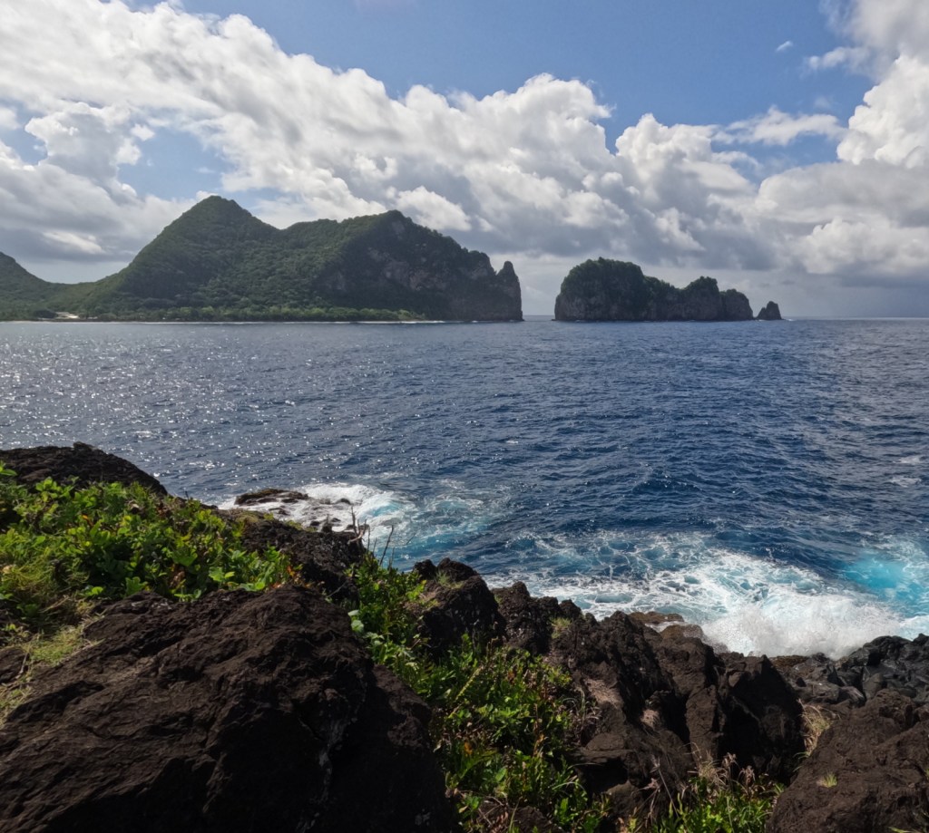
The Lower Sauma Ridge Trail quickly drops down about 300 feet to an incredible view of Pola Island and Vai‘ava Strait National Natural Landmark.
Peak Season

Year round, but the Park Ranger we met said she recommends April after the rainy season ends

Hours

https://www.nps.gov/npsa/planyourvisit/basicinfo.htm

Fees

There is no entrance fee, but this is one of the most expensive National Parks to visit (a roundtrip plane ticket from Honolulu costs around $1,000 per person).

Road Conditions

All roads are paved except for the short stretch to the Pola Island Trailhead, which requires high clearance.  There is no longer a bus that runs to Vatia, so you will need to rent a car to access the trails on the north side of the island, but we did catch a bus to Fagasā Pass for the Mt. ‘Alava Trail (and some buses run on Sunday despite what we were told).

Camping

There is no camping allowed in the National Park, but there are other accommodations on Tutuila (we stayed at an Airbnb in Mesepa).  Since the COVID-19 pandemic, the National Park Service has not been able to get any families to volunteer for the Homestay Program that this park was once known for.

Related Sites

War in the Pacific National Historical Park (Guam)

Haleakalā National Park (Hawai‘i)

El Yunque National Forest (Puerto Rico)
Explore More –What tragic event occurred in 1980 that shut down the tramway across Pago Pago Harbor?

We are a participant in the Amazon Services LLC Associates Program, an affiliate advertising program designed to provide a means for us to earn fees by linking to Amazon.com and affiliated sites.
Land Between The Lakes National Recreation Area

Land Between The Lakes National Recreation Area

Kentucky, Tennessee

Managed by U.S. Forest Service, Southern Region

170,310 acres

Website: https://landbetweenthelakes.us/

Overview

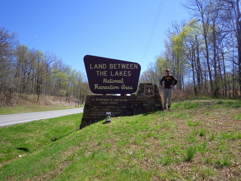
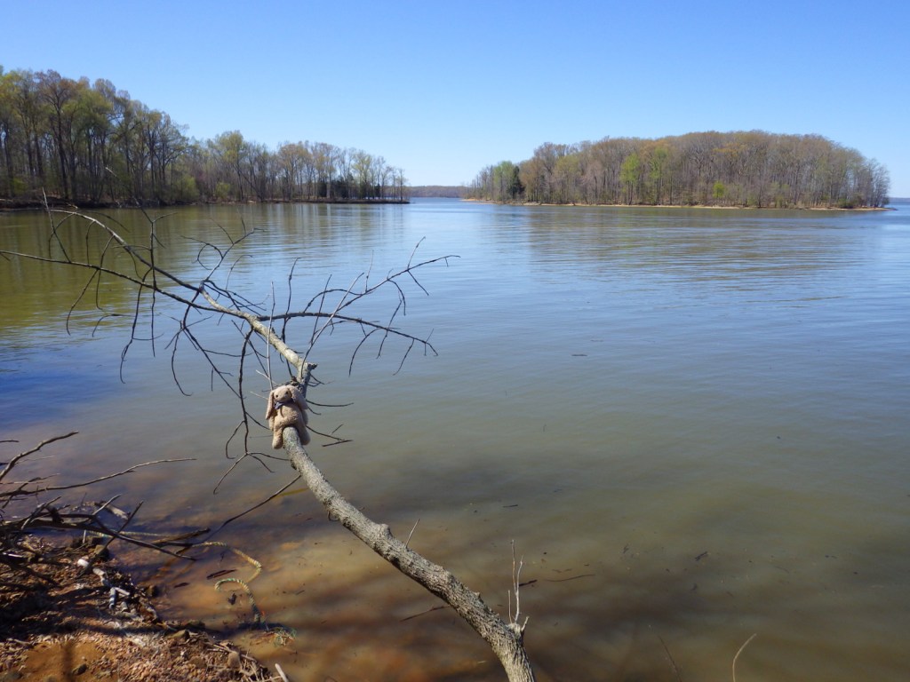
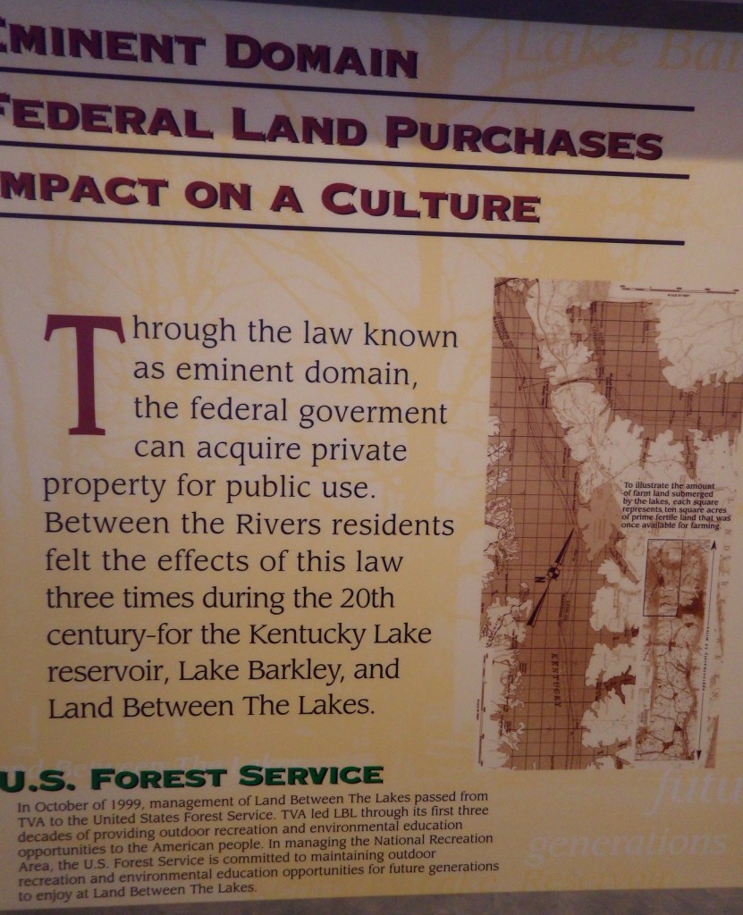
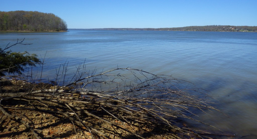
In western Kentucky, the U.S. Forest Service manages 106,458-acres as Land Between The Lakes National Recreation Area (and not part of any National Forest).  It gets its name from the narrow strip of land left after the damming of the Tennessee River to create Kentucky Lake and the Cumberland River to create Lake Barkley.  The dams were constructed by the Tennessee Valley Authority, who managed this area for recreation until 1999.  In 1991, this area was designated a UNESCO Biosphere Reserve, but was withdrawn from the program by the Trump administration.  On December 10, 2021, an EF-4 tornado hit the northern portion of the National Recreation Area and recovery is ongoing.

Highlights

Woodlands Trace National Scenic Byway, Elk and Bison Prairie, Golden Pond Planetarium, Homeplace 1850’s Farm, Golden Pond Visitors Center

Must-Do Activity

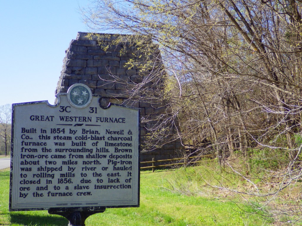
In addition to the traditional watersports, Land Between The Lakes National Recreation Area has several attractions found along the Woodlands Trace National Scenic Byway.  These include developed areas (with fees) like the Golden Pond Visitor Center and Planetarium, Elk and Bison Prairie, Woodlands Nature Station, Turkey Bay Off-Highway Vehicle Area, and Homeplace 1850’s Farm (across the border in Tennessee).  The roadside pullout for the Great Western Furnace is worth a stop to check out the 1854 charcoal furnace used to create pig-iron.

Best Trail

The North-South Trail runs 59 miles from Kentucky’s Nickell Branch Backcountry Area to Tennessee’s Devils Backbone State Natural Area (near where Civil War-era Fort Henry was submerged beneath Kentucky Lake). 

Instagram-worthy Photo

Starting in the 1970s, the Tennessee Valley Authority conducted prescribed burns and reseeded to expand patches of native grasses on 700 acres that became the Elk and Bison Prairie (that officially opened in 1996).  There is also a South Bison Range along the Woodlands Trace National Scenic Byway in Tennessee.

Peak Season

Summer

Fees

It is free to drive through Land Between The Lakes National Recreation Area and park at many trailheads, but most attractions require an admission fee.

Road Conditions

Woodlands Trace National Scenic Byway is paved (as is the 3.5-mile loop in the Elk and Bison Prairie) and the gravel roads are well maintained.

Camping

There are several lakeside campgrounds, including Wrangler’s Campground with horse stalls.  For those interested in backpacking, there are multiple free backcountry areas to explore, including the Devils Backbone State Natural Area where we camped.  The unique Annual Backcountry Camping Permit only costs $30 per person (three-day permits $7).

Related Sites

Fort Donelson National Battlefield (Kentucky-Tennessee)

Big South Fork National Recreation Area (Kentucky-Tennessee)

Daniel Boone National Forest (Kentucky)

Nearest National Park

Mammoth Cave

Explore More – Where were the elk reintroduced from into the Elk and Bison Prairie?

Daniel Boone National Forest

Daniel Boone National Forest

Kentucky

Managed by U.S. Forest Service, Southern Region

2,047,092 acres (706,680 federal/ 1,340,412 other)

Website: https://www.fs.usda.gov/dbnf/

Overview

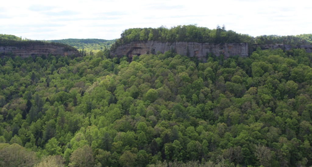
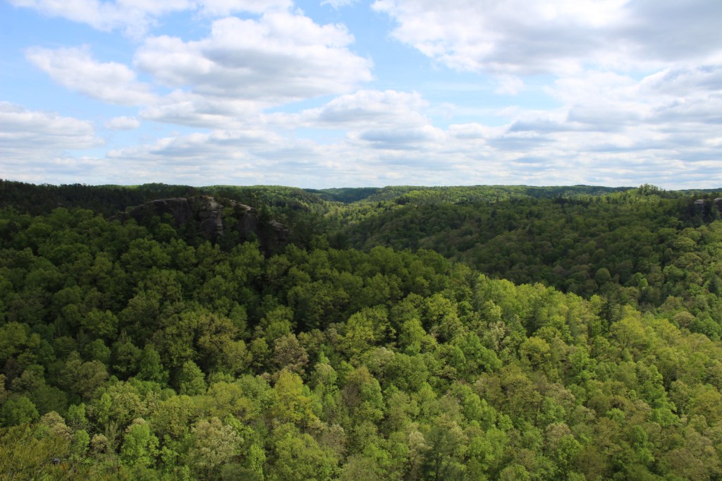
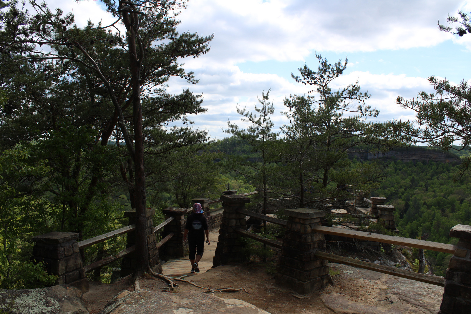
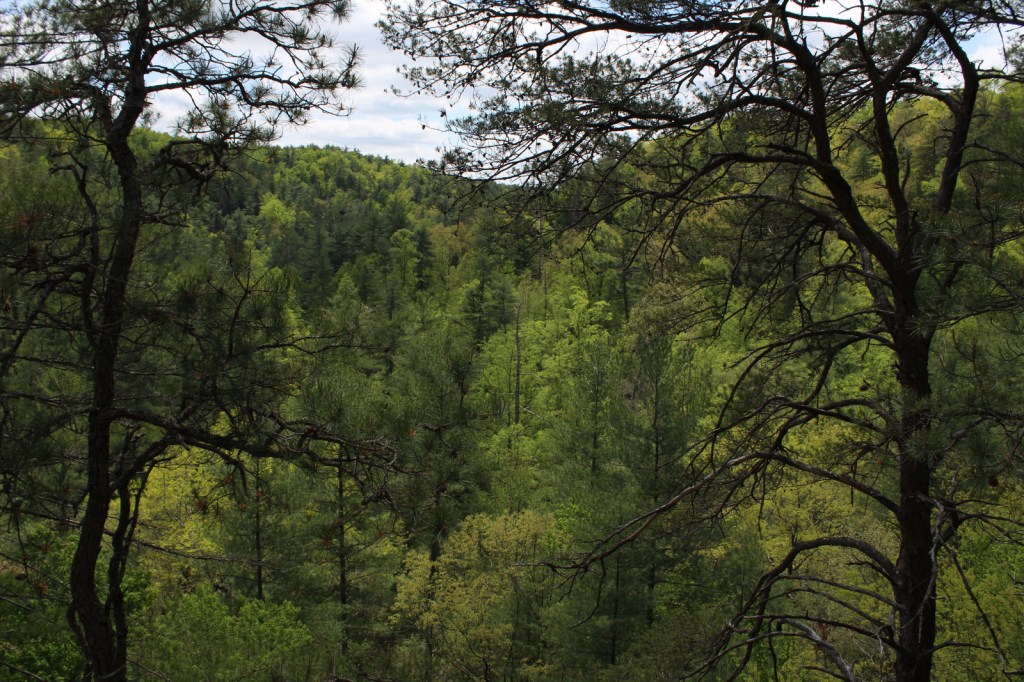
Daniel Boone National Forest is spread across the Cumberland Plateau in Kentucky, covering more than two-million acres when including private land and the 145,839-acre Redbird Purchase Unit.  The National Forest also surrounds three popular State Parks: Buckhorn Lake, Cumberland Falls, and Natural Bridge.  The latter is adjacent to the spectacular Red River Gorge Geological Area, which is a major reason Daniel Boone National Forest sees more than one-million visitors annually.  The forest has nearly 100 developed recreation areas and 600 miles of trails, plus several historic sites like Clear Creek Iron Furnace, Nada Railroad Tunnel, and Camp Wildcat (site of the first Civil War engagement of regular troops in Kentucky).

Highlights

Zilpo Scenic Byway, Red River Gorge Geological Area, Nada Tunnel, Cave Run Lake Recreation Area, Lick Creek Falls, Clear Creek Iron Furnace, Camp Wildcat, Laurel River Lake Recreation Area, Chimney Top Rock, Chestnut Knob, Yahoo Arch, Sheltowee Trace National Recreation Trail

Must-Do Activity

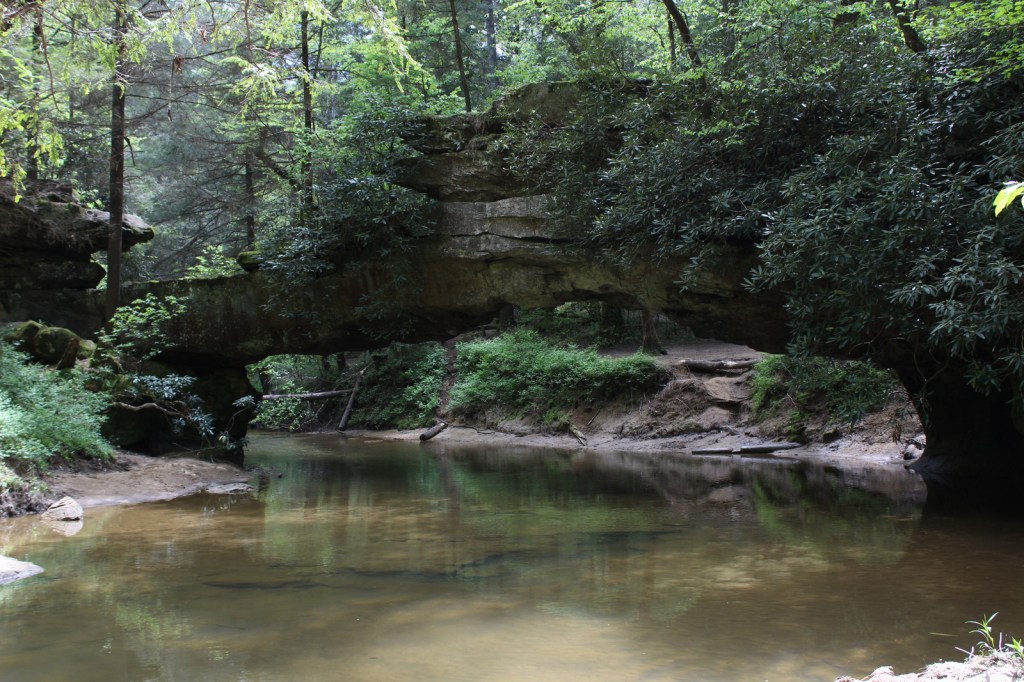
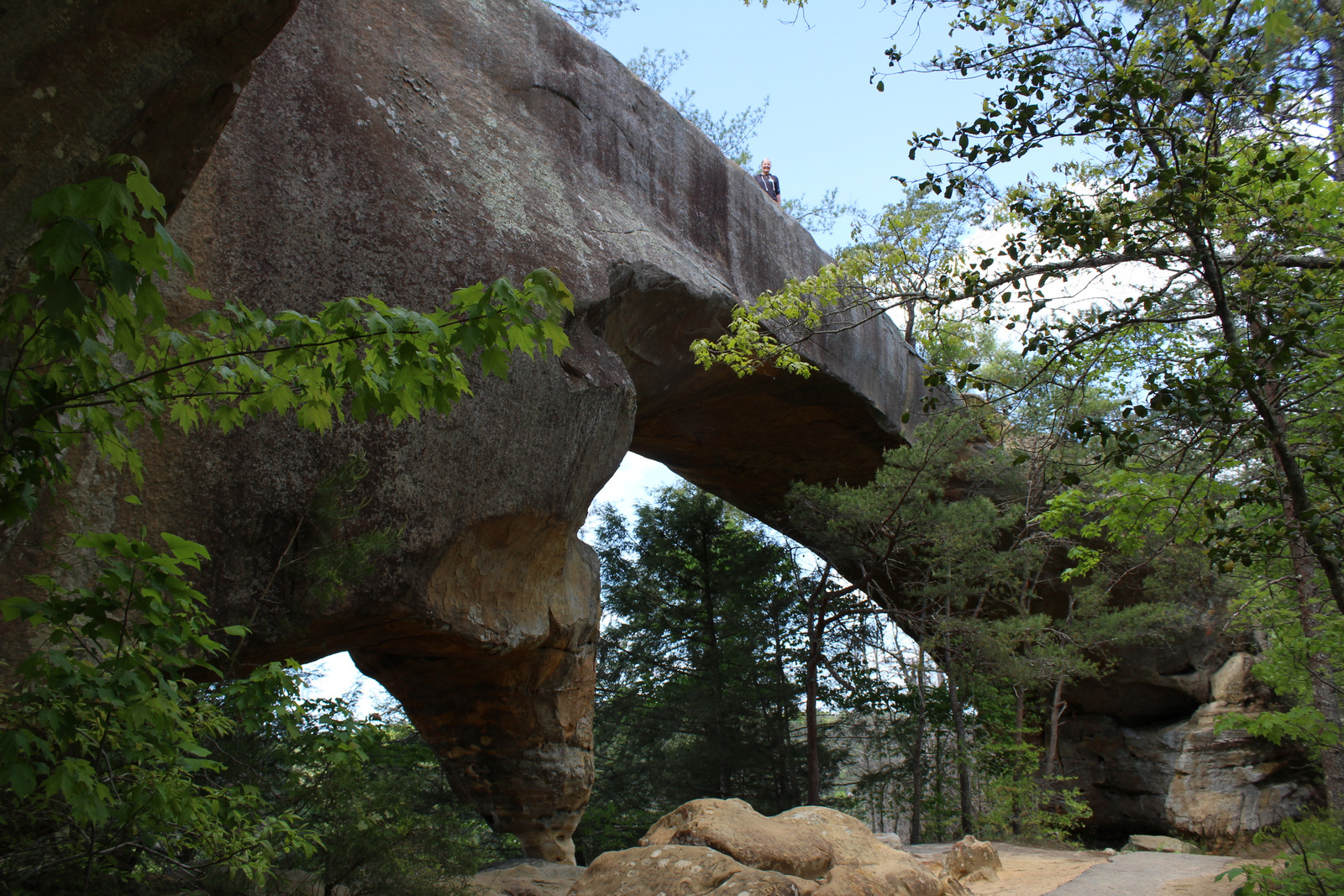
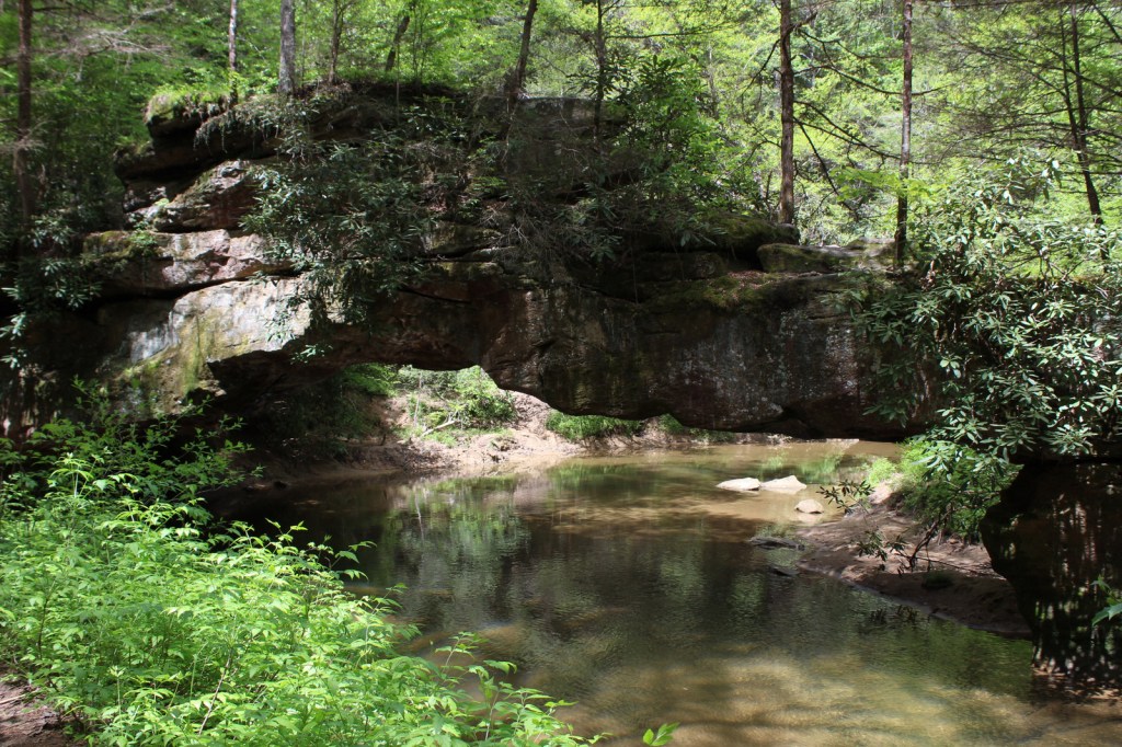
In the rolling hills of the Cumberland Plateau, Red River Gorge Geological Area is full of enough sandstone arches to keep you busy exploring for days.  Although 91-foot long Koger Arch was closed during our visit, we enjoyed short hikes to 75-foot Sky Bridge and 32-foot Princess Arch.  Rock Bridge Trail is a 1.3-mile loop that passes the sole natural bridge in the area with water flowing through it, and the only one formed by a waterfall cutting through the sandstone. 

Best Trail

The 282-mile-long Sheltowee Trace National Recreation Trail runs from Tennessee north into the southern end of Daniel Boone National Forest and Big South Fork National River and Recreation Area (where a camping permit is required by the National Park Service).  The trail marked by white turtle blazes passes through Alum Ford primitive campground on the Big South Fork of the Columbia River.  From Yahoo Falls Scenic Area, a short jaunt takes hikers to 113-foot-tall Yahoo Falls, which you can walk behind.  Yahoo Arch (17 feet tall) is accessible further up that two-mile section of trail or from a separate Forest Service trailhead on KY700, as is Markers Arch on a separate half-mile spur.

Watchable Wildlife

Major mammals found in Daniel Boone National Forest include black bear, coyote, bobcat, red fox, gray fox, mink, white-tailed deer, gray squirrel, muskrat, opossum, raccoon, cottontail rabbit, woodchuck, and three species of bat.  Wild turkey, northern bobwhite quail, ruffed grouse, red-cockaded woodpecker, and bald eagle are some of the 194 bird species identified.  Copperheads and timber rattlesnakes are two types of venomous snakes found here.  Lakes and streams have rainbow trout, largemouth bass, smallmouth bass, bluegill, crappie, and muskie.

Instagram-worthy Photo

Kentucky is riddled with caves—from the manmade Louisville Mega Cavern to Mammoth Cave National Park.  Daniel Boone National Forest has an estimated 1,500 to 2,000 limestone caves, in addition to small overhangs in the sandstone of Red River Gorge Geological Area.

Peak Season

Summer

Fees

There is not a day use fee to park, hike, or picnic in Red River Gorge Geological Area (unless you park overnight).

Road Conditions

Most of the trailheads in Red River Gorge Geological Area are accessed by well-marked and well-maintained dirt roads.

Camping

South of Interstate 64, Cave Run Lake stretches across 8,270 acres in northeastern Kentucky where we spent the night at a Forest Service campground on a cross-country roadtrip in 2007.  There are campgrounds in Red River Gorge Geological Area, where backpacking in the Clifty Wilderness only costs $5 per day per car for a permit.

Wilderness Areas

Beaver Creek Wilderness

Clifty Wilderness

Related Sites

Big South Fork National Recreation Area (Kentucky-Tennessee)

Cumberland Gap National Historical Park (Kentucky -Tennessee-Virginia)

Land Between The Lakes National Recreation Area (Kentucky-Tennessee)

Nearest National Park

Mammoth Cave

Conifer Tree Species

eastern hemlock, loblolly pine, Virginia pine, pitch pine, shortleaf pine

Flowering Tree Species

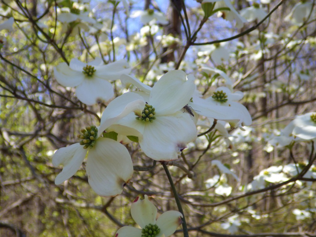
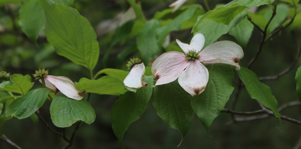
chestnut oak, scarlet oak, black oak, northern red oak, white oak, rock chestnut oak, tulip-poplar, American beech, mockernut hickory, bitternut hickory, pignut hickory, black gum, white ash, sassafras, mountain laurel, basswood, red mulberry, witch hazel, sugar maple, red maple, sourwood, cucumber magnolia, bigleaf magnolia, flowering dogwood, serviceberry, pawpaw, river birch, sycamore, silver maple, black willow, sweetgum, devil’s walkingtick, white rhododendron, Cumberland azalea

Explore More – In what year did the frontiersman Daniel Boone fight in the Battle of Blue Licks during the American Revolution?

Learn more about this and the 154 other National Forests in our new guidebook Out in the Woods

We are a participant in the Amazon Services LLC Associates Program, an affiliate advertising program designed to provide a means for us to earn fees by linking to Amazon.com and affiliated sites.
Camp Nelson National Monument

Camp Nelson National Monument

Kentucky

Managed by National Park Service

Established 2018

525 acres

Website: nps.gov/cane

Overview

Camp Nelson National Monument occupies 525 acres where a Civil War fort was located 20 miles south of Lexington.  During the war, Kentucky was technically a Union state so the Emancipation Proclamation of 1863 did not apply to the state’s slaves.  Many local slaves were impressed by the U.S. Army to build the camp and their owners were compensated for the work.  In May 1864, when freedom was offered to any black man to join the United States Colored Troops, thousands of escaped slaves brought their families (who were not granted freedom) to this supply depot, which led to numerous conflicts between refugees and Army officials. 

Know someone who loves exploring new National Monuments? Gift them our book Monumental America: Your Guide to All 138 National Monuments that is available for sale on Amazon.com.

Highlights

Museum, film, Oliver Perry House, barracks, Fort Putnam, Fort Jones, Home for Colored Refugees Site

Must-Do Activity

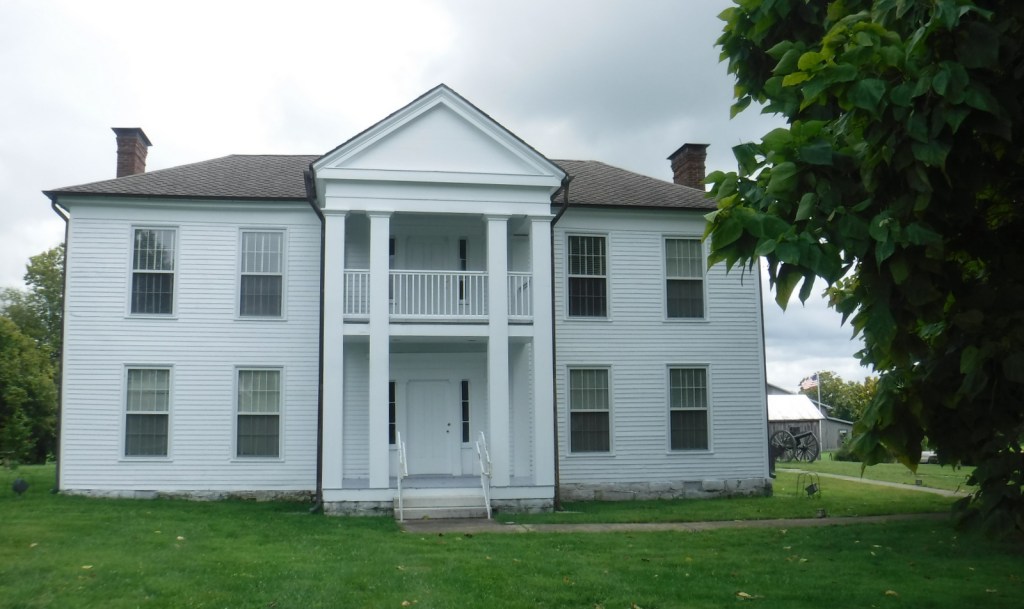
Unlike many new National Monuments, this one was already developed as the Camp Nelson Civil War Heritage Park so it has a historical museum, hiking trails, and interpretive film (that made our Top 10 list for NPS films).  The Oliver Perry House is the only original structure on site, although a barracks building and the earthworks of Fort Putnam have been reconstructed.  A living history weekend is typically held during the summer in the park, which is adjacent to Camp Nelson National Cemetery (see photos below) where hundreds of Civil War soldiers are buried.

Best Trail

There are four miles of trails in Fort Nelson National Monument with numerous interpretive signs and flags placed to identify the former locations of the bakery, prison, stables, Quartermaster Office, and other structures.  The Fort Jones/Overlook Trail accesses extensive stone revetment walls that provided defenses for the eastern side of Camp Nelson.  There is little shade in this grassy landscape, so come prepared on hot summer afternoons.

Instagram-worthy Photo

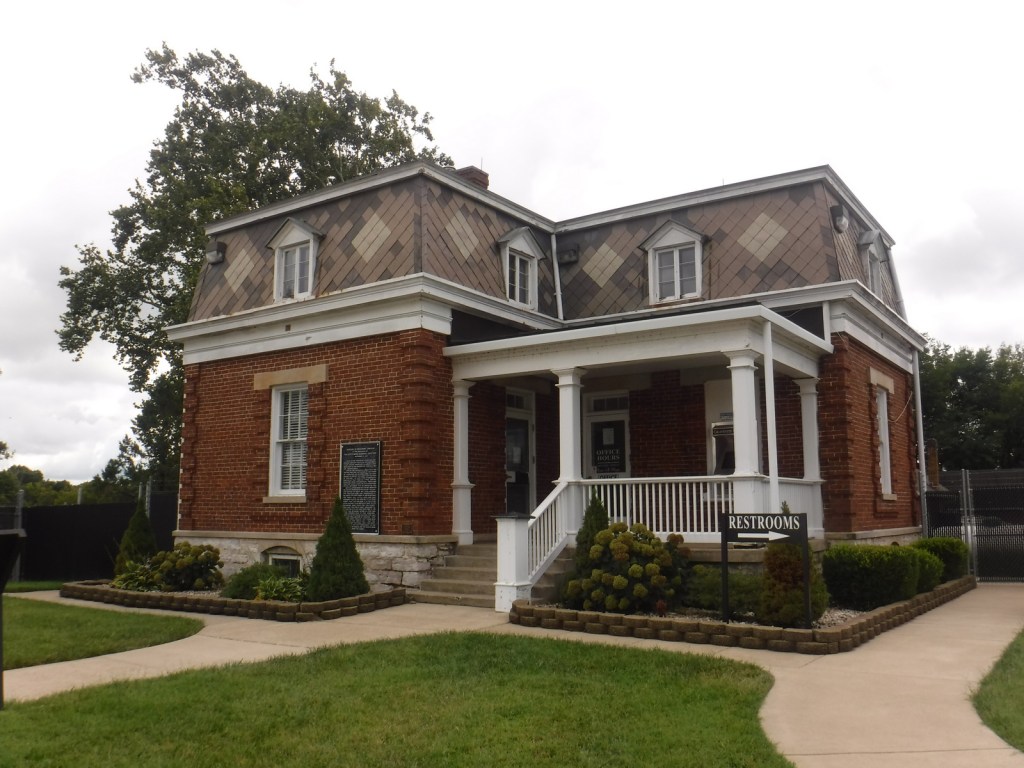
Built in 1846, the Oliver Perry House (also called the White House) is the only remaining original structure on site, which served as officers’ quarters.

Peak Season

Summer

Hours

https://www.nps.gov/cane/planyourvisit/hours.htm

Fees

None

Road Conditions

All roads paved

Camping

There is no campground on site, but there are some nice ones found throughout the Kentucky state parks system and Daniel Boone National Forest (where we recommend Cave Run Lake).

Related Sites

Daniel Boone National Forest (Kentucky)

Mill Springs Battlefield National Monument (Kentucky)

Mammoth Cave National Park (Kentucky)

Explore More – When was Army policy changed at Camp Nelson to allow the families of United States Colored Troops to have a mess hall, school, and housing?

Learn more about the other 137 National Monuments in our book Monumental America: Your Guide to All 138 National Monuments

Top 10 Films at National Park Service Visitor Centers

This fall we have driven all over the country and stopped at a handful of National Park Service (NPS) sites that we had never visited.  We have been surprised at the quality of the introductory films shown at some of these lesser-known spots, so we decided to put together a list of our all-time favorites.  Not every NPS site has a film, nor have we watched every one available at the 385 units we have visited, so there is a good bet we have missed some excellent ones.  Please let us know if you have a recommendation, as quite a few of the films are now available for free through the NPS app or on YouTube.  Click here to see all of our Top 10 lists, including some lists of movies not made by the NPS.
Know someone who loves National Parks? Gift them our travel guidebook A Park to Yourself: Finding Solitude in America’s 63 National Parks

10. Fort Davis National Historic Site (Texas)

Basketball star Kareem Abdul-Jabbar in a cowboy hat is probably the best reason to watch this film about the “Buffalo Soldiers” (click to watch it on YouTube)

9. Moores Creek National Battlefield (North Carolina)

Reenactors in kilts holding swords make this seem more like Braveheart than the historically-accurate Revolutionary War scene that it is

8. Camp Nelson National Monument (Kentucky)

This recent addition to the NPS system has a great film about how a Civil War fort became a haven for runaway slaves

7. Big South Fork National River and Recreation Area (Tennessee-Kentucky)

Most of these films emphasize history, but this one focuses on the natural beauty and recreational opportunities in this forested wonderland

Scott with the 42′ x 377′ Cyclorama mural

6. Gettysburg National Military Park (Pennsylvania)

The only movie on this list that charges an admission fee, it is well-produced and pairs well with viewing the Cyclorama painting

5. Nez Perce National Historical Park (Idaho-Oregon-Washington-Montana)

The Nez Perce have a thriving nation as shown in this documentary that emphasizes the present more than the past (it plays at the visitor center in Spaulding, Idaho)

4. Stones River National Battlefield (Tennessee)

A short, modern film (on YouTube) that thoroughly and artfully explains the battle with long, uncut shots and realistic depictions of bullet wounds

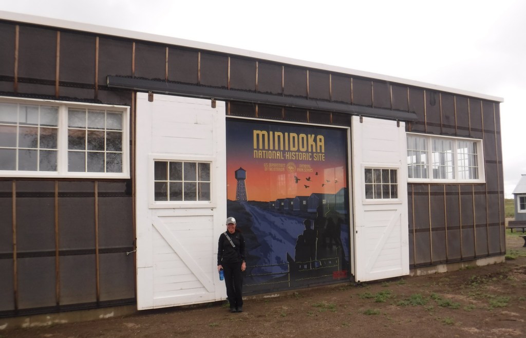
3. Minidoka National Historic Site (Idaho)

New film covers the internment of 110,000 Japanese-Americans during World War II, not just the 13,000 imprisoned in central Idaho

2. Eleanor Roosevelt National Historic Site (New York)

The excellent documentary Close To Home (on YouTube) focuses primarily on the former First Lady’s inspirational career after her time in the White House

…and finally our #1 film at a National Park Service visitor center:

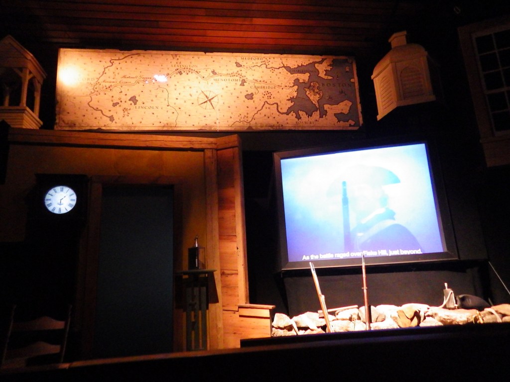
1. Minute Man National Historical Park (Massachusetts)

Multiple screens with props in the foreground make for an unforgettable telling of Paul Revere’s ride at the visitor center in Lexington

.

Honorable Mentions

Minuteman Missile National Historic Site (South Dakota)

Intercontinental Ballistic Missiles (ICBMs) and Mutually Assured Destruction (MAD) are the topics of this excellent 27-minute film you can watch at home

Hopewell Culture National Historical Park (Ohio)

This film is less than six minutes long, but it is very informative and available on YouTube

Frederick Douglass National Historic Site (District of Columbia)

This film is very dated to the 1970s, so it is unintentionally funny while still being informative

President William Jefferson Clinton Birthplace National Historic Site (Arkansas)

Interviews with the former President highlight this retelling of his childhood in the small town of Hope where he was born to a widowed mother under the name Billy Blythe III

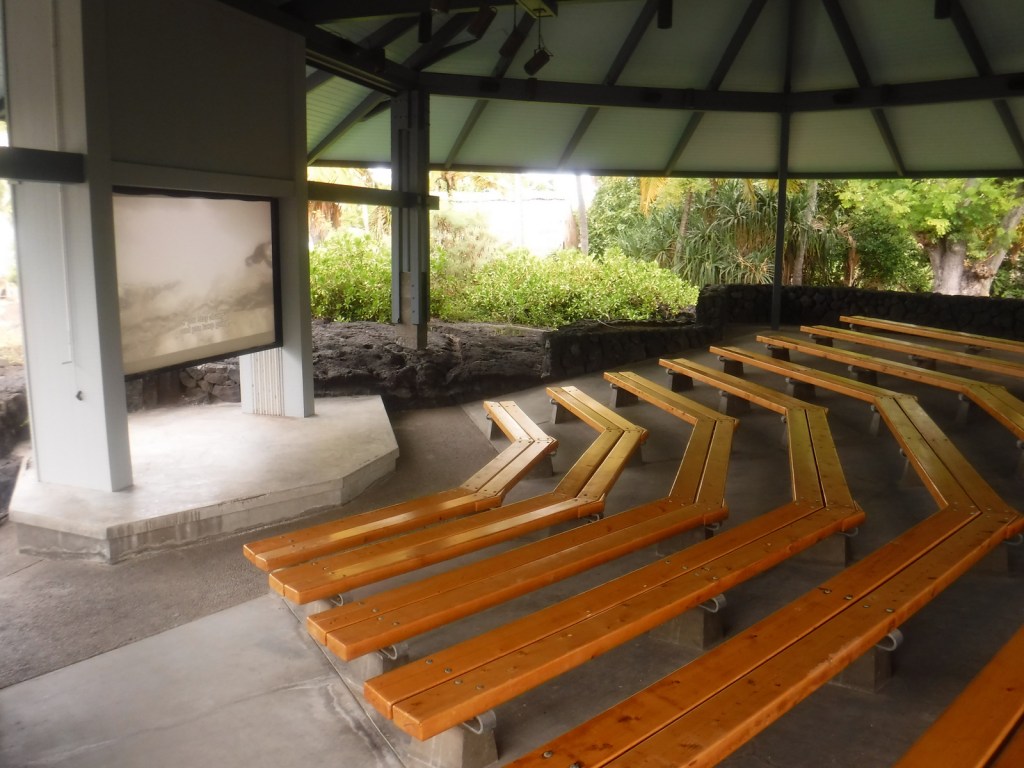
Pu’uhonua O Hōnaunau National Historical Park (Hawai’i)

We did not watch the whole film, but this must be the most pleasant theater in the NPS system

Independence National Historical Park (Pennsylvania)

There are actually two films shown at the visitor center in downtown Philadelphia, but only one stars a young Kristen Bell (from Veronica Mars and Disney’s Frozen)

Know someone who loves National Parks? Gift them our travel guidebook A Park to Yourself: Finding Solitude in America’s 63 National Parks