Tag Archives: hiking

Big South Fork National River and Recreation Area

Overview

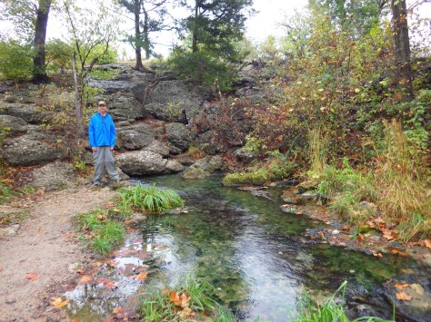
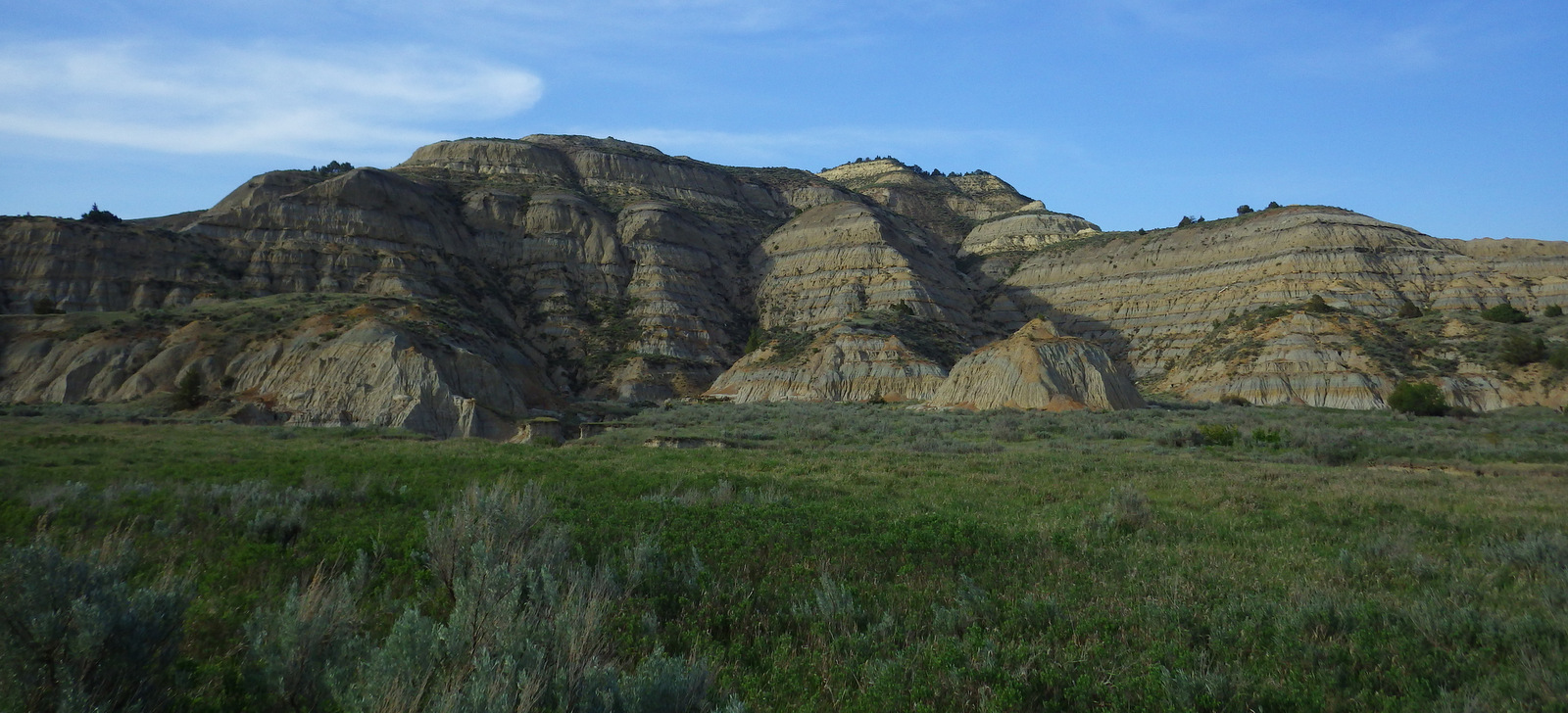
Crossing the Tennessee – Kentucky border, the Big South Fork of the Cumberland River cuts a 90-mile long gorge that was spared damming in 1974 when 125,000 acres were set aside by the federal government.  The area is renowned for its Class IV rapids and 400 miles of trails for hikers, mountain bikers, and horseback riders.  Seasonally, a concessionaire runs the Big South Fork Scenic Railway from Stearns Depot to the Blue Heron Mining Community, an outdoor museum.

Fork

Highlights

Natural bridges, waterfalls, whitewater, train ride, trails, new film

Must-Do Activity

The film shown in the 6 visitor centers was released in 2016 and provides an excellent overview of the area.  You might want to ask for the subtitles to be turned on so you can understand the regional accents.

Best Trail

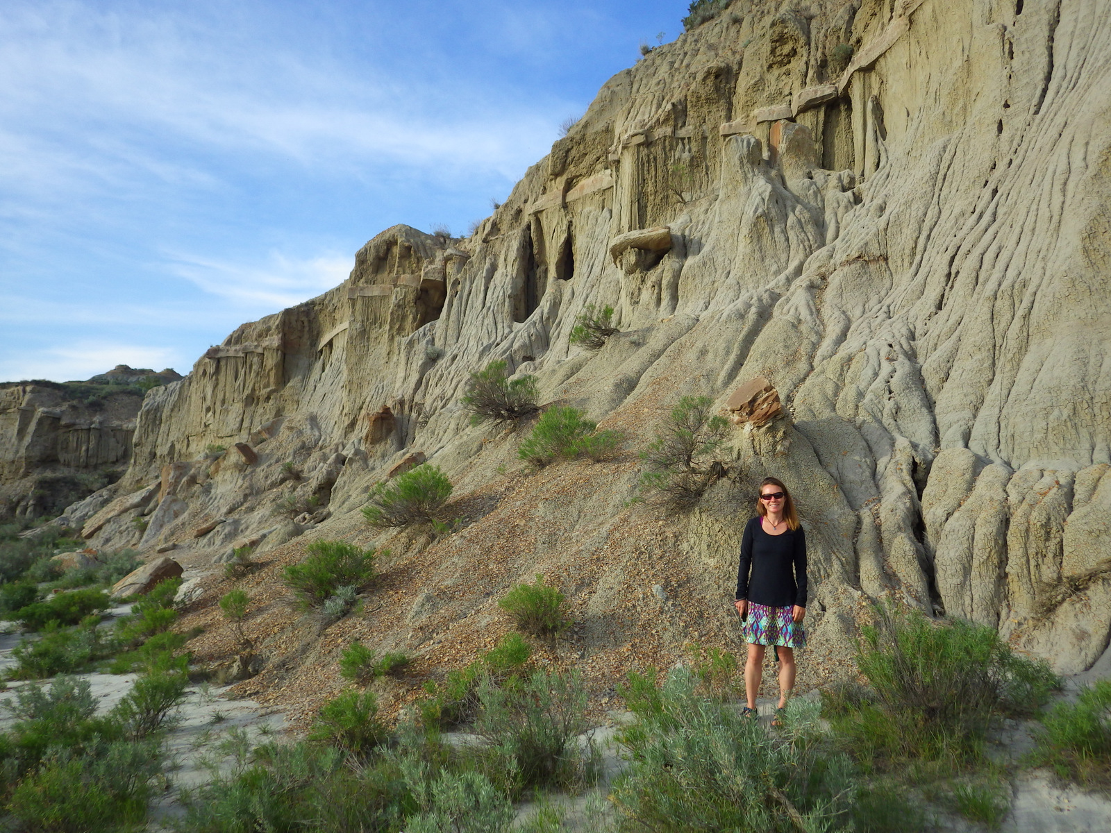
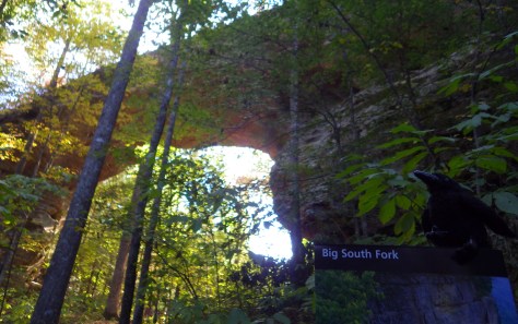
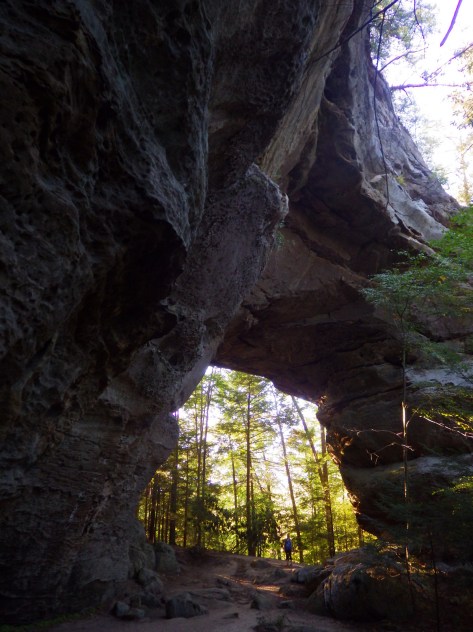
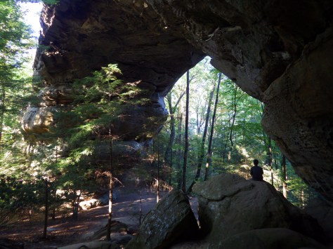
We enjoyed our 2-mile hike to Twin Arches (which are actually natural bridges formed by water).  We look forward to returning to this park to explore its other trails and waterways, especially to see Wagon Arch, Yahoo Falls, and Devil’s Jump Rapids.

Instagram-worthy Photo

Of the two Twin Arches, North Arch (93-foot span) is easier to photograph than South Arch (135-foot span) because there are fewer trees in the way.

IMGP0239

Peak Season

Summer, though the Spring Planting Festival (April) and “Haunting in the Hills” Storytelling Festival (September) offer many free activities.

Hours

https://www.nps.gov/biso/planyourvisit/basicinfo.htm

Fees

None, except to ride the concessionaire-operated Big South Fork Scenic Railway.

Road Conditions

The dirt roads we drove (Divide Road and Twin Arches Road) were passable for any vehicle.

Camping

There are many options, from full service Bandy Creek Campground in Scott State Forest to dispersed backpack camping along the trails.

IMGP0200

Tiff on the way to Twin Arch

Scott on the "trail" to Twin Arch

Scott exploring a slot
Exploring a slot in the sandstone behind North Arch of the Twin Arches.
IMGP0226
North Arch spans 93 feet with a 51-foot clearance, making me look small underneath it.

Explore More – How deep is the gorge cut by the Big South Fork River?

1WonsTiny2


WONDON WAS HERE

Fort Necessity National Battlefield

Overview

In a nondescript field in rural western Pennsylvania, a battle began what some historians consider the first worldwide war.  In April 1754, a young George Washington led British troops, Virginia militia, and their American Indian allies on a mission to push the French out of the western frontier.  After Washington’s troops ambushed and scalped French officers, an angry retaliatory force pinned him down at the hastily constructed Fort Necessity.  Washington surrendered on July 3, 1754, starting a global conflict that became known as the Seven Years War (or the French and Indian War).

Necessity.JPG

Highlights

Museum, reconstructed fort, Mount Washington Tavern

Must-Do Activity

The National Park Service manages an excellent museum and a re-creation of the small fort.  There is a playground, too, perhaps to entice children to come learn that little actions can have big consequences.

Best Trail

Make a side trip to nearby Jumonville Glen, where a short loop trail guides visitors through the forest where the initial ambush on the French occurred.

Instagram-worthy Photo

The reconstructed Mount Washington Tavern, a stagecoach stop on the historic National Road.  Construction of the National Road began in 1811 and businesses like this one soon popped up to serve travelers.

June North Carolina 051

Peak Season

Open year round, except Jumonville Glen and Braddock’s Grave are only open in summer.

Hours

https://www.nps.gov/fone/planyourvisit/hours.htm

Fees

None

Road Conditions

All roads paved

Camping

Ohiopyle State Park has running water, as do several private campgrounds nearby.

June North Carolina 061

June North Carolina 055
Archaeologist using a metal detector to look for artifacts from 1754.
June North Carolina 066
Not many National Park Service sites have a playground like Fort Necessity National Battlefield.
June North Carolina 028
The free National Park Service museum details the battle and its global ramifications; there’s young George Washington.

June North Carolina 069

June North Carolina 046
Inside the Mount Washington Tavern.

June North Carolina 043

June North Carolina 072
Ambush site at Jumonville Glen.

Explore More – Despite its name, the Seven Years War actually lasted how many years after fighting took place on four continents (as well as in the Philippines and Caribbean islands)?

1WonsTiny2

WONDON WAS HERE

John Day Fossil Beds National Monument

Overview

There are three units of this National Monument named for the John Day River that drains this region in the rain shadow of the Cascades.  It is less green than much of Oregon, but that lack of vegetation allows the wonderful colors of the soil to show through in places like the Painted Hills and Blue Basin.

July Oregon 1777.JPG

Highlights

Scenic views, geologic formations, fossils, museum

Must-Do Activity

The Thomas Condon Paleontology Center gets our vote for the best museum in the entire National Park Service System.   Across from Sheep Rock, it has awesome exhibits on the 40-million years of mammalian history this monument protects.  Plus, watch real laboratory specimens being prepared by archaeologists.  Across the highway, have a picnic at the James Cant Ranch Historic District and learn about sheep and cattle ranching in this region.

Best Trail

The Blue Basin is accurately named at the end of the one-mile Island in Time Trail.

Instagram-worthy Photo

If you can only see one unit of the monument, make sure it is the surreal Painted Hills. Stunning colors on large clay hills with several interpretive loop trails describe the geological history and fossils found there.

2016ORjohnday4

Peak Season

Summer, though wildfires can cause road closures.

Hours

https://www.nps.gov/joda/planyourvisit/hours.htm

Fees

None

Road Conditions

Dirt roads at the Painted Hills are passable with most vehicles when dry.

Camping

None within the monument, but there are several campgrounds in the area, including a nice one we stayed at in the town of Fossil, Oregon.

July Oregon 1732
The John Day River running through the National Monument.
Rock formations like the ones at Devils Postpile NM
The Thomas Condon Paleontology Center gets our vote for the best museum in the entire NPS System.
July Oregon 1746
The blue badlands at the end of the one-mile Island in Time Trail. 

Group shot


2016ORjohnday6
There are several trails through the Painted Hills for up-close views of the colorful soil.

IMG_1709


Explore More – Which unit of the National Monument is known for its fossil plants in mudstone?

1WonsTiny2

WONDON WAS HERE

Chickasaw National Recreation Area

Overview

In 1976, Platt National Park was combined with the nearby reservoir at Arbuckle National Recreation Area to form Chickasaw National Recreation Area, named for the neighboring Chickasaw Nation of central Oklahoma.  The trails and infrastructure in the park were predominantly built in the 1930s by the Civilian Conservation Corps (CCC).

Chickasaw.JPG

Highlights

Natural springs, bison herd, Lincoln Bridge, reservoir

Must-Do Activity

Visitors should start at the Travertine Nature Center, then visit the bison pasture and “take the waters” at Vendome Well.  Other diverse recreational opportunities include camping and water sports on the Lake of the Arbuckles.

Best Trail

Take the trail from the Travertine Nature Center to Antelope Springs and photogenic Buffalo Springs.  There is also loop trail around the bison pasture.

Instagram-worthy Photo

The U.S. Mint quarter (see photo below) for Oklahoma depicts the Lincoln Bridge built by the CCC, but it can be difficult to photograph through the trees.

IMGP1910

Peak Season

Summer

Hours

https://www.nps.gov/chic/planyourvisit/hours.htm

Fees

None

Road Conditions

All roads paved, except in Bluestem Prairie.

Camping

Multiple campgrounds, including several on the shores of the Lake of the Arbuckles.

IMGP1892
The adventurous road to Travertine Nature Center.
IMGP1896
There is a lot to learn inside the Travertine Nature Center.

IMGP1894

IMGP1907

IMGP1899

IMGP1898
The acorn caps from bur oak trees are huge.
IMGP1912
You have to try the sulphurous water fountain at Vendome Well.

Explore More – What was the original name for this federally protected area in 1902?

1WonsTiny2

WONDON WAS HERE

We are a participant in the Amazon Services LLC Associates Program, an affiliate advertising program designed to provide a means for us to earn fees by linking to Amazon.com and affiliated sites.