Overview
Originally managed as part of Yosemite National Park, this monument was established in 1911 to protect it from demolition by dam builders. It is only 798 acres, so it can easily feel crowded; therefore we recommend getting an early or late start when the shuttles from Mammoth Lakes, California are not running.

Highlights
Devils Postpile, Rainbow Falls, Minaret Falls
Must-Do Activity
Devils Postpile National Monument is named for a 60-foot tall wall of columnar basalt formed by a volcanic eruption that occurred less than 100,000 years ago. These interesting columns are one to three feet in diameter and more than half are hexagonal in shape.
Best Trail
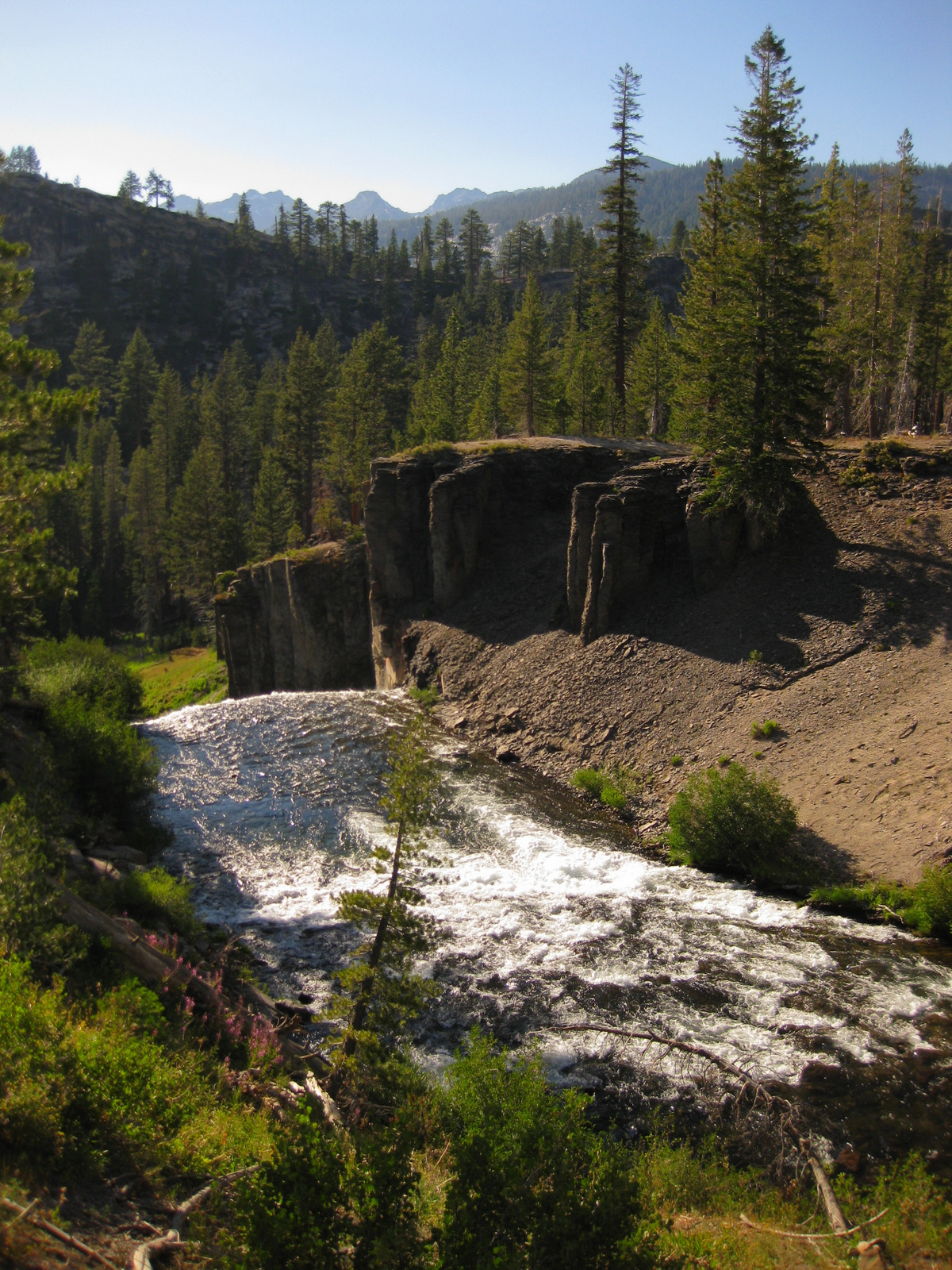
The Pacific Crest National Scenic Trail runs through the monument, but just outside its boundaries in Inyo National Forest is a 3-mile round trip hike to pretty Minaret Falls.
Instagram-worthy Photo
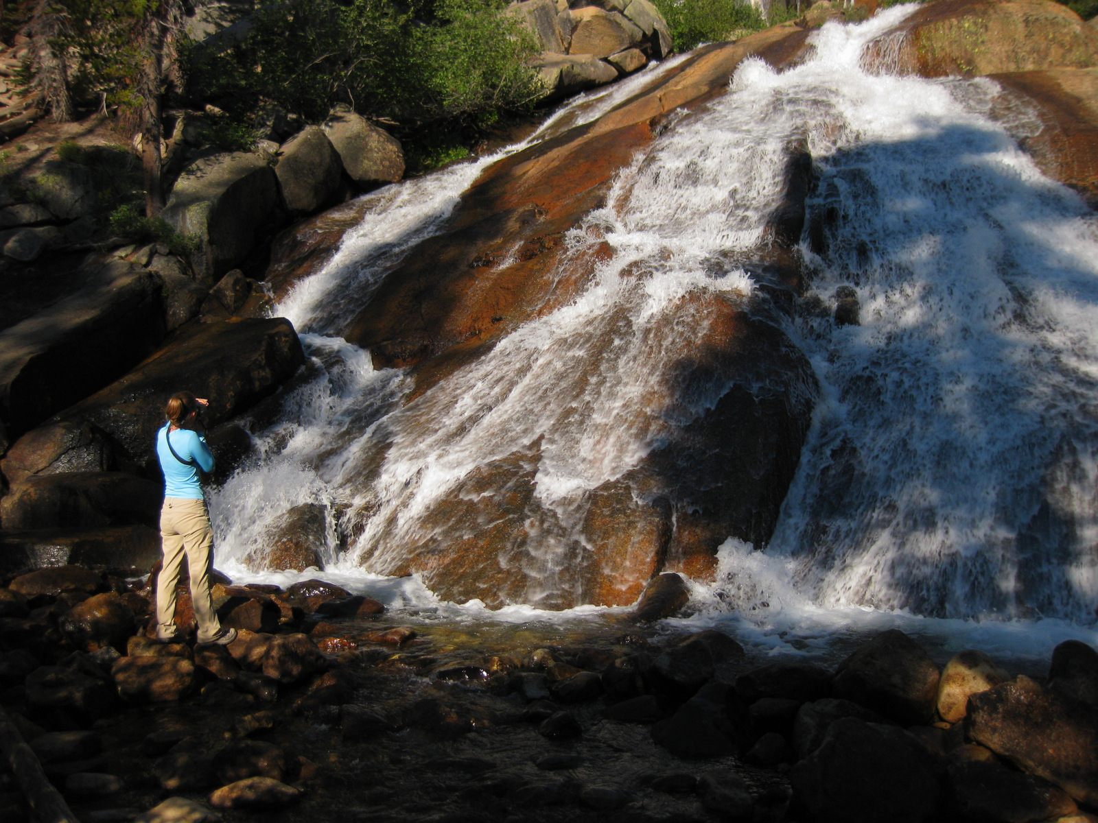
A short 1.3-mile roundtrip hike takes you to 101-foot-high Rainbow Falls, which usually lives up to its name and is one of the most stunning waterfalls we have ever seen.

Peak Season
Due to high snowfall in the Eastern Sierra, it is generally only open from June through October.
Hours
https://www.nps.gov/depo/planyourvisit/hours.htm
Fees
$20 per vehicle or America The Beautiful pass, but most visitors have to pay $8 per person for a shuttle bus to enter the monument.
Road Conditions
You are only allowed to drive your own vehicle down the narrow access road if you are staying at Reds Meadow Resort or the Inyo National Forest campground. Otherwise, you must pay to take a shuttle from Mammoth Lakes, California.
Camping
A 21-site campground is located near the National Monument and many others outside Mammoth Lakes, California in Inyo National Forest, where dispersed camping is also allowed in some places.
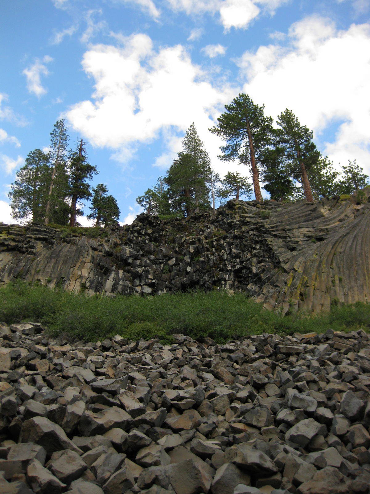
Devils Postpile 

Tiff and Wondon on top of Devils Postpile 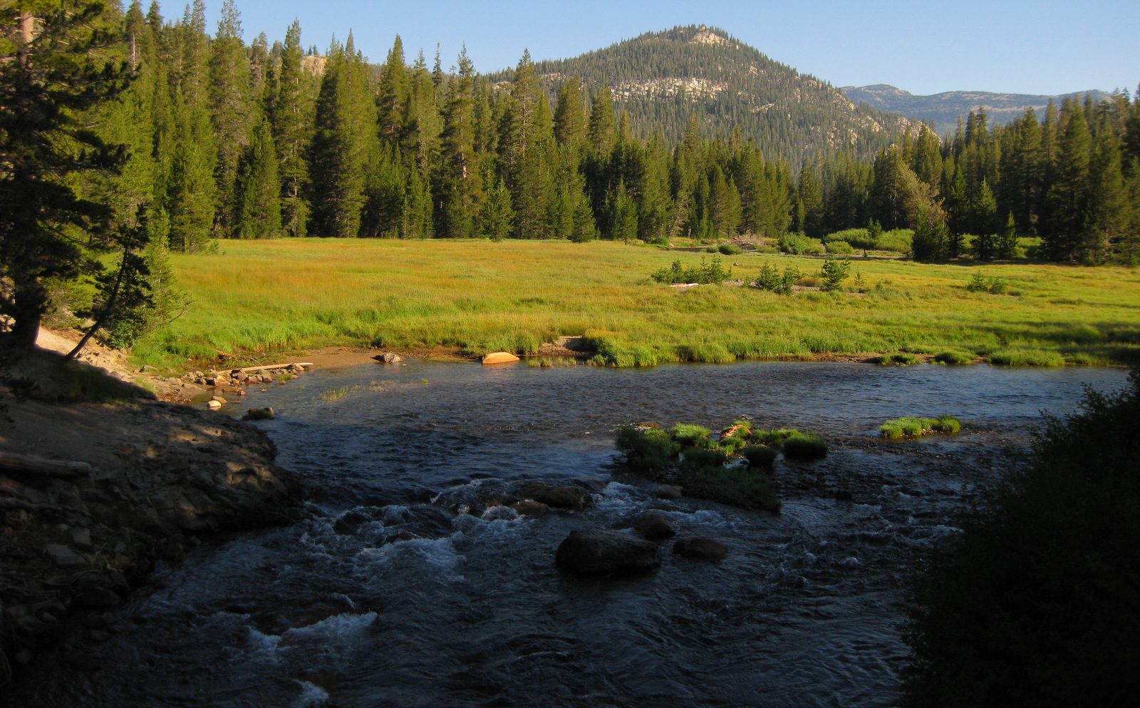
Top of Rainbow Falls 
Tiff at Minaret Falls 
Minaret Falls 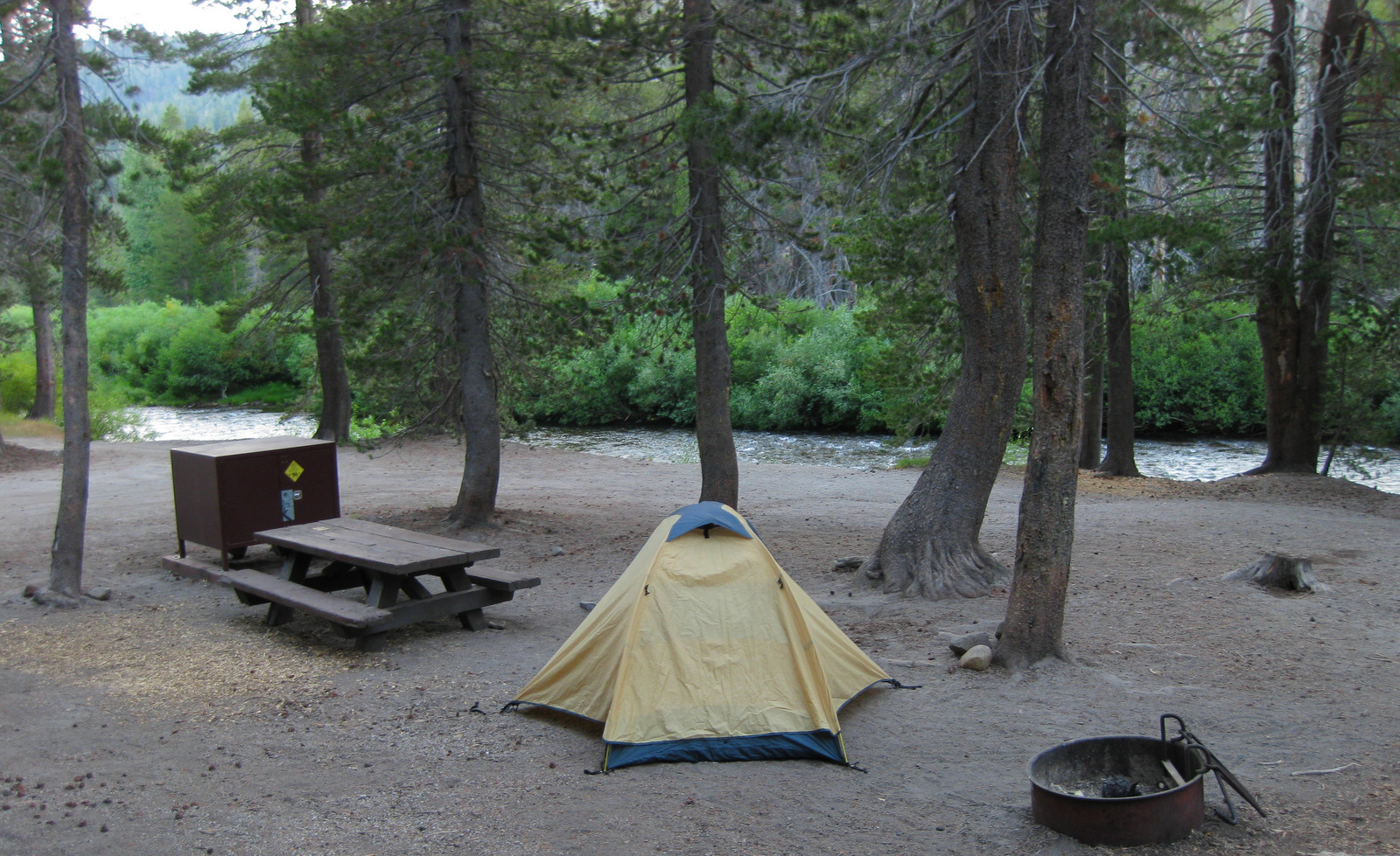
Explore More – How did glaciers help expose the Devils Postpile formation 10,000 years ago?