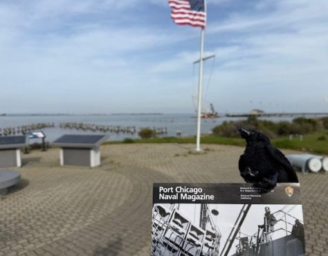
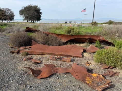
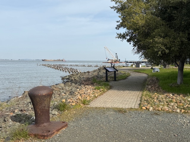
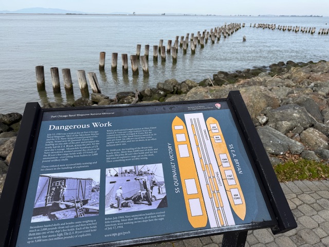
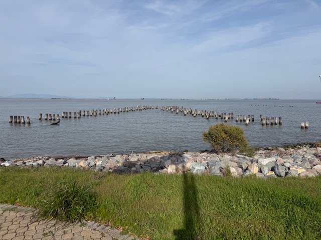
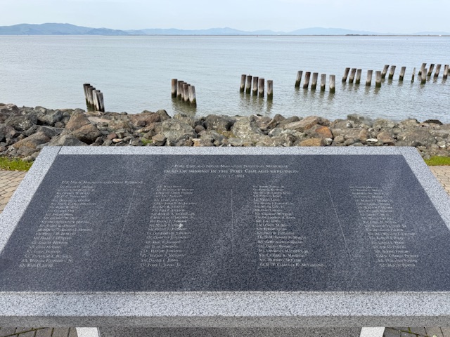
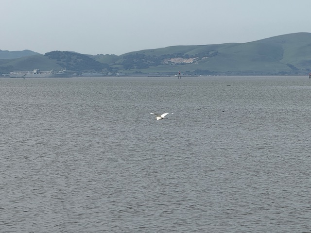
On July 17, 1944 at 10:18 p.m., a massive explosion at a U.S. Navy facility rocked the San Francisco Bay area. The blast started at a pier where munitions were being loaded onto two ships and killed 320 men. The majority of the dead were African American sailors who were segregated at the time and not allowed to serve in combat roles or as officers. After refusing to return to unsafe working conditions, 206 sailors were convicted after a summary courts-martial, and the “Port Chicago 50” were sentenced to 15 years imprisonment for mutiny. After receiving negative publicity, the Navy actually became the first of the military branches to integrate during World War II, well before President Truman required it in 1948. On January 6, 1946, the Navy released 47 of the 50 men being held and in 2024, the Navy posthumously exonerated all 256 men and vacated any remaining dishonorable discharges.
Highlights
Memorial, film, revetment
Must-Do Activity
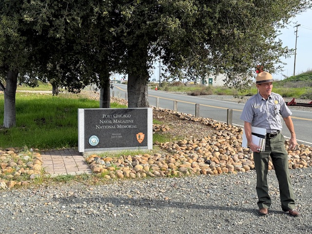
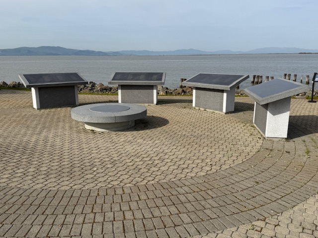
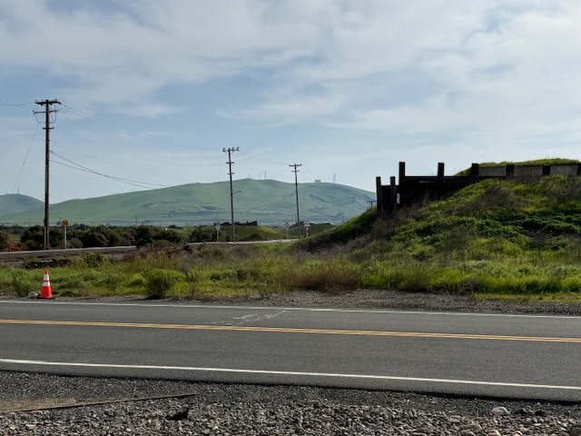
The memorial is located on an active military base called Military Ocean Terminal Concord on Suisun Bay. Therefore, all visitors are required to be U.S. Citizens and must make a reservation at least two weeks before their visit by calling or emailing the National Park Service (NPS) to receive a background check. Tours are given only on Thursdays, Fridays, or Saturdays and meet at John Muir National Historic Site (where you can watch a short film) in Martinez where the group boards government vehicles to drive to the site. After a thorough search of the vehicle and each visitor getting checked off a list, it is a short drive to the memorial where the NPS ranger explains the history of the site at two locations with time to walk around and take photos (but only of the memorial area).
Best Trail
None
Photographic Opportunity
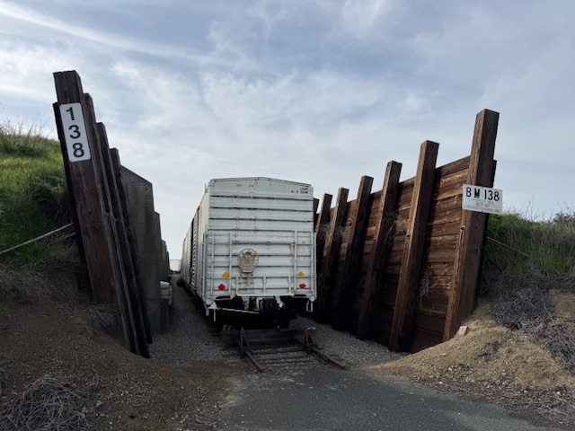
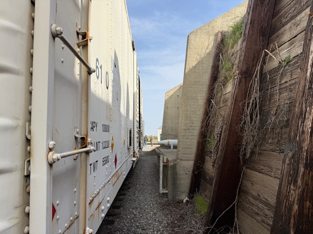
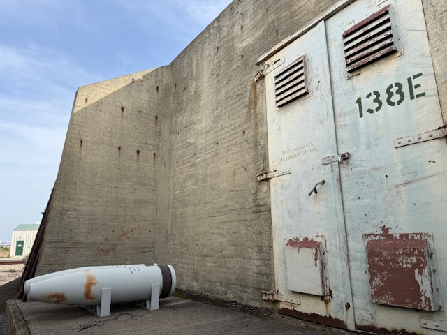
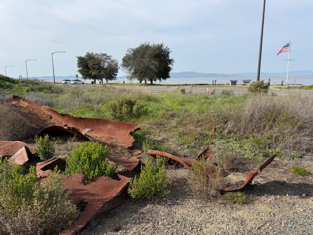
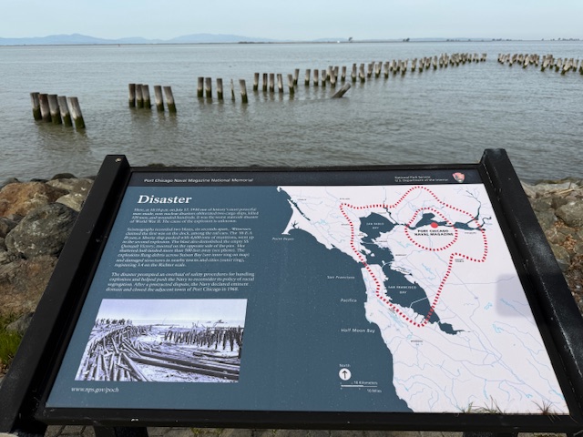
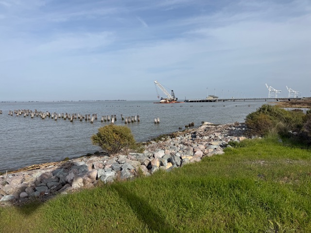
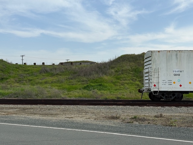
Shrapnel from the 1944 blast is located at the first stop on the guided tour where historic train cars are parked in a revetment.
Peak Season
Summer
Hours
Tours are available only on Thursdays, Fridays, or Saturdays when the base is not closed to civilians.
Explore More – What future Supreme Court Justice observed the courts-martial and has a regional park named in his honor near Port Chicago Naval Magazine National Memorial?
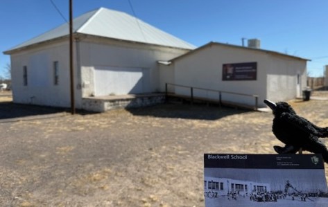
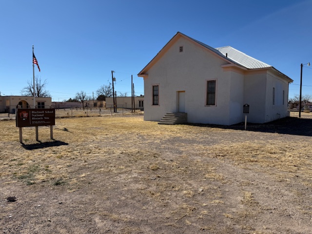
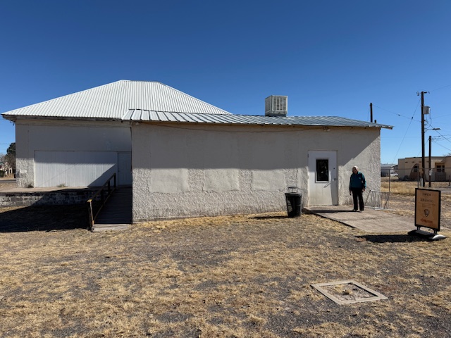
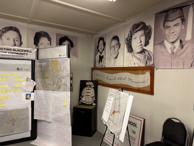
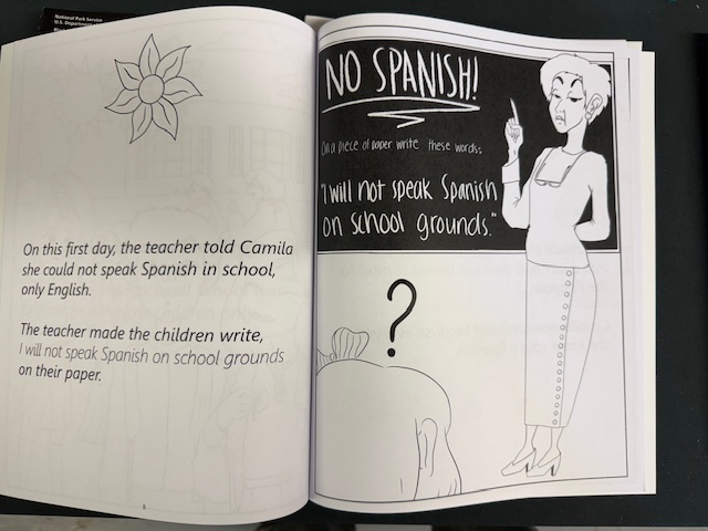
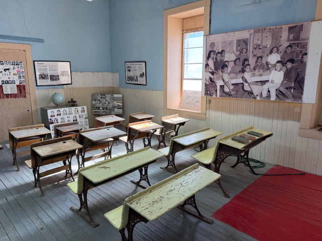
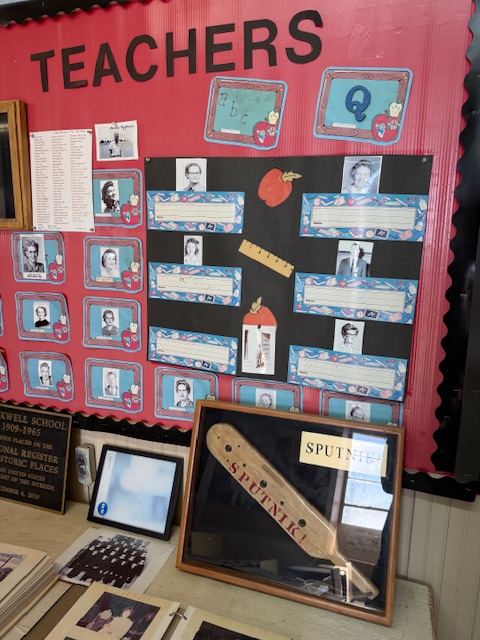
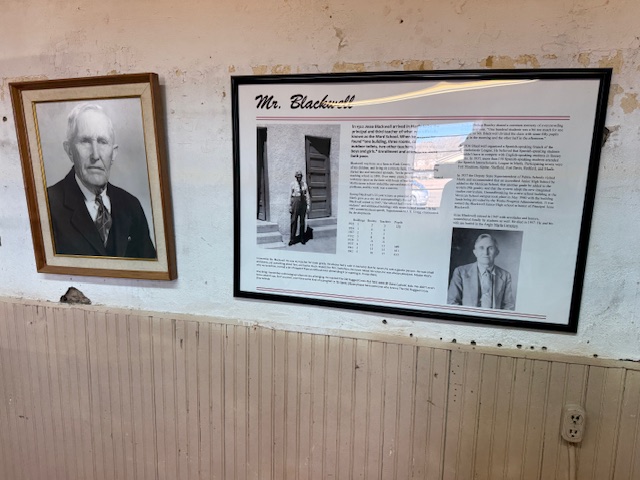
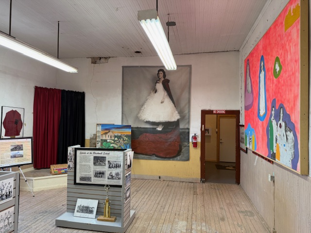
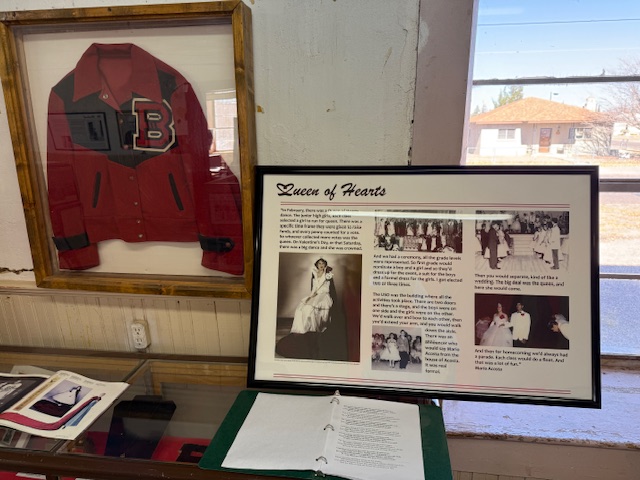
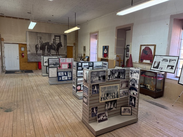
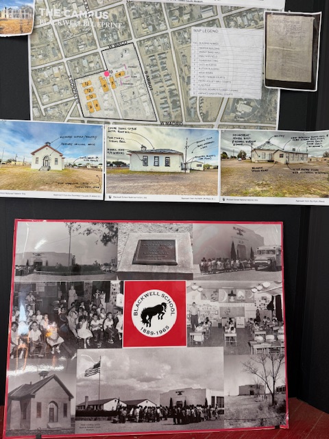
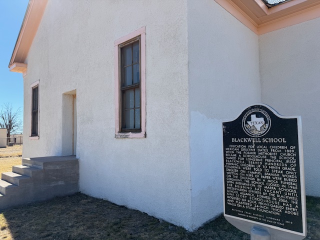
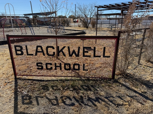
A three-room schoolhouse built for Marfa’s Hispanic children in 1909 is all that remains of a once larger campus (the Band Hall from 1927 is still attached). Blackwell School was named for a prominent early principal, and it closed in 1965 following legally mandated integration more than a decade after the Brown v. Board of Education decision. At its peak, the school had more than 600 students, with Hispanic students segregated, except on sports teams. After 1954, students were no longer allowed to speak Spanish on campus with a mock funeral held for the language and corporal punishment inflicted upon violators. Not all former students wanted to preserve this site where “separate but equal” education was practiced, but enough felt it was important to recall this history. The main building was saved from demolition by the nonprofit Blackwell School Alliance who helped the National Park Service (NPS) acquire the property from the Marfa Independent School District in 2024. The NPS has plans to reconstruct a belltower atop the adobe building.
Highlights
School building, playground
Must-Do Activity
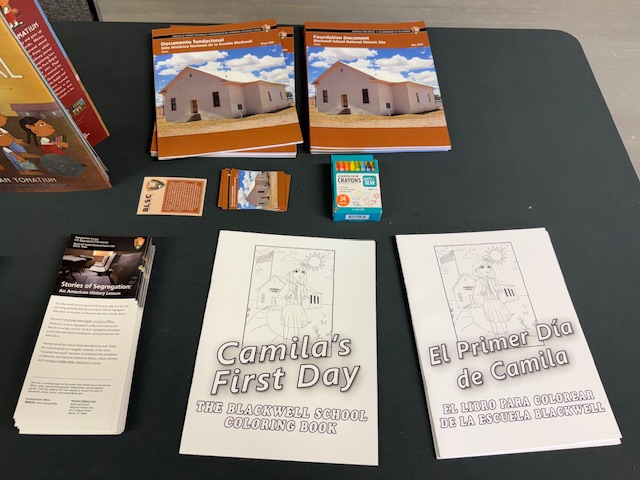
You definitely want to arrive when an NPS employee is on site to allow you inside the building and to explain its history. There are artifacts and informational panels on display inside. There is even a coloring book available in both English and Spanish that explains the story of Blackwell School to children.
Best Trail
None
Photographic Opportunity
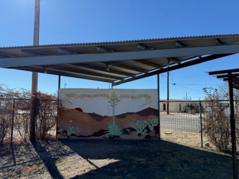
In the lot next to the school building is a playground, and there are plans to install outdoor interpretive signs and photos under the awning to provide information to visitors when the site is closed on weekdays.
Paved street parking is available at the site in Marfa.
Camping
There is an RV park in Marfa, or you can boondock at the Marfa Lights viewing area that has bathrooms. Big Bend National Park takes reservations for its campsites (with no hookups).
We recently published our guidebook 50 States of Great: Road Trip Guide to America, so we decided to start a new type of blog post where we create a travel itinerary for all 50 states, in addition to our usual National Forest and National Park entries. After starting with Kansas, Georgia, Idaho, Rhode Island, Minnesota, Hawai’i, Arizona, Louisiana, South Dakota, Indiana, and Montana, we decided to do another state in the deep south. We made an ambitious seven-day plan starting in the south on the Gulf Coast and then zigzagging across the state with plenty of options to extend the trip.
You will have to take a ferry to enjoy the white sand beaches of West Ship Island, which are considered some of the best in the U.S. If you are stuck on the mainland, at least check out the visitor center and hiking trails just off Interstate 10.
Biloxi
Biloxi has beaches, a lighthouse, casinos, and the Maritime and Seafood Industry Museum. I still want to see the Patriarch Oak, estimated to be more than 2,000 years old and located at Mary Mahoney’s Old French House seafood restaurant.
Tuxachanie National Recreation Trail runs 12 miles through De Soto National Forest with the path from its western trailhead following an old logging railroad right off Highway 49. Near the far eastern end of the trail is a lakeside World War II Prisoner of War camp with a pond.
Some sandhill cranes migrate to this forested spot for the winter, but a small population lives there year-round. There are trails, interpretive signs, and a visitor center.
National Park Service (NPS) rangers or volunteers are on location at the William Johnson House, Melrose Estate, and the Forks of the Road where hundreds of thousands of slaves were sold in the 1800s. The William Johnson House tells the story of a slave freed at age 11 who apprenticed to a barber, and became a successful businessman before his murder.
There is a nice campground with showers on Clear Springs Lake, accessed by a paved road four miles south of Highway 84. A one-mile trail circles the lake, which has a picnic shelter built by the Civilian Conservation Corps (CCC) in 1935 that is listed on the National Register of Historic Places.
This paved road runs 444 miles from the Mississippi River to Nashville, Tennessee, including 309 miles in Mississippi. The trace (or trail) started as an American Indian footpath and was heavily used in the 1800s by “Kaintuck” flatboatmen returning from New Orleans who left the Mississippi River at Natchez and continued on foot north. At several roadside pullouts, you can still follow portions of the “sunken” trail worn down by travelers over the centuries. Popular stops along the way include the boardwalk at Cypress Swamp outside Jackson and its three free campgrounds.
Paralleling the parkway, this trail exists in five segments totaling 67 miles in length. One of the longest sections is located north of Jackson (Miles 108-130). There are also eight miles of the original trace around the free Rocky Springs Campground (Mile 58) accessing Owens Creek Waterfall and a historic town site.
Day 4
Jackson
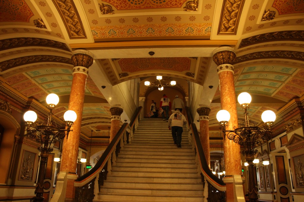
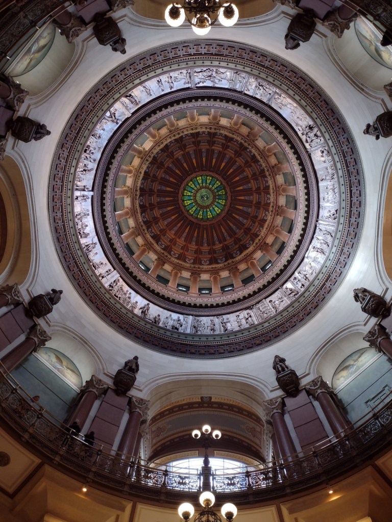
The capital city is home to the Mississippi Civil Rights Museum, Museum of Mississippi History, and Mississippi Agriculture and Forestry Museum. The Mississippi Museum of Natural Science is a 73,000-square-foot facility situated in a 300-acre forest with 2.5 miles of trails that also boasts a 200-seat theater and many aquariums, including “The Swamp” where alligators reside inside a large greenhouse.
In Jackson, the National Park Service manages the former home of a prominent Civil Rights Leader who was assassinated in his driveway in 1963. Across the street, there is a sidewalk through Myrlie’s Garden, a community garden where interpretive signs on the wooden fence tell the story of the Evers family.
There are several lakes here open to the public, including 50-acre Marathon Lake (which got its name a lumber company that closed in 1929). The lake was built in the 1950s for recreation in a former logging camp and now has 34 campsites (with water and electric hook-ups), a boat ramp, a swimming area, and a 1.7-mile trail that circles it.
The numerous failed attempts to take Vicksburg by force are evidenced by the 17,000 soldiers buried in the National Cemetery here. Following a 46-day bombardment, the city finally surrendered on July 4, 1863. The best part of visiting the park is walking through the partially-reconstructed U.S.S. Cairo, an ironclad gunboat which was carefully salvaged from the Yazoo River during the 1960s.
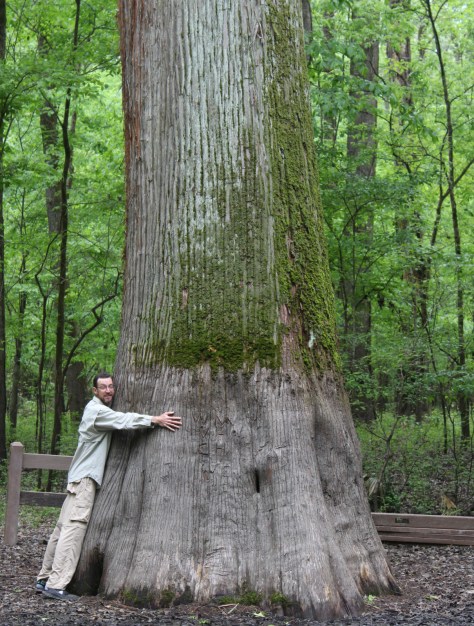
Delta National Forest is seasonally flooded for wildlife, but it was dry enough to walk up to the Kay Cypress Tree even when other trails were underwater during our April visit. The tree is more than ten feet in diameter even above the widely fluted base common to baldcypress. It is located across from Blue Lake on unpaved Fire Tower Road.
Located in a former cotton gin near the site of Emmett Till’s torture and murder on the farm of “J.W.” Milam in Glendora. Established in 2005, there is an atmosphere to the museum that bears the full weight of history, heightened by the short introductory video showing Emmett Till’s family members’ recollections of the events of 1955.
The National Park Service operates out of the Emmett Till Interpretive Center, located in a strip mall opposite the Tallahatchie County Second District Courthouse in Sumner. It has limited hours, but the courtroom where the September 1955 trial was held was unlocked when we visited on a Tuesday morning.
Optional stop at a Blues Museum
The Yazoo-Mississippi Delta (or simply “the Delta”) is a distinct section of western Mississippi renowned for its blues musicians. There is plenty to learn and listen to at the Delta Blues Museum in Clarksdale, GRAMMY Museum Mississippi in Cleveland, and B.B. King Museum and Delta Interpretive Center in Indianola. Spend the night in the area to go to a bar for live music in the evening.
Optional stop at Belzoni Catfish Museum and Welcome Center
At its peak in 1993, this region produced 461-million pounds of catfish annually (about 60% of U.S. production) and still hosts the World Catfish Festival every April. The best part is that Belzoni has catfish sculptures spread around town, painted to represent different occupations like a fireman and nurse.
The National Park Service site here is tiny with no facilities and only a couple interpretive signs, but a local battlefield commission owns 1,400 acres with walking trails. The nearby Mississippi Final Stands Interpretive Center is located five miles east of the battlefield in Baldwyn.
Two cannons and a monument mark this one-acre National Park Service site surrounded by the city of Tupelo. Its visitor center is combined with the one for the Natchez Trace Parkway just outside Tupelo.
Tishomingo State Park is located just off the Natchez Trace Parkway (Milepost 304) northeast of Tupelo. The park’s sandstone and limestone rock formations represent the furthest southwest extent of the Appalachian Plateau. The park opened in 1939, after its infrastructure was built using local rock by the Civilian Conservation Corps (CCC). Several structures remain from that period, including a spectacular swinging bridge over Bear Creek.
Chewalla Lake Recreation Area is the most developed site offering a swimming beach and campground, plus fishing and boating opportunities. A 2.3-mile trail at the 260-acre lake passes an overlook and a reconstructed Choctaw burial mound. In the northeast corner off Highway 72, a short trail accesses Baker’s Pond, the source of the Wolf River. Further south, Lake Tillatoba is a fee-free primitive site managed by Tombigbee National Forest.
An important railroad crossroads in Corinth made it a strategic spot during the Civil War. In April 1862, two days of intense fighting across the border in Tennessee resulted in 23,746 soldiers killed, wounded, captured, or missing, and the Confederates abandoned the field and Corinth. There were an additional 7,000 casualties when they failed to recapture the town in October 1862, which is the focus of the museums in town.
Apron Museum
Iuka is home to the Apron Museum that has collected thousands of vintage aprons, plus it has a gift shop with quilts, crafts, and, of course, aprons for sale. Nearby, a restored wooden covered bridge is also worth a look-see and a drive across.
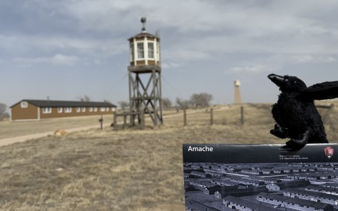
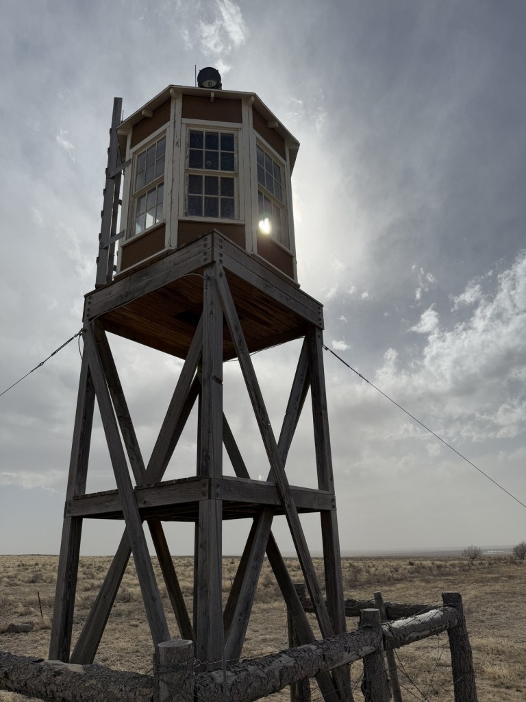
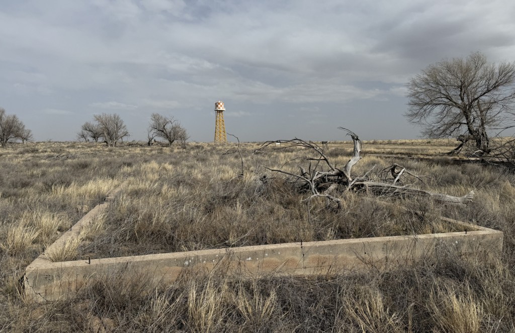
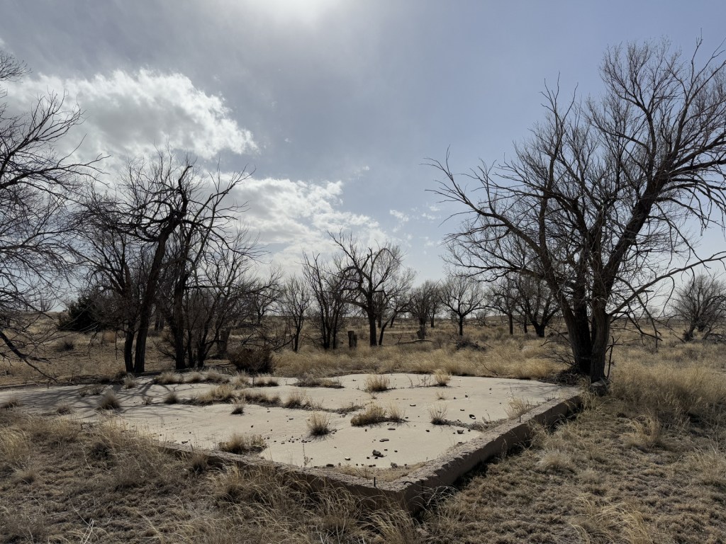
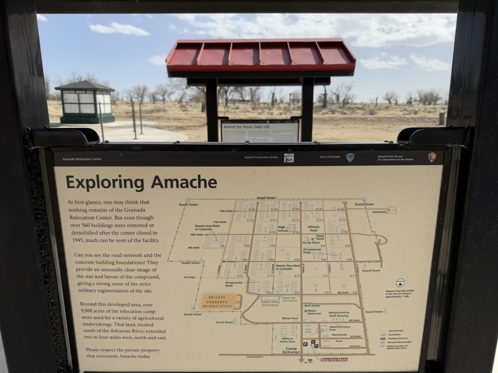
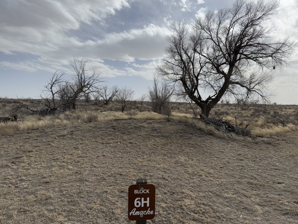
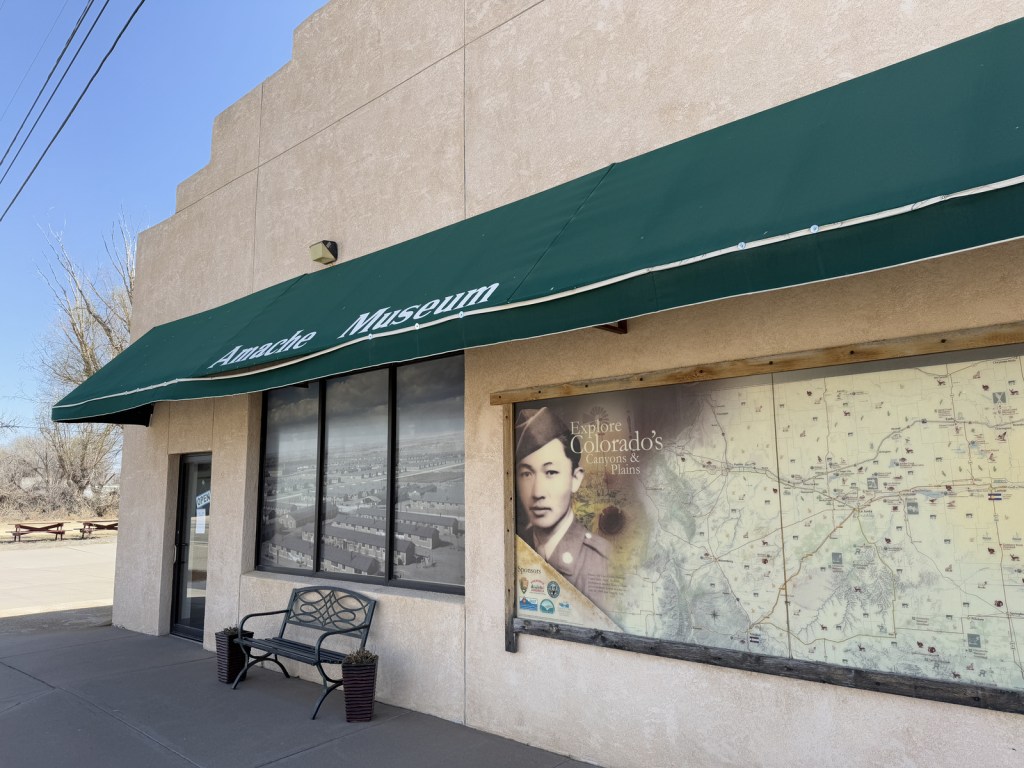
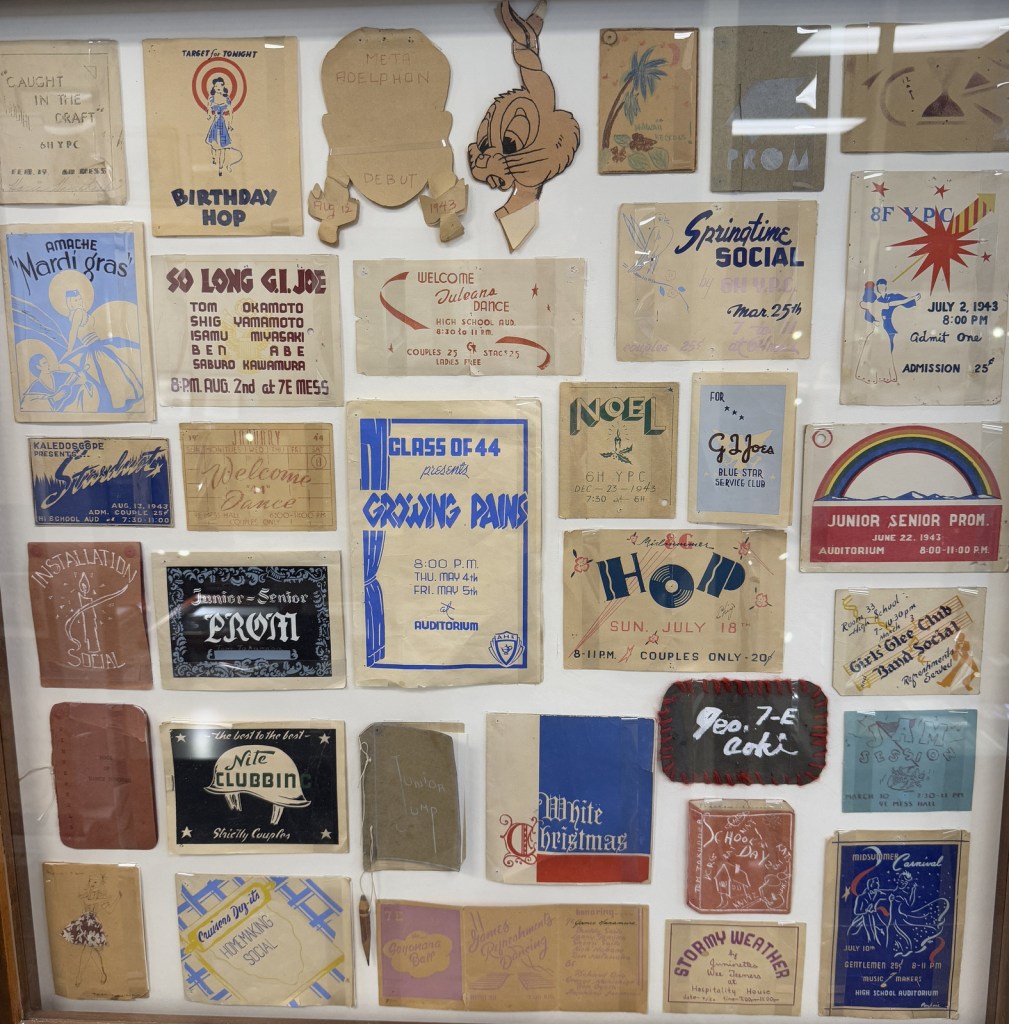
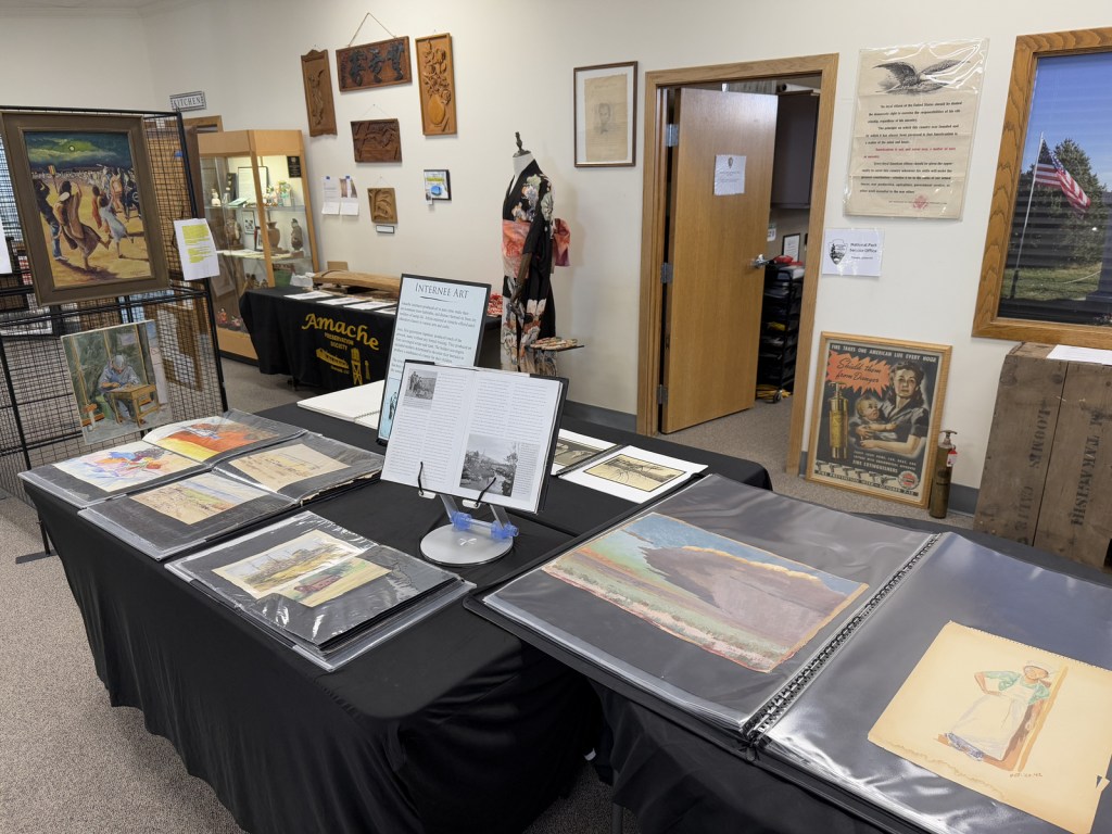
Added to the National Park Service (NPS) system on February 15, 2024, Amache National Historic Site is the fifth unit dedicated to remembering the sad story of the forced internment of 110,000 Japanese-Americans during World War II. Operated between 1942 and 1945, at its peak the Granada Relocation Center in southeast Colorado housed 7,310 incarcerees making it the state’s tenth largest city at the time. Although it does not have a visitor center, the site of the internment camp is more developed than other new NPS sites since it was previously added to the National Register of Historic Places in 1994 and then designated a National Historic Landmark in 2006. Learn more about the history of these camps by checking out the Related Sites below and watching some of our Top 10 World War II Films or reading one of the Top 10 World War Novels.
Highlights
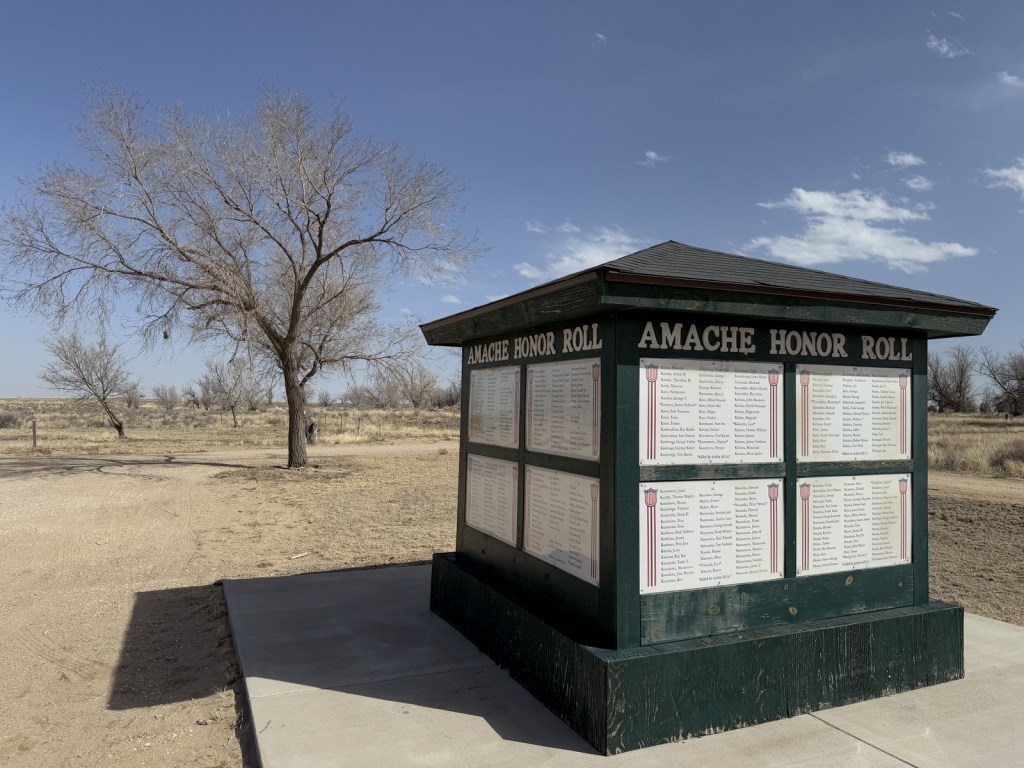
Amache Museum, water tower, barracks, guard tower, cemetery, Recreation Hall
Must-Do Activity
Start at the excellent Amache Museum in Granada, which is run by local high school students and has free admission (donations accepted). Be sure to pick up a map of the driving tour or visit the website (https://amache.org/driving-tour-map-podcasts) to listen to the audio recordings at each stop (there is smartphone coverage on site). Drive the route in order or skip around, but make it a point to see Stop 4 (guard tower and barracks), Stop 8 (cemetery), and the Rec Hall. Starting in June 2025, ranger-led tours will be offered at 10 a.m. on the first and third Friday of the summer months.
Best Trail
There is a short loop trail with many interpretive signs at the picnic area when you first arrive at the site by the Honor Roll square structure. There is also an off-trail walk to the old koi pond at Stop 2 that you can navigate if you listen to the directions on the audio recordings.
Photographic Opportunity
The reconstructed barracks and guard tower at the south end of the site are two of the only structures standing above the open prairie. They are near the water tower, which is worth a short detour to see.
Explore More – Most of the 10,000 acres dedicated to Granada Relocation Center was for agriculture, so how many acres were used for residential and administrative buildings?
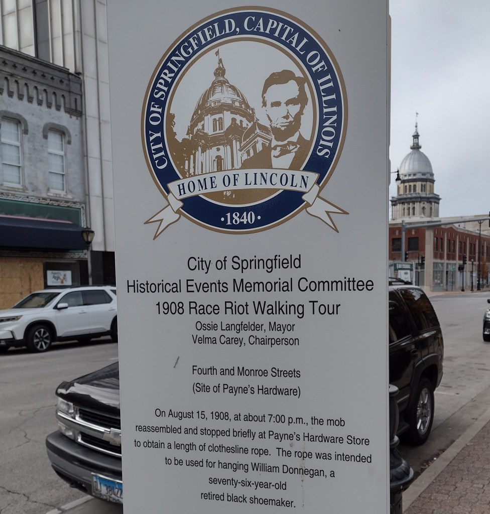
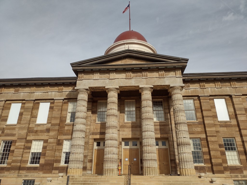
In 1908, African Americans made up only 5.5% of Springfield’s population of 47,000. However, racial tensions ran high across the nation, and, on August 14, a mob formed outside the jail where two African-American men were accused of separate incidents of sexual assault and murder. When the crowd found out the prisoners had been secretly moved 60 miles away, a full riot broke out. They destroyed buildings, looted, and lynched two prominent members of the African-American community—a barber named Scott Burton and the wealthy William Donnegan. By the time the National Guard arrived to restore order, seven people were dead and the mob had already burned the African-American neighborhood known as the “Badlands” to the ground. Eventually, the trials of the 80 riot suspects at the Old Court House led to only one conviction for petty larceny. While the rape suspect, George Richardson, was released when his accuser admitted fabricating the story, Joe James was convicted of murder and executed on October 23, 1908 despite being legally exempt from the death penalty as a minor. These events catalyzed the formation of the National Association for the Advancement of Colored People (NAACP) a few months later in New York City.
Walking tour, Acts of Intolerance sculpture, mural, Old Court House, Springfield and Central Illinois African American History Museum, Oak Ridge Cemetery, Mechanicsburg Cemetery
Must-Do Activity
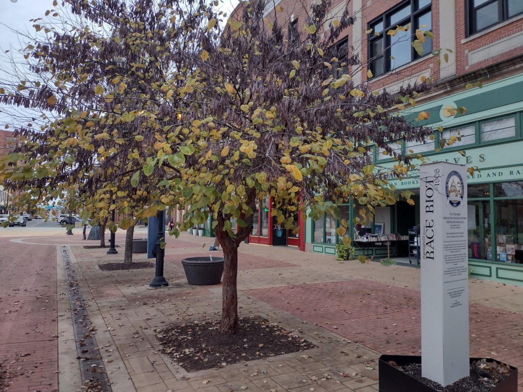
Before the National Monument was designated in 2024, the city of Springfield had already created a walking tour highlighting the events of the 1908 race riot marked by seven silver pillars. After starting at the former site of the jail, the tour moves to where Loper’s Restaurant once stood; its white owner having assisted in moving the prisoners, his restaurant and his car were destroyed. During the frenzy, a restaurant patron named Louis Johnson was shot and killed. There are five other stops detailing the events chronologically, but they do not include the mural inside HSHS St. John’s Hospital Women & Children’s Clinic, which is next to the officially designated National Monument boundaries where the foundations of five homes burned in the “Badlands” remain fenced off. Upon our visit less than three months after its creation, the National Park Service visitor center for Lincoln Home National Historic Site did not have any information on the new National Monument, but they already had a passport stamp.
Best Trail
When followed in chronological order, the walking tour bounces back and forth across the city, so you will get your steps in that day. In the summer, guided tours are offered from the Springfield Convention and Visitors Bureau. Alternatively, you can drive the route and read the descriptions in the publication available online and from the visitors bureau.
Photographic Opportunity
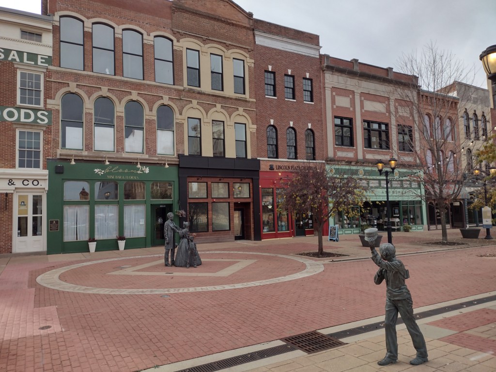
After the burning of the “Badlands” neighborhood, two chimneys were about the only structures left standing. The sculptor Preston Jackson utilized this imagery in his work Acts of Intolerance that depicts scenes of the race riot in bas relief. Dedicated in 2009, it stands across the street from the Abraham Lincoln Presidential Library in Union Square Park.
There is no free parking in downtown Springfield, so you can use a parking meter or the NPS pay lot at Lincoln Home National Historic Site.
Camping
Lincoln’s New Salem State Historic Site is 20 miles northwest of Springfield and its campground has running water. Further north, Starved Rock State Park is a beautiful spot for camping, and it also offers a historic lodge.
Related Sites
New Philadelphia National Historic Site (Illinois)