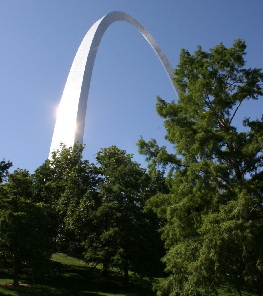
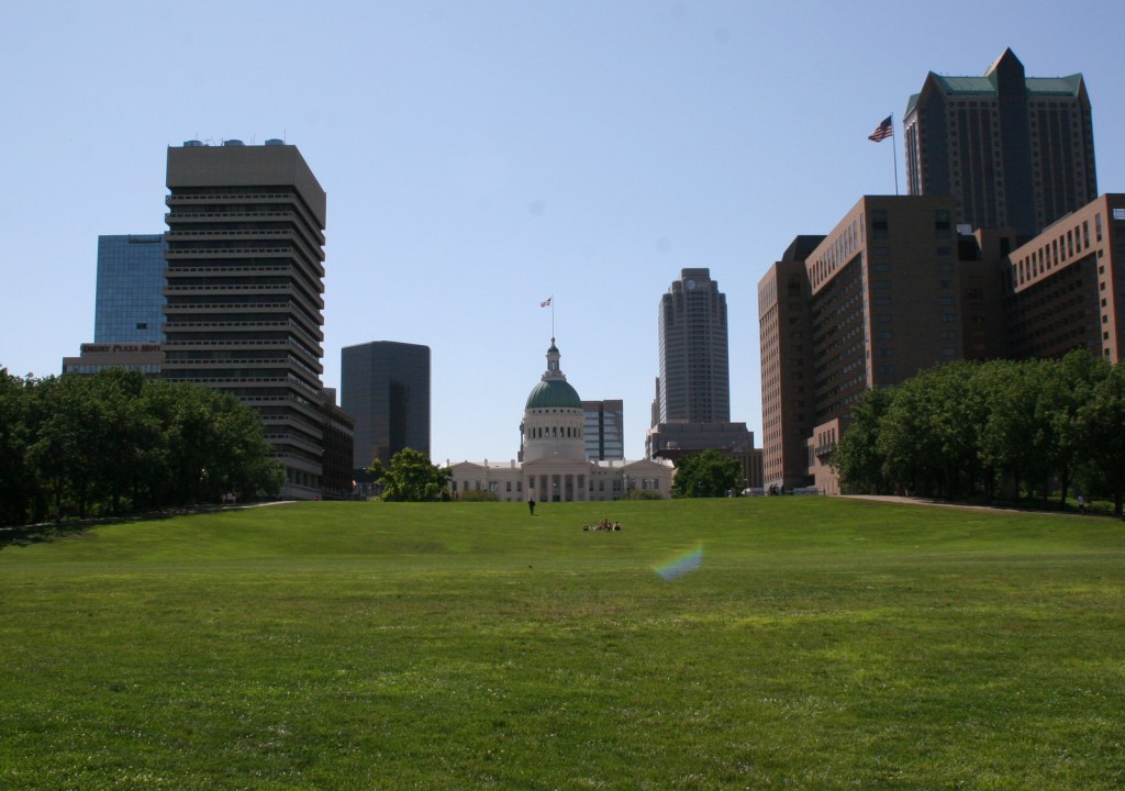
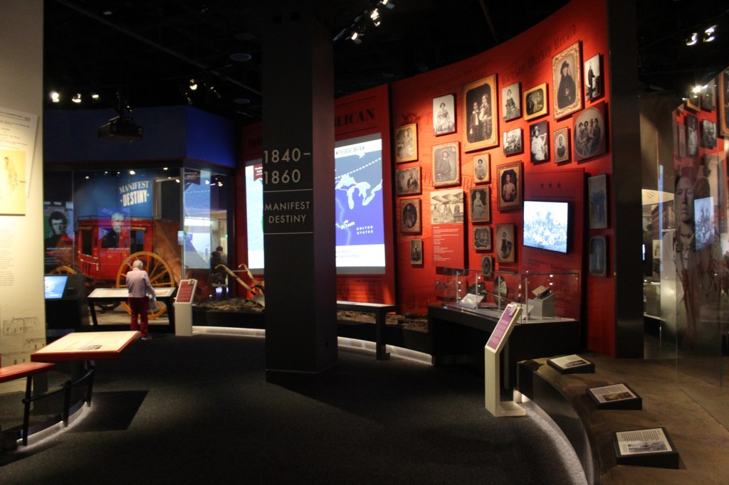
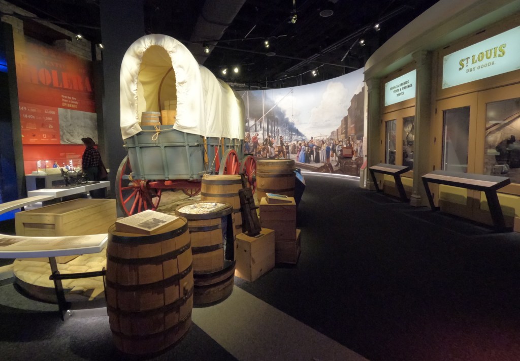
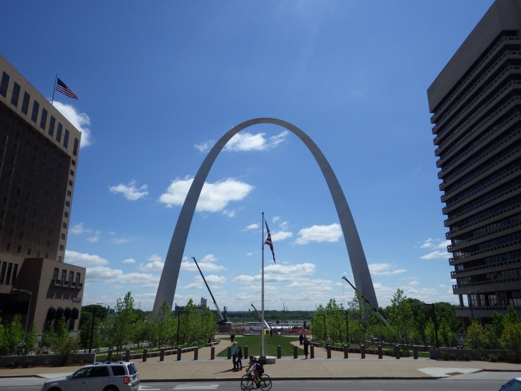
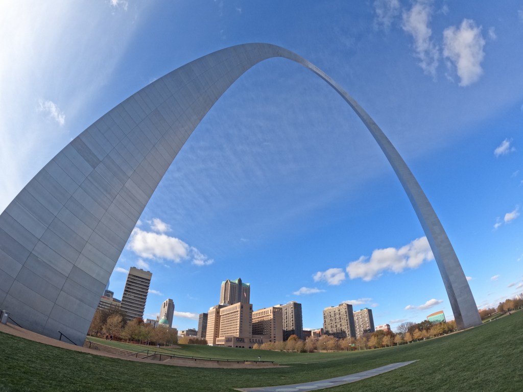
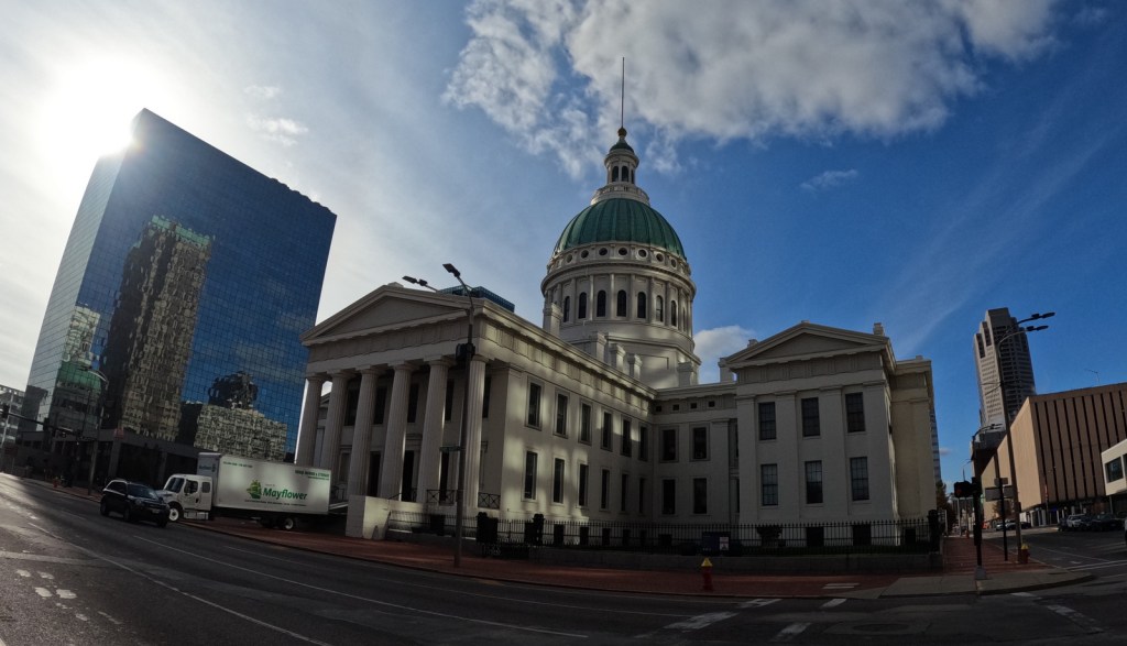
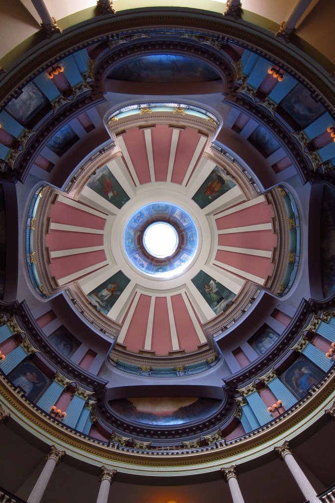
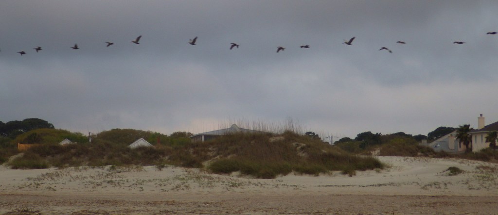
On February 22, 2018, the 60th National Park in the U.S. was created from what was formerly Jefferson National Expansion Memorial in St. Louis, Missouri. Gateway Arch National Park encompasses 91 acres on the Mississippi River, including the historic 1828 courthouse and the iconic 630-foot-tall arch that was finished in 1965. We first visited on our cross-country road trip in 2007 and returned in 2016 while the underground museum was under construction and the greenway was extended over Interstate 44. When we came back in 2022, the courthouse was closed for renovation, but the museum had reopened with exhibits explaining the importance of this city as a starting point for the settlement of the west after President Thomas Jefferson signed the Louisiana Purchase, doubling the size of the country in 1803. It is by far the smallest of the 63 National Parks (5,457 acres less than Hot Springs), which begs the question: Why wasn’t this designated a National Historical Park instead?
Gateway Arch, tram, film, museum, Old Courthouse, Old Cathedral
Must-Do Activity
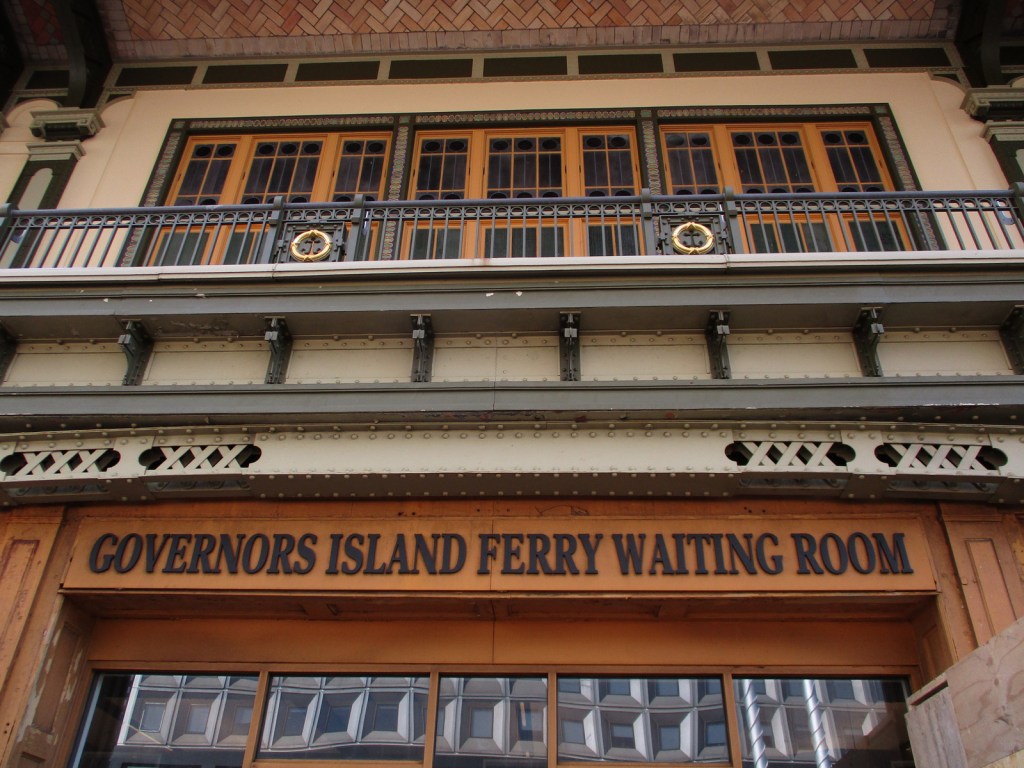
Unlike other National Parks, this one does not preserve a natural landmark, but it does have claustrophobia-inducing tram cars (fee) that take you four-minutes to the top of the Gateway Arch for excellent views across Illinois and Missouri. It is worth the hassle to go through a security screening to see the new museum. The 35-minute film Monument to the Dream is also available for a fee.
Best Trail
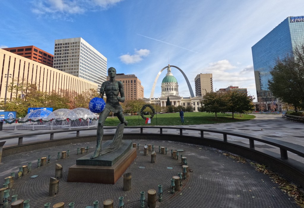
There are sidewalks that follow the Mississippi River and loop around the arch. Be sure to cross the street to the Old Courthouse where the first of two trials in the infamous Dred Scott case was held in 1854. Continue west behind to the courthouse to the Kiener Memorial Fountain for a photo that frames the building beneath the Gateway Arch.
Photographic Opportunity
The 630-foot-tall Gateway Arch is the defining landmark of St. Louis, but the historic 1834 Old Cathedral still serves as an active Catholic Church inside the park boundaries.
There is no fee to walk the grounds or pass through security for the museum and gift shop, but you do have to pay to view the film or ride the tram to the top of Gateway Arch. When open, the Old Courthouse is also free to enter.
Road Conditions
All roads are paved, but parking can be tricky. We suggest paying for a parking garage or paying to park on the river levee near the paddlewheel boats, since car break-ins are common in downtown St. Louis.
Camping
This is the only National Park without the option to camp, so consider heading southwest to the wonderful Ozark National Scenic Riverways or Mark Twain National Forest. In southeast Missouri, Johnson’s Shut-Ins State Park is rated as one of the best RV campgrounds in the country.
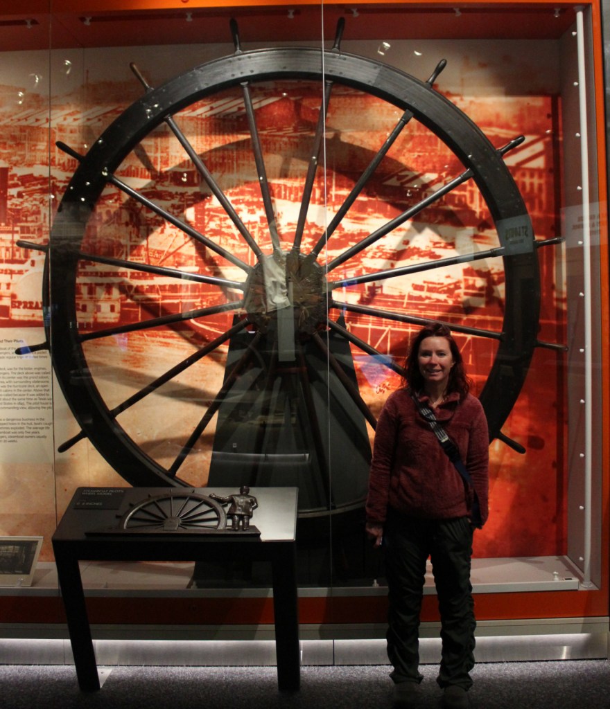
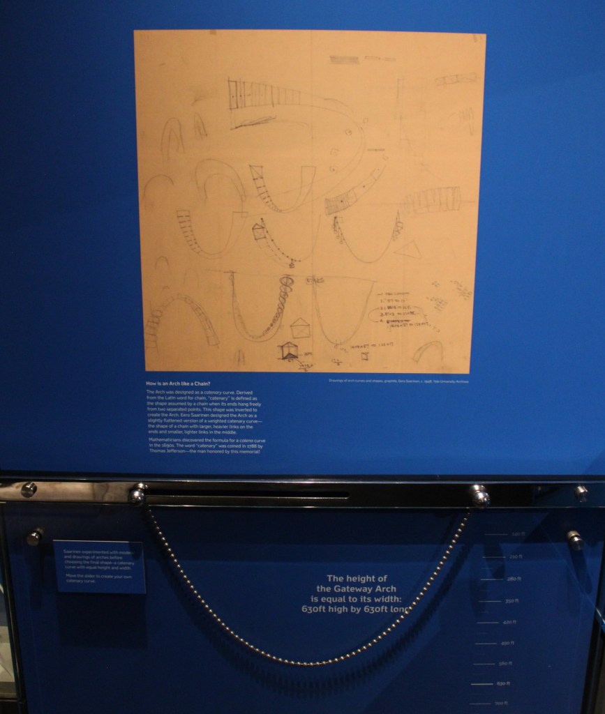
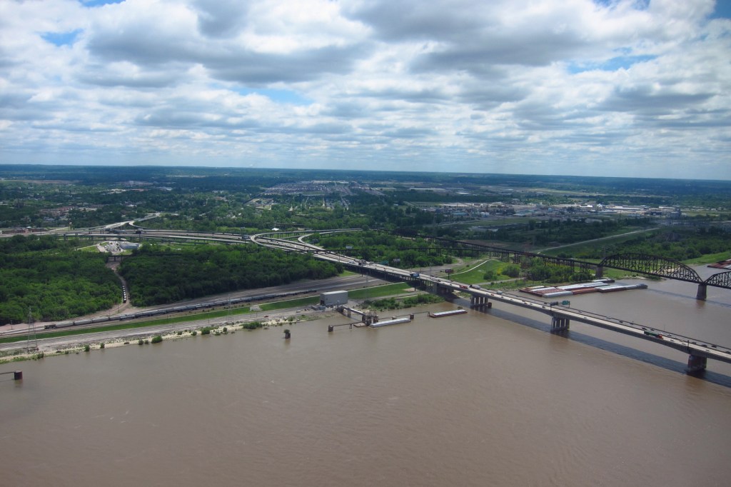
Entering the museum after security screeningDear NPS, that’s actually a Douglas-fir coneTiff riding the tramView from the top during 2016 constructionYou can watch a Cardinals game from up hereIf you’re claustrophobic, save some money and get the view while still inside the museumInside the Old CourthouseKiener Memorial FountainMississippi River
Explore More – In 1947, how many city blocks were razed to make way for the memorial, including several historic buildings dating back to 1818?
We designed this Gateway Arch logo for the park available on Amazon.com
We are a participant in the Amazon Services LLC Associates Program, an affiliate advertising program designed to provide a means for us to earn fees by linking to Amazon.com and affiliated sites.
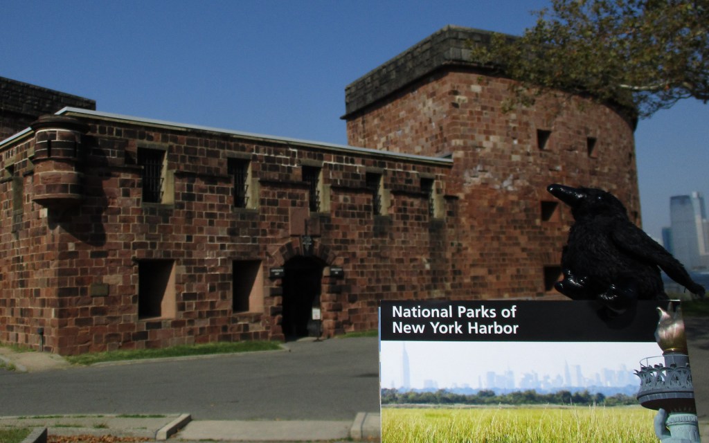
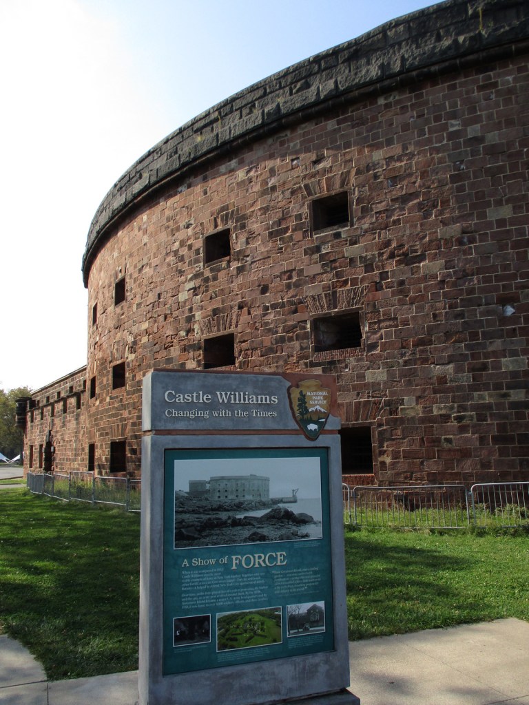
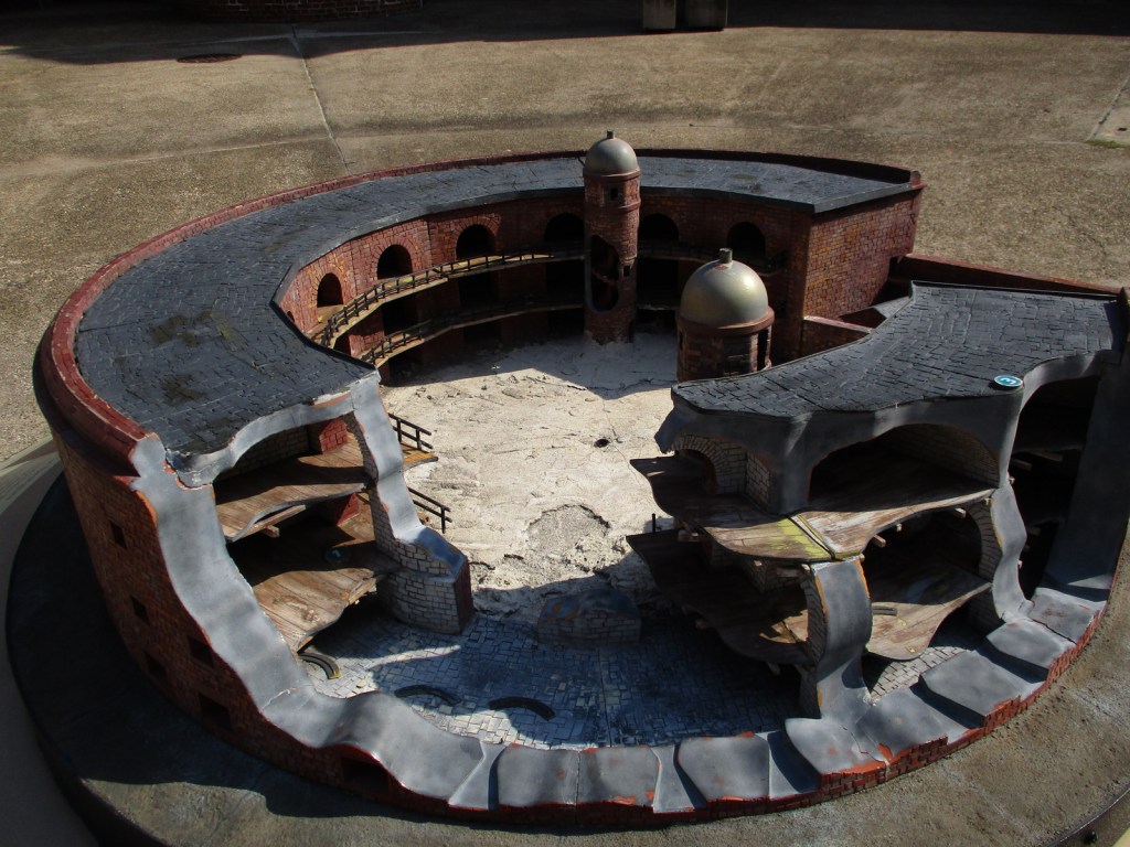
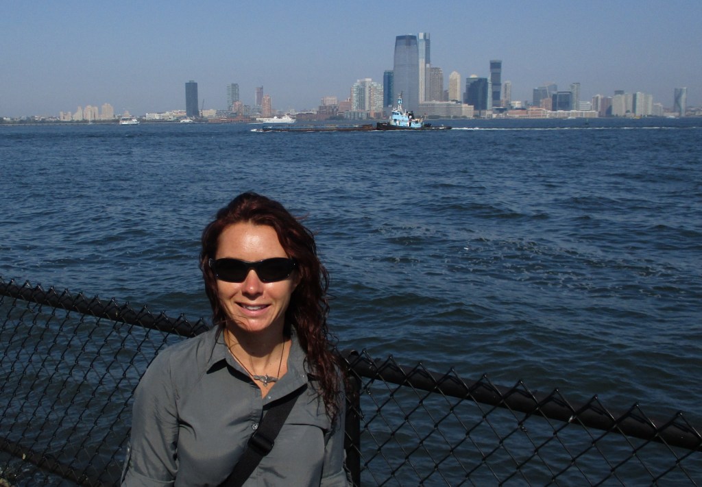
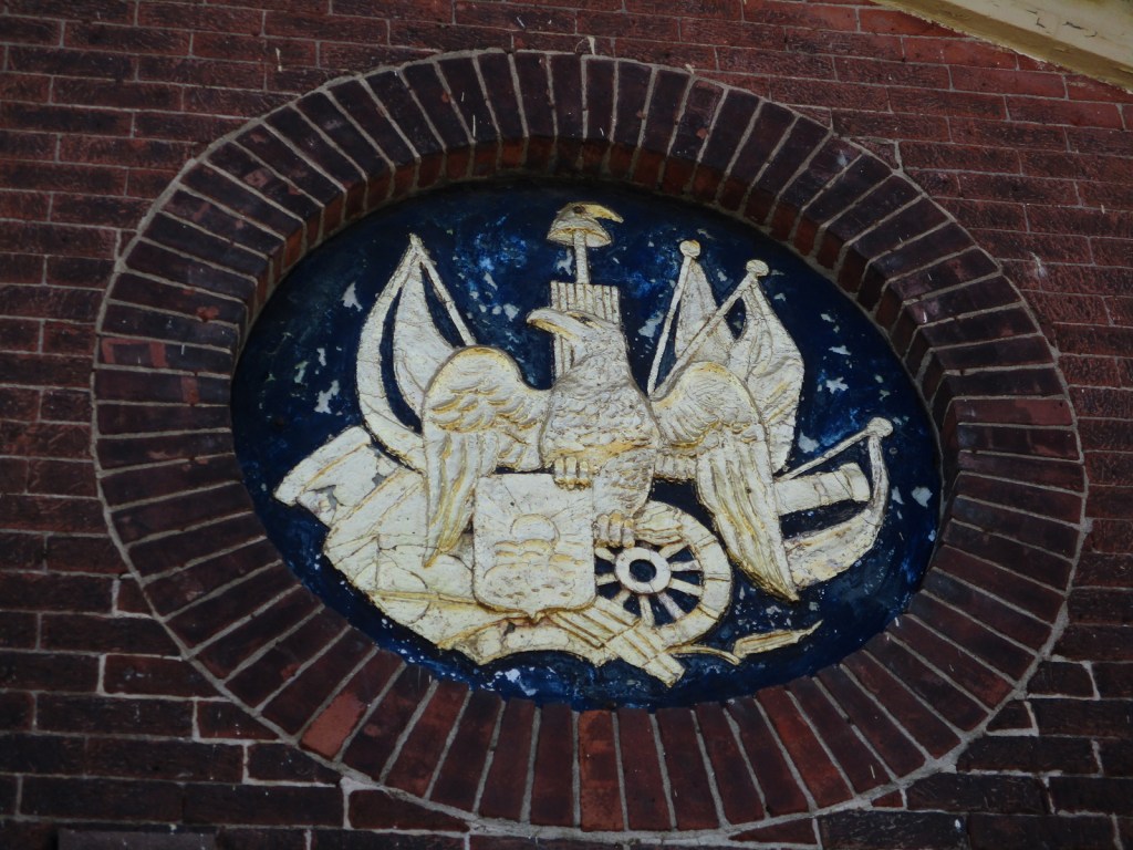
Originally named Nutten Island by the Dutch who settled New Amsterdam in 1624, this 172-acre island off Manhattan was later set aside for the exclusive use of the British royal governors of New York. The indigenous Lenape called it Paggank (“Nut Island”) because of its chestnut, hickory, and oak trees. After 200 years of military use by the Army and Coast Guard, Governors Island was retired in 1996. Like nearby Castle Clinton National Monument, Fort Jay and Castle Williams date to pre-War of 1812 and were saved from demolition in 1901 by forward-thinking Secretary of War Elihu Root. Over the decades, the island served as a Civil War prison, a muster area for troops during the Mexican-American War and World War II, the largest Coast Guard base in the nation for its final 30 years, and runway for Wilbur Wright’s 1909 flight around the Statue of Liberty. Governors Island National Monument is part of a 90-acre National Historic Landmark District that contains the commanding officer’s quarters known as the Admiral’s House.
Private boats are not allowed, so the only way to get onto Governors Island is by ferry and it is only open to visitors from Memorial Day weekend through September. From the Battery Maritime Building in Lower Manhattan you will dock at Soissons Landing near Fort Jay. There may also be weekend ferry service from Brooklyn Bridge Park Pier 6 and Wall Street/Pier 11 that both land at Yankee Pier near the South Battery. During special events, living history demonstrations celebrate the island’s military heritage. Near Soissons Landing, be sure to enter Castle Williams and Fort Jay, which have interpretive signs from the National Park Service.
Best Trail
Most visitors do not go much south of the Parade Ground, but almost the entire island is open for walking or biking (rentals available) on the old roads.
Photographic Opportunity
On a clear day, the ferry boat and island both afford incredible views of the New York City skyline, Ellis Island, and Statue of Liberty.
Ferry tickets cost about $5 roundtrip for an adult.
Road Conditions
Roads are heavily trafficked in New York City and there is no designated parking for the National Park Service site, so we recommend you take the subway to access the ferry.
Camping
Collective Retreats has glamping tents and suites on their private property on the west side of Governors Island. Click here to visit their website for details.
Brooklyn BatteryCastle Williams modelCastle WilliamsCastle WilliamsCastle WilliamsGovernors Island National Monument mapStaten Island Ferry passing Ellis IslandBoarding the ferryBack in New York City
Explore More – What group owns and manages the other 150 acres of Governors Island that is not part of the National Monument?
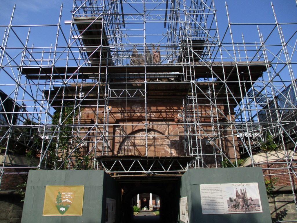
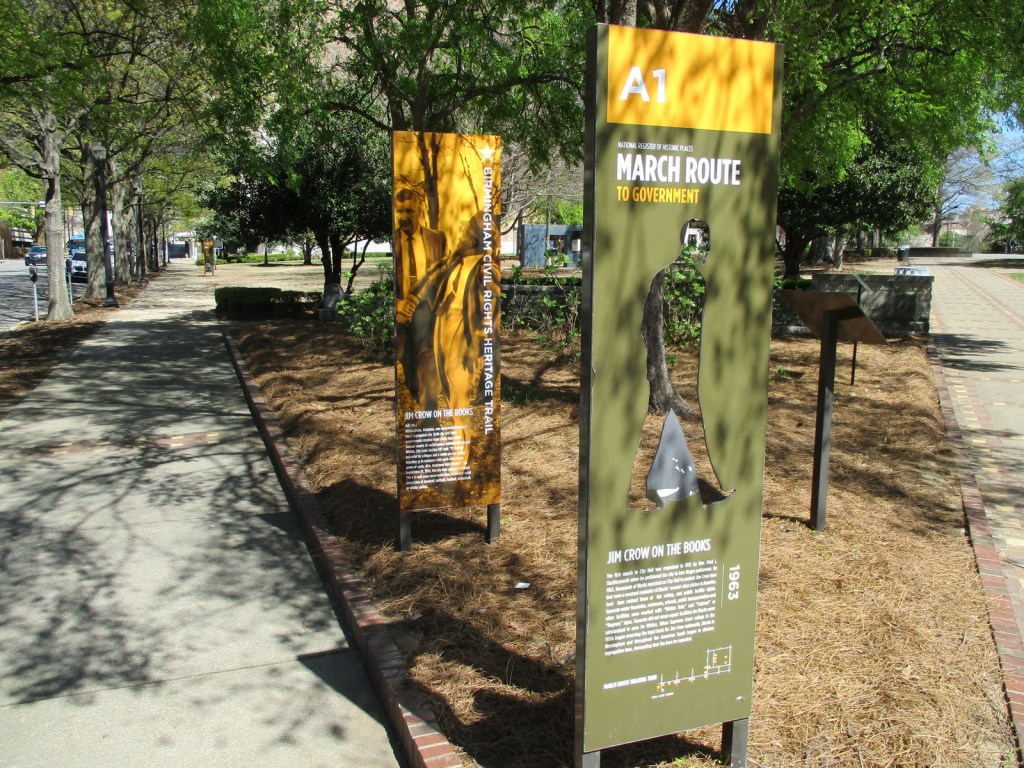
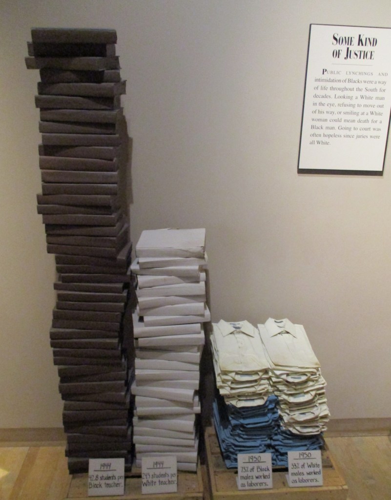
Created by President Barack Obama on January 12, 2017 (the same day as Freedom Riders and Reconstruction Era National Monuments), this site encompasses four city blocks of downtown within the larger 36-acre Birmingham Civil Rights District. In 1963, this area was where the 16th Street Baptist Church was bombed and the Children’s Crusade (a non-violent protest march) was attacked by policemen with water hoses and dogs. The only portion of the site run by the National Park Service (NPS) is the A. G. Gaston Motel, which was bombed by the KKK after Rev. Martin Luther King, Jr. and other civil rights leaders stayed there from April through May 1963 to plan their non-violent campaign against segregation laws. The City of Birmingham and the NPS have restored the motel to its historic appearance and a park ranger is stationed there three days a week.
Birmingham Civil Rights Institute, A.G. Gaston Motel, 16th Street Baptist Church, Kelly Ingram Park, St. Paul United Methodist Church, Bethel Baptist Church
Must-Do Activity
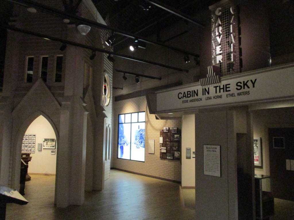
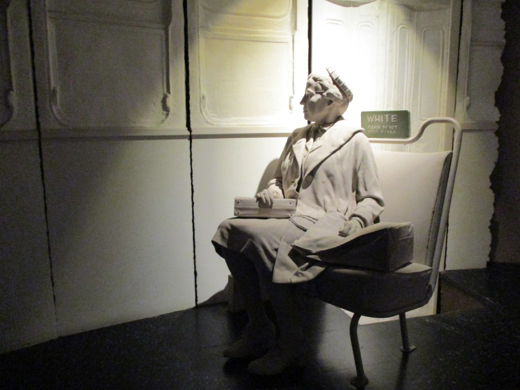
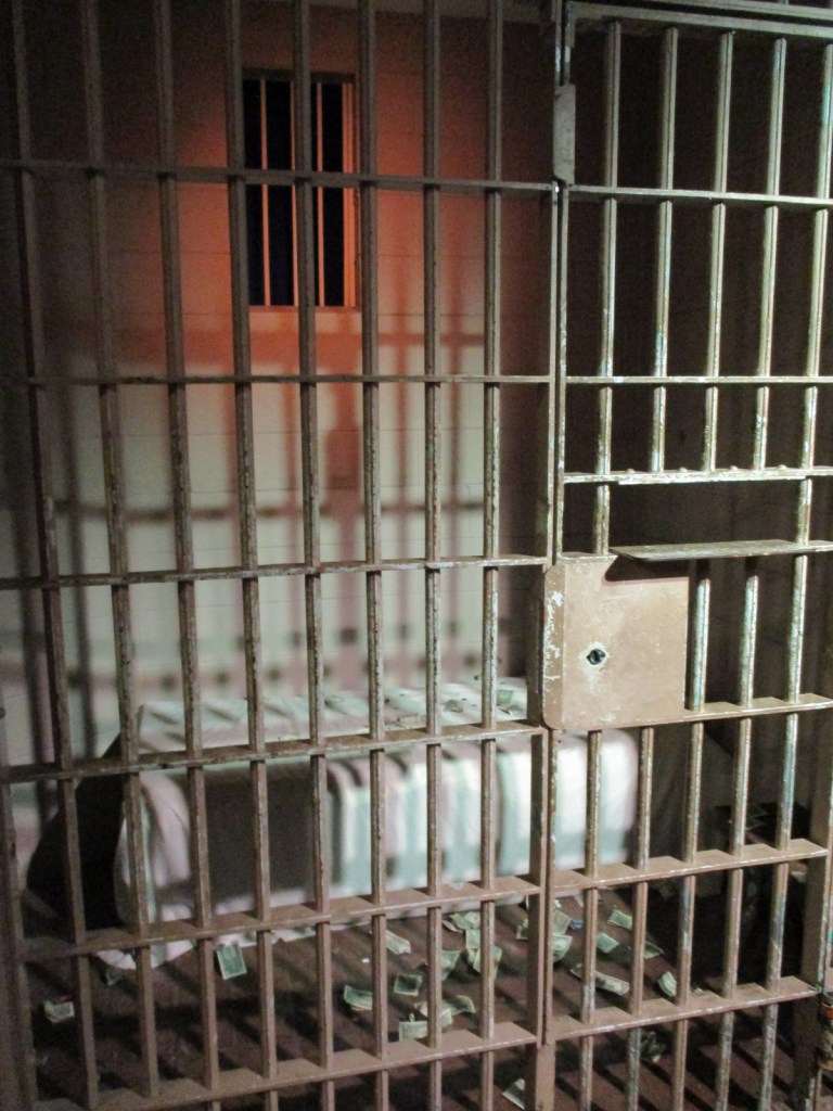
The Birmingham Civil Rights Institute is a history museum that opened in 1992 across from the 16th Street Baptist Church (see Photographic Opportunity). With a timed entry ticket, your self-guided tour starts with a short video, then an immersive walk through the struggle for civil rights in Birmingham and around the U.S. It includes powerful displays on the Freedom Riders bus burning and Rev. Martin Luther King, Jr.’s “Letter from Birmingham Jail,” as well as the decades-long effort to bring to justice the bombers of the 16th Street Baptist Church. If you come on one of the three days per week that a park ranger is posted at the A.G. Gaston Motel, be sure to stop there afterwards to see the ongoing reconstruction work. Six miles north of the city in the Collegeville neighborhood, Bethel Baptist Church was bombed three times in 1956, 1958 and 1962, partly why the city earned the nickname “Bombingham.” The church is associated with the influential Rev. Fred Shuttlesworth, who has a statue outside the Birmingham Civil Rights Institute.
Best Trail
Across the street from the Birmingham Civil Rights Institute, Kelly Ingram Park features sculptures, interpretive signs, and an audio tour describing the violent attacks by police officers and dogs on civil rights protesters (many of them children) on May 7, 1963.
Photographic Opportunity
Across the street from the Birmingham Civil Rights Institute, 16th Street Baptist Church was bombed on September 15, 1963, killing four young girls, an act of domestic terrorism that propelled the passage of the Civil Rights Act of 1964. Tours inside the church are by appointment only.
Peak Season
Spring and fall
Hours
The A.G. Gaston Motel is open Thursday through Saturday 10 a.m. to 4 p.m. and the Birmingham Civil Rights Institute is open Tuesday through Saturday 10 a.m. to 5 p.m.
No cost for the A.G. Gaston Motel or Kelly Ingram Park, but there is an admission fee at the Birmingham Civil Rights Institute (online reservations recommended).
Road Conditions
All roads are paved with a free parking lot next to the Birmingham Civil Rights Institute.
Camping
In northeast Alabama, De Soto State Park offers camping, in addition to excellent hiking trails to several waterfalls. There are also three backcountry campsites in Little River Canyon National Preserve available from February through September with a permit. Cheaha State Park and Joe Wheeler State Park both have campgrounds and lodges. Talladega, Tuskegee, and William B. Bankhead National Forests also offer car camping and backpacking opportunities.
A.G. Gaston MotelA.G. Gaston MotelA.G. Gaston MotelKelly Ingram ParkScott at Kelly Ingram ParkKelly Ingram ParkKelly Ingram ParkKelly Ingram ParkRev. Fred ShuttlesworthBirmingham Civil Rights InstituteBirmingham Civil Rights InstituteMLK, Jr. jail cell
Explore More – When did the City of Birmingham establish the 36-acre Birmingham Civil Rights District?
Best time of year: Spring for mild temperatures and flowering dogwood blooms
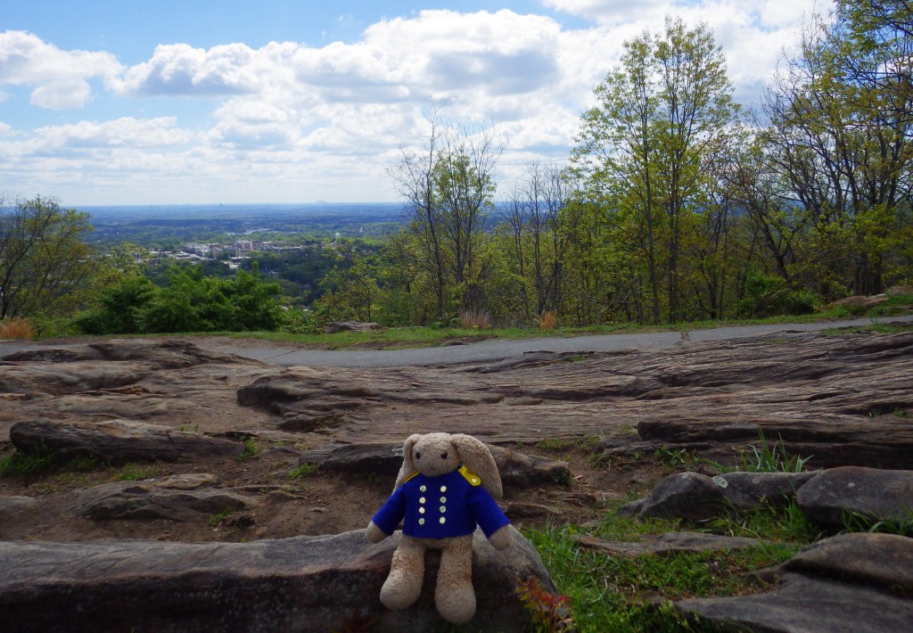
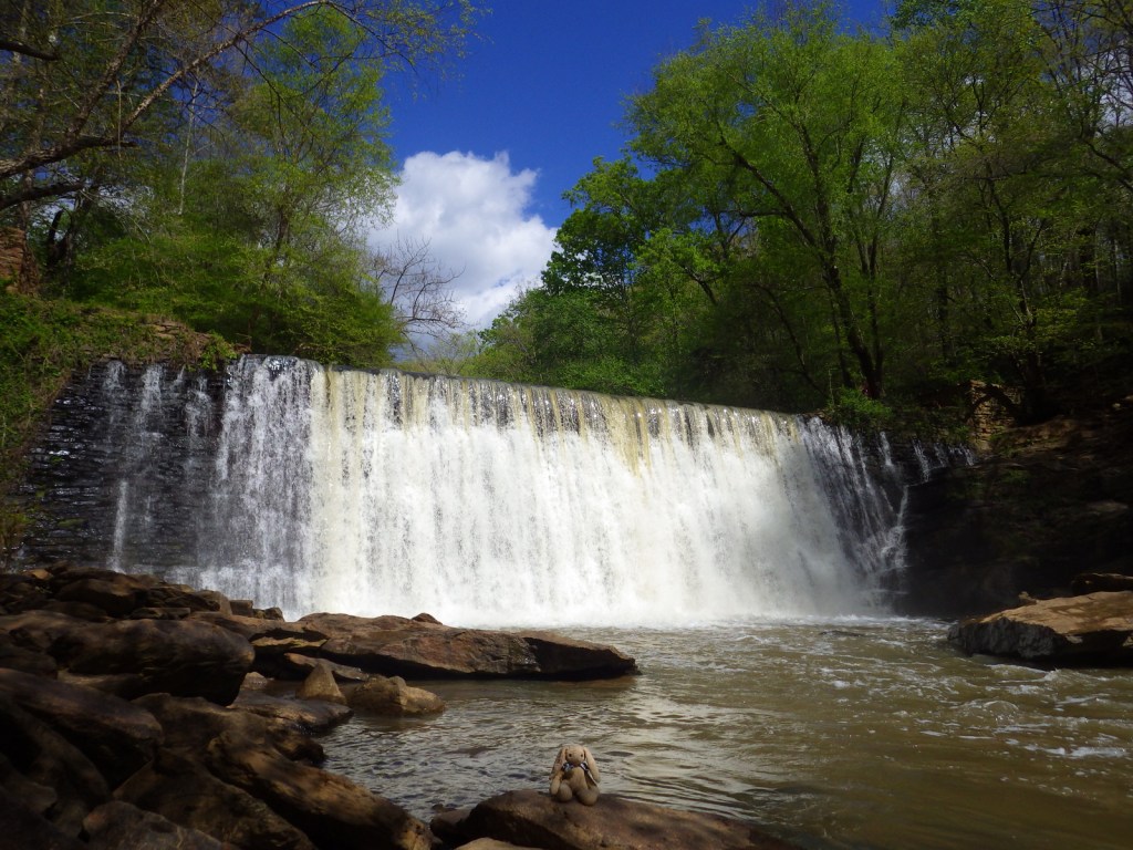
We recently published our guidebook 50 States of Great: Road Trip Guide to America, so we decided to start a new type of blog post where we create a travel itinerary for all 50 states, in addition to our usual National Forest and National Park entries. After starting with Kansas, we decided to do an east coast state. We made an ambitious seven-day plan starting in the northwest corner of Georgia, with many options to extend the trip.
Formerly named after Springer Mountain, the southern terminus of the Appalachian National Scenic Trail (click here for our blog post) is marked with a bronze plaque and trail register. Most backpackers start from potholed Forest Service Road 42 and ascend 0.9 miles south to the summit then spend the night in the open-front trail shelter or turn around to head back north. For day hikers, a nice option is to add the eastern part of the Benton MacKaye Trail to make a 4.7-mile loop that passes Owen Vista.
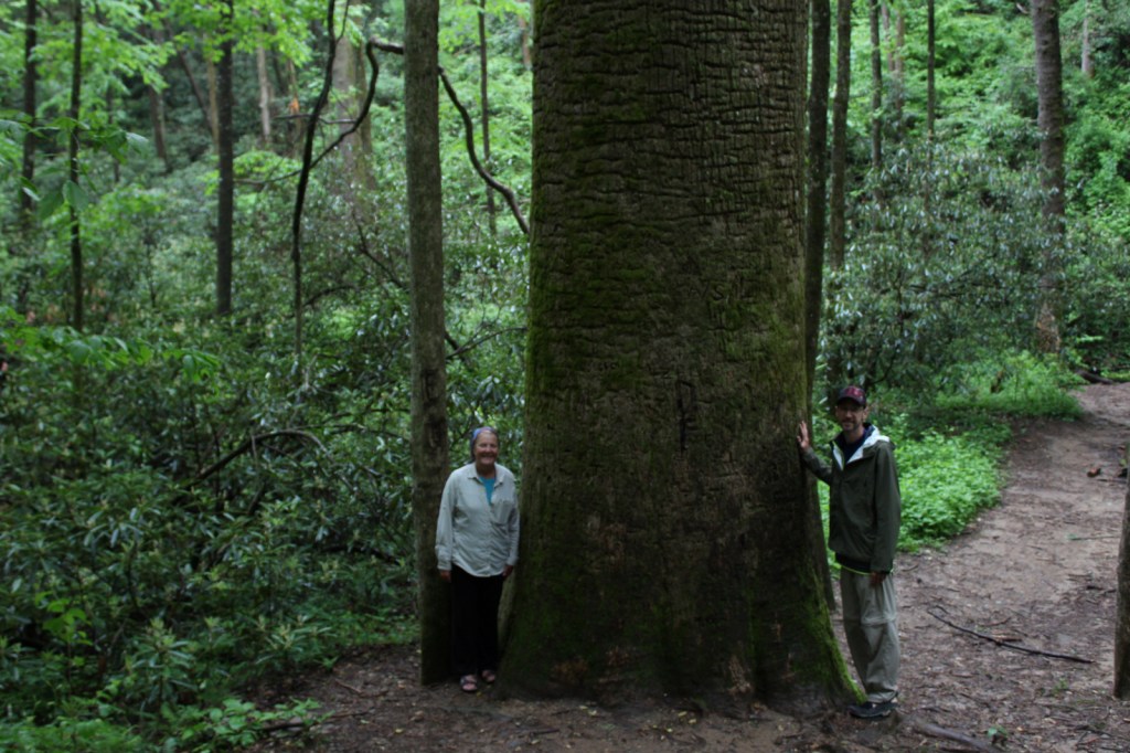
The Gennett Poplar (a tulip-poplar tree more than five feet in diameter) is accessed by hiking 1.8 miles out-and-back with two stream crossings on the Bear Creek Tail. Other large tulip-poplars and yellow buckeyes are found in 175-acre Sosebee Cove Scenic Area. You can spend the night riverside at the free Hickey Gap Campground, one of our Top 10 National Forest Campgrounds.
Half of this park is situated in Tennessee around Lookout Mountain, but at Georgia’s Chickamauga battlefield a seven-mile long driving tour explains what happened there on September 20, 1863.
Optional stops at Brasstown Bald, Tallulah Gorge State Park, Amicolola Falls State Park, and Cloudland Canyon State Park
Start your itinerary a day early in Georgia’s northeast corner by enjoying some State Parks and the state’s high point Brasstown Bald, managed by Chattahoochee National Forest.
Wait out the morning traffic into Atlanta by driving or hiking to the top of this steep hill in the city’s suburbs.
Georgia Aquarium
Holding more than 10-million gallons of water in its numerous tanks, Georgia Aquarium is the best in the nation (even better than California’s Monterey Bay Aquarium). It contains more than 500 aquatic species, but the most impressive are the 30-foot-long whale sharks that reside in the 6.3-million-gallon Ocean Voyager Gallery, the world’s largest indoor marine exhibit.
A short walk from the visitor center is required to enter King’s boyhood home (which is wheelchair accessible). Silence is mandatory while inside. Outside the neighboring King Center, the Reflection Pool contains the tombs of Martin Luther King, Jr. and his wife Coretta Scott King, as well as an eternal flame.
Established in 1978, this park is a combination of government jurisdictions and private land that protects 48 miles of the Chattahoochee River downstream from Lake Sidney Lanier northeast of Atlanta. Due to its lack of large rapids it is popular with canoers.
This notorious Civil War prison remains an active military cemetery and is also home to the National Prisoner of War Museum run by the National Park Service. This may not be the best place to bring children, given that the exhibits in the museum do not pull punches in their depictions of the brutality endured by captured combatants throughout the ages.
One of the best examples of temple mounds from the Mississippian Culture that began around 1,100 years ago. Starting from the National Park Service museum (which contains artifacts dating back to 8000 B.C.E.), walk under the railroad tracks, go inside the replica earth lodge, and up the stairs to access the top of the 55-foot-tall Great Temple Mound.
Day 4
Savannah
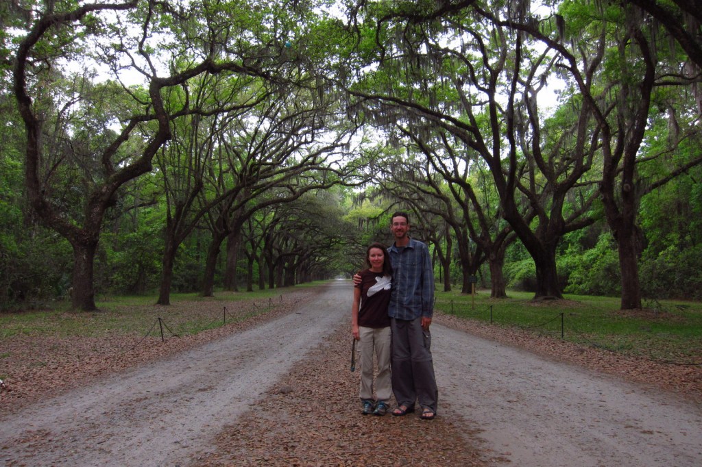
Savannah is a great city for walking that offers countless public squares, beautifully landscaped Forsyth Park with its iconic fountain, spooky Bonaventure Cemetery (see photo), legendary River Street shopping district, and architectural gems like the birthplace of Juliette Gordon Low (who founded the Girl Scouts of America in 1912). Do not miss a photo at the tree-lined entrance to Wormsloe State Historic Site, a plantation located on the edge of an expansive marsh.
Optional stop at Tybee Island
After touring the city, drive on to the Atlantic Ocean for some beach time. Once you have soaked up some saltwater, sand, and sun, check out the Tybee Island Light Station and Museum, built at this site in 1773, then reconstructed after the Civil War. Also, check out the nearby World War II-era Battery Garland in the decommissioned Fort Screven.
Located 17 miles from Savannah on Cockspur Island, photogenic Fort Pulaski National Monument protects a brick fort named for a Polish Count who was killed in action during the American Revolution. Claimed by the Confederacy early during the Civil War, it was surrendered to the Union Army in April 1862 after thirty hours of shelling from nearby Tybee Island.
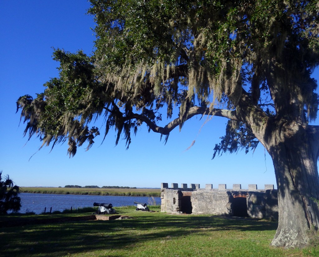
The British established Fort Frederica in the 1730s to stop Spanish encroachment from Florida into their American colonies. The town that formed around the fort peaked at a population of 1,000. Today it is a beautiful setting with tabby wall ruins and Spanish moss-draped trees.
Only accessible by boat, most visitors arrive by ferry from St. Marys (reservations recommended) and spend a full day here. Bicycles can be rented once you arrive on the island (they are not allowed on the ferry) and are permitted on the many miles of roads, but not on the trails or beach. While it is fun to spend time beachcombing or seeing the ruins of the Dungeness mansion, what really sets Cumberland Island apart are the 50 miles of hiking trails that cut through the maritime forest of twisty live oak trees. Watch for feral horses, white-tailed deer, armadillos, turkeys, and other birds along the way.
The largest freshwater wetlands in the country are home to about 12,000 alligators. The baldcypress swamp spreads across 448,000 acres around the Suwannee River. There are no roads across Okefenokee National Wildlife Refuge and it is most easily accessible from the west through Stephen C. Foster State Park, which has a campground and kayak rentals to access camping platforms in the swamp.
Clearing the forests for farmland in the mid-1800s is what allowed these 16 gullies to erode the soft red-clay hills into the colorful spectacle they are today (with many shades of orange, pink, lavender, and yellow). The 1,003-acre State Park was established in 1971 to protect the area and it is featured as a U-Haul Super Graphic. The best views are from the rim walk, but to truly appreciate the depth (up to 150 feet deep) and palette of colors you need to hike down into some of the nine canyons with trails.
The former Governor, Nobel Peace Prize-winner, and U.S. President Jimmy Carter is the most well-known peanut farmer in Plains, and was a regular at the Plains Peanut Festival held every September. The National Park Service manages the Jimmy Carter National Historical Park with two visitor centers, one at the former Plains High School and the other at the family’s 360-acre farm.
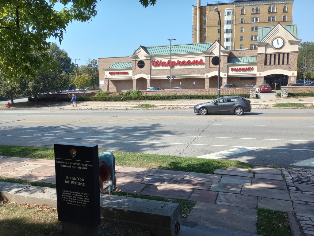
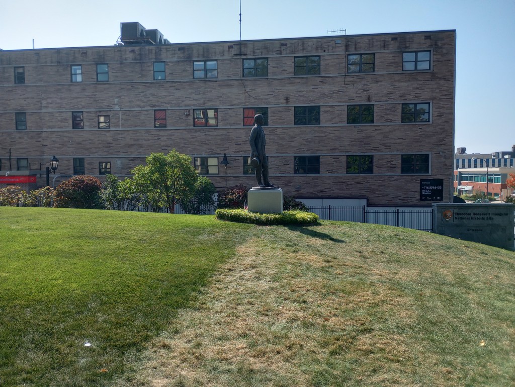
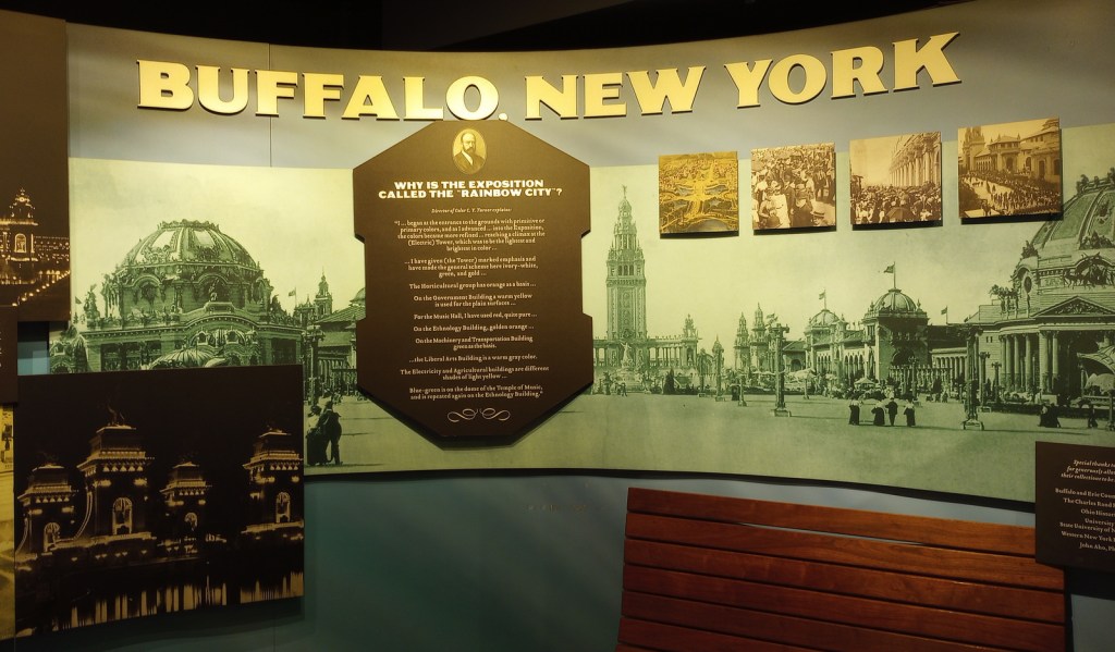
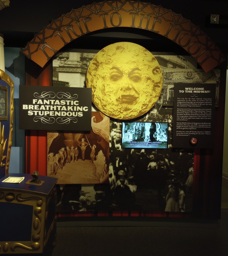
On September 6, 1901, while attending the Pan-American Exposition in Buffalo, New York, President William McKinley was shot by anarchist Leon Czolgosz. Vice President Theodore Roosevelt came by the house (now demolished) where McKinley was recovering and left after being assured he would survive. Roosevelt was hiking the highest peak in the Adirondacks when he was informed that he needed to rush back to Buffalo because the President was dying. Rather than take the oath of office in the house where McKinley died 11 hours before Roosevelt’s arrival, he chose the residence of his friend Ansley Wilcox, which has been preserved as a National Historic Site. Oddly, no photographs were taken at the historic event.
Highlights
Wilcox house, museum, films
Must-Do Activity
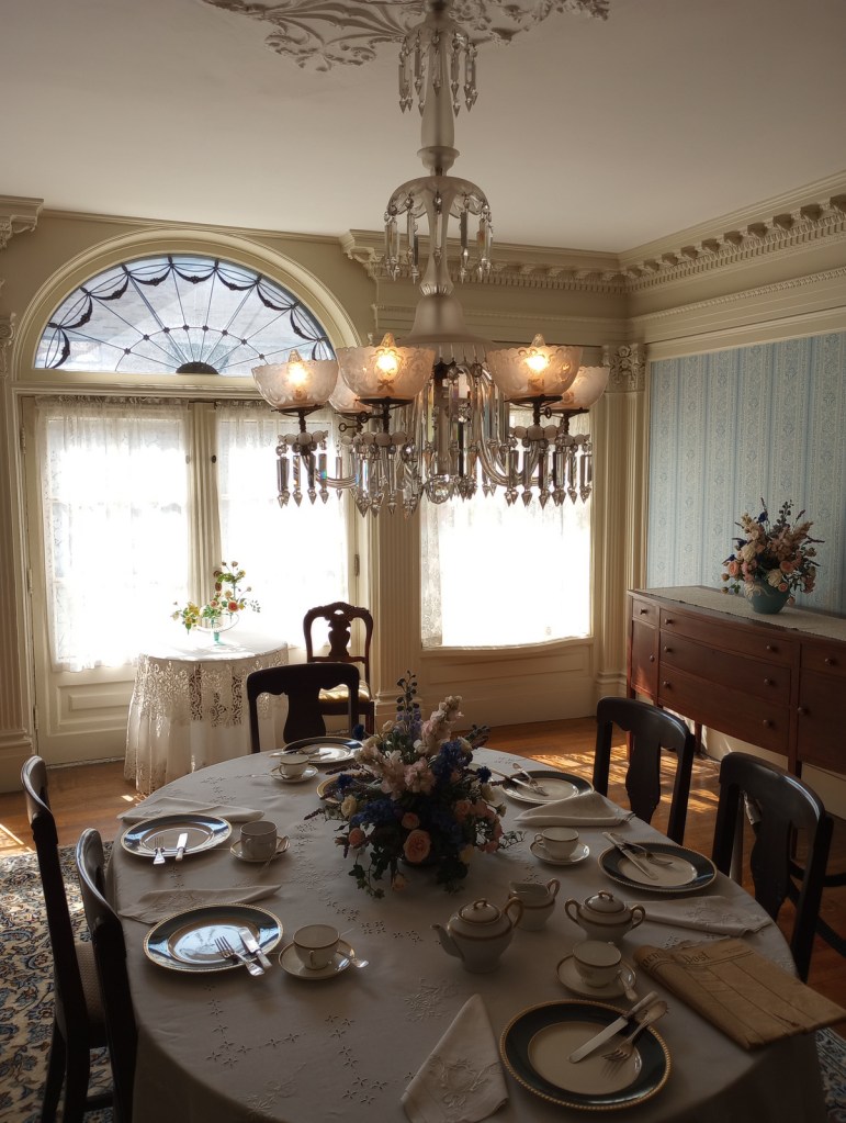
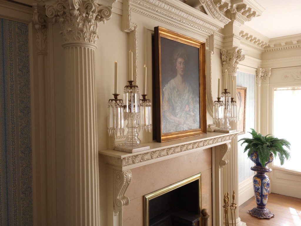
The Wilcox house dates back to 1837, when it was built as an officers’ quarters at the U.S. Army’s Poinsett Barracks. The only way inside is on a ranger-guided tour, which you can reserve online in advance (see Fees below). The downstairs has a small, nice museum featuring interactive exhibits, where you will watch the second of three video presentations during your 45-minute tour. It was good enough that we added it to our Top 10 Museums Run by the National Park Service. There is an annual reenactment of the 1901 Inauguration held every September 14.
Best Trail
No trails, but you can walk the sidewalks of Delaware Avenue in downtown Buffalo and stop by the Bank of America ATM conveniently located next door. Maybe you will find a four-leaf clover like Tiff did (see photo below).
Instagram-worthy Photo
The third video is presented in a small theater upstairs about halfway through the tour and features dramatic lighting and videos highlighting the challenges facing the U.S. in the early 1900s.
Scott at the front doorTiff finding a four-leaf clover out frontEntrance to visitor center behind the houseInside the visitor centerInside the Wilcox houseTiff with Teddy’s statue
Explore More – When was the Wilcox house turned into a restaurant?
Start your U.S. National Parks, National Forests, and National Monuments adventure here!