Tag Archives: archaeology

Hoosier National Forest

Hoosier National Forest

Indiana

Managed by U.S. Forest Service, Eastern Region

644,214 acres (202,814 federal/ 441,400 other)

Website: https://www.fs.usda.gov/hoosier

Overview

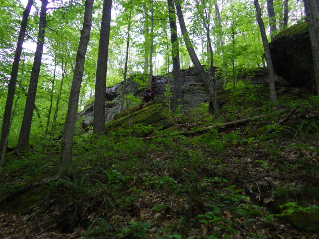
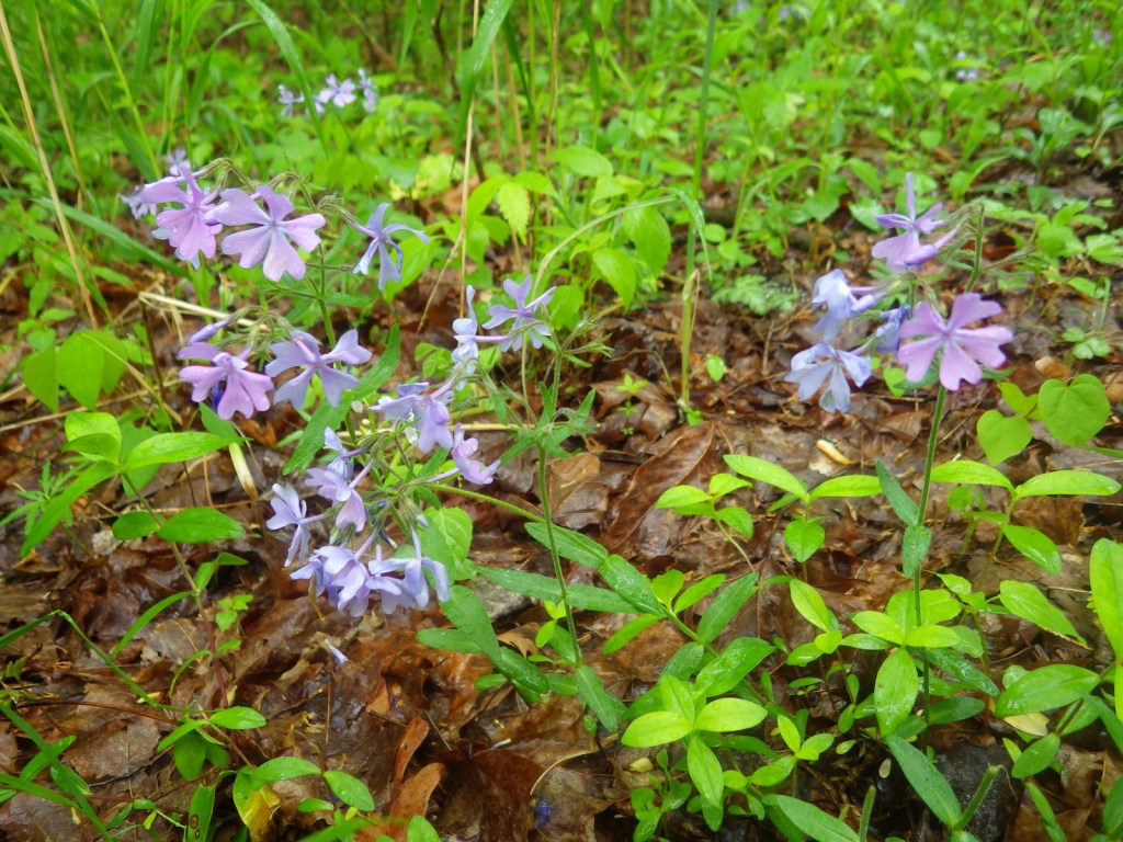
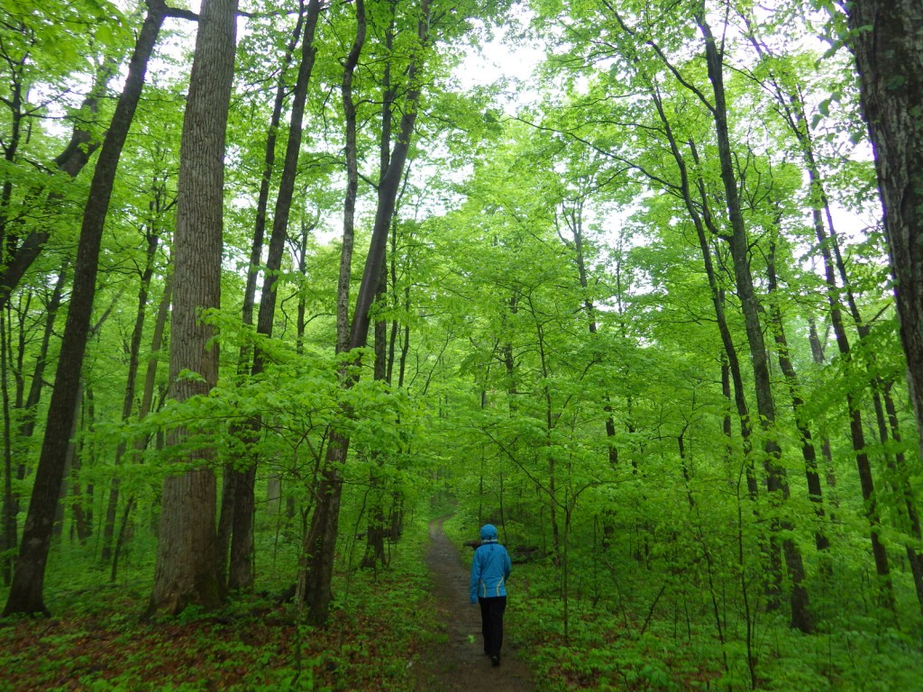
Southern Indiana’s Hoosier National Forest was created in 1935 from cutover and abandoned farm land.  Six years later an additional 88 acres of old-growth forest was purchased that became Pioneer Mothers Memorial Forest, which has never been cut and is used to study natural succession.  A 0.8-mile trail runs through the woods and accesses the Indiana Pioneer Mothers Memorial and Lick Creek Settlement Site.  The latter was a community of free African-Americans led by the Quaker Jonathan Lindley from 1819 to 1865, and located nearby is an archaeological site where there was a stockaded village in the 1300s. 

Highlights

Pioneer Mothers Memorial Forest, Monroe Lake, Hickory Ridge Lookout Tower, German Ridge Lake, Lick Creek Settlement Site, Sundance Lake, Potts Creek Rockshelter Archeological Site, Lake Tarzian, Rickenbaugh House, Tipsaw Lake, Buzzard Roost Overlook, Clover Lick Barrens, Hardin Ridge Recreation Area, Birdseye Trail, Hemlock Cliffs Trail

Must-Do Activity

There are 266 miles of trails in Hoosier National Forest, including the 36.3-mile Terrill Ridge Trail that enters the Charles C. Deam Wilderness (Indiana’s one and only) and the 24.1 miles of trails around German Ridge Lake.  Horse camps provide access to miles of bridle trails, including the 48.7-mile Hickory Ridge Trail.  Many of the National Forest’s trails are old roads (even in the Wilderness), so while hiking watch for evidence of house foundations, fences, domestic plants, and cemeteries.

Best Trail

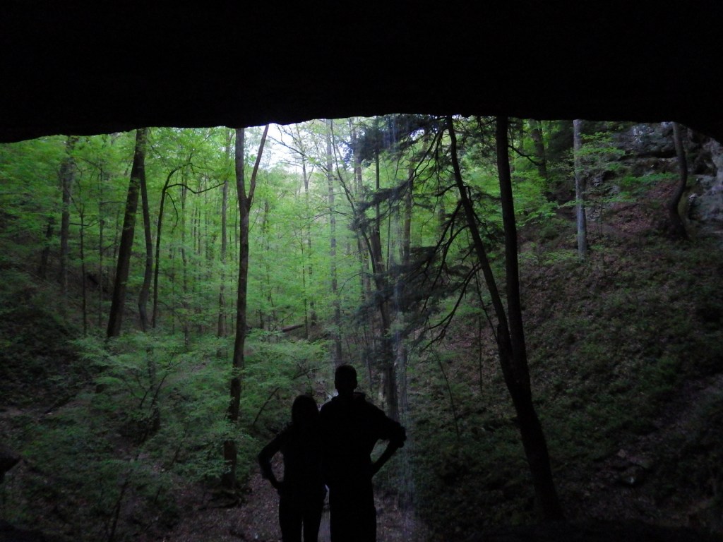
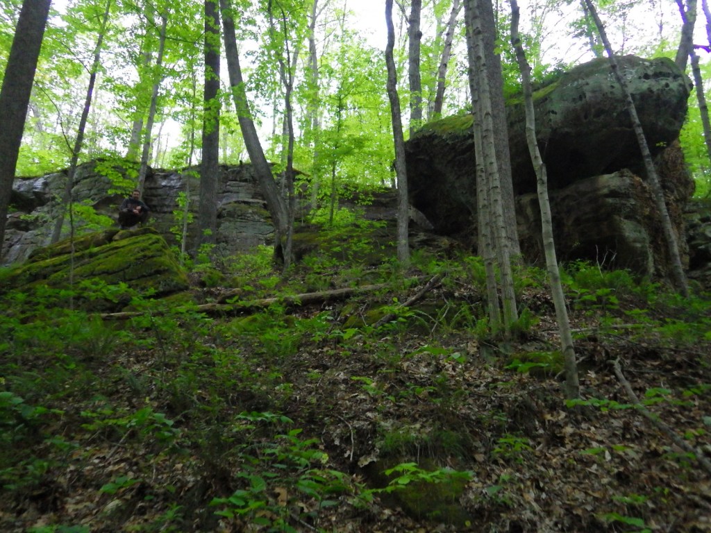
Hemlock Cliffs Trail is a 1.2-mile loop through a sandstone canyon that passes two unique waterfalls.  Tall eastern hemlock trees surround both waterfalls that you can walk behind where the cliffs are undercut by erosion in this crumbly sedimentary rock.  The falls only flow seasonally, but when they do the trail is often muddy and slippery, so take caution. 

Watchable Wildlife

In 1972, wild turkeys were reintroduced to 6,000 acres around Clover Lick Barrens, an area of prairie vegetation.  Other birds of interest include red-shouldered hawks, sharp-shinned hawks, scarlet tanagers, and pileated woodpeckers.  Timber rattlesnakes and copperheads are two venomous snake species found here.  Mammals include fox squirrels, raccoons, and white-tailed deer, which attract hunters in season.

Instagram-worthy Photo

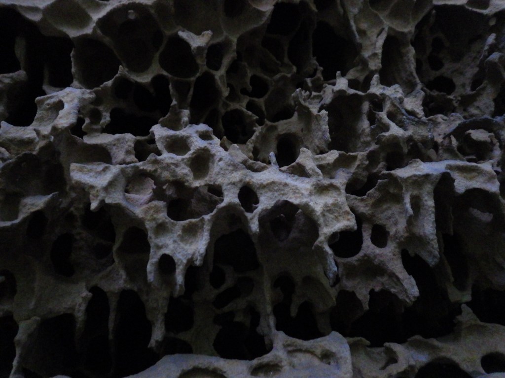
Southern Indiana is known for its Karst topography, which often forms limestone caves, as well as some beautiful Swiss-cheese formations that can be seen along the Hemlock Cliffs Trail.

Peak Season

Summer

Fees

None

Road Conditions

Road access is paved to the pullout for the Pioneer Mothers Memorial Forest, and the unpaved road to Hemlock Cliffs Trailhead was a good enough for our mini-van.

Camping

There are horse camps at Shirley Creek, Blackwell, Hickory Ridge, and Youngs Creek, in addition to other campgrounds dispersed throughout Hoosier National Forest.

Wilderness Areas

Charles C. Deam Wilderness

Related Sites

Shawnee National Forest (Illinois)

Lincoln Boyhood National Memorial (Indiana)

George Rogers Clark National Historical Park (Indiana)

Nearest National Park

Indiana Dunes

Conifer Tree Species

eastern hemlock, eastern white pine, shortleaf pine, eastern redcedar

Flowering Tree Species

American beech, tulip-poplar, basswood, Ohio buckeye, white ash, green ash, American elm, winged elm, black walnut, white oak, northern red oak, black oak, chinquapin oak, rock chestnut oak, post oak, blackjack oak, sugar maple, red maple, ironwood, sassafras, black cherry, black gum, black walnut, honeylocust, Kentucky coffeetree, flowering dogwood, redbud, basswood, sycamore, mockernut hickory, shagbark hickory, pawpaw, slippery elm, butternut, hophornbeam, sweetgum, mountain laurel

Explore More – Who was Charles C. Deam, the namesake for the only Wilderness in Indiana (designated in 1982)?

Learn more about this and the 154 other National Forests in our new guidebook Out in the Woods

Grand Mesa National Forest

Grand Mesa National Forest

Colorado

Managed by U.S. Forest Service, Rocky Mountain Region

351,715 acres (346,555 federal/ 5,160 other)

Website: https://www.fs.usda.gov/gmug

Overview

Covering 540 square-miles, Grand Mesa is the largest flattop mountain in the world and has an average elevation of 10,500 feet.  It rises east of Grand Junction and is easily explored via paved Highway 65, also known as Grand Mesa Scenic Byway.  Due to its high elevation, Grand Mesa National Forest is a popular destination for snowmobiles in the winter.  This area was first set aside by President Harrison in 1892 as Battlement Mesa Forest Reserve, only the third such designation in U.S. history.  It is now co-managed with Colorado’s Gunnison and Uncompahgre National Forests.

Highlights

Grand Mesa Scenic Byway, Land’s End Ranger Observatory, Ward Lake, Island Lake Interpretive Trail, Crag Crest National Recreation Trail, Eggleston Lake, Leon Peak, Battlement Trail

Must-Do Activity

Also covering a portion of Battlement Mesa, Grand Mesa National Forest contains more than 300 lakes, several of which have campgrounds.  The Grand Mesa Visitor Center on Highway 65 near Island Lake is a great place to start, with a 20-minute film shown detailing the 1999 Land’s End archaeological excavation that found evidence of 8,000 years of human activity at 9,000 feet in elevation.  Dirt roads travel east from there deeper into the National Forest, or you can take a side trip west on the Grand Mesa Scenic Byway to the visitor center at Land’s End Ranger Observatory for views all the way into Utah’s La Sal National Forest. 

Best Trail

The best trail in Grand Mesa National Forest is without a doubt Crag Crest National Recreation Trail.  It can be hiked as a 10.3-mile loop from two trailheads, one at Island Lake (paved access) and the other at Eggleston Lake (that requires some dirt road driving).  The crest portion of the hike is the highlight as it follows a narrow ridge of volcanic rock that offers spectacular views.  Due to its exposure and the high altitude (up to 11,189 feet) it is recommended that you get an early start to avoid afternoon thunderstorms.  For those not wishing to do the entire loop, we found that by starting out counterclockwise from Eggleston Lake the trail climbs steeply providing panoramas within two miles.  We completed five miles out-and-back with a cumulative elevation gain of 1,100 feet and felt we had gotten the full experience.

Watchable Wildlife

Trout fishing is one of the main draws to the 300 lakes in Grand Mesa National Forest.  The lakes and streams also attract elk, mule deer, bighorn sheep, raccoons, red foxes, black bears, and mountain lions, in addition to large birds like bald eagles, golden eagles, peregrine falcons, common ravens, and wild turkeys.  Due to its high elevation, look for pikas in the rocks along Crag Crest National Recreation Trail.

Instagram-worthy Photo

Starting counterclockwise on the Crag Crest National Recreation Trail from Eggleston Lake, we climbed to stunning panoramas within two miles. 

Peak Season

Summer

Fees

None

Road Conditions

Grand Mesa Scenic Byway follows paved Highway 65 up above 10,000 feet in elevation, as well as west to Land’s End Ranger Observatory.  The unpaved Land’s End Road continues switchbacking down the mesa to Highway 50, but is not recommended for vehicles more than 21 feet in length.  The unpaved roads on Grand Mesa were in good shape during our June visit, but are closed in the winter.

Camping

There are campgrounds at several lakes in Grand Mesa National Forest, as well as dispersed camping options along the dirt roads.

Wilderness Areas

None

Related Sites

Gunnison National Forest (Colorado)

Colorado National Monument (Colorado)

Arapaho National Forest (Colorado)

Nearest National Park

Black Canyon of the Gunnison

Conifer Tree Species

Engelmann spruce, subalpine fir, Douglas-fir, two-needle pinyon pine, ponderosa pine

Flowering Tree Species

Gambel oak, quaking aspen, narrowleaf cottonwood, mountain-mahogany, chokecherry

Explore More – Now a geological term, what does “mesa” mean in Spanish?

Learn more about this and the 154 other National Forests in our new guidebook Out in the Woods

We are a participant in the Amazon Services LLC Associates Program, an affiliate advertising program designed to provide a means for us to earn fees by linking to Amazon.com and affiliated sites.

Keweenaw National Historical Park

Overview

The Keweenaw Peninsula juts north into Lake Superior from Michigan’s Upper Peninsula and is home to the richest copper ore (97% pure) on the planet.  American Indian artifacts made from this region’s copper have been found at several other National Park Service (NPS) sites, such as Georgia’s Ocmulgee Mounds National Historical Park and Ohio’s Hopewell Culture National Historical Park.  In the 1840s, immigrants representing 38 ethnic groups flooded this area to work as miners.  More recently, the NPS led a project to recreate historic buildings and archaeological sites within the digital world of Minecraft (click here for an article).

Highlights

Adventure Mine Tours, Quincy Mine, Delaware Copper Mine, downtown Calumet, Laurinium Mansion

Must-Do Activity

The NPS does not have much of a presence in this park, but rather relies on its partners to preserve the heritage sites.  We highly recommend the Miner’s Tour guided by the Adventure Mining Company in Greenland, Michigan.  In addition to getting a great history lesson, we rappelled down an 80-foot deep mine shaft and walked across a swinging bridge without handrails.  They also offer a less intense tour for all ages.

Best Trail

We walked the streets of Calumet, Michigan while doing our laundry across the street from the historic Calumet Theatre.  The NPS visitor center was closed, but we still got to see the Copper Country Firefighters History Museum and the Keweenaw Heritage Center inside St. Anne’s Church.  We also recommend a stop at the quirky vintage consignment store in the three-story Vertin Building built in 1885.

Instagram-worthy Photo

Quincy Mine is the most tourist-friendly part of Keweenaw National Historical Park offering a museum, tram ride, and underground mine tours.

Peak Season

Summer

Hours

https://www.nps.gov/kewe/planyourvisit/hours.htm

Fees

No NPS fees, but each heritage site charges its own admission with one of the cheapest being the $1 donation per person requested at the Copper Range Historical Museum in South Range, Michigan.

Road Conditions

Most roads are paved, with the exception of the short gravel road to the Adventure Mining Company.

Camping

Fort Wilkins and McLain State Parks both have campgrounds and dispersed campsites can be found in parts of Ottawa National Forest.  Backpacking is popular in Porcupine Mountains Wilderness State Park.

Related Sites

Pictured Rocks National Lakeshore (Michigan)

Isle Royale National Park (Michigan)

Effigy Mounds National Monument (Iowa)

Explore More – How deep was the shaft dug at Quincy Mine before it was closed in 1945 and allowed to fill with water?

Petroglyph National Monument

Overview

Bordered by the suburban neighborhoods of Albuquerque, Petroglyph National Monument is a nice place to take a walk and enjoy some intricate artwork.  The petroglyphs were chipped into the patina of volcanic rocks in a long-populated region of the Rio Grande Valley.  Some of these images may be up to 3,000 years old, with most believed to be carved between AD 1400 and 1700.  A few were added by Hispanic settlers and explorers through the 1800s, but the National Park Service (NPS) politely requests no aspiring artists add any more.

Highlights

Boca Negra Canyon, Rinconada Canyon Trail, Piedras Marcadas Canyon, Volcanoes Day Use Area

Must-Do Activity

There are multiple areas of this National Monument established in 1990, some literally in Albuquerque residents’ backyards.  At Boca Negra Canyon, you will find interesting depictions of humans, snakes, and even parrots from Central America, as well as many puzzling illustrations.  Use your imagination to try to guess what the original carver was trying to display. 

Best Trail

Volcanoes Day Use Area offers loop trails around three volcanic cones on the West Mesa with incredible views of the Sandia Mountains and Rio Grande Valley (but no petroglyphs).

Instagram-worthy Photo

Rinconada Canyon Trail is 1.25 miles one-way and starts at a small NPS parking lot in suburban Albuquerque and accesses an area with thousands of petroglyphs.

Peak Season

Spring and fall

Hours

https://www.nps.gov/petr/planyourvisit/hours.htm

Fees

None

Road Conditions

All roads are paved, but be prepared for stoplights, especially on the main connecting road Unser Boulevard.

Camping

There are private campgrounds around Albuquerque, New Mexico, or you can look for options in the Cibola and Santa Fe National Forests.

Related Sites

Pecos National Historical Park (New Mexico)

El Morro National Monument (New Mexico)

Salinas Pueblo Missions National Monument (New Mexico)

Explore More – How many petroglyphs are estimated to be protected within this National Monument?

Boca Negra Canyon contains thousands of petroglyphs and fascinating volcanic rock formations.

Some petroglyphs are more difficult to interpret.  I think this one depicts a yucca fruit.

Dinosaur National Monument

Overview

As its name suggests, Dinosaur National Monument was first created in 1915 to protect an archaeological dig.  The 200-foot long wall of unexcavated fossils at Dinosaur Quarry outside Jensen, Utah is still the park’s main attraction.  A major addition of 200,000 acres was added in 1938, stretching into the neighboring state of Colorado.  More than 90% of the National Monument (click here to see where it ranks in our Top 10) is managed as wilderness and is best explored by whitewater rafting the Green and Yampa Rivers.

Highlights

Dinosaur Quarry, Harpers Corner Road, Fremont pictographs, Jones Hole Trail, whitewater rafting

Must-Do Activity

Whitewater rafting trips on the Green River can last a few hours or multiple days depending upon where you put in.  We highly recommend a three night trip starting at the Gates of Lodore with Adrift Dinosaur or one of several other outfitters.  They also offer multi-day trips down the Yampa River, which is undammed and only navigable during the spring snowmelt.  If you do not feel like getting wet, simply enjoy a quiet picnic on the shoreline at easily-accessible Split Mountain (or take a high-clearance vehicle down the rough road to scenic Echo Park).

Best Trail

The 4-mile long Jones Hole Trail is accessible to rafters on the Green River and from a fish hatchery at the end of a paved road near the Utah-Colorado border.  It provides access to Ely Creek Falls and the Deluge Shelter pictographs, which are approximately 800 to 1,400 years old.

Instagram-worthy Photo

Dinosaur Quarry may be the only mountainside in America surrounded by its own glass-enclosed, air-conditioned building.  It contains thousands of fossilized bones of giant creatures sitting in the same place they have been for the past 148-million years.  It is a completely different experience than seeing dinosaur skeletons reconstructed in a museum, although they have those, too. 

Peak Season

Spring and summer

Hours

https://www.nps.gov/dino/planyourvisit/hours.htm

Fees

No entrance fees for the Colorado side, but $25 per vehicle to enter the Utah side to view the Dinosaur Quarry.

Road Conditions

There are many dirt roads in the National Monument, some of which are impassable when wet, so check at a visitor center before entering.  The roads to the Dinosaur Quarry, Jones Hole Trailhead, Deerlodge Park, and Harpers Corner are paved.

Camping

There are several campgrounds within the park accessible by paved or unpaved roads, as well as numerous backcountry campsites located along the Green and Yampa Rivers (plus, one on the Jones Hole Trail). 

Explore More – Who was the one-armed Civil War veteran that led the first exploration of the Green River (and named the Gates of Lodore after a poem) in 1869?

WONDON WAS HERE