Category Archives: Colorado

Amache National Historic Site

Amache National Historic Site

Colorado

Managed by National Park Service

Established 2024

410 acres

Website: nps.gov/amch

Overview

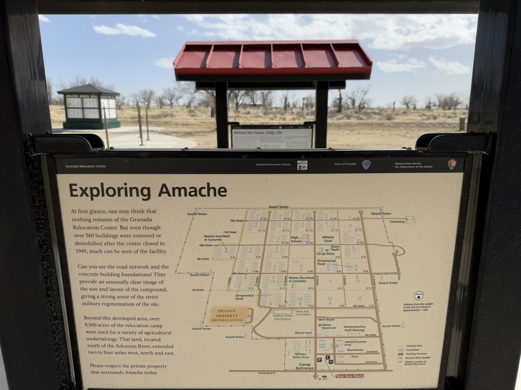
Added to the National Park Service (NPS) system on February 15, 2024, Amache National Historic Site is the fifth unit dedicated to remembering the sad story of the forced internment of 110,000 Japanese-Americans during World War II.  Operated between 1942 and 1945, at its peak the Granada Relocation Center in southeast Colorado housed 7,310 incarcerees making it the state’s tenth largest city at the time.  Although it does not have a visitor center, the site of the internment camp is more developed than other new NPS sites since it was previously added to the National Register of Historic Places in 1994 and then designated a National Historic Landmark in 2006.  Learn more about the history of these camps by checking out the Related Sites below and watching some of our Top 10 World War II Films or reading one of the Top 10 World War Novels

Highlights

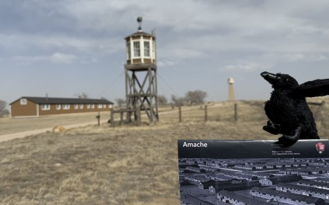
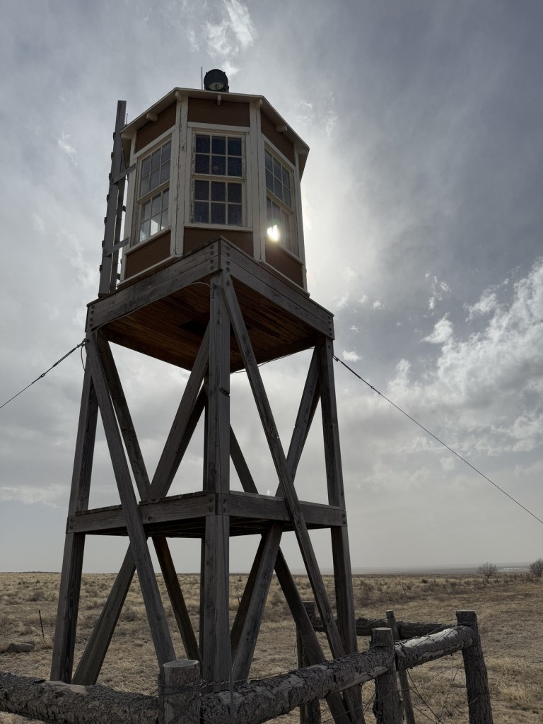
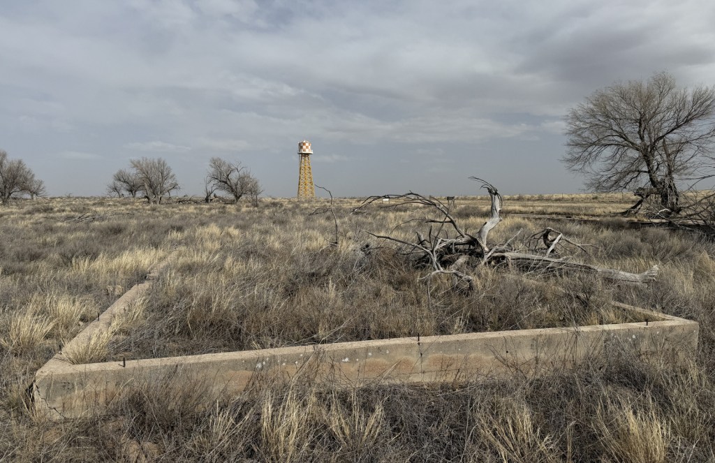
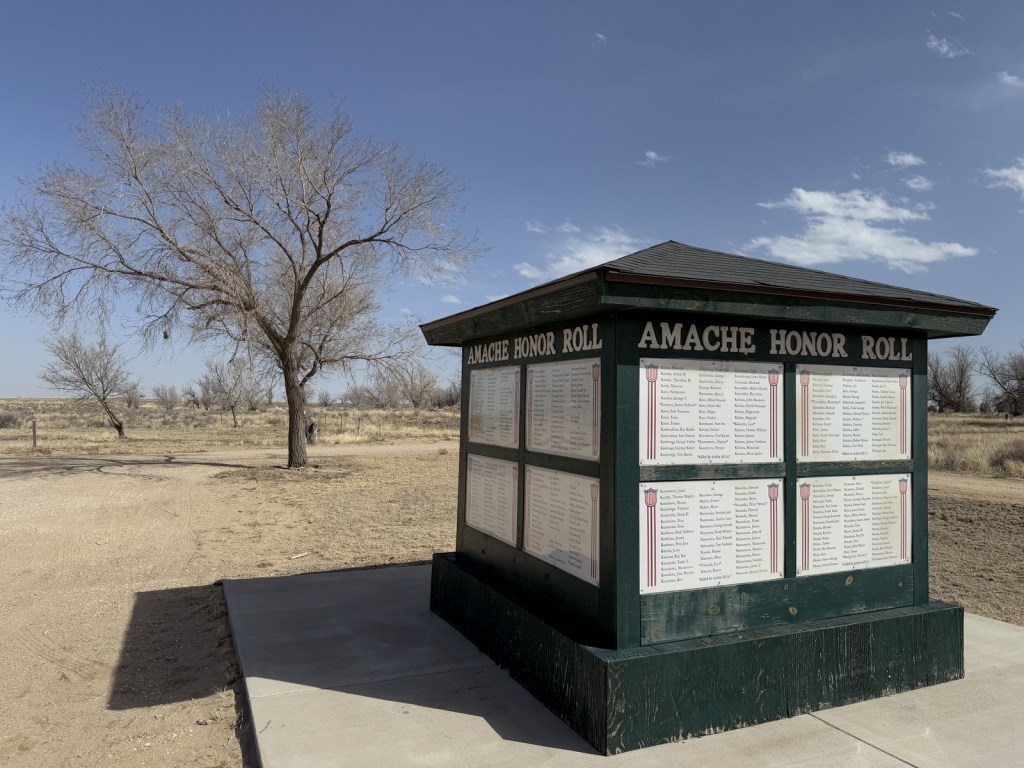
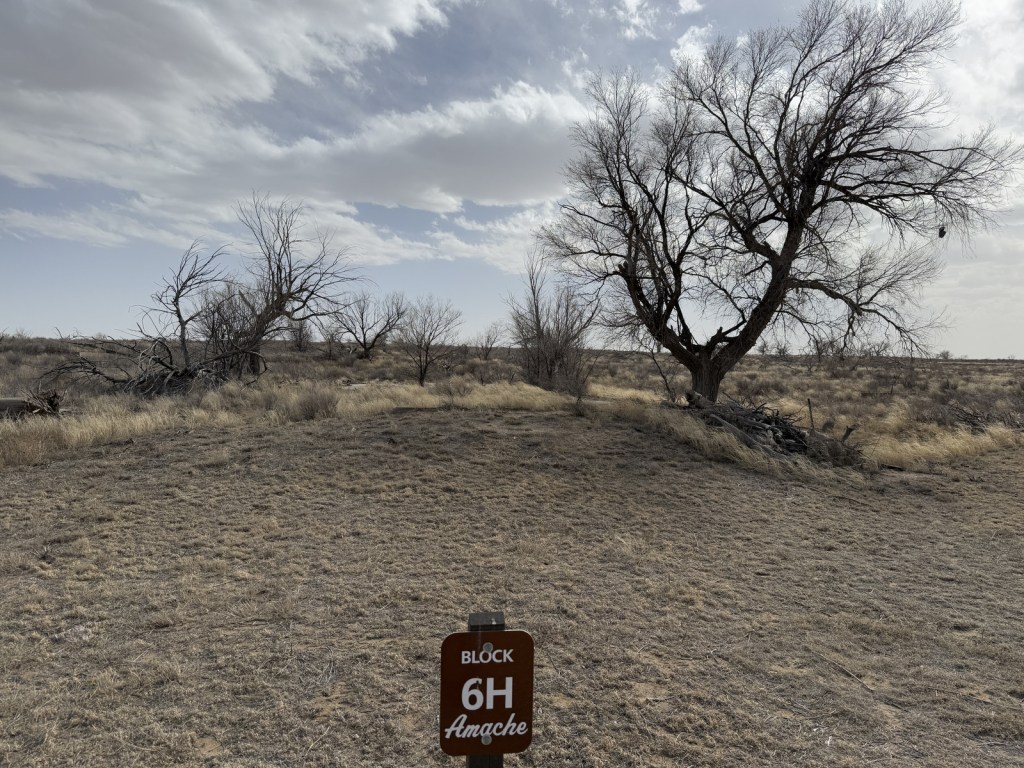
Amache Museum, water tower, barracks, guard tower, cemetery, Recreation Hall

Must-Do Activity

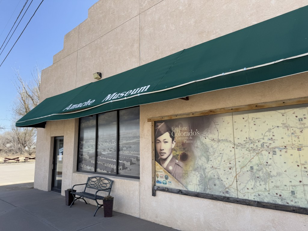
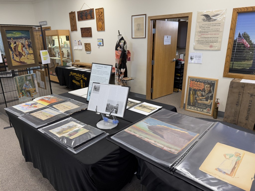
Start at the excellent Amache Museum in Granada, which is run by local high school students and has free admission (donations accepted).  Be sure to pick up a map of the driving tour or visit the website (https://amache.org/driving-tour-map-podcasts) to listen to the audio recordings at each stop (there is smartphone coverage on site).  Drive the route in order or skip around, but make it a point to see Stop 4 (guard tower and barracks), Stop 8 (cemetery), and the Rec Hall.  Starting in June 2025, ranger-led tours will be offered at 10 a.m. on the first and third Friday of the summer months.

Best Trail

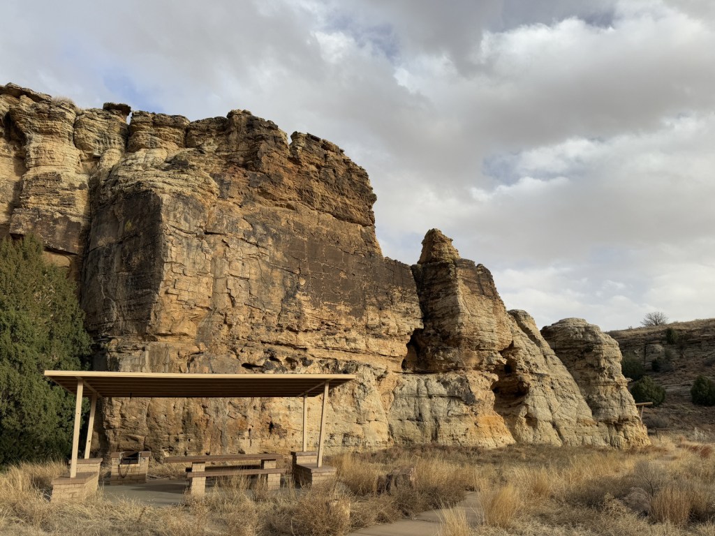
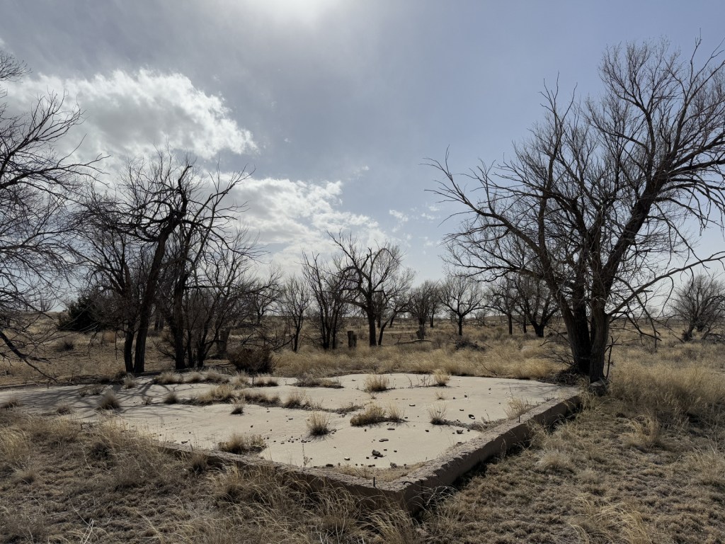
There is a short loop trail with many interpretive signs at the picnic area when you first arrive at the site by the Honor Roll square structure.  There is also an off-trail walk to the old koi pond at Stop 2 that you can navigate if you listen to the directions on the audio recordings.

Photographic Opportunity

The reconstructed barracks and guard tower at the south end of the site are two of the only structures standing above the open prairie.  They are near the water tower, which is worth a short detour to see.

Peak Season

Spring and fall

Hours

https://www.nps.gov/amch/planyourvisit/basicinfo.htm

Amache Museum: https://amache.org/visitor-information/

Fees

None; donations accepted at Amache Museum

Road Conditions

Roads through the site are gravel, but they seemed to be in good condition and seemingly passable even when wet.

Camping

Most of the southeast corner of Colorado is privately-owned agriculture land, so to find dispersed camping drive to Comanche National Grassland or Cimarron National Grassland.

Related Sites

Manzanar National Historic Site (California)

Tule Lake National Monument (California)

Minidoka National Historic Site (Idaho)

Nearest National Park

Great Sand Dunes

Explore More – Most of the 10,000 acres dedicated to Granada Relocation Center was for agriculture, so how many acres were used for residential and administrative buildings?

Comanche National Grassland

Comanche National Grassland

Colorado

Managed by U.S. Forest Service, Rocky Mountain Region

Established 1960

467,373 acres (443,081 federal/ 24,292 other)

Website: https://www.fs.usda.gov/psicc

Overview

Near the Oklahoma border in southeast Colorado, Comanche National Grassland is comprised of two areas of shortgrass prairie co-managed with Pike and San Isabel National Forests and Cimarron National Grassland (in nearby Kansas).  The Timpas Unit is in the watershed of the Purgatoire (or Picket Wire) River, while the more southern Carrizo Unit is mostly centered around Carrizo Creek, a tributary of the Cimarron River.  There is a long history of human use of the canyons here, with petroglyphs dating back as far back as 8,000 years.  Before giving the National Grassland its name, the Comanche pushed the Apache out of this area in the 1700s and their circular tipi rings can still be found.  A branch of the Santa Fe National Historic Trail runs through the northern Timpas Unit with interpretive sites at Sierra Vista Overlook and Timpas Picnic Area (including a three-mile trail following the wagon tracks between the two). 

Highlights

Picture Canyon, Crack Cave, Picket Wire Canyon, Dolores Mission, Rourke Ranch, Carrizo Canyon, Vogel Canyon, Santa Fe National Historic Trail

Must-Do Activity

Petroglyphs can be seen on trails near Vogel Canyon and Carrizo Canyon Picnic Areas, with the most famous found in Picture Canyon.  It is about 16 miles of unpaved roads to access Picture Canyon from Highway 287, and there are vault toilets and picnic tables at the site.  From there, the U.S. Forest Service traditionally leads a hike on Arch Rock Trail to Crack Cave on both the spring and fall equinox, when at dawn the sun’s rays illuminate a specific petroglyph that is usually behind a locked gate that blocks a narrow opening in the sandstone.  A similar petroglyph with deeply-carved lines can be seen in an opening above a blue-tinted pictograph about a quarter-mile down the trail.  Rock climbing is also a draw here, with a few permanent anchors in the sandstone behind the picnic tables. 

Best Trail

It is a 17-mile drive down unpaved roads to Picket Wire Canyon, where a long trail leads to dinosaur tracks (19 miles out-and-back) and Rourke Ranch National Historic District (25 miles) that dates back to 1871.  There are approximately 1,900 tracks left by Apatosaurs and Allosaurs over 150-million years ago.  Along the way, look for petroglyphs, a model of a dinosaur fossil, and the ruins of Dolores Mission (see Photographic Opportunity). 

Watchable Wildlife

Elevations range from 3,900 to 6,200 feet atop Fallas Mesa with ponderosa pine, pinyon pine, juniper, Gambel oak, and cottonwoods trees found in moister areas.  Yucca and cacti are common in the prairie, as are desert-dwelling creatures like roadrunners and tarantulas (we saw one crossing the road).  Hunters come here for mule deer, elk, pronghorn, and wild turkey in season.  The National Grassland contains a lek for lesser prairie chickens, but it is typically closed during mating season due to their endangered status.  About 328 bird species have been identified here, including many eastern birds at the extent of their range. 

Photographic Opportunity

On the way to the dinosaur track site in Picket Wire Canyon, hikers pass Dolores Mission with a cemetery and the ruins of a small Catholic church dating back to 1898.

Peak Season

Spring and fall

Fees

None

Road Conditions

We have almost gotten stuck twice on the long dirt roads in Comanche National Grassland, once in deep mud following a spring thunderstorm and another time on thick ice following a spring blizzard. 

Camping

It is free to disperse camp almost anywhere not on private lands in Comanche National Grassland, with the exception of the parking lots at the following canyons: Picture, Carrizo, Vogel, and Picket Wire.

Related Sites

Cimarron National Grassland (Kansas)

Bent’s Old Fort National Historic Site (Colorado)

Sand Creek Massacre National Historic Site (Colorado)

Nearest National Park

Great Sand Dunes

Explore More – The markings in Crack Cave are theorized by some people to spell out what word in Ogam (an ancient Celtic alphabet)?

La Sal National Forest

La Sal National Forest

Utah, Colorado

Managed by U.S. Forest Service, Intermountain Region

535,288 acres

Website: https://www.fs.usda.gov/mantilasal

Overview

La Sal National Forest is found in two separate sections of southeastern Utah surrounding the La Sal and Abajo Mountains, topping out on 12,721-foot Mt. Peale.  Much of the southern portion of the National Forest, including the Dark Canyon Wilderness, was included in the 1.35-million-acre Bears Ears National Monument, established in 2016 and then controversially reduced in size before being restored.  Since 1949, it has been administratively combined with the northern and separate Manti National Forest, so it can be difficult to find information for La Sal National Forest alone.  

Highlights

Bears Ears National Monument, La Sal Mountain Loop Scenic Backway, Warner Lake, Bull Canyon Dinosaur Tracks, Buckeye Reservoir, Elk Ridge Scenic Backway, Harts Draw Highway, Abajo Loop State Scenic Backway, Mt. Peale, Arch Canyon, Mt. Tukuhnikivatz

Must-Do Activity

Many visitors access the forest south from Moab on the mostly-paved La Sal Mountain Loop Scenic Backway, a steep drive suitable for passenger vehicles that is accessible in the warmer months.  The often snow-capped La Sal Mountains are featured as the backdrop in nearly every photo of Delicate Arch in Arches National Park.  The Sierra La Sal (“Salt Mountains” in Spanish) were a prominent landmark on the Old Spanish Trail between Santa Fe and Los Angeles.  Be sure to make the dirt Gateway Road (FS 207) detour 5.4 miles to visit Bull Canyon Dinosaur Tracks, where there is also a commanding view of Fisher Mesa and Bull Canyon.  Oowah Lake and Warner Lake are also located on unpaved side roads (3.2 and 5.2 miles respectively) from La Sal Mountain Loop Road.

Best Trail

The 58-mile-long Elk Ridge Scenic Backway is a well-maintained, though unpaved route that leads north from Natural Bridges National Monument to Highway 211, which connects to the Needles District of Canyonlands National Park.  There are multiple trails along the way that provide access to the Dark Canyon Wilderness, an area known for old-growth forests, natural arches, and Ancestral Puebloan ruins and pictographs.  A high-clearance vehicle is not required to reach Big Notch Trailhead where a trail steeply drops into Dark Canyon.  Erosion has cut red clay walls that make navigation somewhat difficult in places.  About four miles in, not far past the large Cicada Arch on the north side, you reach a spring at the meeting with Drift Trail Canyon.  Another two miles takes you to Scorup Cabin, a good place to turn around or explore Horse Pasture Canyon.

Watchable Wildlife

Wildlife species are similar to Utah’s Dixie National Forest and Fishlake National Forest, including black bears, mountain lions, bobcats, coyotes, porcupines, raccoons, skunks, badgers, bighorn sheep, elk, mule deer, and pronghorns.  Large birds include bald eagles, golden eagles, northern goshawks, turkey vultures, wild turkeys, common ravens, and various species of owls and woodpeckers.  Look for short-horned lizards in the Dark Canyon Wilderness.  There are many trout and other gamefish found in the streams and small lakes spread across the high-elevations of the La Sal and Abajo Mountains.

Photographic Opportunity

In the summer months, take La Sal Mountain Loop Scenic Backway to Bull Canyon Dinosaur Tracks to see 200-million-year-old therapod tracks, plus an awesome overlook to the north.

Peak Season

Summer

Fees

None

Road Conditions

La Sal Mountain Loop Road is mostly paved, but side roads to Bull Canyon Dinosaur Tracks, Oowah Lake, and Warner Lake are not.  The 58-mile-long Elk Ridge Scenic Backway is a rocky, unpaved route that leads north from Natural Bridges National Monument to Highway 211; and side roads to some trailheads require a high-clearance vehicle.

Camping

Warner Lake Campground takes reservations, as does Buckeye Reservoir in Colorado and a few others.  Dispersed camping is also an option, especially along lightly-traveled Elk Ridge Scenic Backway.

Wilderness Areas

Dark Canyon Wilderness

Wilderness

Related Sites

Arches National Park (Utah)

Bears Ears National Monument (Utah)

Natural Bridges National Monument (Utah)

Nearest National Park

Canyonlands

Conifer Tree Species

Utah juniper, Rocky Mountain juniper, two-needle pinyon pine, ponderosa pine, white fir, subalpine fir, Engelmann spruce, Douglas-fir

Flowering Tree Species

Gambel oak, quaking aspen, Fremont cottonwood, Utah serviceberry, bigtooth maple, manzanita, sagebrush

Explore More – Due to an administrative error in 1908, what was the misspelled name of La Sal National Forest (which was quickly corrected)?

Learn more about this and the 154 other National Forests in our new guidebook Out in the Woods

We are a participant in the Amazon Services LLC Associates Program, an affiliate advertising program designed to provide a means for us to earn fees by linking to Amazon.com and affiliated sites.

Gunnison National Forest

Gunnison National Forest

Colorado

Managed by U.S. Forest Service, Rocky Mountain Region

1,766,941 acres (1,671,941 federal/ 95,000 other)

Website: https://www.fs.usda.gov/gmug

Overview

Gunnison National Forest surrounds the town of Crested Butte, a prime destination for mountain bikers and winter sports enthusiasts.  It also shares mountainous borders and four of its eight designated Wilderness areas with neighboring Rio Grande, San Isabel, Uncompahgre, and White River National Forests.  It was originally called the Cochetopa Forest Reserve, created by President Teddy Roosevelt on June 13, 1905.  It is now co-managed with the Grand Mesa and Uncompahgre National Forests.

Highlights

Silver Thread Scenic Byway, Slumgullion Slide, Mt. Emmons Iron Bog, Taylor Park Reservoir, San Luis Peak, Fossil Ridge Recreation Area, Gothic Research Natural Area, Judd Falls, Alpine Tunnel, Mineral Creek Trail

Must-Do Activity

Much of the area was mined in the past, so there are many miles of four-wheel-drive roads to explore over mountain passes like Tomichi, Hancock, Taylor, Tincup, and Pearl Pass.  Near the Victorian-era town of Lake City, the famous Slumgullion Slide crosses Highway 149 where a massive earth flow created Lake San Cristobal about 700 years ago.  Visible from a pullout at Windy Point, a secondary flow of sludgy montmorillonite continues to move trees downslope to this day.

Best Trail

Just past the Bureau of Land Management (BLM) recreation site at Needle Rock, a gravel road enters Gunnison National Forest where two trailheads afford entrance into the West Elk Wilderness.  Throughline Trail heads northeast toward 12,719-foot Mt. Gunnison, but it can be connected with the Lone Pine Trail at the 3.5-mile point to form a loop with Sink Creek Trail (a total of 13 miles roundtrip).  We hiked a portion of Sink Creek Trail in late September when the aspen trees were changing colors and found a nice place for dispersed camping near the South Smith Fork Trailhead (high-clearance vehicle recommended).

Watchable Wildlife

There are presumably elk in the mountainous West Elk Wilderness, as well as mule deer and bighorn sheep (a herd overwinters near the junction of the East and Taylor Rivers).  Mountain lions, black bears, and pine martens also inhabit Gunnison National Forest.  On our hikes we came across a gopher snake and a dam built by a beaver.  Watch the skies for raptors like golden eagles, red-tailed hawks, and peregrine falcons.

Instagram-worthy Photo

A good gravel road east of Crawford leads into Gunnison National Forest past Needle Rock Outstanding Natural Area, run by the Bureau of Land Management (BLM).  The landmark is a 28-million-year-old volcanic plug which can be explored on a steep trail that does not completely circle it because of private land.

Peak Season

Summer and fall

Fees

None

Road Conditions

Several paved highways crisscross the National Forest, including a stretch of the Silver Thread Scenic Byway.  Not every back road requires a high-clearance vehicle, as good graded roads go over Kebler Pass, Ohio Pass, and Cumberland Pass into the town of Pitkin.  Popular four-wheel-drive routes include Pearl Pass Road, Old Monarch Pass Road, and Schofield Pass north into Crystal Canyon. 

Camping

There are many nice campgrounds in Gunnison National Forest, including Slumgullion Campground at 11,200 feet, Lost Lake Campground next to a wildflower meadow, and Dorchester Campground on the road to 11,928-foot Taylor Pass (accessible by four-wheel-drive vehicles).  Dispersed camping is also allowed throughout the National Forest; we found a nice spot near the South Smith Fork Trailhead (high-clearance vehicle recommended).

Wilderness Areas

Collegiate Peaks Wilderness Area (also in San Isabel National Forest)

Fossil Ridge Wilderness

La Garita Wilderness (also in Rio Grande National Forest)

Maroon Bells-Snowmass Wilderness (also in White River and San Isabel National Forests)

Powderhorn Wilderness (also on BLM land)

Raggeds Wilderness (also in White River National Forest)

West Elk Wilderness

Uncompahgre Wilderness (also in Uncompahgre National Forest)

Related Sites

Arapaho National Forest (Colorado)

Colorado National Monument (Colorado)

Grand Mesa National Forest (Colorado)

Nearest National Park

Black Canyon of the Gunnison

Conifer Tree Species

Engelmann spruce, subalpine fir, Douglas-fir, ponderosa pine, lodgepole pine, two-needle pinyon pine, Rocky Mountain juniper

Flowering Tree Species

Gambel oak, quaking aspen, Utah serviceberry, red elderberry, sagebrush

Explore More – Who was John Gunnison, the Gunnison River’s namesake?

Learn more about this and the 154 other National Forests in our new guidebook Out in the Woods

Grand Mesa National Forest

Grand Mesa National Forest

Colorado

Managed by U.S. Forest Service, Rocky Mountain Region

351,715 acres (346,555 federal/ 5,160 other)

Website: https://www.fs.usda.gov/gmug

Overview

Covering 540 square-miles, Grand Mesa is the largest flattop mountain in the world and has an average elevation of 10,500 feet.  It rises east of Grand Junction and is easily explored via paved Highway 65, also known as Grand Mesa Scenic Byway.  Due to its high elevation, Grand Mesa National Forest is a popular destination for snowmobiles in the winter.  This area was first set aside by President Harrison in 1892 as Battlement Mesa Forest Reserve, only the third such designation in U.S. history.  It is now co-managed with Colorado’s Gunnison and Uncompahgre National Forests.

Highlights

Grand Mesa Scenic Byway, Land’s End Ranger Observatory, Ward Lake, Island Lake Interpretive Trail, Crag Crest National Recreation Trail, Eggleston Lake, Leon Peak, Battlement Trail

Must-Do Activity

Also covering a portion of Battlement Mesa, Grand Mesa National Forest contains more than 300 lakes, several of which have campgrounds.  The Grand Mesa Visitor Center on Highway 65 near Island Lake is a great place to start, with a 20-minute film shown detailing the 1999 Land’s End archaeological excavation that found evidence of 8,000 years of human activity at 9,000 feet in elevation.  Dirt roads travel east from there deeper into the National Forest, or you can take a side trip west on the Grand Mesa Scenic Byway to the visitor center at Land’s End Ranger Observatory for views all the way into Utah’s La Sal National Forest. 

Best Trail

The best trail in Grand Mesa National Forest is without a doubt Crag Crest National Recreation Trail.  It can be hiked as a 10.3-mile loop from two trailheads, one at Island Lake (paved access) and the other at Eggleston Lake (that requires some dirt road driving).  The crest portion of the hike is the highlight as it follows a narrow ridge of volcanic rock that offers spectacular views.  Due to its exposure and the high altitude (up to 11,189 feet) it is recommended that you get an early start to avoid afternoon thunderstorms.  For those not wishing to do the entire loop, we found that by starting out counterclockwise from Eggleston Lake the trail climbs steeply providing panoramas within two miles.  We completed five miles out-and-back with a cumulative elevation gain of 1,100 feet and felt we had gotten the full experience.

Watchable Wildlife

Trout fishing is one of the main draws to the 300 lakes in Grand Mesa National Forest.  The lakes and streams also attract elk, mule deer, bighorn sheep, raccoons, red foxes, black bears, and mountain lions, in addition to large birds like bald eagles, golden eagles, peregrine falcons, common ravens, and wild turkeys.  Due to its high elevation, look for pikas in the rocks along Crag Crest National Recreation Trail.

Instagram-worthy Photo

Starting counterclockwise on the Crag Crest National Recreation Trail from Eggleston Lake, we climbed to stunning panoramas within two miles. 

Peak Season

Summer

Fees

None

Road Conditions

Grand Mesa Scenic Byway follows paved Highway 65 up above 10,000 feet in elevation, as well as west to Land’s End Ranger Observatory.  The unpaved Land’s End Road continues switchbacking down the mesa to Highway 50, but is not recommended for vehicles more than 21 feet in length.  The unpaved roads on Grand Mesa were in good shape during our June visit, but are closed in the winter.

Camping

There are campgrounds at several lakes in Grand Mesa National Forest, as well as dispersed camping options along the dirt roads.

Wilderness Areas

None

Related Sites

Gunnison National Forest (Colorado)

Colorado National Monument (Colorado)

Arapaho National Forest (Colorado)

Nearest National Park

Black Canyon of the Gunnison

Conifer Tree Species

Engelmann spruce, subalpine fir, Douglas-fir, two-needle pinyon pine, ponderosa pine

Flowering Tree Species

Gambel oak, quaking aspen, narrowleaf cottonwood, mountain-mahogany, chokecherry

Explore More – Now a geological term, what does “mesa” mean in Spanish?

Learn more about this and the 154 other National Forests in our new guidebook Out in the Woods

We are a participant in the Amazon Services LLC Associates Program, an affiliate advertising program designed to provide a means for us to earn fees by linking to Amazon.com and affiliated sites.