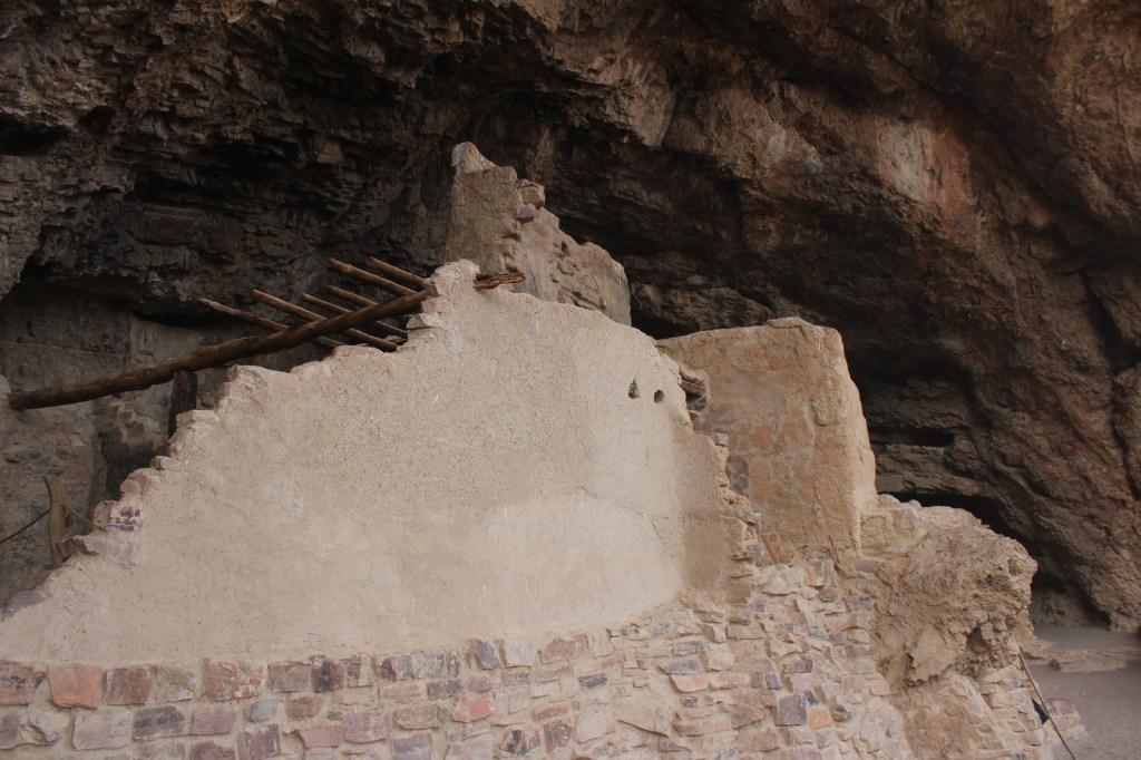
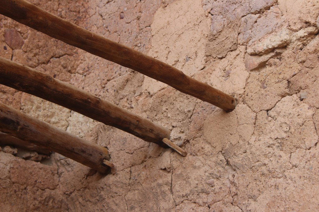
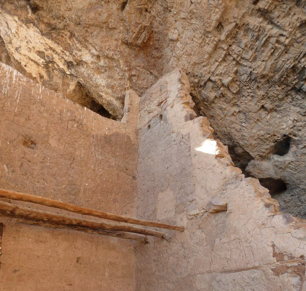
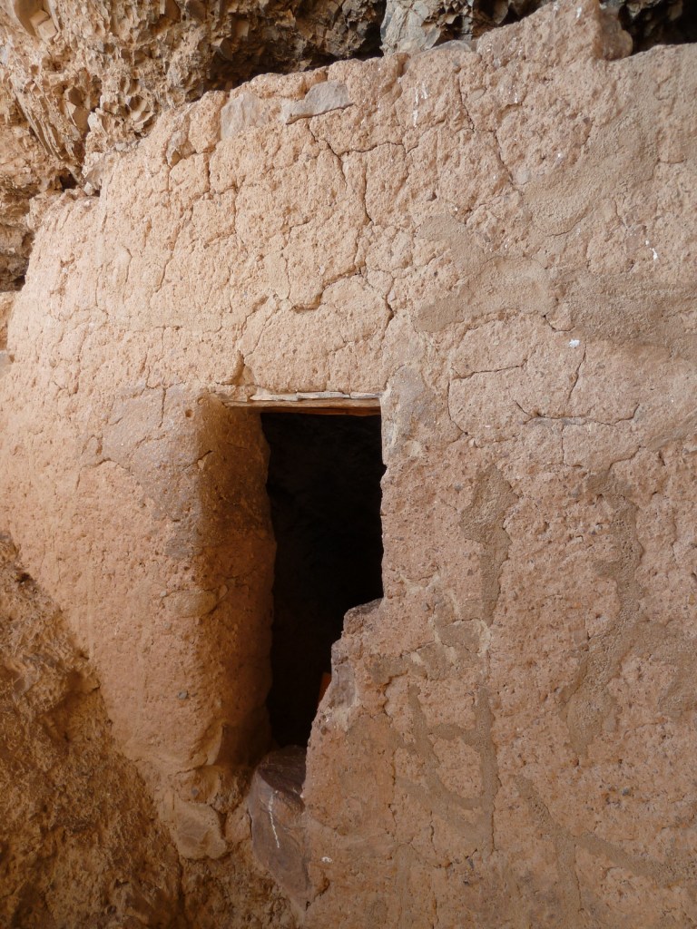
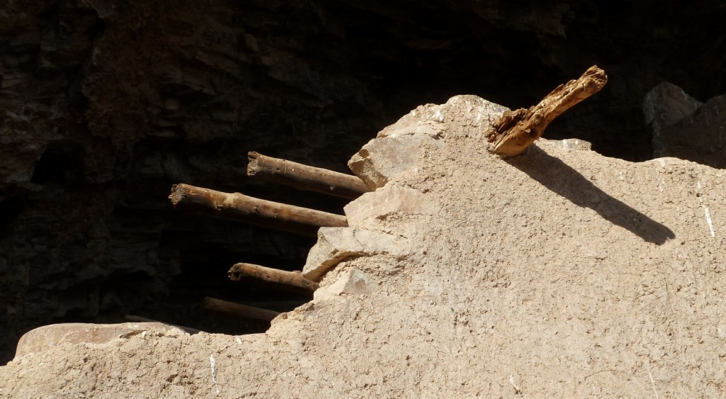
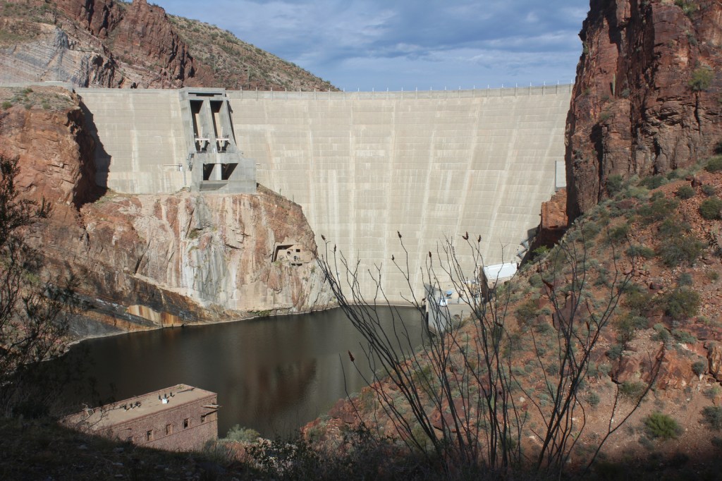
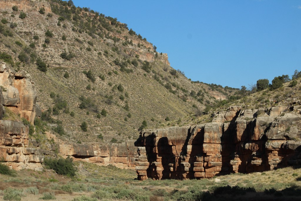
After farming along the Salt River (or Rio Salado) for centuries, in the 1300s the Salado people moved to natural caves where they constructed cliff dwellings. Perhaps following catastrophic flooding or drought, the entire Tonto Basin was abandoned by 1450. When construction of Theodore Roosevelt Dam began in 1906, its namesake President protected these ruins using the power of the 1906 Antiquities Act.
Museum, film, Lower Cliff Dwelling, Upper Cliff Dwelling guided tour
Must-Do Activity
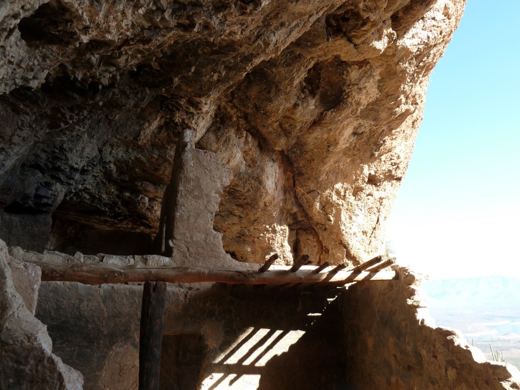
Every visitor who is in good enough shape for the 350 foot ascent should make their way up to Lower Cliff Dwelling (with 28 rooms) after watching the film at the National Park Service visitor center. While at the top, talk to the volunteer stationed there for more information about the people who once inhabited the ruins. Only offered from November through April, the 10 a.m. ranger-guided tour (reservations required) to the Upper Cliff Dwelling (with 40 rooms) crosses washes and ascends 600 feet via switchbacks and 60 steps over a three-mile roundtrip.
Best Trail
The paved trail to the Lower Cliff Dwelling gains 350 feet of elevation in a half-mile, providing excellent views of Theodore Roosevelt Lake.
Photographic Opportunity
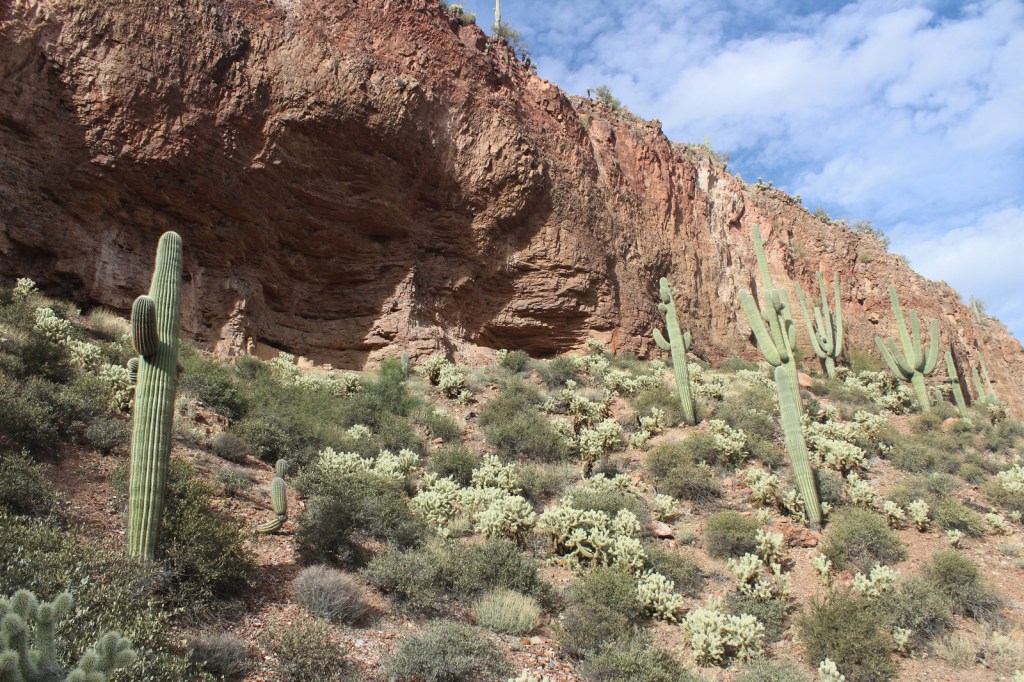
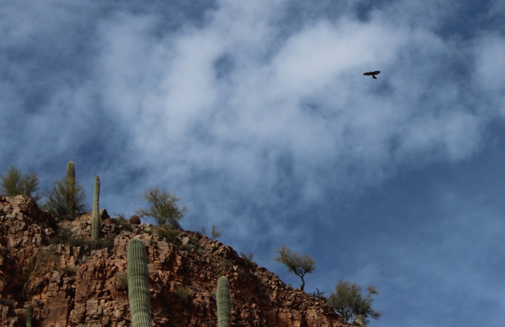
Hiking to Lower Cliff Dwelling is a good introduction to native plants of the Sonoran Desert, including the iconic saguaro cactus, yucca, sotol, cholla, and barrel cactus.
Highway 188 provides paved access to Tonto National Monument between Payson and Globe, while Arizona Highway 88 (“Apache Trail”) is unpaved past Canyon Lake and until December 2024 that section was closed due to a wash out in 2019. Together they make for a beautiful scenic loop drive suitable for high-clearance vehicles.
Camping
There are campgrounds around Theodore Roosevelt Lake and within Tonto National Forest, which also allows dispersed camping in some areas.
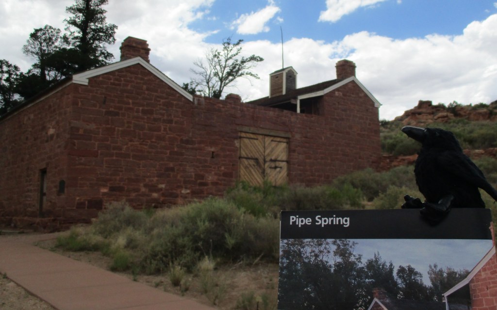
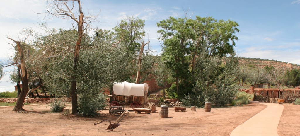
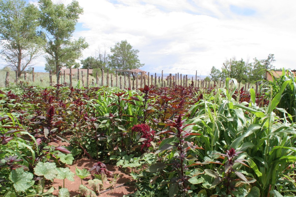
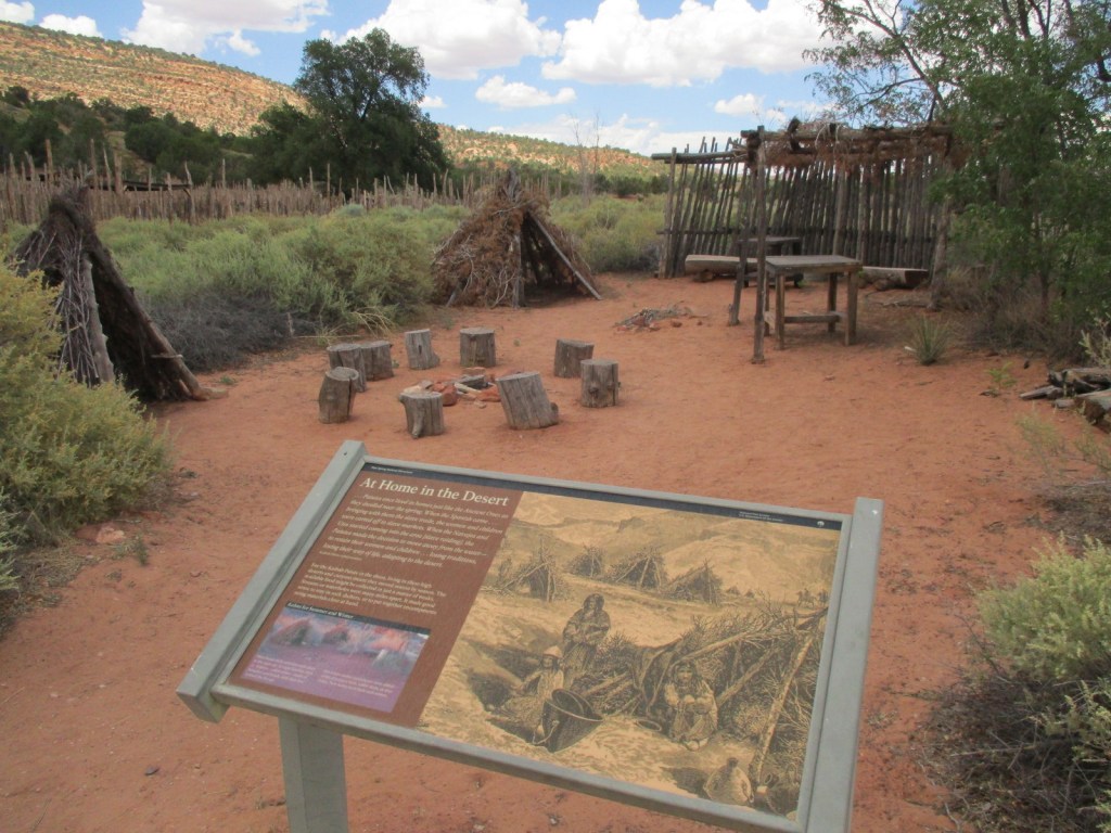
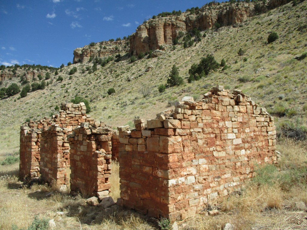
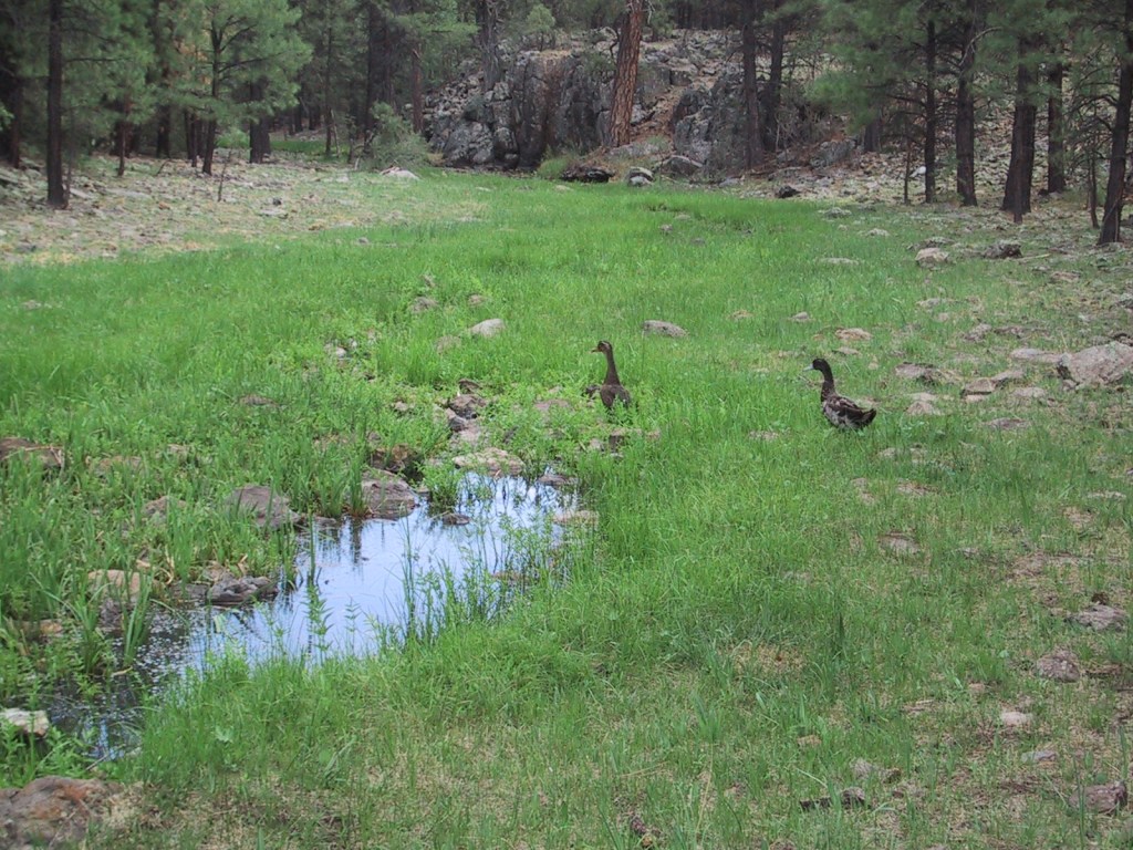
Near the Utah border, Pipe Spring National Monument is located near the turn off from Highway 389 for Grand Canyon-Parashant National Monument and the remote Toroweap Overlook in western Grand Canyon National Park. Likewise, it is only 60 miles from Utah’s famous Zion National Park, so it makes a good stopping point if you are also visiting Kaibab National Forest or the North Rim of the Grand Canyon. The oasis surrounding the three natural springs here demonstrate what this soil can produce when given a little bit of extra water. Ancestral Puebloans and Kaibab Paiute Indians have been coming here for over 1,000 years and it was an important stop on the Old Spanish Trail. In 1858, Pipe Spring was named by Mormon/Latter-day Saint missionary Jacob Hamblin on his way to the Hopi mesas. Following the 1866 Black Hawk War, Mormon settlers built a sandstone fort called Winsor Castle around the source of the main spring where polygamists used to hide their plural wives before selling the ranch in 1895. Today this park on the secluded Arizona Strip is recognized by the International Dark Sky Association.
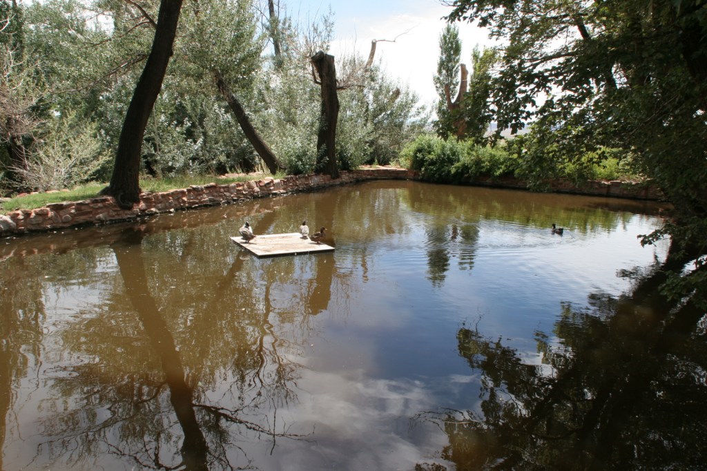
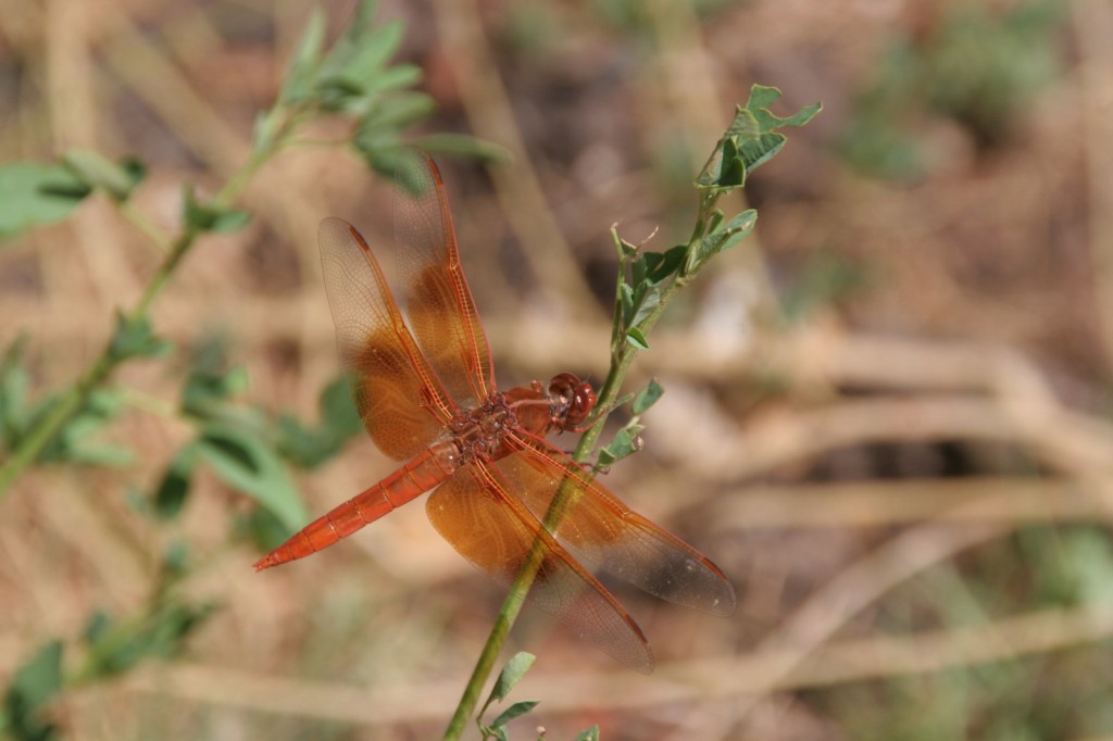
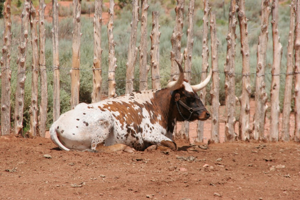
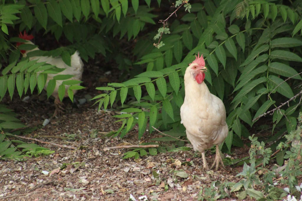
Retention ponds keep Pipe Spring National Monument green in the hot summer months where ducks paddle and dragonflies buzz through the humid air. The National Park Service manages a garden with living history demonstrations given occasionally, plus there is livestock including chickens and two longhorns. When a ranger is present, you can walk around inside Winsor Castle, a Mormon fort that dates back to 1870. If you visit during the summer, we recommend you cool off after some time outside by watching the short film and exploring the museum and gift shop. The museum is co-managed with the Kaibab Band of Paiute Indians whose reservation surrounds the site. On December 7, 2024, the park was open late for the Holiday Traditions event with caroling, Victorian-era crafts, and free food.
Best Trail
The half-mile Ridge Trail leads uphill to an overlook of the Kaibab Plateau and distant Mt. Trumbull in Grand Canyon-Parashant National Monument.
Photographic Opportunity
The modest dimensions of Winsor Castle make it unlikely to be confused with Windsor Castle in England.
There is a paved parking lot located off Highway 389.
Camping
The Kaibab Band of Paiute Indians runs a small campground adjoining Pipe Spring National Monument. Dispersed camping is allowed in Kaibab National Forest and the millions of acres run by the Bureau of Land Management on the Arizona Strip.
Navajo National Monument was created to protect the Keet Seel ruin on the Navajo Nation, although the Ancestral Puebloan people who lived here in the 1200s are more closely related to the Hopi and Zuni. Three years later, the ruins at Betatakin and Inscription House (closed to the public) were added to the National Monument. We had such a great visit that we had to add it to his list of Top 10 National Monuments.
During the pandemic, the National Park Service (NPS) closed all access to the ruins until 2023, but visitors can now reserve spots on the 20-person ranger-led backpacking trips to Keet Seel that are offered twice per month in the summer. This strenuous trip covers 17 miles total with numerous stream crossings and all water must be carried in. The hardest part is at the end, when a 1,000 foot climb awaits, but it is worth it to be one of the few who get to see Keet Seel, the 150-room ruin that is second in size only to Cliff Palace at Mesa Verde National Park. You also get to eat lunch at a surprisingly large waterfall in Keet Seel Canyon. For those looking for a shorter five-mile trip with only 580 feet elevation change, weekend day hikes to Betatakin are led by park rangers (sign up the day before on a first-come, first-served basis).
Best Trail
From the NPS visitor center (which is actually on Navajo land outside the National Monument boundary), the paved Sandal Trail follows the canyon rim to an overlook of the Betatakin cliff dwelling. There are signs explaining the local plant species and their uses by indigenous people on the 1.3-mile out-and-back trail. The 0.8-mile roundtrip Aspen Trail and 0.8-mile Canyon View Trail also leave from the visitor center.
Photographic Opportunity
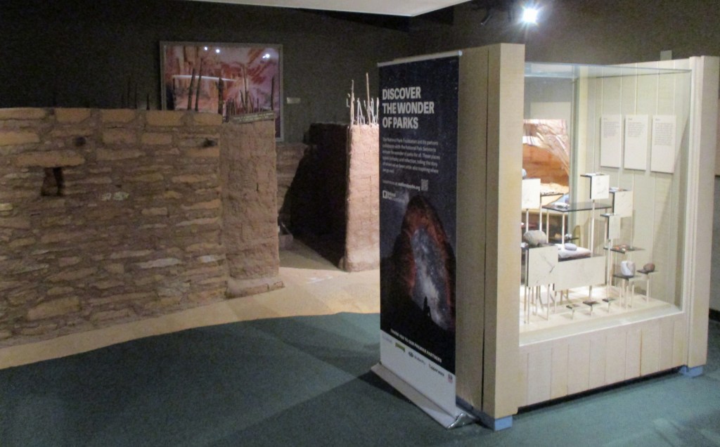
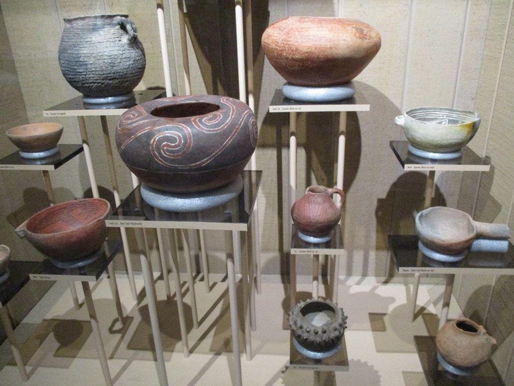
Outside the visitor center, a replica sweathouse and male hogan are on display, plus examples of three-toed dinosaur footprints left in the sandstone. Inside the visitor center, pottery and an example of a family dwelling are on display, plus a short introductory film is offered.
Highway 564 is paved to the visitor center and Sunset View Campground, then a good dirt road leads to the Canyon View Campground and gated trailhead for ranger-led hikes to Betatakin and Keet Seel.
Camping
The free Sunset View Campground has running water and is one of the nicest campgrounds in the entire NPS system (now added to the Top 10 National Park Campgrounds with Running Water). There are vault toilets at Canyon View Campground, which is also free. Campers are limited to a total of seven nights per year at the campgrounds.
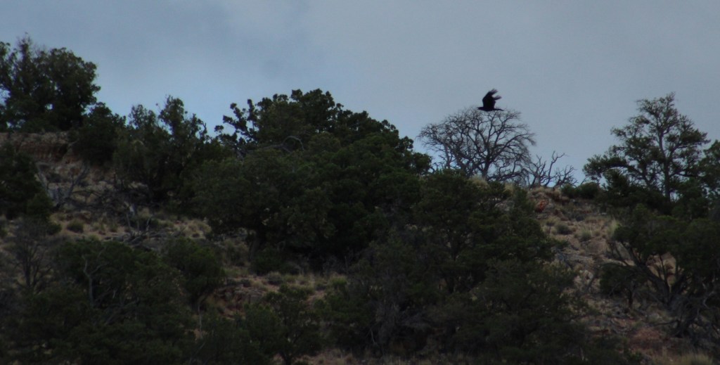
Raven flying through BetatakinSunset View Campground is free and has running waterInside visitor centerGuided backpacking tour to Keet SeelKeet SeelKeet SeelSunset from Sunset View Campground
Explore More – When was the large white fir tree added above the main entrance to Keet Seel cliff dwelling?
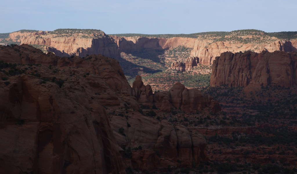
This new National Monument is situated on both the North and South Rim of the Grand Canyon, but outside the boundaries of Grand Canyon National Park. It includes the entirety of the Tusayan District of Kaibab National Forest on the South Rim, as well as two sections east and west of the 9,000-foot Kaibab Plateau on the Arizona Strip. Its name is derived from the Havasupai words Baaj Nwaavjo, which translate as “where indigenous peoples roam,” plus the Hopi term I’tah Kukveni, which means “our ancestral footprints.” According to the Bureau of Land Management (BLM) website it is pronounced “Baahj-Nuh-Waahv-Joh, Ee-Tah-Kook-Venny.” The National Monument was created primarily to prevent future uranium mining claims in this area and further protect evidence of thousands of years of human habitation (see Best Trail).
Red Butte, Hull Cabin, Apex Logging Camp, Grand Canyon Airport Historic District, Marble Canyon, Snake Gulch, Arizona National Scenic Trail
Must-Do Activity
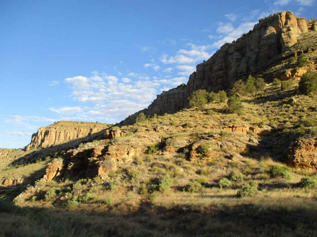
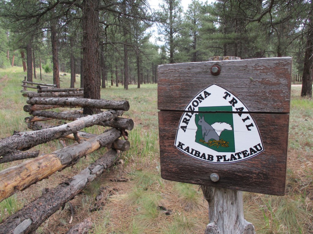
Red Butte is located just east of paved Highway 64/180 on the way to Grand Canyon National Park’s South Rim. A short 3.3-mile out-and-back trail with 912 feet of elevation gain is found at this geological formation sacred to the Havasupai, Hualapai, Navajo, Hopi, and Zuni people. Also in this area, Hull Cabin dates back to 1889 and Apex Logging Camp was situated along the Grand Canyon Railroad between 1928 and 1936 (although not much remains other than the foundation of a one-room schoolhouse). The Arizona National Scenic Trail runs through this part of Kaibab National Forest before entering the Grand Canyon and crossing the Kaibab Plateau.
Best Trail
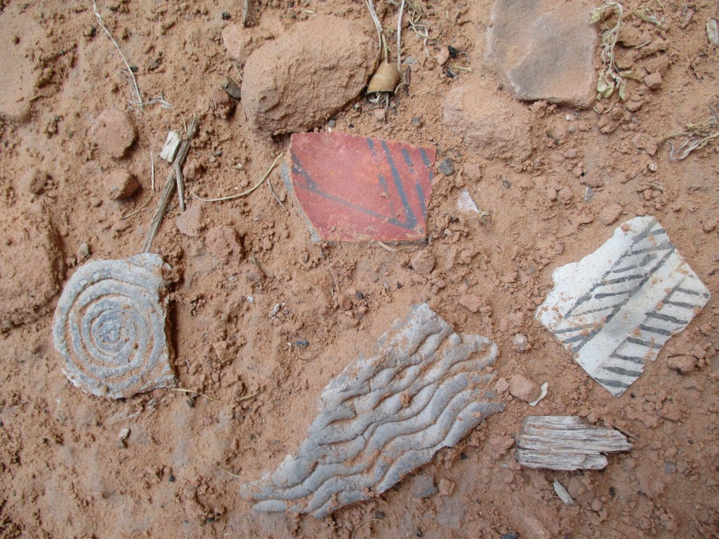
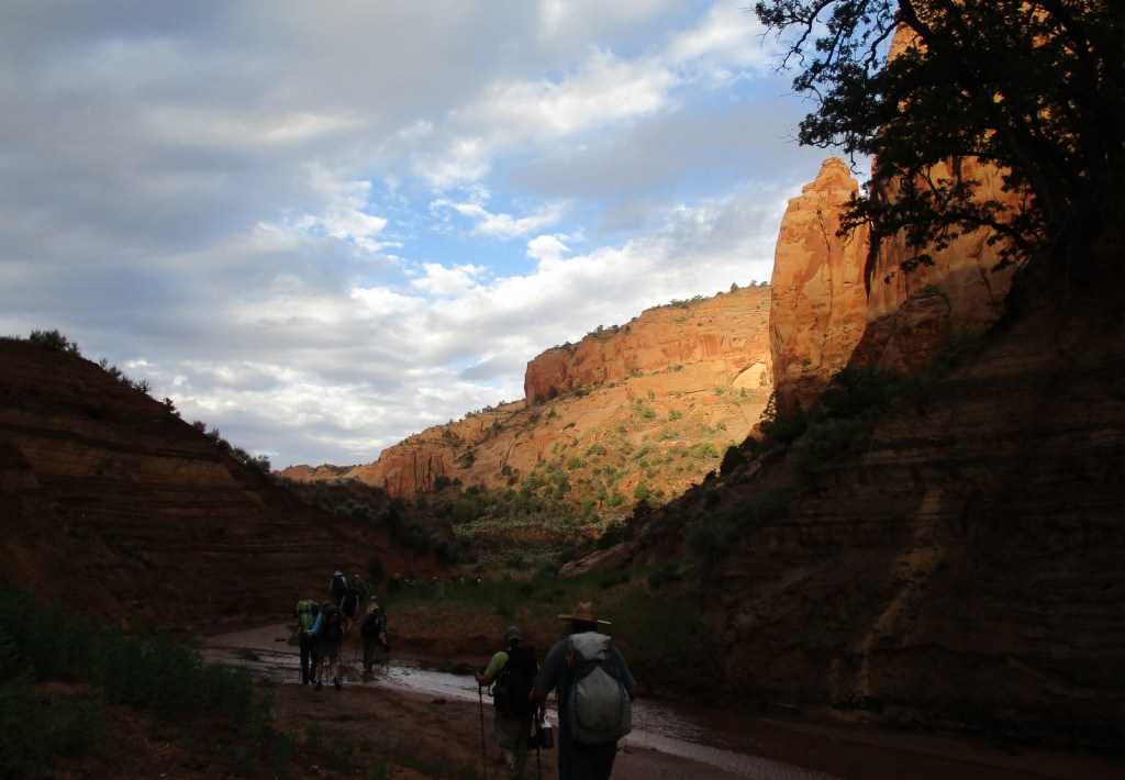
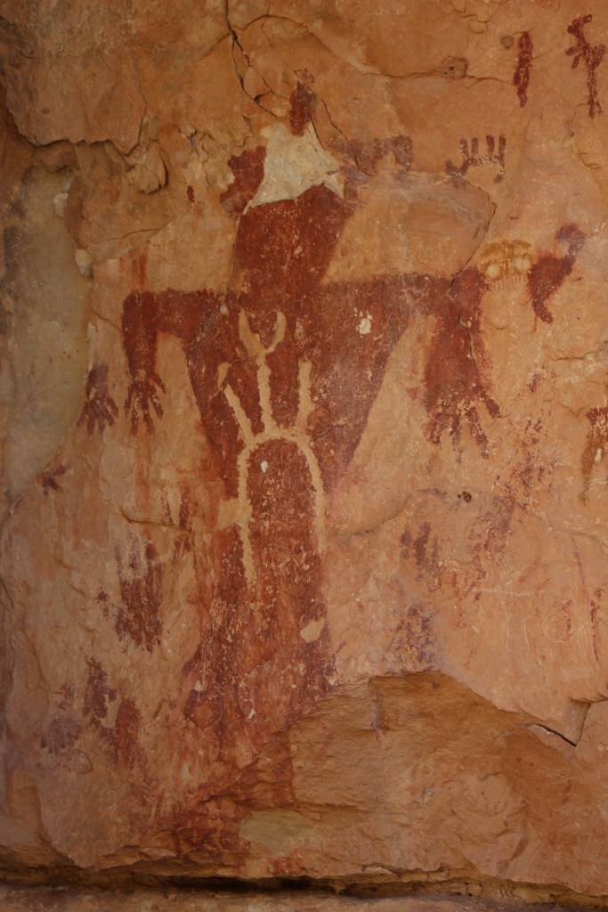
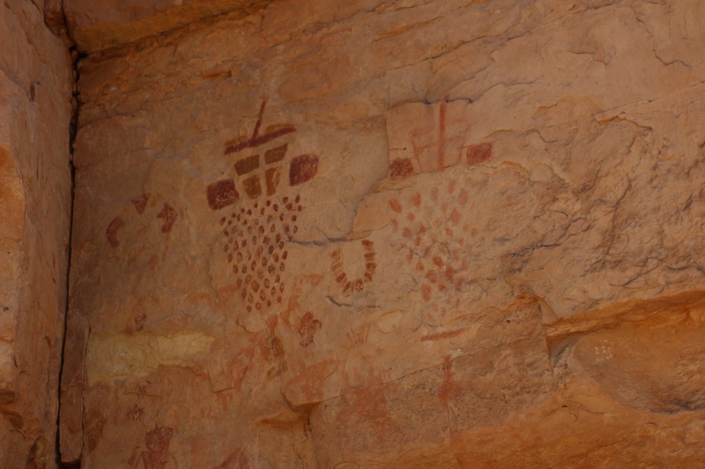
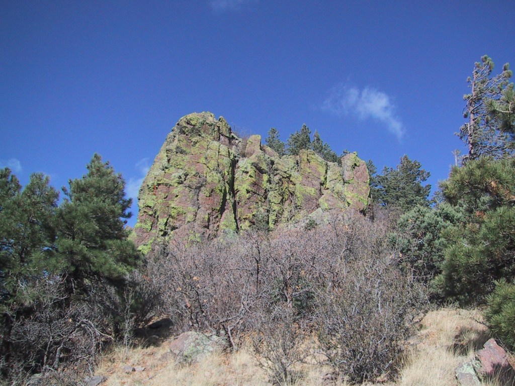
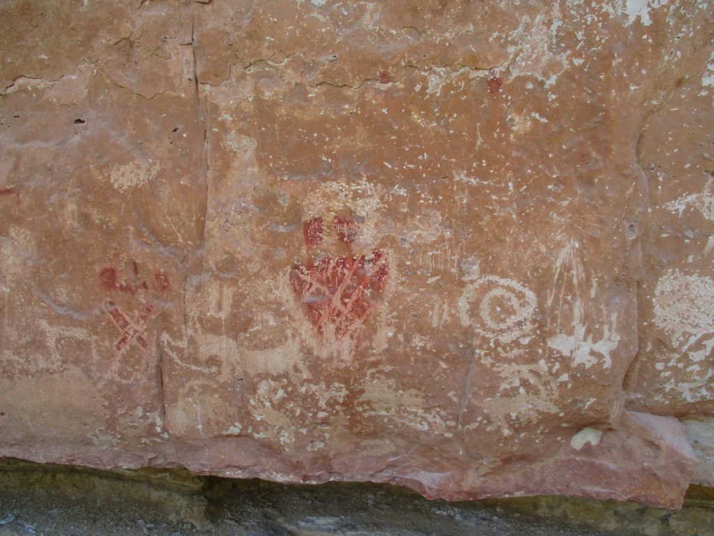
Snake Gulch-Kanab Creek Trail #59 starts at the end of unpaved Forest Road 642 (about five miles from the end of pavement on Forest Highway 22). It soon passes an old homestead and turns left to enter the canyon, part of the extensive Kanab Creek Wilderness (and within the National Monument boundary). The first pictographs can be seen about 2.5 miles in and from then on consistently on the north side of the canyon. The images are primarily done in red paint from the Basketmaker People who resided in this region from 300 BCE to AD 800. We hiked in seven miles then turned around as it started to get really hot in late June, but the trail through the canyon continues 21 miles to where it connects with Ranger Trail #41. Our favorite pictographs were located about four miles in, which would make a good turnaround point for a day hike.
Instagram-worthy Photo
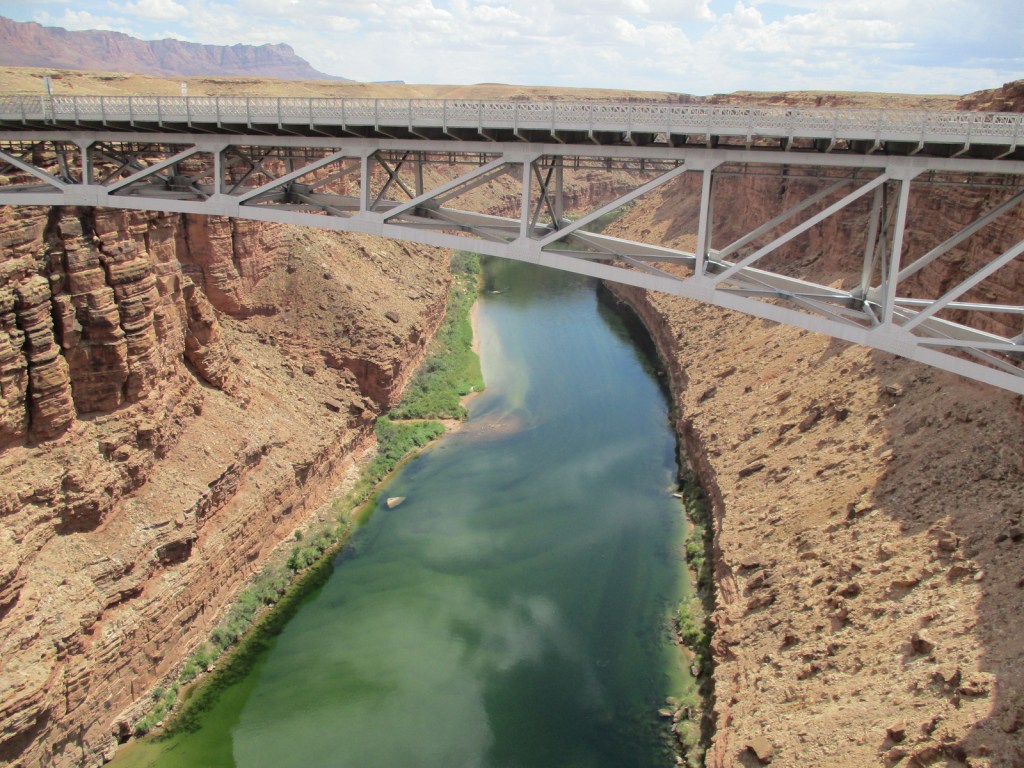
Stop at the historic Navajo Bridge that crosses the Colorado River at Marble Canyon where four public lands meet: Grand Canyon National Park, Glen Canyon National Recreation Area, Vermilion Cliffs National Monument, and Baaj Nwaavjo I’tah Kukveni-Ancestral Footprints of the Grand Canyon National Monument.
Peak Season
Spring and fall, as summer can be very hot
Hours
Navajo Bridge Visitor Center (National Park Service)
There are many unpaved and four-wheel-drive-only roads spread across this area, but Highway 64/180 to the South Rim is paved. High clearance is recommended to access Snake Gulch-Kanab Creek Trailhead. Highway 67 and most Forest Roads on the Kaibab Plateau are closed in winter due to heavy snowfall.
Camping
There are good, dispersed camping options throughout Kaibab National Forest, including along the dirt roads just outside the east entrance of Grand Canyon National Park’s South Rim before entering the Navajo Nation.
Grand Canyon-Parashant National Monument (Arizona)
Pipe Spring National Monument (Arizona)
Snake GulchSnake Gulch-Kanab Creek TrailheadSnake GulchSnake GulchFirst panel of pictographs and petroglyphs on trailSnake GulchPictograph panel about 4 miles inSnake GulchNew Mexico locustRaven about the parkSnake GulchPinyon jaySnake GulchRaven about the park
Explore More – When were beefalo (bison and cattle mix) introduced to the House Rock Valley area west of Marble Canyon (and now found roaming inside Grand Canyon National Park and Kaibab National Forest)?
Kaibab National Forest is located both north and south of Grand Canyon National Park, although the paved road from Jacob Lake to the North Rim is closed throughout the winter months due to heavy snowfall on the 9,000-foot Kaibab Plateau. There are numerous dirt roads to explore on each side of the canyon that in 2023 were encompassed into Baaj Nwaavjo I’tah Kukveni – Ancestral Footprints of the Grand Canyon National Monument (see our next blog post). The Grand Canyon Forest Reserve was first set aside in 1893, then became Kaibab National Forest in 1908 before Grand Canyon National Park was removed from its acreage a decade later. In 1934, the southern Tusayan National Forest was joined to form the present boundaries.
Highlights
Kaibab Plateau Scenic Byway, Hull Cabin, Snake Gulch, Kendrick Peak, Sycamore Canyon, Beale Wagon Road, Overland Road, Bill Williams Mountain, Kanab Creek Wilderness, Thunder River Trail
Must-Do Activity
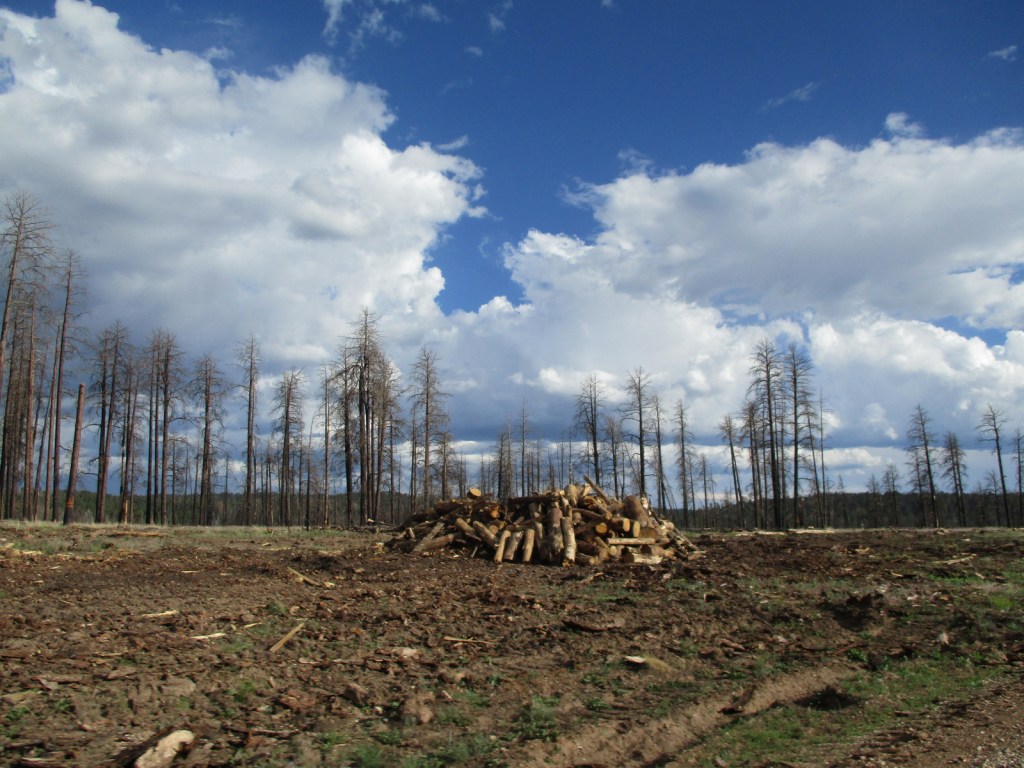
The highest point in Kaibab National Forest is 10,418-foot Kendrick Peak located in the Kendrick Peak Wilderness northwest of Flagstaff, which experienced a large wildfire in 2000. Scott started as a student at Northern Arizona University the next year, and has been able to watch this area recover over the decades since. Seven miles of dirt roads leave Highway 180 to access the Kendrick Mountain Trailhead at 7,980 feet in elevation. A steep, switchbacking 4.6-mile one-way trail partly follows a closed road to the top past Old Lookout Cabin (built in 1912). Bull Basin and Pumpkin Trails also lead to Kendrick Peak, but require more dirt road driving. From the summit, views are good north towards the Grand Canyon and east to the taller San Francisco Peaks within Coconino National Forest.
Best Trail
Bill Williams Mountain dominates the skyline in the town of Williams, the southern terminus of the 65-mile-long Grand Canyon Railway. Several routes climb to the top of the peak, but Bixler Saddle Trail starts higher than the others at 7,700 feet. It is accessed by a rocky road that leads to a small parking area at the saddle. From there the trail gains 1,000 feet in elevation in 2.5 miles before connecting with Bill Williams Mountain Trail to finish climbing a half-mile to the lookout tower at 9,256 feet. No matter how you summit, at the top there are breathtaking views in all directions.
Watchable Wildlife
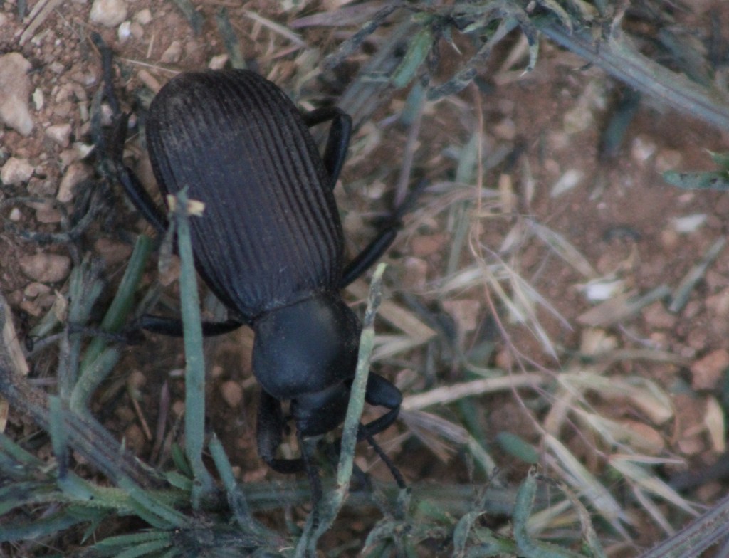
Elk and mule deer are commonly seen on both sides of the Grand Canyon. Apparently, bison were introduced in the early 1900s and now roam freely in the National Forest, in addition to mountain lions, bobcats, and black bears. The canyon formed a natural barrier for the evolution of distantly-related Kaibab squirrels on the North Rim, a subspecies of the Abert’s squirrels found on the South Rim. Common birds include wild turkeys, robins, nuthatches, northern flickers, rufous hummingbirds, Steller jays, American crows, common ravens, and a variety of hawks. Fishing is a popular activity, with some excellent trout streams found in the National Forest.
Instagram-worthy Photo
There are five trailheads that access the 12-mile Sycamore Rim Trail loop, located south of Interstate 40 after driving ten miles of good dirt road. The trail passes through a ponderosa pine forest with overlooks of the Sycamore Canyon Wilderness, also managed by Coconino and Prescott National Forests.
Peak Season
Summer
Fees
None
Road Conditions
The paved road from Jacob Lake, Arizona to the North Rim of Grand Canyon National Park is closed throughout the winter months due to heavy snowfall. There are countless miles of dirt roads on each side of the canyon that access trailheads and allow for dispersed camping.
Camping
There are numerous campgrounds spread throughout the National Forest, as well as rentals of the historic 1917 Spring Valley Cabin and 1889 Hull Cabin (within the newly created Baaj Nwaavjo I’tah Kukveni – Ancestral Footprints of the Grand Canyon National Monument).
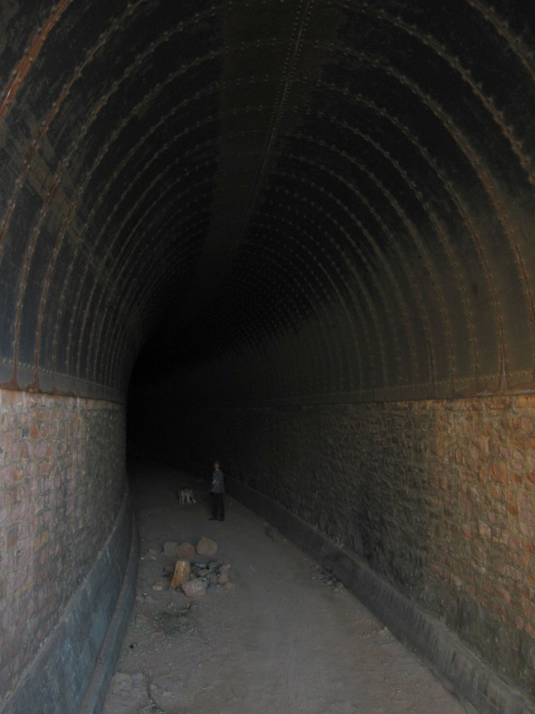
Government Prairie and Kendrick PeakBixler Saddle TrailheadView from atop Bill Williams MountainSycamore Rim Trail Scott and his mother with Wendigo on Sycamore Rim Trail Sycamore Rim Trail Scott and his father with Wendigo on Sycamore Rim Trail Sycamore Rim Trail Sycamore Rim Trail Sycamore Rim Trail Sycamore Rim Trail Johnson Canyon Railway Tunnel Trail outside Kaibab National Forest near WilliamsKaibab Plateau Visitor Center in Jacob LakePictographs on road to Snake GulchRaven about the forest
Explore More – Kaibab is the Paiute name for the Grand Canyon, which translates as what?
Learn more about this and the 154 other National Forests in our new guidebook Out in the Woods
We are a participant in the Amazon Services LLC Associates Program, an affiliate advertising program designed to provide a means for us to earn fees by linking to Amazon.com and affiliated sites.
Start your U.S. National Parks, National Forests, and National Monuments adventure here!