All posts by Raven About The Parks

Bienville National Forest

Bienville National Forest

Mississippi

Managed by U.S. Forest Service, Southern Region

382,821 acres (178,541 federal/ 204,280 other)

Website: https://www.fs.usda.gov/mississippi

Overview

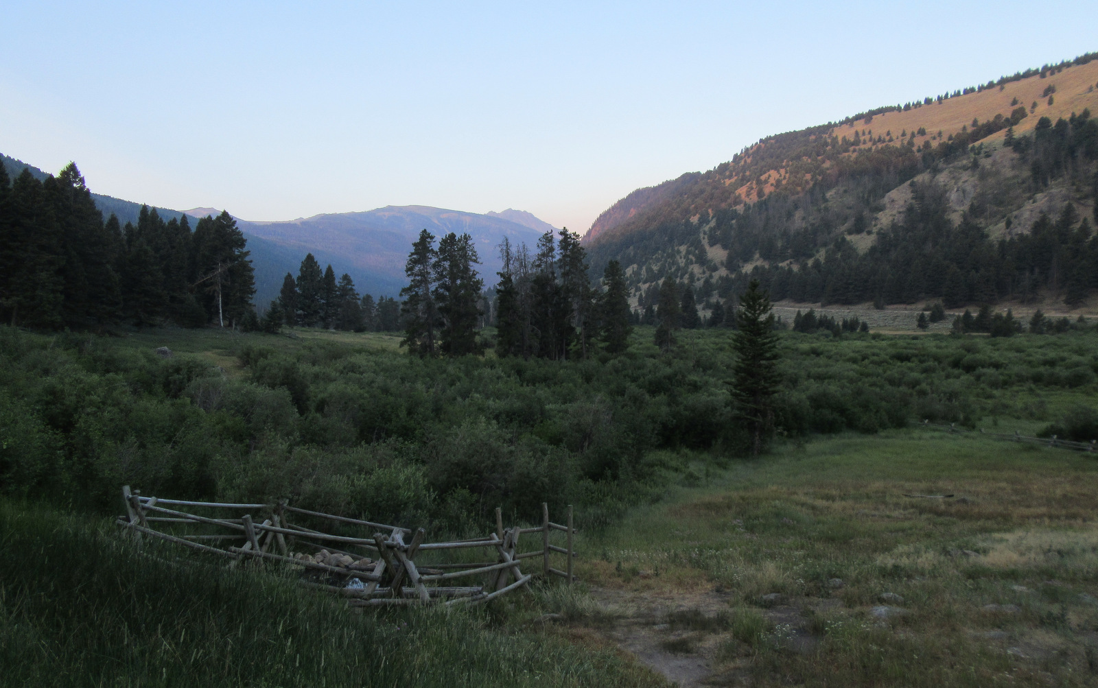
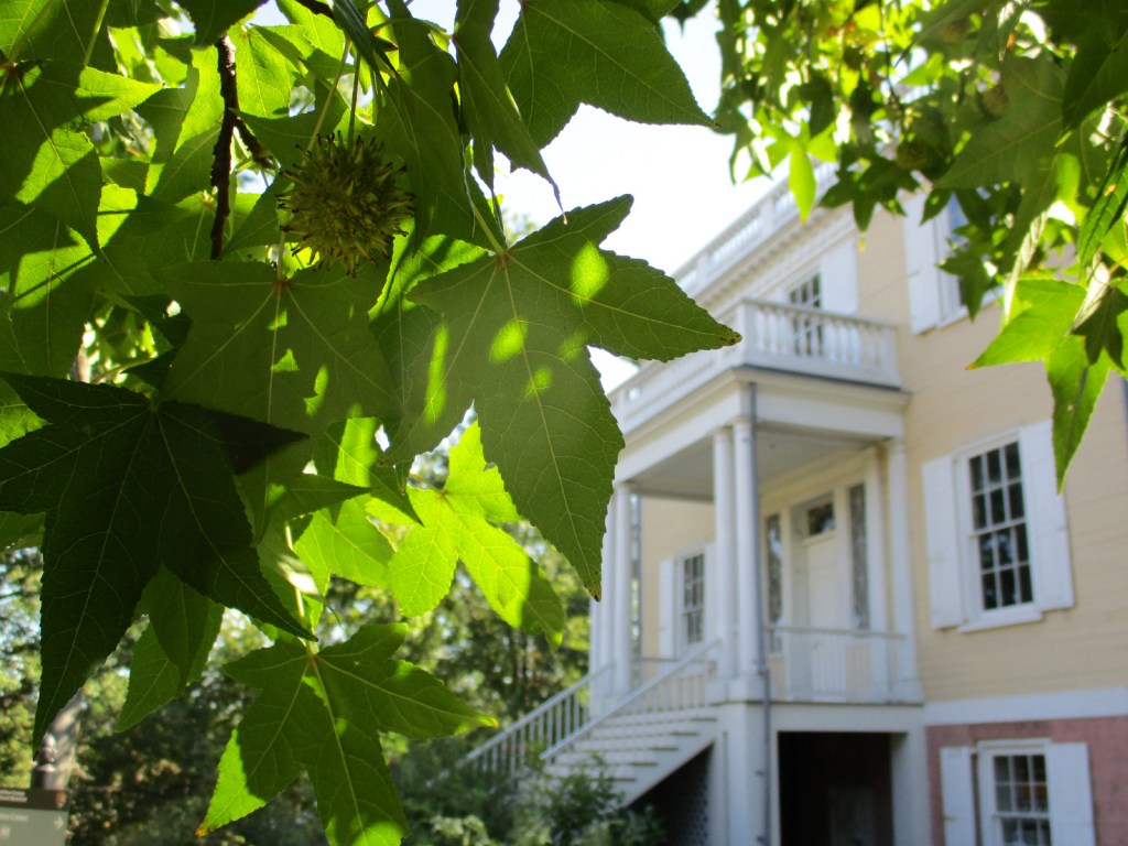
Managed collectively with Mississippi’s five other National Forests, Bienville is centered around the town of Forest, which has numerous rooster statues.  The ranger station is located just south of Interstate 20 and has an interpretive trail that passes a pond on a half-mile loop.  Just north of the freeway, there is Harrell Prairie Hill National Natural Landmark and 189 acres of old-growth forest protected in Bienville Pines Scenic Area (which we could not locate any signs nor trailheads to access).

Highlights

Harrell Prairie Hill National Natural Landmark, Marathon Lake Recreation Area, Coursey Lookout Tower, Shongelo Lake Recreation Area, Shockaloe Horse Trail

Must-Do Activity

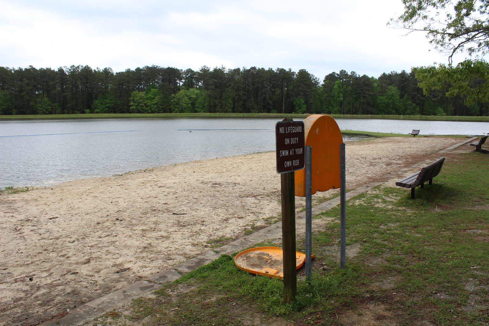
Marathon Lake is 50 acres in size and got its name from Marathon Lumber Company, which closed in 1929.  The lake was built in the 1950s for recreation in the former logging camp.  Bienville National Forest also has the upper courses of the Leaf and Strong Rivers and several other lakes, including five-acre Shongelo Lake (with a swimming area and hiking trail open May to September), 67-acre Beaver Lake (open year round), and 33-acre Greentree Reservoir (open year round).

Best Trail

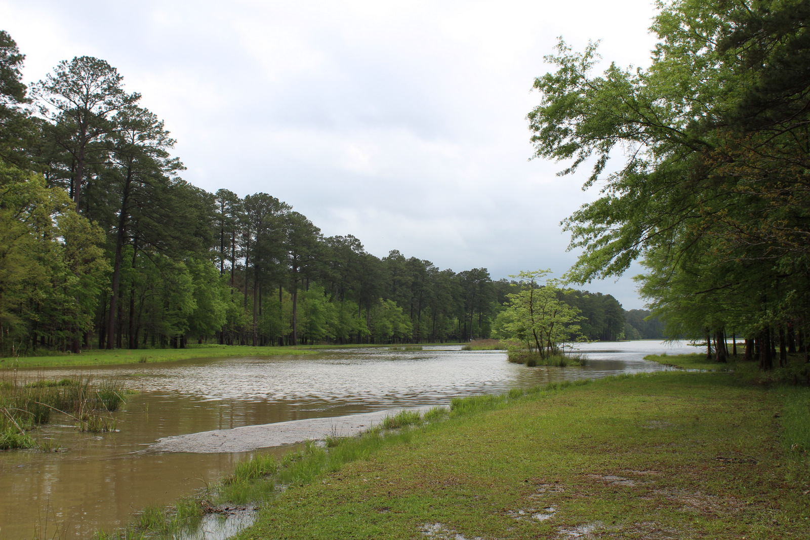
Despite the lake being at flood levels that submerged many parts of the trail, we circumnavigated Marathon Lake in about 1.7 miles and didn’t get our feet wet.  The 22-mile long Shockaloe Horse Trail was too muddy for us to hike in April.
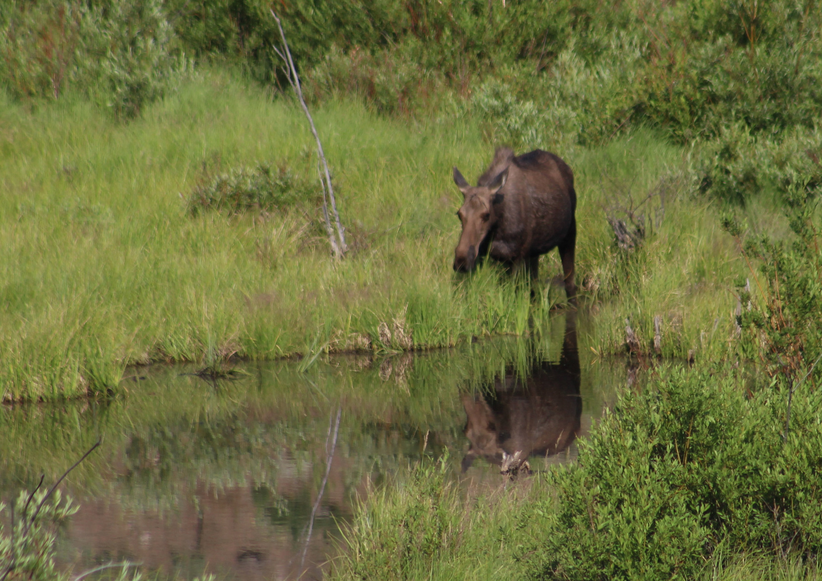
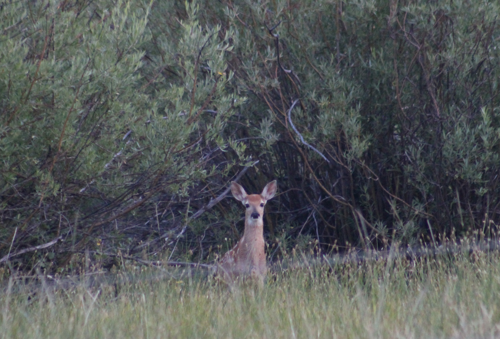
Watchable Wildlife

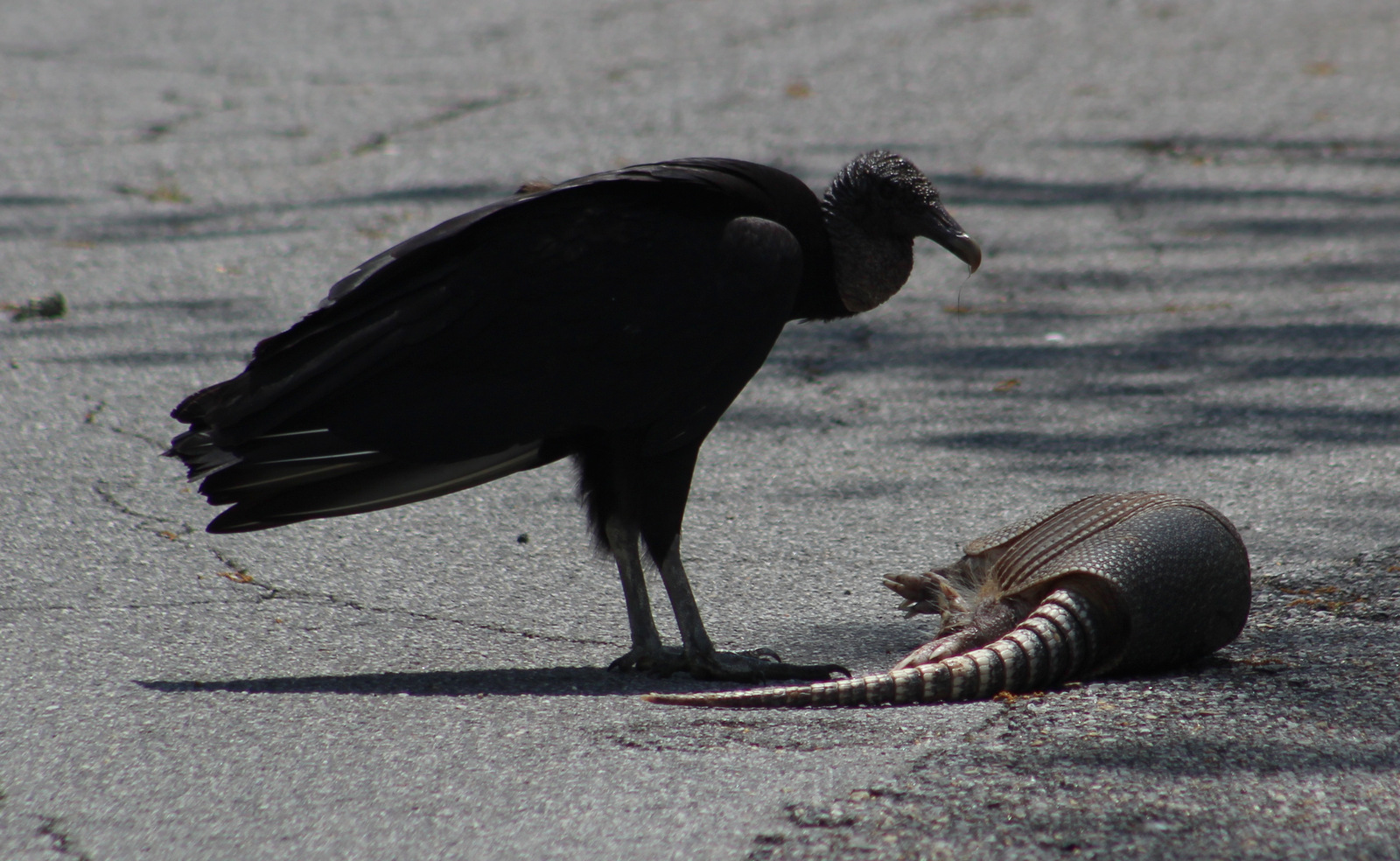
The National Forest’s lakes have largemouth bass, bream, catfish, and crappie that attract fishermen.  At Marathon Lake we saw several great egrets, little blue herons, and a very noisy murder of crows.  Endangered red-cockaded woodpeckers nest in large pines trees (at least 60 years old), especially longleaf pines.  Gray rat snakes can climb trees, so red-cockaded woodpeckers drill small holes around their nesting cavity because fresh pine resin causes the snakes to turn around or slip off the tree.  There are three Wildlife Management Areas within Beinville National Forest that provide hunting opportunities for white-tailed deer, wild turkey, and invasive wild pigs.

Instagram-worthy Photo

Harrell Prairie is the largest and least disturbed alkaline prairie in the state and is burned about every three years to maintain native vegetation.  It is located down Forest Road 518 in Caney Creek Wildlife Management Area, which is closed May 2 to September 14, perhaps to protect wildflowers.
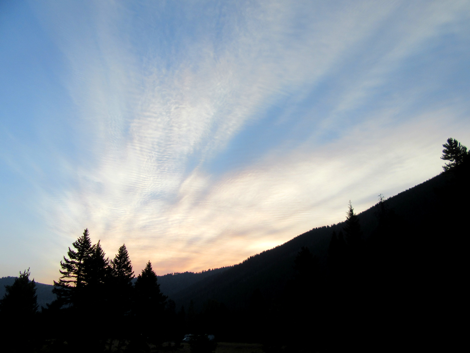
Peak Season

Spring and fall

Fees

There is a $5 day-use fee at Shongalo Lake and Marathon Lake, but no day-use fee at the Shockaloe Trailhead or Greentree Reservoir.
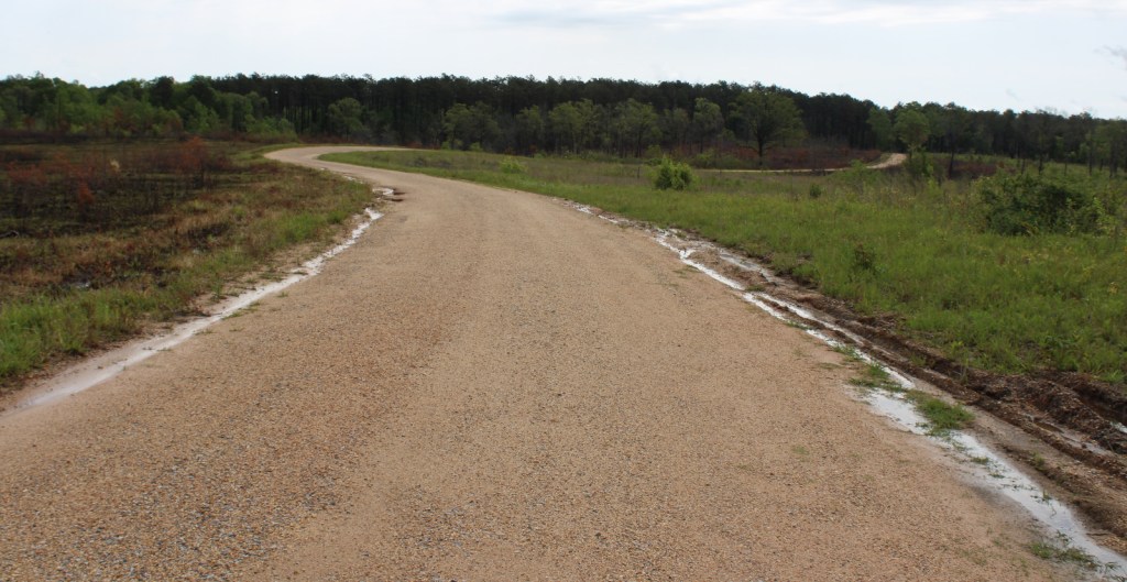
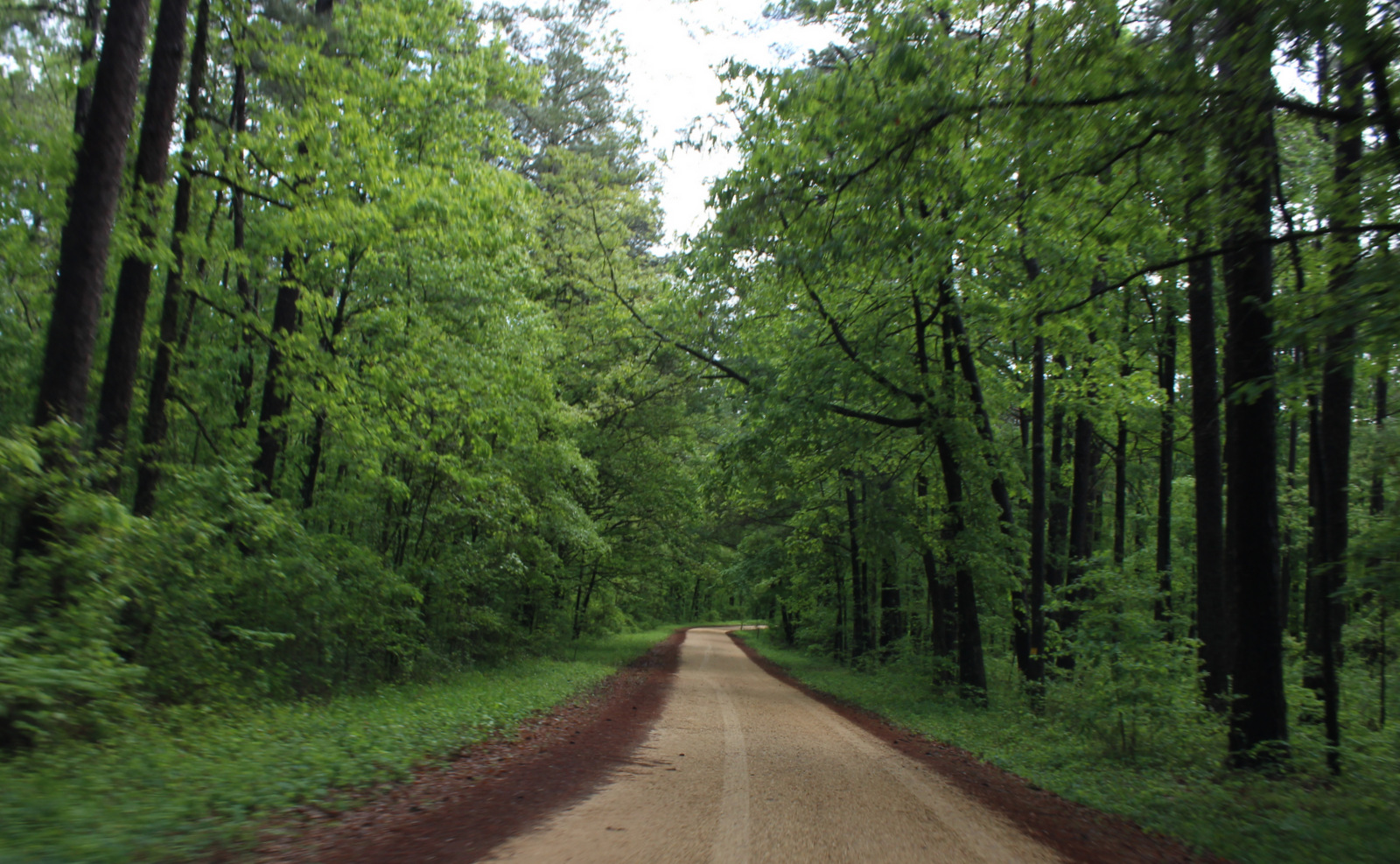
Road Conditions

The dirt roads were in good condition in April, even when the trails were flooded and muddy.

Camping

Marathon Lake has 34 campsites ($20 per night with water and electric hook-ups), a boat ramp, a swimming area, and two bath houses with warm showers.  Camping is only $7 per night at Shockaloe Base Camp I, but no camping is allowed at Base Camp II.

Wilderness Areas

None

Related Sites

Natchez Trace National Scenic Trail (Mississippi-Alabama-Tennessee)

Medgar and Myrlie Evers Home National Monument (Mississippi)

Tupelo National Battlefield (Mississippi)

Nearest National Park

Hot Springs (Arkansas)

Conifer Tree Species

baldcypress, loblolly pine, longleaf pine, shortleaf pine

Flowering Tree Species

white oak, southern red oak, willow oak, overcup oak, blackjack oak, laurel oak, shagbark hickory, winged elm, black gum, tupelo gum, sweetgum, red maple, flowering dogwood, tulip-poplar, sweet bay, southern magnolia, black cherry, loblolly bay, Amerian holly, yaupon holly, dahoon holly, black titi, azalea

Explore More – Bienville National Forest is named after whom?

Beaverhead National Forest

Beaverhead National Forest

Montana

Managed by U.S. Forest Service, Northern Region

2,199,013 acres (2,130,671 federal/ 68,342 other)

Website: https://www.fs.usda.gov/bdnf

Overview

Co-managed since 1996, Beaverhead-Deerlodge National Forest is spread across multiple mountain ranges in the southwest corner of Montana.  The dividing boundaries between the two forests are unclear, though Beaverhead National Forest tends to be more southeast than Deerlodge National Forest and includes portions of the Beaverhead, Bitterroot, Centennial, Gravelly, Madison, Pioneer, Tendoy, and Tobacco Root Mountains.  Bordering Idaho’s Salmon National Forest, 7,323-foot Lemhi Pass is located on the Lewis and Clark National Historic Trail.  This is where the Corps of Discovery crossed the Continental Divide in 1805 and is why the Sacajawea Memorial Area was established here in 1932.

Highlights

Pioneer Mountains Scenic Byway, Lemhi Pass, Sacajawea Memorial, Chief Joseph Pass, Pintler Falls, Upper Potosi Hot Springs, Charcoal Kilns, Gravelly Range Auto Tour, Nez Perce National Historic Trail, Continental Divide National Scenic Trail

Must-Do Activity

It is about a 17-mile drive from Harrison, Montana back to the free Potosi Campground, but it is well signed and worth the effort.  From here a 0.8-mile trail leads to Upper Potosi Hot Springs, a clear 100°F pool with room for about six adults.  Further west, about ten miles north of Highway 278, is the privately owned Elkhorn Hot Springs (fee), a great place to relax after hiking around Big Hole National Battlefield (managed by the National Park Service).  If you keep driving north on Wise River Polaris Road (FR 484), there are plenty of dispersed campsites and trailheads for several long hikes into the Pioneer Mountains.

Best Trail

We only hiked less than a mile trail to Upper Potosi Hot Springs, but that trail keeps climbing three miles to the top of the ridge.  We read good reviews for Louise Lake National Recreation Trail (see note on Road Conditions below), Pioneer Lake National Recreation Trail, Browns Lake Trail, Blue Creek Trail, Sand Lake/Lily Lake Trail, and Gold Butte Trail.  Hopefully we will make it back here to go backpacking someday.

Watchable Wildlife

Beaverhead National Forest still has most of its pre-settlement carnivores: grizzly bears, black bears, mountain lions, Canadian lynx, coyotes, and gray wolves.  Grazing ungulate species include moose, elk, mule deer, white-tailed deer, bighorn sheep, mountain goats, and pronghorns.  We saw bald eagles and ospreys on our drive out from Upper Potosi Hot Springs.  Mountain whitefish, golden trout, cutthroat trout, rainbow trout, brook trout, lake trout, arctic grayling, and burbot are some of the gamefish sought by fishermen.

Instagram-worthy Photo

The ruins of a developed hot springs resort (located on private land) are visible from Upper Potosi Hot Springs.  Watch for moose downhill in South Willow Creek and a cute little garter snake that hangs out in the rocks by the pool (possibly year round if it stays warm enough not to hibernate).

Peak Season

Summer

Fees

None

Road Conditions

The dirt roads to Potosi Campground and over Lemhi Pass are both in very good condition, but we do not know about all the other dirt roads that cross the Continental Divide.  We read the access road to Louise Lake National Recreation Trail is pretty rough, requiring four-wheel drive the last two miles.

Camping

There are more than 20 spots to set up at Potosi Campground, which is free and located near the trailhead for Upper Potosi Hot Springs.  You will want a high-clearance vehicle to drive across South Willow Creek to the official trailhead, but there are also pedestrian bridges.

Wilderness Areas

Anaconda-Pintler Wilderness (also in Deerlodge and Bitterroot National Forests)

Lee Metcalf Wilderness (also in Gallatin National Forest)

Related Sites

Deerlodge National Forest (Montana)

Big Hole National Battlefield (Montana)

Grant-Kohrs Ranch National Historic Site (Montana)

Nearest National Park

Yellowstone (Wyoming-Montana-Idaho)

Conifer Tree Species

lodgepole pine, whitebark pine, ponderosa pine, Douglas-fir, Engelmann spruce, subalpine fir, subalpine larch

Flowering Tree Species

quaking aspen, balsam poplar, Bebb willow, sagebrush

Explore More – How tall is Hilgard Peak, the highest point in Beaverhead National Forest?

Flaming Gorge National Recreation Area

Flaming Gorge National Recreation Area

Wyoming, Utah

Managed by U.S. Forest Service, Ashley National Forest

207,363 acres

Website: https://www.fs.usda.gov/attmain/ashley/specialplaces

Overview

Flaming Gorge National Recreation Area surrounds the Flaming Gorge Reservoir that straddles the Wyoming-Utah border in the northern portion of Ashley National Forest.  The partially-submerged canyon was named by John Wesley Powell who in 1869 started his expedition down the Colorado River near the headwaters of the Green River.  The reservoir has 360 miles of shoreline, five full-service marinas, and numerous boat launches and campgrounds.

Highlights

Sheep Creek National Geological Area, Flaming Gorge-Uinta Scenic Byway, Cart Creek Bridge, Flaming Gorge Dam, Red Canyon Recreation Complex, Green River, Firehole Canyon

Must-Do Activity

The top activities in Flaming Gorge National Recreation Area are boating and fishing, as the reservoir is known for its large population lake trout, as well as kokanee salmon, rainbow trout, brown trout, smallmouth bass, channel catfish, and burbot.  Ice fishing is available in the winter, as are trails for snowmobiling and cross-country skiing.  Southwest of the reservoir, Sheep Creek National Geological Area offers a scenic drive through nine rock formations with interpretive signs.  Downstream from the dam, the Green River is a rafting destination.

Best Trail

Little Hole National Recreation Trail runs 7.2 miles along the Green River from the Flaming Gorge Spillway to the Little Hole boat ramp.  Canyon Rim Trail starts at the Red Canyon Overlook and follows the canyon rim for 1.5 miles before cutting three miles towards the Greendale Overlook.

Instagram-worthy Photo

The Flaming Gorge Dam stands 502 feet high and is crossed by Highway 191 on the Flaming Gorge-Uinta Scenic Byway, as is beautiful Cart Creek Bridge.

Peak Season

Summer

Fees

Every boat launch and day-use area requires a recreation pass ($5 per day, $15 per week, or America the Beautiful pass), but there is no fee to drive the Flaming Gorge-Uinta Scenic Byway or across the dam.

Road Conditions

The 82-mile long Flaming Gorge-Uinta Scenic Byway is paved the whole way, but there are many unpaved roads including popular Red Canyon and Sheep Creek National Geological Area.  Access roads to boat ramps at Lucerne Valley, Antelope Flat, Cedar Springs, Mustang Ridge, Buckboard Crossing, and Firehole Canyon are paved.

Camping

There are numerous campgrounds on and off the lake, mostly open May to September, although Dripping Springs is open year round.

Related Sites

Canyonlands National Park (Utah)

Glen Canyon National Recreation Area (Arizona-Utah)

Lake Mead National Recreation Area (Nevada-Arizona)

Nearest National Park

Arches (Utah)

Explore More – When was the Flaming Gorge Dam completed?

Ashley National Forest

Ashley National Forest

Utah, Wyoming

Managed by U.S. Forest Service, Intermountain Region

1,402,656 acres (1,382,346 federal/ 20,310 other)

Website: https://www.fs.usda.gov/ashley

Overview

Ashley National Forest is located on the Utah-Wyoming border and includes the High Uintas Wilderness and Flaming Gorge National Recreation Area (which we will discuss in our next blog post).  The Uinta Mountains are a popular destination for campers, hikers, mountain bikers, horseback riders, and anybody who is into magnificent mountain peaks and picturesque lakes.  It is one of the few east-west running ranges in North America and includes the highest point in Utah: 13,528-foot tall Kings Peak.  In 2019, Congress set aside 173,475 acres of the National Forest as the Ashley Karst National Recreation and Geologic Area, the first such designation in the U.S.

Highlights

Flaming Gorge National Recreation Area, Red Cloud Loop Scenic Backway, Flaming Gorge-Uinta Scenic Byway, Indian Canyon Scenic Byway, Outlaw ATV Trail, Moon Lake, Strawberry Peak, Swett Ranch, Kings Peak, Highline Trail

Must-Do Activity

The High Uintas Wilderness is a premier backpacking destination with numerous lakes and 545 miles of trails.  The Wilderness is actually found in both the Wasatch and Ashley National Forests, but not Uinta National Forest.  Even if that makes sense to you, you will probably still need a good map to navigate your way to the highest point in Utah.  Summiting Kings Peak is a minimum 30 miles roundtrip from the Henrys Fork Trailhead in Wasatch National Forest to the north, and even further from the southern trailheads.

Best Trail

We backpacked into the High Uintas Wilderness on a 41-mile lollipop loop leaving from the Uinta Canyon Trailhead.  The first portion along the Uinta River Trail was flat, then started climbing when we split off on the Chain Lakes-Atwood Trail to cross Roberts Pass and Trail Rider Pass into Painter Basin, a beautiful area that sits below Kings Peak.  At more than 90 miles in length, the Highline Trail runs east-west through the area and is accessible from many side-trails, including the ones we were on.

Watchable Wildlife

Flaming Gorge Reservoir is known for its large population lake trout, as well as kokanee salmon, rainbow trout, brown trout, smallmouth bass, channel catfish, and burbot.  The reservoir also hosts a large nesting colony of ospreys, as well as many other raptors.  In the mountains, watch for moose, elk, mule deer, mountain goats, and black bears.

Instagram-worthy Photo

Leaving from the Uinta Canyon Trailhead, after about an hour of walking the Uinta River Trail reaches a bridge across its namesake.  The river is popular with fisherman and we spotted a moose grazing near the water.

Peak Season

Summer

Fees

Every boat launch and day-use area in Flaming Gorge National Recreation Area requires a recreation pass ($5 per day, $15 per week) or America the Beautiful pass, but there is no charge to drive the Flaming Gorge-Uinta Scenic Byway or cross the dam.  We did not encounter any fees in the rest of Ashley National Forest, except in campgrounds.

Road Conditions

The 82-mile Flaming Gorge-Uinta Scenic Byway is paved the whole way, but there are many unpaved roads off it including access to popular Red Canyon and Sheep Creek National Geological Area.  Many roads are closed seasonally, like Red Cloud Loop and Spirit Lake Scenic Backways.

Camping

There are numerous campgrounds on and off the lake in Flaming Gorge National Recreation Area, mostly open May to September, although Dripping Springs is open year round.  There are also campgrounds near most of the trailheads that access the High Uintas Wilderness.  We found dirt roads off Highway 191 to be packed with dispersed campers and RVs in mid-July 2020.

Wilderness Areas

High Uintas Wilderness (also in Wasatch National Forest)

Related Sites

Dinosaur National Monument (Utah-Colorado)

Timpanogos Cave National Monument (Utah)

Fossil Butte National Monument (Wyoming)

Nearest National Park

Arches (Utah)

Conifer Tree Species

lodgepole pine, limber pine, ponderosa pine, pinyon pine, Douglas-fir, subalpine fir, white fir, Engelmann spruce, Rocky Mountain juniper

Flowering Tree Species

quaking aspen, blue elderberry, Gambel oak, bigtooth maple, boxelder, western birch, red osier dogwood, narrowleaf cottonwood, sagebrush

Explore More –Ashley National Forest is named after whom?

Top 10 National Memorials

We recently posted about Saint Francis Dam Disaster National Memorial and Monument, so now feels like the perfect time to release this Top 10 List.  That is the only National Memorial managed by the U.S. Forest Service, but there are 31 in the National Park Service (NPS) system, and it only seems like all of them are in Washington, D.C. where the Dwight D. Eisenhower National Memorial opened in 2021.  There are many others not run by the NPS, and we have not been to all of them yet, but these are our favorites.  Click here to see all our Top 10 Lists.

10. Franklin Delano Roosevelt Memorial (District of Columbia)

Opened in 1997, this series of sculptures is appropriately wheelchair-accessible

9. Fort Caroline National Memorial (Florida)

The original French fort has never been found (and is probably underwater), but you can tour a one-third scale reconstruction of the triangular structure based upon a drawing from 1564

8. General Grant National Memorial (New York)

Often referred to as Grant’s Tomb, this 150-foot tall marble and granite rotunda is the largest mausoleum in North America

7. Perry’s Victory and International Peace Memorial (Ohio)

This 352-foot tall memorial tower is located on South Bass Island in western Lake Erie

6. Lincoln Memorial (District of Columbia)

This iconic building at the west end of the National Mall receives around 7-million visitors annually

5. Flight 93 National Memorial (Pennsylvania)

As far we are aware, the only National Memorial representing the 21st century

4. Wright Brothers National Memorial (North Carolina)

The brothers’ momentous 12-second flight occurred here on December 17, 1903

3. Coronado National Memorial (Arizona)

There is no statue of Coronado, but there is a steep three-quarter mile trail to a 600-foot long limestone cave

2. Pearl Harbor National Memorial (Hawaii)

The memorial built atop the sunken U.S.S. Arizona is tasteful and beautiful

…and finally our #1 National Memorial:

1. Mount Rushmore National Memorial (South Dakota)

Inspiring during the day, but for the full effect do not miss the Evening Lighting Ceremony offered May through September

Honorable Mentions

Theodore Roosevelt Island National Memorial (District of Columbia)

Washington, D.C. is full of memorials (even the Washington Monument counts), but this one is the most unique

Martin Luther King, Jr. National Memorial (District of Columbia)

Simple yet stunning, this statue of MLK is surrounded by some of his best quotes

Hamilton Grange National Memorial (New York)

Alexander Hamilton’s house is the only memorial built by the person it honors, though it has been moved twice since his death