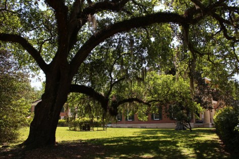
Originally called California National Forest in 1908, this area between Interstate 5 and Highway 101 was renamed Mendocino National Forest 24 years later. It stretches north-south along the Coast Range covering parts of six counties north of San Francisco. Similar to Los Padres National Forest, it contains rocky serpentine ridgelines where only specially adapted plants can tolerate the heavy metals in the soil, like Sargent cypress and the shorter McNab cypress. Both species can be found along Frenzel Creek near Little Stoney Campground. In 1953, a Forest Service employee and 14 volunteer firefighters died in the Rattlesnake Fire and a memorial overlooking Rattlesnake Canyon is located off Forest Highway 7 on Alder Springs Road. Mendocino National Forest includes the northern portion of Berryessa Snow Mountain National Monument (see our full blog post), established in 2015 and administered in cooperation with the Bureau of Land Management.
Know someone who loves the National Forests? Gift them our travel guidebook Out in the Woods so they can learn more about all 155 National Forests.
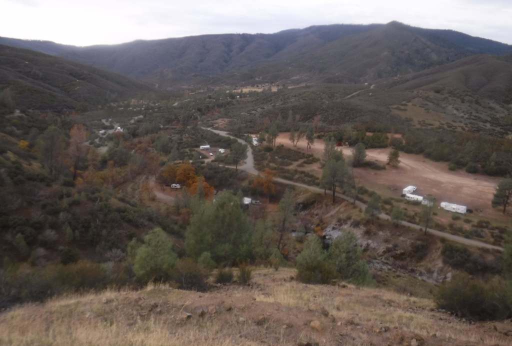
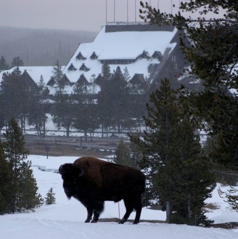
There are 18 National Forests in California (the most of any state), but Mendocino is the only one not crossed by a paved highway. It is a wonderful destination for outdoor recreation, both motorized and non-motorized, including Hull Mountain which is popular with hang gliders. Lake Pillsbury is 2,280 acres and offers boat ramps, campgrounds, and a resort, while 35-acre Letts Lake has a campground and access to hiking trails.
Best Trail
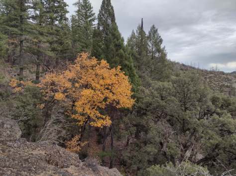
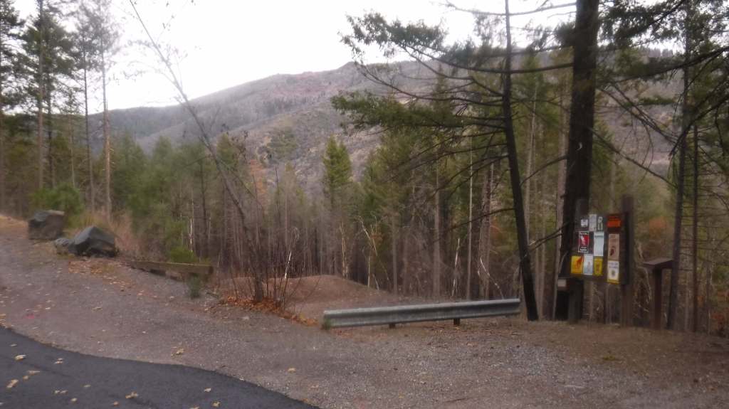
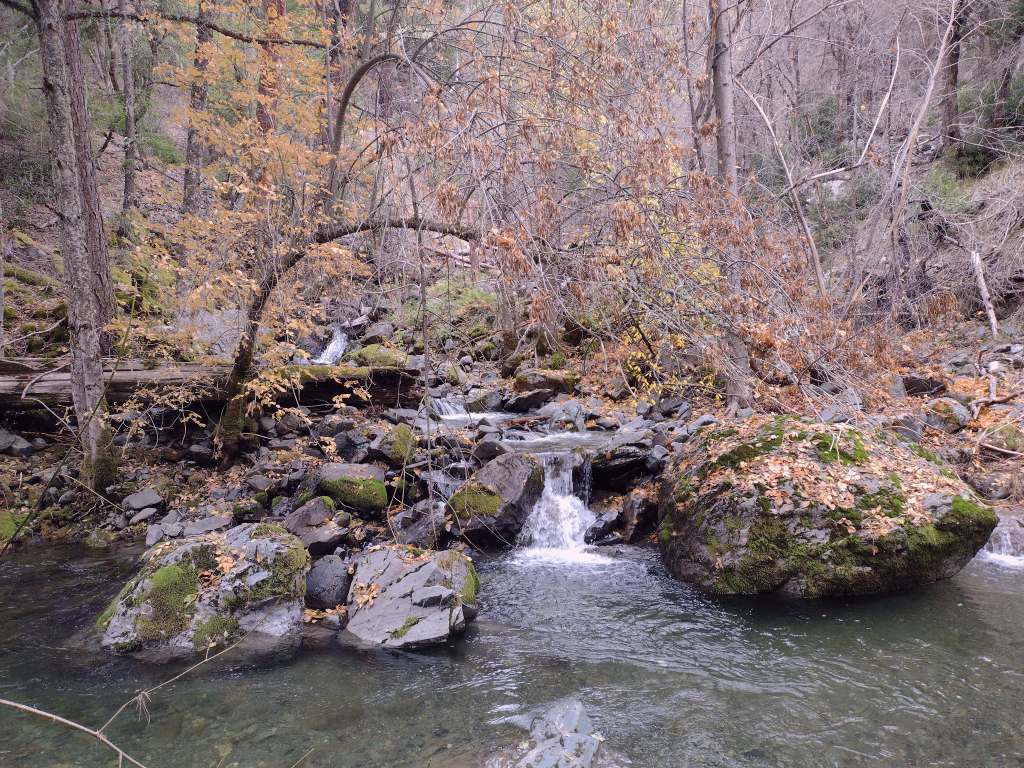
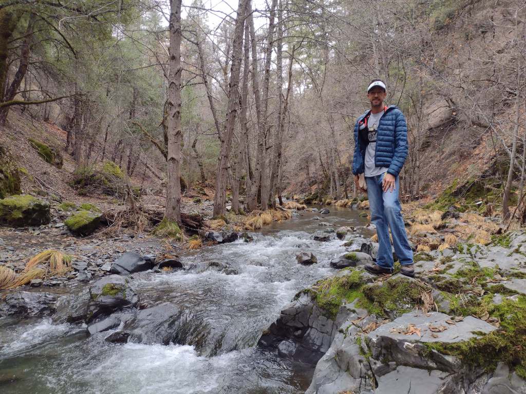
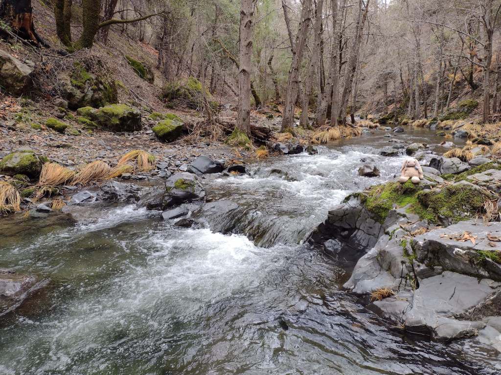
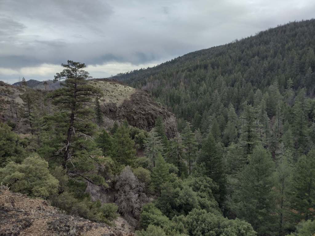
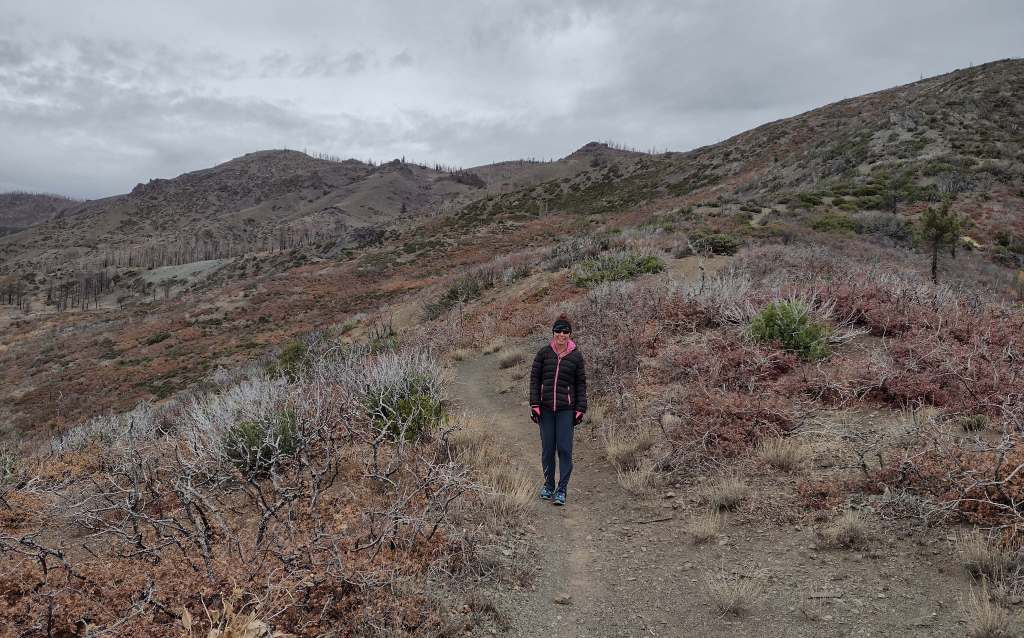
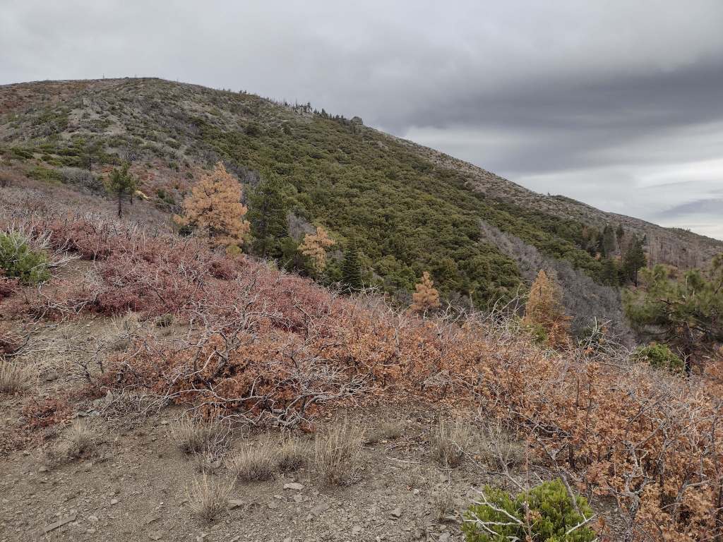
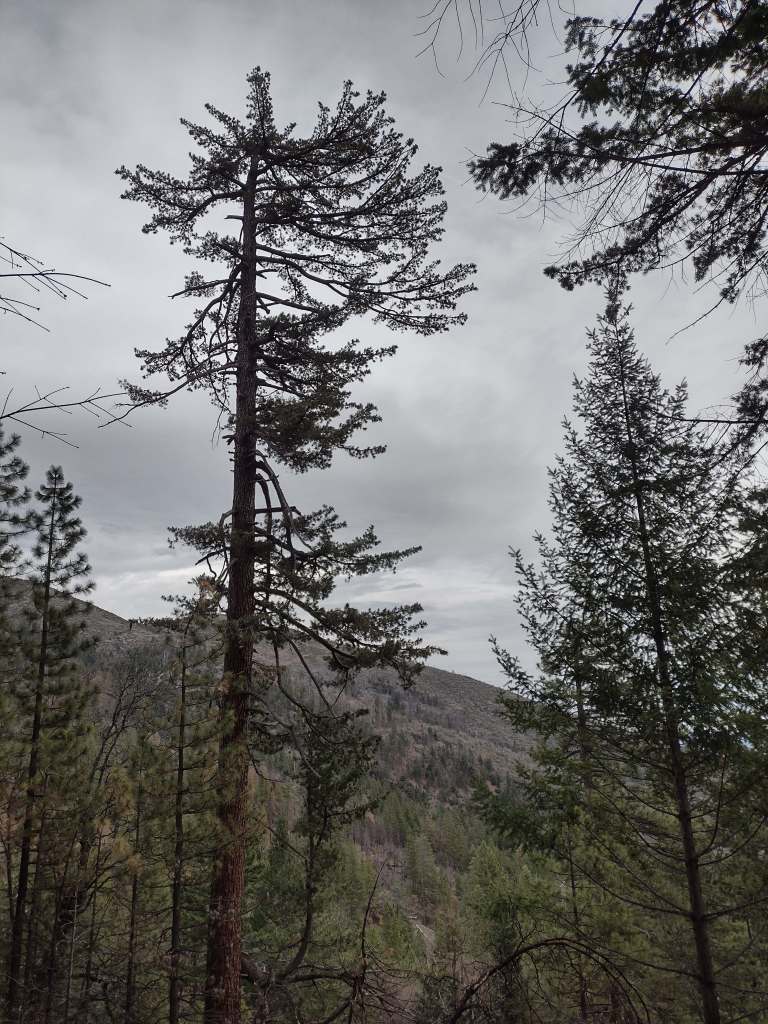
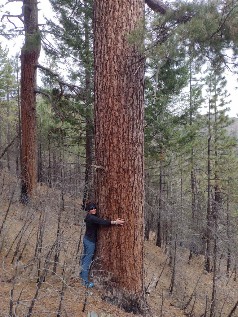
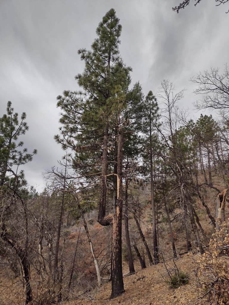
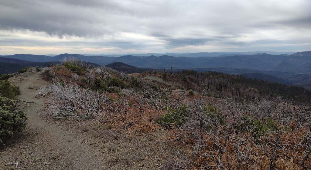
As we drove the winding road from Stonyford to the tiny roadside pullout for Deafy Glade Trail, we passed campgrounds full of RVs that were getting ready for a motorcycle event. Our hike took us far from any road noise, as we dropped down to and waded across the frigid South Fork of Stony Creek and then climbed steeply to 5,300 feet in elevation. The trail continued to the summit of 7,056-foot Snow Mountain, but we already had great views of the Rice Valley and decided to turn around at the 4.5-mile point, just inside the official boundary of the Snow Mountain Wilderness. We expected a desolate landscape after reading about recent fires, but about three-quarters of the trees along the trail were still alive and showed only minor charring at their bases.
Watchable Wildlife
Mendocino National Forest protects a biodiverse area home to tule elk, black-tailed deer, river otters, black bears, and mountain lions. Rivers that drain these highlands are used by California coastal chinook salmon and Northern California steelhead. Fishing in the lakes is a popular activity and a chance to see ospreys and bald eagles.
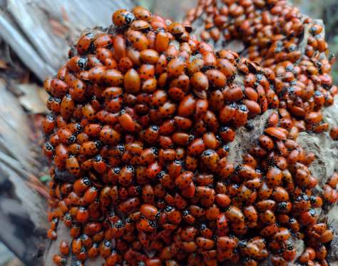
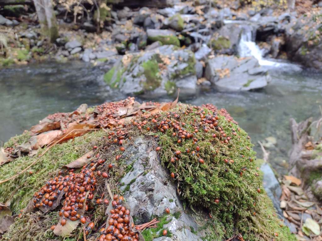
Photographic Opportunity
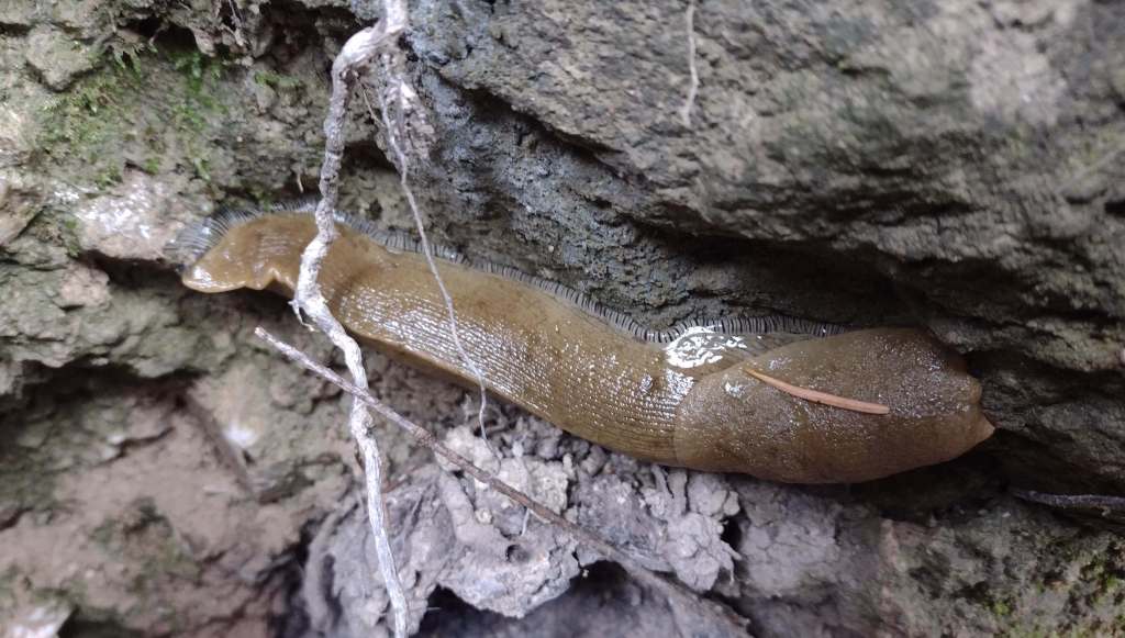
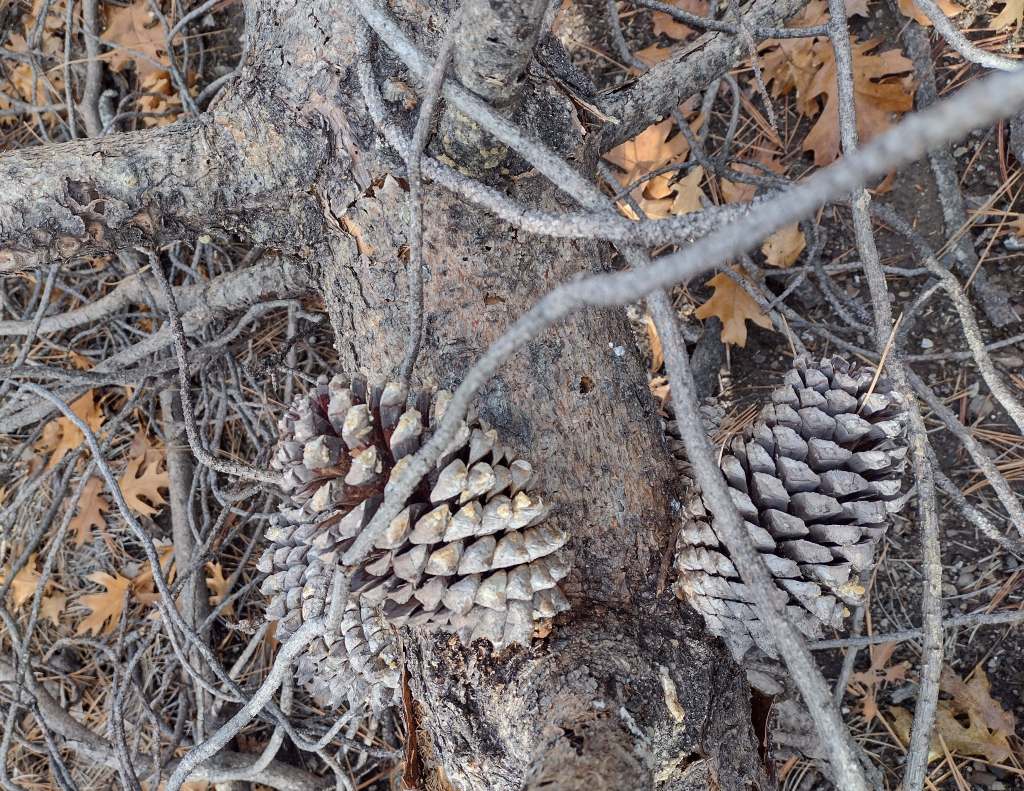
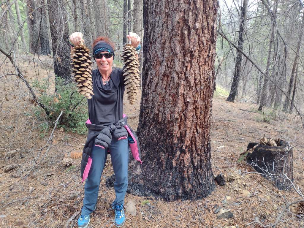
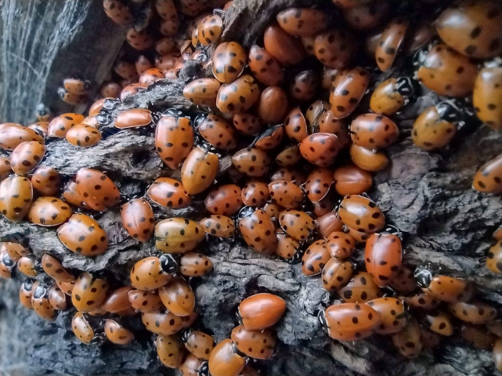
On Deafy Glade Trail, there were congregations of lady bugs that numbered in the hundreds along the South Fork of Stony Creek.
Peak Season
Summer
Fees
None
Road Conditions
Fouts Springs Road (Forest Road M10) is a well-maintained gravel road that crosses the National Forest west of Stonyford. That area is popular with motorcycles and OHVs, so keep an eye out for them while driving.
Camping
Mendocino National Forest manages Bear Creek Campground and Lower Nye Dispersed Campground among many others, plus there are countless places for dispersed camping.
Wilderness Areas
Sanhedrin Wilderness
Snow Mountain Wilderness
Yolla Bolly-Middle Eel Wilderness (also in Six Rivers and Trinity National Forests)
Yuki Wilderness (also run by the Bureau of Land Management)
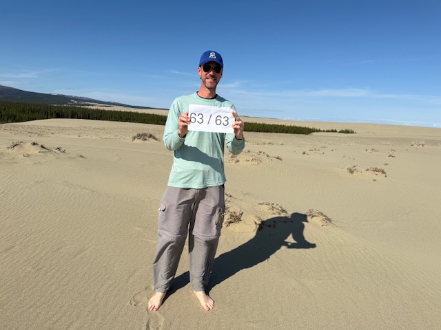
For years I have been helping my Mom visit National Parks and she enjoys seeing new places and adding a sticker to her National Parks water bottle. In June 2025, together we finally made it to Kobuk Valley National Park in Alaska (my last of the 63 National Parks and 401 of 433 NPS sites). Recently we went to Big Bend National Park, number 55 of 63 for her. It was my third visit there, but I hiked several new trails and it made me think about how there are so many different places to explore in some of the National Parks. I have returned to most of the parks in researching my travel guidebooks, so I thought I would make a list of my favorite ones that I keep going back to. I was surprised how the list varied from my rankings of the Top 10 National Parks and Top 10 National Parks for Hiking (click here to see all our Top 10 Lists).
If you or someone you love are interested in visiting the 63 National Parks, our travel guidebook A Park to Yourself makes a great gift!
So many trails to hike through ecosystems ranging from the coast to the alpine regions; after multiple visits, I am still hoping to make it to Staircase someday.
You have to come in multiple seasons because spring is best for waterfall flow, Glacier Point and Tuolumne Meadows are closed in the winter, Half Dome has chains in the summer (reservations required), and Horsetail Fall only glows at sunset in late February (reservations required).
Countless trails to waterfalls (if you can find a parking spot), amazing fall foliage, the seasonal road closure to Clingman’s Dome, and backpacking the Appalachian National Scenic Trail all mean this a year round destination.
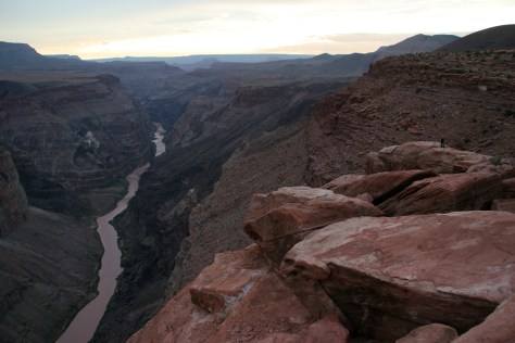
It takes good planning to visit both the North and South Rims in one trip, plus it is worth the long drive to see Toroweap (free online permit required). If you are able, hike to the bottom of the canyon or take a long float trip on the Colorado River.
The road across the park closes in the winter, when snowshoeing is still possible from many trailheads on both the west and east sides. High elevations open up for exploration after spring snowmelt, as does the Continental Divide National Scenic Trail.
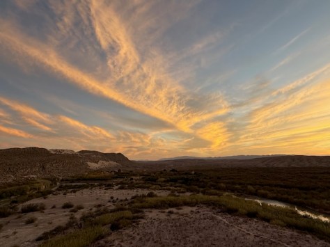
A great National Park to hike and drive in the winter, the elevations of Chisos Basin are inviting when the desert heats up the rest of the year. I still want to canoe part of the Rio Grande Wild and Scenic River.
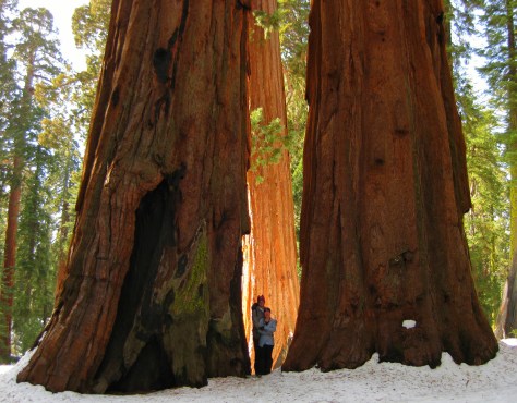
I prefer snowshoeing through the sequoia groves in the winter, when you can also reserve a bed in the Pear Lake Ski Hut. Summer melts the High Sierra for exploration, including Mt. Whitney (permits required).
…and finally the #1 National Park for multiple return visits:
If you have never been to the world’s first National Park in the winter, then book your snow coach (or snowmobile) and lodging as soon as possible. It is very different than a summer visit and wildlife is still abundant (except bears). I have been to Yellowstone more than a dozen times and plan to return.
There are two different entrances east and west that are a long drive apart, both have hiking access to different caves (check before going to avoid seasonal closures).
The unpredictability of lava flows mean that you might have to come back to see active eruptions, or maybe you want to make the strenuous backpacking trip to the top of Mauna Loa. Who wouldn’t want to return to the Big Island?
This is a personal favorite because of the Wild Caving Tour and free permits to backpack on the prairie with the free-ranging bison herd. The Black Hills keep calling me back.
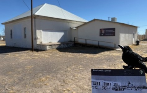
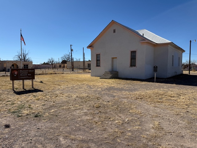
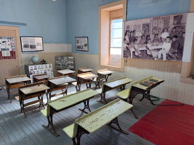
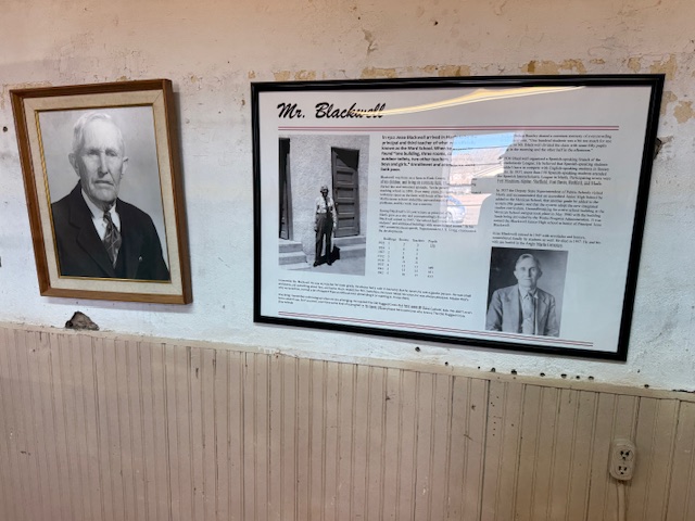
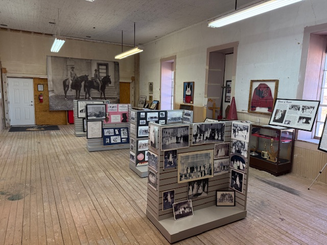
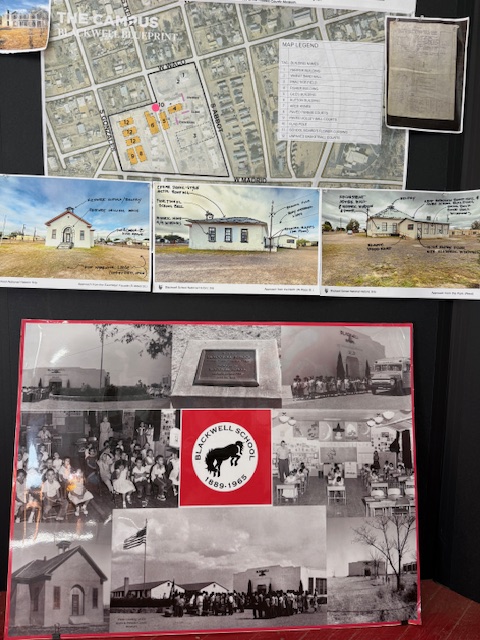
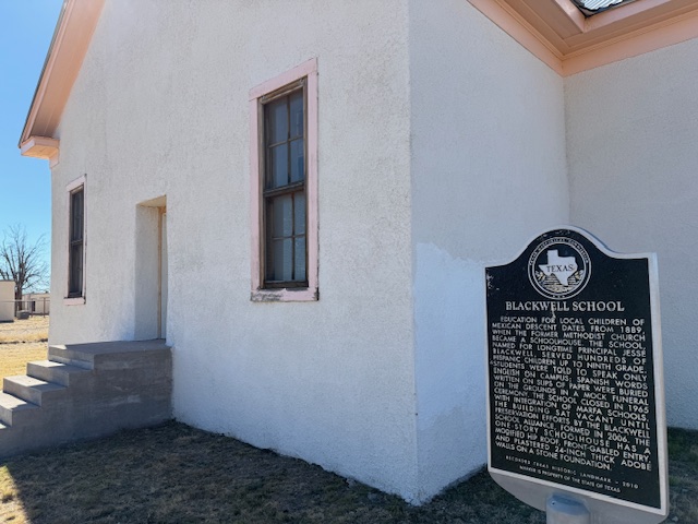
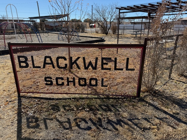
A three-room schoolhouse built for Marfa’s Hispanic children in 1909 is all that remains of a once larger campus (the Band Hall from 1927 is still attached). Blackwell School was named for a prominent early principal, and it closed in 1965 following legally mandated integration more than a decade after the Brown v. Board of Education decision. At its peak, the school had more than 600 students, with Hispanic students segregated, except on sports teams. After 1954, students were no longer allowed to speak Spanish on campus with a mock funeral held for the language and corporal punishment inflicted upon violators. Not all former students wanted to preserve this site where “separate but equal” education was practiced, but enough felt it was important to recall this history. The main building was saved from demolition by the nonprofit Blackwell School Alliance who helped the National Park Service (NPS) acquire the property from the Marfa Independent School District in 2024. The NPS has plans to reconstruct a belltower atop the adobe building.
Highlights
School building, playground
Must-Do Activity
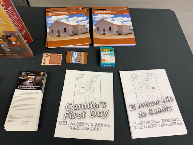
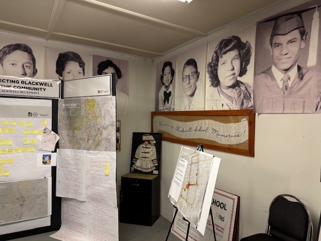
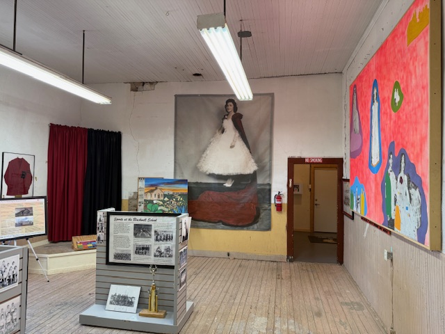
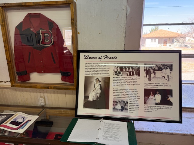
You definitely want to arrive when an NPS employee is on site to allow you inside the building and to explain its history. There are artifacts and informational panels on display inside. There is even a coloring book available in both English and Spanish that explains the story of Blackwell School to children.
Best Trail
None
Photographic Opportunity
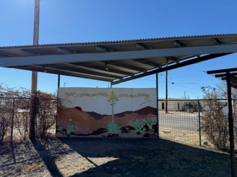
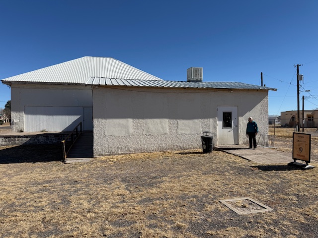
In the lot next to the school building is a playground, and there are plans to install outdoor interpretive signs and photos under the awning to provide information to visitors when the site is closed on weekdays.
Paved street parking is available at the site in Marfa.
Camping
There is an RV park in Marfa, or you can boondock at the Marfa Lights viewing area that has bathrooms. Big Bend National Park takes reservations for its campsites (with no hookups).
We recently published our guidebook 50 States of Great: Road Trip Guide to America, so we decided to start a new type of blog post where we create a travel itinerary for all 50 states, in addition to our usual National Forest and National Park entries. After starting with Kansas, Georgia, Idaho, Rhode Island, Minnesota, Hawai’i, Arizona, Louisiana, South Dakota, Indiana, and Montana, we decided to do another state in the deep south. We made an ambitious seven-day plan starting in the south on the Gulf Coast and then zigzagging across the state with plenty of options to extend the trip.
You will have to take a ferry to enjoy the white sand beaches of West Ship Island, which are considered some of the best in the U.S. If you are stuck on the mainland, at least check out the visitor center and hiking trails just off Interstate 10.
Biloxi
Biloxi has beaches, a lighthouse, casinos, and the Maritime and Seafood Industry Museum. I still want to see the Patriarch Oak, estimated to be more than 2,000 years old and located at Mary Mahoney’s Old French House seafood restaurant.
Tuxachanie National Recreation Trail runs 12 miles through De Soto National Forest with the path from its western trailhead following an old logging railroad right off Highway 49. Near the far eastern end of the trail is a lakeside World War II Prisoner of War camp with a pond.
Some sandhill cranes migrate to this forested spot for the winter, but a small population lives there year-round. There are trails, interpretive signs, and a visitor center.
National Park Service (NPS) rangers or volunteers are on location at the William Johnson House, Melrose Estate, and the Forks of the Road where hundreds of thousands of slaves were sold in the 1800s. The William Johnson House tells the story of a slave freed at age 11 who apprenticed to a barber, and became a successful businessman before his murder.
There is a nice campground with showers on Clear Springs Lake, accessed by a paved road four miles south of Highway 84. A one-mile trail circles the lake, which has a picnic shelter built by the Civilian Conservation Corps (CCC) in 1935 that is listed on the National Register of Historic Places.
This paved road runs 444 miles from the Mississippi River to Nashville, Tennessee, including 309 miles in Mississippi. The trace (or trail) started as an American Indian footpath and was heavily used in the 1800s by “Kaintuck” flatboatmen returning from New Orleans who left the Mississippi River at Natchez and continued on foot north. At several roadside pullouts, you can still follow portions of the “sunken” trail worn down by travelers over the centuries. Popular stops along the way include the boardwalk at Cypress Swamp outside Jackson and its three free campgrounds.
Paralleling the parkway, this trail exists in five segments totaling 67 miles in length. One of the longest sections is located north of Jackson (Miles 108-130). There are also eight miles of the original trace around the free Rocky Springs Campground (Mile 58) accessing Owens Creek Waterfall and a historic town site.
Day 4
Jackson
The capital city is home to the Mississippi Civil Rights Museum, Museum of Mississippi History, and Mississippi Agriculture and Forestry Museum. The Mississippi Museum of Natural Science is a 73,000-square-foot facility situated in a 300-acre forest with 2.5 miles of trails that also boasts a 200-seat theater and many aquariums, including “The Swamp” where alligators reside inside a large greenhouse.
In Jackson, the National Park Service manages the former home of a prominent Civil Rights Leader who was assassinated in his driveway in 1963. Across the street, there is a sidewalk through Myrlie’s Garden, a community garden where interpretive signs on the wooden fence tell the story of the Evers family.
There are several lakes here open to the public, including 50-acre Marathon Lake (which got its name a lumber company that closed in 1929). The lake was built in the 1950s for recreation in a former logging camp and now has 34 campsites (with water and electric hook-ups), a boat ramp, a swimming area, and a 1.7-mile trail that circles it.
The numerous failed attempts to take Vicksburg by force are evidenced by the 17,000 soldiers buried in the National Cemetery here. Following a 46-day bombardment, the city finally surrendered on July 4, 1863. The best part of visiting the park is walking through the partially-reconstructed U.S.S. Cairo, an ironclad gunboat which was carefully salvaged from the Yazoo River during the 1960s.
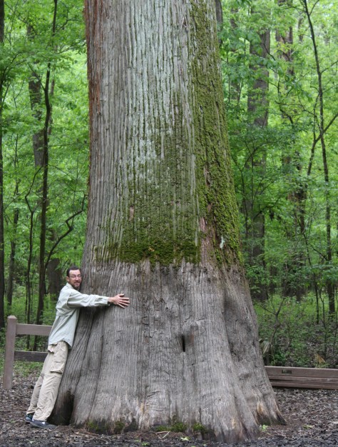
Delta National Forest is seasonally flooded for wildlife, but it was dry enough to walk up to the Kay Cypress Tree even when other trails were underwater during our April visit. The tree is more than ten feet in diameter even above the widely fluted base common to baldcypress. It is located across from Blue Lake on unpaved Fire Tower Road.
Located in a former cotton gin near the site of Emmett Till’s torture and murder on the farm of “J.W.” Milam in Glendora. Established in 2005, there is an atmosphere to the museum that bears the full weight of history, heightened by the short introductory video showing Emmett Till’s family members’ recollections of the events of 1955.
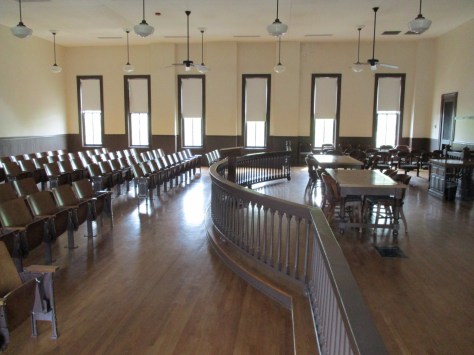
The National Park Service operates out of the Emmett Till Interpretive Center, located in a strip mall opposite the Tallahatchie County Second District Courthouse in Sumner. It has limited hours, but the courtroom where the September 1955 trial was held was unlocked when we visited on a Tuesday morning.
Optional stop at a Blues Museum
The Yazoo-Mississippi Delta (or simply “the Delta”) is a distinct section of western Mississippi renowned for its blues musicians. There is plenty to learn and listen to at the Delta Blues Museum in Clarksdale, GRAMMY Museum Mississippi in Cleveland, and B.B. King Museum and Delta Interpretive Center in Indianola. Spend the night in the area to go to a bar for live music in the evening.
Optional stop at Belzoni Catfish Museum and Welcome Center
At its peak in 1993, this region produced 461-million pounds of catfish annually (about 60% of U.S. production) and still hosts the World Catfish Festival every April. The best part is that Belzoni has catfish sculptures spread around town, painted to represent different occupations like a fireman and nurse.
The National Park Service site here is tiny with no facilities and only a couple interpretive signs, but a local battlefield commission owns 1,400 acres with walking trails. The nearby Mississippi Final Stands Interpretive Center is located five miles east of the battlefield in Baldwyn.
Two cannons and a monument mark this one-acre National Park Service site surrounded by the city of Tupelo. Its visitor center is combined with the one for the Natchez Trace Parkway just outside Tupelo.
Tishomingo State Park is located just off the Natchez Trace Parkway (Milepost 304) northeast of Tupelo. The park’s sandstone and limestone rock formations represent the furthest southwest extent of the Appalachian Plateau. The park opened in 1939, after its infrastructure was built using local rock by the Civilian Conservation Corps (CCC). Several structures remain from that period, including a spectacular swinging bridge over Bear Creek.
Chewalla Lake Recreation Area is the most developed site offering a swimming beach and campground, plus fishing and boating opportunities. A 2.3-mile trail at the 260-acre lake passes an overlook and a reconstructed Choctaw burial mound. In the northeast corner off Highway 72, a short trail accesses Baker’s Pond, the source of the Wolf River. Further south, Lake Tillatoba is a fee-free primitive site managed by Tombigbee National Forest.
An important railroad crossroads in Corinth made it a strategic spot during the Civil War. In April 1862, two days of intense fighting across the border in Tennessee resulted in 23,746 soldiers killed, wounded, captured, or missing, and the Confederates abandoned the field and Corinth. There were an additional 7,000 casualties when they failed to recapture the town in October 1862, which is the focus of the museums in town.
Apron Museum
Iuka is home to the Apron Museum that has collected thousands of vintage aprons, plus it has a gift shop with quilts, crafts, and, of course, aprons for sale. Nearby, a restored wooden covered bridge is also worth a look-see and a drive across.
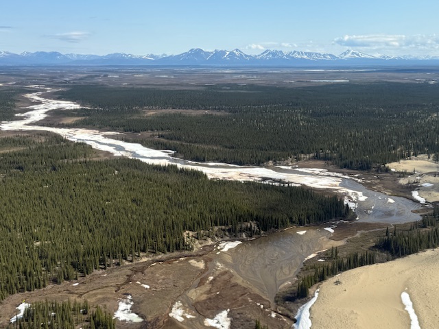
In northwest Alaska, an area roughly the size of Delaware is set aside to protect an 85-mile stretch of the Kobuk River. Kobuk Valley National Park also includes the Waring Mountains to the south and the Baird Mountains that border Noatak National Preserve. Hunters have been coming for at least 12,500 years to Onion Portage where caribou gather to cross the river. In the 1960s, archeologist J. Louis Giddings built a cabin and cache so he could excavate a two-acre plot. He and his assistants dug through 30 artifact-bearing layers that provided evidence of nine cultural periods from the Akmak Complex to the Arctic Woodland Eskimo.
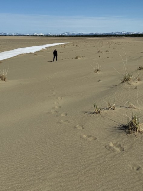
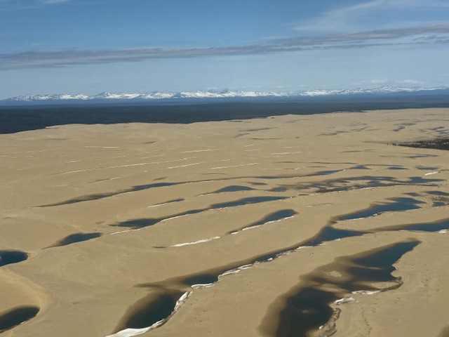
Great Kobuk Sand Dunes, Onion Portage Archeological District
Must-Do Activity
The Northwest Arctic Heritage Center in Kotzebue is located 75 river miles from the western edge of the park. Riverside ranger stations operate in the summer at Kallarichuk in the west and Onion Portage in the east. A flightseeing tour of the park typically lands on the Great Kobuk Sand Dunes, which are the remnant of a dune field that once covered as much as 200,000 acres after the Pleistocene glaciation. Float trips take at least a week on the wide Kobuk River or the rougher Salmon River, which is designated a Wild and Scenic River. The Kobuk River starts within a narrow canyon with Class V rapids inside Gates of the Arctic National Park and Preserve, but soon flattens out and becomes a braided channel, like many rivers in Alaska.
Best Trail
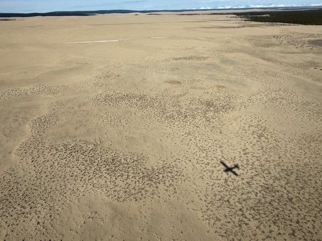
There are no established trails in the park, but it is easy to wander through the sand dunes and soft enough to go barefoot.
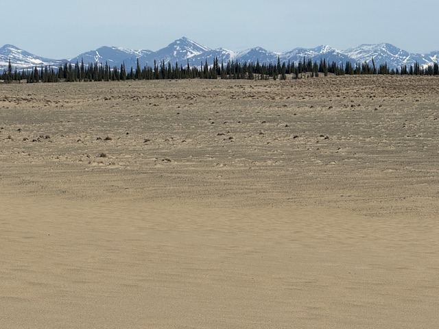
Photographic Opportunity
The Great Kobuk Sand Dunes are a geological anomaly sitting north of the Arctic Circle, once studied by NASA as an analog for polar dunes on Mars.
There are no roads into Kobuk Valley National Park, so most visitors arrive by small airplane, which can cost around $5,000 to charter for the day. If you are leaving from Fairbanks, we recommend flying with Sven from Aviation Expeditions who will do a combination trip that also lands in Gates of the Arctic National Park and Preserve.
Camping
Backcountry camping is allowed throughout the park, but is not permitted on the 81,000 acres of Native Corporation lands that are typically situated along the rivers.
Related Sites
Gates of the Arctic National Park and Preserve (Alaska)