Overview
Bryce Canyon is not really a canyon at all, but instead a cliffside amphitheater eroded away into extravagant creamsicle-colored hoodoos. Your first view from Sunrise or Sunset Point will surely take your breath away and not just because you are standing above 7,000 feet in elevation. A portion of the main park road is only open during the busy summer season, but seeing the amphitheater under a fresh carpet of white snow makes the effort worthwhile to get here in the winter. Learn more about the logistics of a winter visit in our first travel guidebook to the National Parks (available on Amazon).

Highlights
Sunrise Point, Sunset Point, Navajo Loop Trail, Queens Garden Trail, Natural Bridge, Rainbow Point
Must-Do Activity
The amphitheater is beautiful from the overlooks, but to really experience this park you have to hike down from the rim. Peakaboo Loop is a strenuous four-mile hike with approximately 1,700 feet cumulative elevation gain that offers up close views of the hoodoos. It is accessed from Sunset Point or Bryce Point. You could easily spend your whole trip in this northern section of the park and not be disappointed, but be sure to take a slow drive south with stops at Natural Bridge and Rainbow Point to complete the experience.
Best Trail
It is four miles out and back on the Under-the-Rim Trail from Bryce Point to the Hat Shop, in the quiet backcountry area where hoodoos are topped with boulders (like they are wearing hats). Ask a park ranger about the “I Hiked the Hoodoos” program to earn a prize.
Instagram-worthy Photo
Douglas-fir trees snake their way to the light in the narrow Wall Street section of the Navajo Loop Trail. A photograph of Tiff walking into a snowy Wall Street made the cover (see below) of our first travel guidebook to the National Parks (available on Amazon).

Peak Season
Summer due to long, snowy winters at this elevation.
Hours
https://www.nps.gov/brca/planyourvisit/hours.htm
Fees
$35 per vehicle or America the Beautiful pass
Road Conditions
The main park road is paved, but there are dirt roads that access the lower elevations of the park, though we have been warned that they are in rough shape.
Camping
The National Park Service has a campground that is open year round, but we prefer camping along the dirt roads in adjacent Dixie National Forest. A free permit is required to camp in Grand Staircase-Escalante National Monument.
Related Sites
Cedar Breaks National Monument (Utah)
Zion National Park (Utah)
Capitol Reef National Park (Utah)


This photograph is for sale on Imagekind.com 

Mule deer 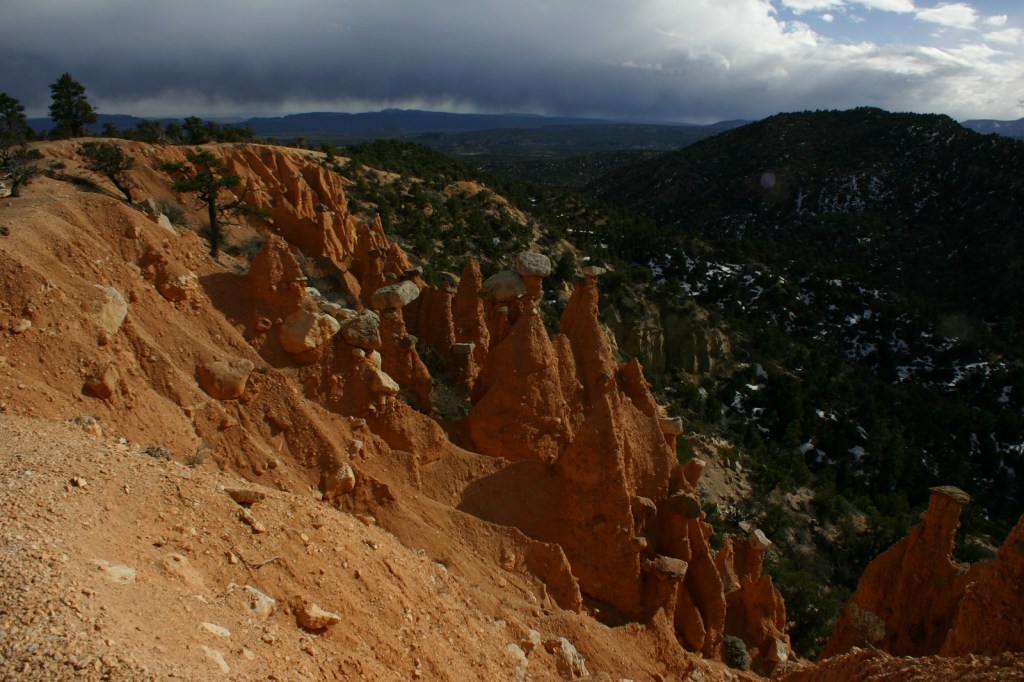
Hat Shop 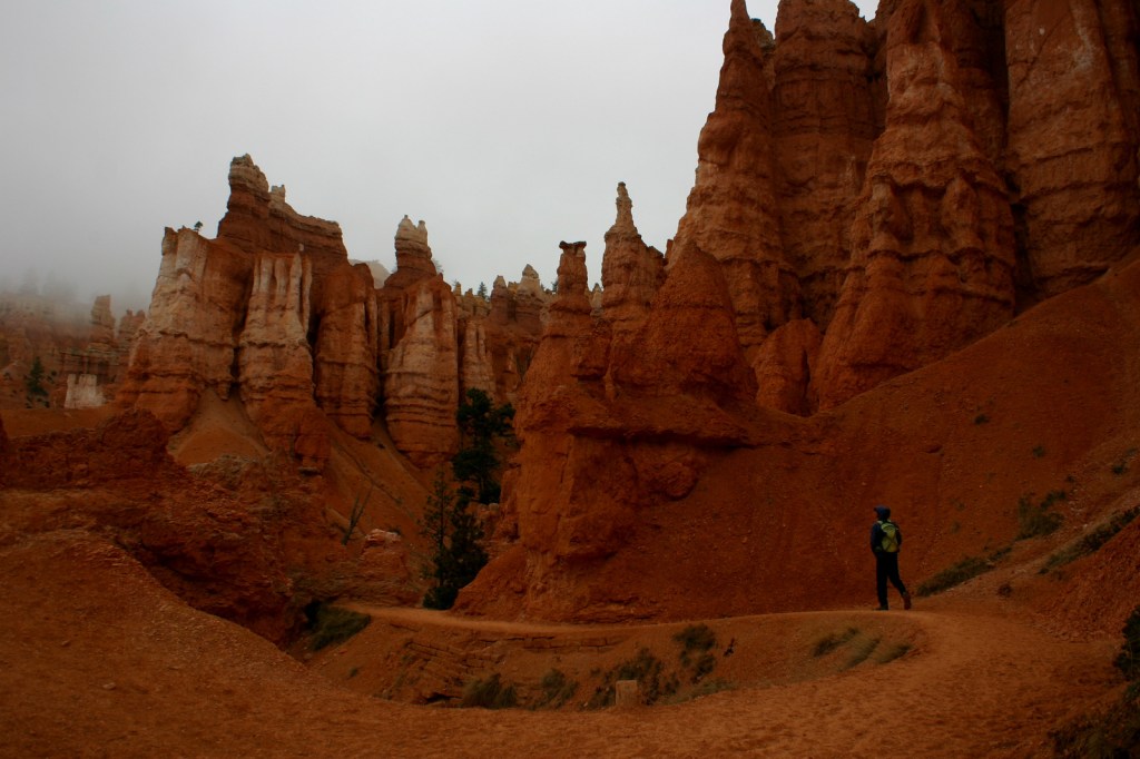
Scott hiking on the Peekaboo Trail 

Scott on the Navajo Loop Trail switchbacks 
Natural Bridge 
Raven about the park 

Explore More – Who described Bryce Canyon as “a hell of a place to lose a cow?”

We are a participant in the Amazon Services LLC Associates Program, an affiliate advertising program designed to provide a means for us to earn fees by linking to Amazon.com and affiliated sites.