Tag Archives: Tennessee

Shiloh National Military Park

Overview

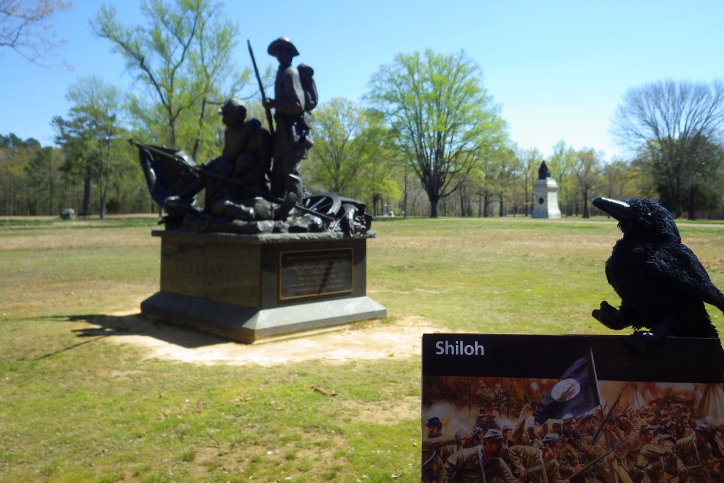
Following the victory at Fort Donelson, Union General Ulysses S. Grant moved his 50,000 troops aboard steamboats down the Tennessee River to Pittsburg Landing.  The army camped near a log church named the Shiloh Meeting House where they awaited the marching Army of Ohio before advancing on the important railroad crossroads in Corinth, Mississippi.  The Confederate army launched a surprise attack on April 6, 1862, pushing the enemy lines back two miles before Union reinforcements finally arrived.  After two days and 23,746 soldiers killed, wounded, captured, or missing, the Confederates abandoned the field and Corinth.  There were an additional 7,000 casualties when they failed to recapture the town in October 1862.

Highlights

Museum, film, driving tour, Shiloh Meeting House, Indian mounds, cannons

Must-Do Activity

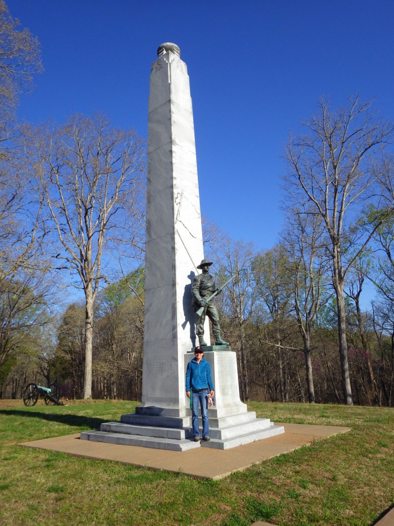
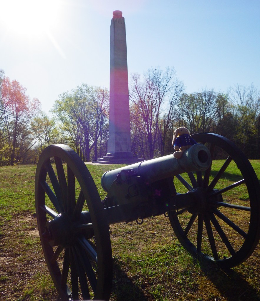
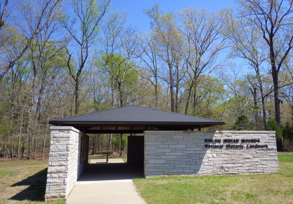
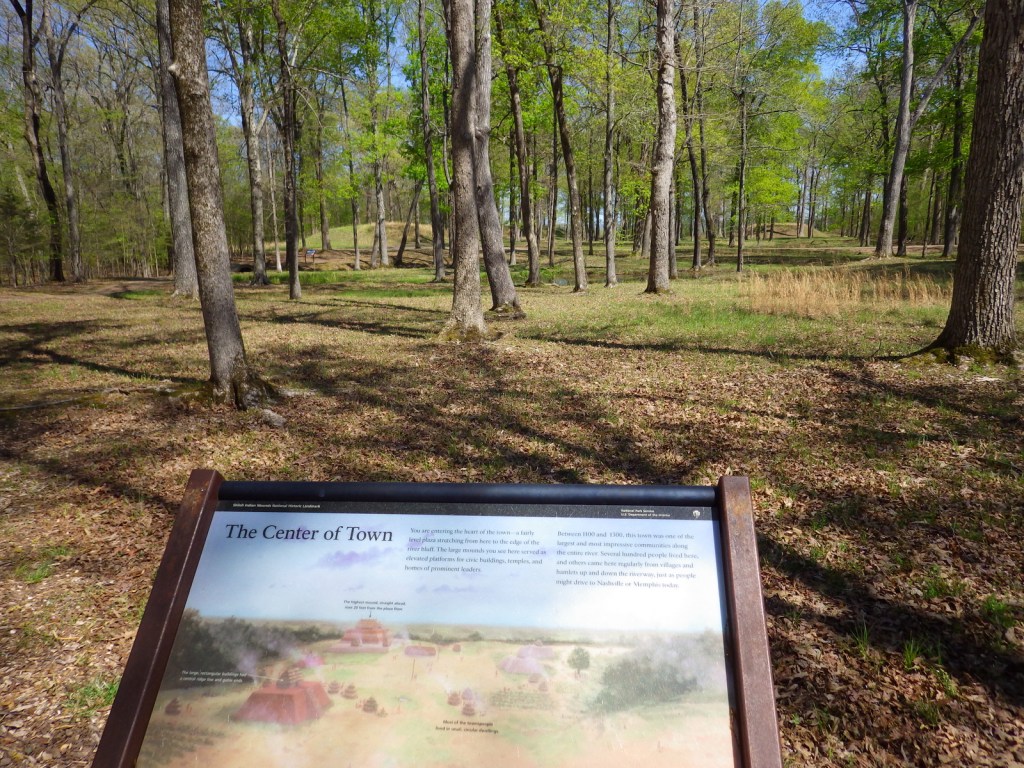
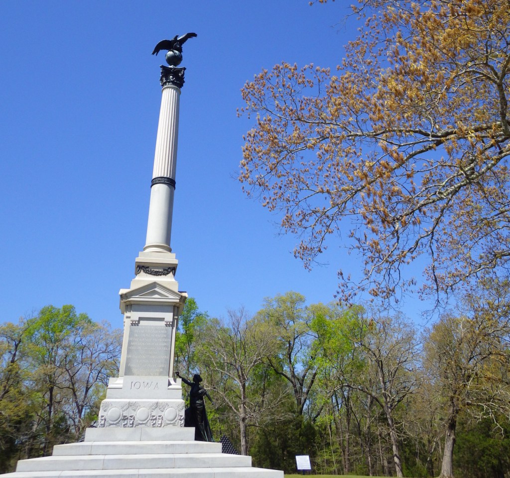
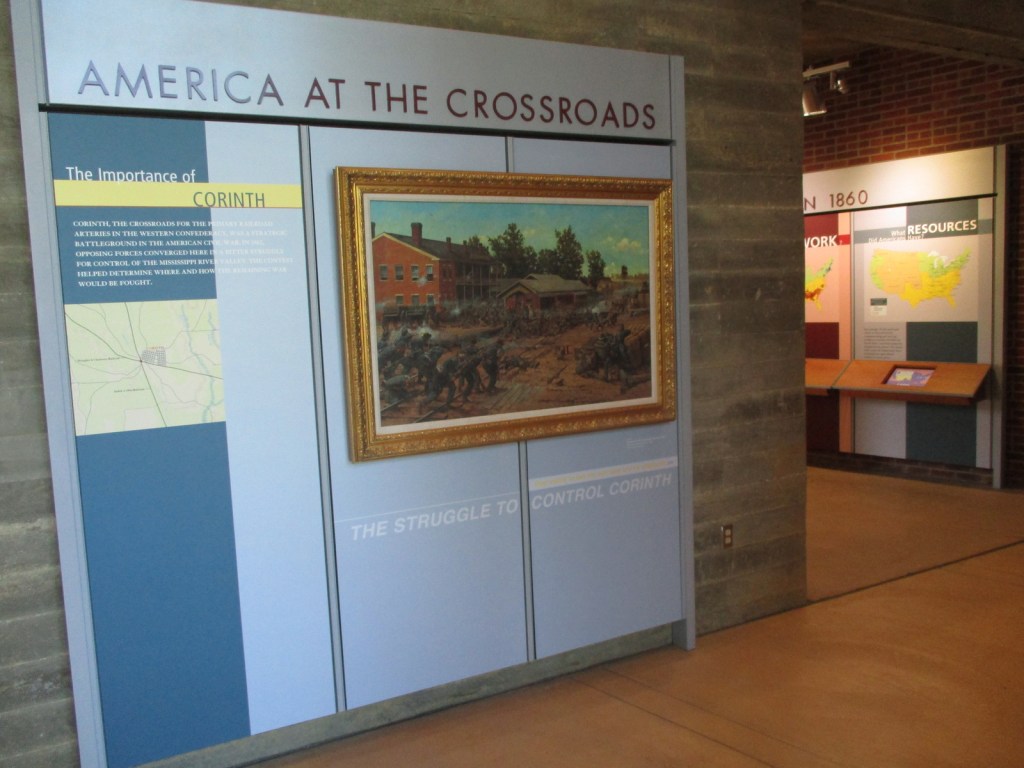
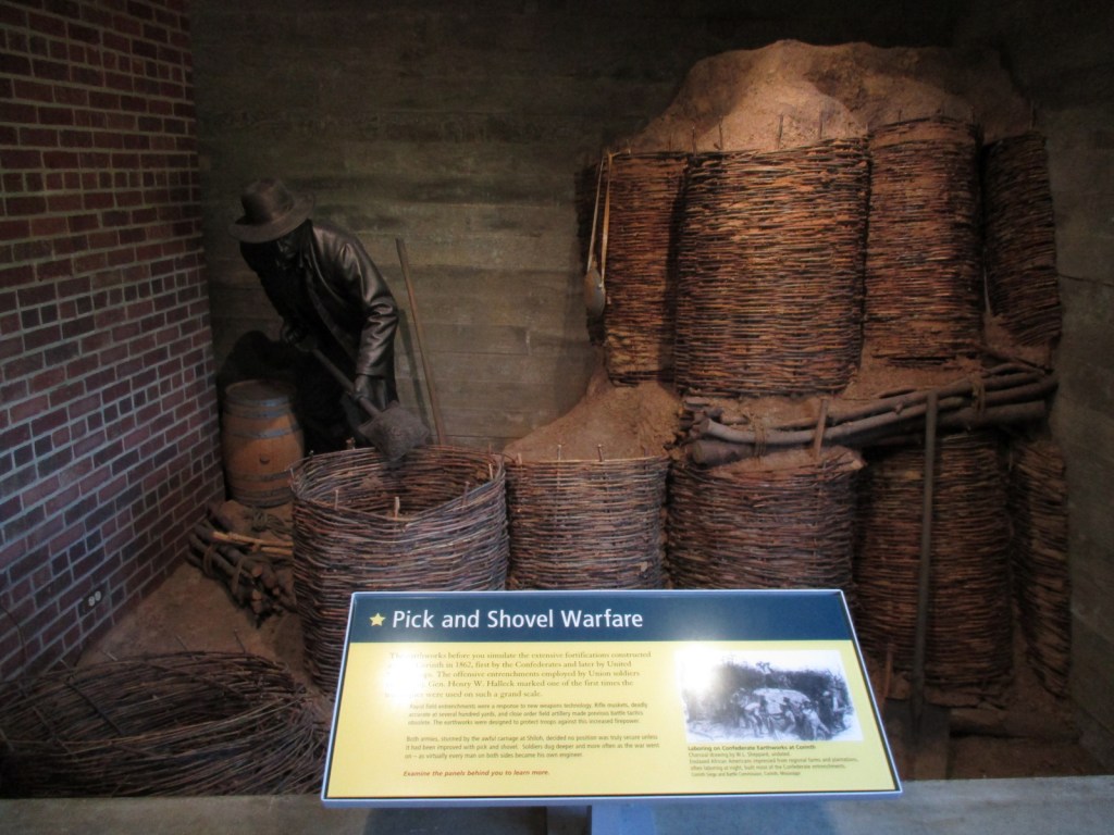
Start with the great 45-minute movie at the National Park Service (NPS)  visitor center then take the 12.7-mile driving tour with twenty stops that passes 150 commemorative monuments, 229 cannons, and 4,000 graves in Shiloh National Cemetery.  The site also contains 800-year-old American Indian mounds within a 45-acre National Historic Landmark.  A free pass to the Tennessee River Museum in Savannah is also provided at the NPS visitor center.  In addition to the NPS unit in Shiloh, Tennessee, there is an Interpretive Center 22 miles away in Corinth, Mississippi. 

Best Trail

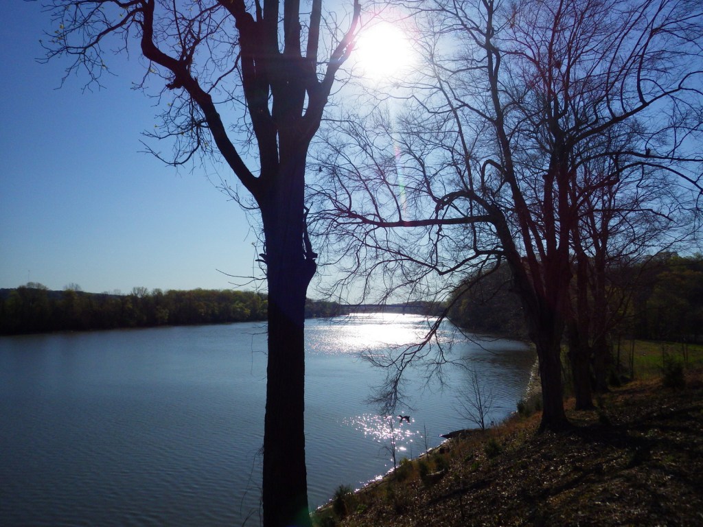
The short trail through the 800-year-old Indian mounds provides views of the Tennessee River.

Instagram-worthy Photo

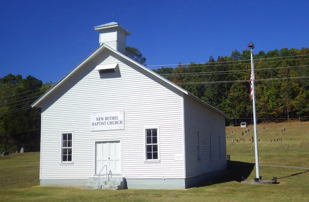
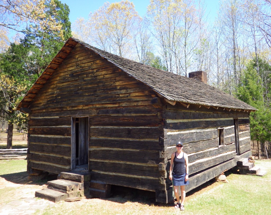
A reconstruction of the Shiloh Meeting House log church is found along the driving tour.

Peak Season

Summer

Hours

https://www.nps.gov/shil/planyourvisit/basicinfo.htm

Fees

None

Road Conditions

All roads paved

Camping

None in the park, but Pickwick Landing State Park is located 15 miles to the southeast.

Related Sites

Fort Donelson National Battlefield (Tennessee-Kentucky)

Stones River National Battlefield (Tennessee)

Vicksburg National Military Park (Mississippi)

Explore More – Originally managed by the U.S. military, when was this park established?

Fort Donelson National Battlefield

Overview

Fort Donelson National Battlefield commemorates the first major Union victory of the Civil War.  It quickly followed the capture of Fort Henry on the Tennessee River (which is now flooded by Kentucky Lake).  The battle earned Union General U.S. Grant fame for his reply to Confederate General Simon Buckner: “No terms except an unconditional and immediate surrender can be accepted.”  This led to the joke that his initials stood for “Unconditional Surrender.”  After more than 12,000 Confederate troops were taken prisoner on February 16, 1862, the Union army soon took Nashville, Tennessee.

Highlights

Dover Hotel, Land Between the Lakes National Recreation Area, cannons

Must-Do Activity

Visitors today can take a six-mile driving tour to see the rifle pits, lower river battery, and earthworks along the Cumberland River, in addition to an exhibit on the first floor of the Dover Hotel (where terms of surrender were signed).  This hilly riverside park is also a nice place to exercise and watch for bald eagles and other wildlife. Fort Donelson National Cemetery is located nearby.

Best Trail

Fort Donelson National Battlefield is neighbors with Land Between the Lakes National Recreation Area, which is managed by the U.S. Forest Service.  Tucked between the Tennessee and Cumberland Rivers, this area was claimed through eminent domain by the Tennessee Valley Authority (TVA) when dams were built.  Outdoor recreation is now the focus with reservoirs, trails, bison and elk herds, a living history museum, and a planetarium.  Also, there are more than 200 cemeteries in this 170,000-acre area.

Instagram-worthy Photo

Giant cannons are mounted in the lower river battery along the Cumberland River.

Peak Season

Summer

Hours

https://www.nps.gov/fodo/planyourvisit/hours.htm

Fees

None for the National Battlefield, but there are entry fees for portions of Land Between the Lakes National Recreation Area

Road Conditions

All roads paved

Camping

There are numerous campgrounds in Land Between the Lakes National Recreation Area, as well as at Paris Landing State Park.

Related Sites

Shiloh National Military Park (Tennessee)

Big South Fork National River and Recreation Area (Tennessee)

Mammoth Cave National Park (Kentucky)

Explore More – Fort Donelson and which other nearby fort were havens for escaped slaves later in the Civil War?

Cumberland Gap National Historical Park

Overview

As one of the easiest crossings of the Alleghany Mountains, Cumberland Gap saw steady foot traffic from 1775 to 1810 as American settlers moved west then sent their trade goods and livestock east.  It later became the corner where the states of Kentucky, Tennessee, and Virginia all converge.  Today there is a tunnel on Highway 25E, maintaining the park’s quiet and its appearance of centuries ago. 

Highlights

Pinnacle Overlook, Tri-State Peak, Wilderness Road Trail, Hensley Settlement, Gap Cave

Must-Do Activity

All visitors will want to drive the steep four-mile long Pinnacle Road, along which trailheads lead to scenic overlooks and earthen forts dating to the 1860s.  Reservations are recommended if you want to take a tour of the Hensley Settlement or Gap Cave, which typically sell out.  Even if you cannot make it on a tour, there are 85 miles of shady trails through the park’s 24,000 acres of forest to make your visit worthwhile.

Best Trail

At Cumberland Gap National Historical Park you can follow in the footsteps of salt-seeking bison, Shawnee and Cherokee warriors, hundreds of thousands of pioneers, and Civil War soldiers from both sides.  Hike the Wilderness Road Trail to the saddle of the official Cumberland Gap, which is marked by a sign.  You will also pass the same Indian Rock that was seen by frontiersman Daniel Boone when he helped blaze the Wilderness Trail in 1775.

Instagram-worthy Photo

You can see parts of Kentucky, Virginia, and Tennessee from Pinnacle Overlook at 2,440 feet in elevation.  With its commanding views, you can see why both sides found the Cumberland Gap strategic during the Civil War.

Peak Season

Summer

Hours

https://www.nps.gov/cuga/planyourvisit/hours.htm

Fees

None, except for the separate tours of Hensley Settlement and Gap Cave (reservations recommended).

Road Conditions

The four-mile long road up to Pinnacle Overlook is paved but steep enough to be closed to all trailers and vehicles over 20 feet in length.

Camping

The park’s Wilderness Road Campground is large and open year round.  Free permits are available for backcountry campsites.  Black bears are common in the park, so proper food storage is required.

Related Sites

Mammoth Cave National Park (Kentucky)

Big South Fork National River and Recreation Area (Tennessee-Kentucky)

Great Smoky Mountains National Park (Tennessee-North Carolina)

Explore More – Who was the Virginian who first “discovered” and named the Cumberland Gap in 1750?

We are a participant in the Amazon Services LLC Associates Program, an affiliate advertising program designed to provide a means for us to earn fees by linking to Amazon.com and affiliated sites.

Great Smoky Mountains National Park

Overview

Great Smoky Mountains National Park straddles the border of Tennessee and North Carolina, with both sides offering incredible views.  The park is similar to Shenandoah National Park in that it was mostly purchased from private landowners before its establishment by the federal government in 1934.  With around 11-million visitors annually, it is easily the most visited of the 62 National Parks in the National Park Service system, perhaps because it has no entrance fee.

Highlights

Clingman’s Dome, Cades Cove, Roaring Fork Motor Nature Trail, Foothills Parkway, Oconaluftee, Appalachian National Scenic Trail

Must-Do Activity

Many interesting sections of Great Smoky Mountains National Park preserve the human history of the region, like the popular Cades Cove with its iconic old grist mill.  To learn more about the Cherokee indigenous to this region, visit Oconaluftee Visitor Center on the North Carolina side.  While there you might also spot a herd of reintroduced elk.

Best Trail

Even on the bumper to bumper Roaring Fork Motor Nature Trail, all you have to do is park and take a hike to find some solitude.  Grotto Falls Trail passes through old-growth hemlock forest, an area very popular with black bears.

Instagram-worthy Photo

As you can imagine, this park is incredibly popular in October and November because of the beautiful fall foliage.  Early in the season, head to 6,643-foot Clingman’s Dome, then drop in elevation as the autumn progresses.

Peak Season

Summer and fall

Hours

https://www.nps.gov/grsm/planyourvisit/hours.htm

Fees

None

Road Conditions

Newfound Gap Road is the major thoroughfare connecting the two sides of the park and it is plowed throughout the winter.  The 11-mile loop road through Cades Cove is open year round, but the 7-mile spur road up to Clingman’s Dome and the 6-mile one-way Roaring Fork Motor Nature Trail are seasonal.

Camping

There are 10 campgrounds within Great Smoky Mountains National Park, but if you need RV hookups you will have to find a private campground outside the park.

Related Sites

Big South Fork National River and Recreation Area (Tennessee-Kentucky)

Blue Ridge Parkway (North Carolina-Virginia)

Shenandoah National Park (Virginia)

This design we created to celebrate Great Smoky Mountains National Park is available on a variety of products at Cafe Press and Amazon.

Explore More – While most National Parks do not allow dogs on trails, what are the two trails in Great Smoky Mountains National Park that do?

We are a participant in the Amazon Services LLC Associates Program, an affiliate advertising program designed to provide a means for us to earn fees by linking to Amazon.com and affiliated sites.

Manhattan Project National Historical Park

Overview

During the National Park Service (NPS) centennial in 2016, a new, ambitious park was established linking three far-flung sites in the states of Washington, New Mexico, and Tennessee.  The purpose is to tell the story of the “Manhattan Project,” the military code name during World War II for the secret undertaking to create the world’s first atomic weapon. 

Highlights

Bradbury Science Museum (NM), American Museum of Science and Energy (TN), Hanford Reach National Monument (WA)

Must-Do Activity

In 1942, hundreds of eastern Tennessee families were displaced in order to construct Oak Ridge National Laboratory where experimental nuclear reactors produced plutonium and enriched uranium.  More than 75,000 people hurriedly built and operated this brand new industrial complex, which continues to be used as a Department of Energy research facility to this day.  Due to security and safety concerns, visitors can only enter on a 3-hour bus tour that leaves from the American Museum of Science and Energy.  The tour is well worth your time, as it is currently the only way to see Y-12, X-10, and K-25 and learn more about what those code names really mean.

Best Trail

The Hanford Reach is one of the last free-flowing sections of the Columbia River in eastern Washington and is an important site for salmon spawning.  The area is ecologically pristine, mostly untouched by development since it became the Hanford Nuclear Reservation in 1943.  It is home to the world’s first full-scale nuclear reactor that produced the plutonium used by Los Alamos National Laboratories for its scientific breakthroughs in 1945.  Since 2000, Hanford Reach National Monument has been managed by the U.S. Fish and Wildlife Service and much of the area is off limits.  Other than boating on the river, the best place to get a feel for the area is to walk around the Ringold Fish Hatchery.

Instagram-worthy Photo

The free Bradbury Science Museum in Los Alamos, New Mexico offers tourists a closer look at the original and ongoing research conducted at Los Alamos National Laboratories (LANL), including a scale model of the “Fat Man” plutonium bomb built here in 1945.  Nearby, the Los Alamos Historical Museum is located in a cabin on historic Bathtub Row, so named because when the government took over the Ranch School in 1943 these were the only dwellings equipped with that luxury. 

Peak Season

Open year round, but summer is best at the high elevations of Los Alamos, New Mexico.

Hours

https://www.nps.gov/mapr/planyourvisit/hours.htm

Fees

$5 per adult for the American Museum of Science and Energy and a 3-hour tour (11:30-2:30, reservations recommended) of Oak Ridge National Laboratory in Tennessee.

Road Conditions

All roads paved except around Hanford Reach National Monument

Camping

Dispersed camping is allowed in Santa Fe National Forest surrounding Los Alamos and it is not far to the campground in Bandelier National Monument.

Explore More – What was the job of the “Calutron Girls” in Oak Ridge during World War II?