Tag Archives: Native American

Sand Creek Massacre National Historic Site

Overview

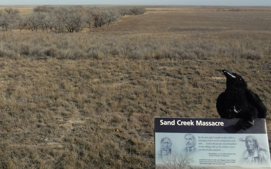
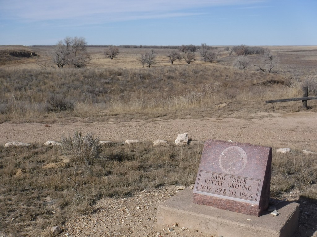
On November 29, 1864, in the middle of the Civil War, a tragedy played out on this spot where Chief Black Kettle and 700 other American Indians were peacefully spending the winter in accordance with the 1861 Treaty of Fort Wise.  A surprise attack led by Colonel John Chivington killed between 165 and 200 Cheyenne and Arapaho, primarily women, children, and the elderly.  The site is held sacred by the Cheyenne and Arapaho, so is only viewable from an overlook above the cottonwood-lined creek.  It serves as an important reminder of the terrible acts people can undertake when they dehumanize their fellow men.

Highlights

Memorial, trail, overlook

Must-Do Activity

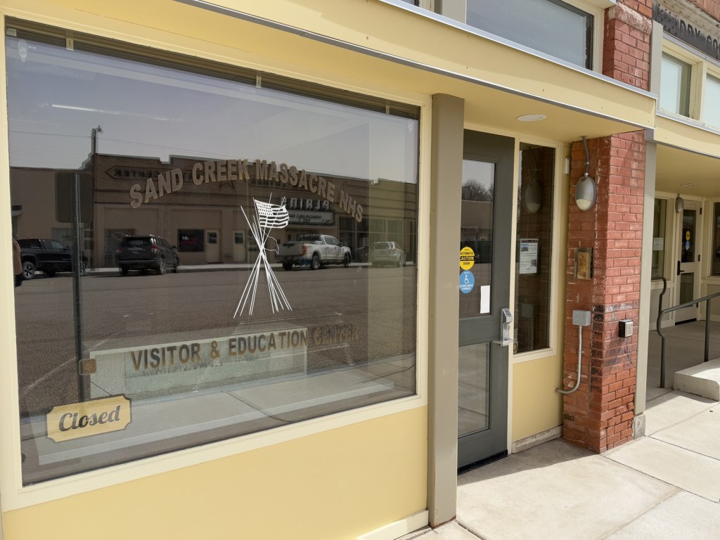
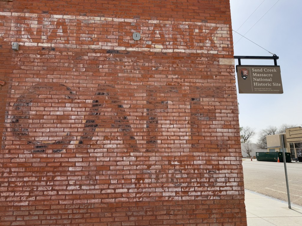
Authorized in 2000 upon the discovery of two grisly letters describing the gruesome event, Sand Creek Massacre National Historic Site opened to the public in 2007.  It is located in a remote section of the eastern Colorado plains, down a long dirt road, but it does have a small visitor center in a trailer staffed by the National Park Service (NPS).  Near the parking lot you will find posted the letters written by Captain Soule and Lieutenant Cramer, whose units refused to fire during the massacre.  Be warned that the description of the mutilation of the bodies is painful to read and not suitable for children. Another NPS visitor center is located in the town of Eads, Colorado (see photos below).

Best Trail

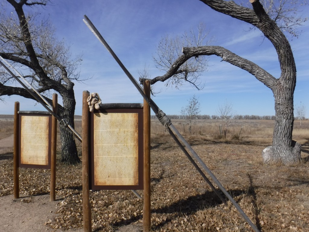
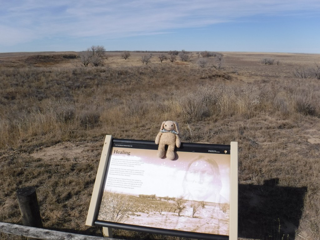
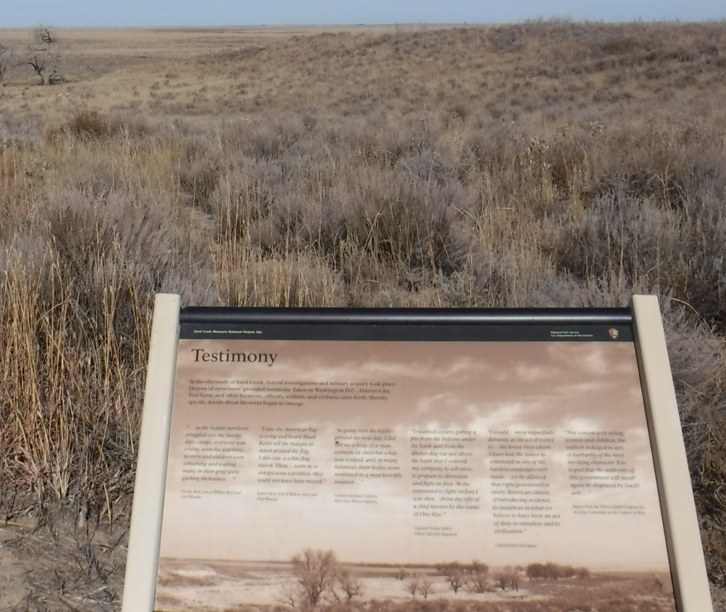
There is a 0.8-mile self-guided walking trail with a few interpretive signs. There is also a 600-mile Sand Creek Massacre Trail designated on highways between here and the Wind River Reservation in Wyoming.

Instagram-worthy Photo

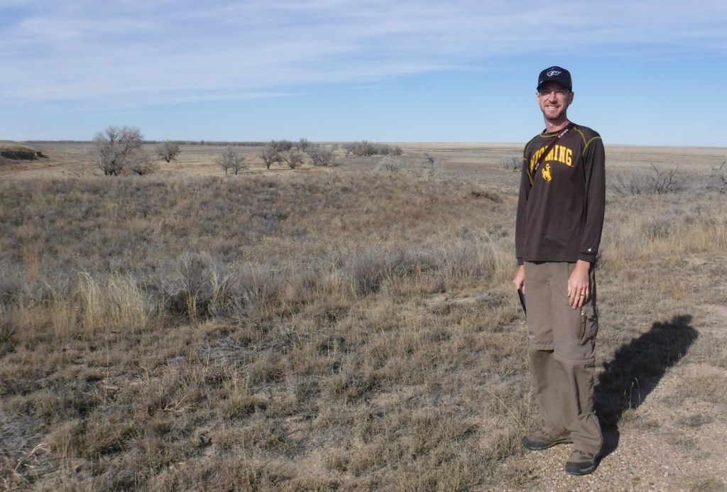
We took this photo from the overlook of the 1864 Cheyenne and Arapaho camp in November nearly 153 years after the massacre.

Peak Season

Summer

Hours

https://www.nps.gov/sand/planyourvisit/hours.htm

Fees

None

Road Conditions

The dirt access road is well maintained.

Camping

None

Related Sites

Washita Battlefield National Historic Site (Oklahoma)

Bent’s Old Fort National Historic Site (Colorado)

Comanche National Grassland (Colorado)

Nearest National Park

Great Sand Dunes

Explore More – Who was the Colorado Territorial Governor that authorized the 100-day volunteer cavalry to “kill and destroy” hostile American Indians?

Whitman Mission National Historic Site

Overview

While there was some limited European settlement on the west coast prior to her journey, the popularization of the Oregon Trail for families can be traced to publication of the letters of Narcissa Whitman after her journey in 1836.  While in the Black Hills she wrote, “It is astonishing how well we get along with our wagons where there are no roads.  I think I may say it is easier traveling here than on any turnpike in the States.”  Narcissa came with her doctor husband and other Protestants to establish missions among the American Indians.  The Whitmans did much to open the west to emigrant families and you can visit their graves at this 138-acre National Park Service (NPS) site in Walla Walla, Washington.

Highlights

Museum, film, millpond, Whitman Memorial, Oregon National Historic Trail

Must-Do Activity

The Whitmans set up near Waiilatpu, which translates to “place of the people of the rye grass.”  The main Oregon Trail would eventually detour south of their mission, but the couple would still care for stragglers, even adopting 10 children.  Following a devastating 1847 measles epidemic they and eleven others were killed by grieving Cayuse families who blamed the doctor for poisoning them.  News of the November 29 attack and subsequent retaliations spurred Congress to create the Oregon Territory within the year. 

Best Trail

A self-guided interpretive trail leads up to an overlook of Waiilatpu from atop the Whitman Memorial hill.  The trail passes a restored millpond and the Great Grave where 13 victims were buried in 1847, including Narcissa Whitman and her husband.

Instagram-worthy Photo

A portion of the Oregon Trail passed through Waiilatpu until rerouted south after 1844.

Peak Season

Summer

Hours

https://www.nps.gov/whmi/planyourvisit/hours.htm

Fees

None

Road Conditions

All roads paved

Camping

There is not an NPS campground, but private campgrounds are located in Walla Walla, Washington.

Related Sites

Fort Vancouver National Historic Site (Washington)

Lake Chelan National Recreation Area (Washington)

Lewis and Clark National Historical Park (Oregon-Washington)

Explore More – In addition to those killed in the attack at Whitman Mission on November 29, 1847, how many others were held hostage for a month until their ransom was paid?

Canyonlands National Park

Overview

Canyonlands National Park was established in 1964, part of a large expansion of the National Park Service (NPS) system during the Johnson administration.  It is divided into four distinct areas that are not easily connected by roads: The Needles District, The Maze District, Horseshoe Canyon Unit, and the most heavily-trafficked Island in the Sky District near Moab, Utah.  Backpacking is a major draw to this park, as is whitewater rafting on the Colorado and Green Rivers.

Learn more in our guidebook to the 62 National Parks, A Park to Yourself: Finding Adventure in America’s National Parks (available on Amazon).

Highlights

Mesa Arch, Grand View Point, Chesler Park, Druid Arch, The Maze, Great Gallery

Must-Do Activity

Horseshoe Canyon is a separate unit of Canyonlands National Park accessible by good dirt road from Highway 24 southwest of Green River, Utah.  Its main attractions are four large pictograph panels estimated at 3,000 years old at the bottom of the 800-foot deep canyon.  The largest panel, dubbed the Great Gallery, stretches over 200 feet with numerous life-sized human figures painted in red and white on a sandstone wall.  It is a 3.5-mile hike to get there from the trailhead on top of the canyon rim that drops down to and then follows a meandering stream which passes three smaller panels.

Best Trail

There are miles of incredibly scenic trails in The Needles District, many of which leave from Elephant Hill Trailhead.  We recommend the six-mile roundtrip hike to Chesler Park where you will see the pointy formations that gave this district its name.  Druid Arch or Angel Arch make great destinations for long day hikes, but you should at least stop at Slickrock Foot Nature Trail to get a feel for sandstone beneath your soles.

Instagram-worthy Photo

You may have never heard of the Island in the Sky District, but you have surely seen a sunrise photograph of Mesa Arch since it makes it on many calendars.  Walk the half-mile loop to the edge of the cliff where this famous formation frames distant mountains.

Peak Season

Spring and fall

Hours

https://www.nps.gov/cany/planyourvisit/hours.htm

Fees

$30 per vehicle or America the Beautiful pass

Road Conditions

There are seriously rough 4×4 roads throughout this park, so ask a park ranger about road conditions before attempting any drive.  The scenic drive that dead ends at Grand View Point in the Island in the Sky District is entirely paved.

Camping

There is running water at Squaw Flat Campground in The Needles District, but none available at the small Willow Flat Campground in the Island in the Sky District.  White Rim Road and Chesler Park are also famous for their backcountry campsites accessible by 4×4 vehicles (permit required).  Due to high demand, backpacking permits within this park are among the most expensive in the entire NPS system.

Related Sites

Arches National Park (Utah)

Capitol Reef National Park (Utah)

Natural Bridges National Monument (Utah)

This design we created to celebrate Canyonlands National Park is available on a variety of products at Cafe Press and Amazon.

Explore More – It may look small in photographs, but just how tall is Druid Arch in The Needles District?

We are a participant in the Amazon Services LLC Associates Program, an affiliate advertising program designed to provide a means for us to earn fees by linking to Amazon.com and affiliated sites.

Pecos National Historical Park

Overview

In 1540, Pecos (called Cicuyé by the natives) was a thriving trading center connecting Plains Indians and the Pueblos of northern New Mexico.  It was that year that Spanish conquistador Francisco Vasquez de Coronado led his army to the site during his futile search for the Seven Cities of Gold.  Today you can explore the fascinating ruins at Pecos National Historical Park not far off Interstate 25, which came to replace portions of Route 66, which itself replaced the original Santa Fe Trail.  All of these routes funneled through the mountains at 7,562-foot Glorieta Pass, one of the main reasons for the creation of Northern Rio Grande National Heritage Area.  Glorieta Pass was also the site of a March 26-28, 1862 Civil War battle.

Highlights

Museum, film, Pueblo and Mission Ruins Trail, Glorieta Unit

Must-Do Activity

A massive Catholic mission with walls eight feet thick was the legacy the Spanish left behind, which was subsequently destroyed in the widespread revolt of 1680.  The church ruins seen today are a remnant of one rebuilt at a smaller scale in 1717, which interestingly includes ceremonial kivas adjacent to its lofty walls.  In the following centuries Comanche raids commenced, trade routes changed, and the pueblo abandoned in 1838.  At the main National Park Service (NPS) visitor center, you can get the combination for the lock at Pigeon’s Ranch where a 2.25-mile trail passes through parts of the 1862 Battle of Glorieta Pass.

Best Trail

A 1.25-mile self-guided trail allows you to take a peek inside the mission and climb down into two reconstructed kivas to imagine what life was like when this was a bustling pueblo of over 2,000 inhabitants.

Instagram-worthy Photo

There are two reconstructed kivas along the 1.25-mile Pueblo and Mission Ruins Trail, including one right outside the walls of the Catholic mission.  Climb down into a kiva for a trip back in time and a great photographic opportunity (once the dust settles).

Peak Season

Summer

Hours

https://www.nps.gov/peco/planyourvisit/hours.htm

Fees

None

Road Conditions

All roads paved

Camping

There is no NPS campground at the site, but there are numerous camping opportunities throughout Santa Fe National Forest.

Related Sites

Salinas Pueblo Missions National Monument (New Mexico)

Petroglyph National Monument (New Mexico)

Fort Union National Monument (New Mexico)

Explore More – Who was the religious leader credited with organizing the 1680 Pueblo Revolt that drove the Spanish out of northern New Mexico (though they returned in 1692)?

Shiloh National Military Park

Overview

Following the victory at Fort Donelson, Union General Ulysses S. Grant moved his 50,000 troops aboard steamboats down the Tennessee River to Pittsburg Landing.  The army camped near a log church named the Shiloh Meeting House where they awaited the marching Army of Ohio before advancing on the important railroad crossroads in Corinth, Mississippi.  The Confederate army launched a surprise attack on April 6, 1862, pushing the enemy lines back two miles before Union reinforcements finally arrived.  After two days and 23,746 soldiers killed, wounded, captured, or missing, the Confederates abandoned the field and Corinth.  There were an additional 7,000 casualties when they failed to recapture the town in October 1862.

Highlights

Museum, film, driving tour, Shiloh Meeting House, Indian mounds, cannons

Must-Do Activity

Start with the great 45-minute movie at the National Park Service (NPS)  visitor center then take the 12.7-mile driving tour with twenty stops that passes 150 commemorative monuments, 229 cannons, and 4,000 graves in Shiloh National Cemetery.  The site also contains 800-year-old American Indian mounds within a 45-acre National Historic Landmark.  A free pass to the Tennessee River Museum in Savannah is also provided at the NPS visitor center.  In addition to the NPS unit in Shiloh, Tennessee, there is an Interpretive Center 22 miles away in Corinth, Mississippi. 

Best Trail

The short trail through the 800-year-old Indian mounds provides views of the Tennessee River.

Instagram-worthy Photo

A reconstruction of the Shiloh Meeting House log church is found along the driving tour.

Peak Season

Summer

Hours

https://www.nps.gov/shil/planyourvisit/basicinfo.htm

Fees

None

Road Conditions

All roads paved

Camping

None in the park, but Pickwick Landing State Park is located 15 miles to the southeast.

Related Sites

Fort Donelson National Battlefield (Tennessee-Kentucky)

Stones River National Battlefield (Tennessee)

Vicksburg National Military Park (Mississippi)

Explore More – Originally managed by the U.S. military, when was this park established?