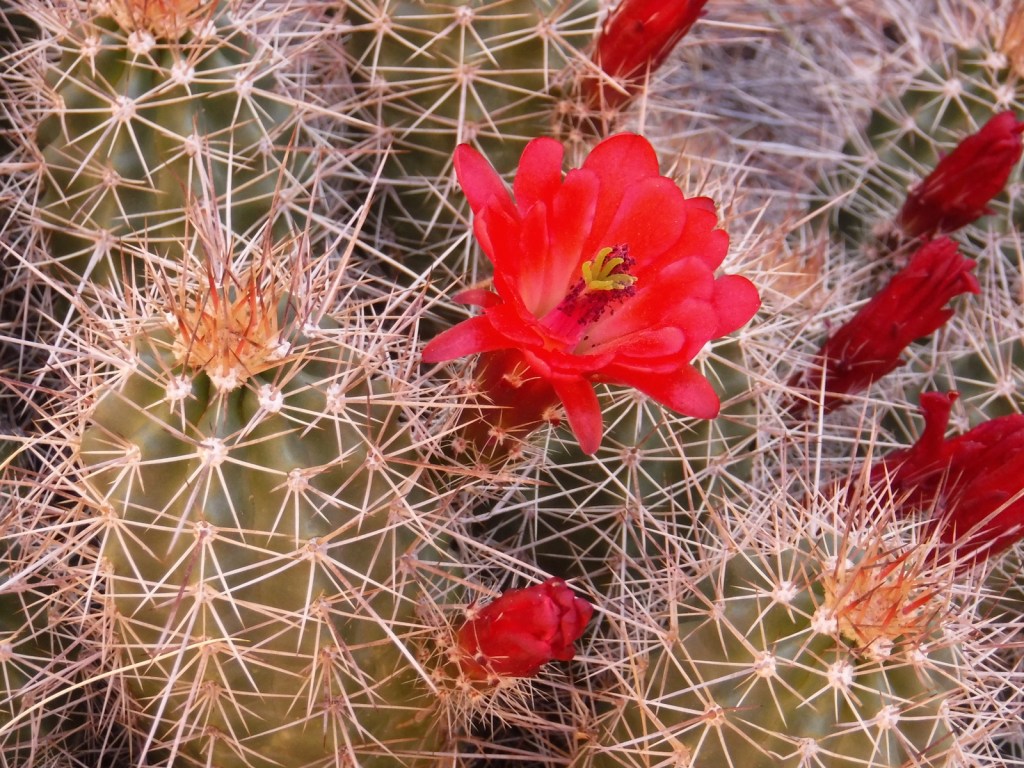
The mission of our guidebook is to introduce readers to the diversity of National Monuments by providing information on what makes each of them worthy of protection and how to go about experiencing what they have to offer. National Monuments cover a broad range of sites of historic and geologic interest from as small as 0.07 of an acre up to 2.2-million acres in size.
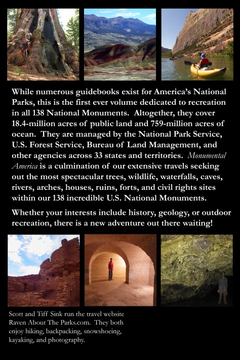
While numerous guidebooks exist for the United States of America’s National Parks, this is the first ever volume dedicated to recreation in all 138 National Monuments. Altogether, they cover 18.4-million acres of public land across 33 states and territories, plus 759-million acres of ocean in the five expansive Marine National Monuments created since 2006. Only 40 National Monuments have an entry fee, while the others provide free opportunities to learn about history or enjoy the outdoors.
National Monuments feature internationally recognized icons like the Statue of Liberty, as well as overlooked places that even locals rarely visit. They protect fossil quarries, historic homes of important Americans, caves open for exploration, sites significant to the Civil Rights Movement, volcanic wonders, relics of indigenous cultures, old military forts, and whitewater rafting spots. A select few National Monuments have visitor centers and guided tours, while others are undeveloped wildlands encompassing everything from deserts to glaciers, including wetlands, sand dunes, and coastlines that provide habitat for countless species of wildlife.
Whatever you are interested in, there is a new adventure out there waiting!
Please keep your eye out for our next post with the Introduction to our new guidebook. Check out our entire selection of U.S. travel guidebooks on our Amazon.com Author Page.
We are a participant in the Amazon Services LLC Associates Program, an affiliate advertising program designed to provide a means for us to earn fees by linking to Amazon.com and affiliated sites.
After we published our guidebook 50 States of Great: Road Trip Guide to America in 2023, we decided to start a new type of blog post where we create a travel itinerary for all 50 states, in addition to our usual public land entries. After starting with Kansas, Georgia, Idaho, Rhode Island, Minnesota, Hawai’i, Arizona, Louisiana, South Dakota, and Indiana, we decided to head back west to Montana. There are so many great trails in the state’s National Forests that we had a difficult time narrowing it down. We made an ambitious seven-day plan starting in southeast Montana on Interstate 90, with enough options to easily extend the trip into three weeks or more.
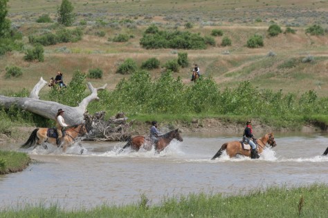
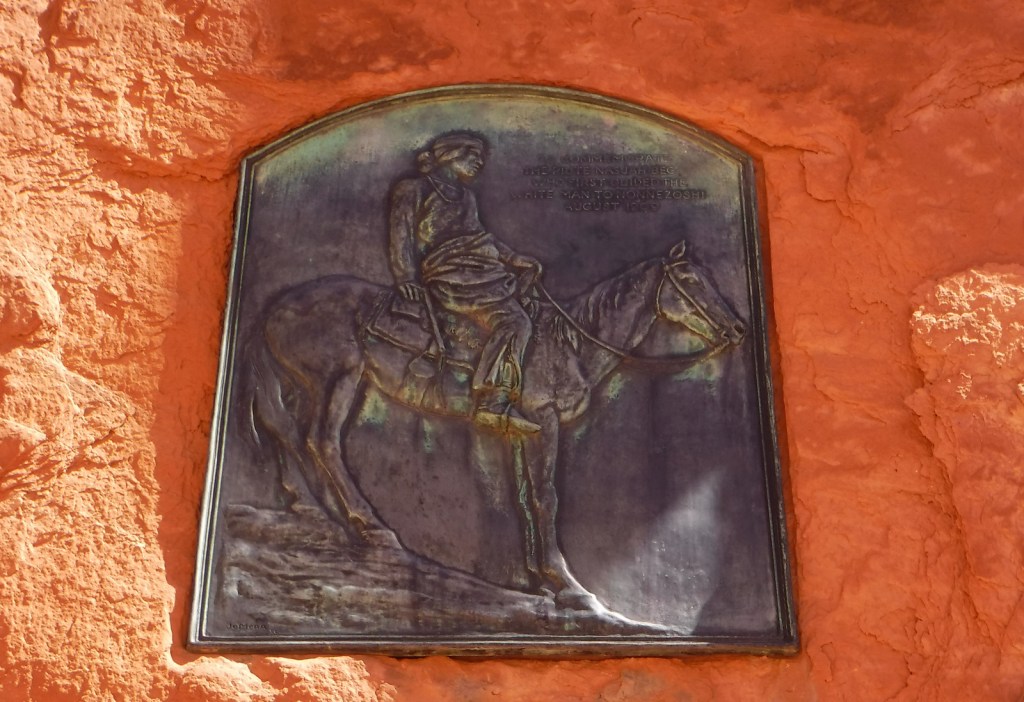
The best time to visit the National Monument is around June 25, the anniversary of Custer’s Last Stand when a reenactment of the battle is held on private land bordering the National Park Service site.
Makoshika State Park
It is illegal to remove dinosaur fossils from these badlands, but there are many on display at the visitor center, in addition to nearby museums (plus reservations can be made to dig on private land). The few campsites are in high demand to spend the night in these colorful canyons where caprocks rise high above juniper trees.
Optional stop at Pompeys Pillar National Monument
A sandstone monolith on the Yellowstone River has been a place for humans to record their passing for 11,000 years. The most famous inscription was left by Captain William Clark on July 25, 1806, the sole on-site evidence of the Corps of Discovery’s three-year journey.
This underappreciated gem in the National Park Service system features gorgeous scenery and abundant wildlife, including bighorn sheep and wild horses. The highlight is across the state line in Wyoming where Devil Canyon Overlook sits atop cliffs that drop over 1,000 feet straight down to the level of the narrow reservoir.
Gallatin Petrified Forest is only accessible by trail, either from a short two-mile one-way jaunt or by backpacking the 27-mile Gallatin Divide-Devils Backbone Trail. Earthquake Lake Geologic Area stretches along Highway 287 to commemorate the events that occurred around midnight on August 17, 1959, when a deadly magnitude 7.5 earthquake hit West Yellowstone.
Some of the National Forest’s miles of hiking trails access the Crazy Mountains and Hellroaring Plateau. The two-mile Glacier Lake Trail steadily climbs 1,100 feet then drops into a bowl containing a stunning reservoir that straddles the Wyoming-Montana border.
Optional drive on Beartooth All-American Road
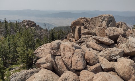
Custer National Forest is famous for its stretch of Highway 212 that climbs from the prairie around the town of Red Lodge up to 10,947 feet at Beartooth Pass across the Wyoming border in Shoshone National Forest. The road follows the southern border of the giant 943,626-acre Absaroka-Beartooth Wilderness, which contains the highest point in Montana.
Located mostly in Wyoming and partly in Montana and Idaho, you could easily spend an entire summer in the world’s first National Park and not see all the thermal features, lakes, waterfalls, wildlife, and hiking trails.
Day 3
Lewis & Clark Caverns State Park
Once a U.S. National Monument, the state now runs a campground here and offers guided tours through a limestone show cave where bats live in the summer.
The free Potosi Campground is situated near the trailhead for Upper Potosi Hot Springs where a 0.8-mile trail leads past the uphill side of a clear 100°F pool with room for about six adults.
Optional stop at Chico Hot Springs
If you leave Yellowstone National Park north through Gardiner on Highway 89, consider stopping at this developed hot springs (fee) that offers live music poolside on some nights (especially if the park’s Boiling River was closed). In business since 1897, even Teddy Roosevelt stopped to rest here.
Day 4
Bannack State Park
East of Lemhi Pass on the Idaho border (which is also the Continental Divide National Scenic Trail through there), Bannack State Park preserves more than 50 buildings from a gold rush town that was the territorial capital in 1864.
The site of a surprise attack by the U.S. Army on the morning of August 9, 1877, where Nez Perce warriors forced the troops to retreat, capturing a Howitzer cannon and allowing women and children to escape toward the newly created Yellowstone National Park. Part of the widespread Nez Perce National Historical Park, a small visitor center here overlooks the battlefield and a paved road accesses trails through it.
Blodgett Creek Trail leads 12.6 miles one-way to Blodgett Lake, but you do not have to go that far to appreciate its incredible beauty.
Optional stop at Elkhorn Hot Springs
In the Pioneer Mountains, about ten miles north of Highway 278 is the privately owned Elkhorn Hot Springs (fee), a great place to relax after hiking. There is free dispersed camping to the north in Beaverhead National Forest.
Day 5
Travelers’ Rest State Park
Follow in the footsteps of the Lewis and Clark expedition by driving the Lolo Trail (Highway 12), soaking at Lolo Hot Springs, or walking around Travelers’ Rest State Park (still a great place to camp).
Missoula
Do as the University of Montana students do and float tubes down the Clark Fork River through town. In the summer, look for webcam-famous Iris the Osprey in the parking lot near the football stadium. The Historical Museum at Fort Missoula preserves buildings dating back to 1877, including an Alien Detention Center used during World War II.
Outside Missoula, there are many trails in Rattlesnake National Recreation Area and Blue Mountain Recreation Area, plus the Aerial Fire Depot and Smokejumper Center, Ninemile Historic Remount Depot, and Savenac Historic Tree Nursery Area.
This working ranch commemorates the nineteenth-century lifestyle of cattle barons and cowboys. Free guided tours are offered inside the large ranch house, and a self-guided walking tour enters 15 buildings with displays on the history of barbwire, branding irons, and much more.
Day 6
National Bison Range
Established in 1908 under President Theodore Roosevelt and now run by the Confederated Salish and Kootenai Tribes. Start at the visitor center, then take the 19-mile Red Sleep Mountain Drive to see mule deer, white-tailed deer, elk, pronghorns, bighorn sheep, and the namesake bison.
Jewel Basin Hiking Area is famous among backpackers, and further south so is Holland Lake, which has several campgrounds. The steep Holland-Gordon Trail passes Holland Falls as it climbs 2,100 feet in 5.8 miles to Upper Holland Lake and continues into “the Bob” (Bob Marshall Wilderness). Flathead National Forest contains more than 2,800 miles of hiking trails, including 38 miles of the Pacific Northwest National Scenic Trail and a stretch of the Continental Divide National Scenic Trail.
Optional stop at Mission Mountains Wilderness
Located within Flathead National Forest, a popular trail accesses multiple mountain lakes; it is only 1.5 miles one-way to Glacier Lake, but we recommend continuing to Turquoise Lake. It borders the Mission Mountains Tribal Wilderness (permits required).
Waterton-Glacier International Peace Park’s renowned Going-to-the-Sun Road was built to cross the park from east to west in the 1920s (reservations are required to drive it between 7 a.m. and 3 p.m. in the summer). At its highest point at 6,646-foot Logan Pass, the road crosses the Continental Divide National Scenic Trail.
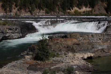
In the state’s northwest corner, incredible views await at Blue Mountain Trail, Skyline National Recreation Trail, Scenery Mountain Lookout Trail, Ross Creek Scenic Area of old-growth western redcedar trees, and Kootenai Falls (located in a county park on the side of Highway 2).
Meriwether Lewis named the Gates of the Mountains on July 19, 1805, and today a two-hour jet boat tour on the Missouri River provides history on the Corps of Discovery, American Indian pictographs, the Mann Gulch Fire, and the collapse of Hauser Dam. A trail through Refrigerator Canyon is less than ten feet wide at its narrowest point, where towering 200-foot limestone cliffs keep it cool and breezy throughout the summer.
Great Falls
North of Helena on Interstate 15 is the Lewis and Clark Interpretive Center (fee), which is managed by the U.S. Forest Service on the banks of the Missouri River.
This 375,000-acre National Monument preserves a stretch of the Missouri River that still looks much the way it did when Lewis and Clark explored it. Start your journey by paying for permits at the Bureau of Land Management interpretive center in historic Fort Benton, where you can launch your canoe or kayak to access 149 miles of the river. There are developed boat camps with vault toilets along the route, or you can pick your own spot near one of the Corps of Discovery campsite markers.
It includes portions of the Boulder Mountains, Flint Creek Range, and Elkhorn Mountains, as well as part of the Anaconda-Pintler Wilderness. Our favorite hike is Haystack Mountain National Recreation Trail off Interstate 15, where a climb of 2,000 feet ends at a mountaintop boulder field with panoramic views and the remnants of a fire lookout tower.
Backpacking is a major draw with trails in the Snowy Mountain Range and parts of the Scapegoat and Bob Marshall Wilderness areas, which provide crucial habitat for grizzly bears. It encompasses one of the most famous formations along the Continental Divide National Scenic Trail, the 15-mile long Chinese Wall (a 1,000-foot-tall cliff composed of five-million-year-old limestone).
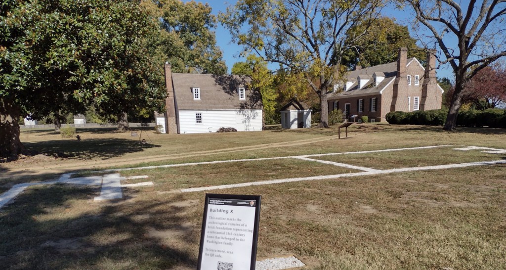
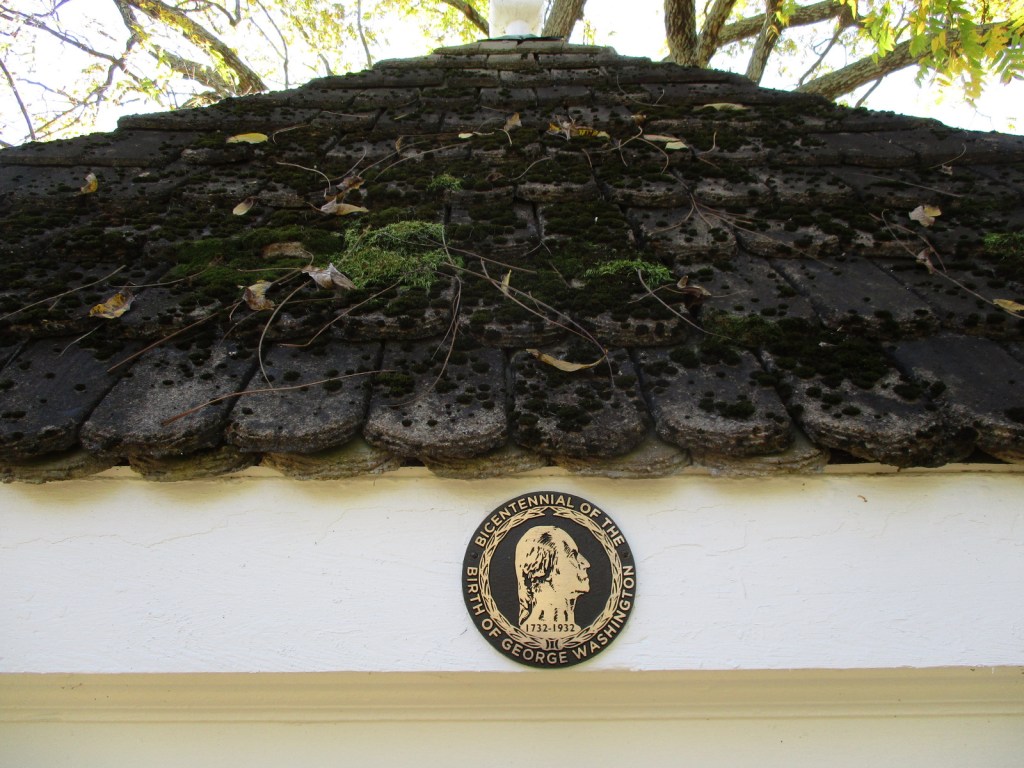
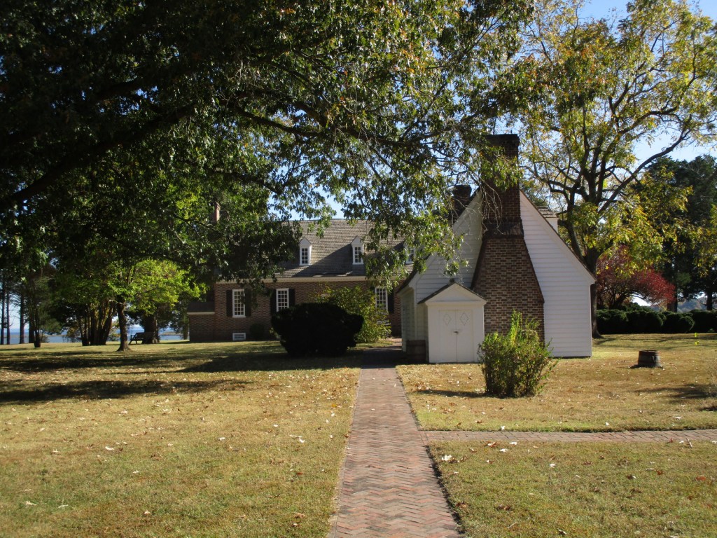
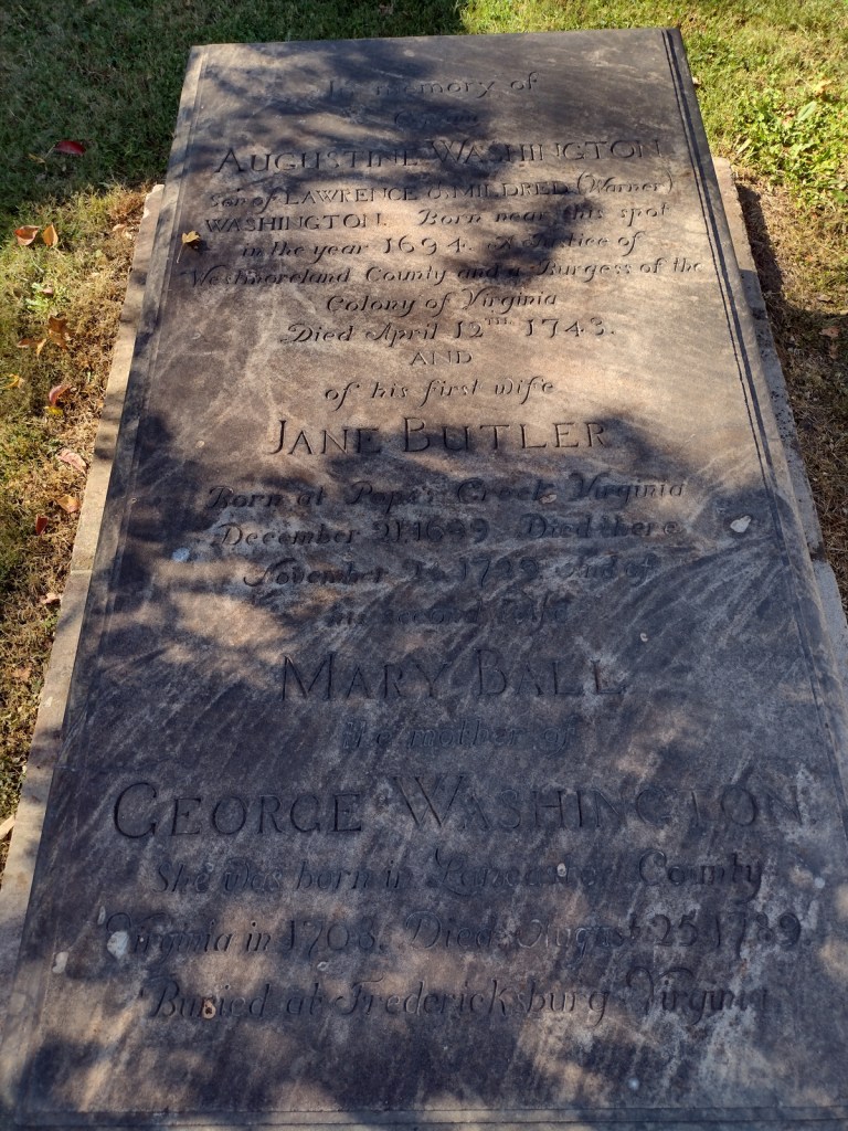
George Washington’s great-grandfather John first came to Virginia in 1657 and later settled this slave plantation on Popes Creek. The future general and president was born on the property in 1732 in a house that burned down whose foundation is now outlined in the ground by crushed oyster shells. The current Memorial House was constructed to celebrate the bicentennial of his birth, although the architect had no idea of the original house’s layout. Those interested in the first U.S. President should combine this free tour with an expensive visit to his mansion at Mount Vernon located 68 miles north.
Memorial Obelisk, film, Memorial House, Family Burial Ground, Nature Trail, Dancing Marsh Loop Trail
Must-Do Activity
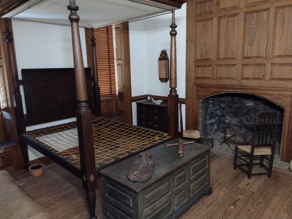
After passing the Memorial Obelisk on the drive in, your first stop should be the visitor center to watch the 15-minute film, see artifacts from the burned-down house, and find out about a tour. The hour-long ranger-guided walking tour covers about a half-mile on a gravel pathway to the Memorial House with frequent interpretive stops. In the summer, the house also has open hours for dropping in before and after the tour. There may be living history demonstrations at the colonial herb and flower garden, farm workshop, and colonial revival kitchen. It is worth a short drive to the tidewater beach on the Potomac River and a stop along the way at the Washington Family Burial Ground that has replicas of gravestones.
Best Trail
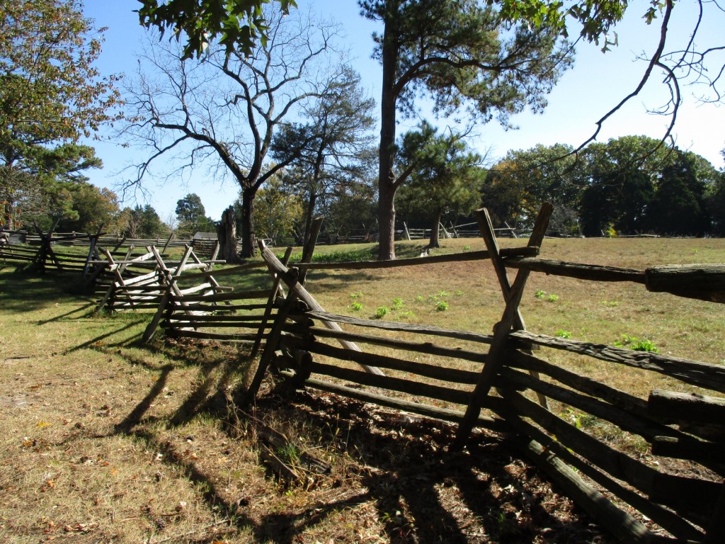
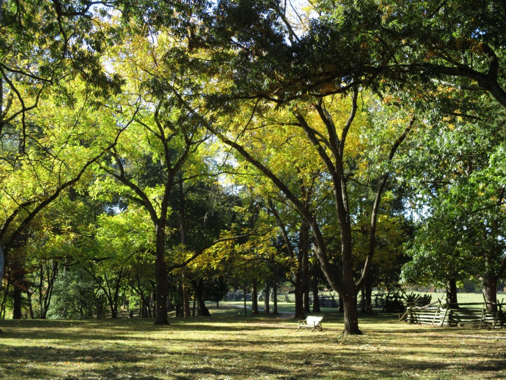
From the Memorial House, it is less than a mile to walk Dancing Marsh Loop Trail including open views on the footbridge across Popes Creek and the boardwalk through the marsh. This trail connects with the one-mile Nature Trail loop for a longer walk, and that is also accessible from the picnic area parking lot.
Photographic Opportunity
Originally constructed in 1896 by the War Department on the site where Memorial House now stands, the 50-foot-tall Memorial Obelisk is made of Vermont granite at one-tenth scale of the Washington Monument 70 miles to the north in Washington, D.C.
All roads are paved, but be aware there is a toll to cross the bridge into Virginia on Highway 301 southbound from Maryland.
Camping
There is no camping at the National Monument, so the nearest campground is seven miles southeast at Westmoreland State Park, which offers RV sites with hookups.
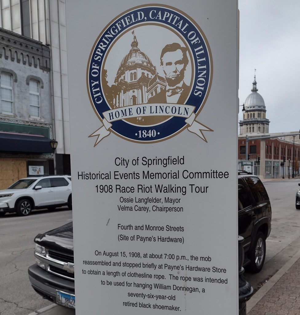
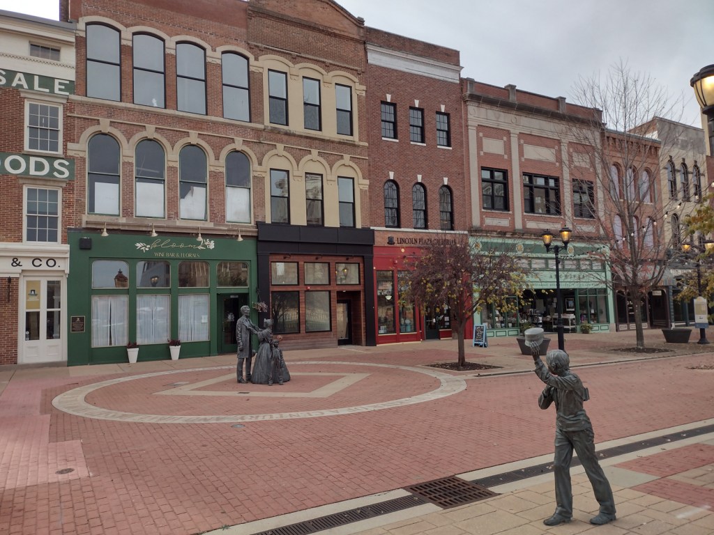
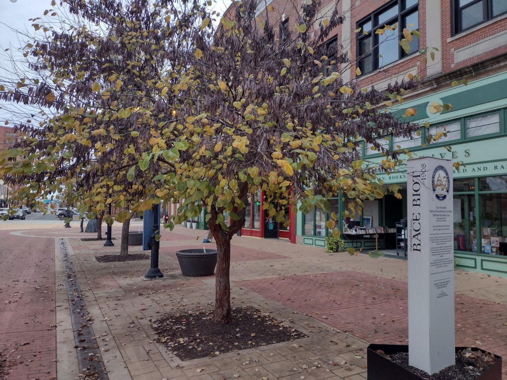
In 1908, African Americans made up only 5.5% of Springfield’s population of 47,000. However, racial tensions ran high across the nation, and, on August 14, a mob formed outside the jail where two African-American men were accused of separate incidents of sexual assault and murder. When the crowd found out the prisoners had been secretly moved 60 miles away, a full riot broke out. They destroyed buildings, looted, and lynched two prominent members of the African-American community—a barber named Scott Burton and the wealthy William Donnegan. By the time the National Guard arrived to restore order, seven people were dead and the mob had already burned the African-American neighborhood known as the “Badlands” to the ground. Eventually, the trials of the 80 riot suspects at the Old Court House led to only one conviction for petty larceny. While the rape suspect, George Richardson, was released when his accuser admitted fabricating the story, Joe James was convicted of murder and executed on October 23, 1908 despite being legally exempt from the death penalty as a minor. These events catalyzed the formation of the National Association for the Advancement of Colored People (NAACP) a few months later in New York City.
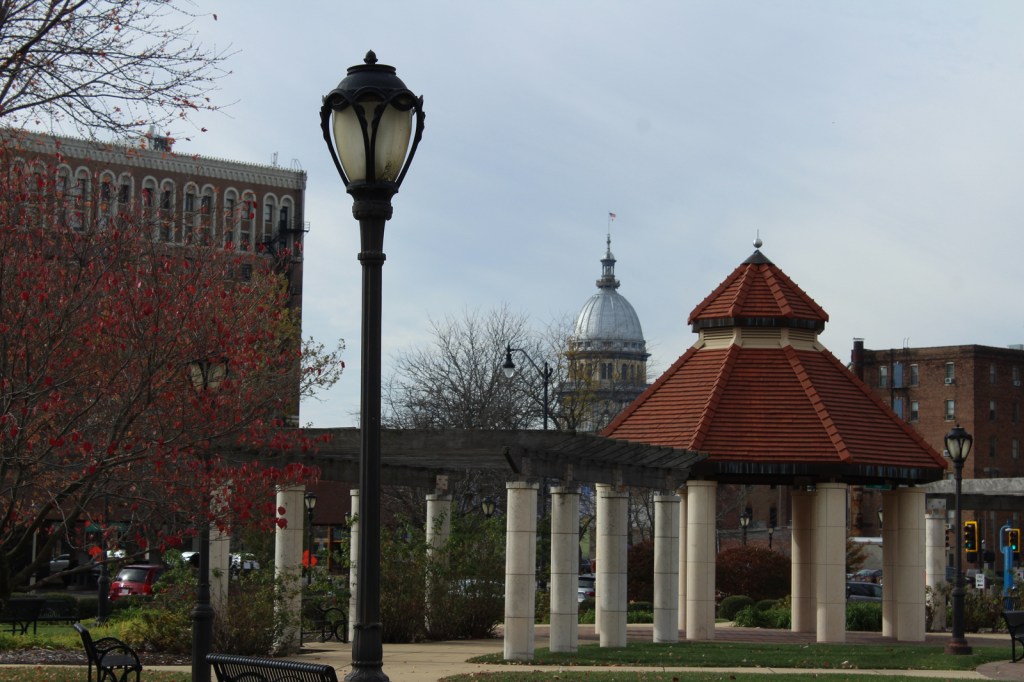
Walking tour, Acts of Intolerance sculpture, mural, Old Court House, Springfield and Central Illinois African American History Museum, Oak Ridge Cemetery, Mechanicsburg Cemetery
Must-Do Activity
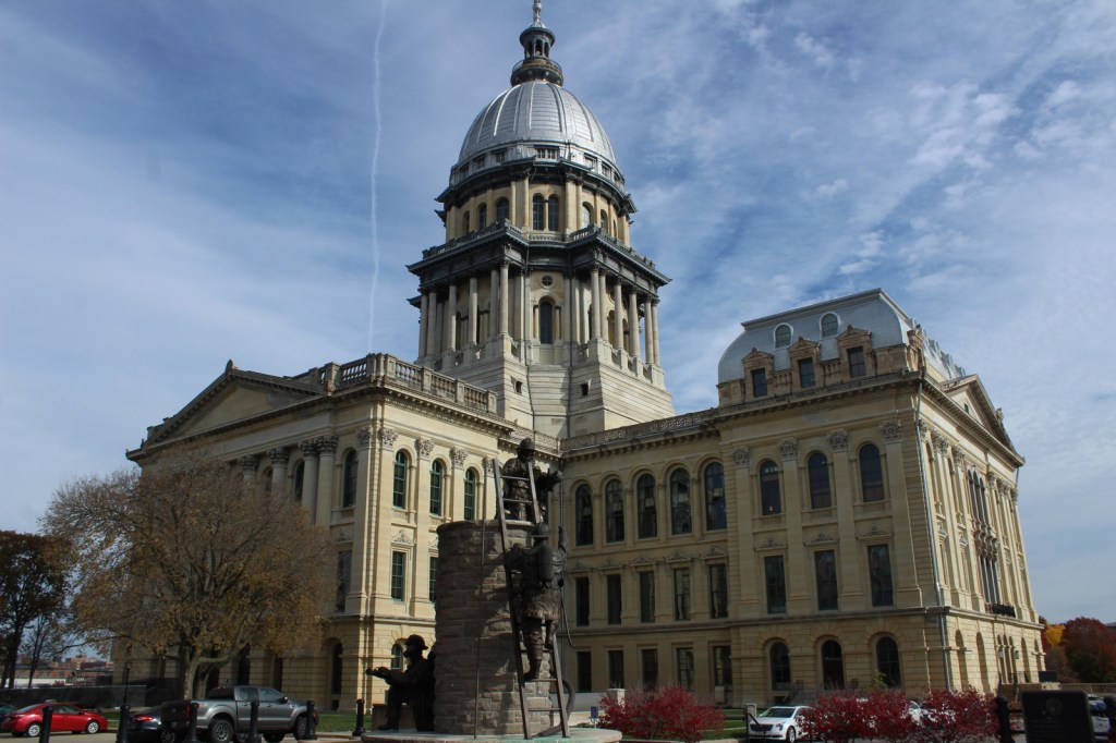
Before the National Monument was designated in 2024, the city of Springfield had already created a walking tour highlighting the events of the 1908 race riot marked by seven silver pillars. After starting at the former site of the jail, the tour moves to where Loper’s Restaurant once stood; its white owner having assisted in moving the prisoners, his restaurant and his car were destroyed. During the frenzy, a restaurant patron named Louis Johnson was shot and killed. There are five other stops detailing the events chronologically, but they do not include the mural inside HSHS St. John’s Hospital Women & Children’s Clinic, which is next to the officially designated National Monument boundaries where the foundations of five homes burned in the “Badlands” remain fenced off. Upon our visit less than three months after its creation, the National Park Service visitor center for Lincoln Home National Historic Site did not have any information on the new National Monument, but they already had a passport stamp.
Best Trail
When followed in chronological order, the walking tour bounces back and forth across the city, so you will get your steps in that day. In the summer, guided tours are offered from the Springfield Convention and Visitors Bureau. Alternatively, you can drive the route and read the descriptions in the publication available online and from the visitors bureau.
Photographic Opportunity
After the burning of the “Badlands” neighborhood, two chimneys were about the only structures left standing. The sculptor Preston Jackson utilized this imagery in his work Acts of Intolerance that depicts scenes of the race riot in bas relief. Dedicated in 2009, it stands across the street from the Abraham Lincoln Presidential Library in Union Square Park.
There is no free parking in downtown Springfield, so you can use a parking meter or the NPS pay lot at Lincoln Home National Historic Site.
Camping
Lincoln’s New Salem State Historic Site is 20 miles northwest of Springfield and its campground has running water. Further north, Starved Rock State Park is a beautiful spot for camping, and it also offers a historic lodge.
Related Sites
New Philadelphia National Historic Site (Illinois)
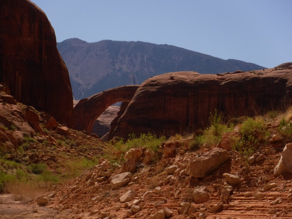
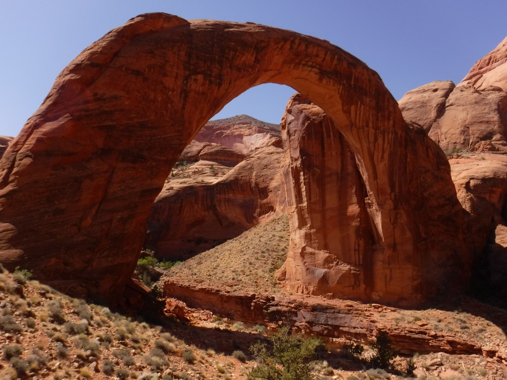
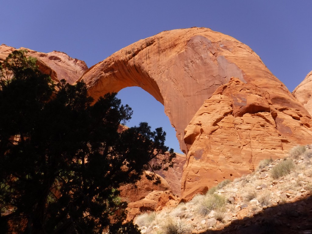
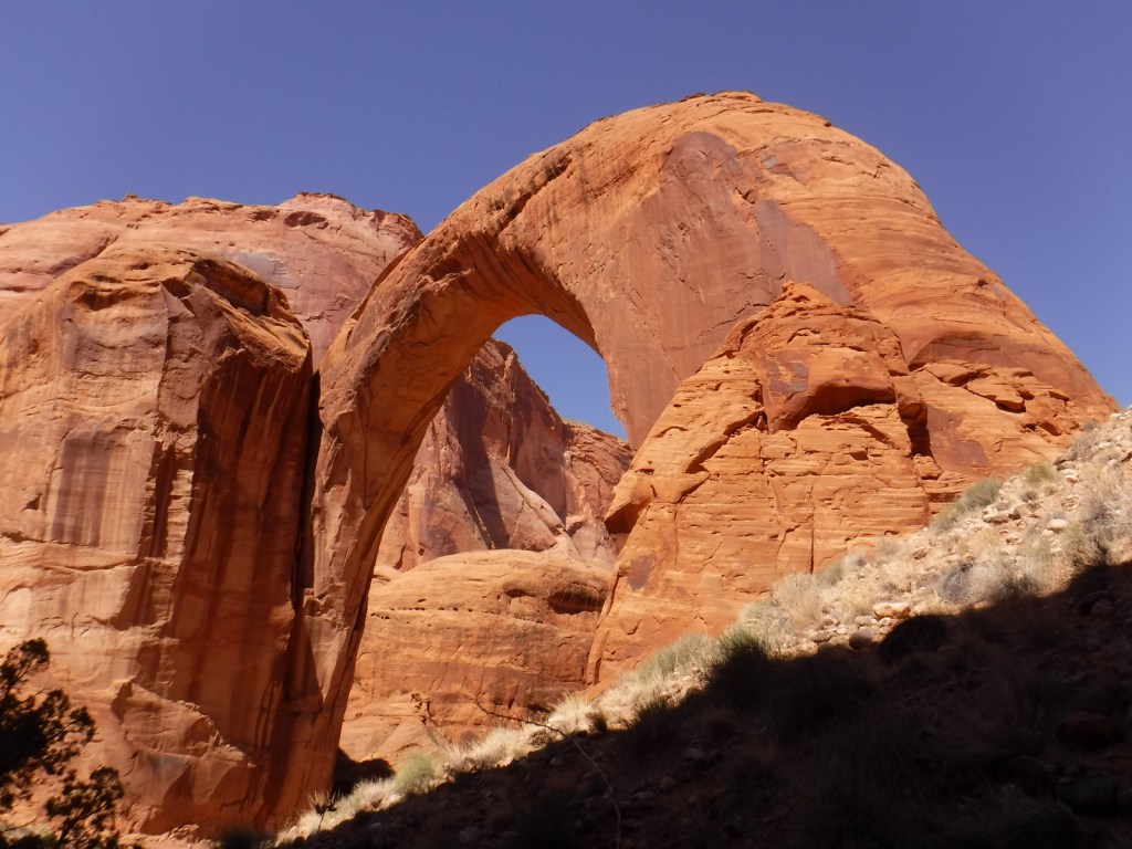
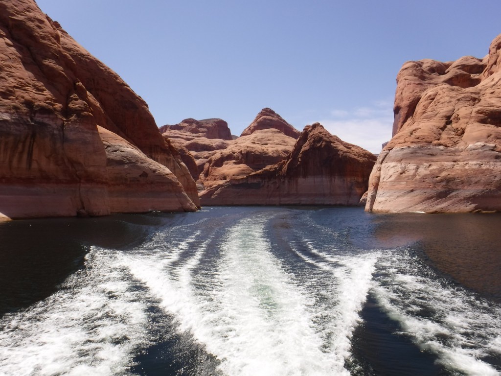
The statistics on Rainbow Bridge are impressive: it spans 275 feet with a height of 290 feet (compare that to the 151-foot-tall Statue of Liberty), and the sandstone at its top is 42 feet thick and 33 feet wide. Before geologists started lumping together natural bridges and arches, it was considered the largest natural bridge in the world formed by water running underneath it. The Navajo and other tribes consider Rainbow Bridge sacred and request that nobody walks beneath its span. When Glen Canyon Dam was completed in 1963, many archaeological sites were submerged beneath Lake Powell and at the reservoir’s peak volume this sacred site has had water reach to its base. The National Park Service (NPS) manages Rainbow Bridge National Monument as part of Glen Canyon National Recreation Area that straddles the Utah-Arizona border.
The NPS runs Carl Hayden Visitor Center in Page, Arizona, which is a good place to plan a visit to Rainbow Bridge or purchase tickets for a Glen Canyon Dam tour. If you do not want to attempt to navigate 50 miles one-way in your own boat (rentals available), there are all-day commercial boat trips into Bridge Canyon. Depending on the water level, the hike from the boat dock to the first overlook of the natural bridge is around one-mile one-way and is not wheelchair accessible. Photos do not do Rainbow Bridge justice, and you must see it for yourself to truly appreciate the size of this entry on our Top 10 NPS Sites for Natural Bridges/Arches.
Best Trail
There is always a hike from the boat dock to the overlook, but if you are in good shape continue on the trail around to the left to see the other side of Rainbow Bridge. With proper permits from the Navajo Nation in Window Rock, Arizona, it is possible to backpack into the site on either a 14-mile or 17-mile trail.
Photographic Opportunity
Obviously, Rainbow Bridge is the star attraction here. Navajo legends tell how one of the Hero Twins was saved from drowning when his father Jo’hanaa’éí (the Sun) sent a rainbow, later turned to stone to symbolize a father’s love. Another story says a measuring worm turned itself to stone to save both Hero Twins.
There is a $30 per vehicle entrance fee at the two marinas in Page (America the Beautiful passes accepted), in addition to charges for guided boat tours.
Road Conditions
The roads are paved to the marinas in Page, Arizona. Glen Canyon National Recreation Area is famous for its backcountry 4×4 roads (like Hole-in-the-Rock Road) and flash floods, so check with a park ranger before attempting anything unpaved. A fee is charged to ferry across Lake Powell between Halls Crossing and Bullfrog Marina.
Camping
There are several developed campgrounds in Glen Canyon National Recreation Area (mostly near marinas), but free primitive camping is also allowed along most dirt roads. A permit is required for backpack camping in the beautiful Coyote Gulch area off Hole-in-the-Rock Road.