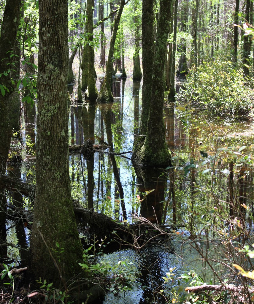
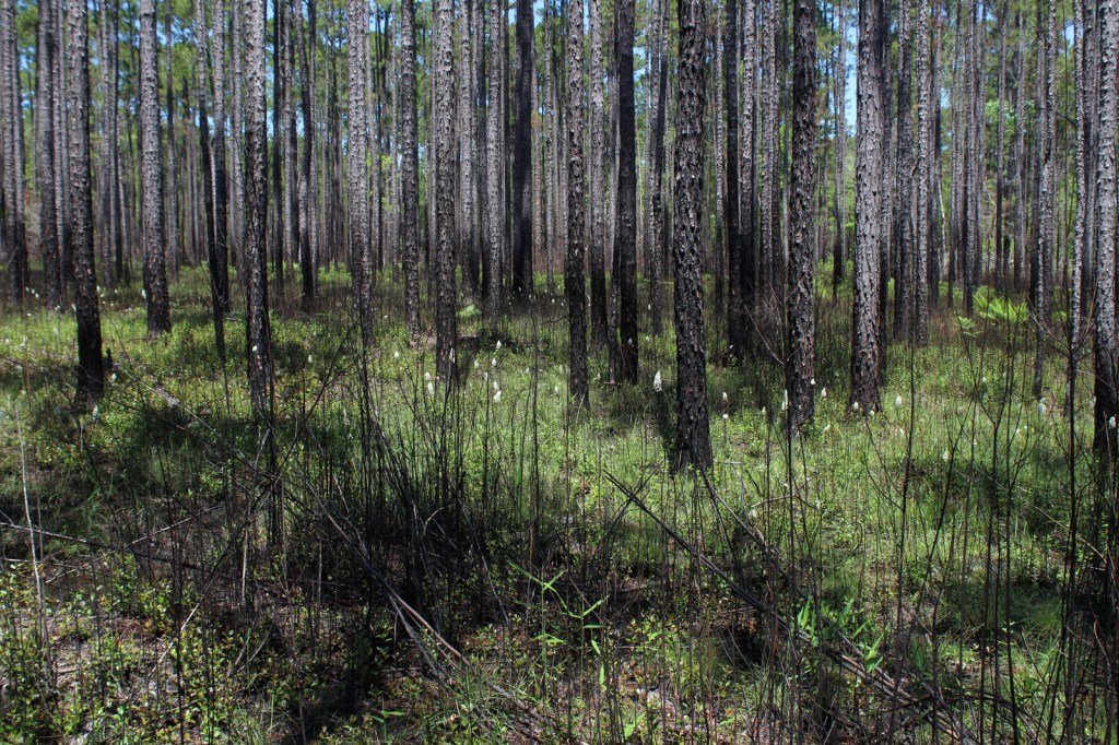
In southern Alabama, Conecuh National Forest was created in 1936 from clearcut and burned-over lands that were replanted with fast-growing slash pine. Reforestation efforts today focus on native longleaf pine trees that provide habitat for endangered red-cockaded woodpeckers. The topography of these coastal plain forests is fairly flat with broad ridges flanked by bottomlands and floodplains. Conecuh National Forest is primarily developed at two Recreation Areas: Open Pond and Blue Lake.
Highlights
Open Pond Recreation Area, Buck Pond, Blue Spring, Open Pond Fire Tower, Yellow River Basin, Blue Lake Recreation Area, Lake Shore Trail, Conecuh National Recreation Trail
Must-Do Activity
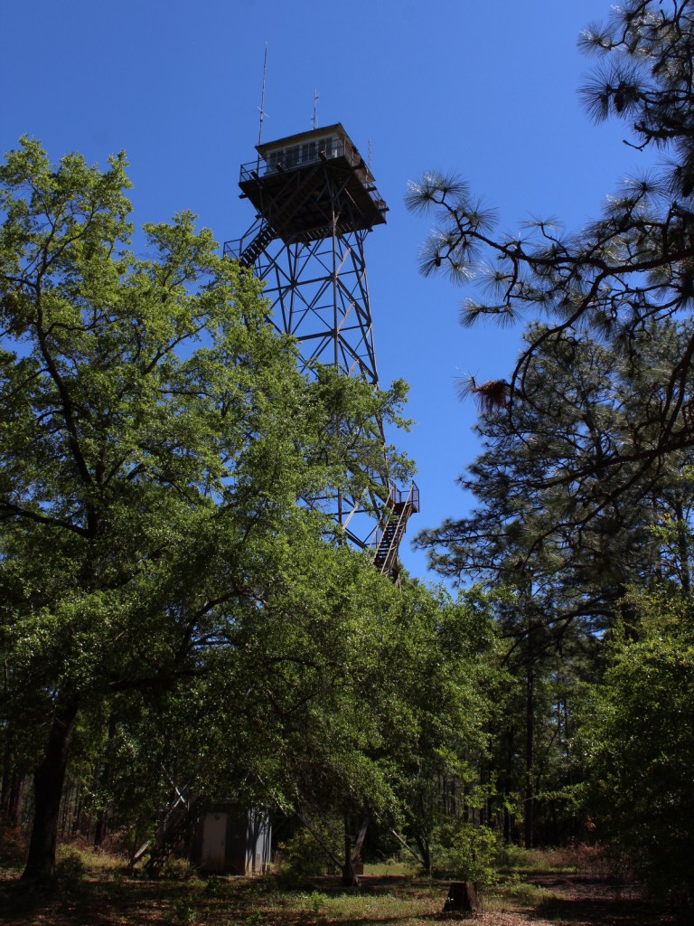
Open Pond Recreation Area (fee) surrounds a 30-acre natural sinkhole lake and has a campground, boat ramps, and a historic 1938 fire tower. Located only a ten-minute drive away, Blue Lake Recreation Area (fee) offers a day-use picnic area and swimming beach (the only place in the National Forest where swimming is allowed, presumably due to the presence of alligators elsewhere).
Best Trail
The 20-mile long Conecuh Trail was built by the Youth Conservation Corps beginning in 1976 and traverses longleaf pine stands and hardwood bottomlands. Leaving from Open Pond Recreation Area, the seven-mile long South Loop of the Conecuh Trail passes Blue Spring, but that portion of the trail was closed due to hurricane damage during our visit.
Watchable Wildlife
Notable wildlife species that inhabit Conecuh National Forest include red-cockaded woodpeckers (see above), wild turkeys, fox squirrels, raccoons, red foxes, gray foxes, bobcats, coyotes, black bears, and alligators. Fishing is a popular activity, with interesting spiky PVC pipe constructions put in the water to provide habitat for bream, bass, and crappie.
Instagram-worthy Photo
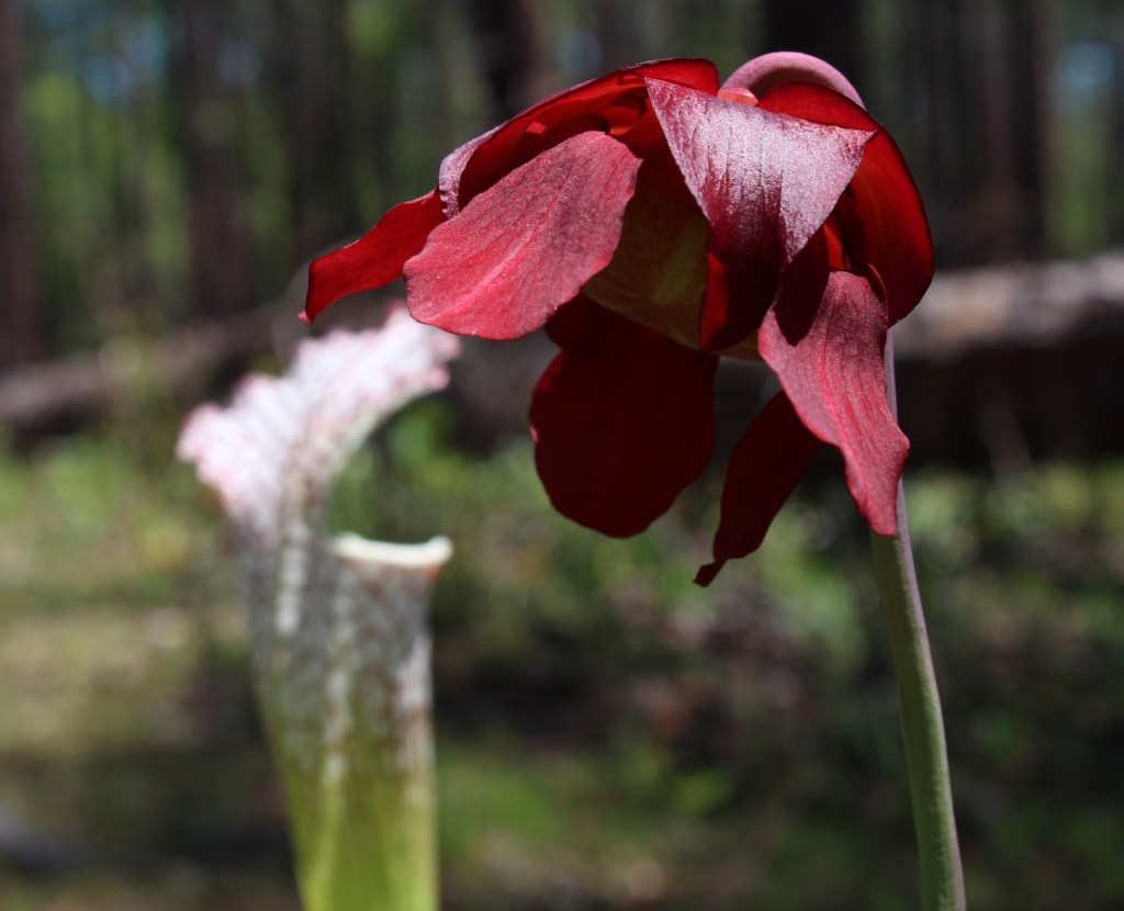
Watch for carnivorous pitcher plants growing in the wet soils on the edge of bogs and baldcypress ponds.
Peak Season
Spring and fall
Fees
There is a day use fee at both Open Pond and Blue Lake Recreation Areas, but an America the Beautiful pass can be substituted.
Road Conditions
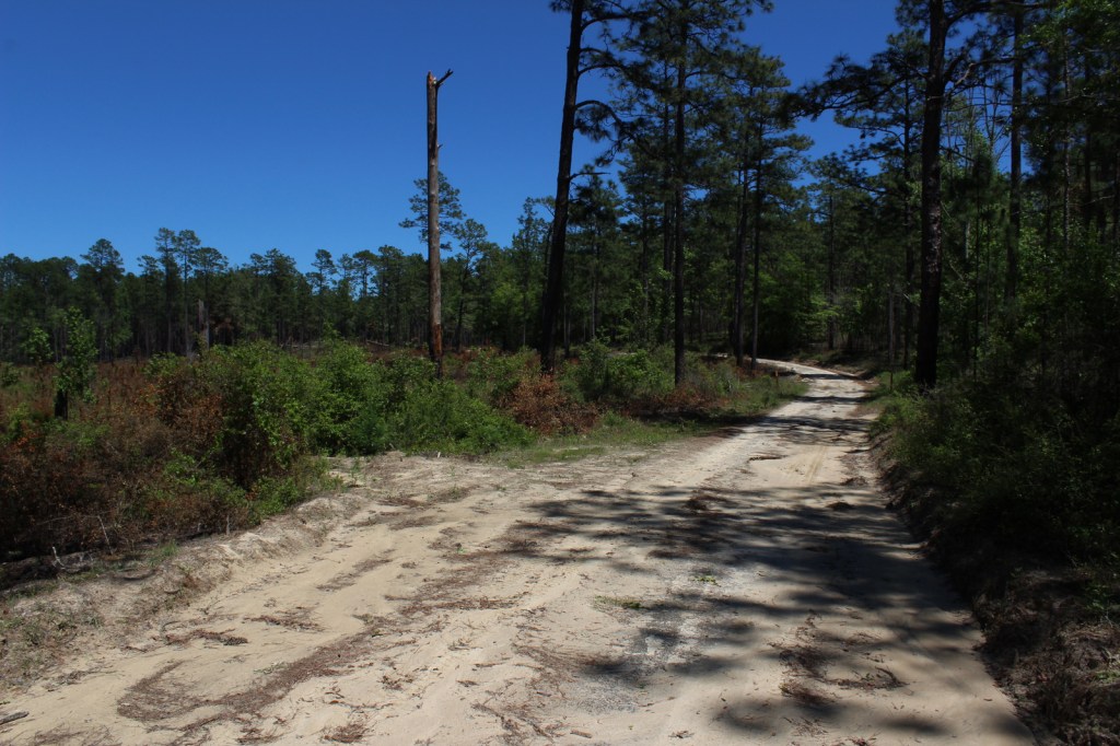
Many of the roads in Conecuh National Forest are unpaved, but the sand packs down well and provides a good surface for any vehicle to drive.
Camping
Open Pond Campground contains 75 campsites available on a first-come, first-served basis.
American holly, flowering dogwood, southern magnolia, swamp tupelo, pumpkin ash, swamp cottonwood, overcup oak, swamp chestnut oak, cherryark oak
Explore More – Believed to be of Muskogee origin, what does the name “Conecuh” translate as?
Learn more about this and the 154 other National Forests in our new guidebook Out in the Woods
We are a participant in the Amazon Services LLC Associates Program, an affiliate advertising program designed to provide a means for us to earn fees by linking to Amazon.com and affiliated sites.
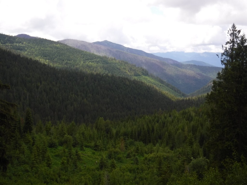
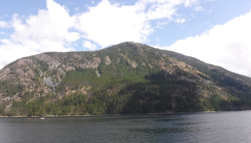
In northeast Washington, Colville National Forest is divided into two sections on either side of the Columbia River. In the west are the Kettle River Mountains, which are crossed by Sherman Pass Scenic Byway (Highway 20). To the east, the remote Selkirk Mountains contain the Salmo-Priest Wilderness that spills over into Kaniksu National Forest. Colville National Forest also borders Little Pend Oreille National Wildlife Refuge and Lake Roosevelt National Recreation Area.
Highlights
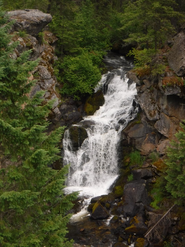
Sherman Pass Scenic Byway, Pewee Falls, Sullivan Lake, Marble Creek Falls, Trout Lake, Kettle Creek National Recreation Trail, Crowell Ridge Trail, Sherman Creek Trail, Grassy Top National Recreation Trail, Brown’s Lake Interpretive Trail, Pacific Northwest National Scenic Trail
Must-Do Activity
In the Selkirk Mountains east of the Pend Oreille River, the large Sullivan Lake is a scenic spot for boating and camping. Designated in 1978, the Sullivan Lake National Recreation Trail runs 4.3 miles between the two campgrounds located at either end of the lake. Colville National Forest is also known for 200-foot-tall Pewee Falls that cascades into the Boundary Dam Reservoir near the Canadian border, but we did not make it up there.
Best Trail
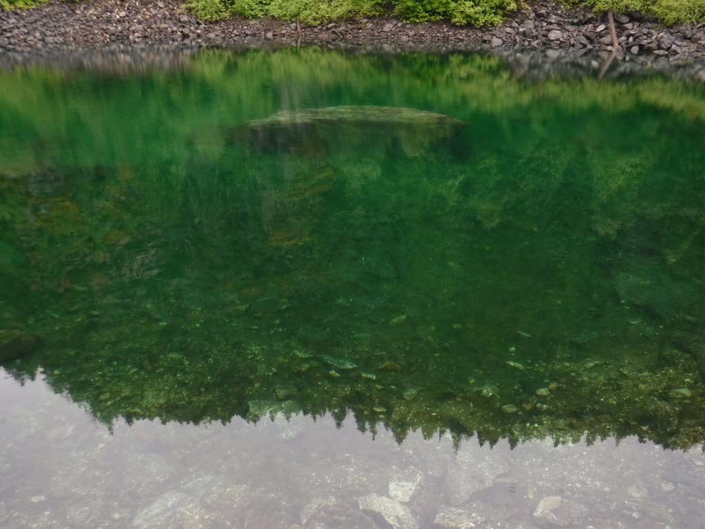
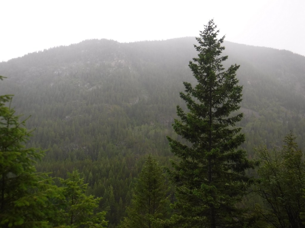
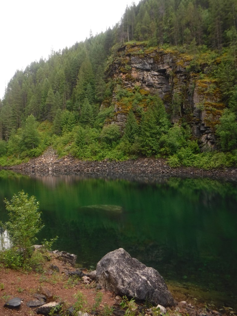
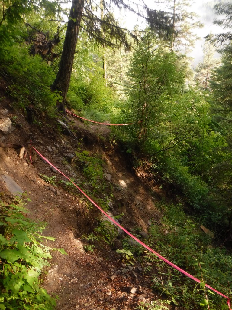
Hoodoo Canyon Trail is 4.8 miles one-way and accessible from two trailheads, one on unpaved Deadman Creek Road and the other at Trout Lake Campground, which is five miles from the Sherman Pass Scenic Byway. We started out in the rain from our dispersed campsite along Deadman Creek Road and the trail soon made a steep climb through a dense conifer forest. Eventually the route leveled out and we got our first view of shamrock green Emerald Lake, so we took a well-worn path down to its shoreline. The trail was officially closed at the 3.2-mile point due to a small landslide (see photo), but it was not hard to navigate past that spot to gain a view of Trout Lake, at which point we turned around.
Watchable Wildlife
The remote Selkirk Mountains represent the sole place south of Canada where there is a herd of mountain caribou. Grizzly bears, Canadian lynx, mountain lions, and gray wolves also inhabit this wild borderland region. More common species include mule deer, bighorn sheep, moose, beavers, bald eagles, and loons.
Instagram-worthy Photo
The water of Emerald Lake truly lives up to its gem of a name, even on a cloudy day.
Peak Season
Summer
Fees
None
Road Conditions
Sherman Pass Scenic Byway (Highway 20) is paved, but most the roads we drove through Colville National Forest were unpaved but in very good condition.
Camping
Trout Lake Campground seemed like a nice spot, secluded but only five miles off the Sherman Pass Scenic Byway. We found many excellent dispersed campsites along the unpaved portions of Deadman Creek Road.
Wilderness Areas
Salmo-Priest Wilderness (also in Kaniksu National Forest)
Learn more about this and the 154 other National Forests in our new guidebook Out in the Woods
We are a participant in the Amazon Services LLC Associates Program, an affiliate advertising program designed to provide a means for us to earn fees by linking to Amazon.com and affiliated sites.
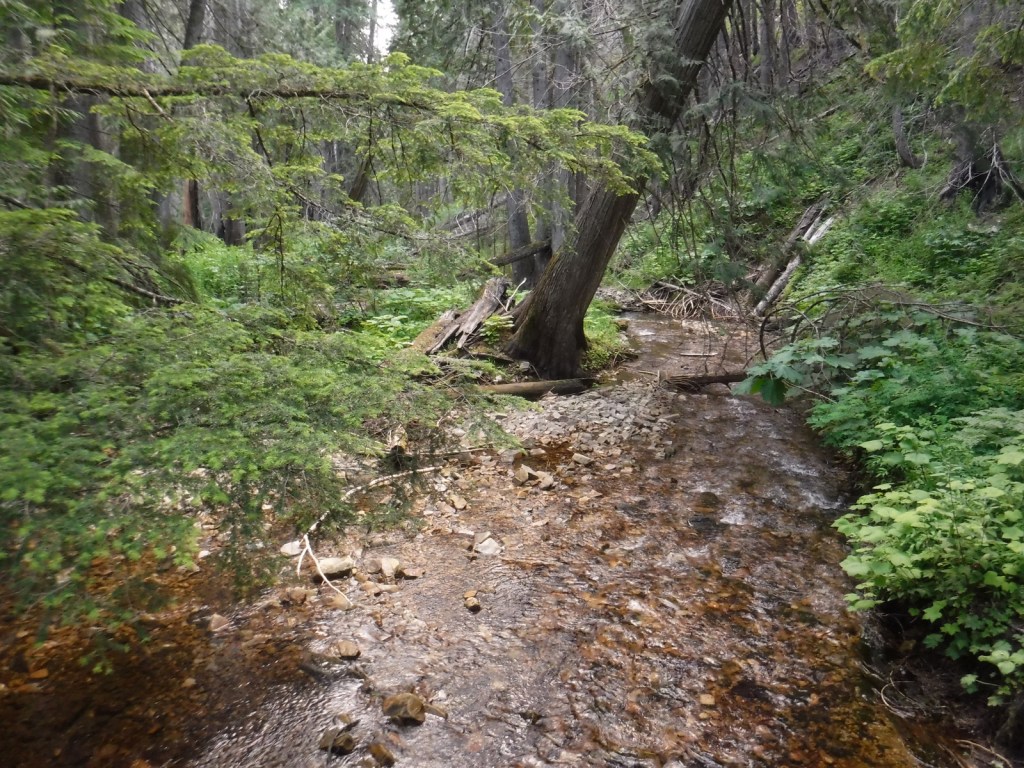
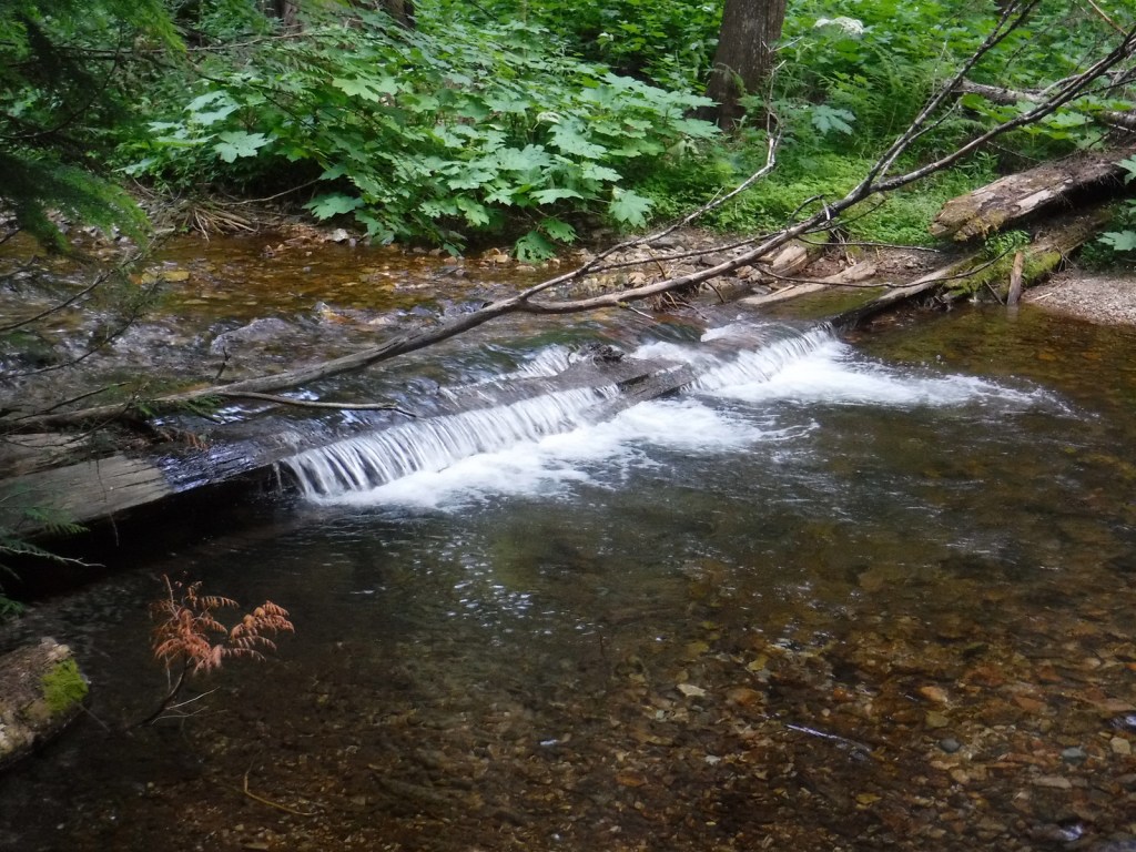
Coeur d’Alene National Forest is located on both sides of Interstate 90, east of the city of Coeur d’Alene, which was the French name given to the indigenous people. In 1973, it was joined with Kaniksu and St. Joe National Forests to form Idaho Panhandle National Forests. A good base for exploration, Wallace is a silver mining boomtown that refused to die despite its close call during the infamous Big Burn of 1910 (read more about it and the Pulaski Tunnel in Timothy Egan’s book). On the Montana border, Lookout Pass Ski Area provides permits, equipment rentals, and shuttles for the famous Route of the Hiawatha bicycling trail (that is technically in St. Joe National Forest).
Highlights
Lake Hayden, Lookout Pass, Prichard Bridge, Stevens Lake, Willow Creek Falls, Steamboat Rock, Grassy Mountain Lookout, Lake Hayden, Settler’s Grove of Ancient Cedars, Pulaski Tunnel Trail
Must-Do Activity
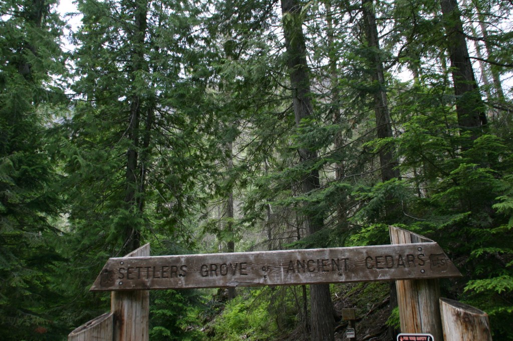
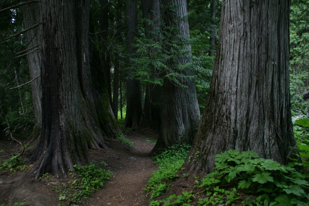
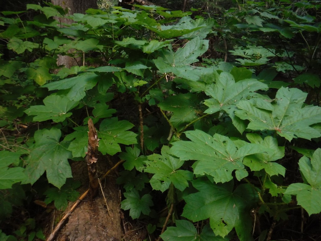
North of Wallace, a good dirt road follows the West Fork of Eagle Creek to the Settler’s Grove of Ancient Cedars. This 173-acre stand contains western redcedar trees up to seven feet in diameter, as well as large western hemlocks. Fire has burned through the understory of this grove freeing nutrients for a lush growth of ferns and devil’s-club. Look for a geocache near the sign that reads “end of Cedar Grove Trail” and points uphill to Trail No. 162, which continues another three miles.
Best Trail
The Idaho Centennial Trail follows the mountainous Idaho-Montana border on the eastern side of Coeur d’Alene National Forest, although it does dip west to cross Interstate 90 near the town of Mullan. The old Mullan Road was cut through this rugged area in 1859-61; the terrain was so steep that workers had to construct 47 bridges to cover a distance of only 28 miles.
Watchable Wildlife
Coeur d’Alene National Forest is home to mule deer, elk, moose, black bears, bobcats, coyotes, and mountain lions. This close to Canada, it is also possible to find grizzly bears and gray wolves. Common large birds include ospreys, golden eagles, bald eagles, wild turkeys, and ravens. Although the National Forest does not encompass Lake Coeur d’Alene, it does contain many of the rivers and creeks that feed it, which provide incredible fishing opportunities.
Instagram-worthy Photo
There are some impressive western redcedar trees growing in the Settler’s Grove of Ancient Cedars.
Peak Season
Summer
Fees
None
Road Conditions
Even the paved roads we drove north of Wallace were slow going—very steep with hairpin switchbacks. Once we got on the unpaved road following the West Fork of Eagle Creek, it was wide and flat. We drove through Coeur d’Alene National Forest to access Bullion Pass on a four-wheel-drive-only road up a steep three-mile-long grade about a mile west (on a paved frontage road) from the Dena Mosa-Lookout Pass Rest Area on eastbound Interstate 90.
Camping
There are campgrounds located throughout the National Forest, including Mokins Bay Campground on Hayden Lake and Bell Bay Campground on Lake Coeur d’Alene. We found a good dispersed campsite along the West Fork of Eagle Creek on the road to the Settler’s Grove of Ancient Cedars.
western redcedar, Engelmann spruce, lodgepole pine, western white pine, Douglas-fir, western hemlock, grand fir, subalpine fir, Pacific yew, western larch
Learn more about this and the 154 other National Forests in our new guidebook Out in the Woods
We are a participant in the Amazon Services LLC Associates Program, an affiliate advertising program designed to provide a means for us to earn fees by linking to Amazon.com and affiliated sites.
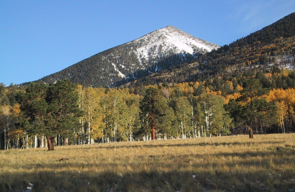
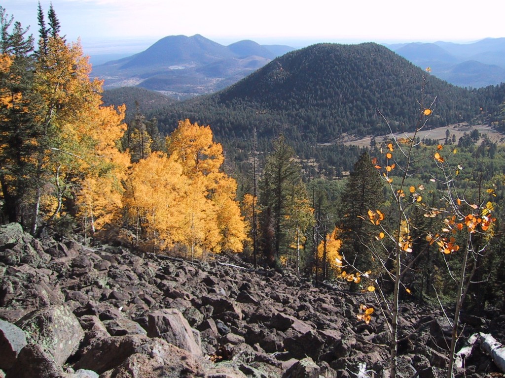
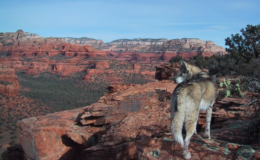
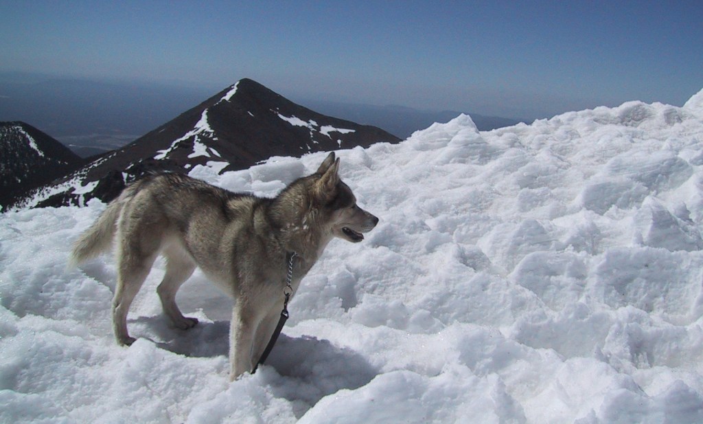
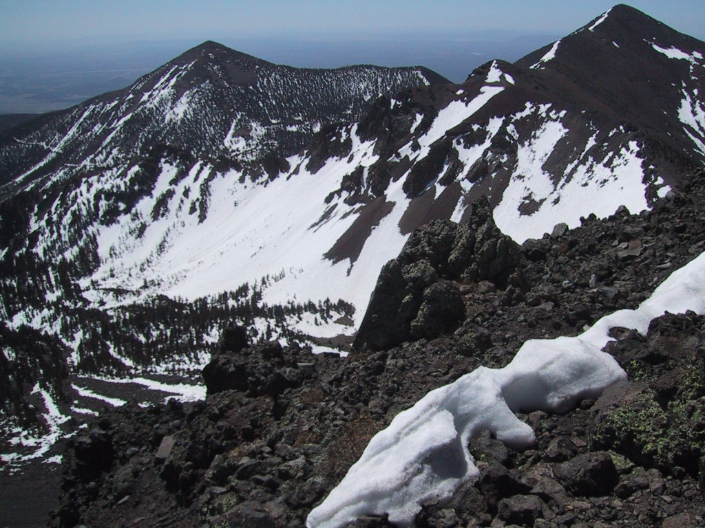
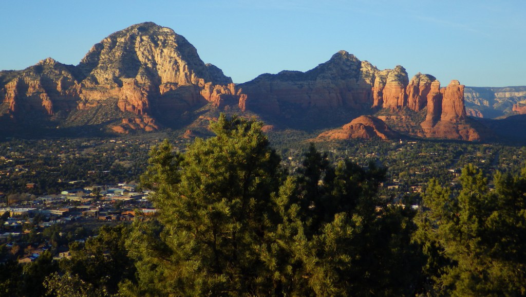
Coconino National Forest has an elevation range of 10,000 feet from the Verde River up to 12,637-foot Mt. Humphreys, the highest point in Arizona. It borders four other National Forests: Kaibab, Prescott, Sitgreaves, and Tonto. The National Forest encompasses two busy recreational areas: the red rocks around Sedona and the San Francisco Peaks north of Flagstaff. While in college for three years at Northern Arizona University, Scott probably hiked 100 different trails and more than 1,000 miles through Coconino National Forest. He and his Siberian husky would often wake up early to get a hike in before class, including one moonlit summiting of Mt. Humphreys completed in time for an 8 a.m. lecture. See where it ended up on our list of Top 10 Summit Trails in National Forests.
Highlights
Oak Creek Canyon, Bell Rock, Vultee Arch, Cathedral Rock, Sycamore Canyon, Honanki Ruins, Wet Beaver Creek, San Francisco Peaks, Mt. Humphreys, Lockett Meadow, Mt. Elden, West Clear Creek, Upper Lake Mary, West Fork Trail, Kachina Trail, Bear Jaw Canyon Trail, Dixon Lewis Trail
Must-Do Activity
North of Sedona is the deep, shady Oak Creek Canyon that houses a diversity of plant species, including riparian trees like sycamore and walnut. The steep, forested walls make for beautiful scenery, but also create ideal conditions for crown fires as evidenced in 2006 and 2014. The steep Wilson Mountain South Trail #10 provides extraordinary panoramas and the shady West Fork Trail #108 is perfect on hot summer days, though in the winter it is also beautiful covered in snow and ice. The remains of the historic lodge and orchard at the latter site provide a glimpse into the past of a place immortalized in Zane Grey’s novel The Call of the Canyon. Continue driving north up Highway 89A for unforgettable hairpin turns that lead to Oak Creek Vista and on to Flagstaff.
Best Trail
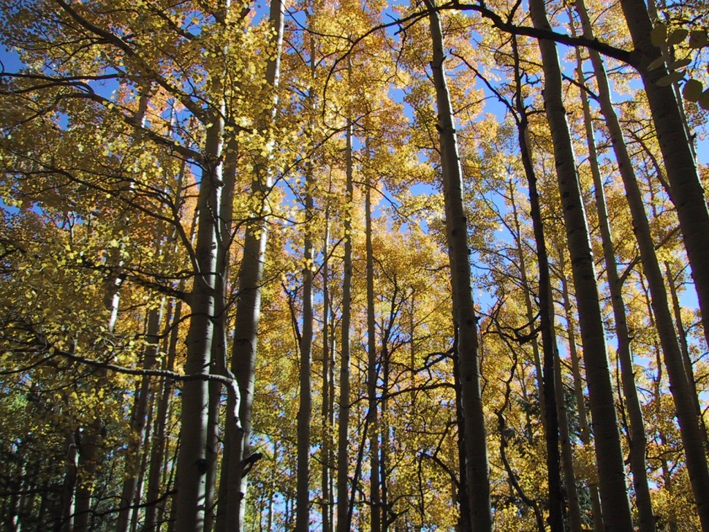
The San Francisco Peaks are the remains of an extinct volcano that forms the dramatic mountain skyline north of Flagstaff. You cannot actually see the highest summit (12,637-foot Mt. Humphreys) from town, but you will if you drive Highway 180 toward Grand Canyon National Park. The shortest route to the top leaves from 8,800 feet at Arizona Snowbowl Ski Resort and is nine miles roundtrip. For the more adventurous: start on the Inner Basin Trail from Lockett Meadow (now requires three-mile hike on closed road), hike 19 miles roundtrip via the Weatherford Trail, or tack on seven miles to Snowbowl on the scenic Kachina Trail. The San Francisco Peaks are beautiful (especially when aspen trees turn in the fall), but can be dangerous during thunderstorms that occur almost every afternoon during monsoon season. Nostalgia may have been a factor in naming this #1 on the list of Top 10 National Forests for Day Hiking.
Watchable Wildlife
Elk are the most prevalent charismatic megafauna in Coconino National Forest, although mule deer and pronghorns are also common. We have encountered black bears in the San Francisco Peaks and rattlesnakes in Sycamore Canyon. Tassel-eared squirrels are the noisiest residents of the ponderosa pine forests, enough so that Bertie the talking squirrel became the main character in the children’s book Scott illustrated while working for the Ecological Restoration Institute at Northern Arizona University.
Instagram-worthy Photo
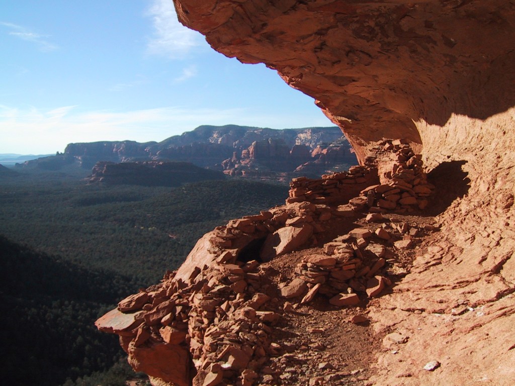
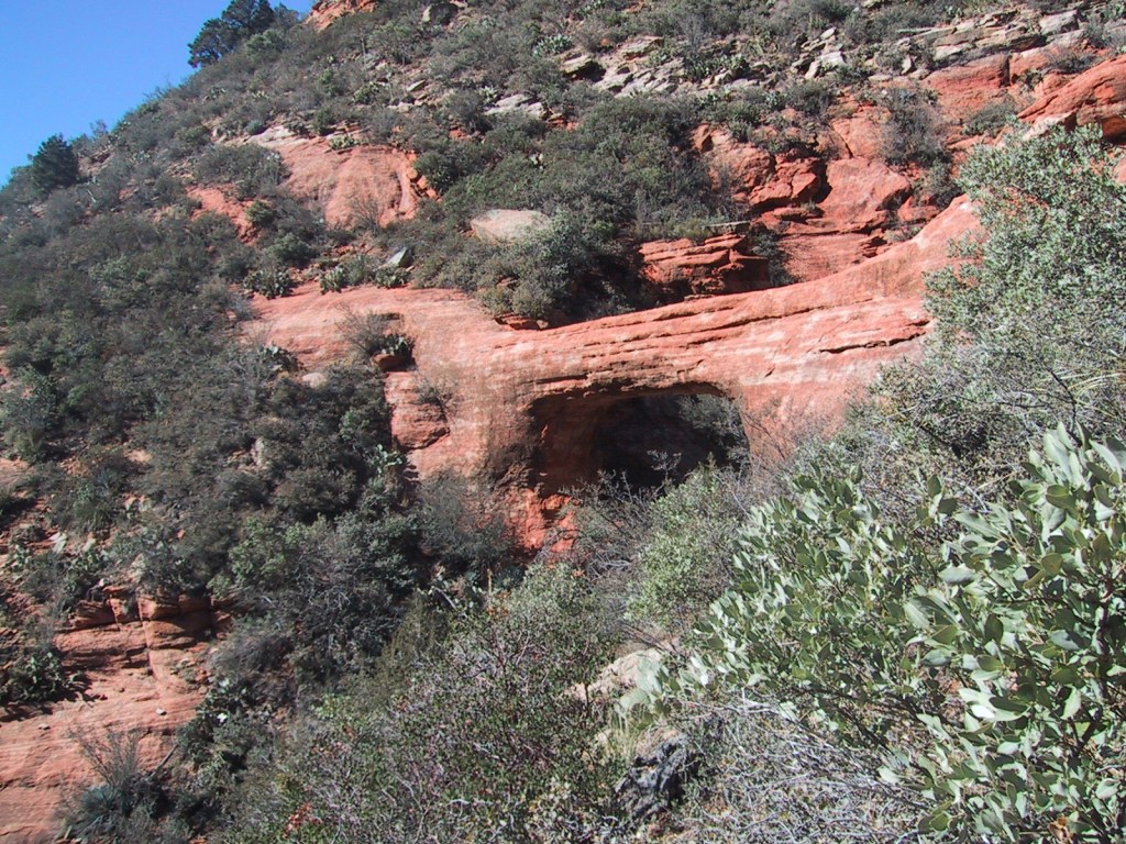
The cliff dwelling in Sedona’s Lost Canyon is in a beautiful spot overlooking a wide green valley that cuts between the red rock buttes and escarpments. There is water in this narrow canyon, feeding the tall Arizona cypress trees below. Just outside the cave, juniper trees offered firewood, pinyon pine produced edible nuts, and yucca plants provided thread for its former residents. To the north numerous canyons drain the ponderosa pine forests where elk and mule deer reside in the summer.
Peak Season
Summer
Fees
A day-use fee applies at nearly every trailhead in Sedona, but an America the Beautiful pass can be substituted. A $6 online reservation per vehicle is required to park at Dixon Lewis (formerly Waterfall) Trail to Fossil Creek from April 1 to October 1.
Road Conditions
Most of the dirt roads through Coconino National Forest are well maintained, especially around Sedona. One exception to that is Woody Mountain Road that requires high-clearance once you get past the first 20 miles or so towards the Mogollon Rim above Sycamore Canyon.
Camping
Lockett Meadow Campground is special place that came in at #4 on our Top 10 Campgrounds in National Forests list. However, camping there now requires a three-mile hike up the road since it closed following the Pipeline Fire (which does mean you are more likely to get a campsite). The coveted campsites in Oak Creek Canyon on scenic Highway 89A are full throughout the summer and fall (online reservations available).
Wilderness Areas
Fossil Springs Wilderness
Kachina Peaks Wilderness
Kendrick Mountain Wilderness (also in Kaibab National Forest)
Mazatzal Wilderness (also in Tonto National Forest)
Munds Mountain Wilderness
Red Rock-Secret Mountain Wilderness
Strawberry Crater Wilderness
Sycamore Canyon Wilderness (also in Prescott and Kaibab National Forests)
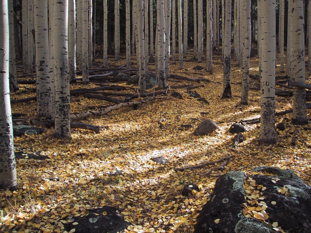
Mt. HumphreysSunset in SedonaVultee ArchOak Creek Canyon from Wilson Mountain South TrailQuaking aspensLockett MeadowWendigo in SedonaCollared lizardOak Creek CanyonWendigo on Mt. Humphreys in MayKachina Peaks WildernessSedona at sunsetScott and Tiff at Cathedral RockTiff cross-country skiingTiff hugging a quaking aspen
Explore More – What is largest natural lake in the state of Arizona, which is found atop Coconino National Forest’s Anderson Mesa (although it is often dried up in the summer)?
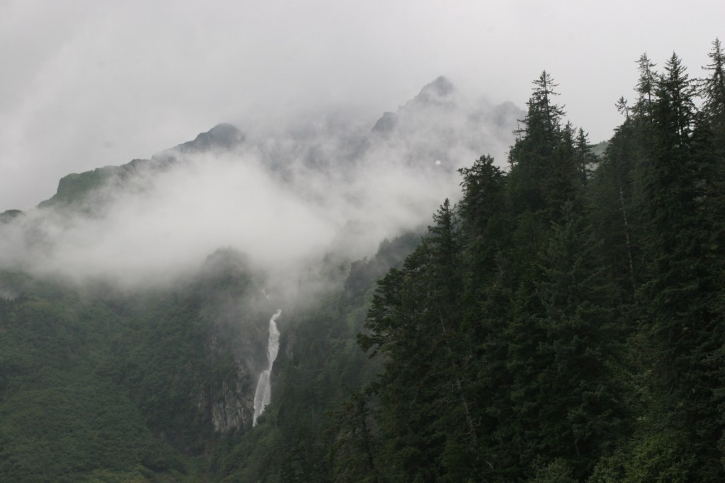
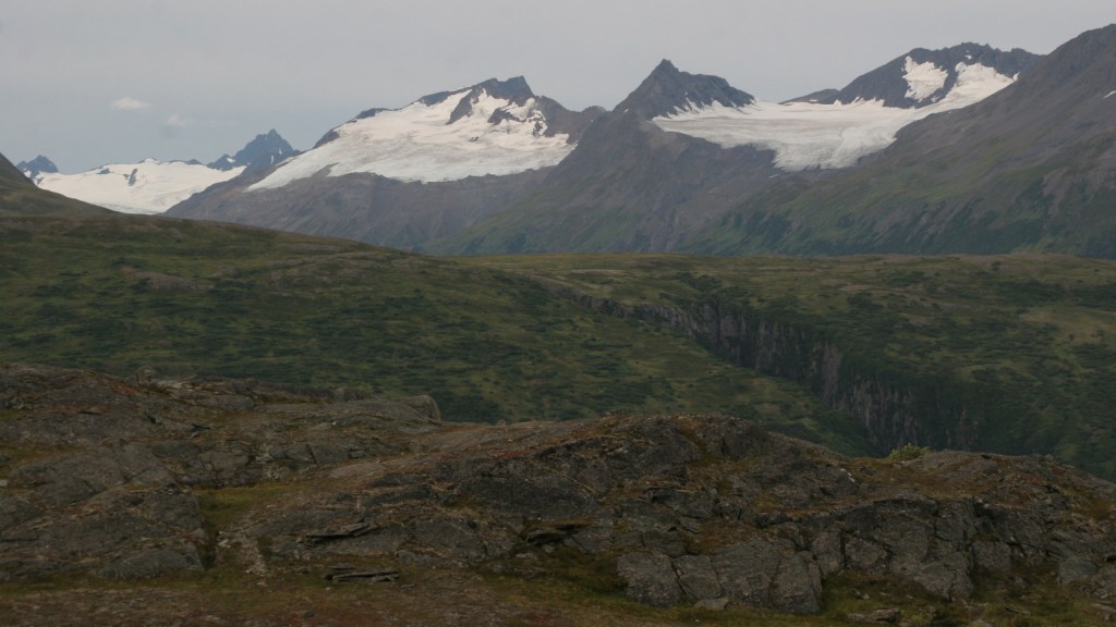
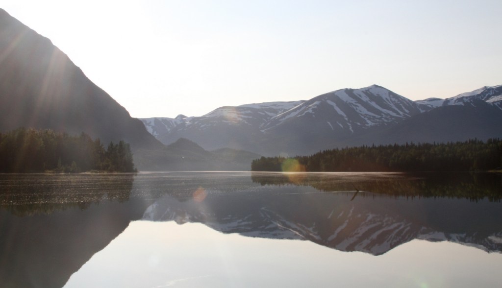
Roughly the size of New Hampshire, Chugach National Forest stretches from Seward, Alaska to the east beyond Cordova. It encompasses 3,500 miles of shoreline in scenic Prince William Sound, one of the sport fishing world’s top destinations for halibut, ling cod, and salmon. It is the northernmost and westernmost of all 155 National Forests, and 30% of its acreage is covered by glaciers (including 22 tidewater glaciers). Chugach National Forest was established in 1907 from part of a Forest Reserve originally created in 1892, only 25 years after Alaska was purchased from Russia.
Highlights
Seward Scenic Byway, Turnagain Arm, Portage Glacier, Porcupine Campground, Russian River, Columbia Glacier, Million Dollar Bridge, Childs Glacier, Grayling Lake, Porcupine Creek Falls, Hope Point Trail, Iditarod National Historic Trail, Johnson Pass Trail, Russian Lakes Trail
Must-Do Activity
Cut off from the road system of Alaska, Cordova is a fishing village on Prince William Sound at the end of the Copper River Delta, which is considered the largest contiguous wetlands complex on North America’s Pacific coast. Surrounded by Chugach National Forest, Cordova’s road network was dramatically shortened in 2011 when the mighty Copper River washed out a bridge 36 miles outside of town. Now if you want to get to the dramatic Million Dollar Bridge or stunning Childs Glacier you have to arrange a trip by air boat. Starting in 1911, the Million Dollar Bridge brought railcars full of copper ore from Kennecott Mine (which is now part of Wrangell-St. Elias National Park and Preserve). Just across the Million Dollar Bridge, a short climb up a small hill provides great views of Miles Lake and the surrounding area.
Best Trail
There are over 500 miles of designated trails in the National Forest, including several long trails on the Kenai Peninsula, which is accessible by paved roads from Anchorage. Three trails popular with backpackers are the 23-mile Johnson Pass Trail, 22-mile long Russian Lakes Trail (with three Forest Service cabins for rent along its route), and 39-mile Resurrection Pass Trail (with eight Forest Service cabins).
Watchable Wildlife
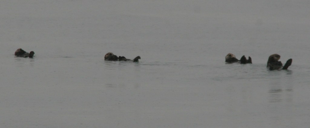
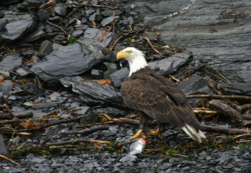
Chugach National Forest provides nesting habitat for millions of birds, including a huge population of bald eagles and more than 200 colonies of seabirds. Large mammals include moose, caribou, Sitka black-tailed deer, Dall sheep, mountain goats, pine martens, coyotes, gray wolves, black bears, and grizzly/brown bears. Marine mammals include humpback whales, minke whales, Dall’s porpoises, Steller sea lions, and sea otters. Rivers and creeks provide spawning beds for all five species of Pacific salmon: chinook/king, sockeye/red, coho/silver, chum/dog, and pink/humpback.
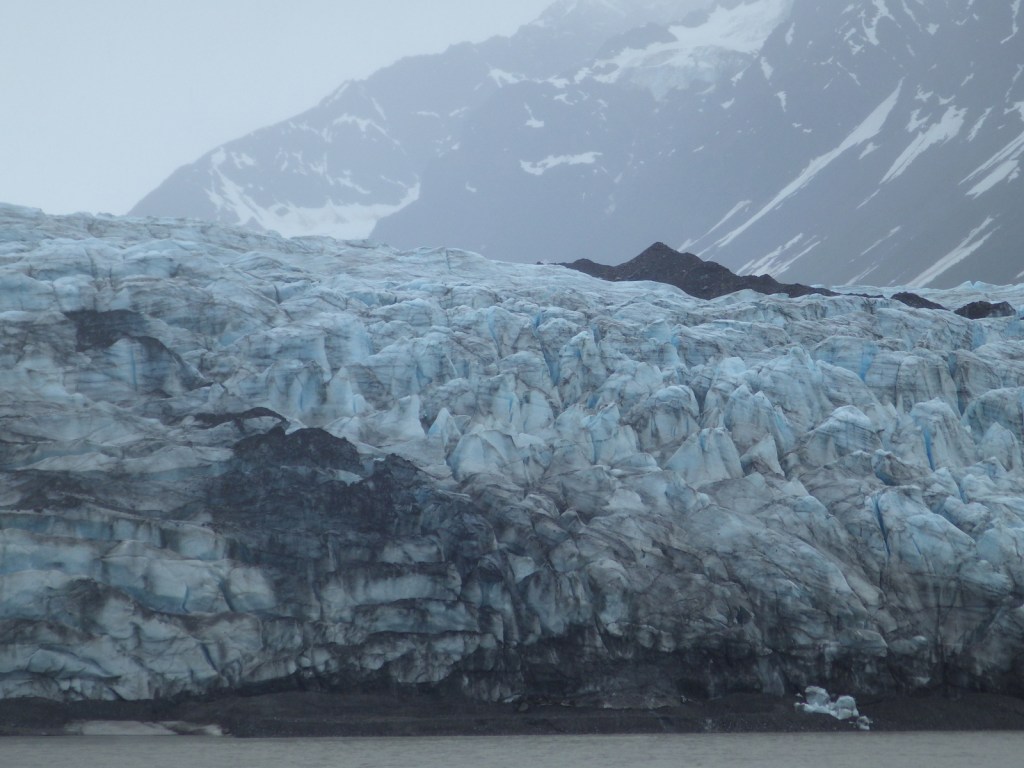
Instagram-worthy Photo
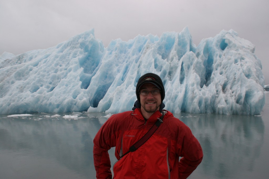
Boat tours out of the beautiful port of Valdez get close to the massive Columbia Glacier, a tidewater glacier that produces so many icebergs that it is inaccessible from the water.
Peak Season
Summer
Fees
None
Road Conditions
There are not many roads in Chugach National Forest, and to access the Million Dollar Bridge and Childs Glacier outside Cordova you will need to arrange a trip by air boat since a bridge washed out in 2011.
Camping
There are 16 campgrounds in Chugach National Forest, including the Porcupine Campground in Hope near a creek popular for salmon fishing.
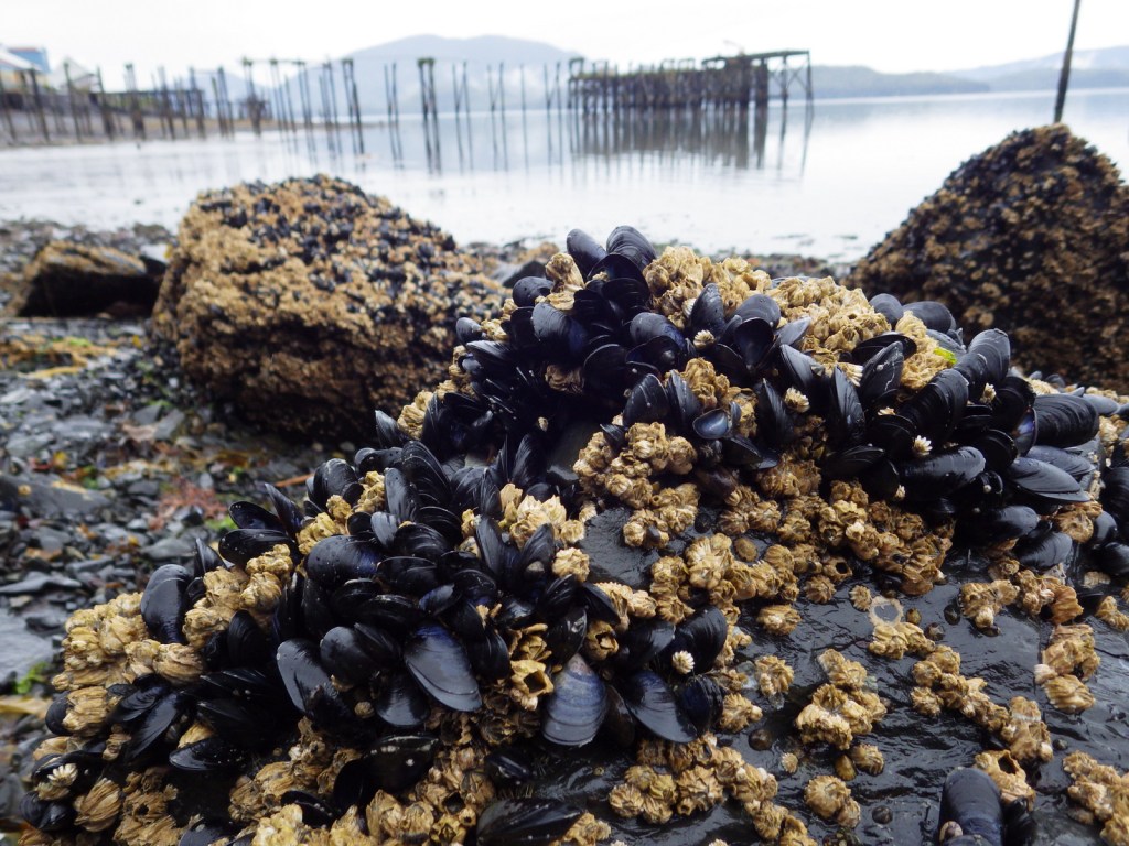
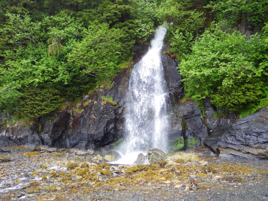
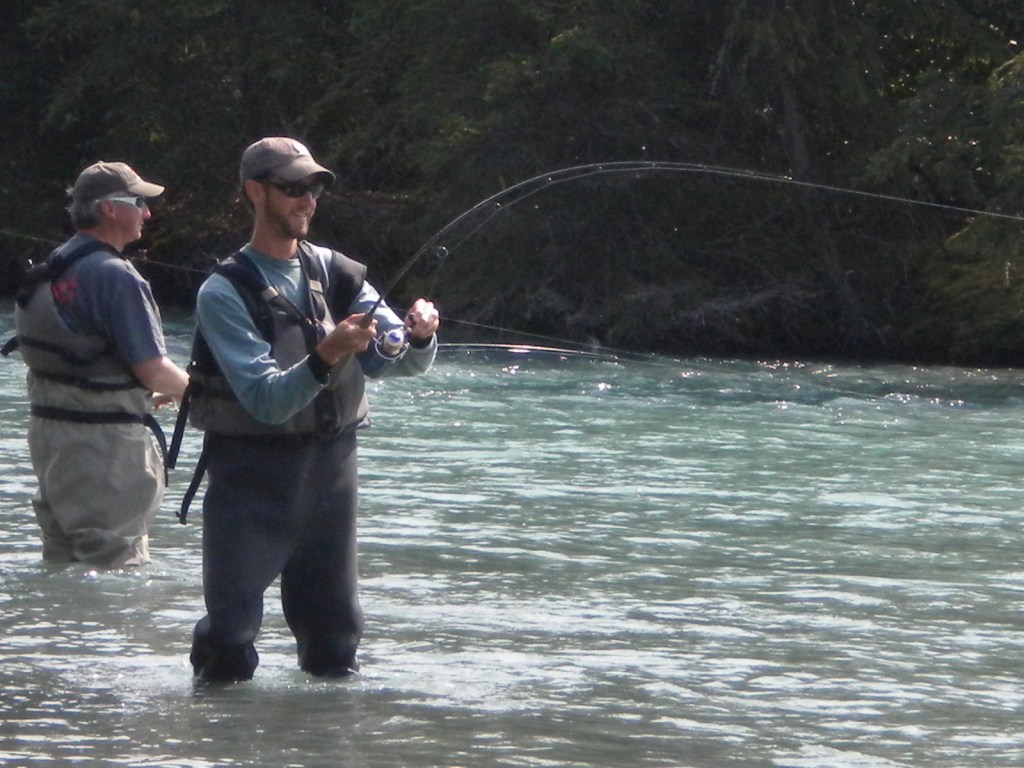
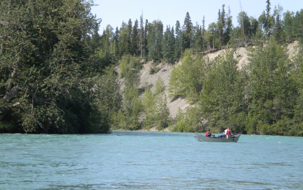
Whittier, AlaskaTidepooling in CordovaOrca Adventure Lodge in CordovaWaterfalls abound in the temperate rainforestScott and his father after crossing the Copper River on an air boatMillion Dollar BridgeMillion Dollar BridgeChilds GlacierChilds GlacierSea ottersScott and Tiff near the Columbia GlacierSteller sea lionsThompson Pass outside ValdezThompson Pass outside ValdezBald eagleKenai LakeScott and his father fishing the Kenai RiverKenai RiverRaven about the forest
Conifer Tree Species
Sitka spruce, western hemlock, mountain hemlock, yellow-cedar
Learn more about Chugach and the 154 other National Forests in our new guidebook Out in the Woods
We are a participant in the Amazon Services LLC Associates Program, an affiliate advertising program designed to provide a means for us to earn fees by linking to Amazon.com and affiliated sites.
Start your U.S. National Forests, National Parks, and National Monuments adventure here!