In 1816, Thomas and Nancy Lincoln moved their two children, Sarah and Abraham, from Hodgenville, Kentucky to a 160-acre farm in southern Indiana. The future-President Abraham Lincoln lived there 14 years until he turned 21 and the family relocated to Illinois. In 1818, his mother Nancy Hanks Lincoln died of milk poisoning because a dairy cow had eaten white snakeroot plant, and visitors can learn more about the poison tremetol in the Memorial Visitor Center and stop at her memorial stone in the pioneer cemetery (although her exact burial place is unknown).
Highlights
Museum, film, Abraham Lincoln Hall, U.S. Post Office, cemetery, spring, Living Historical Farm, Cabin Site Memorial
Must-Do Activity
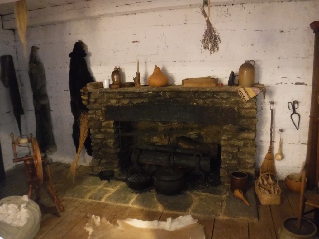
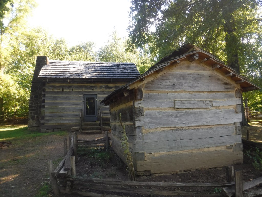
Start at the Memorial Visitor Center to visit the museum inside and use the U.S. Post Office if needed. If the weather is nice, take a walk past the pioneer cemetery to the Cabin Site Memorial where a bronze casting of sill logs and the fireplace hearthstones are at the site of the Lincoln’s cabin begun in 1829. The Living Historical Farm has costumed interpreters in the summer that depict homestead life at an authentic cabin and several outbuildings that were moved here from other parts of Indiana.
Best Trail
It is about one mile roundtrip to walk from the museum to the Living Historical Farm and then return on the Trail of Twelve Stones. There is a parking area closer to the Cabin Site Memorial, if you do not wish to walk the entire way. The Boyhood Nature Trail offers an additional one-mile loop through the forest.
Instagram-worthy Photo
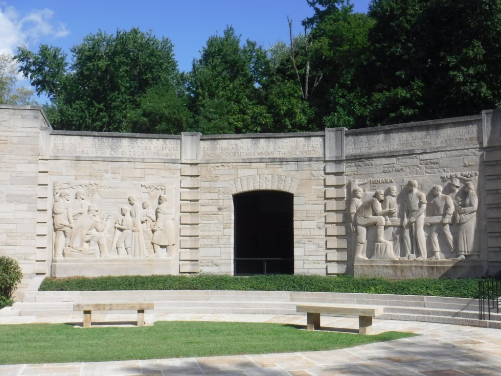
The five relief panels on the outside of the Memorial Visitor Center were created from Indiana limestone by E.H. Daniels to depict different periods in Abraham Lincoln’s life. The building was constructed in the 1940s by the state of Indiana and given to the National Park Service when they took over the site in 1962.
U.S. Post Office inside memorialAbraham Lincoln HallWhite snakeroot plantMarker for Nancy Hanks Lincoln, although her exact gravesite is unknownCabin Site Memorial
Explore More – How many step-siblings did Abraham Lincoln gain when his father wed the widow Sarah Bush Johnston from Kentucky in 1819?
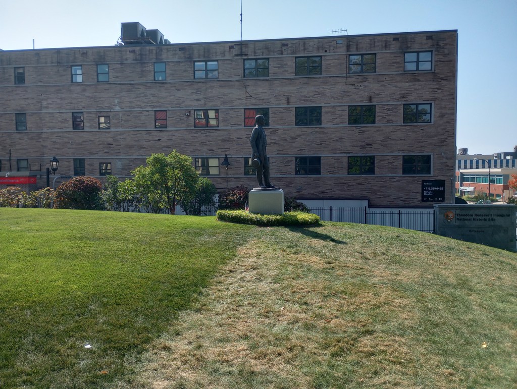
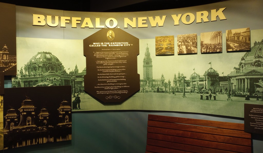
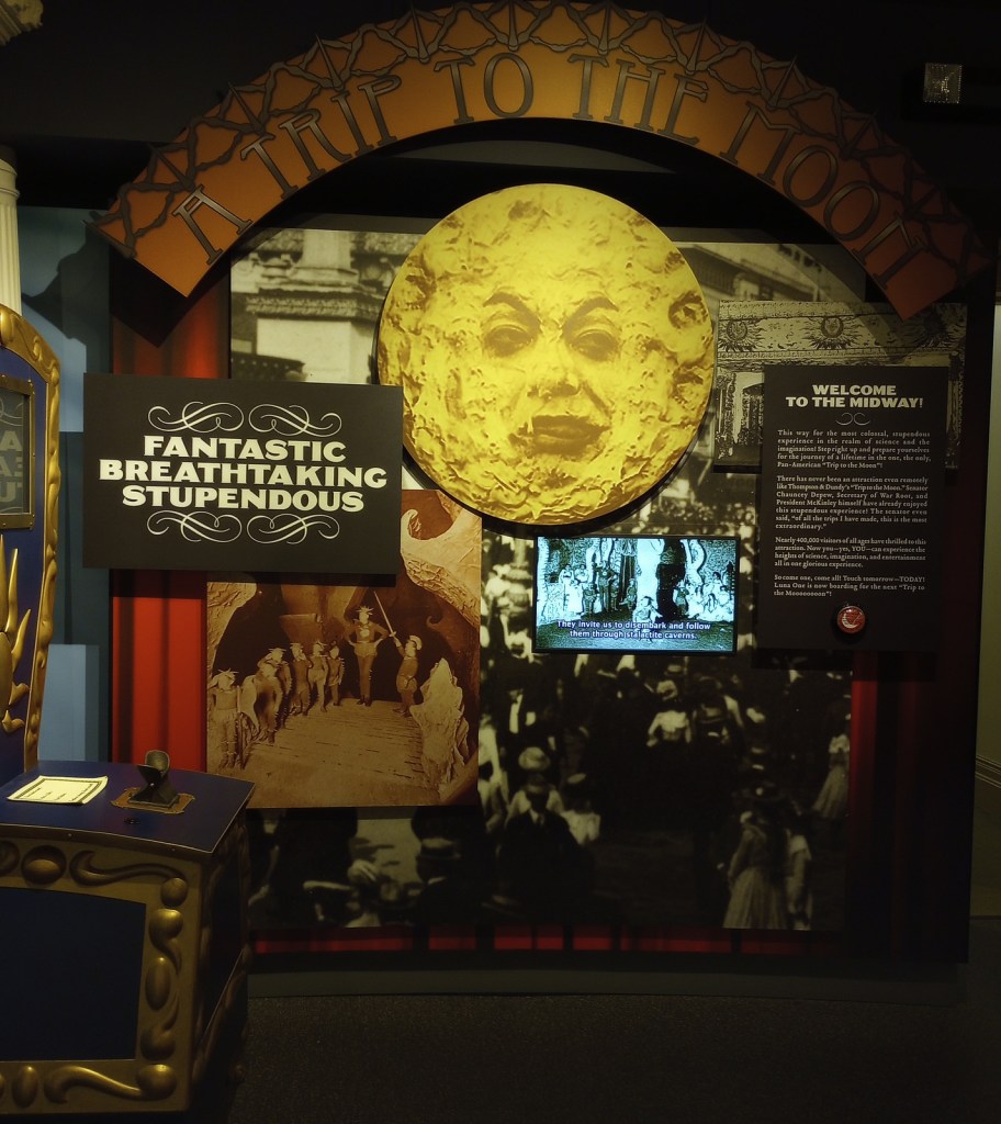
On September 6, 1901, while attending the Pan-American Exposition in Buffalo, New York, President William McKinley was shot by anarchist Leon Czolgosz. Vice President Theodore Roosevelt came by the house (now demolished) where McKinley was recovering and left after being assured he would survive. Roosevelt was hiking the highest peak in the Adirondacks when he was informed that he needed to rush back to Buffalo because the President was dying. Rather than take the oath of office in the house where McKinley died 11 hours before Roosevelt’s arrival, he chose the residence of his friend Ansley Wilcox, which has been preserved as a National Historic Site. Oddly, no photographs were taken at the historic event.
Highlights
Wilcox house, museum, films
Must-Do Activity
The Wilcox house dates back to 1837, when it was built as an officers’ quarters at the U.S. Army’s Poinsett Barracks. The only way inside is on a ranger-guided tour, which you can reserve online in advance (see Fees below). The downstairs has a small, nice museum featuring interactive exhibits, where you will watch the second of three video presentations during your 45-minute tour. It was good enough that we added it to our Top 10 Museums Run by the National Park Service. There is an annual reenactment of the 1901 Inauguration held every September 14.
Best Trail
No trails, but you can walk the sidewalks of Delaware Avenue in downtown Buffalo and stop by the Bank of America ATM conveniently located next door. Maybe you will find a four-leaf clover like Tiff did (see photo below).
Instagram-worthy Photo
The third video is presented in a small theater upstairs about halfway through the tour and features dramatic lighting and videos highlighting the challenges facing the U.S. in the early 1900s.
Scott at the front doorTiff finding a four-leaf clover out frontEntrance to visitor center behind the houseInside the visitor centerInside the Wilcox houseTiff with Teddy’s statue
Explore More – When was the Wilcox house turned into a restaurant?
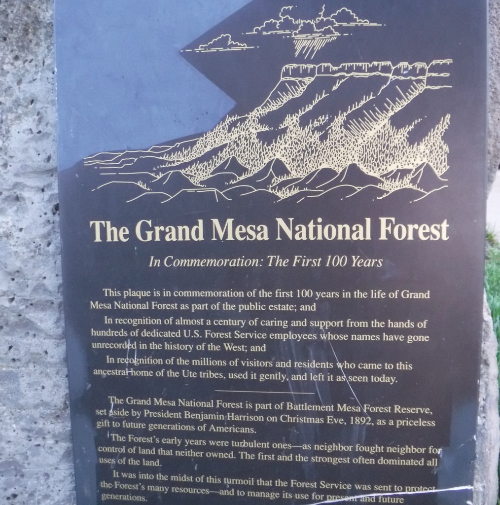
Covering 540 square-miles, Grand Mesa is the largest flattop mountain in the world and has an average elevation of 10,500 feet. It rises east of Grand Junction and is easily explored via paved Highway 65, also known as Grand Mesa Scenic Byway. Due to its high elevation, Grand Mesa National Forest is a popular destination for snowmobiles in the winter. This area was first set aside by President Harrison in 1892 as Battlement Mesa Forest Reserve, only the third such designation in U.S. history. It is now co-managed with Colorado’s Gunnison and Uncompahgre National Forests.
Highlights
Grand Mesa Scenic Byway, Land’s End Ranger Observatory, Ward Lake, Island Lake Interpretive Trail, Crag Crest National Recreation Trail, Eggleston Lake, Leon Peak, Battlement Trail
Must-Do Activity
Also covering a portion of Battlement Mesa, Grand Mesa National Forest contains more than 300 lakes, several of which have campgrounds. The Grand Mesa Visitor Center on Highway 65 near Island Lake is a great place to start, with a 20-minute film shown detailing the 1999 Land’s End archaeological excavation that found evidence of 8,000 years of human activity at 9,000 feet in elevation. Dirt roads travel east from there deeper into the National Forest, or you can take a side trip west on the Grand Mesa Scenic Byway to the visitor center at Land’s End Ranger Observatory for views all the way into Utah’s La Sal National Forest.
Best Trail
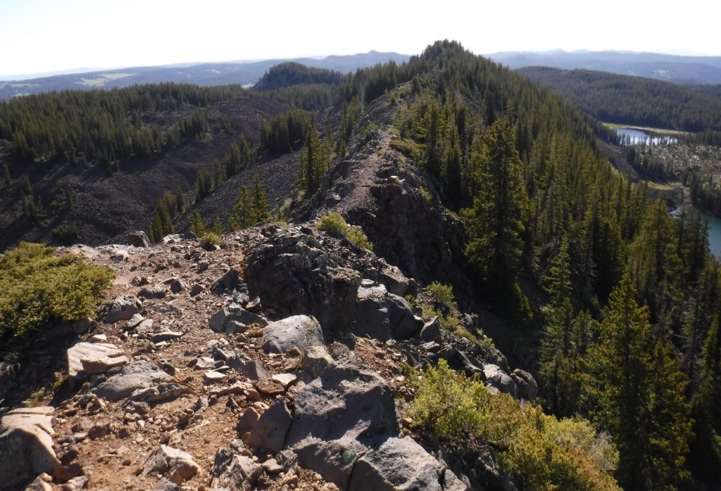
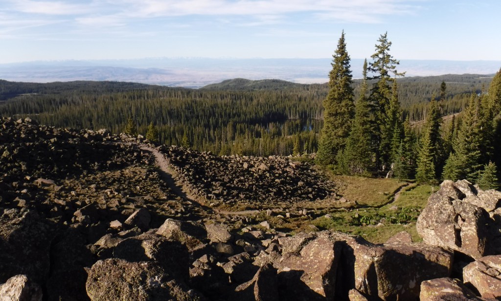
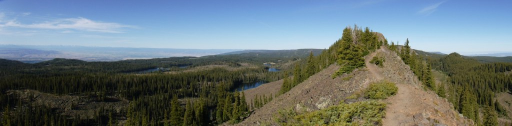
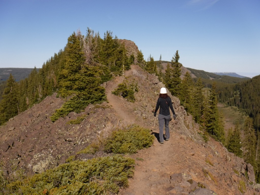
The best trail in Grand Mesa National Forest is without a doubt Crag Crest National Recreation Trail. It can be hiked as a 10.3-mile loop from two trailheads, one at Island Lake (paved access) and the other at Eggleston Lake (that requires some dirt road driving). The crest portion of the hike is the highlight as it follows a narrow ridge of volcanic rock that offers spectacular views. Due to its exposure and the high altitude (up to 11,189 feet) it is recommended that you get an early start to avoid afternoon thunderstorms. For those not wishing to do the entire loop, we found that by starting out counterclockwise from Eggleston Lake the trail climbs steeply providing panoramas within two miles. We completed five miles out-and-back with a cumulative elevation gain of 1,100 feet and felt we had gotten the full experience.
Watchable Wildlife
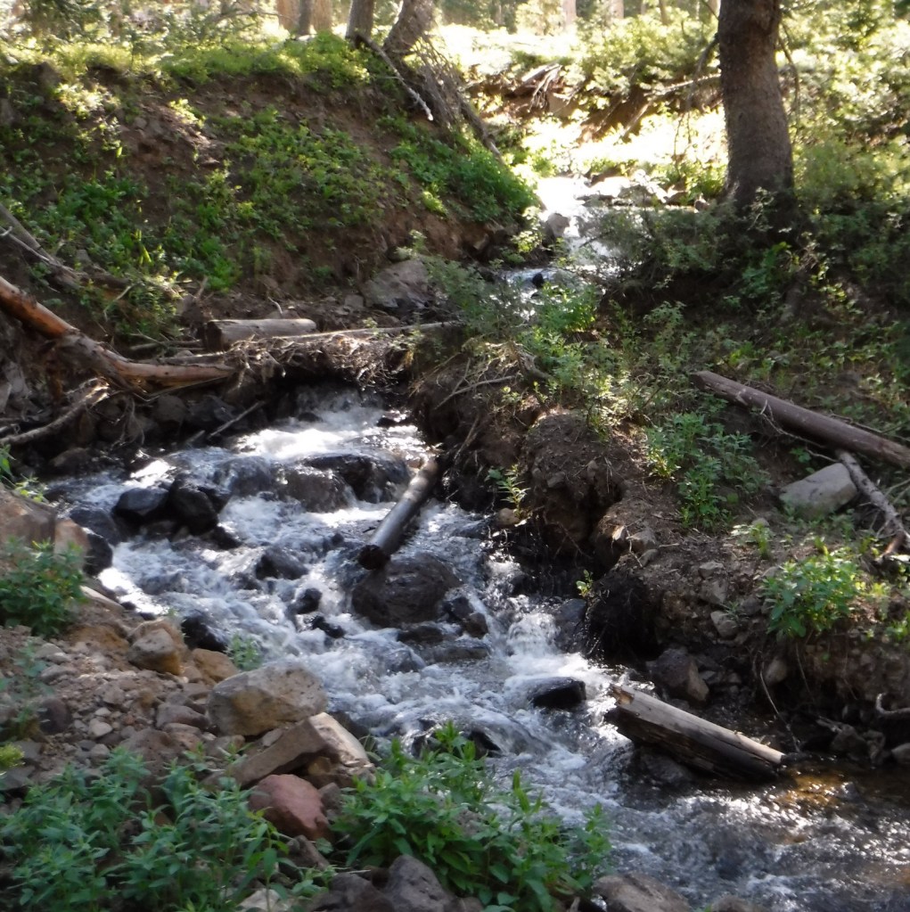
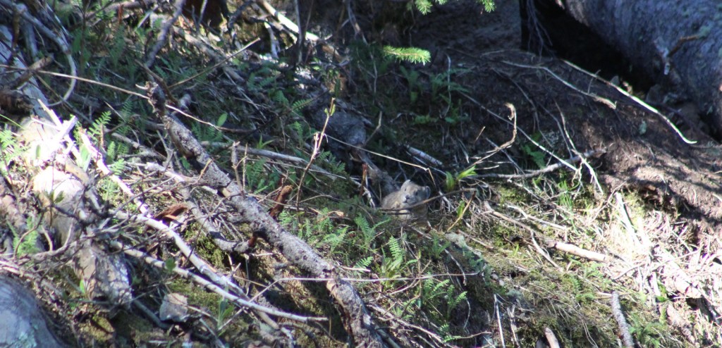
Trout fishing is one of the main draws to the 300 lakes in Grand Mesa National Forest. The lakes and streams also attract elk, mule deer, bighorn sheep, raccoons, red foxes, black bears, and mountain lions, in addition to large birds like bald eagles, golden eagles, peregrine falcons, common ravens, and wild turkeys. Due to its high elevation, look for pikas in the rocks along Crag Crest National Recreation Trail.
Instagram-worthy Photo
Starting counterclockwise on the Crag Crest National Recreation Trail from Eggleston Lake, we climbed to stunning panoramas within two miles.
Peak Season
Summer
Fees
None
Road Conditions
Grand Mesa Scenic Byway follows paved Highway 65 up above 10,000 feet in elevation, as well as west to Land’s End Ranger Observatory. The unpaved Land’s End Road continues switchbacking down the mesa to Highway 50, but is not recommended for vehicles more than 21 feet in length. The unpaved roads on Grand Mesa were in good shape during our June visit, but are closed in the winter.
Camping
There are campgrounds at several lakes in Grand Mesa National Forest, as well as dispersed camping options along the dirt roads.
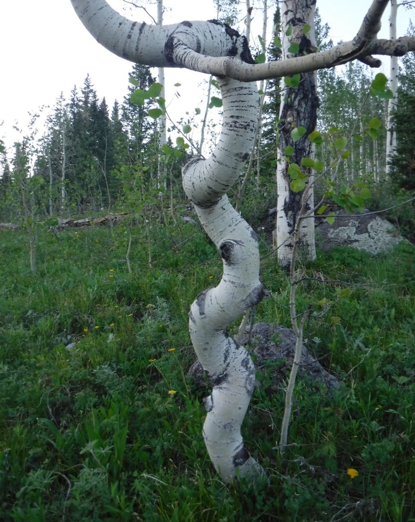
Quaking aspenEggleston LakeCrag Crest National Recreation TrailCrag Crest National Recreation TrailCrag Crest National Recreation TrailTiff on Crag Crest National Recreation TrailScott on Crag Crest National Recreation TrailBook Cliffs from Crag Crest TrailTiff on Crag Crest National Recreation TrailPikaRaven about the forest
Explore More – Now a geological term, what does “mesa” mean in Spanish?
Learn more about this and the 154 other National Forests in our new guidebook Out in the Woods
We are a participant in the Amazon Services LLC Associates Program, an affiliate advertising program designed to provide a means for us to earn fees by linking to Amazon.com and affiliated sites.
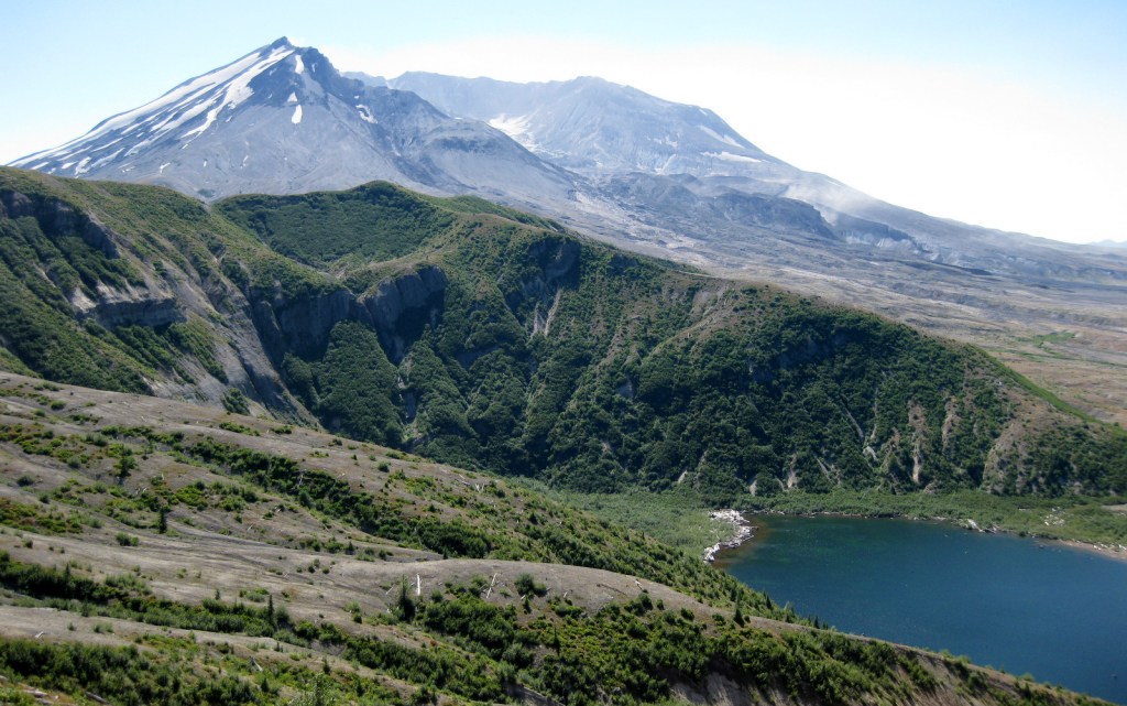
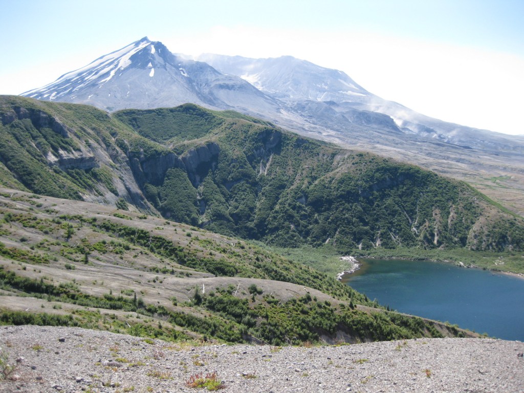
Mt. St. Helens erupted Sunday, May 18, 1980 decreasing its elevation by 1,300 feet and depositing all of that material across the landscape as ash and a lahar (volcanic mudslide) claiming 57 human lives. The site is now protected as Mt. St. Helens National Volcanic Monument and is accessed from the east or west through Gifford Pinchot National Forest. Mt. St. Helens is geologically young as it began to form only 37,600 years ago. It is considered the most active volcano in the Cascade Range, with a major eruption in 1480 several times larger than that which occurred 500 years later, as well as written records that noted activity from 1800 to 1857. Prior to the most recent blast it was distinguished for its perfect cone shape, likened to the renowned outline of Mt. Fuji in Japan.
Highlights
Johnston Ridge Observatory, films, Forest Learning Center, Windy Ridge, Spirit Lake, Bear Meadows, Winds of Change Trail
Must-Do Activity
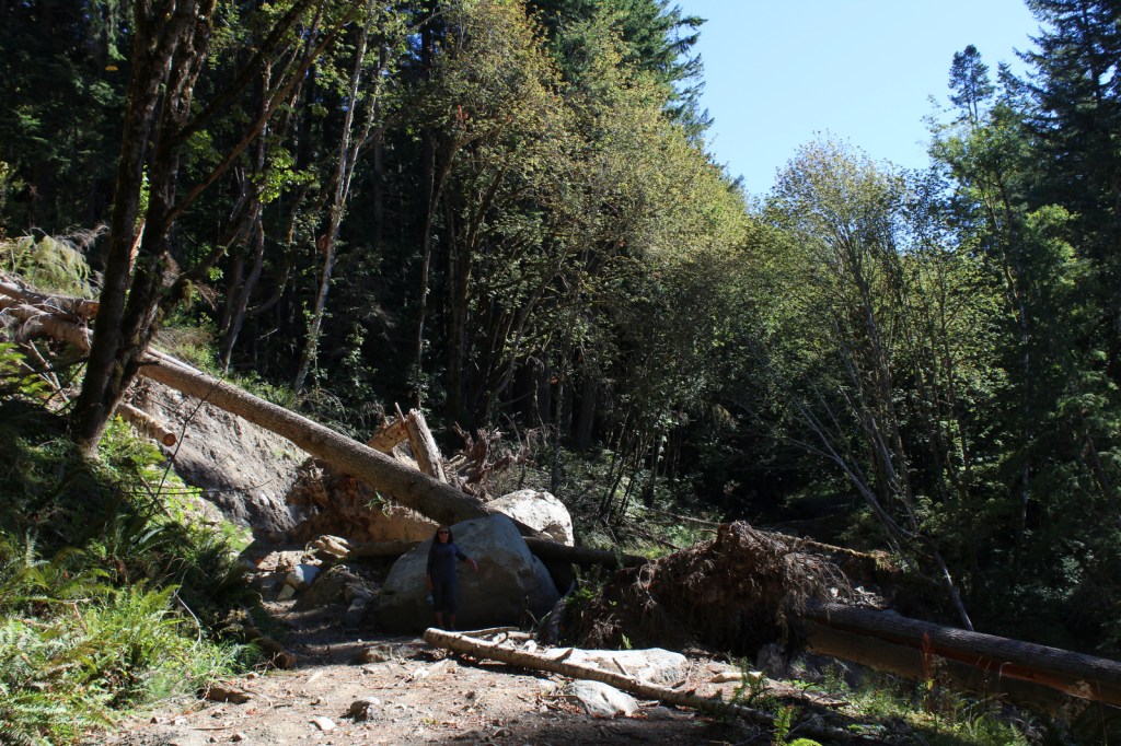
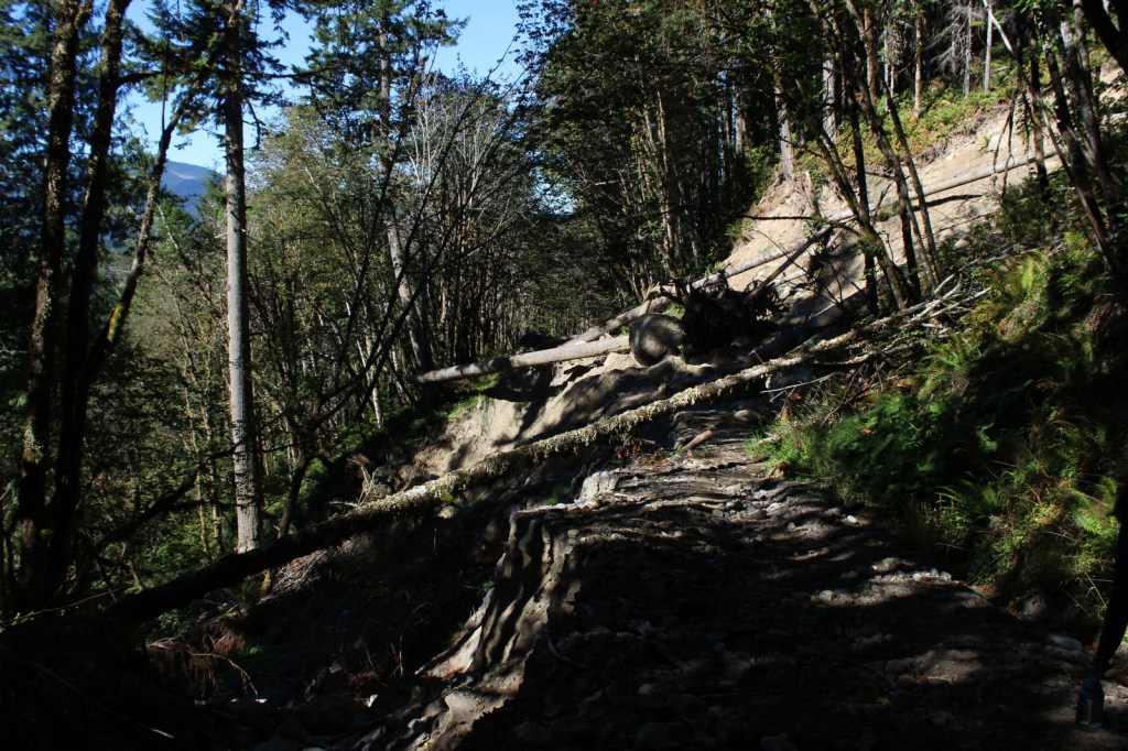
Coming from Mount Rainier National Park, we decided to visit the more remote eastern side of the National Monument (see Best Trail) on Spirit Lake Memorial Highway. From Interstate 5 on the volcano’s west side, Highway 504 leads east past an excellent visitor center (Milepost 5) at Seaquest State Park in Silver Lake (admission charged). Highway 504 next reaches the free Forest Learning Center managed by the Weyerhaeuser Company, Washington State Department of Transportation, and the Rocky Mountain Elk Foundation. The road ends at Johnston Ridge Observatory (Milepost 52), which is known for its awesome views of Mt. St. Helens. We have been told not to miss the introductory films at the museum (admission charged). [Update: Highway 504 closed due to landslides at Milepost 43 in June 2023 and has not reopened yet.] Climbers need a permit to ascend Mt. St. Helens, but even from an overlook the scene is enough to fill one with an appreciation for nature’s awesome power.
Best Trail
After a breathtaking ascent of 361 steps, we reached a breathtaking view atop the aptly named Windy Ridge. It provided a panorama of the destruction wrought by the volcano, which is still visibly spewing smoke and cinders. Today the waters of Spirit Lake remain clogged with thousands of weathered snags, floating upon its surface like debarked, sun-bleached ghosts. Elsewhere the rate of reforestation has been astounding. Due to natural regeneration and planting efforts within Gifford Pinchot National Forest, millions of Douglas-fir, noble fir, and other trees are rapidly growing in the nitrogen-rich deposits, up to 100 feet deep in some places.
Instagram-worthy Photo
From Windy Ridge, the pale gray summit of the horseshoe-shaped volcano was still streaked in glacial ice on a warm September afternoon, the venting steam clearly visible against the deep blue sky.
Admission to Johnston Ridge Observatory is $8 per adult or free with an America the Beautiful Pass. At Seaquest State Park, a $5 per adult admission fee is charged to enter Mt. St. Helens Visitor Center operated by Washington State Parks in Silver Lake.
Road Conditions
The major roads (like Highway 504) are paved to viewpoints in Mt. St. Helens National Volcanic Monument. [Update: Highway 504 closed due to landslides at Milepost 43 in June 2023 and has not reopened, but Windy Ridge is still accessible.]
Camping
There is a campground in Seaquest State Park on Silver Lake near Interstate 5, plus dispersed camping is allowed in parts of Gifford Pinchot National Forest.
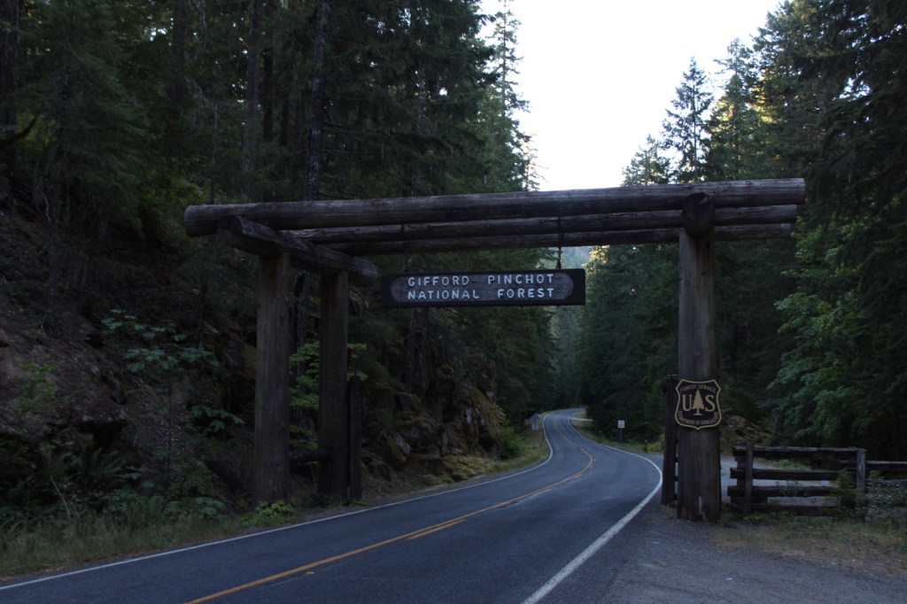
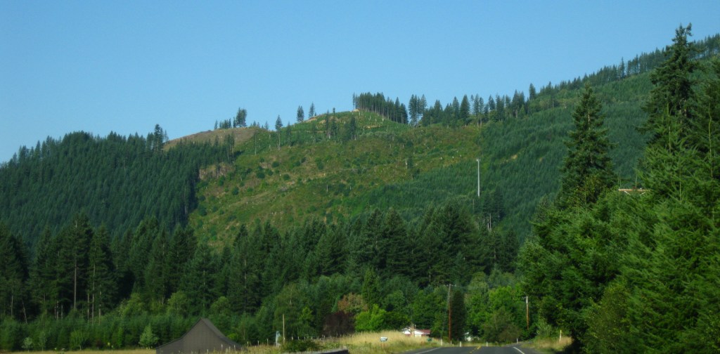
First set aside as Mt. Rainier Forest Reserve in 1897, nearly one-million acres were renamed Columbia National Forest in 1908. It became Gifford Pinchot National Forest in 1949 to honor the chief of the U.S. Division of Forestry (1898-1905) and first chief of the U.S. Forest Service (1905-1910). The Yale graduate studied forestry in Europe and his family founded the Yale Forest School (see Grey Towers National Historic Site). Gifford Pinchot National Forest borders the Columbia River to the south, across from Oregon’s Mt. Hood National Forest. It stretches north to Mt. Rainier National Park and contains 12,276-foot Mt. Adams (the state’s second tallest volcano) and Mt. St. Helens, which was designated a National Monument after its eruption on Sunday, May 18, 1980. There are 1,475 miles of trails and more than 4,000 miles of roads in the National Forest, so there is plenty to explore outside the volcanoes.
Highlights
Mt. St. Helens National Volcanic Monument, Silver Star Scenic Area, Lower Falls of the Lewis River, Tatoosh Range, Packwood Lake, Quartz Creek, Ape Cave, Langfield Falls, Horseshoe Lake, Panther Creek Falls, Ice Cave, Mt. Adams, Midway High Lakes Area, Takhlakh Lake, Lava Canyon Trail, Pacific Crest National Scenic Trail
Must-Do Activity
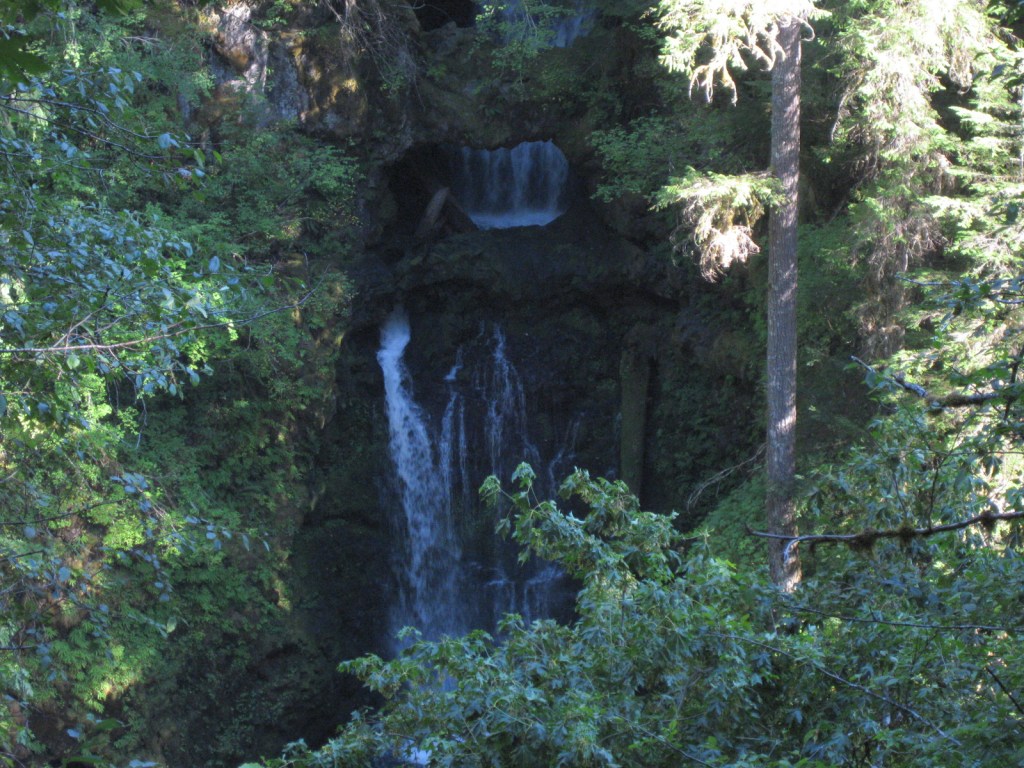
We will cover Mt. St. Helens National Volcanic Monument in a separate post, so here we will focus on the National Forest’s other attractions. North of Mt. St. Helens, a half-mile trail follows Quartz Creek through an old-growth forest of huge Douglas-firs. To the south, check out Lava Canyon Trail and Cedar Flats Research Natural Area where old-growth western redcedar trees are draped in lichen. There are numerous waterfalls in the National Forest, including dual Panther Creek Falls that drops 175 feet side by side and the triple Falls Creek Falls that cascades 150 feet. This lush region is also known for its berry picking, especially the renowned Sawtooth Berry Fields.
Best Trail
Ape Cave is a lava tube located south of Mt. St. Helens, which at 2.5 miles is the third longest in North America. The cave is not named for a fossil discovery, but rather the local Boy Scout troop that explored its interior in the 1950s after its discovery. It is believed that the lava tube formed during a basaltic flow 1,900 years ago. Ape Cave Trail is a National Recreation Trail receiving approximately 170,000 visitors annually (a timed reservation is required). There are two layers to the cave, a smoother 0.8-mile upper level and a rougher 1.5-mile lower level that requires scaling an eight-foot lava wall. Bundle up if you visit, as the underground temperature is 42°F year round. The 650-foot-long Ice Cave is another lava tube known for its ice stalactites in spring (reservation required).
Watchable Wildlife
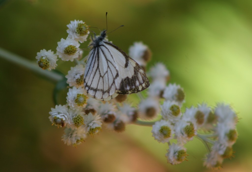
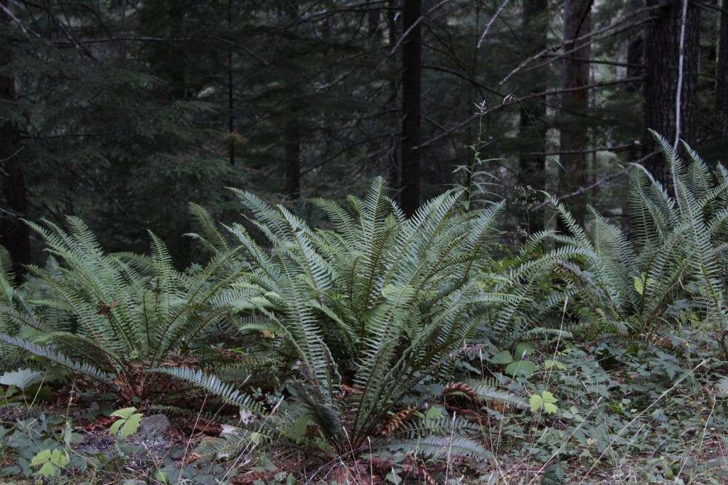
Located on the rainy side of the Cascades, Gifford Pinchot National Forest receives plenty of precipitation to feed its many rivers, including the glacier-fed White Salmon National Wild and Scenic River. Four species of fish identified as threatened inhabit this region’s waters: bull trout, steelhead, chinook salmon, and coho salmon. Another threatened species, the northern spotted owl requires buffer zones around its nests. Mammals of Gifford Pinchot National Forest include elk, black-tailed deer, black bears, bobcats, and several species of marmots. The wettest parts of the forest, especially in riparian corridors, have a variety of frogs, salamanders, and newts.
Instagram-worthy Photo
There are numerous waterfalls in this forest due to its high annual rainfall and steep elevation gradients.
Peak Season
Summer
Fees
An America the Beautiful Pass or Northwest Forest Pass ($5 day use) is required at many parking areas in the National Forest, including Ice Cave and Ape Cave (where a timed reservation is required from recreation.gov).
Road Conditions
The major roads are paved to viewpoints in Mt. St. Helens National Volcanic Monument, but there are plenty of unpaved roads throughout the National Forest, some requiring high-clearance vehicles.
Camping
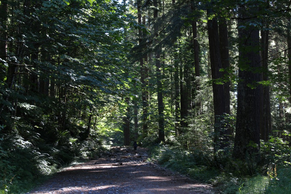
Iron Creek Campground north of Mt. St. Helens has two short trails, a quarter-mile trail through old-growth forest and one that follows a river 1.5 miles under a canopy of Douglas-fir and western redcedar. Dispersed camping is allowed throughout the National Forest, and we have camped here to avoid the crowds while visiting the beautiful waterfalls of Columbia River Gorge National Scenic Area, part of Oregon’s Mt. Hood National Forest.
Wilderness Areas
Dark Divide Roadless Area
Glacier View Wilderness
Goat Rocks Wilderness (also in Wenatchee National Forest)
Indian Heaven Wilderness
Mount Adams Wilderness
Tatoosh Wilderness
Trapper Creek Wilderness
William O. Douglas Wilderness (also in Wenatchee National Forest)
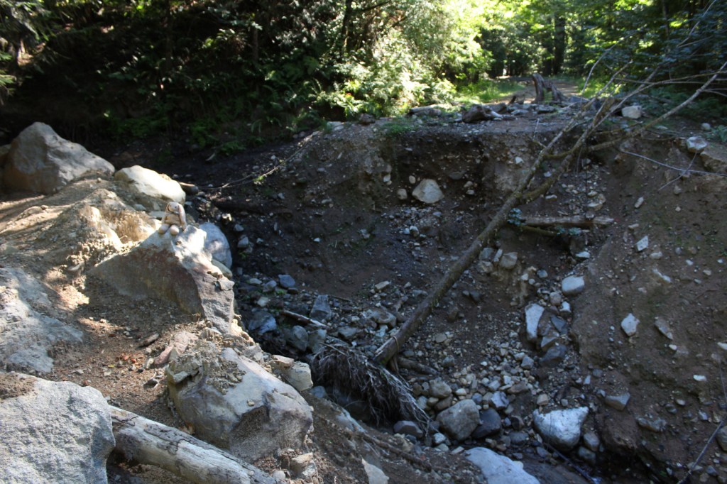
Border with Mount Rainier National ParkHiking a washed out road near the Nisqually Entrance to Mount Rainier NPBigleaf mapleMt. St. HelensMt. AdamsGrand fir conesPacific rhododendron
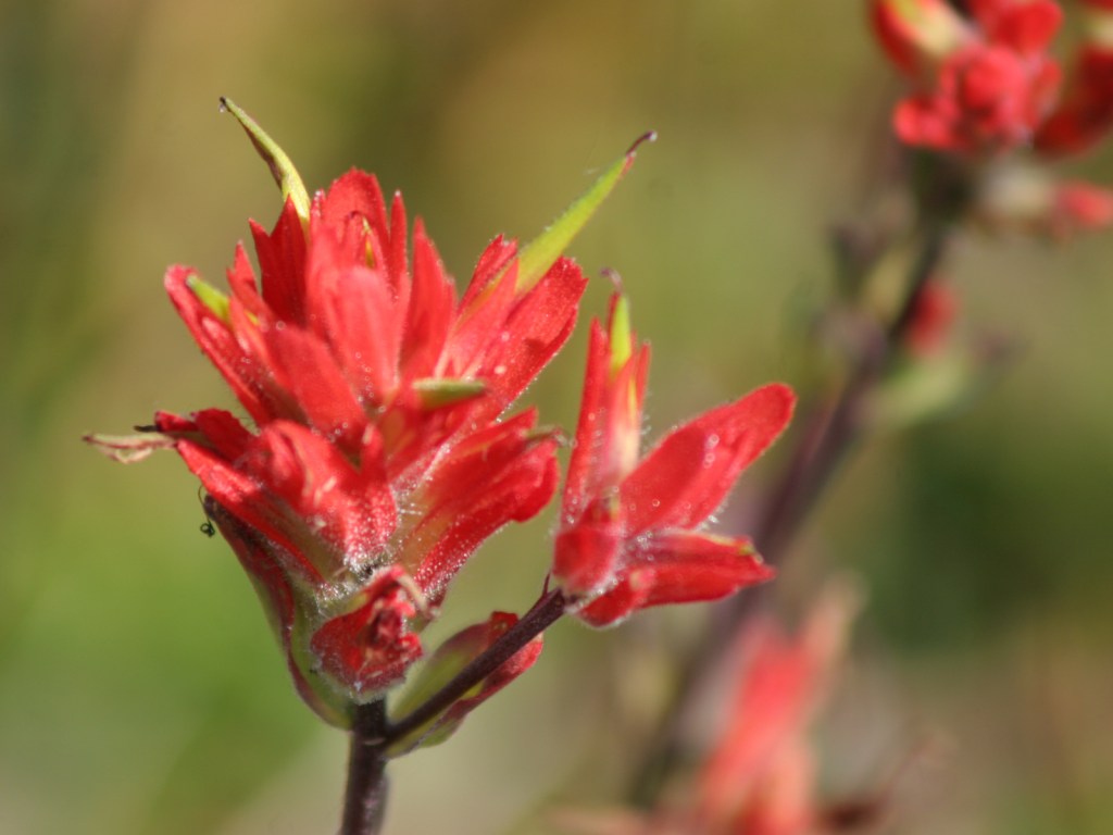
balsam poplar, paper birch, willow, red alder, bigleaf maple, Pacific rhododendron
Explore More – In addition to the White Salmon River, which four other waterways in the National Forest have been recommended to be added to the Wild and Scenic River System?
Learn more about this and the 154 other National Forests in our new guidebook Out in the Woods
We are a participant in the Amazon Services LLC Associates Program, an affiliate advertising program designed to provide a means for us to earn fees by linking to Amazon.com and affiliated sites.
Start your U.S. National Parks, National Forests, and National Monuments adventure here!