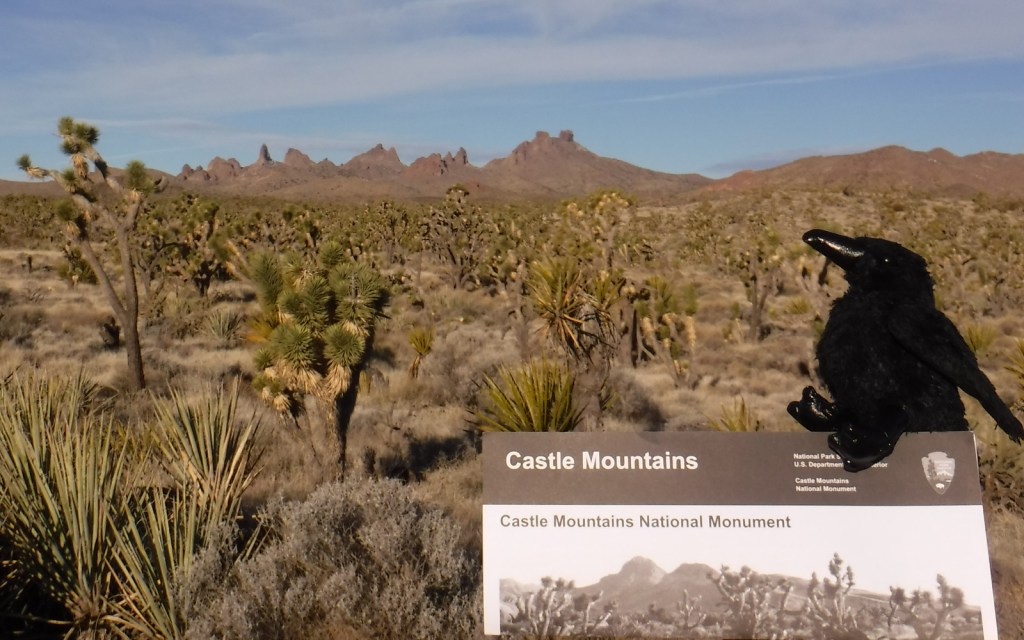
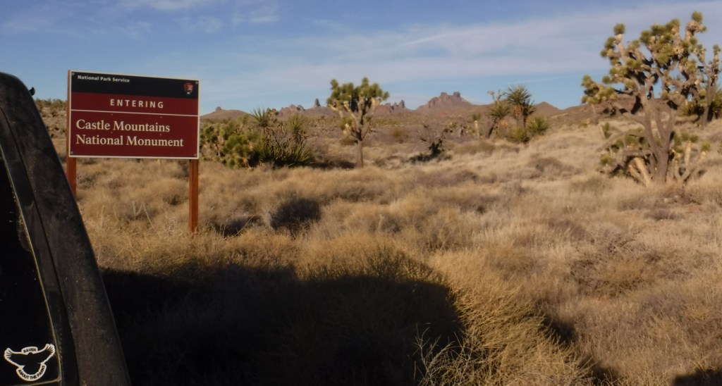
Designated in February 2016, this small monument borders Nevada and is surrounded by the much larger Mojave National Preserve on its other three sides. Its highest point is Hart Peak (5,543 feet), named for James Hart who discovered gold here in 1907 and founded a boomtown that reached 1,500 residents.
Highlights
Hart Peak (5,543 feet), Hart Mine ghost town, view of Castle
Peaks
Must-Do Activity
This new National Monument is undeveloped with no trails, no
visitor center, and little signage. Drive
or walk its network of dirt roads to get a feel for the Mojave Desert.
Best Trail
None
Instagram-worthy
Photo
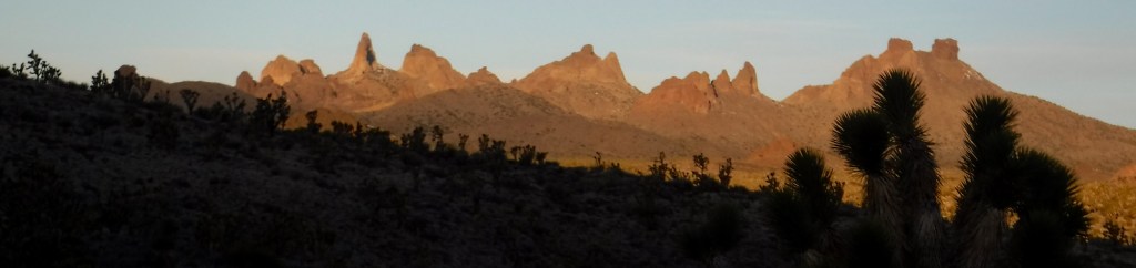
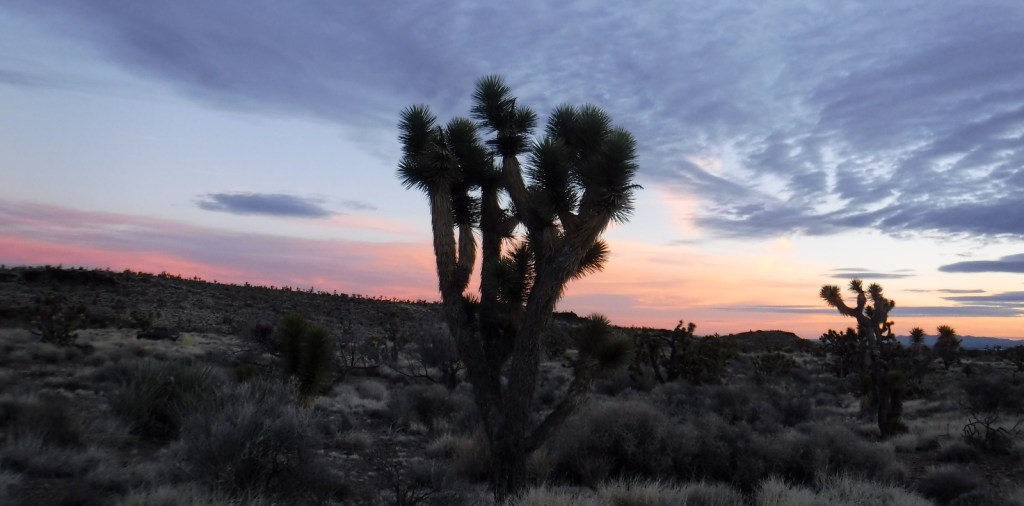
Joshua trees are always photogenic, especially when the jagged Castle Peaks are in the background (though they are outside the monument’s northern boundary within Mojave National Preserve).
Peak Season
Spring and fall
Hours
There are visitor centers in the adjacent Mojave National Preserve that have hours posted here:
Walking Box Ranch Road is a groomed dirt road passable to
any vehicle from Highway 164 west of Searchlight, Nevada. Access roads from Mojave National Preserve
require high-clearance.
Camping
Dispersed camping is allowed within the monument. Hole-in-the-Wall Campground within Mojave National Preserve is accessible by paved road from Interstate 40.
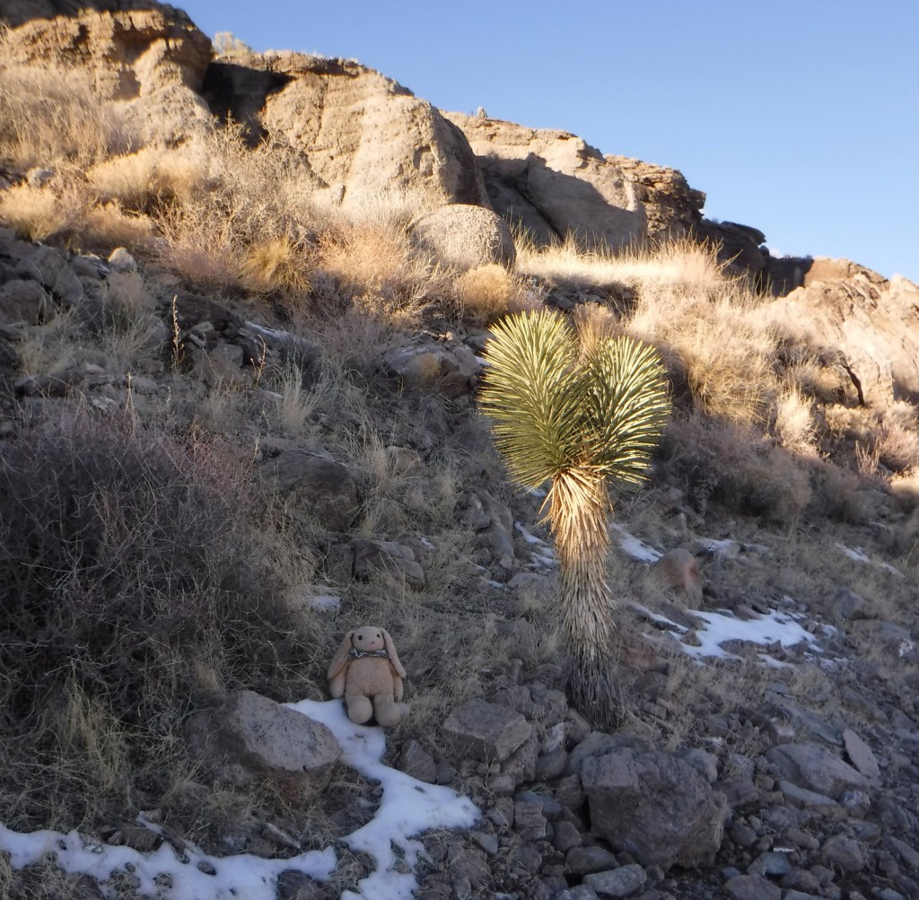
It does snow in the Mojave Desert
Rusty cans are evidence of historic human use
Raven About The Parks was here
Explore More – Piute
Spring is charged by the aquifer within Castle Mountains National Monument;
when researchers tested it, how long ago did its water fall as precipitation?
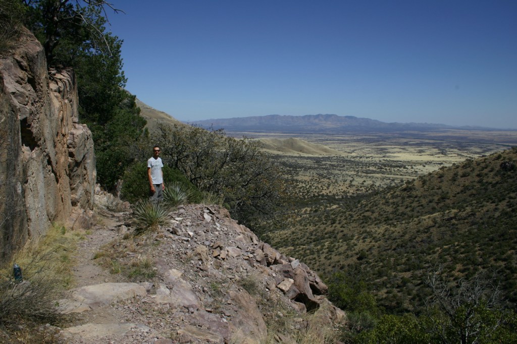
There was no international border in 1540, but this valley in southern Arizona is where Francisco Vasquez de Coronado’s expedition crossed into the U.S.A. His Spanish army marched north in search of the Seven Cities of Cibola, discovering multiple pueblos (including Pecos) and establishing a route for missionaries to follow.
Highlights
Coronado Cave, Montezuma Pass, Coronado Peak
Must-Do Activity
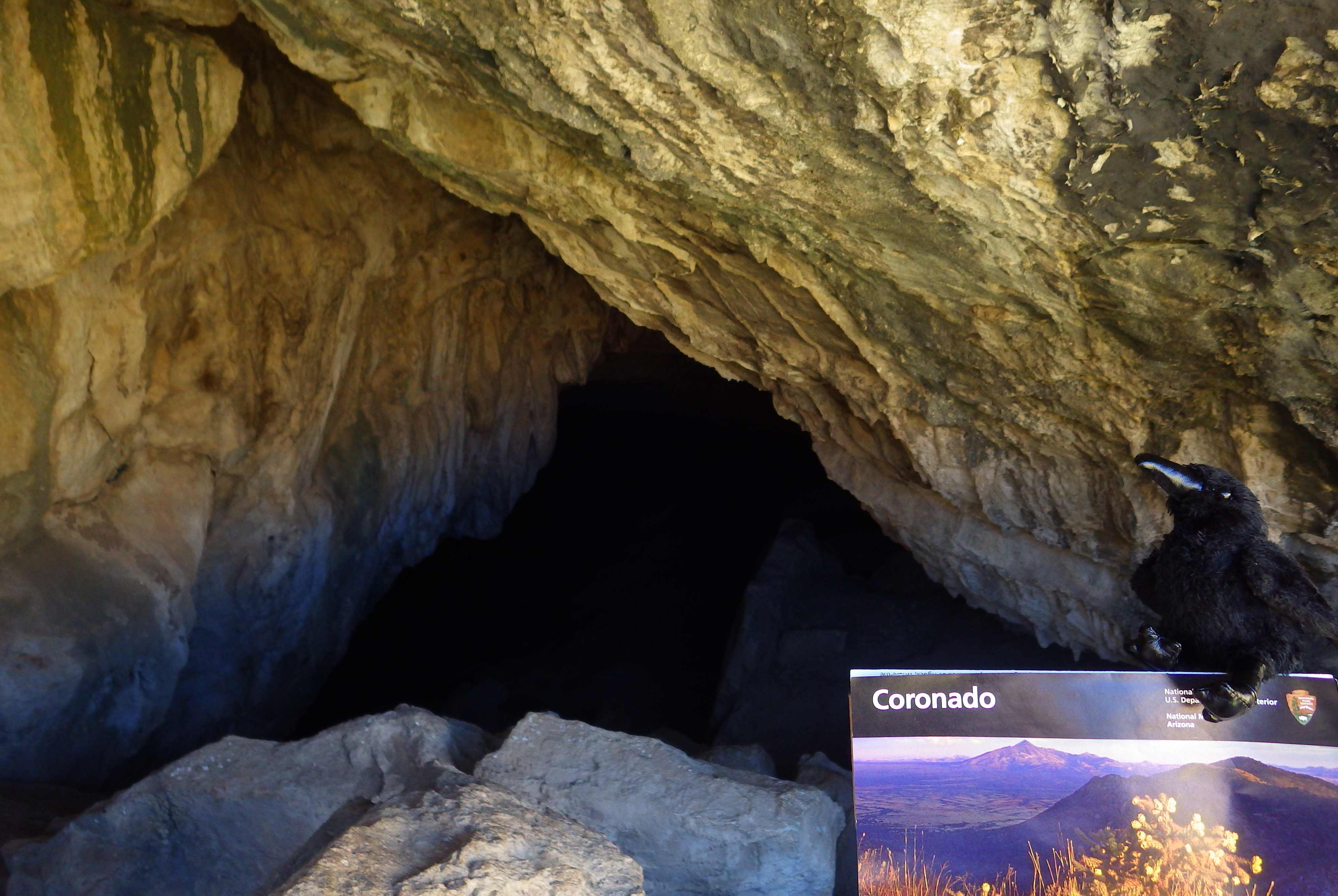
The park does not actually contain a statue or large
memorial to Coronado. It does have a
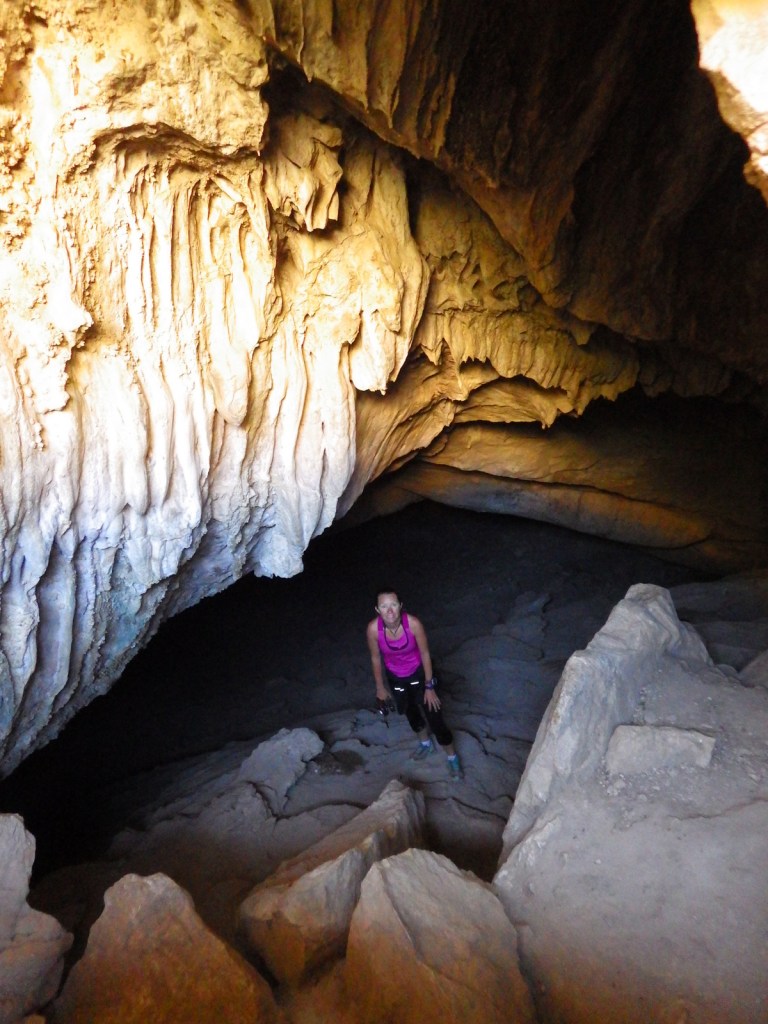
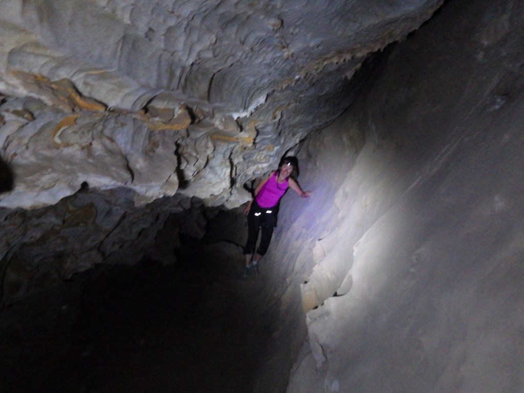
steep three-quarter mile trail to a 600-foot long limestone cave bearing his
name, which visitors can explore on their own with flashlights.
Best Trail
From the parking area at Montezuma Pass it is half a mile to
Coronado Peak. This “sky island” at
6,864 feet in elevation offers excellent views north towards the Huachuca
Mountains in the surrounding Coronado National Forest and south into
Mexico. From there, Joe’s Canyon Trail
leads 3 miles down to the visitor center and works great with a car
shuttle.
Instagram-worthy Photo
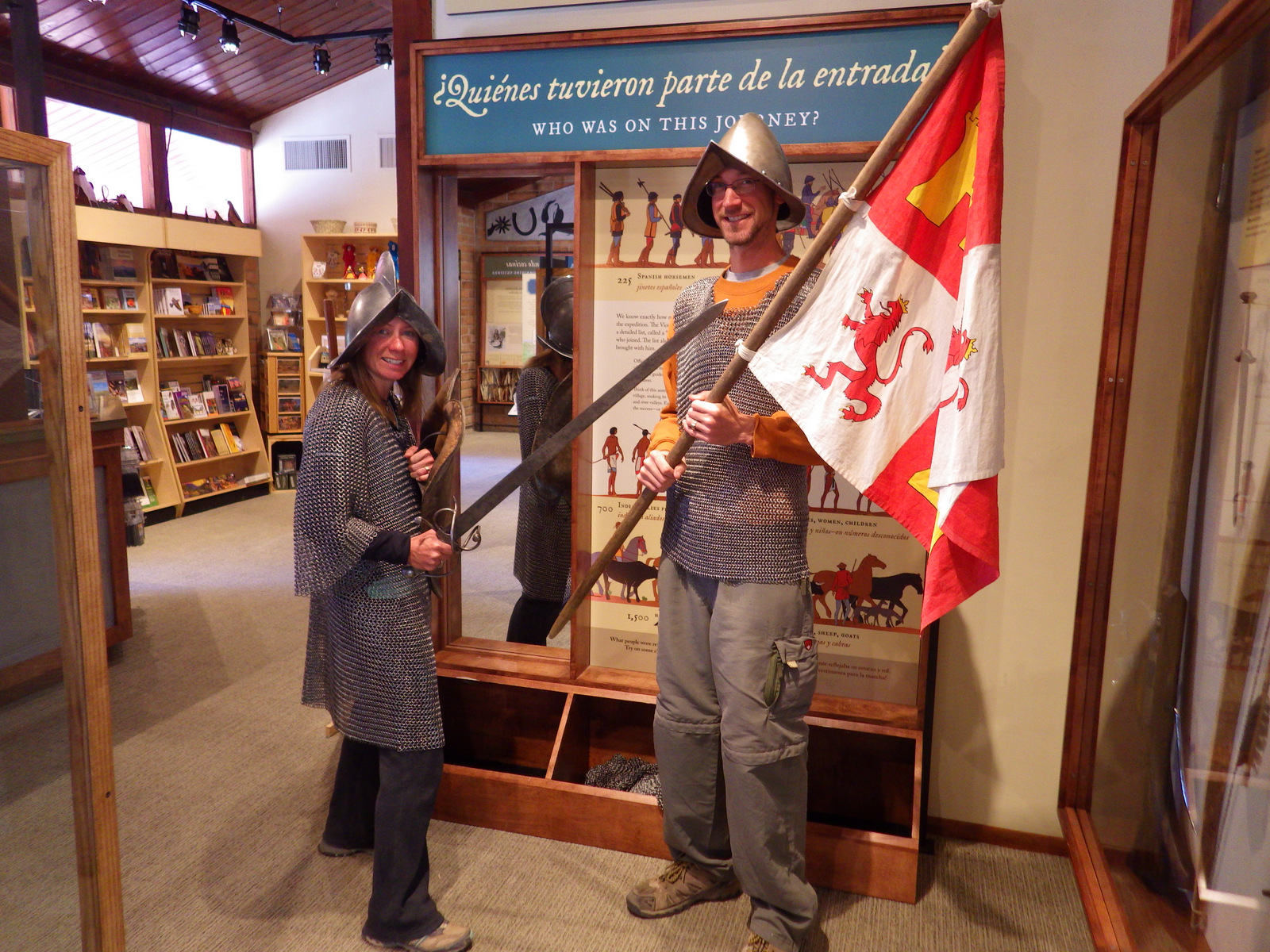
The small but educational visitor center provides
information on trails, the history of the Coronado expedition, wildlife, and
the “I Hike for Health” program. Plus,
you can dress up in replica Spanish Conquistador armor, which is very heavy.
Tiff at the entrance of Coronado CaveInside Coronado Cave, which is dry now but has remnant flowstone featuresTiff checking out a side channelTiff, Scott, and Scott’s mother in Coronado CaveEntrance to Coronado Cave. Be sure to bring a backup flashlight and sturdy boots.Huachuca MountainsTiff and Scott’s mother at the top of Coronado Peak looking towards MexicoScott on Joe’s Canyon Trail
Explore More – Disillusioned
by not finding the Seven Cities of Cibola, in which present-day state did the
Coronado expedition turn around in 1541?
Sand dunes are like giant sandboxes for big kids to play in and hike on, so we came up with a list of our favorites from across the National Park Service (NPS) System. Unlike most NPS backcountry trails, dogs are allowed on many of these dunes if they are leashed and picked up after.
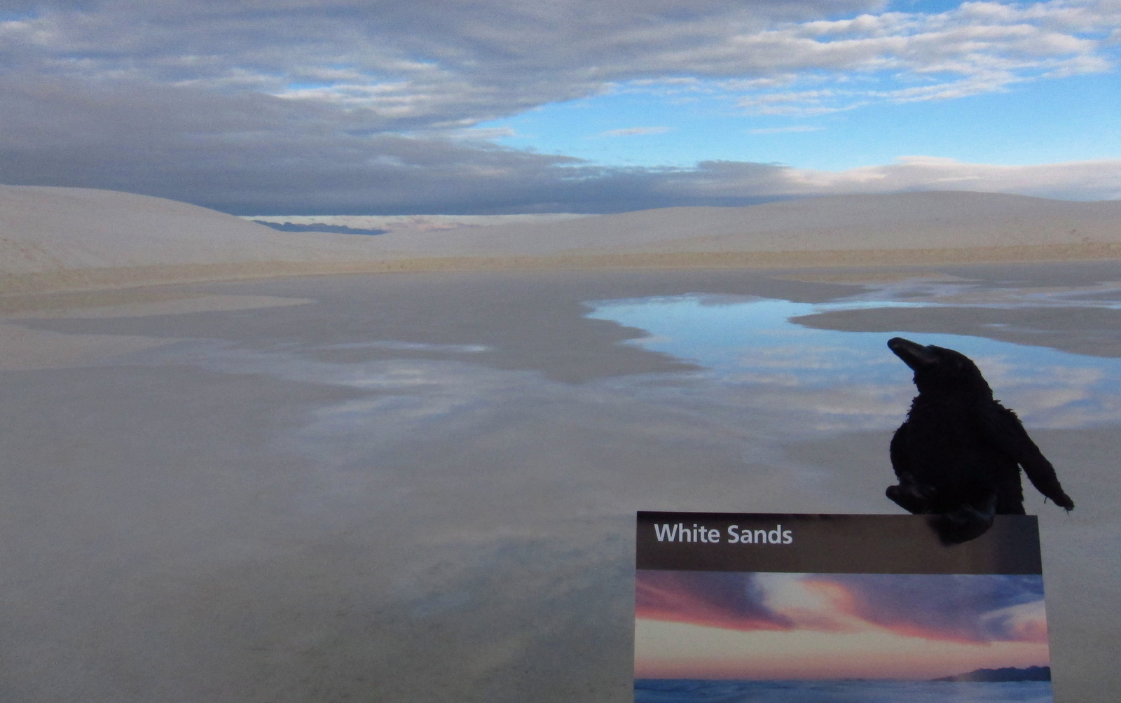
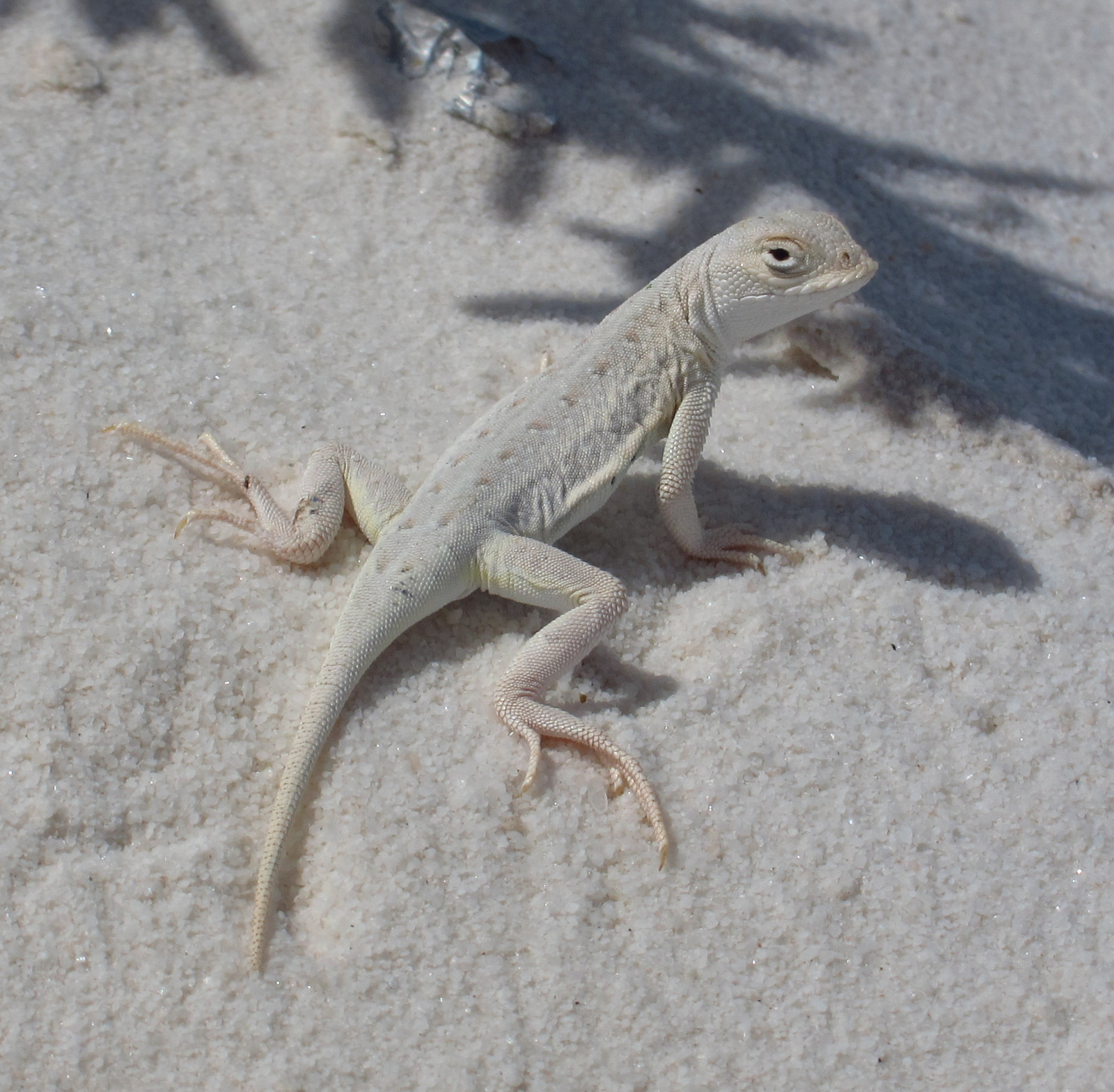
You might know gypsum as the white powder inside drywall panels. Gypsum readily dissolves in water, but here it forms sand dunes because no river drains the Tularosa Basin. The white color of the dunes does make for extra intense albedo, so be sure to bring sunglasses and carry plenty of water. Most of the wildlife here is nocturnal, but during the day you may spot a lizard species evolved to camouflage in the sand.
Update: As of December 20, 2019, the former National Monument is now called White Sands National Park.
Dunes composed of gypsum make a great destination for snow sledding year round, especially after a rainfall. It is fun to see children wearing T-shirts and shorts sliding down the sparkling white slopes.
Best Trail
Follow markers on the five-mile round trip Alkali Flat Trail that goes up and down dunes with views of the San Andres Mountains.
Instagram-worthy
Photo
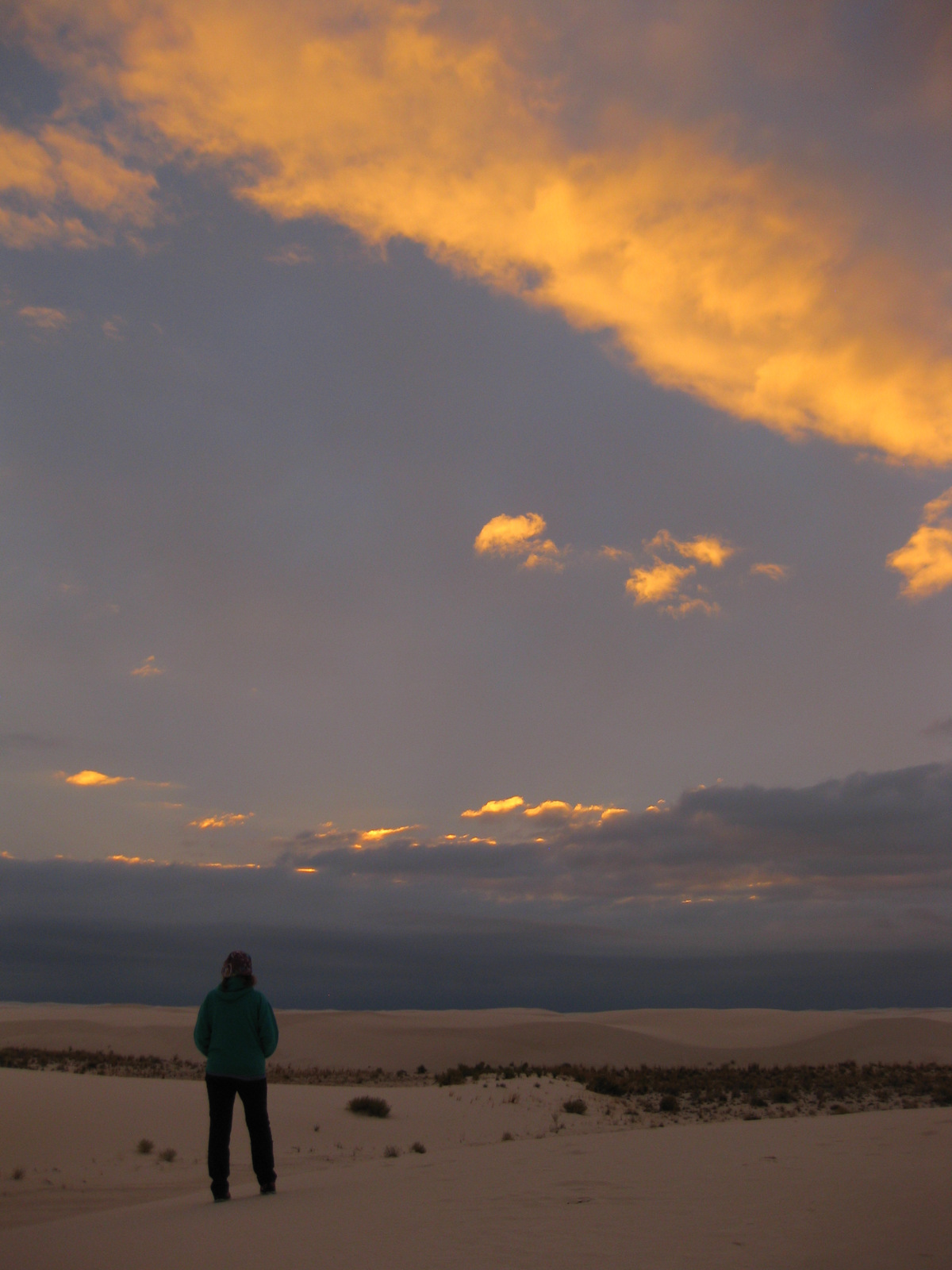
The white dunes take on the colors of the sunset if you decide to backpack or take the ranger-guided Sunset Stroll.
Peak Season
Spring and fall, since it can be very hot in the summer.
Mostly paved and the packed dirt road is drivable by all vehicles.
Camping
Only backcountry camping is allowed in 10 designated sites for $3 per person, but that is dependent upon whether the military is conducting missile tests overnight so call ahead or check the schedule online. Oliver Lee Memorial State Park offers a full service campground south of Alamogordo.
Bleached earless lizard
Scott’s mother getting ready to sled down a sand dune in October
The white sands blooming in October
Scott’s mother sledding at their backcountry campsite in December
A raven about the park
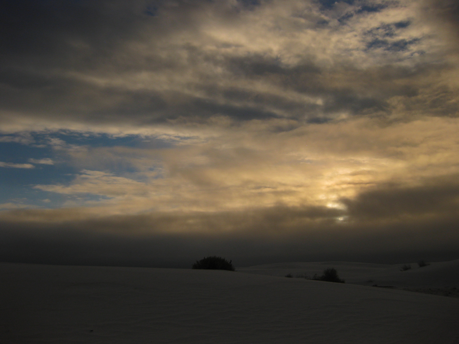
Sunrise in December
Tiff getting ready to sled in May
This design we created to celebrate White Sands National Park is available on a variety of products at Cafe Press and Amazon.
Explore More – What happens to the deep root system of a soaptree yucca when the dune it is growing on blows away?
We are a participant in the Amazon Services LLC Associates Program, an affiliate advertising program designed to provide a means for us to earn fees by linking to Amazon.com and affiliated sites.
Death Valley is our favorite of the 9 National Parks in California. Ghost towns and abandoned mills abound throughout its 3.4-million acres, including Leadfield on the one-way dirt road through Titus Canyon. Most of the attractions are found in and around the historic Furnace Creek Inn: watch sunrise at Zabriskie Point or sunset at 5,475-foot Dantes View; hike through gorgeous Golden Canyon or under Natural Bridge; drive to the ironic Devils Golf Course or the colorful Artists Drive; and walk into Badwater Basin, which at -282 feet below-sea-level is the lowest point in North America, even more impressive since it sits directly beneath 11,049-foot Telescope Peak.
Highlights
Badwater Basin, Zabriskie Point, Golden Canyon Trail, Devils Golf Course, Artists Drive, Salt Creek Interpretive Trail, Titus Canyon, Telescope Peak, sand dunes
Must-Do Activity
Death Valley averages less than 2 inches of precipitation annually, yet less than 10,000 years ago Badwater Basin was the bottom of a massive inland lake, the remnants of which be found along Salt Creek Interpretive Trail. Here tiny desert pupfish survive in the salty, hot water. The related and endangered Devils Hole pupfish can be seen at a disconnected part of Death Valley National Park surrounded by Nevada’s Ash Meadows National Wildlife Refuge.
Best Trail
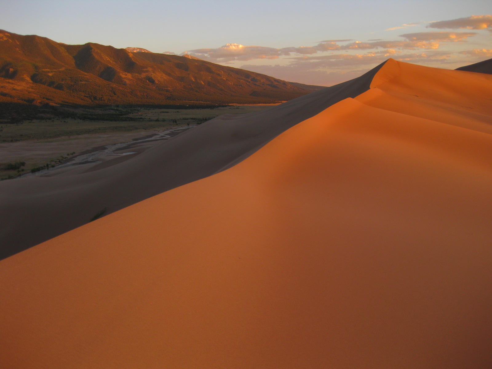
There are great trails throughout this park, but we prefer walking wherever we want on the many sand dunes. The best are the Panamint Dunes; tucked on a mountain slope they require a three mile hike to reach. That means when you drop your sleeping bag on top you will likely have the place to yourself. More centrally located are the popular Mesquite Flat Sand Dunes. In the northern section of the park the steep Eureka Dunes have a free primitive campground at their base.
Instagram-worthy
Photo
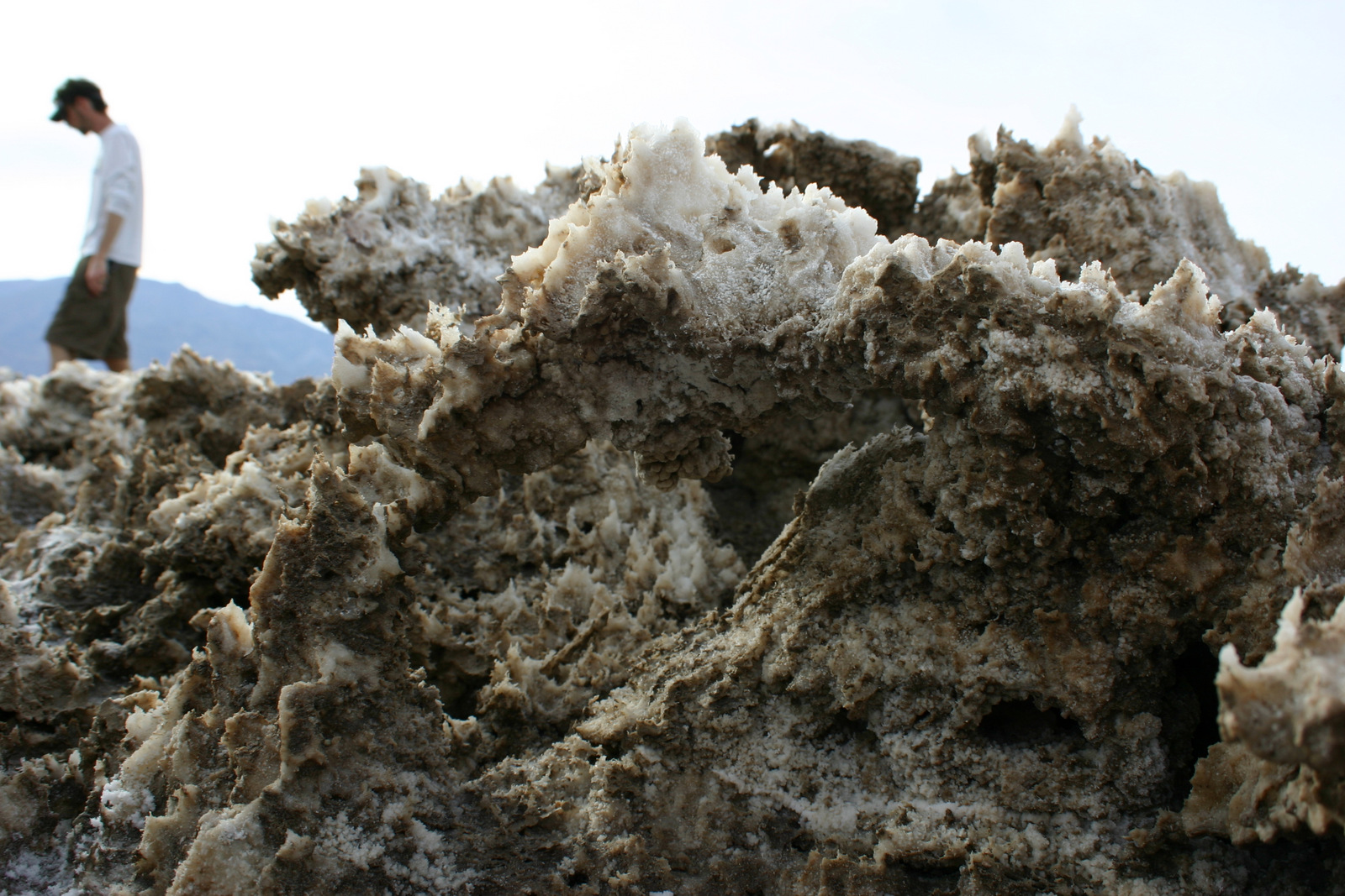
A dry, flat lakebed in the northwestern corner of the park provides a racetrack for rocks of all shapes and sizes. High winds and ice crystals are the key to their movement, which is clearly shown in their wake. Do not let the 26 mile dirt road stop you from visiting this spectacular site. It is passable by most vehicles when the road is dry (we drove our mini-van there)and when the Racetrack is wet you should refrain from walking on it anyway.
Peak Season
Spring and fall, with summer’s being incredibly hot except at the highest elevations. However, it can snow just about any month of the year.
The main roads are paved, but to really enjoy the park you should drive a high-clearance vehicle (rental 4x4s are available near Furnace Creek). As of December 2018, Scotty’s Castle is still inaccessible due to flood damage on the road.
Camping
There are campgrounds, but a unique aspect of this National Park is that you can disperse camp for free along many of its dirt roads. Backcountry camping is also free and does not require a permit.
Sunset on the Panamint Dunes
Tiff backpacking on the Panamint Dunes
Scotty’s Castle will be inaccessible until at least 2020
A March wildflower bloom
Scott with some salt formations at Devil’s Golfcourse
Zabriskie Point sunset
Desert pupfish on the Salt Creek Interpretive Trail.
Raven in Death Valley
This design we created to celebrate Death Valley National Park is available on a variety of products at Cafe Press and Amazon.
Explore More – What is the connection between Death Valley, 20 Mule Team Borax, and Stephen Mather (who in 1916 became the first Director of the National Park Service)?
We are a participant in the Amazon Services LLC Associates Program, an affiliate advertising program designed to provide a means for us to earn fees by linking to Amazon.com and affiliated sites.
Start your U.S. National Parks, National Forests, and National Monuments adventure here!