Tag Archives: cannons

Brices Cross Roads National Battlefield Site

Brices Cross Roads National Battlefield Site

Mississippi

Managed by National Park Service

Established 1929

1 acre

Website: nps.gov/brcr

Overview

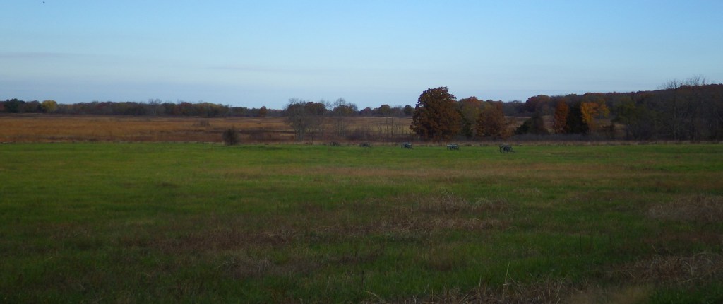
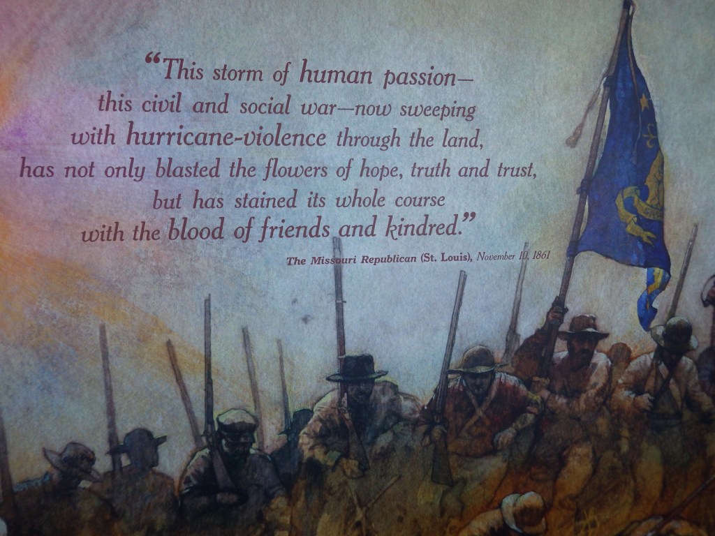
During General Sherman’s “march to the sea” in 1864, he dispatched troops under Brigadier General Samuel D. Sturgis to northern Mississippi to protect the 151-mile Nashville & Chattanooga Railroad line from Major General Nathan Bedford Forrest’s Confederate cavalry.  The two sides clashed on June 10 at this site in northern Mississippi, when a larger Union force of 8,100 men was routed by 3,500 Confederates.  However, Sherman’s supply line remained intact during his march towards Atlanta.

Highlights

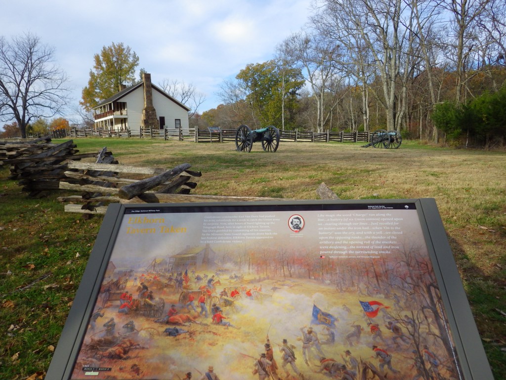
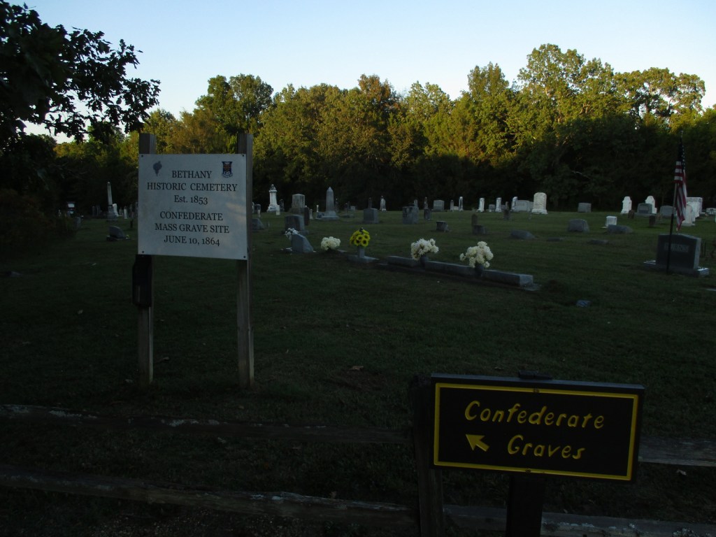
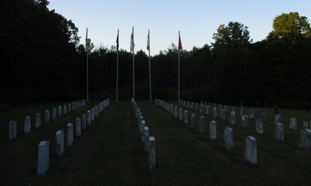
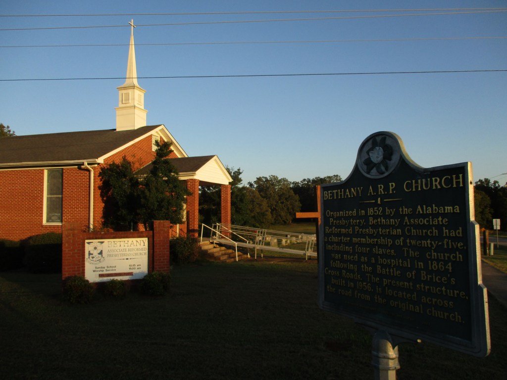
Bethany Church Cemetery, Mississippi Final Stands Interpretive Center

Must-Do Activity

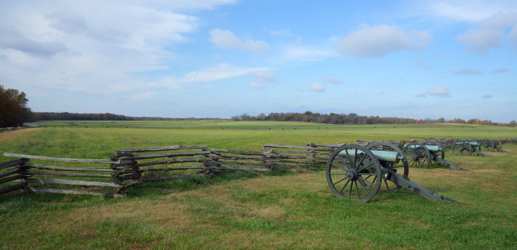
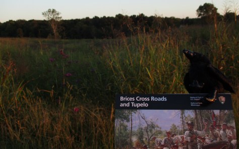
The National Park Service site here is tiny with no facilities and only a couple interpretive signs, but a local battlefield commission owns 1,400 acres with walking trails.  The nearby Mississippi Final Stands Interpretive Center is located five miles east of the battlefield in Baldwyn.  For a passport stamp, stop at the Natchez Trace Parkway visitor center outside Tupelo.  We arrived at Brices Cross Roads National Battlefield Site near sunset, but we were still able to explore the small park at the four-way stop at the crossroads of Highway 370. 

Best Trail

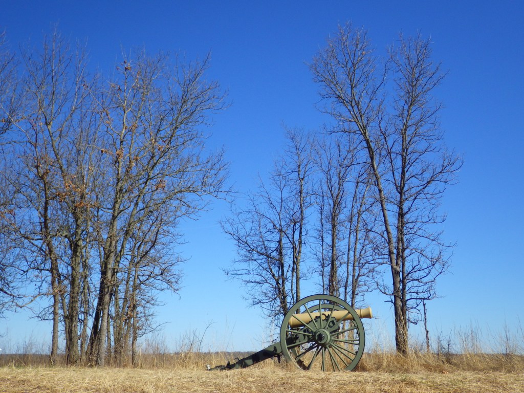
A local battlefield commission owns 1,400 acres with miles of walking trails, with the longest located at Log Cabin Knoll.

Instagram-worthy Photo

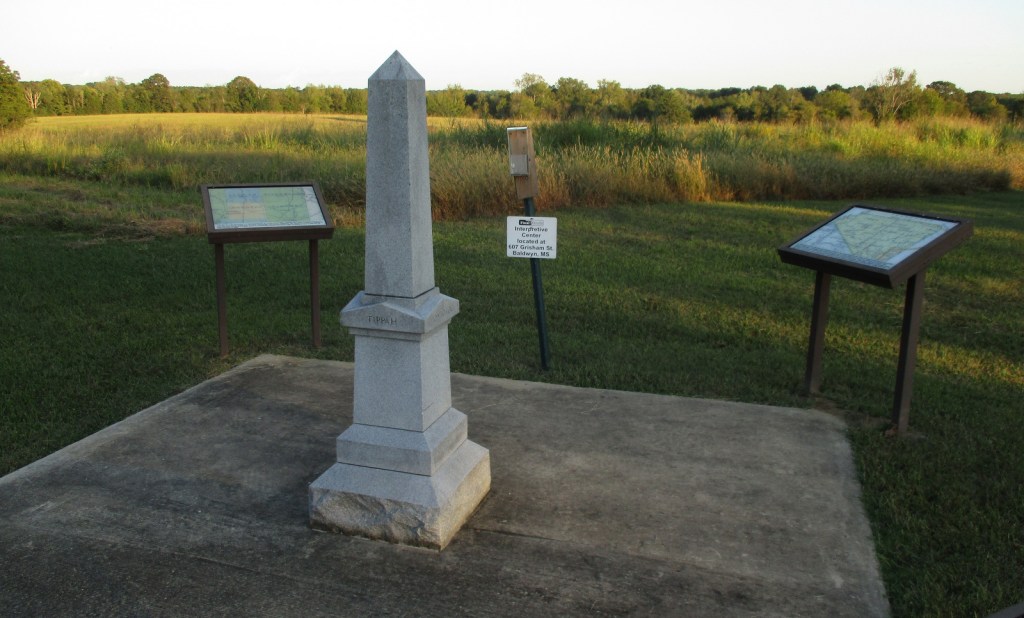
A monument was erected where the Brice home once stood, used as a place to treat the wounded of both armies during the battle.

Peak Season

Spring and fall

Hours

The Battlefield Site is never closed, but Mississippi Final Stands Interpretive Center is closed every Sunday, Monday, and most holidays.

Fees

None for Brices Cross Roads National Battlefield Site, but $7 per person at Mississippi Final Stands Interpretive Center.

Road Conditions

Park on the shoulder of the paved highway to access the site.

Camping

J.P. Coleman State Park is located east of Corinth and Tombigbee State Park is near Tupelo.

Related Sites

Holly Springs National Forest (Mississippi)

Tupelo National Battlefield (Mississippi)

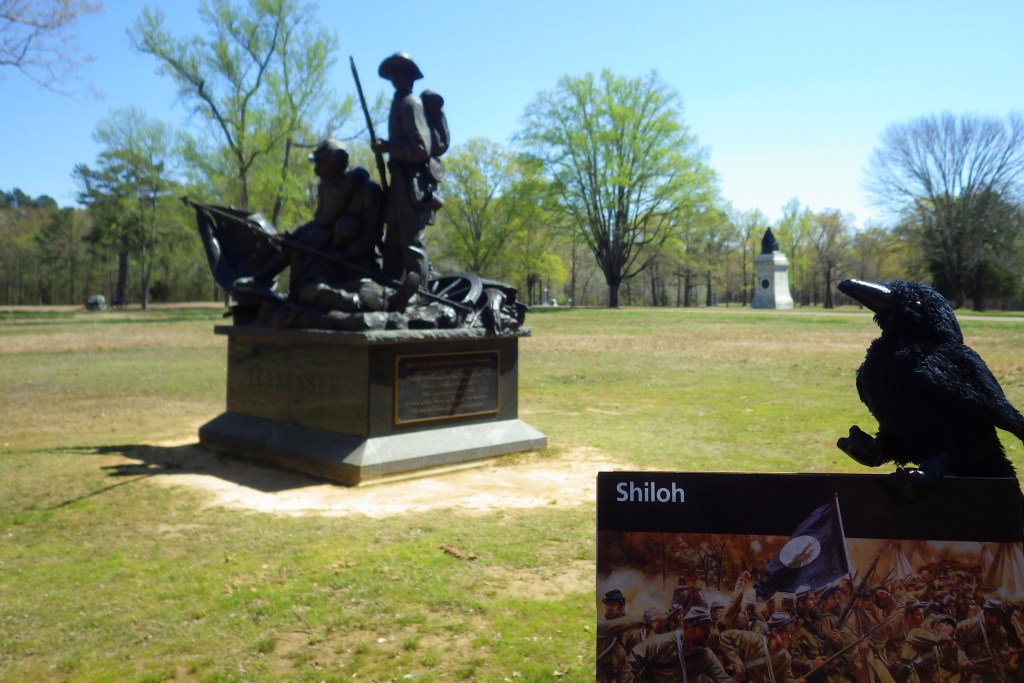
Shiloh National Military Park (Tennessee-Mississippi)

Explore More – Who was the Colonel that commanded several regiments of United States Colored Troops (USCT) instrumental in the defensive actions that protected the Union Army’s retreat across the Tishomingo River?

Shiloh National Military Park

Overview

Following the victory at Fort Donelson, Union General Ulysses S. Grant moved his 50,000 troops aboard steamboats down the Tennessee River to Pittsburg Landing.  The army camped near a log church named the Shiloh Meeting House where they awaited the marching Army of Ohio before advancing on the important railroad crossroads in Corinth, Mississippi.  The Confederate army launched a surprise attack on April 6, 1862, pushing the enemy lines back two miles before Union reinforcements finally arrived.  After two days and 23,746 soldiers killed, wounded, captured, or missing, the Confederates abandoned the field and Corinth.  There were an additional 7,000 casualties when they failed to recapture the town in October 1862.

Highlights

Museum, film, driving tour, Shiloh Meeting House, Indian mounds, cannons

Must-Do Activity

Start with the great 45-minute movie at the National Park Service (NPS)  visitor center then take the 12.7-mile driving tour with twenty stops that passes 150 commemorative monuments, 229 cannons, and 4,000 graves in Shiloh National Cemetery.  The site also contains 800-year-old American Indian mounds within a 45-acre National Historic Landmark.  A free pass to the Tennessee River Museum in Savannah is also provided at the NPS visitor center.  In addition to the NPS unit in Shiloh, Tennessee, there is an Interpretive Center 22 miles away in Corinth, Mississippi. 

Best Trail

The short trail through the 800-year-old Indian mounds provides views of the Tennessee River.

Instagram-worthy Photo

A reconstruction of the Shiloh Meeting House log church is found along the driving tour.

Peak Season

Summer

Hours

https://www.nps.gov/shil/planyourvisit/basicinfo.htm

Fees

None

Road Conditions

All roads paved

Camping

None in the park, but Pickwick Landing State Park is located 15 miles to the southeast.

Related Sites

Fort Donelson National Battlefield (Tennessee-Kentucky)

Stones River National Battlefield (Tennessee)

Vicksburg National Military Park (Mississippi)

Explore More – Originally managed by the U.S. military, when was this park established?

Pea Ridge National Military Park

Overview

This 4,300-acre park memorializes a battle fought early in the Civil War for control of the Union state of Missouri.  It took place in March 1862, seven months after the events at Wilson’s Creek National Battlefield.  Pea Ridge National Military Park is located near Fayetteville, Arkansas and also contains a section of the Trail of Tears National Historic Trail.  Two regiments fighting on the Confederate side during the Battle of Pea Ridge were Cherokees that were forced to march to Indian Territory from North Carolina in 1838.

Highlights

Museum, film, driving tour, Elkhorn Tavern, cannons

Must-Do Activity

A quality film and further exhibits at the visitor center help fill in any unclear parts about the battle on March 7-8, 1862 that kept Missouri in the Union.  The seven-mile driving tour includes informational stops that explain the battle in chronological order from the Confederate assault at Leetown to their eventual retreat from Elkhorn Tavern. 

Best Trail

There are ten miles of hiking trails and 11 miles of equestrian trails that run through the park.  Also, a portion of the infamous Trail of Tears follows the route of the telegraph wire road from 1838.  To learn more about the Trail of Tears National Historic Trail, we recommend a visit to Fort Smith National Historic Site, which is only a two-hour drive away.

Instagram-worthy Photo

Stop to walk around a reconstruction of Elkhorn Tavern, which was used as a hospital by both sides during the battle and later as a Union telegraph station.  The original building was burned by Confederate guerillas in 1863.

Peak Season

Summer

Hours

https://www.nps.gov/peri/planyourvisit/hours.htm

Fees

$20 per vehicle or America the Beautiful pass

Road Conditions

All roads paved

Camping

Beaver Reservoir is 20 miles away and has public campgrounds.

Related Sites

Wilson’s Creek National Battlefield (Missouri)

Buffalo National River (Arkansas)

Fort Smith National Historic Site (Arkansas-Oklahoma)

Explore More – The Trail of Tears National Historic Trail has multiple routes; how long is it in total?

Wilson’s Creek National Battlefield

Overview

Early in the Civil War control of the state of Missouri hung in the balance.  Union and Confederate forces gathered near Springfield and both organized surprise attacks for the morning of August 10, 1861.  Rain overnight caused Confederate General Sterling Price to cancel his plan, but Union General Nathaniel Lyon went through with his in the face of overwhelming odds.  The strategy worked briefly but cost Lyon his life.  Even though the Union army retreated that day, seven months later they prevailed during the Battle of Pea Ridge in northern Arkansas, successfully keeping Missouri in the Union. 

Highlights

Museum, film, driving tour, Ray House, cannons

Must-Do Activity

Missouri stayed in the Union throughout the war despite the $10-million in property damage caused by guerrilla fighters, making it the third most fought-over state.  Start your visit by watching a short film, then peruse the excellent museum before taking the five-mile driving route that provides an overview of the battle at eight interpretive stops.  The paved road is heavily used by locals for jogging and biking, so drive carefully.

Best Trail

A portion of the infamous Trail of Tears crosses through this park following the route of the telegraph wire south towards Elkhorn Tavern in Arkansas’ Pea Ridge National Military Park.  There are also hiking and equestrian trails through the park’s 1,926 acres.

Instagram-worthy Photo

Rebuilt at its original location, there is a reconstruction of the Ray House, which was used as a Confederate hospital.  Nearby split-rail fences add to the bucolic ambiance.

Peak Season

Summer

Hours

https://www.nps.gov/wicr/planyourvisit/hours.htm

Fees

$20 per vehicle or America the Beautiful pass

Road Conditions

Paved, but gate closes tour road exactly at 5 p.m.

Camping

Within five miles there is a private campground near Interstate-44, plus a variety of state parks within an hour’s drive.

Related Sites

Pea Ridge National Military Park (Arkansas)

Ulysses S. Grant National Historic Site (Missouri)

George Washington Carver National Monument (Missouri)

Explore More – How many Union soldiers were buried in the sinkhole near Totten’s Battery on Bloody Hill (then in 1867 were moved to a National Cemetery in Springfield)?

Manassas National Battlefield Park

Overview

The first major confrontation of the Civil War occurred on July 21, 1861 at Bull Run Creek near Manassas, Virginia.  Due to its proximity to Washington, D.C., civilians drove their carriages down to picnic and watch the spectacle of 34,000 men trying to kill each other.  It was on Henry Hill that Confederate General Thomas “Stonewall” Jackson earned his nickname when he refused to flee in the face of a Union advance.  In the north it was known as the Battle of Bull Run and run they did when Confederate reinforcements arrived to take the field.  The next year there was another fight here, which the southern army also won on its march north before being turned back at Antietam.

Highlights

Museum, film, “Stonewall” Jackson statue, cannons, Stone House

Must-Do Activity

As with other battlefield sites, Manassas National Battlefield Park has a National Park Service (NPS) visitor center with a movie, maps, driving tour, and hiking trails.  Start in the museum, as the fiber-optic maps with recorded narration are one of the best ways to understand the events of each battle.  The first of the two Battles of Bull Run took place around the visitor center on Henry Hill.  The second battle was spread across the landscape and is the focus of the 18-mile driving tour.

Best Trail

Cannons line the one-mile hiking trail on Henry Hill, where one of the first civilian casualties of the Civil War occurred in a house that was rebuilt in 1870 and still stands.

Instagram-worthy Photo

General Thomas “Stonewall” Jackson earned his nickname at the first battle at Manassas.  We understand that Confederate statues are justifiably controversial, but this is one place that they actually belong.

Peak Season

Summer

Hours

https://www.nps.gov/mana/planyourvisit/hours.htm

Fees

None

Road Conditions

Exercise caution as the 18-mile driving tour goes through residential areas with a couple unpaved roads.

Camping

There is not an NPS campground, but nearby Bull Run Regional Park has 150 sites with RV hookups.

Related Sites

Antietam National Battlefield (Maryland)

Fredericksbug and Spotsylvania County Battlefields Memorial National Military Park (Virginia)

Cedar Creek and Belle Grove National Historical Park (Virginia)

Explore More – What state has a memorial to its troops on the spot where 123 men were killed in five minutes on August 30, 1862 (which was the greatest loss of life in any single infantry regiment in a Civil War battle)?