White Rocks National Recreation Area is located in the southern portion of Vermont’s Green Mountain National Forest and was officially renamed Robert T. Stafford White Rocks National Recreation Area. It encompasses Big Branch Wilderness, Peru Peak Wilderness, Big Branch Observation Area, and its namesake White Rocks Picnic Area (see Must-Do Activity). A section of the Long Trail (which in 1931 became the first named long-distance hiking trail in America) passes through this area, where it coincides with the newer Appalachian National Scenic Trail (AT). Other popular activities include biking, fishing, snowshoeing, cross-country skiing, and snowmobiling.
Highlights
Big Branch Observation Area, White Rocks Day Use Area, Bully Brook, Ice Beds Trail, Keewaydin Trail, White Rocks Cliffs Trail, Greenwall Shelter, Long Trail, Appalachian National Scenic Trail
Must-Do Activity
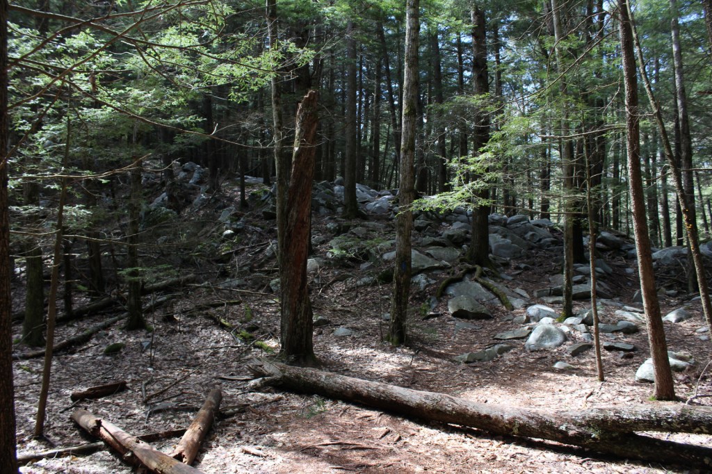
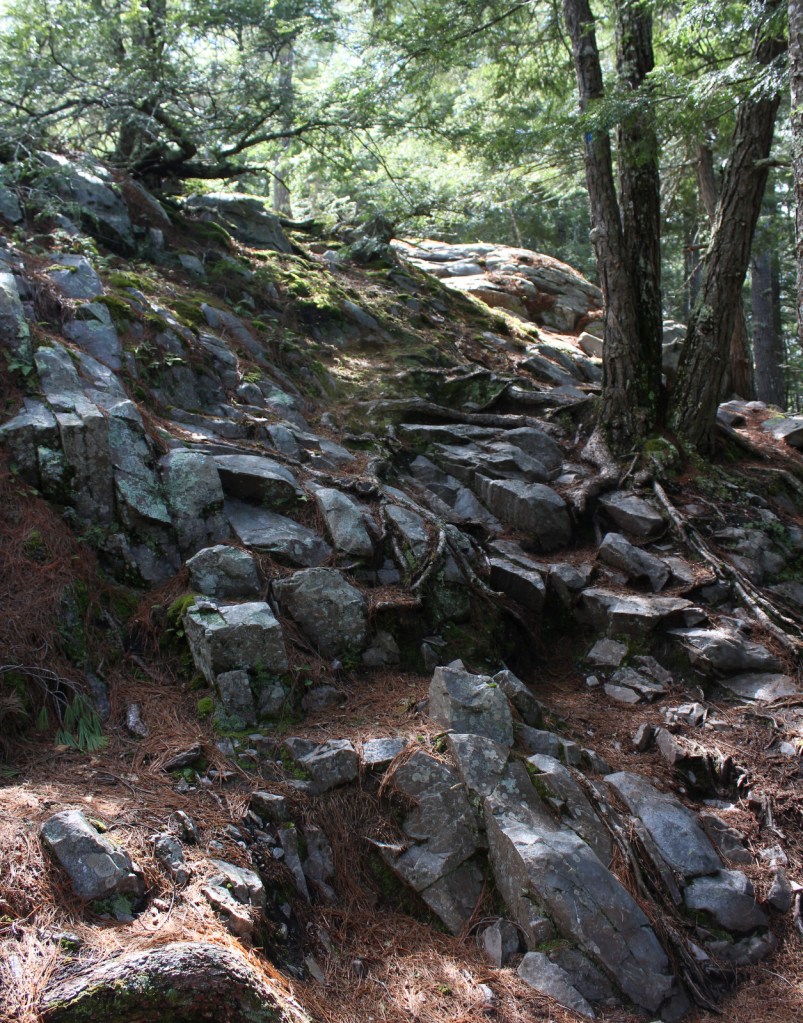
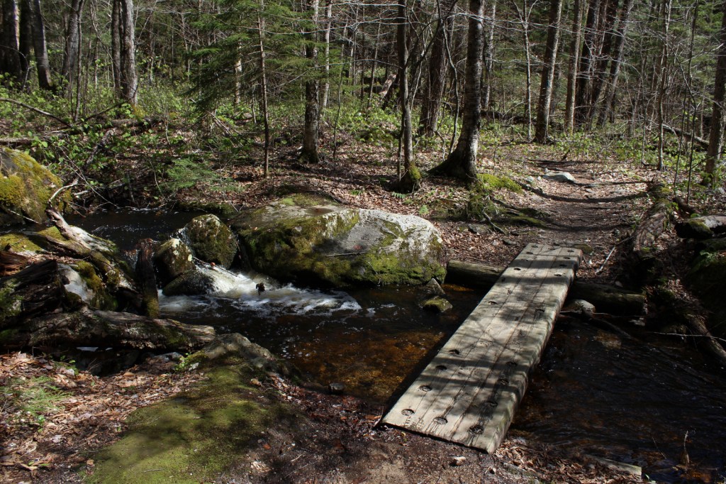
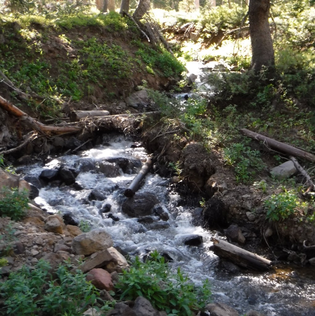
A great place to access Robert T. Stafford White Rocks National Recreation Area is the White Rocks Day Use Area off State Route 140. Several trails start from the picnic area, including a short walk to a cascading waterfall on Bully Brook. Less than a mile up the Ice Beds Trail, a short climb reaches a viewpoint of the white rocks, a glacier-scoured cliff of Cheshire quartzite, which was used by Native Americans to make tools. Continue on this trail 0.9 miles one-way to the Ice Beds where ice melts deep in a scree slope throughout the summer. You probably will not see any ice, but it is deep in the rocky recesses and releases cool drafts of air. We were told by a local that there is a black bear named Jenny that hangs out around the trailhead.
Best Trail
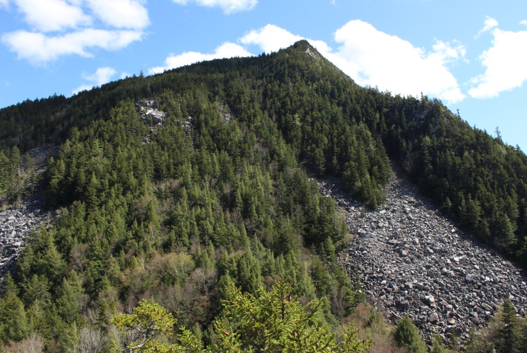
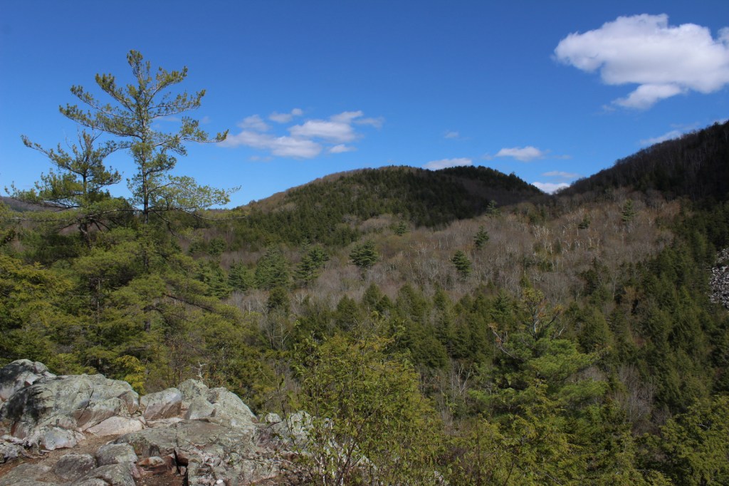
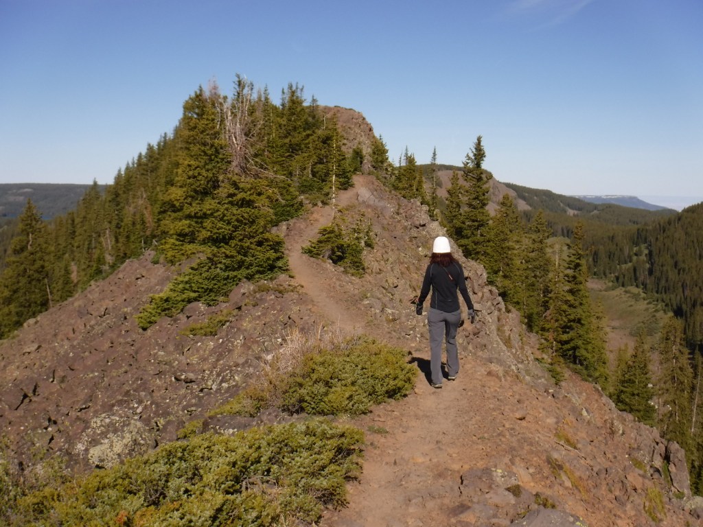
In 0.4 miles from White Rocks Day Use Area, Keewaydin Trail connects with the Long Trail and Appalachian Trail (AT). By going south, the trail ascends 1,250 feet to a cutoff for the Greenwall Shelter and just past there watch for a stone cairn on the right side. From there a side trail descends 0.2 miles to an overlook above the White Rock Cliffs providing views of the Adirondack and Taconic Mountains (3.8 miles roundtrip).
Instagram-worthy Photo
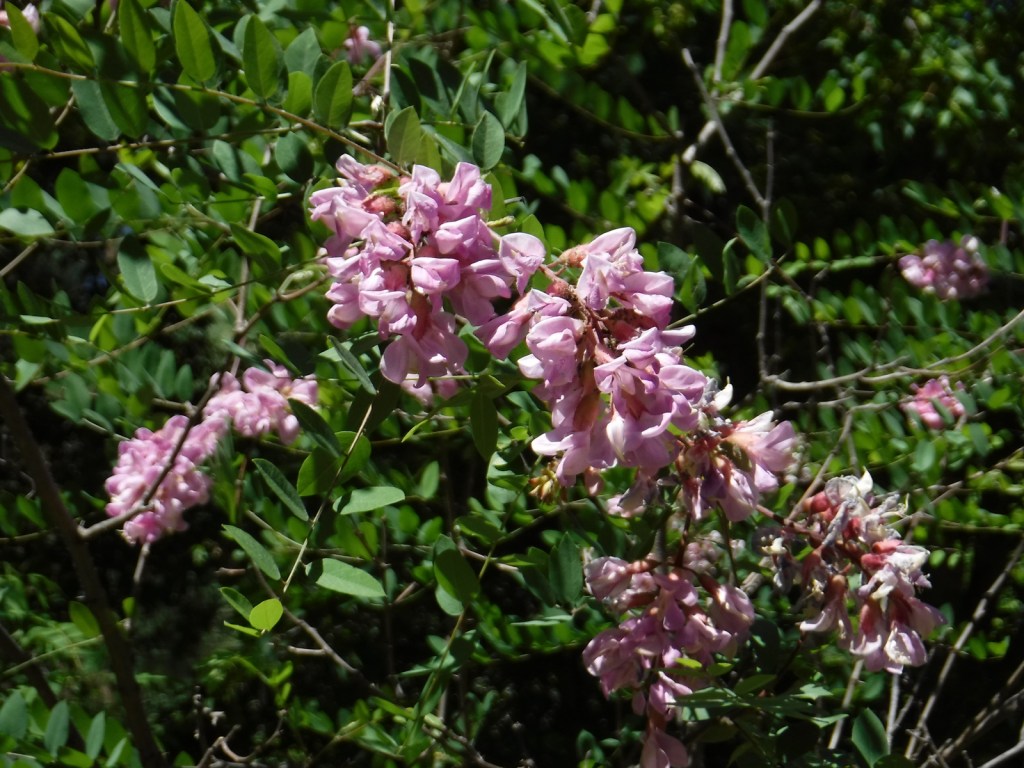
Visible less than a mile up the Ice Beds Trail, the white rocks are a glacier-scoured cliff of Cheshire quartzite once used by Native Americans to make tools.
Peak Season
Summer
Fees
None
Road Conditions
State Route 140 is paved, but the access road to White Rocks Day Use Area is an unpaved road passable by RVs.
Camping
Overnight shelters on the Long Trail/AT at Greenwall and Minerva Hinchey are free, while camping at Little Rock Pond, Peru Peak, Stratton Pond, and Griffith Lake requires a $5 per person, per night fee. Drive-up campgrounds are located on Forest Road 10 at Big Branch and Black Branch near the Big Branch Wilderness.
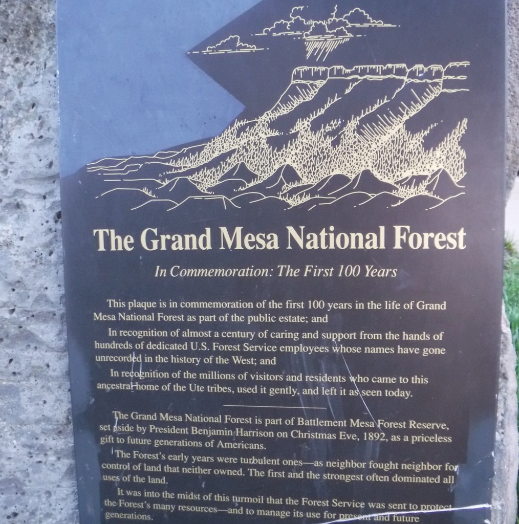
Covering 540 square-miles, Grand Mesa is the largest flattop mountain in the world and has an average elevation of 10,500 feet. It rises east of Grand Junction and is easily explored via paved Highway 65, also known as Grand Mesa Scenic Byway. Due to its high elevation, Grand Mesa National Forest is a popular destination for snowmobiles in the winter. This area was first set aside by President Harrison in 1892 as Battlement Mesa Forest Reserve, only the third such designation in U.S. history. It is now co-managed with Colorado’s Gunnison and Uncompahgre National Forests.
Highlights
Grand Mesa Scenic Byway, Land’s End Ranger Observatory, Ward Lake, Island Lake Interpretive Trail, Crag Crest National Recreation Trail, Eggleston Lake, Leon Peak, Battlement Trail
Must-Do Activity
Also covering a portion of Battlement Mesa, Grand Mesa National Forest contains more than 300 lakes, several of which have campgrounds. The Grand Mesa Visitor Center on Highway 65 near Island Lake is a great place to start, with a 20-minute film shown detailing the 1999 Land’s End archaeological excavation that found evidence of 8,000 years of human activity at 9,000 feet in elevation. Dirt roads travel east from there deeper into the National Forest, or you can take a side trip west on the Grand Mesa Scenic Byway to the visitor center at Land’s End Ranger Observatory for views all the way into Utah’s La Sal National Forest.
Best Trail
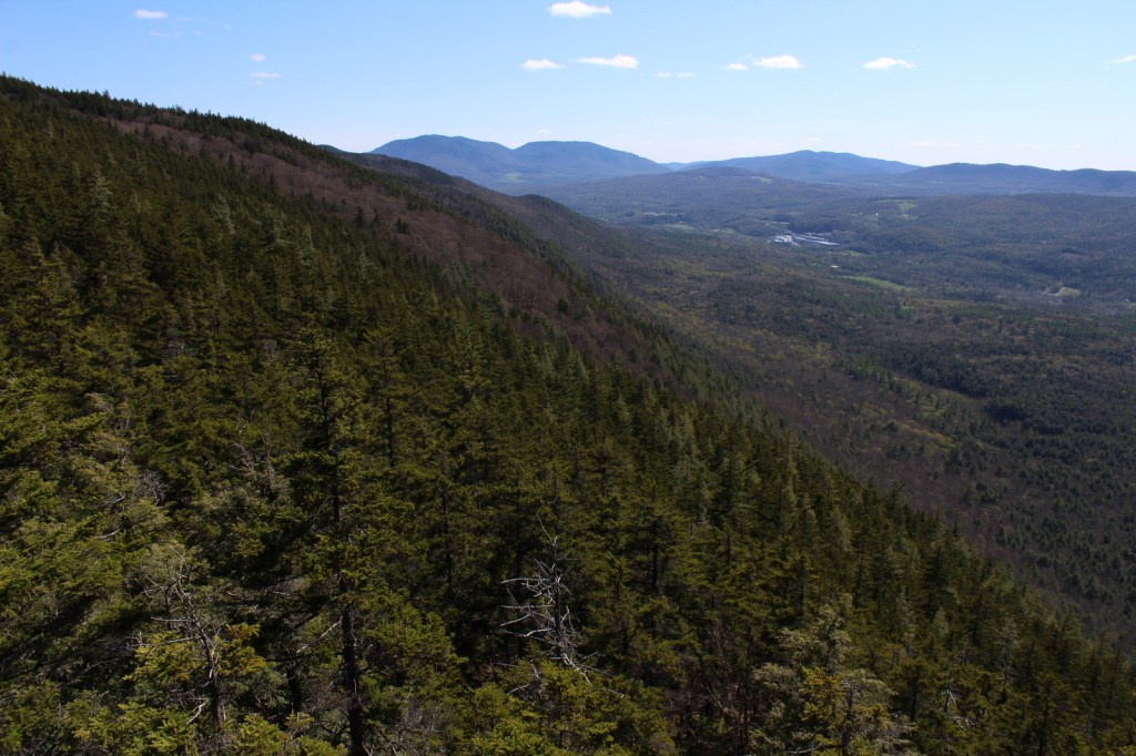
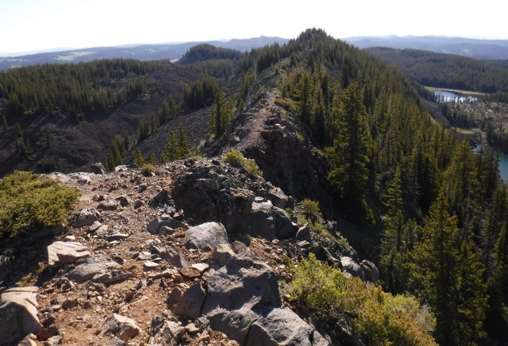
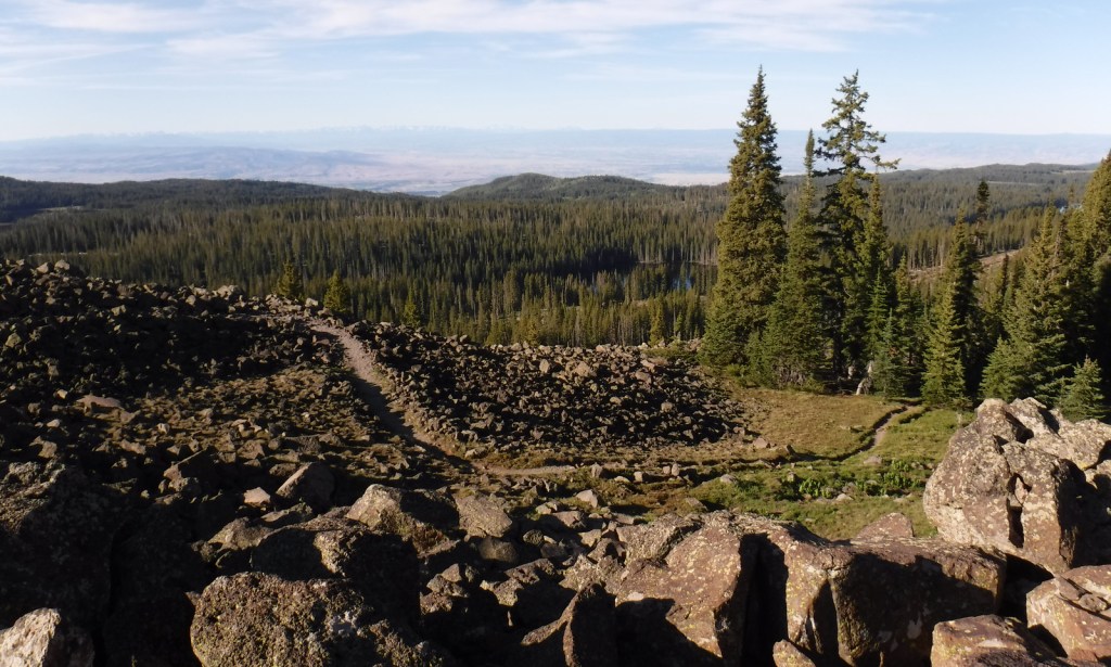
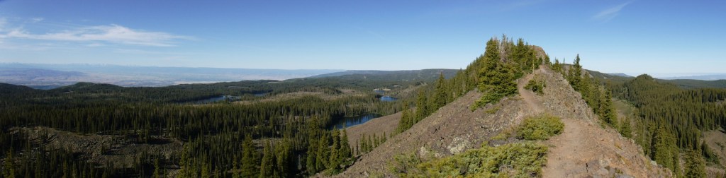
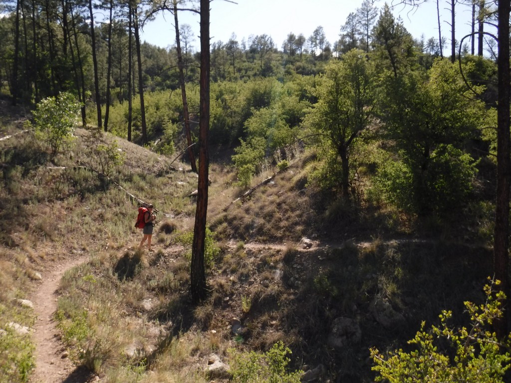
The best trail in Grand Mesa National Forest is without a doubt Crag Crest National Recreation Trail. It can be hiked as a 10.3-mile loop from two trailheads, one at Island Lake (paved access) and the other at Eggleston Lake (that requires some dirt road driving). The crest portion of the hike is the highlight as it follows a narrow ridge of volcanic rock that offers spectacular views. Due to its exposure and the high altitude (up to 11,189 feet) it is recommended that you get an early start to avoid afternoon thunderstorms. For those not wishing to do the entire loop, we found that by starting out counterclockwise from Eggleston Lake the trail climbs steeply providing panoramas within two miles. We completed five miles out-and-back with a cumulative elevation gain of 1,100 feet and felt we had gotten the full experience.
Watchable Wildlife
Trout fishing is one of the main draws to the 300 lakes in Grand Mesa National Forest. The lakes and streams also attract elk, mule deer, bighorn sheep, raccoons, red foxes, black bears, and mountain lions, in addition to large birds like bald eagles, golden eagles, peregrine falcons, common ravens, and wild turkeys. Due to its high elevation, look for pikas in the rocks along Crag Crest National Recreation Trail.
Instagram-worthy Photo
Starting counterclockwise on the Crag Crest National Recreation Trail from Eggleston Lake, we climbed to stunning panoramas within two miles.
Peak Season
Summer
Fees
None
Road Conditions
Grand Mesa Scenic Byway follows paved Highway 65 up above 10,000 feet in elevation, as well as west to Land’s End Ranger Observatory. The unpaved Land’s End Road continues switchbacking down the mesa to Highway 50, but is not recommended for vehicles more than 21 feet in length. The unpaved roads on Grand Mesa were in good shape during our June visit, but are closed in the winter.
Camping
There are campgrounds at several lakes in Grand Mesa National Forest, as well as dispersed camping options along the dirt roads.
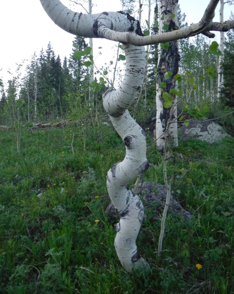
Quaking aspenEggleston LakeCrag Crest National Recreation TrailCrag Crest National Recreation TrailCrag Crest National Recreation TrailTiff on Crag Crest National Recreation TrailScott on Crag Crest National Recreation TrailBook Cliffs from Crag Crest TrailTiff on Crag Crest National Recreation TrailPikaRaven about the forest
Explore More – Now a geological term, what does “mesa” mean in Spanish?
Learn more about this and the 154 other National Forests in our new guidebook Out in the Woods
We are a participant in the Amazon Services LLC Associates Program, an affiliate advertising program designed to provide a means for us to earn fees by linking to Amazon.com and affiliated sites.
Today we published our newest guidebook to all 50 states available for sale on Amazon
50 States of Great: Road Trip Guide to America is a starting point for planning a road trip of any length, covering the best of each state in 12 categories: scenic drive, State Park, museum, waterfall, roadside attraction, National Forest, campsite, and more. 50 States of Great is a culmination of our extensive travels through the United States of America seeking out well-known destinations and less-frequented spots. The goal of our book is to be useful whether you are taking a cross-country road trip or exploring your home state.
We are also giving a presentation on road tripping in the U.S.A. at the Laramie County Library in Cheyenne, Wyoming. It will be held in the Cottonwood Room (1st floor) at 7 p.m. on Tuesday, December 5, 2023. We will have all our books for sale before and after the talk and would be happy to sign them for you.
If you go to our book page on Amazon (https://amzn.to/3tZsK3K) click on the cover image to Look Inside. We have included the Introduction below and will post a sample chapter on this website tomorrow.
We love traveling in the United States of America (U.S.). We have driven hundreds-of-thousands of miles across the country while on dozens of road trips, plus three flights taken to Hawai‘i. Utilizing our expertise, we wrote this guidebook with the goal of helping readers plan a road trip to see the best of what each state has to offer. This informative book presents all 50 states in alphabetical order, with abbreviated chapters at the end on American Samoa, the District of Columbia, Puerto Rico, and the U.S. Virgin Islands.
In our travels, we have visited every state—at least twice. We have spent the night in all 50 states. Between the two of us, we have lived in ten different states from coast to coast (Alaska, Arizona, Arkansas, California, Colorado, New York, North Carolina, Ohio, Tennessee, and Wyoming—our current home of more than a decade). We have visited in person more than 90% of the locations mentioned in this guidebook and we are excited to see some of the ones we learned about during our research, as well as making it to the remote territories of Guam and Northern Mariana Islands. As the old saying goes: “We have not been everywhere, but it is on our list.”
In 2016, we took ten months off to celebrate the centennial of the National Park Service (NPS) by visiting a State Park and an NPS site in all 50 states. Since then, we have traveled to all 50 states again and three territories, including a special trip in 2022 just to say we finally overnighted in Rhode Island. After the COVID-19 pandemic, we completed our effort to take a hike in all 155 National Forests and all 20 National Grasslands. We are currently on quests to hike in at least one National Wildlife Refuge in every single state (19 down) and finish visiting each state capital (only two to go).
We never liked the idea that parts of the U.S. are considered “flyover country,” and not just because we prefer to drive when we travel. This book started as a way to highlight the attractions in the central U.S., then we realized we knew just as many hidden gems in the most “touristy” states. Relying on our first-hand knowledge, we selected a few must-see sites to visit in each of these 50 United States of America. [Historical note: It was not until the Civil War was fought to preserve the union in the 1860s that “these United States of America” began to be referred to as “the United States of America.”]
We created categories that focused on our areas of expertise, leaving hotels and restaurants to somebody better qualified to compare those businesses. Our categories became the headings for each state that are explained below.
Map
For each state we included an outline map with a star for the capital city and a triangle located at the high point.
Acreage
Not all states are equal in size, so we included the number of acres and the percentage of the U.S. that it covers.
Statehood
This is the year that state was admitted to the union and its number in sequence.
Capital
The city where the state capital resides is represented by a star on the map.
Population
Based on the 2020 census, we included total population and rank out of 50.
High Point
The name and elevation of the highest point in each state is listed, and its location is represented by a triangle on the map.
Name Origin
We briefly explain the often-mysterious etymology. Most state names come from the languages of American Indians, while others have European roots.
Nickname
Every state has a nickname (some of which have changed over time) and the origins of those names are sometimes convoluted.
Background
A catch-all heading that provides some history or glosses over the famous attractions to a particular state, like those in New York City or Las Vegas.
Must-Do Activity
The one place to make sure to visit if you are only going to do one thing in a given state. Our choices range from a city to walk around, an outdoor activity to do, or a general type of attraction to focus on, each of which is essential to experience the best of what that state has to offer.
Greatest National Forest
There are a few states with only one National Forest (and ten without any), which made the selection process easy, but others like California (with 19) were a real challenge to pick. For those ten states without, we chose a National Grassland, State Forest, or similar natural area. We gave equal space to all National Forests in our guidebook Out in the Woods: An Introductory Guide to America’s 155 National Forests.
National Parks
A simple list of each of the 63 National Parks that lie within that state’s border. For more information on each of these, check out our guidebook A Park to Yourself: Finding Adventure in America’s National Parks.
Best National Park Service Site
Excluding the 63 National Parks, we chose our favorite unit managed by the National Park Service from among the National Monuments, National Historic Sites, National Memorials, and other classifications.
Most Scenic Drive
States designate specific roads as “Scenic Byways,” but we did not limit our choices to the official ones. We have driven hundreds-of-thousands of miles on vacations, so we have a feel for what makes an interesting route.
#1 Roadside Attraction
There are entire websites dedicated to roadside attractions and we cannot claim to have been to even half of them. However, we try to break up our drives with interesting stops, some of which take longer to visit than others.
Unique Museum
There are thousands of museums across the U.S. covering art, science, history, and everything in between. We would not argue that these are necessarily the best museums in each state, only that they were unique enough to get our attention.
That’s So [State Name]
In our research, we came across patterns of similar attractions in a specific state or someplace exceptional that could exist only in one state. This became our catch-all heading for fun spots that did not seem to fit elsewhere.
Top State Park
All 50 states have State Parks and we have visited at least one in each state. We often highlight State Parks under other headings, but here we focus on one that stands out above the rest.
Favorite Short Hike
There are so many hiking trails and websites dedicated to them that it is often hard to choose a destination. We guarantee that if you take the trail we picked that you will get a good feel for that state.
Backpacking Destination
We love backpacking and have read more about these remote destinations than any other areas. Our experience on the East Coast is limited, but we did find at least a one-night excursion for all 50 states.
Cool Campsite
We have camped in nearly every state, but usually not in a campground. We prefer dispersed camping on public lands, like those run by the U.S. Forest Service and Bureau of Land Management. Here we focused on unique spots for pitching a tent that sometimes require boating, backpacking, or riding a train (see West Virigina).
Wonderful Waterfall
Waterfalls are some of the most popular destinations for hikes and drives. However, due to topography some states are more blessed with options than others. Our choice is not always the tallest or busiest, but we think you will not be disappointed if you go.
***
For trip planners, thick guidebooks can often be overwhelming and travel websites are usually more interested selling something than providing any useful information. Our research method usually starts with reading the short descriptions found in free tourist pamphlets or book series like Off the Beaten Path, and then further investigating those places on the internet. State Parks, National Forests, and National Park Service sites typically have useful information on their websites and apps. We apologize for any out-of-date content, as there may have been significant changes to some of the attractions since 2020. A wealth of data on specific destinations and hiking trails is available free online, often with detailed directions on how to get there. Check these frequently-updated websites first before visiting anywhere in our guidebook since they can close due to various economic and natural disasters.
For each state, we selected two original photographs by the authors from a place discussed in the headings above. We limited the number of photos from National Parks and National Forests as those can be found in our other guidebooks. You might notice our stuffed animal named Wondon in a few of the photos since he has his own travel blog (WondonBuns.blogspot.com).
All illustrations are original drawings by Scott based on photographs we have taken. We selected an animal found in each state to represent it, allowing for some duplicates. Scott’s illustrations from this book are available on a variety of products on our travel website (RavenAboutTheParks.com).
We hope that 50 States of Great provides inspiration for your own explorations of the United States of America.
Adventure on!
-Scott and Tiff
Cheyenne, Wyoming
October 2023
We are a participant in the Amazon Services LLC Associates Program, an affiliate advertising program designed to provide a means for us to earn fees by linking to Amazon.com and affiliated sites.
Nearly 25% of Gila National Forest is designated Wilderness, and the renowned Gila Wilderness became the world’s first such-titled area on June 3, 1924. There are multiple hot springs that attract backpackers to this area and 95% of thru-hikers on the Continental Divide National Scenic Trail (CDT) veer from the official route to enjoy its beauty. The nearby Aldo Leopold Wilderness is named for the Forest Service ranger that helped campaign for that designation and later became a famous ecologist and author of A Sand County Almanac (see our Top 10 Non-Fiction Books on Trees and Forests). In 2016, the Cosmic Campground became the first International Dark Sky Sanctuary in North America (and one of only 18 in the world), so it is a great spot for stargazing. Gila National Forest also manages the part of Arizona’s Apache National Forest that is in New Mexico, adding an additional 614,202 acres.
Highlights
Inner Loop Scenic Byway, Hulsey Lake, Cosmic Campground, Turkey Creek Hot Springs, Lake Roberts, Signal Peak, Quemado Lake, Chimney Rock Canyon, Jordan Hot Springs, Sawmill National Recreation Trail, Catwalk National Recreation Trail, Wood Haul Road National Recreation Trail, Continental Divide National Scenic Trail
Must-Do Activity
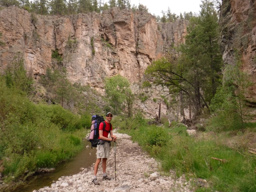
You do not have to journey far into the Gila Wilderness to reach Lightfeather Hot Springs on the Middle Fork Trail. Less than a mile down the trail a shallow pool is formed by stacked rocks where 150-degree hot springs water combines with the cool Middle Fork of the Gila River. It is a great place to watch and listen to wildlife. Seven miles further is Jordan Hot Springs, a very popular backpacking destination that requires countless stream crossings (it is best to wear fast-drying shoes and use trekking poles). The trailhead is located 43 miles north of Silver City on the Inner Loop Scenic Byway, not far from a visitor center co-managed by the Forest Service and National Park Service (that operates nearby Gila Cliff Dwellings National Monument). The Gila Wilderness is the reason this National Forest made it on our list of the Top 10 National Forests for Backpacking.
Best Trail
The most popular spot in Gila National Forest is the Catwalk National Recreation Trail, which requires driving through two stream crossings that are doable by a passenger car when the water is low. The one-mile trail is partially elevated above Whitewater Creek on wide, steel grates complete with handrails. The Catwalk started in 1893 as a way for miners to service a four-inch water pipe, then fell into disrepair before being upgraded by the Civilian Conservation Corps (CCC) in 1935. Today’s safer, tourist-friendly Catwalk was installed in 1961. This trail made our list of the Top 10 Day Hiking Trails in National Forests.
Watchable Wildlife
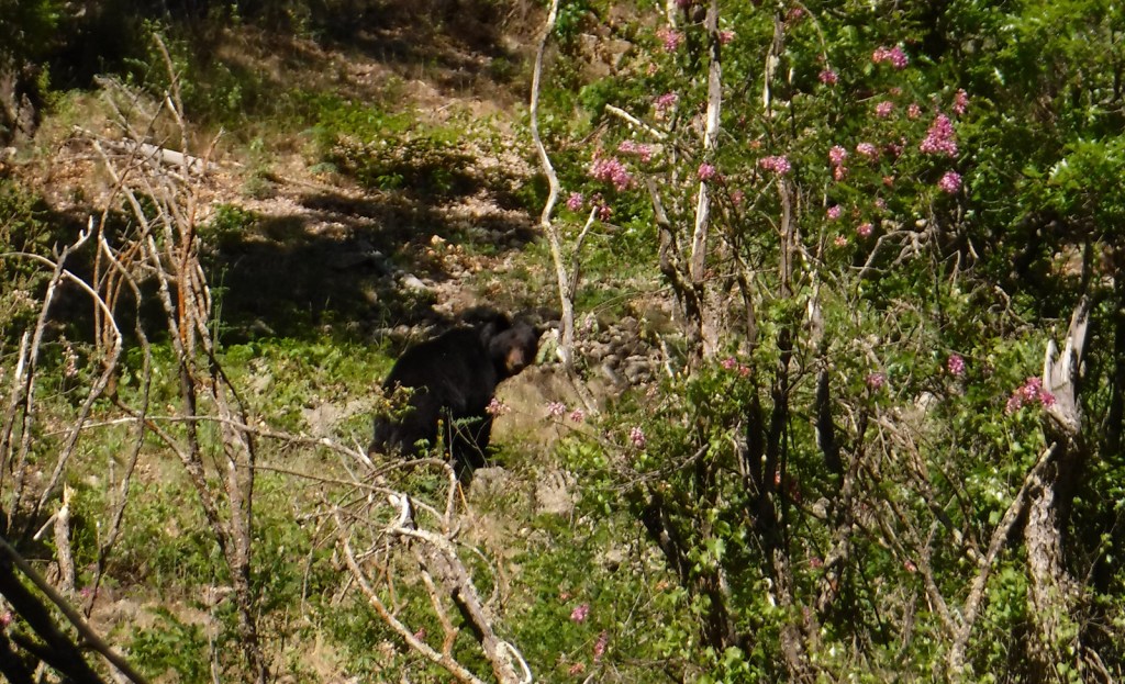
The Gila River gives its name to this National Forest, as well as animals like the venomous Gila monster, Gila woodpecker, and fish, including a trout, topminnow, and several species of chub. Mexican wolves have been reintroduced to this region, and other predators like mountain lions, bobcats, and black bears (we saw one and followed another’s wet footprints while backpacking near Gila Cliff Dwellings National Monument). Unique mammals include the javelina (collared peccary), gray fox, white-nosed coatimundi, and Coues white-tailed deer. Mule deer, elk, pronghorns, and bighorn sheep are additional ungulates found in Gila National Forest. Large birds include roadrunners, Mexican spotted owls, bald eagles, ospreys, peregrine falcons, and wild turkeys. Most of our wildlife encounters were with reptiles like horned lizards (a.k.a. frogs or toads), western fence lizards, and rattlesnakes.
Instagram-worthy Photo
In May 2020, we did a 72-mile backpacking loop connecting the West Fork of the Gila River with the Middle Fork, through gorgeous canyons and old-growth forests protected as the Gila Wilderness since 1924.
Peak Season
Summer
Fees
There is a parking fee at Catwalk National Recreation Trail (or you can display an America the Beautiful Pass), but some cars parked across the river to avoid paying.
Road Conditions
The eastern part of Inner Loop Scenic Byway is paved to the visitor center co-managed by the Forest Service and National Park Service, but the western portion is unpaved and has some steep grades not recommended for RVs. The unpaved road to Catwalk National Recreation Trail with its two stream crossings is doable with a passenger car when the water is low.
Camping
Cosmic Campground became the first International Dark Sky Sanctuary in North America (and one of only 14 in the world), so it is a great spot for stargazing. Pueblo Park Campground offers a trail through Chimney Rock Canyon and Upper End Campground is near 72-acre Lake Roberts. Cottonwood Campground is located near the Blue Range Wilderness on the Arizona border. In eastern Gila National Forest along Highway 152 are found both Upper Gallinas and Iron Creek Campgrounds. In the north, there are three campgrounds on 131-acre Quemado Lake and the Continental Divide National Scenic Trail cuts through primitive Apache Creek Campground.
Overlooking the Gila WildernessWestern fence lizardLightfeather Hot SpringsTiff on the Catwalk National Recreation TrailTiff on the Catwalk National Recreation TrailTiff backpacking in the Gila WildernessScott backpacking in the Gila WildernessRuins in the Gila WildernessTiff backpacking in the Gila WildernessBullfrogNew Mexico locust in bloomThis ponderosa pine was still alive despite its fire scarElkBlack bearRattlesnake
Explore More – Gila is a Spanish simplification of the Yuma word “hah-quah-sa-eel,” translated as what?
Learn more about this and the 154 other National Forests in our new guidebook Out in the Woods
We are a participant in the Amazon Services LLC Associates Program, an affiliate advertising program designed to provide a means for us to earn fees by linking to Amazon.com and affiliated sites.
Mt. St. Helens erupted Sunday, May 18, 1980 decreasing its elevation by 1,300 feet and depositing all of that material across the landscape as ash and a lahar (volcanic mudslide) claiming 57 human lives. The site is now protected as Mt. St. Helens National Volcanic Monument and is accessed from the east or west through Gifford Pinchot National Forest. Mt. St. Helens is geologically young as it began to form only 37,600 years ago. It is considered the most active volcano in the Cascade Range, with a major eruption in 1480 several times larger than that which occurred 500 years later, as well as written records that noted activity from 1800 to 1857. Prior to the most recent blast it was distinguished for its perfect cone shape, likened to the renowned outline of Mt. Fuji in Japan.
Highlights
Johnston Ridge Observatory, films, Forest Learning Center, Windy Ridge, Spirit Lake, Bear Meadows, Winds of Change Trail
Must-Do Activity
Coming from Mount Rainier National Park, we decided to visit the more remote eastern side of the National Monument (see Best Trail) on Spirit Lake Memorial Highway. From Interstate 5 on the volcano’s west side, Highway 504 leads east past an excellent visitor center (Milepost 5) at Seaquest State Park in Silver Lake (admission charged). Highway 504 next reaches the free Forest Learning Center managed by the Weyerhaeuser Company, Washington State Department of Transportation, and the Rocky Mountain Elk Foundation. The road ends at Johnston Ridge Observatory (Milepost 52), which is known for its awesome views of Mt. St. Helens. We have been told not to miss the introductory films at the museum (admission charged). [Update: Highway 504 closed due to landslides at Milepost 43 in June 2023 and has not reopened yet.] Climbers need a permit to ascend Mt. St. Helens, but even from an overlook the scene is enough to fill one with an appreciation for nature’s awesome power.
Best Trail
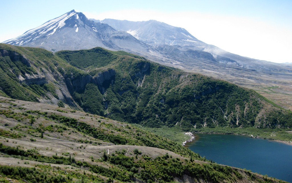
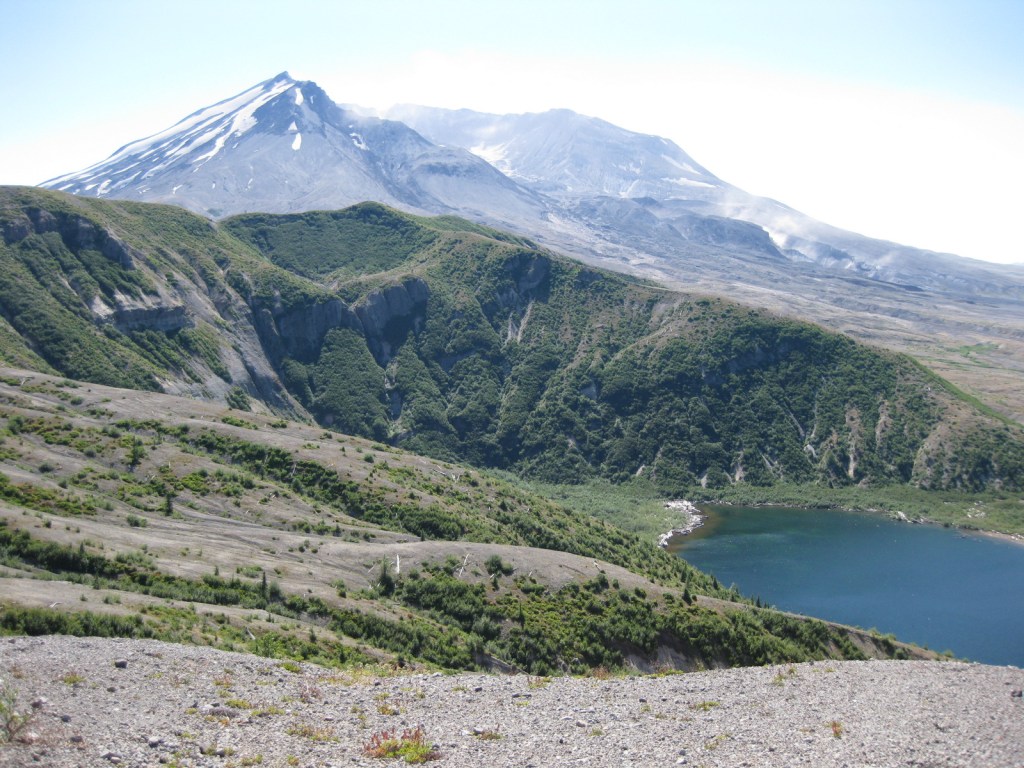
After a breathtaking ascent of 361 steps, we reached a breathtaking view atop the aptly named Windy Ridge. It provided a panorama of the destruction wrought by the volcano, which is still visibly spewing smoke and cinders. Today the waters of Spirit Lake remain clogged with thousands of weathered snags, floating upon its surface like debarked, sun-bleached ghosts. Elsewhere the rate of reforestation has been astounding. Due to natural regeneration and planting efforts within Gifford Pinchot National Forest, millions of Douglas-fir, noble fir, and other trees are rapidly growing in the nitrogen-rich deposits, up to 100 feet deep in some places.
Instagram-worthy Photo
From Windy Ridge, the pale gray summit of the horseshoe-shaped volcano was still streaked in glacial ice on a warm September afternoon, the venting steam clearly visible against the deep blue sky.
Admission to Johnston Ridge Observatory is $8 per adult or free with an America the Beautiful Pass. At Seaquest State Park, a $5 per adult admission fee is charged to enter Mt. St. Helens Visitor Center operated by Washington State Parks in Silver Lake.
Road Conditions
The major roads (like Highway 504) are paved to viewpoints in Mt. St. Helens National Volcanic Monument. [Update: Highway 504 closed due to landslides at Milepost 43 in June 2023 and has not reopened, but Windy Ridge is still accessible.]
Camping
There is a campground in Seaquest State Park on Silver Lake near Interstate 5, plus dispersed camping is allowed in parts of Gifford Pinchot National Forest.