Tag Archives: architecture

Manti National Forest

Manti National Forest

Utah

Managed by U.S. Forest Service, Intermountain Region

735,358 acres

Website: https://www.fs.usda.gov/r04/manti-lasal

Overview

Manti Forest Reserve dates back to 1903, becoming a National Forest four years later and expanded in 1915 with the addition of Nebo National Forest.  Despite being separated by more than 100 miles, Manti and La Sal National Forests were combined in 1949, an early example of improved bureaucratic efficiency by the Forest Service.  Due to this longstanding association, it can be difficult to find information for the more northerly Manti National Forest alone.  Manti National Forest covers much of the Wasatch Plateau and also manages the busy Maple Canyon Trail system (technically in Uinta National Forest).

Highlights

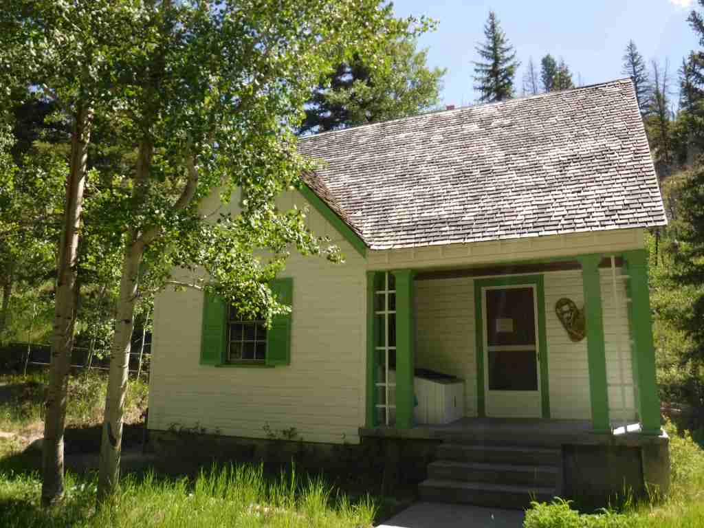
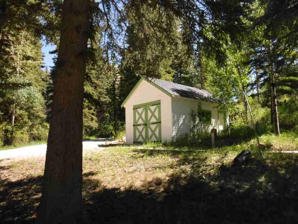
Energy Loop, Skyline, Eccles Canyon, Drive Scenic Backway, Stuart Guard Station National Historic Site, Electric Lake, Nelson Mountain, Maple Canyon, Fish Creek National Recreation Trail, Left Fork of Huntington Creek National Recreation Trail

Must-Do Activity

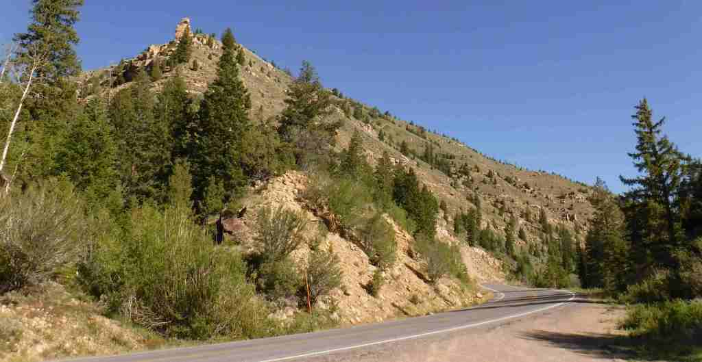
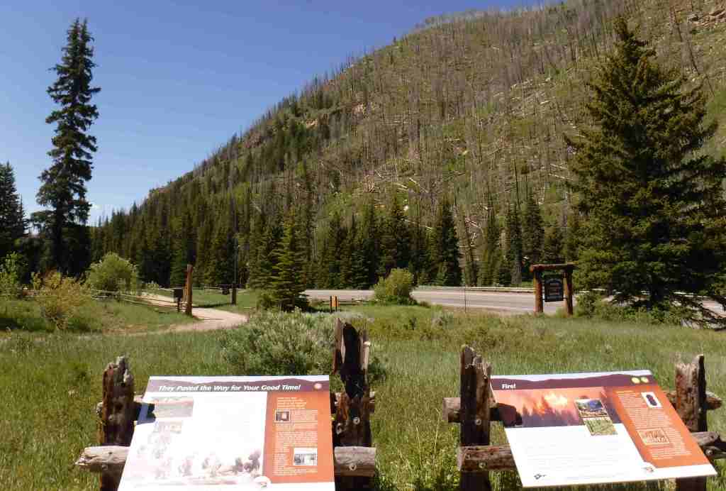
Many visitors to Manti National Forest drive the Energy Loop, named for Utah’s coal country, which partially follows the paved Huntington and Eccles Canyons Scenic Byway.  Campgrounds, historic sites, reservoirs, trails, and trout streams are all accessible along the 86-mile drive.  The more adventurous can take on the unpaved Skyline Drive Scenic Backway that climbs the Wasatch Plateau.  This 58-mile route has many side roads popular with ATV and OHV drivers, and it is open to snowmobiles in the winter. 

Best Trail

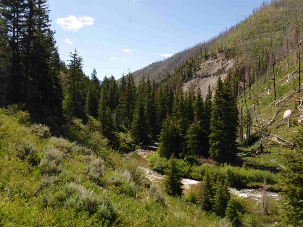
Easily accessible from the Energy Loop drive, the six-mile long Left Fork of Huntington Creek National Recreation Trail follows the canyon gaining 847 feet in elevation.  It can be completed one-way downhill from Miller Flat Trailhead by leaving a vehicle at Forks of Huntington Campground.  Despite a wildfire on the south canyon wall and subsequent erosion, the creek remains a good fishing spot, especially the lower half-mile that has interpretive signs on hydrology for children.  The trail can also be joined with Horse Canyon, Scad Valley, and Mill Canyon Trails to form longer loops, but a vehicle shuttle would still be necessary to avoid walking the highway.  Nearby, Fish Creek National Recreation Trail is ten miles long and open to travel by foot, horse, and bicycle.

Watchable Wildlife

The Wasatch Plateau rises from 5,000 to over 10,000 feet in elevation, and its vertical escarpments and subalpine lakes support a diversity of habitats.  Huntington Creek is one of the premiere fly-fishing streams in Utah.  Joe’s Valley is a 1,200-acre reservoir that offers fishing for splake, and allows motor boats (as does Electric Lake).  Large mammals found here include black bears, mountain lions, bobcats, coyotes, elk, mule deer, and pronghorns.  Birds of Manti National Forest include bald eagles, golden eagles, northern goshawks, turkey vultures, wild turkeys, common ravens, and various species of owls and woodpeckers. 

Photographic Opportunity

Fremont cottonwood trees are named for explorer John C. Fremont and this riparian species is an indicator of permanent subsurface water, with trunks that can reach more than four feet in diameter.

Peak Season

Spring and fall

Fees

None

Road Conditions

The Huntington and Eccles Canyons Scenic Byway is paved, but the Skyline Drive Scenic Backway is not.  Check the Forest Service website for updates on road conditions and closures. 

Camping

There are several designated campgrounds along Huntington and Eccles Canyons Scenic Byway, plus dispersed camping is allowed along most of the unpaved roads.  Maple Canyon Campground is a popular destination with online reservations available May through October.

Wilderness Areas

None

Related Sites

Fishlake National Forest (Utah)

La Sal National Forest (Utah)

Timpanogos Cave National Monument (Utah)

Nearest National Park

Capitol Reef

Conifer Tree Species

subalpine fir, white fir, Engelmann spruce, Douglas-fir, ponderosa pine, limber pine, Rocky Mountain juniper

Flowering Tree Species

Fremont cottonwood, quaking aspen, manzanita, sagebrush

Explore More – In 1849, Brigham Young sent 225 settlers to the San Pitch (now Sanpete) Valley; where did they get the name Manti?

Learn more about this and the 154 other National Forests in our new guidebook Out in the Woods

Amache National Historic Site

Amache National Historic Site

Colorado

Managed by National Park Service

Established 2024

410 acres

Website: nps.gov/amch

Overview

Added to the National Park Service (NPS) system on February 15, 2024, Amache National Historic Site is the fifth unit dedicated to remembering the sad story of the forced internment of 110,000 Japanese-Americans during World War II.  Operated between 1942 and 1945, at its peak the Granada Relocation Center in southeast Colorado housed 7,310 incarcerees making it the state’s tenth largest city at the time.  Although it does not have a visitor center, the site of the internment camp is more developed than other new NPS sites since it was previously added to the National Register of Historic Places in 1994 and then designated a National Historic Landmark in 2006.  Learn more about the history of these camps by checking out the Related Sites below and watching some of our Top 10 World War II Films or reading one of the Top 10 World War Novels

Highlights

Amache Museum, water tower, barracks, guard tower, cemetery, Recreation Hall

Must-Do Activity

Start at the excellent Amache Museum in Granada, which is run by local high school students and has free admission (donations accepted).  Be sure to pick up a map of the driving tour or visit the website (https://amache.org/driving-tour-map-podcasts) to listen to the audio recordings at each stop (there is smartphone coverage on site).  Drive the route in order or skip around, but make it a point to see Stop 4 (guard tower and barracks), Stop 8 (cemetery), and the Rec Hall.  Starting in June 2025, ranger-led tours will be offered at 10 a.m. on the first and third Friday of the summer months.

Best Trail

There is a short loop trail with many interpretive signs at the picnic area when you first arrive at the site by the Honor Roll square structure.  There is also an off-trail walk to the old koi pond at Stop 2 that you can navigate if you listen to the directions on the audio recordings.

Photographic Opportunity

The reconstructed barracks and guard tower at the south end of the site are two of the only structures standing above the open prairie.  They are near the water tower, which is worth a short detour to see.

Peak Season

Spring and fall

Hours

https://www.nps.gov/amch/planyourvisit/basicinfo.htm

Amache Museum: https://amache.org/visitor-information/

Fees

None; donations accepted at Amache Museum

Road Conditions

Roads through the site are gravel, but they seemed to be in good condition and seemingly passable even when wet.

Camping

Most of the southeast corner of Colorado is privately-owned agriculture land, so to find dispersed camping drive to Comanche National Grassland or Cimarron National Grassland.

Related Sites

Manzanar National Historic Site (California)

Tule Lake National Monument (California)

Minidoka National Historic Site (Idaho)

Nearest National Park

Great Sand Dunes

Explore More – Most of the 10,000 acres dedicated to Granada Relocation Center was for agriculture, so how many acres were used for residential and administrative buildings?

Springfield 1908 Race Riot National Monument

Springfield 1908 Race Riot National Monument

Illinois

Managed by National Park Service

Established 2024

1.57 acres

Website: nps.gov/spra

Overview

In 1908, African Americans made up only 5.5% of Springfield’s population of 47,000.  However, racial tensions ran high across the nation, and, on August 14, a mob formed outside the jail where two African-American men were accused of separate incidents of sexual assault and murder.  When the crowd found out the prisoners had been secretly moved 60 miles away, a full riot broke out.  They destroyed buildings, looted, and lynched two prominent members of the African-American community—a barber named Scott Burton and the wealthy William Donnegan.  By the time the National Guard arrived to restore order, seven people were dead and the mob had already burned the African-American neighborhood known as the “Badlands” to the ground.  Eventually, the trials of the 80 riot suspects at the Old Court House led to only one conviction for petty larceny.  While the rape suspect, George Richardson, was released when his accuser admitted fabricating the story, Joe James was convicted of murder and executed on October 23, 1908 despite being legally exempt from the death penalty as a minor.  These events catalyzed the formation of the National Association for the Advancement of Colored People (NAACP) a few months later in New York City.

Learn more about the other 137 National Monuments in our book Monumental America: Your Guide to All 138 National Monuments. It is now available for sale on Amazon.com.

Highlights

Walking tour, Acts of Intolerance sculpture, mural, Old Court House, Springfield and Central Illinois African American History Museum, Oak Ridge Cemetery, Mechanicsburg Cemetery

Must-Do Activity

Before the National Monument was designated in 2024, the city of Springfield had already created a walking tour highlighting the events of the 1908 race riot marked by seven silver pillars.  After starting at the former site of the jail, the tour moves to where Loper’s Restaurant once stood; its white owner having assisted in moving the prisoners, his restaurant and his car were destroyed.  During the frenzy, a restaurant patron named Louis Johnson was shot and killed.  There are five other stops detailing the events chronologically, but they do not include the mural inside HSHS St. John’s Hospital Women & Children’s Clinic, which is next to the officially designated National Monument boundaries where the foundations of five homes burned in the “Badlands” remain fenced off.  Upon our visit less than three months after its creation, the National Park Service visitor center for Lincoln Home National Historic Site did not have any information on the new National Monument, but they already had a passport stamp.

Best Trail

When followed in chronological order, the walking tour bounces back and forth across the city, so you will get your steps in that day.  In the summer, guided tours are offered from the Springfield Convention and Visitors Bureau.  Alternatively, you can drive the route and read the descriptions in the publication available online and from the visitors bureau. 

Photographic Opportunity

After the burning of the “Badlands” neighborhood, two chimneys were about the only structures left standing.  The sculptor Preston Jackson utilized this imagery in his work Acts of Intolerance that depicts scenes of the race riot in bas relief.  Dedicated in 2009, it stands across the street from the Abraham Lincoln Presidential Library in Union Square Park. 

Peak Season

Summer

Hours

https://www.nps.gov/spra/planyourvisit/hours.htm

Fees

None

Road Conditions

There is no free parking in downtown Springfield, so you can use a parking meter or the NPS pay lot at Lincoln Home National Historic Site. 

Camping

Lincoln’s New Salem State Historic Site is 20 miles northwest of Springfield and its campground has running water.  Further north, Starved Rock State Park is a beautiful spot for camping, and it also offers a historic lodge.

Related Sites

New Philadelphia National Historic Site (Illinois)

Emmett Till and Mamie Till-Mobley National Monument (Mississippi-Illinois)

Medgar and Myrlie Evers Home National Monument (Mississippi)

Explore More – Damage from the race riot to black businesses was estimated at $100,000 in 1908, equivalent to how many millions today?

Learn more about the other 137 National Monuments in our book Monumental America: Your Guide to All 138 National Monuments

Pipe Spring National Monument

Pipe Spring National Monument

Arizona

Managed by National Park Service

Established 1923

40 acres

Website: nps.gov/pisp

Overview

Near the Utah border, Pipe Spring National Monument is located near the turn off from Highway 389 for Grand Canyon-Parashant National Monument and the remote Toroweap Overlook in western Grand Canyon National Park.  Likewise, it is only 60 miles from Utah’s famous Zion National Park, so it makes a good stopping point if you are also visiting Kaibab National Forest or the North Rim of the Grand Canyon.  The oasis surrounding the three natural springs here demonstrate what this soil can produce when given a little bit of extra water.  Ancestral Puebloans and Kaibab Paiute Indians have been coming here for over 1,000 years and it was an important stop on the Old Spanish Trail.  In 1858, Pipe Spring was named by Mormon/Latter-day Saint missionary Jacob Hamblin on his way to the Hopi mesas.  Following the 1866 Black Hawk War, Mormon settlers built a sandstone fort called Winsor Castle around the source of the main spring where polygamists used to hide their plural wives before selling the ranch in 1895.  Today this park on the secluded Arizona Strip is recognized by the International Dark Sky Association.

Learn more about the other 137 National Monuments in our book Monumental America: Your Guide to All 138 National Monuments. It is now available for sale on Amazon.com.

Highlights

Museum, film, garden, ponds, Winsor Castle

Must-Do Activity

Retention ponds keep Pipe Spring National Monument green in the hot summer months where ducks paddle and dragonflies buzz through the humid air.  The National Park Service manages a garden with living history demonstrations given occasionally, plus there is livestock including chickens and two longhorns.  When a ranger is present, you can walk around inside Winsor Castle, a Mormon fort that dates back to 1870.  If you visit during the summer, we recommend you cool off after some time outside by watching the short film and exploring the museum and gift shop.  The museum is co-managed with the Kaibab Band of Paiute Indians whose reservation surrounds the site. On December 7, 2024, the park was open late for the Holiday Traditions event with caroling, Victorian-era crafts, and free food.

Best Trail

The half-mile Ridge Trail leads uphill to an overlook of the Kaibab Plateau and distant Mt. Trumbull in Grand Canyon-Parashant National Monument.

Photographic Opportunity

The modest dimensions of Winsor Castle make it unlikely to be confused with Windsor Castle in England.

Peak Season

Summer

Hours

https://www.nps.gov/pisp/planyourvisit/hours.htm

Fees

$10 per person or America the Beautiful pass

Road Conditions

There is a paved parking lot located off Highway 389.

Camping

The Kaibab Band of Paiute Indians runs a small campground adjoining Pipe Spring National Monument.  Dispersed camping is allowed in Kaibab National Forest and the millions of acres run by the Bureau of Land Management on the Arizona Strip.

Related Sites

Grand Canyon National Park (Arizona)

Grand Canyon-Parashant National Monument (Arizona)

Baaj Nwaavjo I’tah Kukveni – Ancestral Footprints of the Grand Canyon National Monument (Arizona)

Explore More – Which indigenous tribes banded together during the 1866 Black Hawk War?

Learn more about the other 137 National Monuments in our book Monumental America: Your Guide to All 138 National Monuments

Gateway Arch National Park

Gateway Arch National Park

Missouri

Managed by National Park Service

Established 1935 National Expansion Memorial, 2018 National Park

91 acres

Website: nps.gov/jeff

Overview

On February 22, 2018, the 60th National Park in the U.S. was created from what was formerly Jefferson National Expansion Memorial in St. Louis, Missouri.  Gateway Arch National Park encompasses 91 acres on the Mississippi River, including the historic 1828 courthouse and the iconic 630-foot-tall arch that was finished in 1965.  We first visited on our cross-country road trip in 2007 and returned in 2016 while the underground museum was under construction and the greenway was extended over Interstate 44.  When we came back in 2022, the courthouse was closed for renovation, but the museum had reopened with exhibits explaining the importance of this city as a starting point for the settlement of the west after President Thomas Jefferson signed the Louisiana Purchase, doubling the size of the country in 1803.  It is by far the smallest of the 63 National Parks (5,457 acres less than Hot Springs), which begs the question: Why wasn’t this designated a National Historical Park instead?

Learn more about how to visit this National Park in the expanded second edition of our guidebook A Park to Yourself: Finding Solitude in America’s 63 National Parks

Highlights

Gateway Arch, tram, film, museum, Old Courthouse, Old Cathedral

Must-Do Activity

Unlike other National Parks, this one does not preserve a natural landmark, but it does have claustrophobia-inducing tram cars (fee) that take you four-minutes to the top of the Gateway Arch for excellent views across Illinois and Missouri.  It is worth the hassle to go through a security screening to see the new museum.  The 35-minute film Monument to the Dream is also available for a fee. 

Best Trail

There are sidewalks that follow the Mississippi River and loop around the arch.  Be sure to cross the street to the Old Courthouse where the first of two trials in the infamous Dred Scott case was held in 1854.  Continue west behind to the courthouse to the Kiener Memorial Fountain for a photo that frames the building beneath the Gateway Arch.

Photographic Opportunity

The 630-foot-tall Gateway Arch is the defining landmark of St. Louis, but the historic 1834 Old Cathedral still serves as an active Catholic Church inside the park boundaries.

Peak Season

Summer

Hours

https://www.nps.gov/jeff/planyourvisit/hours.htm

Fees

There is no fee to walk the grounds or pass through security for the museum and gift shop, but you do have to pay to view the film or ride the tram to the top of Gateway Arch.  When open, the Old Courthouse is also free to enter.

Road Conditions

All roads are paved, but parking can be tricky.  We suggest paying for a parking garage or paying to park on the river levee near the paddlewheel boats, since car break-ins are common in downtown St. Louis.

Camping

This is the only National Park without the option to camp, so consider heading southwest to the wonderful Ozark National Scenic Riverways or Mark Twain National Forest.  In southeast Missouri, Johnson’s Shut-Ins State Park is rated as one of the best RV campgrounds in the country.

Related Sites

Ulysses S. Grant National Historic Site (Missouri)

Ste. Genevieve National Historical Park (Missouri)

Harry S Truman National Historic Site (Missouri)

Explore More – In 1947, how many city blocks were razed to make way for the memorial, including several historic buildings dating back to 1818?

We designed this Gateway Arch logo for the park available on Amazon.com

We are a participant in the Amazon Services LLC Associates Program, an affiliate advertising program designed to provide a means for us to earn fees by linking to Amazon.com and affiliated sites.