Lewis and Clark National Forest
Montana
Managed by U.S. Forest Service, Northern Region
1,999,256 acres (1,863,788 federal/ 135,468 other)
Website: https://www.fs.usda.gov/r01/helena-lewisclark
Overview
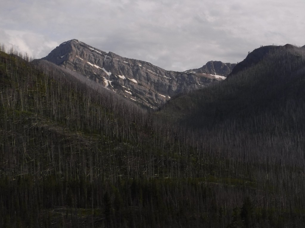
East of the Continental Divide in Montana, Lewis and Clark National Forest is split across eight mountain ranges east and west of the Missouri River. The largest western section butts up against Glacier National Park to the north and includes parts of the Scapegoat and the Bob Marshall Wilderness areas, which provide crucial habitat for grizzly/brown bears and world-class places for backpacking. The Lewis and Clark Forest Reserve dates back to 1897, with the now-defunct Jefferson and Absaroka National Forests added in 1932 and 1945 respectively. Since 2014, it has been co-managed with Helena National Forest.

Highlights
King Hill Scenic Byway, Cataract Falls, Sun River Gorge, Gibson Reservoir, Mt. Wright, Deep Creek Loop National Recreation Trail, Windy Mountain Trail, Crystal Cascades Trail, Crystal Lake Shoreline Loop Trail, Continental Divide National Scenic Trail
Must-Do Activity
We have always wanted to visit the National Park Service and U.S. Forest Service’s 25,000 square-foot Lewis and Clark Interpretive Center in Great Falls, Montana. It features an exhibit hall, hiking trails, and a 158-seat theater, and it is open daily in the summer and Wednesday through Sunday in the offseason. We have also wanted to backpack in the rugged Snowy Mountains, which draw backcountry skiers in the winter and horseback riders in the summer. We will have to return to this central part of Montana, which includes one of our favorite places to explore: Upper Missouri River Breaks National Monument run by the Bureau of Land Management.
Best Trail
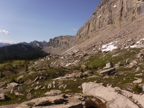
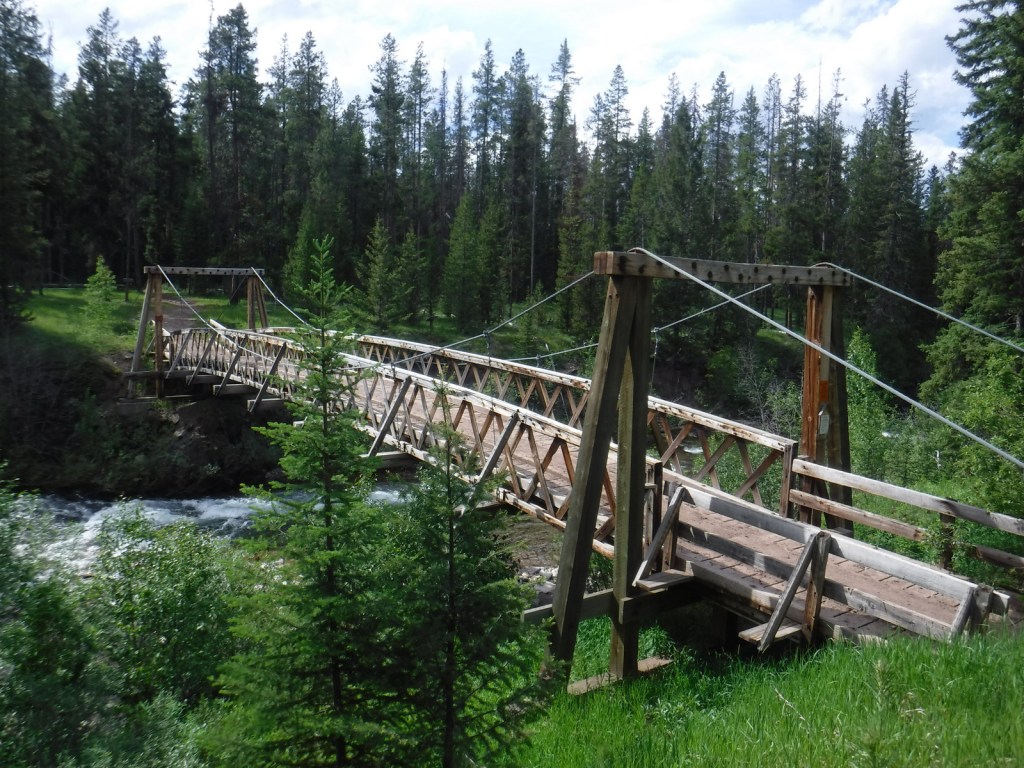
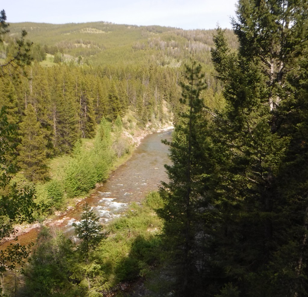
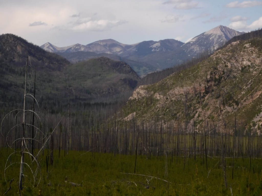
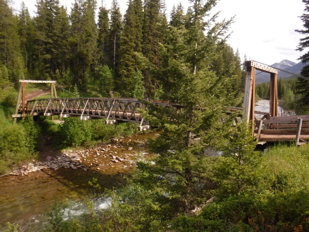
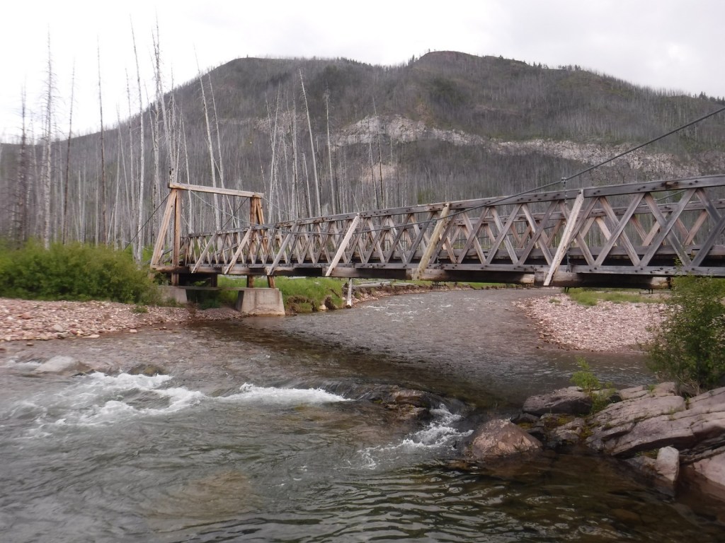
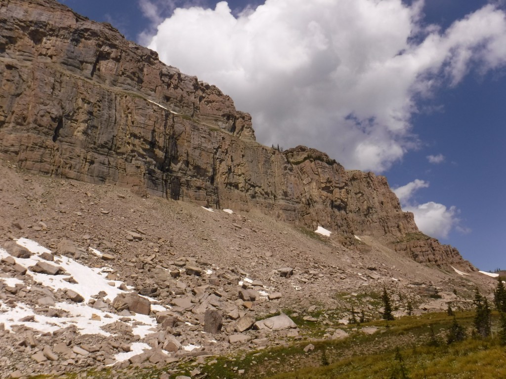
One of the most famous formations along the Continental Divide National Scenic Trail is the 15-mile long Chinese Wall, a 1,000-foot-tall cliff composed of five-million-year-old limestone. Its closest access is 15 miles one-way from the South Fork Sun Trailhead, which is often marked as Packers on maps at the end of the gravel Benchmark Road (Forest Road 235). The trail begins by following the South Fork Sun River before crossing a bridge and entering the Bob Marshall Wilderness. We got a late start on the way in and came across a grizzly/brown bear grazing near the trail that evening and, on the drive out, we stopped to photograph three moose near Wood Lake Campground and a common loon in Anderson Lake.
Watchable Wildlife
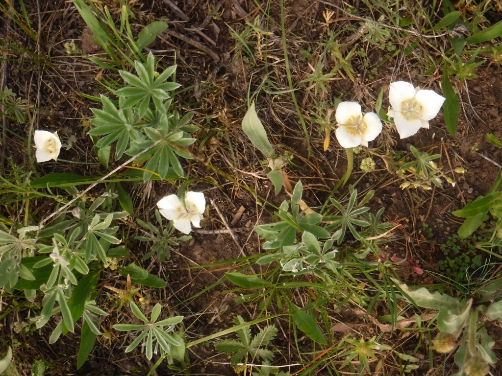
Grizzly/brown bears are the most famous residents of the National Forest. Additional mammals include black bears, mountain lions, Canada lynxes, wolverines, mule deer, Columbian white-tailed deer, mountain goats, bighorn sheep, elk, and moose. Bald eagles, red-tailed hawks, and three types of grouse are often spotted. There are excellent fly-fishing opportunities in the 1,600 miles of rivers and streams.
Photographic Opportunity
The 15-mile long Chinese Wall is an iconic landmark along the Continental Divide National Scenic Trail.
Peak Season
Summer
Fees
None except for the Lewis and Clark Interpretive Center in Great Falls, which costs $8 per person or you can use an America the Beautiful pass.
Road Conditions
We drove the gravel Benchmark Road (Forest Road 235), which was long and in excellent condition.
Camping
There are 29 vehicle-accessible campgrounds in Lewis and Clark National Forest, including Wood Lake Campground near the South Fork Sun Trailhead. Backcountry and dispersed camping options abound.
Wilderness Areas
Bob Marshall Wilderness (also in Flathead National Forest)
Scapegoat Wilderness (also in Helena and Lolo National Forests)
Related Sites
Deerlodge National Forest (Montana)
Bighorn National Forest (Wyoming)
Little Bighorn Battlefield National Monument (Montana)
Nearest National Park


western redcedar, Douglas-fir, limber pine, whitebark pine, lodgepole pine, ponderosa pine, Engelmann spruce, subalpine fir, western larch, common juniper
quaking aspen, Rocky Mountain maple, western serviceberry
Explore More – Why is the 200 square-mile Badger-Two Medicine area of the National Forest managed differently?

Learn more about this and the 154 other National Forests in our new guidebook Out in the Woods