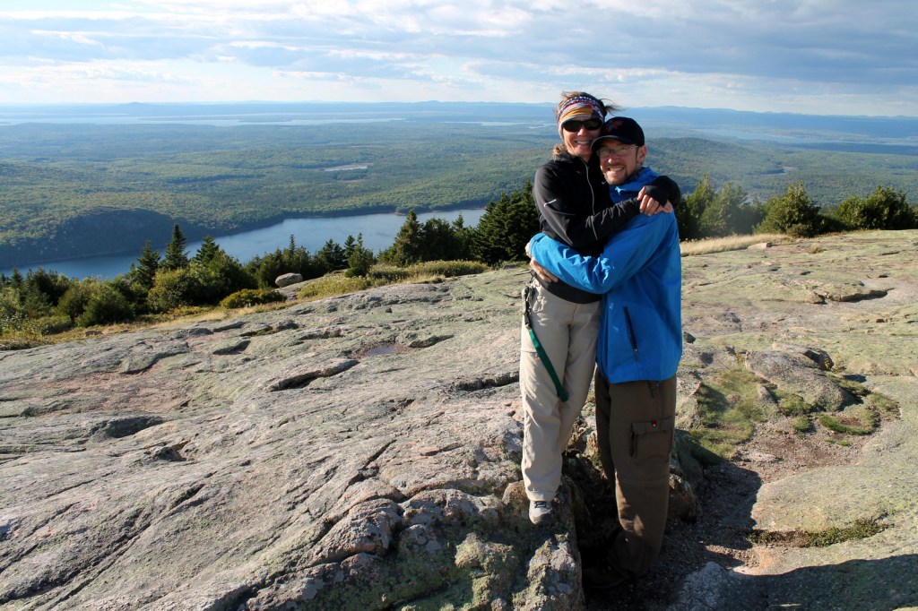
Acadia National Park in Maine is famous for its 45 miles of Carriage Roads and watching a sunrise from atop 1,530-foot tall Cadillac Mountain. We recommend you plan your visit around attending a Star Party to view the night sky through dozens of telescopes. We visited on a September weekend, and even though it was not yet leaf-peeping season, the main park road across Mount Desert Island was jam packed and parking spaces were difficult to come by. [This is also one of 50 National Parks covered in our new guidebook]
Highlights
Cadillac Mountain, Precipice Trail, Bass Harbor Head
Lighthouse
Must-Do Activity
If you don’t like crowds, then visit on a weekday and avoid
Cadillac Mountain, Bar Harbor, Precipice Trailhead, Thunder Hole, Jordan Pond
House, and Bass Harbor Head Lighthouse.
We preferred our time spent on the Schoodic Peninsula with its nice
campground and unoccupied overlooks across the bay towards busy Mount Desert
Island.
Best Trail
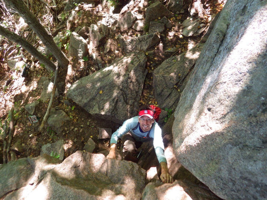
Iron rungs and ladders assist those who wish to climb the
aptly named Precipice Trail. The trail
provides awesome Atlantic Ocean views from the cliffs on the way up to
Champlain Mountain. A 2.5-mile loop can
be formed when combined with Champlain North Ridge and Orange & Black
Trails. Other “ladder trails” in the
park include the Beehive and Perpendicular Trails.
Instagram-worthy
Photo
Photographers hang out for hours waiting for sunset on the rocks below Bass Harbor Head Lighthouse.
View towards Mount Desert Island from Schoodic Point
Raven about the park
This design we created to celebrate Acadia National Park is available on a variety of products at Cafe Press and Amazon.
Cafe Press
Explore More – What was the original name of this park when it was created on February 26, 1919 (the same day as Grand Canyon National Park)?
We are a participant in the Amazon Services LLC Associates Program, an affiliate advertising program designed to provide a means for us to earn fees by linking to Amazon.com and affiliated sites.
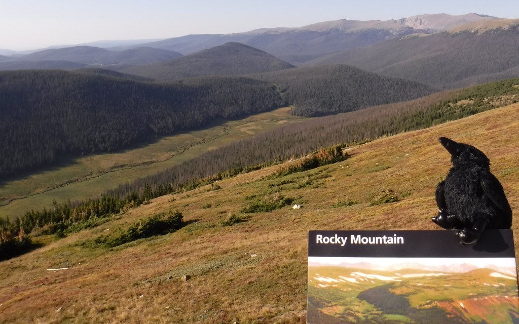
We wanted to demonstrate how our new guidebook (A Park to Yourself: Finding Adventure in America’s National Parks) is different from this website, so we are providing a sample chapter for Rocky Mountain National Park in Colorado. Here is a link to the Raven About The Parks blog post on the park.
The holidays are coming up, so order A Park to Yourself now on Amazon!
39. Rocky Mountain National Park
Colorado
265,795 acres
Established 1915
4,590,493 visitors in 2018
Overview
This truly is a National Park for
all seasons. In the summer, it is worth
the extra time it takes to drive 11 miles up the unpaved curves of one-way Old
Fall River Road to Alpine Visitor Center at 11,796 feet, then back down Trail
Ridge Road. Elk bulls spar and bugle in
the autumn, when aspen trees briefly turn the mountainsides gold. Winter is a wonderful time for outdoor
recreation here if you are prepared for the icy conditions, even on a short
1.6-mile trip up to Gem Lake just outside of Estes Park, Colorado.
Peak Visitation Months
July (20%) August (18%) June (16%)
September (15%)
Busiest Spots
Bear Lake Trailhead, Alluvial Fan,
Alpine Visitor Center, Longs Peak
Worth The Crowds
Bear Lake Trailhead is the busiest
area in the park. Its huge parking lot
fills up early year round, but a hiker shuttle is available during the
summer. While the trail starts above
9,000 feet elevation, it is only 1.1 miles with a steady ascent up to stunning
Dream Lake ringed by jagged peaks. From
there, you can continue on to Emerald Lake or take the long loop around to Lake
Haiyaha and Alberta Falls. Even in the
winter, these trails are generally packed enough that snowshoes are not
required.
A Park To Yourself
The western side of the park is
generally less busy throughout the year, but even less so in the winter when it
is cut off after Trail Ridge Road closes each October. Snowshoeing past Adams Falls up the East
Inlet valley is breathtaking when the snow sparkles in the sun and the river
gurgles deep under foot. There are
majestic mountain views once the forest opens up into a spectacular
meadow. Better yet, there is never a fee
required to park at the East Inlet or North Inlet Trailheads.
Iconic Photograph
Around Memorial Day each year, all
48 miles of Trail Ridge Road open to vehicles.
Its high point is at 12,183 feet, the highest elevation reached by a
fully-paved road in the United States.
For much of its length, jagged black mountaintops lined in pure white
snow surround the visitor on all sides.
Our favorite view is looking southwest towards the Gorge Lakes and Mount
Ida from the overlooks at Rock Cut or Forest Canyon parking areas.
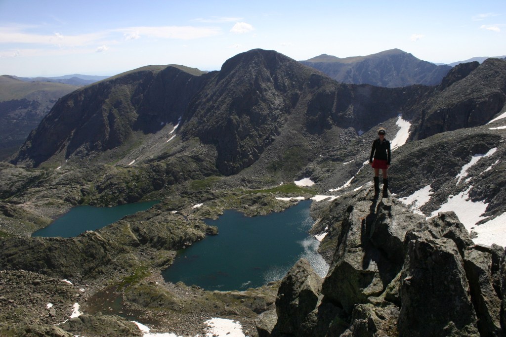
Scott’s Favorite Trail
Starting at the small parking lot
at Poudre Lake, it is a steady climb five miles one-way to Mount Ida at 12,880
feet. After a mile, it is less a trail
and more following cairns along the Continental Divide. Needless to say, above timberline there are
first-class views of surrounding mountains.
Elk and bighorn sheep are commonly spotted on the route. From the top you look down on the colorful
Gorge Lakes and far across to Trail Ridge Road.
Tiff’s Favorite Trail
The Dunraven Trailhead is in
Roosevelt National Forest, northeast of Estes Park. From there a trail drops to the canyon bottom
then follows the North Fork of the Big Thompson River 4.4 miles before it
enters the National Park, and backpack camping is allowed without a permit
along this length. The views open up on
the Mummy Range before the trail ends around Lost Lake. You can continue to explore the other lakes
past there, but overnight stays in this area require a permit from the National
Park Service.
Bonus Winter Trail
In the winter months, the road off
Highway 7 to Wild Basin shuts down, but it is still plowed for those entering
on foot. Adding the two mile road length
to any hiking distance makes it about eight miles roundtrip to Calypso
Cascades, which continues to flow beneath the snow and ice. Snowshoes are recommended as this trail sees
much less use than those around Bear Lake.
Camping
There are multiple campgrounds
within the park, but only Glacier Basin is open year round. Several National Forests surround the park
and provide opportunities for dispersed camping, although near Grand Lake it
does get crowded during the summer.
Backpacking
Backpacking permits are required and
designated sites are reservable, including on the Continental Divide National
Scenic Trail. You must still pay the
National Park entry fee, but there is no additional charge to get a permit to
park at the Bowen/Baker Trailhead and camp in the Never Summer Wilderness
outside the park boundaries.
Getting Around
Most of the park roads are paved and
the two-mile long dirt road to Wild Basin Trailhead is well-maintained. A hiker shuttle operates from Beaver Meadows
Visitor Center in the summer. Old Fall
River Road typically does not open until July, but this 11-mile long one-way
dirt road makes a great loop when connected with Trail Ridge Road (open late-May
to October).
Nearby Public Lands
There are no National Park Service
units near this park, but it does border Arapaho National Recreation Area on
the west side. If you are flying in or
out of Denver International Airport, a short detour from Interstate 70 takes
you to Rocky Mountain Arsenal National Wildlife Refuge, which contains bison,
white-tailed deer, pronghorns, prairie dogs, and other animals.
Insider Tip
Estes Park is the gateway town to
the eastern portion of the park. There
are often elk grazing in its neighborhoods and golf courses. While there, we recommend the ghost tour of
the Stanley Hotel, which inspired Stephen King’s The Shining.
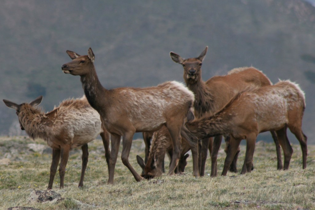
Wildlife
In the summer, most of the elk
herds head to high elevation, but other times of year they walk through the
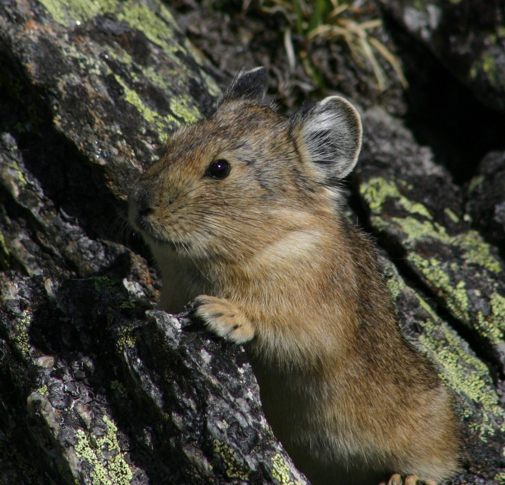
town of Estes Park and congregate near the eastern entrance stations. Rock Cut is a great spot to watch the spastic
wanderings of yellow-bellied marmots and American pikas. Mule deer are found throughout the park, but
moose are more common on the west side.
We commonly see bighorn sheep on Highway 34 through Big Thompson Canyon,
but have never spotted one within the park, even at Sheep Lakes where they come
to lick salt.
Journal Entry
March 2013
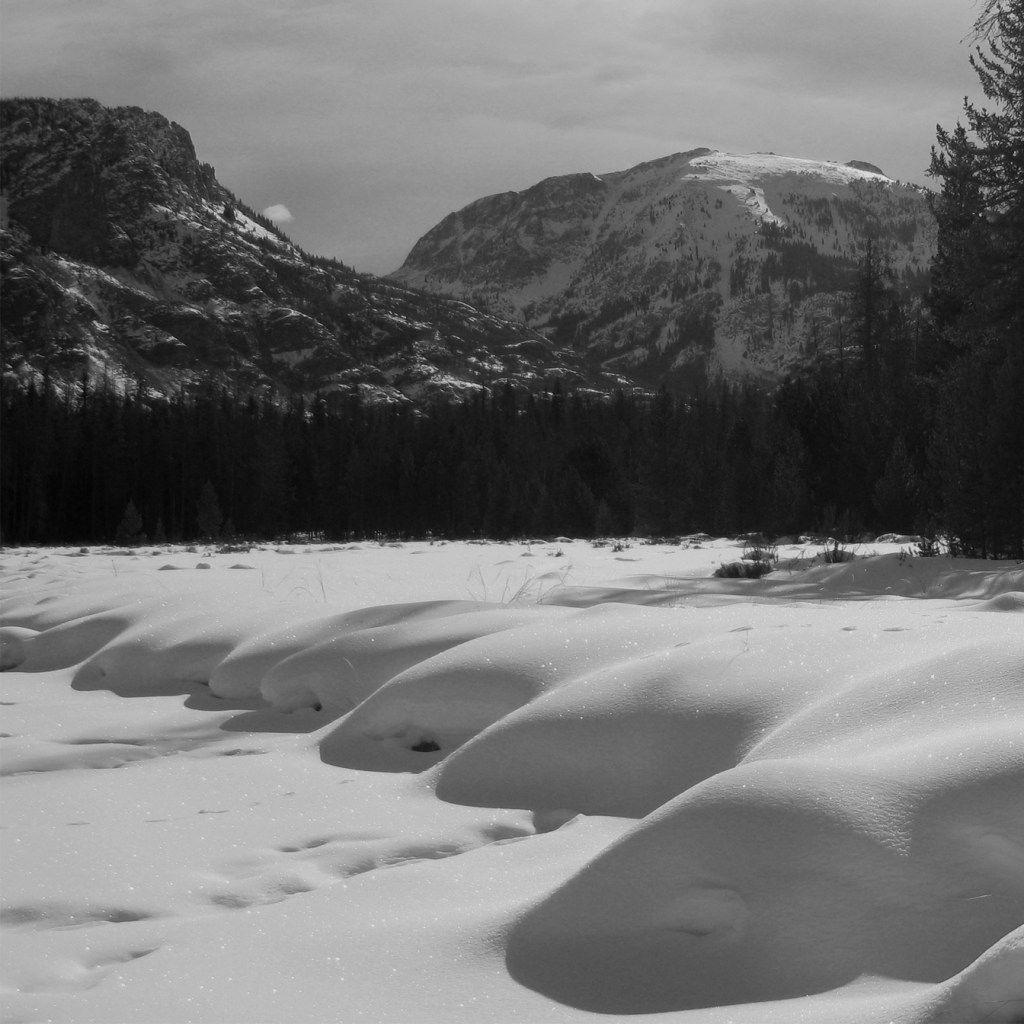
We never thought we would have an entire National Park campground to ourselves, but that is exactly what we found at Timber Creek one beautiful March weekend. The ranger could not recall the last campers they had stayed there and it took some work to excavate a site from almost three feet of snow, but it was worth it. Sitting around the campfire that night, the silence was palpable until abruptly pierced by the eerie cries of coyotes that echoed up the valley. Snow camping is not for the faint of heart, but with proper planning we were well prepared for the 15°F temperatures that met us in the morning. On a clear day, the winter scenery in the Rocky Mountains is unsurpassed.
We are a participant in the Amazon Services LLC Associates Program, an affiliate advertising program designed to provide a means for us to earn fees by linking to Amazon.com and affiliated sites.
This truly is a National Park for all seasons. In the summer, it is worth the extra time it takes to drive eleven miles up the unpaved curves of one-way Old Fall River Road to Alpine Visitor Center at 11,796 feet. From May 22 through mid-October, a timed entry reservation is required. Elk bulls spar and bugle in the autumn, when aspen trees briefly turn the mountainsides gold. Winter is a wonderful time for outdoor recreation if you come prepared for the cold and snow.
From the famous Trail Ridge Road, you do not even have to
get out of your car for amazing panoramas.
If you want to walk, the one-mile Toll Memorial Trail at Tundra
Communities Trailhead is paved and flat enough to not be too strenuous at
12,000 feet in elevation. Elk, pikas,
and yellow-bellied marmots frequent the parking area around Rock Cut.
Best Trail
If you are looking to climb straight up the side of a
mountain, there are plenty of options, including popular Flattop Mountain and
the strenuous climb up Longs Peak. For a
less busy trail, head to Ypsilon Lake and continue up the hillside, scrambling
over boulders all the way to spectacular Spectacle Lakes.
Instagram-worthy
Photo
In Grand Lake on the west side of the park, hiking or snowshoeing past Adams Falls up the East Inlet Trail is breathtaking in all seasons.
Peak Season
Summer is the busiest, but winter brings opportunities for
snowshoeing.
$35 per vehicle ($30 for one day) or America The Beautiful pass
Road Conditions
Almost all roads are paved; one-way Old Fall River Road is
gravel and only open a few months in the summer.
Camping
There are multiple campgrounds within the park and Glacier Basin is open year-round. Several National Forests surround the park and provide opportunities for dispersed camping, although around Grand Lake it does get crowded on summer weekends.
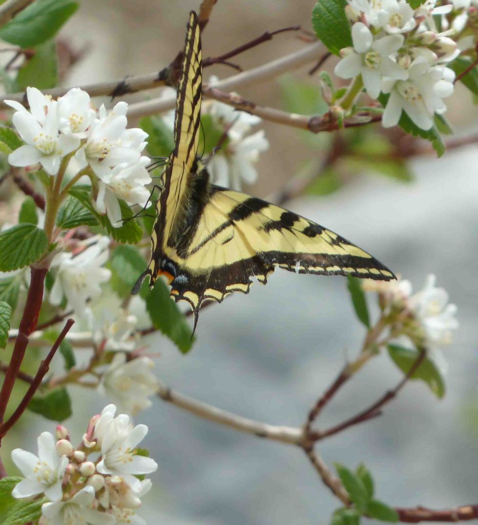
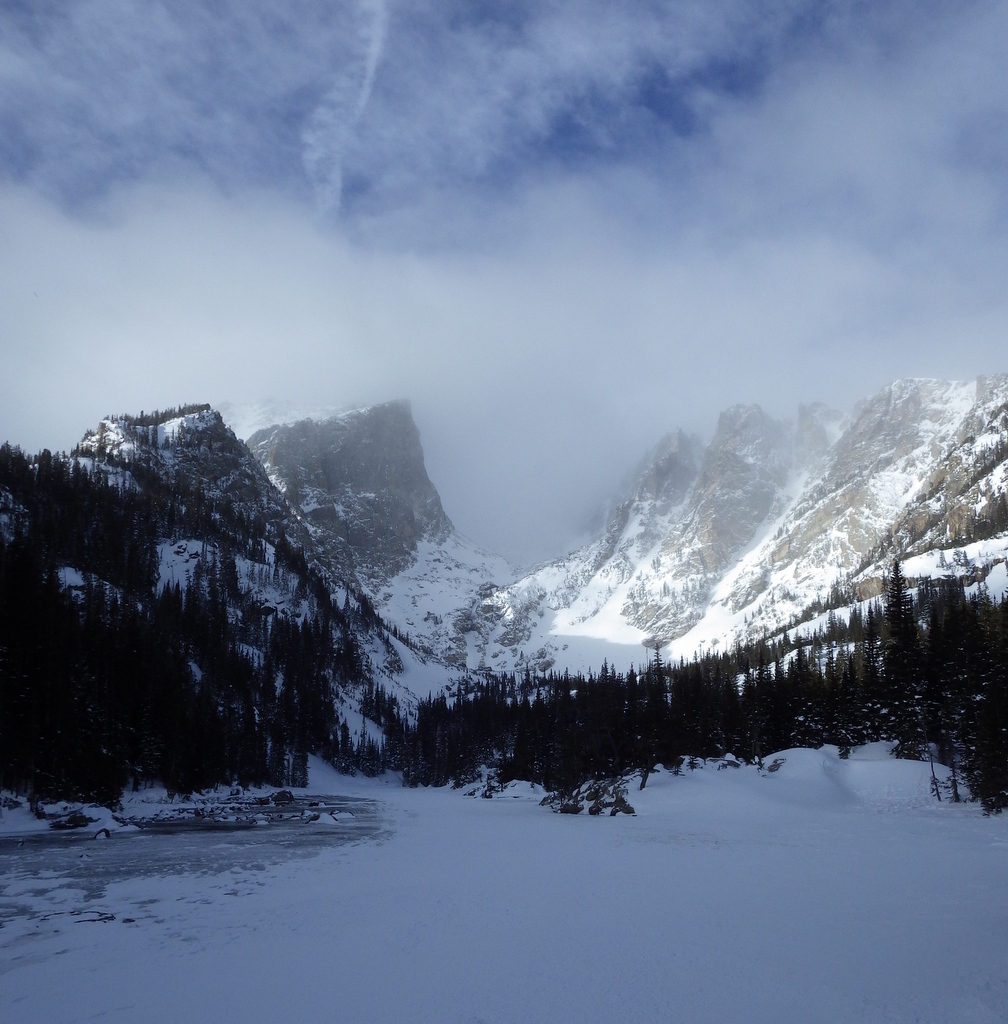
Elk herd at the Tundra Communities Trailhead On the Continental Divide National Scenic TrailPikaTiff and Scott atop 14,259-foot Longs PeakTiger swallowtail butterflyScott with two moose on the trail to Calypso CascadesDream Lake in winterTiff scrambling up to Spectacle Lakes
This design we created to celebrate Rocky Mountain National Park is available on a variety of products at Cafe Press and Amazon.
Following meetings in regards to development in North Las Vegas, the Protectors of Tule Springs was founded in 2006 and successfully preserved 22,650 acres of federal land eight years later. The area contains fossils of Columbian mammoths, ground sloths, American lions, ancient camels, dire wolves, sabre-toothed cats, bison, and three ancient species of horse ranging from 7,000- to 250,000-years-old. There are plans to open a National Park Service (NPS) visitor center at the end of Aliante Parkway.
Highlights
Upper Las Vegas Wash, natural bridge, trash cleanup
Must-Do Activity
The actual Tule Springs are a desert oasis contained within Floyd Lamb Park, operated by the City of Las Vegas. The Bureau of Land Management formerly controlled the acreage that became the National Monument and it was heavily impacted by garbage dumping, off-road driving, and shooting. Your “must-do activity” here is to remove some trash. The Protectors of Tule Springs have hosted several cleanup events.
Best Trail
There are no trails within the National Monument yet, but
there are two access points to Upper Las Vegas Wash from Durango Drive and Aliante
Parkway. The wash contains Joshua trees
and several patches of the rare Las Vegas bear poppy, and provides habitat for
threatened desert tortoises, burrowing owls, and kit foxes.
Instagram-worthy
Photo
Hike the Upper Las Vegas Wash about a half-mile east from the end of Durango Drive and look for a natural bridge carved in the soft mudstone wall.
Peak Season
Winter when snow dusts the top of the Sheep Range and Las
Vegas Range of mountains.
Hours
Tule Springs Fossil Beds National Monument is open sunrise to sunset. Information is available at visitor centers in Lake Mead National Recreation Area. https://www.nps.gov/tusk/planyourvisit/hours.htm
Fees
None
Road Conditions
Roads are paved to access points at the north end of Durango
Drive and at the end of Aliante Parkway. Look for wire barriers and small brown NPS signs
at the two parking areas.
Camping
None within the National Monument, but free dispersed camping is allowed within Desert National Wildlife Refuge to the north. There are campgrounds in nearby Humboldt-Toiyabe National Forest and Lake Mead National Recreation Area.
Sign at end of Durango Drive
The National Monument starts behind the wire barriers
A snowy Las Vegas Range in February 2019
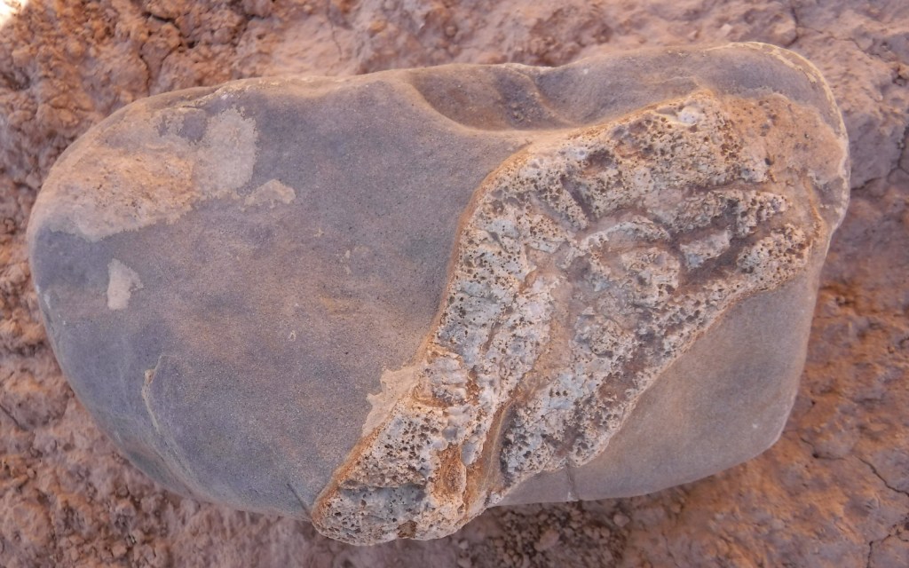
Possible fossil
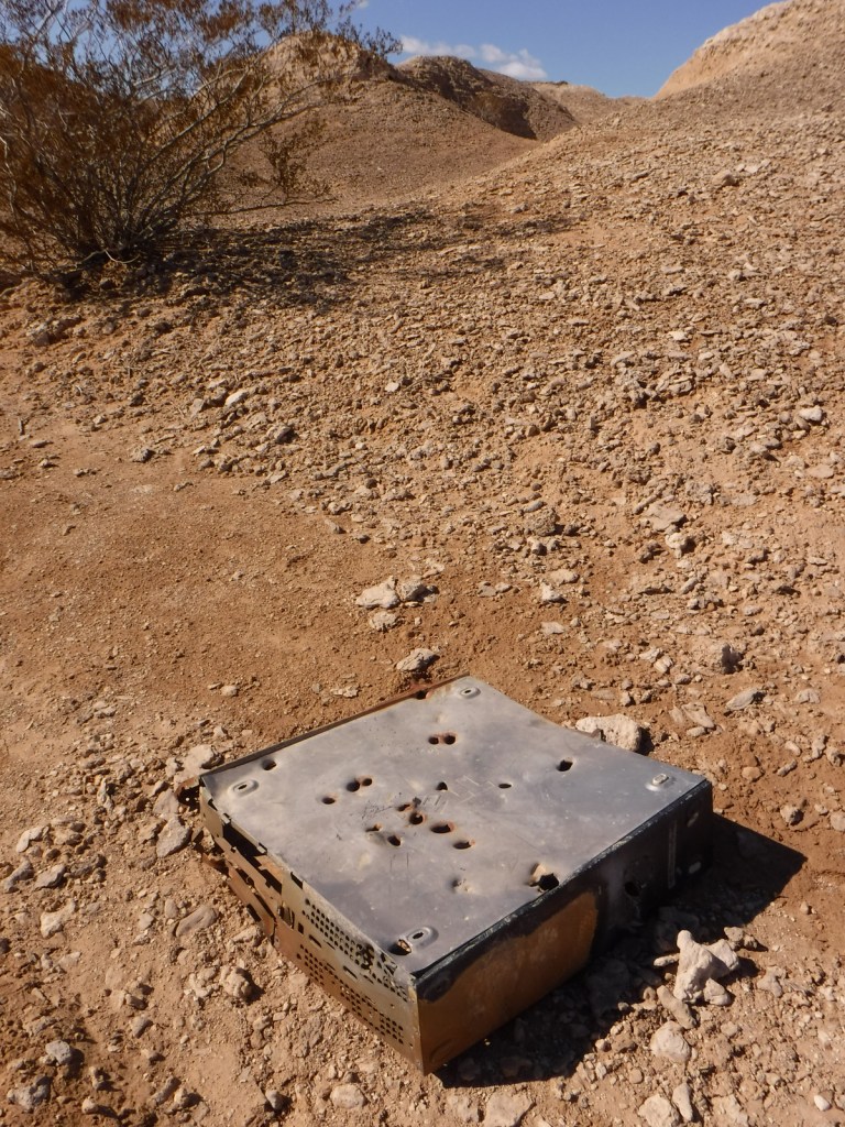
Old computer dumped in Upper Las Vegas Wash
Looking towards Spring Mountains National Recreation Area
Tiff at Aliante Parkway parking area
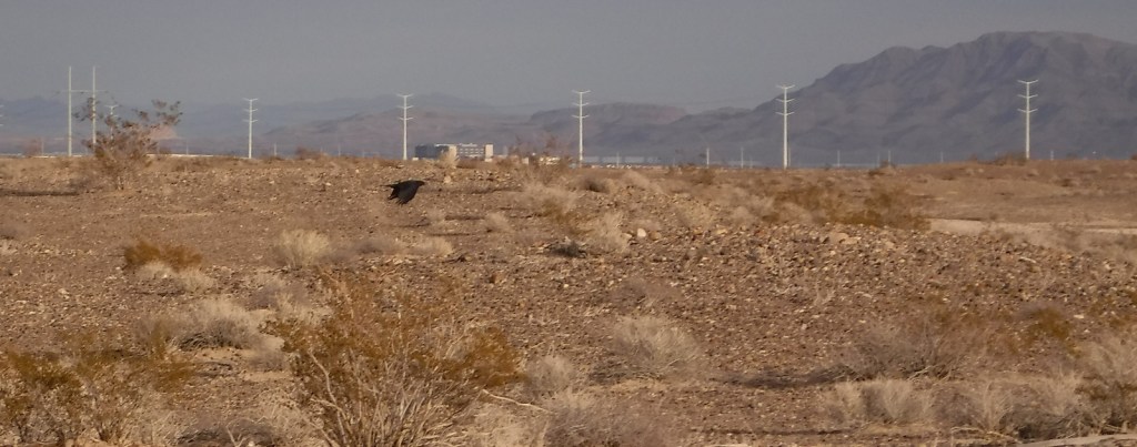
Raven flying through the suburban National Monument
Other side of the natural bridge
Explore More – In
what year did National Geographic conduct a 4-month study here to catalog thousands
of Ice Age mammal fossils?
At one time Shenandoah National Park was entirely private owned, then in the 1930s the government of Virginia went about “procuring” the land for a grand National Park in the east. These mountains are renowned for their colorful fall foliage, which peaks in October, when 18% of annual visitors arrive. If you are looking to avoid traffic in a park only 70 miles from Washington, D.C., we recommend coming in February when almost every park amenity is closed.
Highlights
Skyline Drive, Stony Man, Limberlost Trail, Dark Hollow
Falls, Rapidan Camp, Old Rag Mountain
Must-Do Activity
Skyline Drive runs 105 miles to form the backbone of this narrow National Park. Driving at the posted 35 mile-per-hour speed limit, it takes 3 hours to drive in its entirety if you do not stop once. But with 75 overlooks and 513 miles of trails to choose from, who would want to do that? Skyline Drive is paralleled by 101 miles of the famous 2,185-mile Appalachian National Scenic Trail.
Best Trail
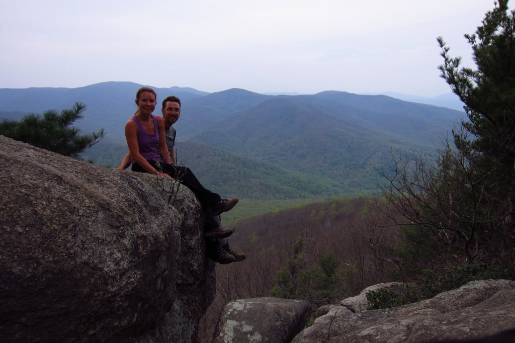
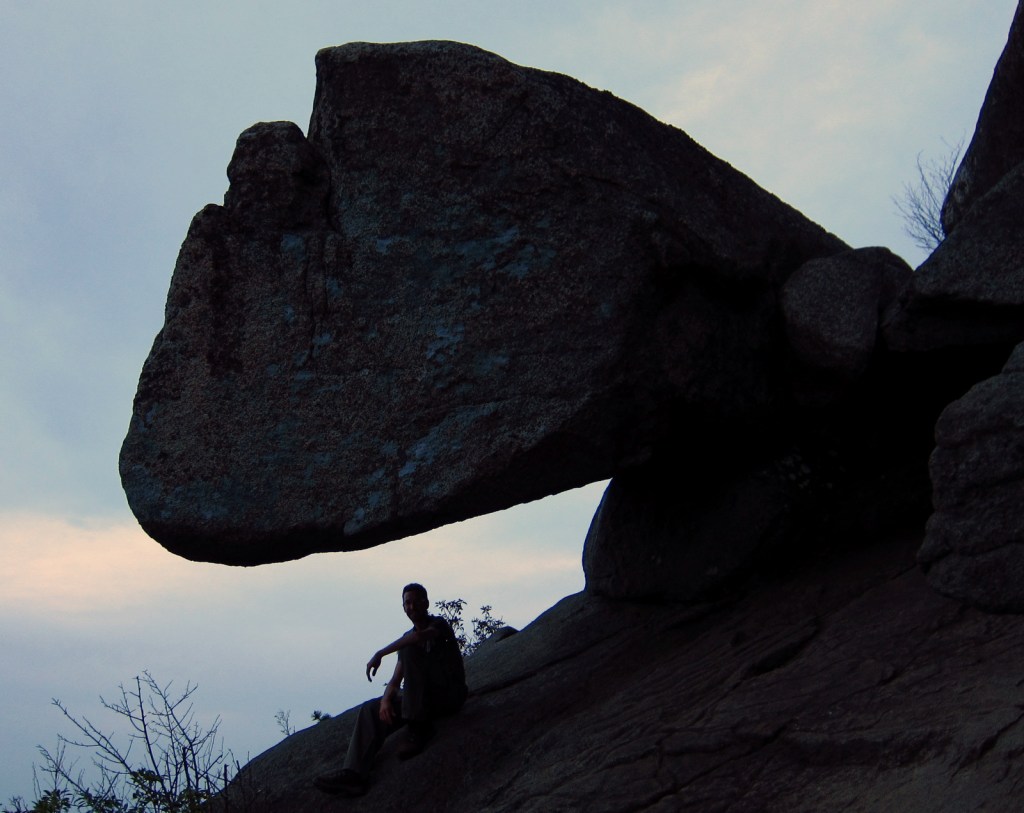
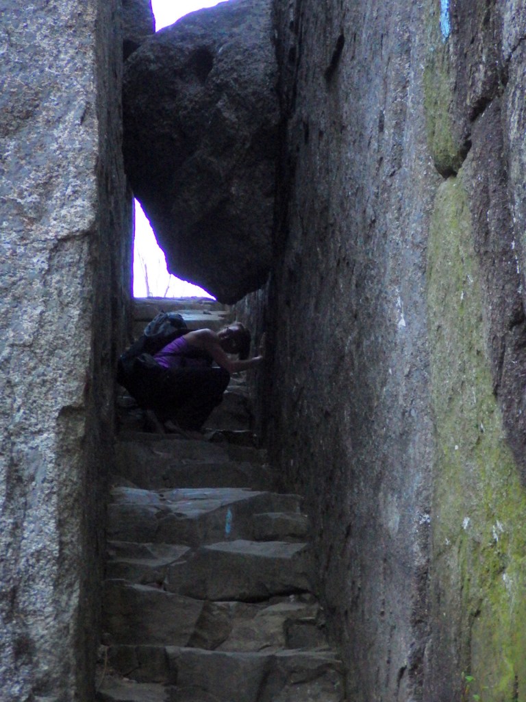
The trailhead for Old Rag Mountain is located east of the
park off Highway 231 (not Skyline Drive), but it is the most popular hike. The challenging route over slick rock faces
and narrow corridors provides wonderful views of the ridgeline that comprises
Shenandoah National Park. Due to the
number of hikers, it is recommended you complete a 7.1-mile loop by connecting Ridge
Trail with Saddle Trail.
Instagram-worthy
Photo
Throughout the park there are numerous trails to waterfalls,
though some may run dry in the summer.
The shortest hike, at 1.4 miles roundtrip, leads to 70-foot tall Dark
Hollow Falls.
The park’s paved backbone Skyline Drive is occasionally
closed after major snowstorms. Located
at Mile 32 (measured from Port Royal, Virginia in the north), the 670-foot long
Mary’s Rock Tunnel allows a maximum vehicle height of 12 feet, 8 inches.
Camping
There are four seasonal campgrounds located along Skyline
Drive and backpacking is allowed with a free permit. West of the Shenandoah River Valley, George
Washington National Forest also provides camping opportunities.
Scott on the trail to Old Rag Mountain
Pink azaleas
Tiff on the Limberlost Trail in February
Ferns unfolding as fiddleheads
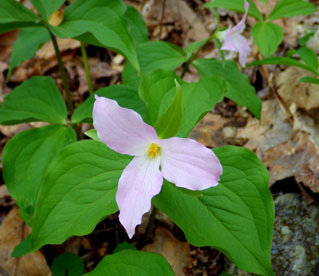
Trillium in bloom
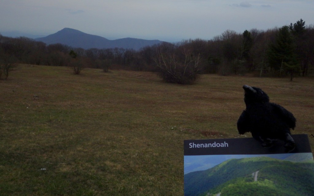
Ravens in the National Park
Tiff on the trail to Old Rag Mountain
This design we created to celebrate Shenandoah National Park is available on a variety of products at Cafe Press and Amazon.
Explore More – What percentage of the 199,218 acres in Shenandoah National Park is designated Wilderness?
We are a participant in the Amazon Services LLC Associates Program, an affiliate advertising program designed to provide a means for us to earn fees by linking to Amazon.com and affiliated sites.
Start your U.S. National Parks, National Forests, and National Monuments adventure here!