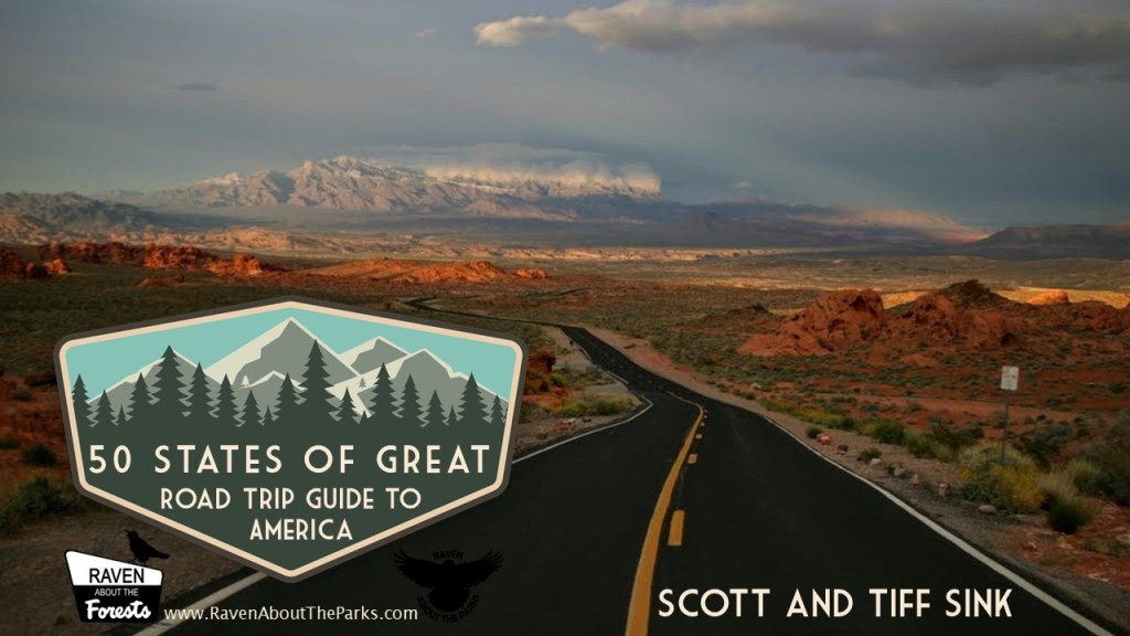
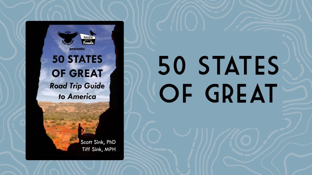
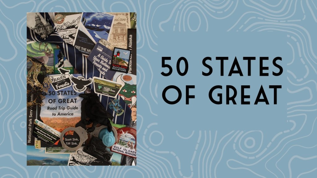
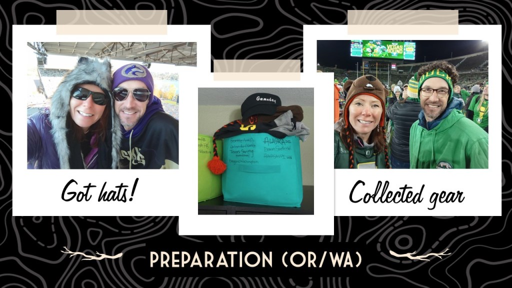
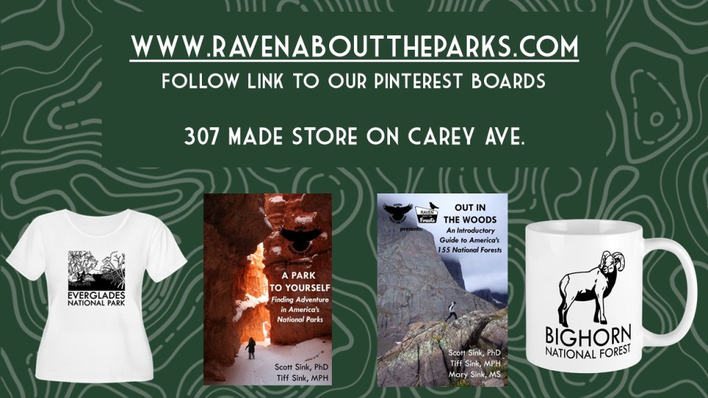
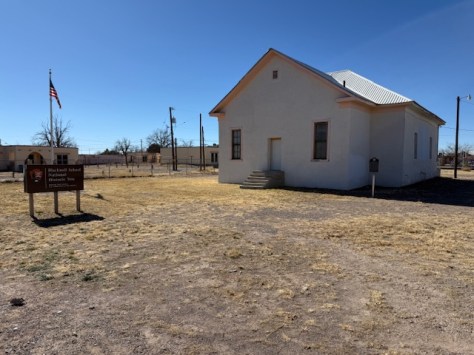
Thank you to everyone who attended the presentation last night on our newest travel guidebook 50 States of Great: Road Trip Guide to America (available for sale on Amazon and at Cheyenne’s 307 Made store). If you couldn’t make it, we have posted the PowerPoint slides below.
Thanks for your support!
We are a participant in the Amazon Services LLC Associates Program, an affiliate advertising program designed to provide a means for us to earn fees by linking to Amazon.com and affiliated sites.
We are giving a presentation on road tripping in the U.S.A. at the Laramie County Library in Cheyenne, Wyoming. It will be held in the Cottonwood Room (1st floor) at 7 p.m. on Tuesday, December 5, 2023. We will have all our books for sale before and after the talk and would be happy to sign them for you.
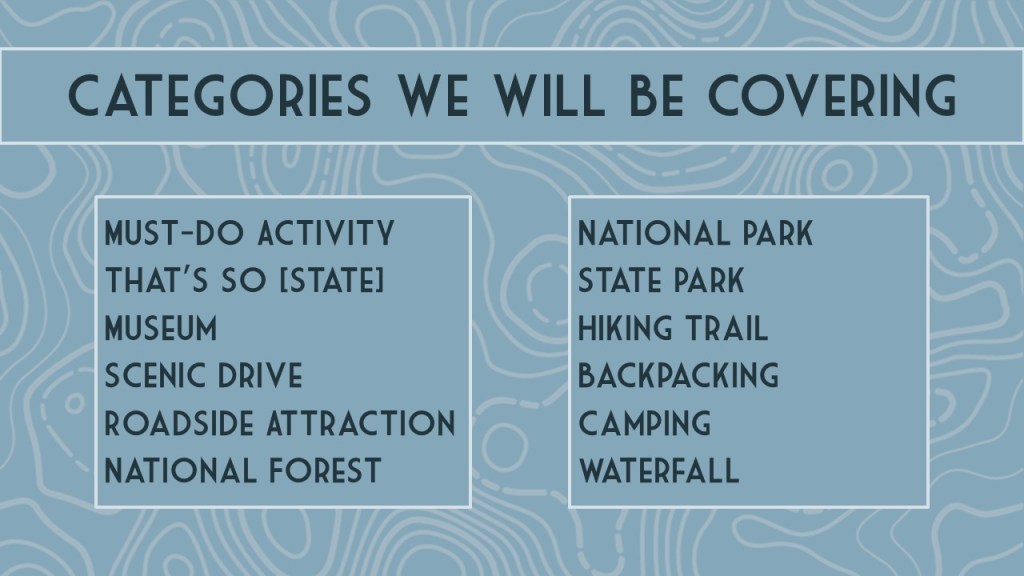
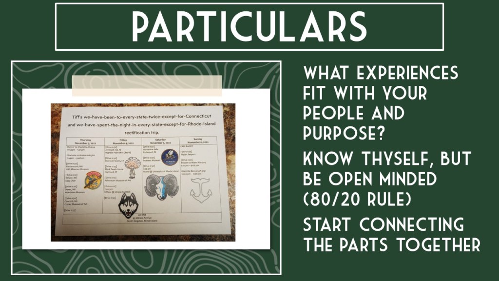
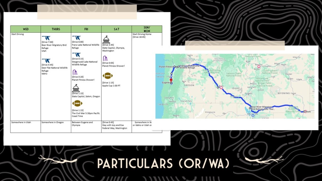
50 States of Great: Road Trip Guide to America is a starting point for planning a road trip of any length, covering the best of each state in 12 categories: scenic drive, State Park, museum, waterfall, roadside attraction, National Forest, campsite, and more. 50 States of Great is a culmination of our extensive travels through the United States of America seeking out well-known destinations and less-frequented spots. The goal of our book is to be useful whether you are taking a cross-country road trip or exploring your home state.
We hope to see you Tuesday!
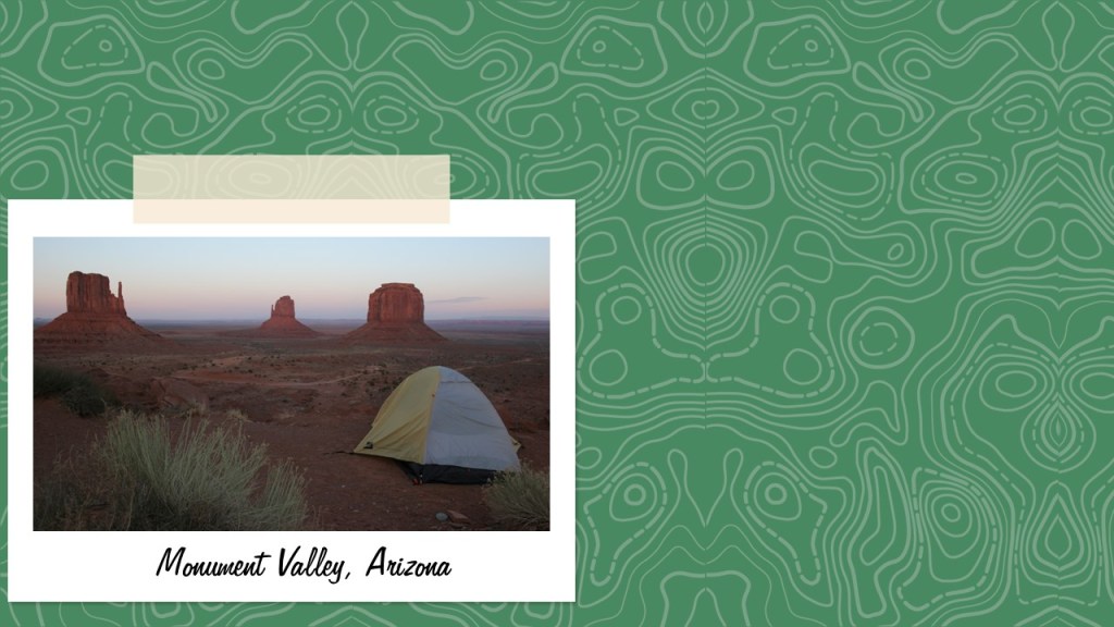
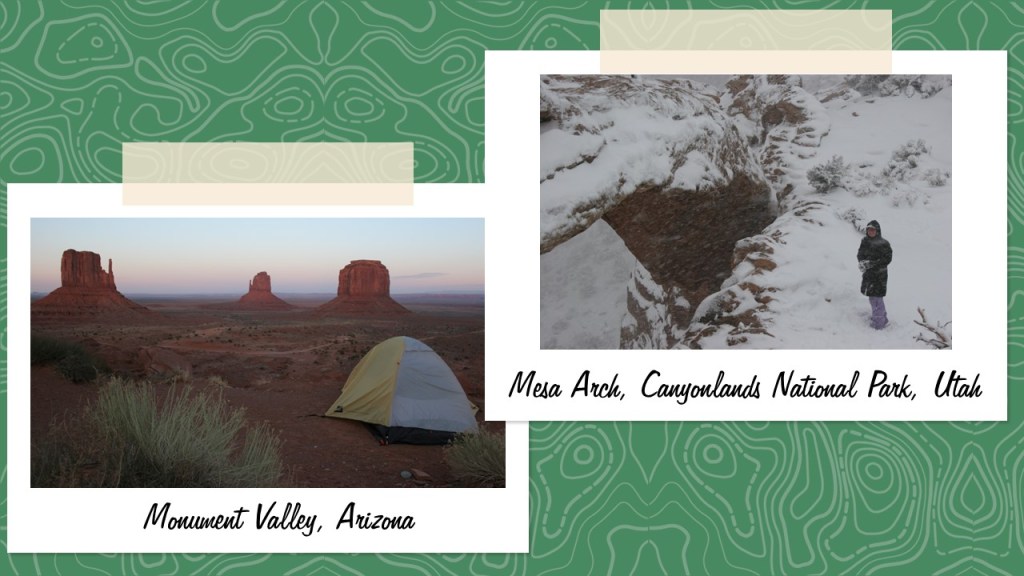
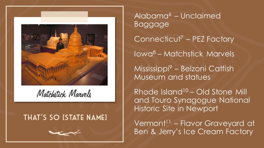
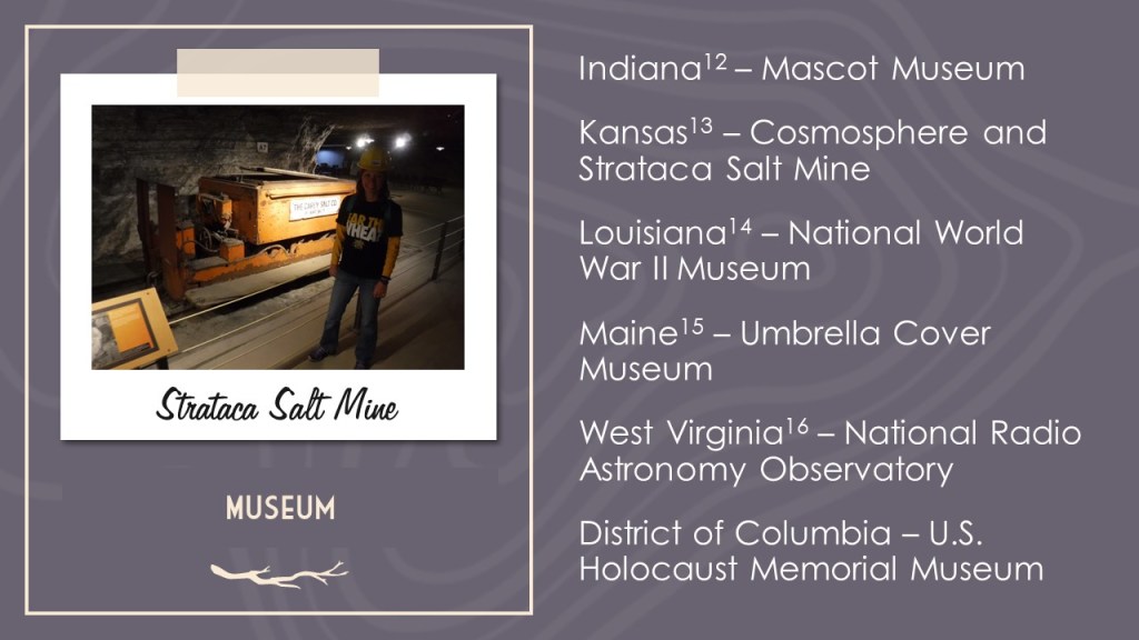
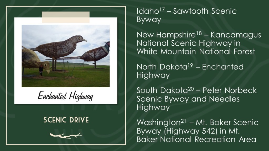
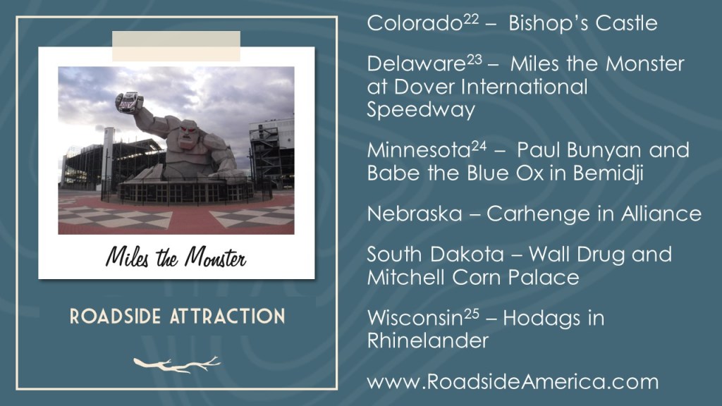
If you can’t make it, you can still check out our slide deck of one (mostly) off-the-beaten-path destination we love in each of the 50 states.
We are a participant in the Amazon Services LLC Associates Program, an affiliate advertising program designed to provide a means for us to earn fees by linking to Amazon.com and affiliated sites.
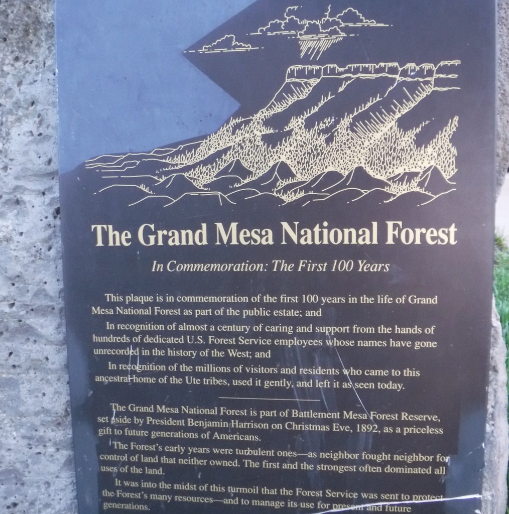
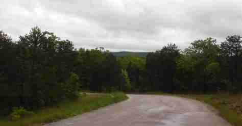
Covering 540 square-miles, Grand Mesa is the largest flattop mountain in the world and has an average elevation of 10,500 feet. It rises east of Grand Junction and is easily explored via paved Highway 65, also known as Grand Mesa Scenic Byway. Due to its high elevation, Grand Mesa National Forest is a popular destination for snowmobiles in the winter. This area was first set aside by President Harrison in 1892 as Battlement Mesa Forest Reserve, only the third such designation in U.S. history. It is now co-managed with Colorado’s Gunnison and Uncompahgre National Forests.
Highlights
Grand Mesa Scenic Byway, Land’s End Ranger Observatory, Ward Lake, Island Lake Interpretive Trail, Crag Crest National Recreation Trail, Eggleston Lake, Leon Peak, Battlement Trail
Must-Do Activity
Also covering a portion of Battlement Mesa, Grand Mesa National Forest contains more than 300 lakes, several of which have campgrounds. The Grand Mesa Visitor Center on Highway 65 near Island Lake is a great place to start, with a 20-minute film shown detailing the 1999 Land’s End archaeological excavation that found evidence of 8,000 years of human activity at 9,000 feet in elevation. Dirt roads travel east from there deeper into the National Forest, or you can take a side trip west on the Grand Mesa Scenic Byway to the visitor center at Land’s End Ranger Observatory for views all the way into Utah’s La Sal National Forest.
Best Trail
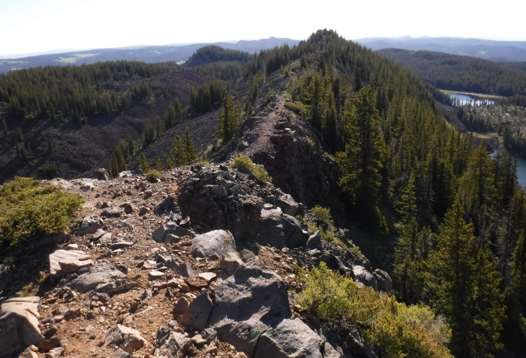
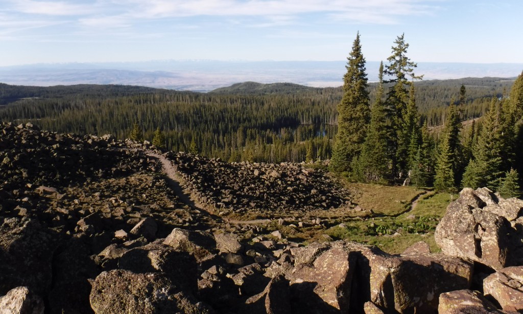
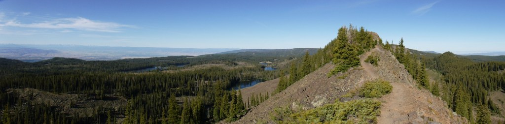
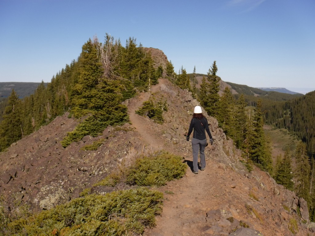
The best trail in Grand Mesa National Forest is without a doubt Crag Crest National Recreation Trail. It can be hiked as a 10.3-mile loop from two trailheads, one at Island Lake (paved access) and the other at Eggleston Lake (that requires some dirt road driving). The crest portion of the hike is the highlight as it follows a narrow ridge of volcanic rock that offers spectacular views. Due to its exposure and the high altitude (up to 11,189 feet) it is recommended that you get an early start to avoid afternoon thunderstorms. For those not wishing to do the entire loop, we found that by starting out counterclockwise from Eggleston Lake the trail climbs steeply providing panoramas within two miles. We completed five miles out-and-back with a cumulative elevation gain of 1,100 feet and felt we had gotten the full experience.
Watchable Wildlife
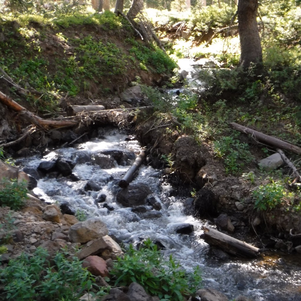
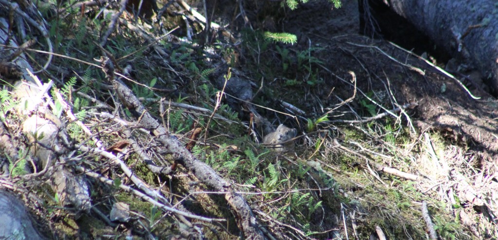
Trout fishing is one of the main draws to the 300 lakes in Grand Mesa National Forest. The lakes and streams also attract elk, mule deer, bighorn sheep, raccoons, red foxes, black bears, and mountain lions, in addition to large birds like bald eagles, golden eagles, peregrine falcons, common ravens, and wild turkeys. Due to its high elevation, look for pikas in the rocks along Crag Crest National Recreation Trail.
Instagram-worthy Photo
Starting counterclockwise on the Crag Crest National Recreation Trail from Eggleston Lake, we climbed to stunning panoramas within two miles.
Peak Season
Summer
Fees
None
Road Conditions
Grand Mesa Scenic Byway follows paved Highway 65 up above 10,000 feet in elevation, as well as west to Land’s End Ranger Observatory. The unpaved Land’s End Road continues switchbacking down the mesa to Highway 50, but is not recommended for vehicles more than 21 feet in length. The unpaved roads on Grand Mesa were in good shape during our June visit, but are closed in the winter.
Camping
There are campgrounds at several lakes in Grand Mesa National Forest, as well as dispersed camping options along the dirt roads.
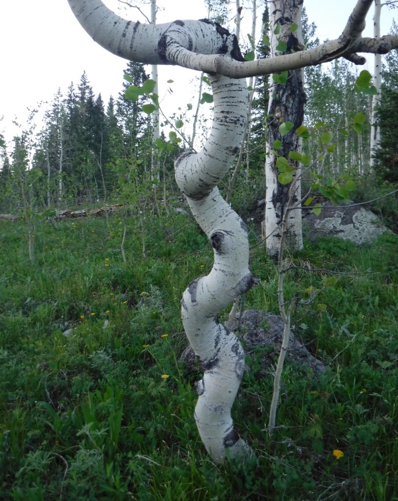
Quaking aspenEggleston LakeCrag Crest National Recreation TrailCrag Crest National Recreation TrailCrag Crest National Recreation TrailTiff on Crag Crest National Recreation TrailScott on Crag Crest National Recreation TrailBook Cliffs from Crag Crest TrailTiff on Crag Crest National Recreation TrailPikaRaven about the forest
Explore More – Now a geological term, what does “mesa” mean in Spanish?
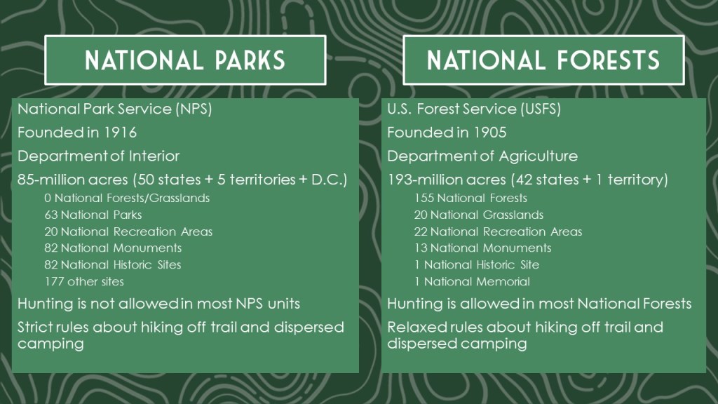
Learn more about this and the 154 other National Forests in our new guidebook Out in the Woods
We are a participant in the Amazon Services LLC Associates Program, an affiliate advertising program designed to provide a means for us to earn fees by linking to Amazon.com and affiliated sites.
Perhaps a bit dated now, but this is a cherished travelogue from the national treasure who wrote The Grapes of Wrath (a novel which is sort of a road trip book itself)
This classic does not really have a plot, just a bunch of interesting characters to drive back and forth across 1950s America with (it is often considered fiction, but it is based on real people and events)
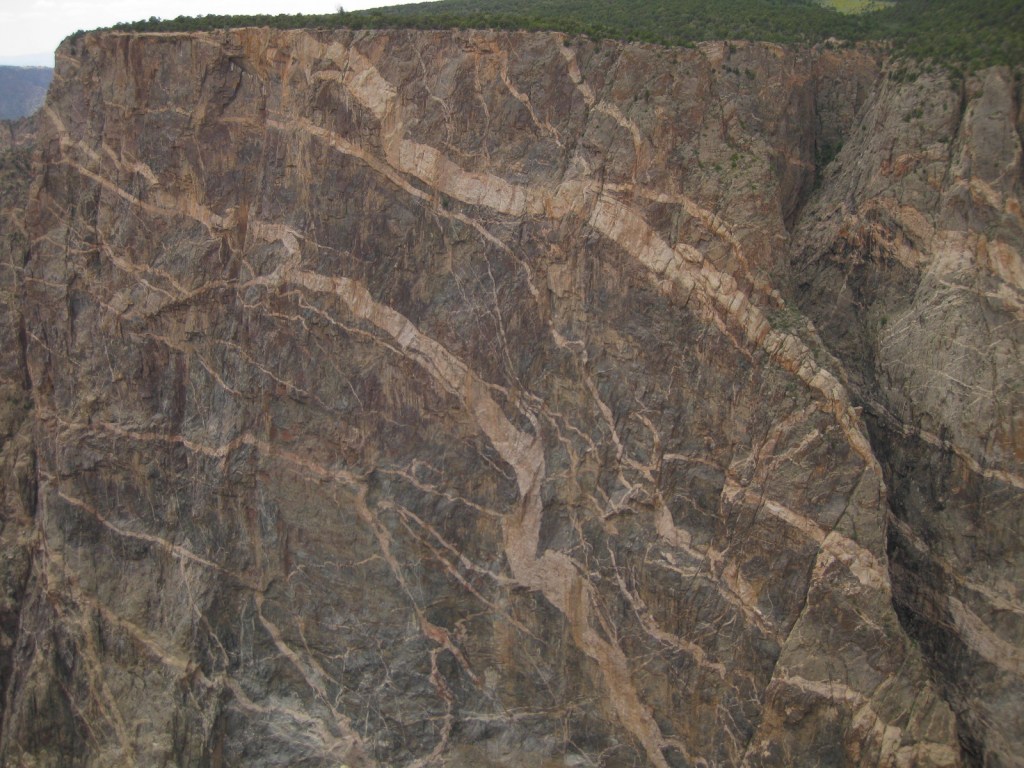
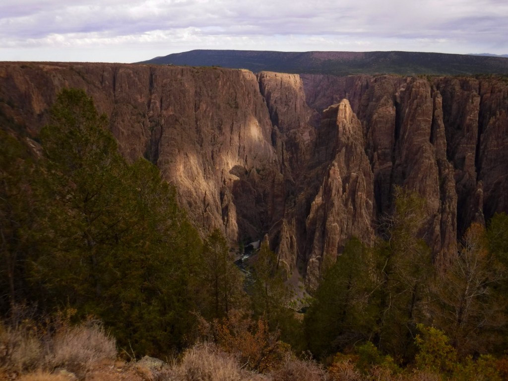
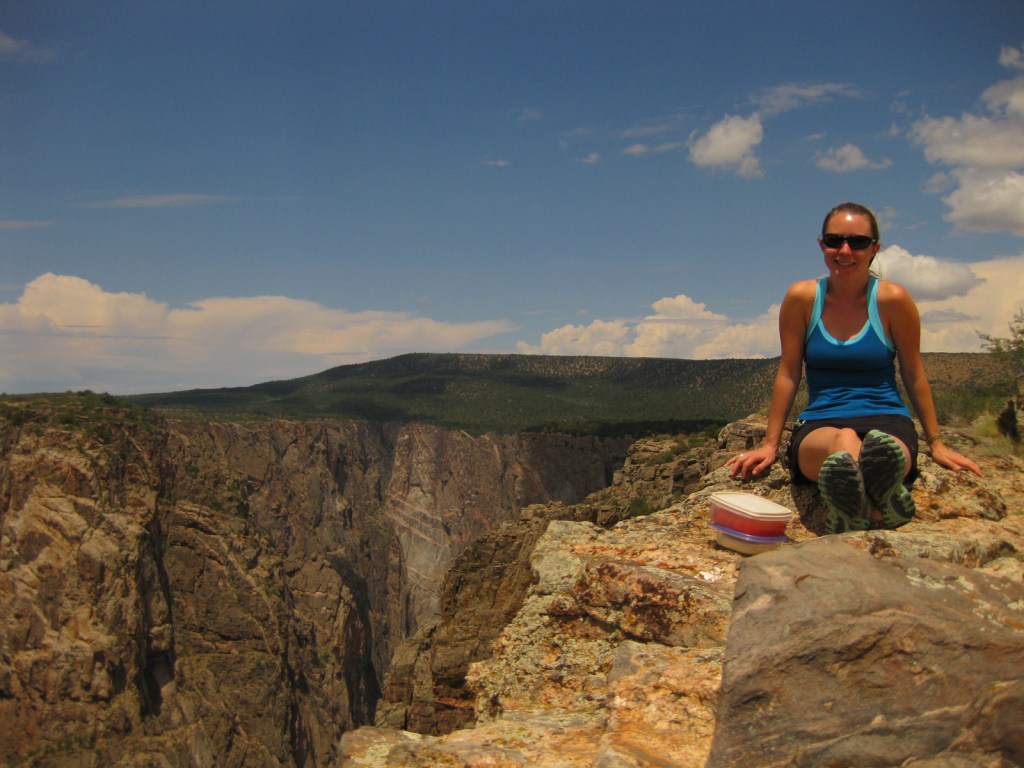
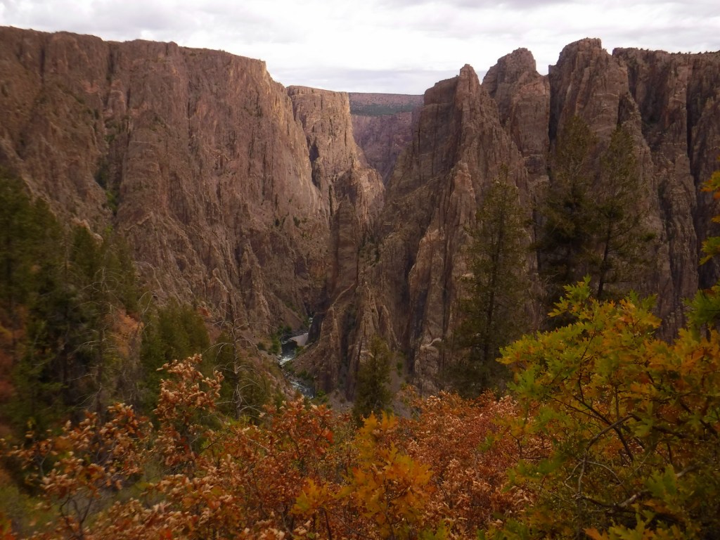
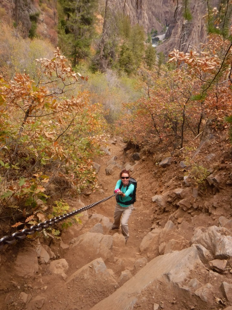
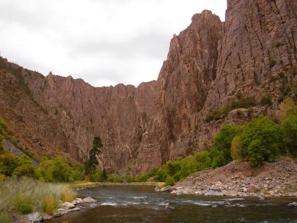
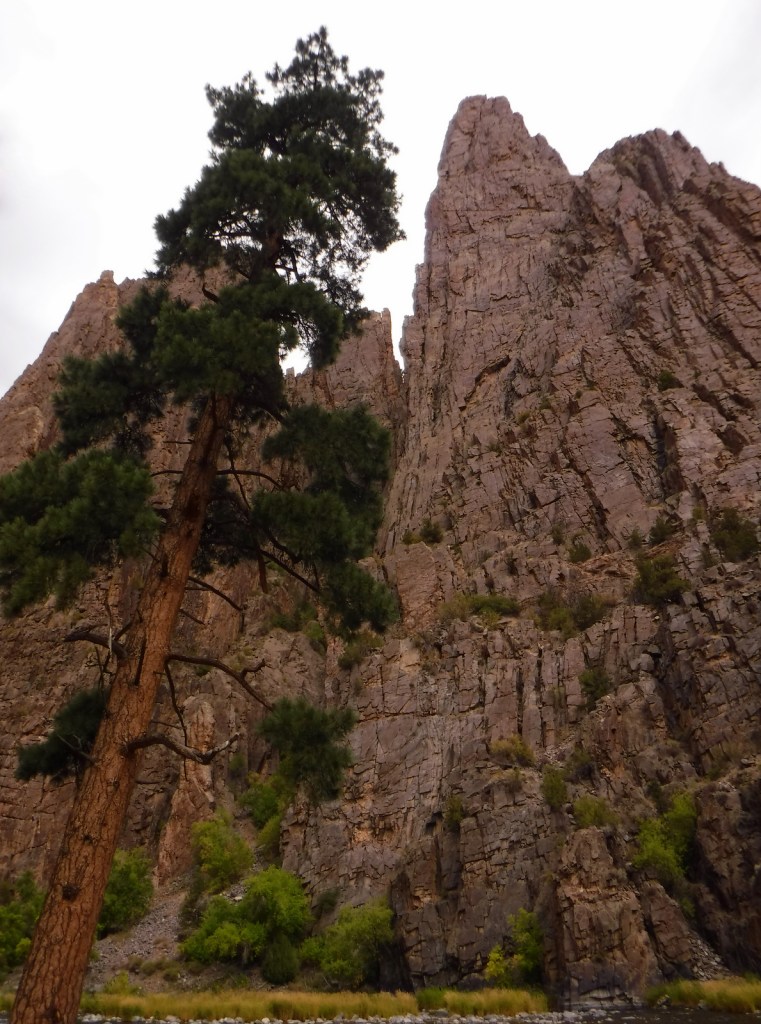
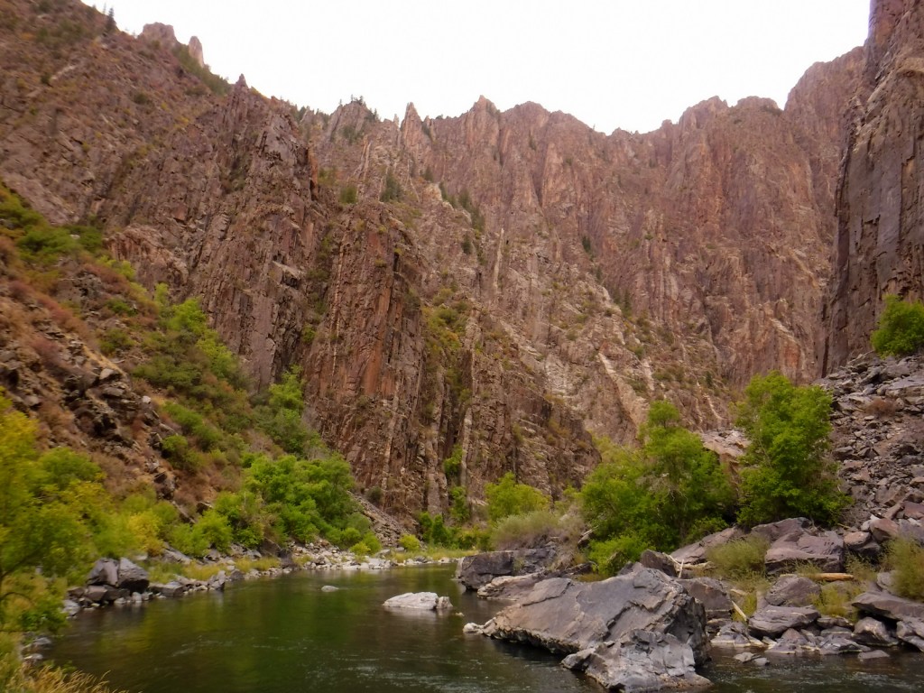
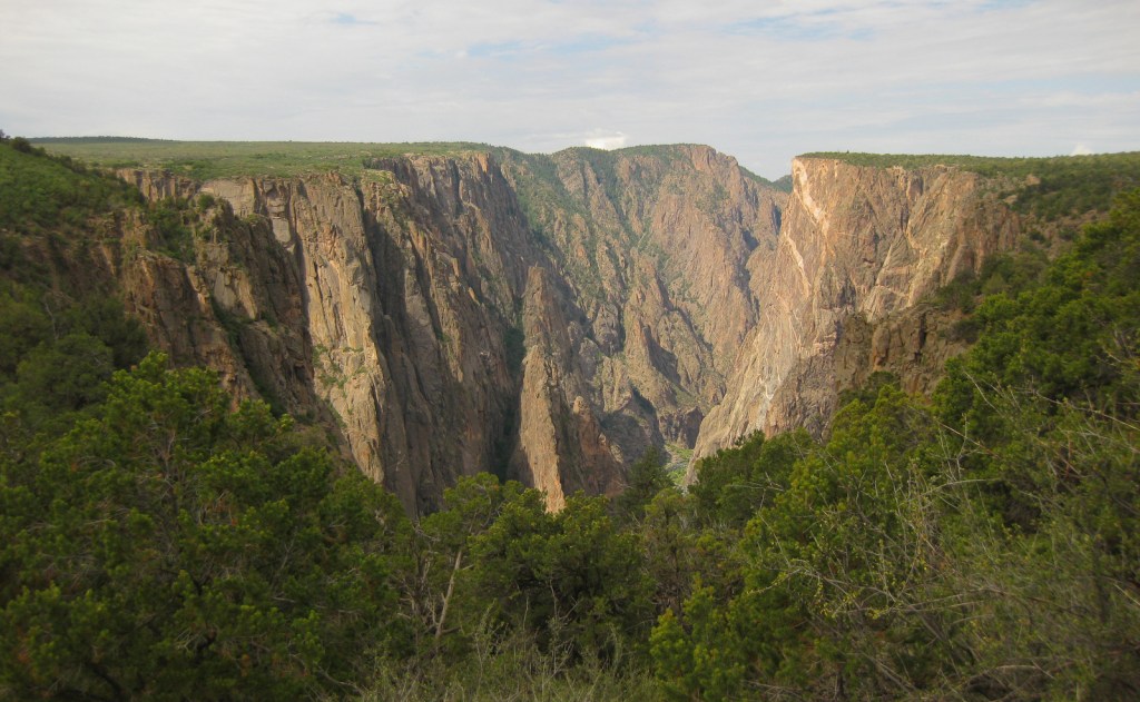
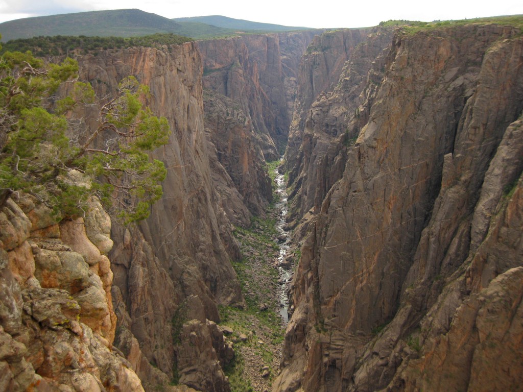
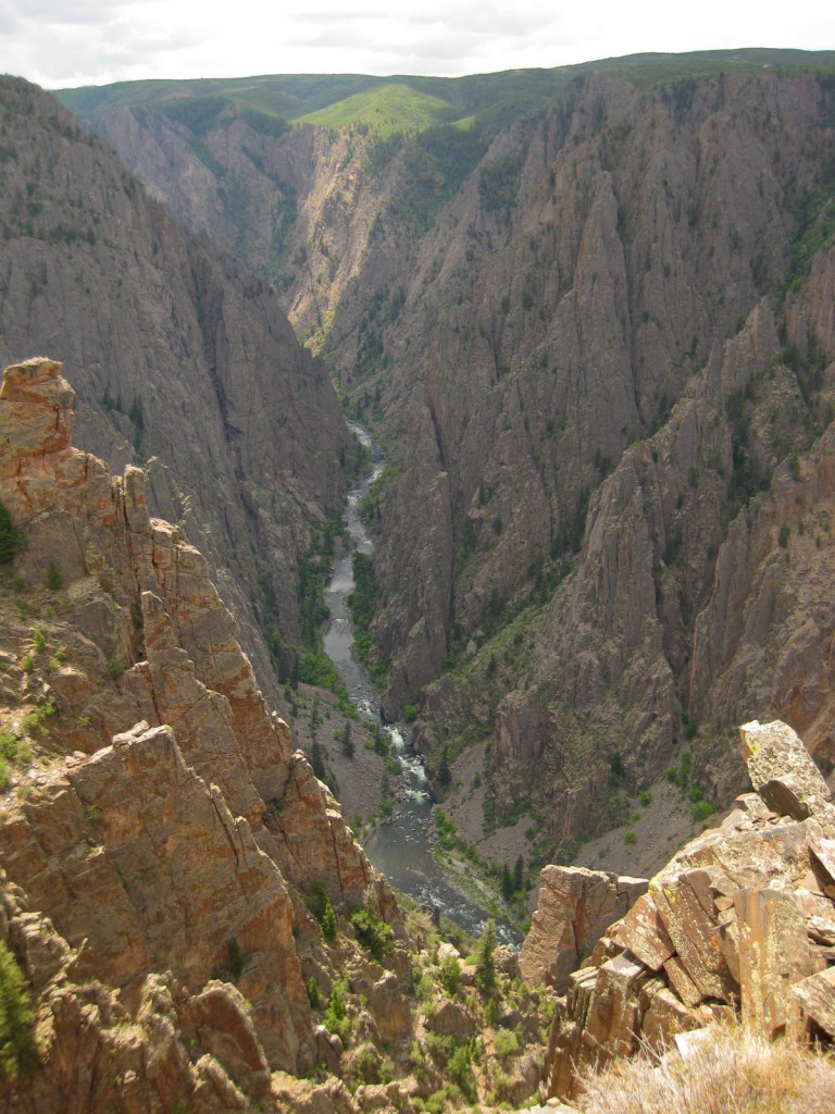
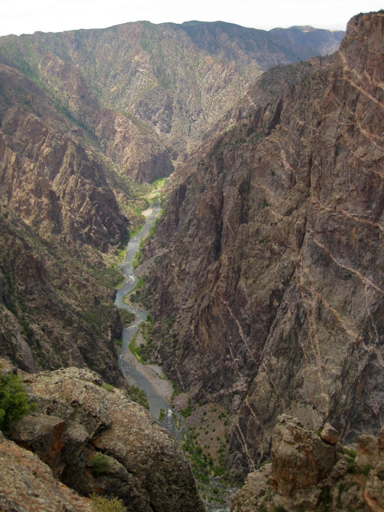
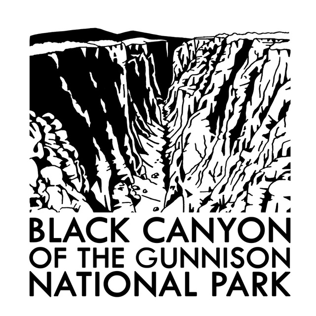
Located in a remote part of central Colorado, visiting Black Canyon of the Gunnison National Park will require hours of driving no matter where you are coming from, but to experience this phenomenal place is well worth the trip. The canyon is incredibly photogenic; its dark cliff faces of gneiss and schist are adorned with white stripes of pegmatite crystals. Although the canyon is less than a quarter-mile across at Chasm View, to get from one rim to the other is a three-hour drive. The best panoramas are found on the rims, but talk to a ranger if you wish to take an unmarked trek 2,000 feet down to the Gunnison River. Even the easiest Gunnison Route (free permit required) is a strenuous and steep effort on loose rock with fixed chains in many sections. It is also possible to drive to the bottom by driving the 16% grades to the end of paved East Portal Road in neighboring Curecanti National Recreation Area.
Pulpit Rock Overlook, Painted Wall View, Exclamation Point, Oak Flat Trail, Warner Point Nature Trail, Rim Rock Trail
Must-Do Activity
Do not miss the opportunity to picnic with an incredible canyon backdrop, just hold onto your food since the cliffs are always windy at spots like Sunset View. Swallows and swifts love to dart around on the thermals here and will get so close that you cannot help but duck as they zip by your head. Bring layers to wear, as it can be gusty and cold year round at around 8,000 feet in elevation.
Best Trail
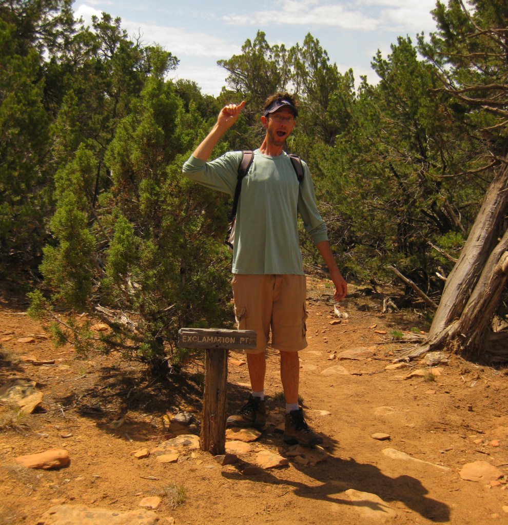
Most visitors to Black Canyon of the Gunnison National Park arrive on the south rim, but we recommend a first stop at the north rim when the dirt road is open in the summer. It is easy to drive right to an overlook for your first view of this geologic wonder, but we think it is better to hike up to one. This can be accomplished by hiking North Vista Trail three miles to Exclamation Point or Rim Rock Trail from the main campground.
Instagram-worthy Photo
One particular outline of white rock intrusion on the north wall is referred to as the Dragon. A short trail leads to the south rim overlook from the Dragon Point parking pullout.
South Rim Road (paved) past the visitor center, East Portal Road (paved), and the dirt road to the north rim are all closed in the winter. Although less than a quarter-mile across at Chasm View, to get between the north and south rims, it is a minimum three-hour drive. Luckily, the eastern route takes you on scenic winding roads that overlook gorgeous Curecanti National Recreation Area. If you drive around the west side of the park instead, you will skirt 62,844-acre Gunnison Gorge National Conservation Area, a Wilderness area known for its whitewater rafting.
Camping
South Rim Campground (closed in winter) has 88 total sites and provides RV sites that can be reserved in advance. There is also primitive camping available on the north rim and at end of East Portal Road within Curecanti National Recreation Area.
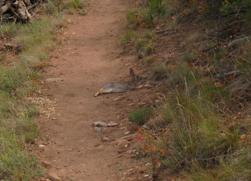
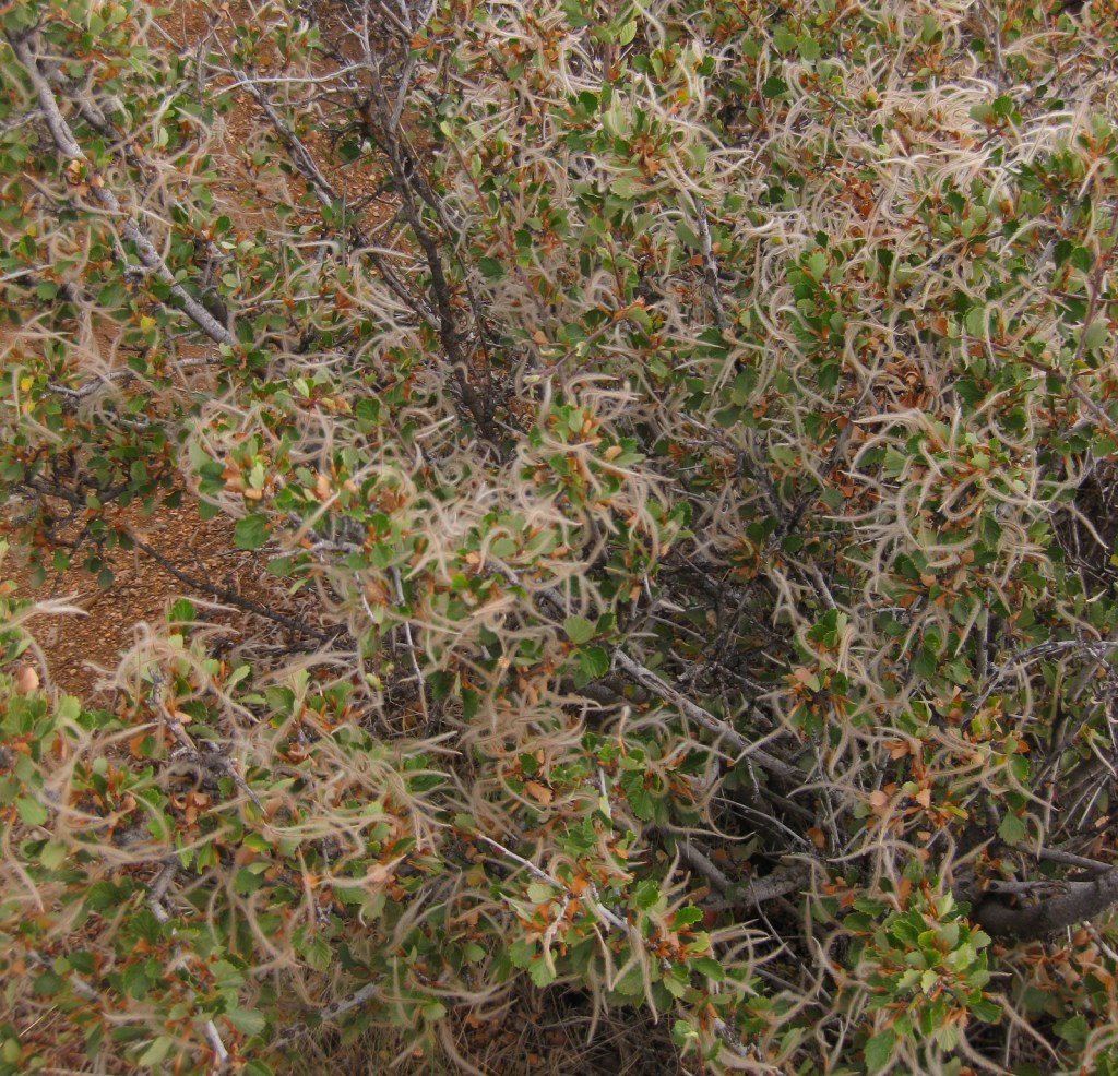
Tiff on the route to the bottomGunnison River at the bottom of the canyonTiff looking over the north rimScott exclaiming at Exclamation PointFlopped out cottontail rabbit on Rim Rock TrailMountain-mahogany achenesAfternoon rainstormTiff on the route to the bottomThis design we created to celebrate this National Park is available on a variety of products at Cafe Press and Amazon.Cafe Press
Explore More – How high is the Painted Wall, which is the tallest cliff in Colorado?
We are a participant in the Amazon Services LLC Associates Program, an affiliate advertising program designed to provide a means for us to earn fees by linking to Amazon.com and affiliated sites.
Start your U.S. National Forests, National Parks, and National Monuments adventure here!