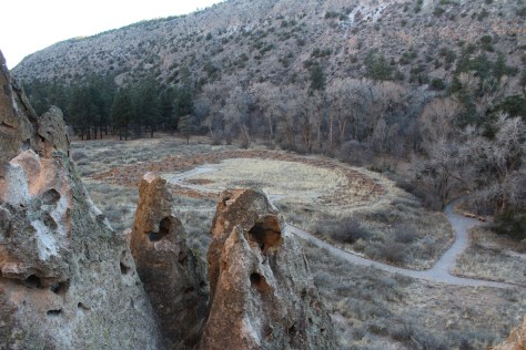
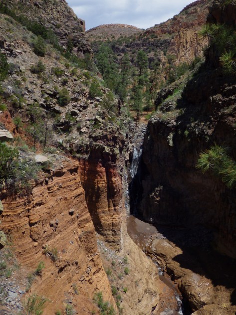
One of 13 national monuments in New Mexico, this archaeological site is located in a beautiful forested canyon at 6,000 feet elevation outside Los Alamos. Ancestral Puebloans inhabited Frijoles Canyon from AD 1150 to 1550, building villages and carving rooms out of the soft volcanic tuff, much like in Cappadocia, Turkey.
Highlights
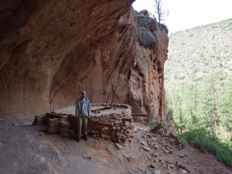
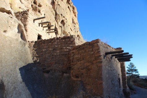
Ruins, cavates, Alcove House, Upper Falls, Painted Cave
Must-Do Activity
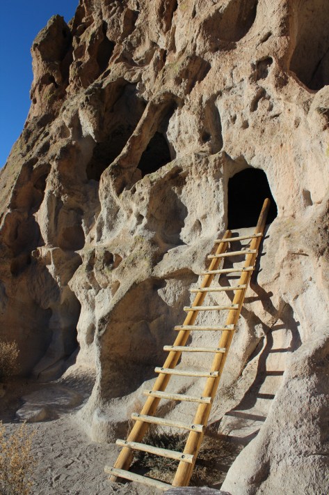
Climb 140 feet up ladders and steep steps to Alcove House cliff dwelling for superlative views of the canyon.
Best Trail
After exploring the ruins, be sure to hike 1.5 miles to Upper Falls downstream from the visitor center.
Instagram-worthy Photo
The National Park Service has installed some awesome, authentic-looking ladders to access the cavates.
Peak Season
Summer when a shuttle is required from Los Alamos, New Mexico due to limited parking
Paved, but visitors are required to take a shuttle from Los Alamos between 9 a.m. and 3 p.m. in the summer (May 17 – October 17)
Camping
Juniper Campground has 94 sites, running water, and is open most of the year. Its 70 miles of trails also make the park popular for backpacking, which requires a zoned camping permit.
Scott inside a cavateTiff inside a cavate
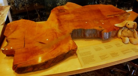
The tuff looks like Swiss cheese; maybe that’s what attracted Swiss anthropologist Adolph Bandelier.Upper Falls is only a 1.5 mile hike downstream from the visitor center
Explore More – When did the giant volcano erupt that created the 16-mile wide Valles Caldera and deposited hundreds of feet of volcanic ash that formed tuff?
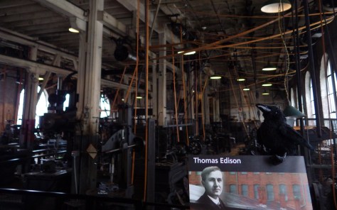
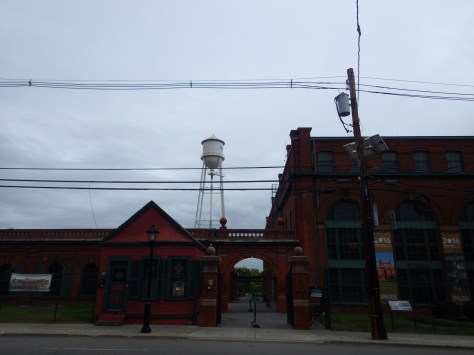
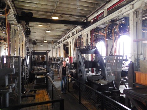
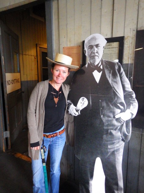
American inventor Thomas Edison still holds the record with 1,093 U.S. patents awarded during his lifetime. Most of those came while running the massive laboratories in West Orange, New Jersey from 1887 until his death in 1931. After perfecting the incandescent lightbulb in 1879, it was here he employed hundreds to work on improving his phonograph, motion picture camera, alkaline storage battery, and Portland cement (one of his most profitable ventures). The park also includes the family estate, Glenmont, located one-mile away (a tour ticket is required to enter the house).
Highlights
Historic laboratories and workshops, inventions on display, house tour
Must-Do Activity
The multi-story Main Laboratory is handicap accessible and contains 400,000 artifacts from Edison’s prolific career. On display are some of the world’s first electric coffee-makers, waffle irons, and toasters marketed by his company Edicraft in the 1920s.
Best Trail
A self-guided walk around the grounds of Glenmont includes Edison’s gravesite.
Instagram-worthy Photo
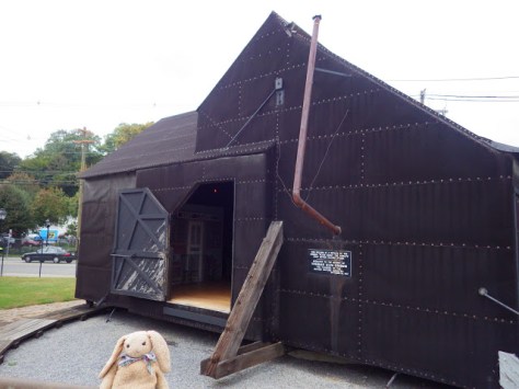
At the West Orange laboratory is a replica of “Black Maria,” the world’s first movie studio originally built in 1893 on a track that allowed it to pivot for better lighting.
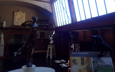
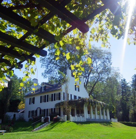
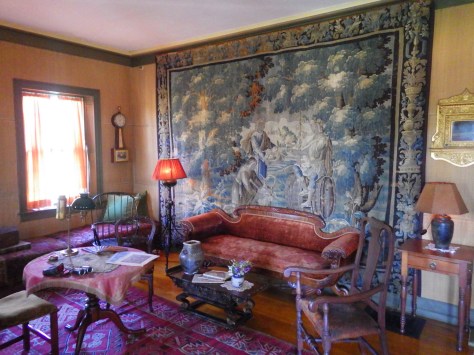
The only site in New Hampshire administered by the National Park Service (NPS) is dedicated to Augustus Saint-Gaudens, an Irish born immigrant that studied art in Paris and Rome. On this country estate he utilized beginning in 1885, he converted a barn into his sculpture studio. Other artists flocked to “Aspet” until his death in 1907.
Highlights
Home and sculptures of famous 19th-century artist, sculptor-in-residence program
Must-Do Activity
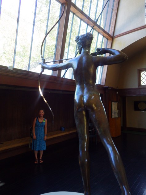
A tour ticket is required to enter the house and is included with your admission fee. While you are waiting, explore the many marble, plaster, and bronze castings of Saint-Gaudens’ work located around the property, including his famous Shaw Memorial whose original can still be found in Boston. A new cast of one of his Abraham Lincoln statues was added in 2016 during the NPS Centennial.
Best Trail
The quarter-mile Ravine Trail starts at the Ravine Studio, the workshop of the sculptor-in-residence. Blow-Me-Down Trail runs 2 miles between the Temple and a swimming hole.
Instagram-worthy Photo
Take a photo of “Aspet” house from the porch of Little Studio framed by the vine-draped arbor.
None at this park, but Mt. Ascutney State Park is short drive away across the border in Vermont.
Covered bridge connecting New Hampshire and VermontScott with a huge honeylocust tree
The Shaw Memorial took Saint-Gaudens 14 years to complete. This cast was completed in 1997.Diana sculptures like this top Madison Square Garden in New York City.
Explore More – Why does the gift shop sell a stuffed animal goat named Seasick?
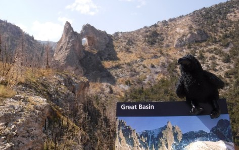
Originally designated a National Monument in 1922, the area surrounding 13,063-foot Wheeler Peak became a National Park in 1986. This park is so remote that moonless nights offer some of the darkest skies you will see in your entire life. Plan to stay multiple nights to walk along the scenic Alpine Lakes Loop Trail, summit the peak, visit Lexington Arch, hike through a grove of ancient trees, and take a guided tour of Lehman Caves.
Highlights
Wheeler Peak Scenic Drive, Lehman Caves, Lexington Arch, bristlecone pine trees
Must-Do Activity
Pass through ancient bristlecone pine trees on your hike to the only remaining glacier in the state of Nevada. This park was once home to the oldest single-stem tree in the world with nearly 5,000 annual rings (a cross-section is on display at the Great Basin Visitor Center). It was killed by a researcher who cut it down to count it in 1964, but he then became a major advocate for creating the national park.
Best Trail
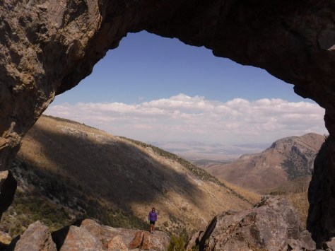
Lexington Arch is located down a long dirt road, the first nine miles of which are passable by any vehicle, but the final two miles require four-wheel-drive. From the trailhead, the hike is 1.7-miles one-way, for a total round trip of 7.4 miles if you park where we did. Lexington Arch is an impressive 60 feet tall and its limestone structure is unique since most arches are sandstone.
Instagram-worthy Photo
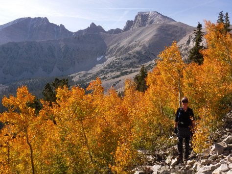
Gnarled branches of bristlecone pine trees reach for the sky at 10,000 feet in elevation. Wheeler Peak provides a great backdrop for them.
Peak Season
Summer, with September a great time of year to visit for changing colors in the aspen stands. Wheeler Peak Scenic Drive closes in winter.
None, which is fairly unique for a National Park, but there is a charge for cave tours.
Road Conditions
Wheeler Peak Scenic Drive is paved and most dirt roads are passable to all vehicles, with the exception of the final 2 miles of the road to Lexington Arch which requires four-wheel-drive.
Camping
There are several campgrounds in the park, plus dispersed sites along two dirt roads available with a permit. Dispersed camping is allowed on roads outside the park boundaries without a permit.
Wheeler Peak protects the only remaining glacier in Nevada from the afternoon sun.The steep trail to Wheeler Peak climbs over 3,000 feet in about four miles, but the destination is always in view.There was fresh snow atop 13,063-foot Wheeler Peak when we summited in mid-September.The Great Basin Visitor Center in Baker, Nevada displays a cross-section from the 4,900-year-old bristlecone pine tree.Ranger-guided tours of Lehman Caves are only a half-mile long and worth the price of admission.On the trail to Lexington ArchTiff standing on cave flowstone beneath Lexington Arch.Our original logo is for sale on a variety of products on Amazon and Cafe Press
Explore More – If the flowstone formations at its base indicate Lexington Arch was once part of a cave, is it actually an arch or a natural bridge?
We are a participant in the Amazon Services LLC Associates Program, an affiliate advertising program designed to provide a means for us to earn fees by linking to Amazon.com and affiliated sites.
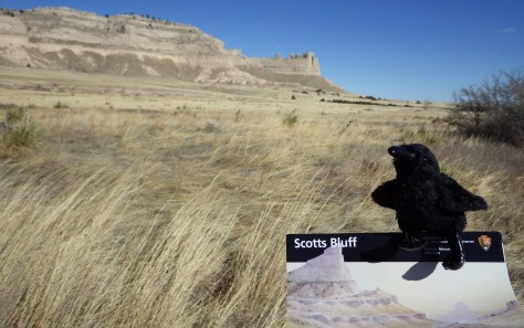
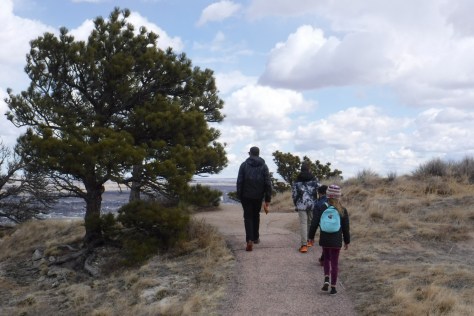
If the names of Scotts Bluff and Chimney Rock sound familiar, it is perhaps because you grew up playing The Oregon Trail computer game on a Macintosh in the early 1990s. The massive 800-foot tall sandstone cliffs enclosed within Scotts Bluff National Monument were once the unofficial one-third mark along the historic trail, as well as a landmark along the California Trail, the Mormon Pioneer Trail, and the short-lived Pony Express Trail.
Highlights
Museum, vistas, historic trail, only road tunnels in Nebraska
Must-Do Activity
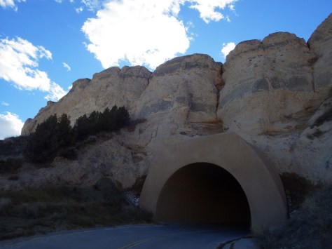
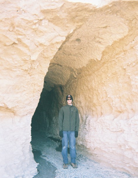
While we recommend the hike to the top from the visitor center, you should probably also drive up there, because these are the only three tunnels dug for a road in the entire state of Nebraska.
Best Trail
Saddle Rock Trail leads from the parking lot at the visitor center 1.6-miles up the 800-foot tall bluff through a tunnel carved in the sandstone for great views of distant Chimney Rock National Historic Site (an affiliated NPS unit), another prominent Nebraska landform noted by early emigrants.
Instagram-worthy Photo
Pose with the oxen sculptures pulling a wagon up Mitchell Pass in front of Scotts Bluff.
There is not a campground within the monument, but the adjacent cities of Scottsbluff and Gering have RV parks.
The only road tunnels in Nebraska are in this National Monument.
The trail on top of Scotts Bluff.Enjoy views of Scottsbluff, Nebraska and the North Platte River from atop the cliffs.Scott in the tunnel on Saddle Rock Trail.Drive east to Chimney Rock National Historic Site for another Nebraska landmark on the Oregon Trail.
Explore More – Did the U.S. Army abandon Fort Mitchell before or after completion of the transcontinental railroad?